
It might boil down to the view.
Many words have been written about the attraction of mountains and in fact the historical anomaly of contemporary interest. They used to be things to be avoided, homes of hobgoblins, monsters and wraiths. When in the fashionable mind they became romantic spectacles, it was not to actually tangle with them. Observe, applaud if you must, and then leave well enough alone.
Australia doesn’t have much in the way of mountains. Too old. And the ones it does have you mainly walk or even drive up rather than climb. So why bother?
I was sitting on top of a boulder at Seager’s Lookout still a bit ragged from a major encounter with Mt Field West — this, Myrna explained, was a hair of the dog — when we discussed this most recently.
Grandeur. What would grandeur be? Bigger than usual? Certainly. But there is something else about the light, often generated by the eccentric and highly changeable weather you get in mountains, that could suggest an encounter with grandeur. Yes you do see how things are and how they are made, geologically anyway.
Yes you can see how things are laid out and you are given an idea of scale — and of your own very limited importance. You see things that you can’t otherwise see. Ever. Like what grows in alpine areas above 1000m in Tasmania, in summer one of the world’s great floral shows.
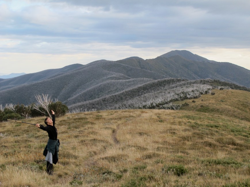
All mountains, even ones which are proximate, have their own character. Above, for example, is Feathertop, the Queen of the Alps. There is no King. With its narrow ridge and winter cornice it is unlike any other mountain nearby, and the walk from where Myrna is standing to the summit, head out all the way, is a blue ribbon affair. I like to get to know them. But who knows why? That’s the question, isn’t it?
Flipping the focus, there’s the challenge. Can you? What will it be like? How hard will it rain? How soft will the snow be? When will it start hurting? Even when you’ve done it before, you just never know.

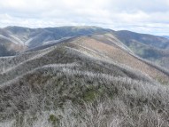
But it’s probably just the view. (The Ovens Valley from the top of Feathertop.)
* * * * * *
Myrna rarely needs persuasion to climb a mountain. I thought I’d like to climb some of my favourite mountains again before getting a new knee. Just in case. You never know. This is a record of that experience.
* * * * * *
MT FEATHERTOP (27/10/17)
Altitude: 1922m
 Route: there are five ways up Feathertop, including the one noted above which starts near Mt Hotham at an altitude of about 1600m. We thought we might go up the Bungalow Spur which starts in Harrietville (alt. 500m). It is a common route for people planning to camp on the mountain but 1500m up, a big climb. About one-third of its 12km length is the remnants of an old tramway on a reasonably generous grade. We planned to go up and down in a day.

The track starts in thick alpine forest following a creek before jumping up along a steep rocky track. Once you get to the top of that section you’re on the tramway and you just have to lie back into the idea of a long steady climb.
You begin to get glimpses through the canopy like this confirming that you’re getting somewhere.
Feathertop has been burnt fiercely several times in the last decade and some of the landmarks have gone — Wombat Gully for example — and that was a good one because it proclaimed progress and used to be good spot for a cup of tea. But you can tell you’re rising. The dominant trees are now large and crowded Stringy Barks rather than the tall but spare Mountain Ash further down.
For a kilometre or two around the halfway mark a storm the previous week had brought down lots of dead trees left after the fires. Even the living ones are very shallow-rooted in the rocky soil.
There was another patch where the stags were monumental.
Two-thirds of the way you pass the site of the ‘Bungalow’ of the Spur. Nothing remains except a cleared area, some grass and a few bits of cement. What it says is that ahead there is a steeper climb through snowgum on broken rock for 40-50 minutes, but at the end ‘head out’ near Federation Hut where people camp. And it’s a good moment.

You cross that hill ahead, the bottom of Little Feathertop, on a very weathered track and come to this wonderful snow gum, almost the only one on the ridge that survived the fires, and only because of its isolation.
 The rest is still mainly ‘old man’s beard’, dead trees now above new growth. Snow gums don’t shoot from the trunk or branches after burning but they do regrow from the base.
And then you’ve got to get up the top, a steep rocky climb to gain another 200m vertically.
 And we did. We’d been lucky with the weather, and getting down was the usual kilometre too far, but it was in sum a great delight.
MT DIFFICULT/ GAR (28/12/17)
Altitude: 809m
 The peak’s nobility is complex, not obvious, perhaps because you have to fight a bit to get there. After climbing, the route enters from the right and makes its way across the face of the scarp.
 Route: Mt Difficult (Gar — Jardwadjali for nose) is the highest peak in the Grampians’ Mt Difficult Range, a fishhook-shaped affair in which the mountain is only just located. Our usual track has been to enter at Beehive Falls, climb up to the plateau, do the there-and-back leg to Briggs’ Bluff then eventually come down to Troopers Creek campsite.
Fires had closed this track until recently — the tops were still unrecognisably bare — and Troopers Creek campsite was still closed. We still could probably have come down there but it would have meant a 6km walk back to our car along Roses Gap Rd.
We’ve done that before, but this day it was in the mid-high 30s and very muggy, and after 16km of scrambling we mightn’t be in the mood. So, just there and back. In at Beehive Falls, forget Briggs’ Bluff, straight on via the slightly rerouted track to Mt Difficult and back again. About 20 km. Altitude gain, about 650m. But rough work.
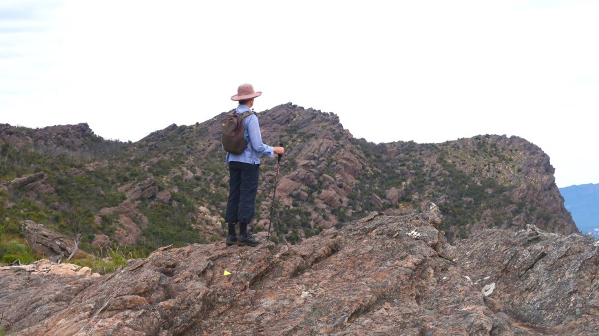
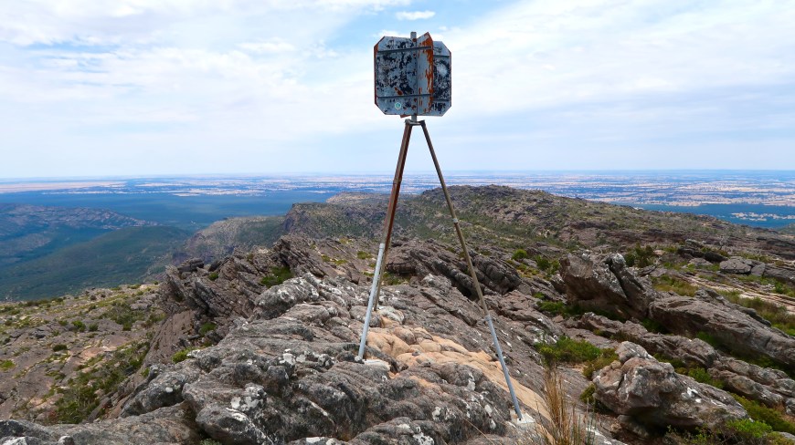
Below, the trig point is just visible to the right of Myrna’s hat.

From Roses Gap this classic Grampians gravel track, undulating gently besides a creek bed, takes you to Beehive Falls 1.5km away. Most climbs throw you straight in without letting you catch your breath. This is 20 minutes of amiability.
We’ve been to Beehive Falls at least five times and I can’t remember them ever running. A finger-thickness trickle was coming over as we climbed up.

As I have remarked many times it’s hard to take photo of ‘steep’ or ‘high’ and this is another failed attempt. Assume ‘steep’, and dry loose rock.
As I remembered it you got to the top of the falls — 200 or so steps as well as the loose rock path — and then, for some relief, you were out on the plateau. But I had forgotten.
This comes next.
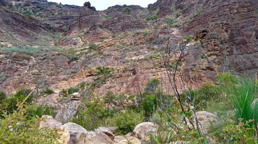

 Somewhere on that cliff face is the track. And like these things often do, it goes on and on. Four or five distinct false dawns.
Going up I knew it was steep but we just chugged along. Coming down — sliding, barely in control, on my bum — I had no idea how we’d got up there. That, to some degree, is the nature of going up and coming down.
Once up on the plateau and an unusual 30 minute walk almost in a straight line along flat rock strata, Briggs Bluff with its bird’s mouth dominates visually. The Wimmera Plains stretch out uninterrupted to the north.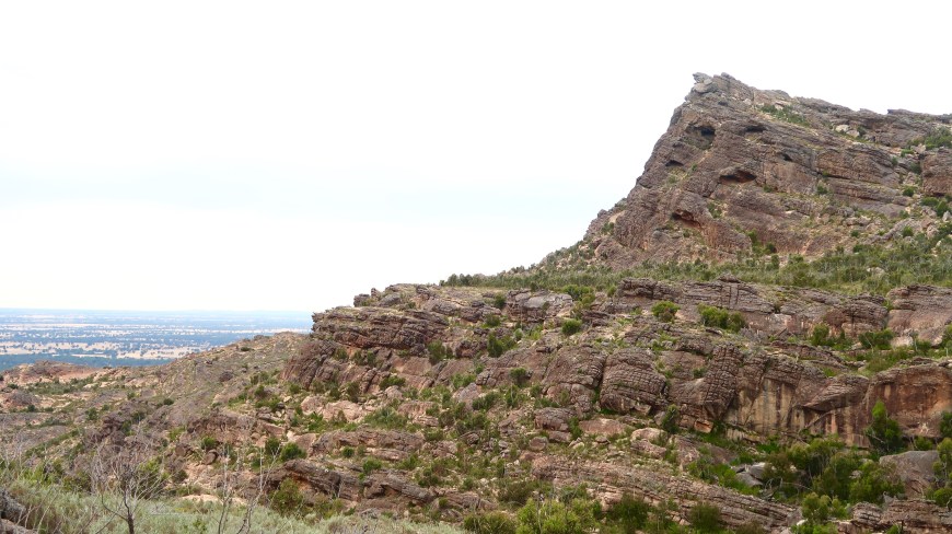 Another climb follows, steep and high steps up into the bottom of a vertical scarp which the track chases, climbing past caves sometimes gradually sometimes steeply to a crack in the cliff. From here you get the first view east.
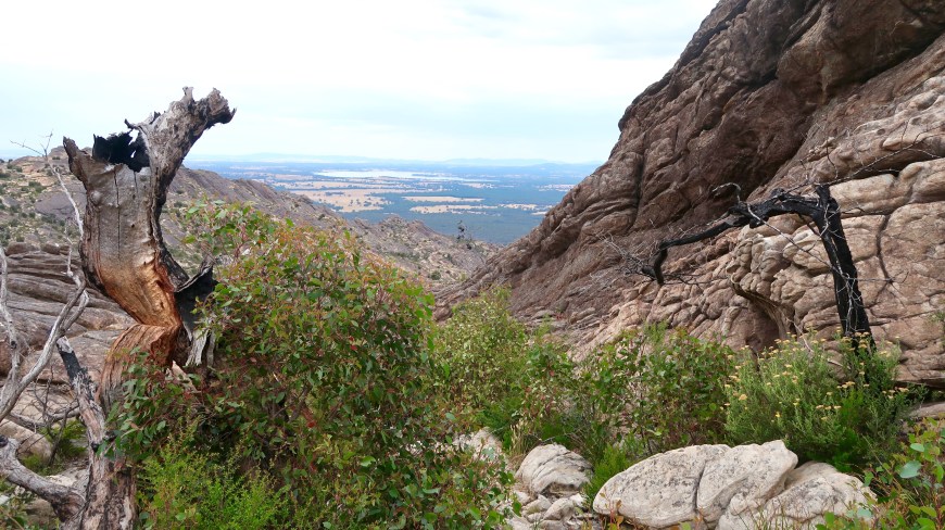 Lake Lonsdale in the distance. But that’s the track. Through the regrowth and down a sharp and rocky V to the intersection with the loop which overnight campers follow. It’s been opened recently as part of the trail from one end of the Grampians to the other. We haven’t walked it and won’t today.
It’s all very dramatic in a Grampians sort of way.
A stiff climb up huge inclined slabs of sandstone. Red face. It was hot and we could have done with a couple more litres of water. There is none on the mountain.
This is to gain enough height to walk somewhere near the contour before the final boulder scramble to get up into the peak. Scrambling where you have to use your hands that is. The track has already been a scramble. I’d forgotten. No photos of the last stage because I was cactus. 
But the view, the view …
Spettacoloso.
Now let us cross Bass Strait for the second two — a symphony in dolerite.

David, I love climbing Feathertop from anywhere (my last climb was up Diamantina Spur which is a climb) but up and back in a day, even on the Bungalow Spur, is a mighty effort and not something I’d even try these days.
I think my friend you’d be up for it. Especially with the Diamantina in your past! Lovely to hear from you.
Pingback: WET MOUNTAINS | mcraeblog
Pingback: ROCK | mcraeblog