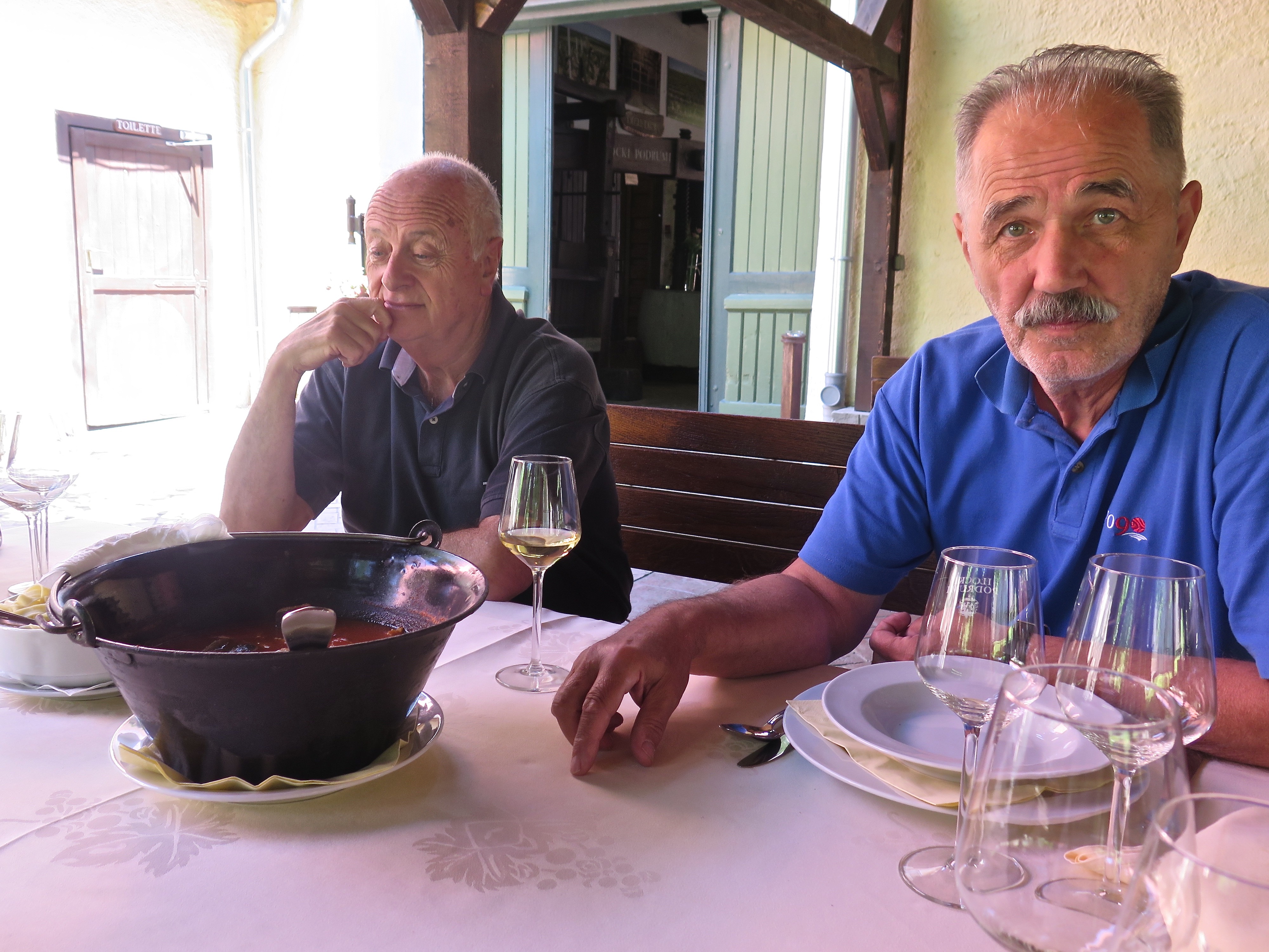
He was in his best smart casual clothes, had a bit of product in his hair and just for one minute he looked shy. But for one minute only. Because this was the boss, the tour guide, the director, the man. He was, of course, going to make it work. It was within his power, well within.
We’d had to talk him into coming to Belgrade to pick us up. That could have been unfair. He was quite big enough to look after himself, in fact a potent brew when roused. But I don’t know what it’s like crossing the Croatian border into Serbia, driving a rented car and needing to offer a paper thin even if true reason if asked — picking up some Australian friends to drive them back through Eastern Croatia to eat, drink and make merry. You could get some arsehole on the gate who wants to refight the war; or you could, as we later discovered, run into a cheery squat young woman with a large pistol on her hip who simply wanted to wish us a good day.
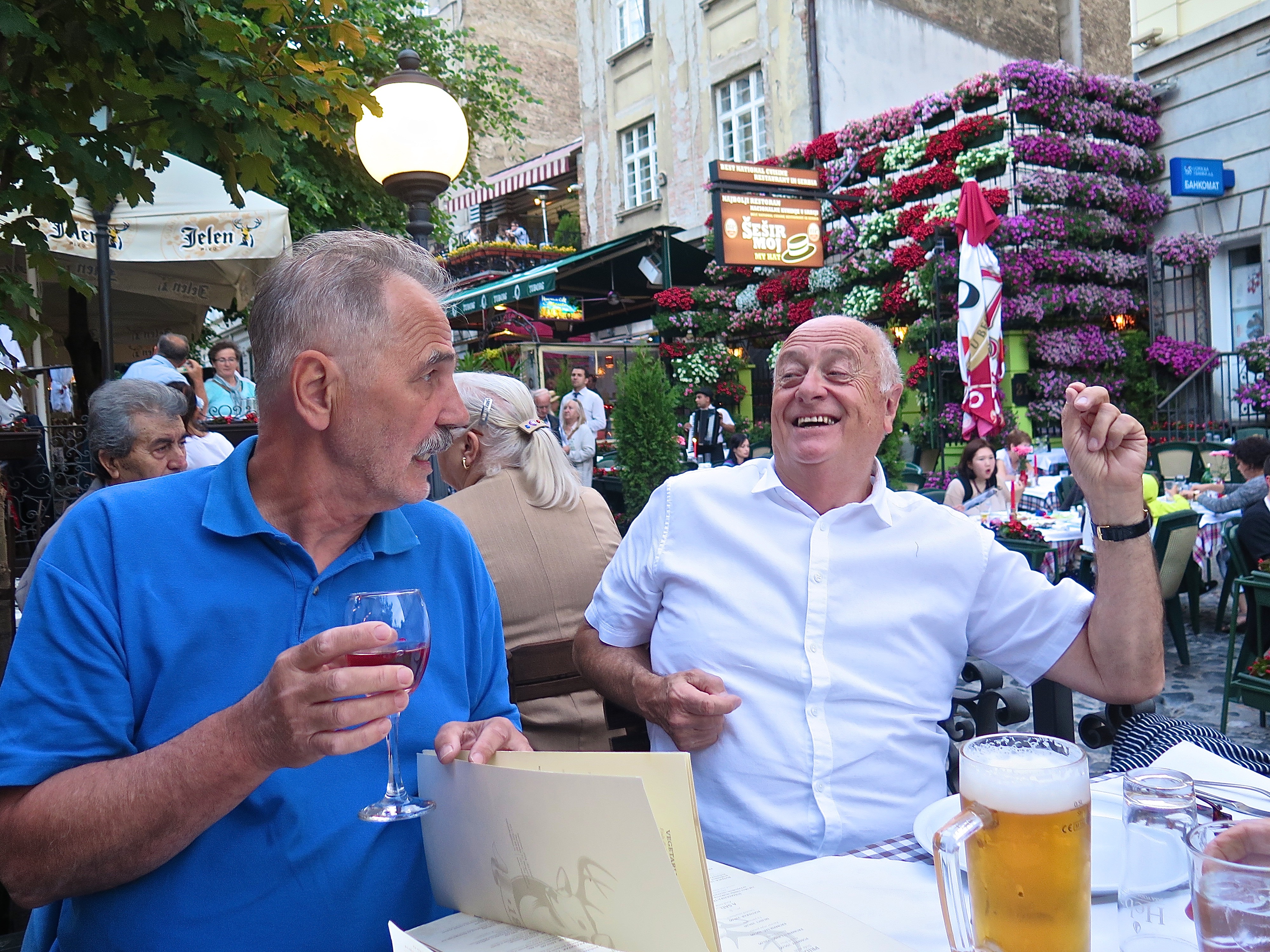
You don’t know, and of course Don wouldn’t say, what he might have been thinking. Far too practised at this game to say; just waiting to play the cards as they are led. Or as Lord Rowland would say hands flying up in the air, eyes rolling, ‘Don. It’s Don. You know Don.’
As it happened, nothing did happen. He was there, we had had a few days of investigation of the White City and beyond, so we were there too. We even knew where to take him for dinner, Dwa Jelena (Two Deer), to offer him the chance to run through what might be wrong with the cuisine. Or the wine. Or the company. But no. It was a party, a fine reunion. Hoorah. I’d forgotten what huge fun we had together.
A new chapter had begun.
From Belgrade it was the same vast expanse of the Pannonian Plain, laser-levelled for agriculture, that we were passing through as when we went to Sremski Karlovci with Joci, but the green protuberance of Fruska Gora (‘The Frankish Mountain’, a reference to ancient borders) was to our right rather than our left. Don may have driven us along the ridge of the national park for reasons of picturesque-ity … I can’t remember. We didn’t dawdle; I do remember that. We had crossed the border into Croatia (the agreeable woman mentioned above) before lunch time.
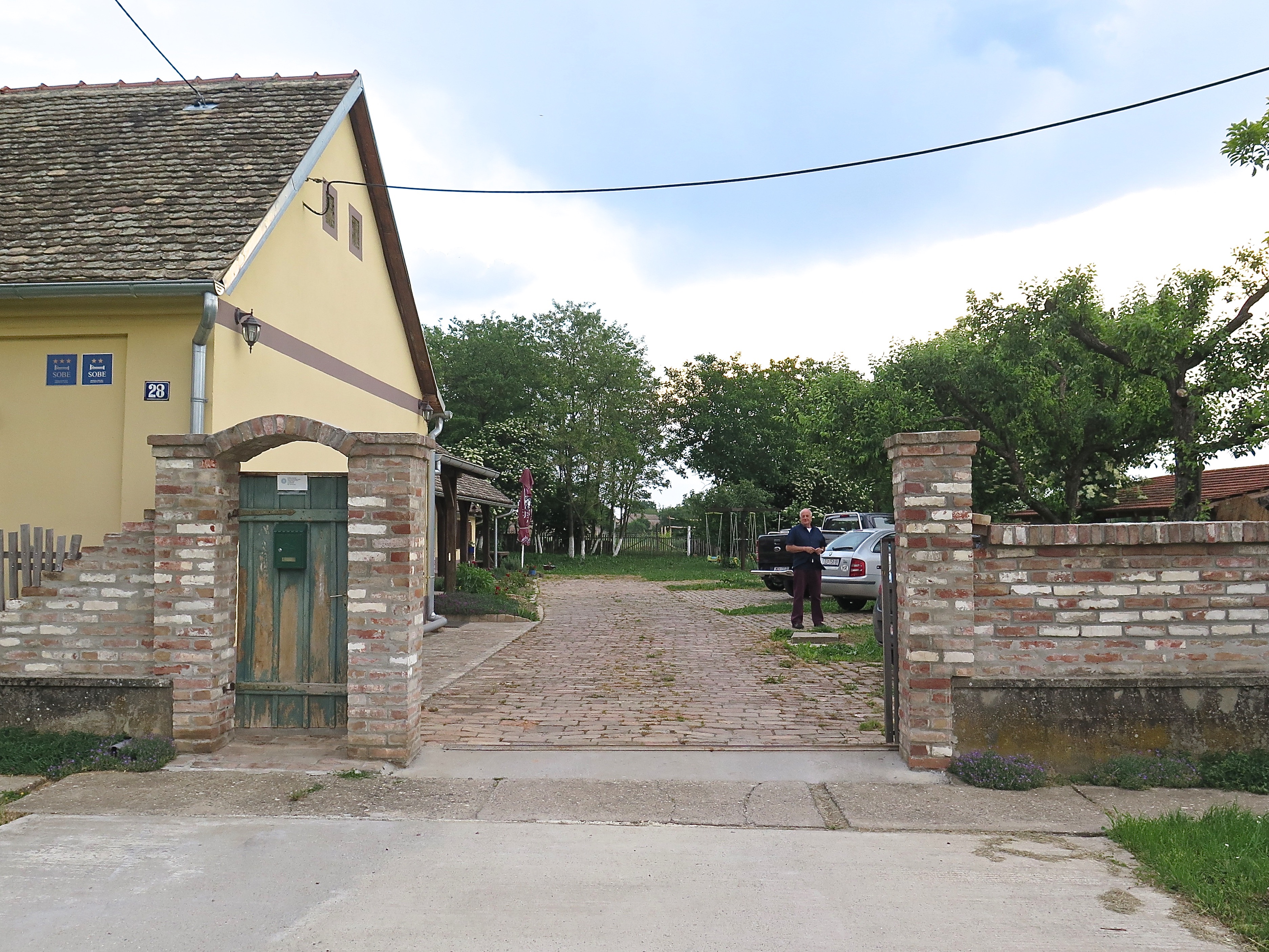
 We arrived at Ilok, more specifically at Stari Podrumi (‘Old Basements’, probably Cellars really) a winery/ accommodation spot where the solid doors closed with a satisfying ‘climp’ and the windows were the complex European type which open in several directions if not necessarily at the same time. Suddenly Croatia rather than Serbia. Out our window I could see the Danube, on one side Srbija; and on the other Hrvatska. We were just into Croatia. A couple of hundred metres. But it felt like a long way further than that.
The feasts began immediately.
 Lunch was Paprika Fish Stew, followed by (at left) two types of pike — rolled in beer batter and chunks deep fried — with catfish in a seeded batter of some sort, accompanied by an award-winning Iločki Podrumi gewurtztraminer. Whatever anyone else thought, I believed it was important to make the most of staying at a superstar winery.
After lunch we had a tour of the cellar with a young woman who spoke excellent English and besides being delightful had answers to all our questions. Quite good going really.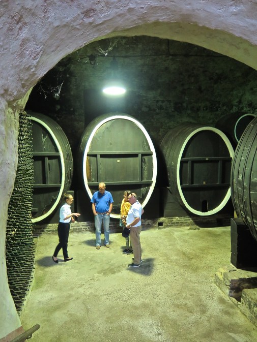 Her name was Maria. I think she stayed with us as our guide to the church, the fort and other highlights of the town. I hope we gave her a good tip.
 It was just near here that our vehicle pulled over and we had an encounter with strawberries, the best strawberries I have ever eaten. They were startlingly good: plump, as big as a baby’s fist but not inflated artificially with hormones, crimson, with a strong inviting smell and irresistible flavour. Powerhouses of the genre.
And this was all before our trip to Principovac for dinner. Don knows how to pack an itinerary.
 ‘Near the centre of the historic town of Ilok, on the landscape hill offering stunning views of Ilok, Srijem and Backa, lies the Principovac Castle and Estate that was built in 1864th as summer residence of the Odescalchi family – The Dukes of Ilok, who stayed here during hunting seasons and grape harvestings. Whether you are a true wine connoisseur or you’re on just your way to become one, when you taste the royal Traminer and Graševina from Principovac in different styles you’ll realize that wine is here much more than a profession – it is a lifestyle.
‘Inside the restored castle of Odescalchi family is the Principovac restaurant, which has rich gourmet offer – new age cuisine that is based on indigenous ingredients, flavours of the Croatian Danube and Slavonia prepared in a sophisticated way serving each course with a glass of wine chosen from our rich wine offer.’
Weddings, parties, anything. Four-star accommodation, golf, team building, tennis and badminton courts, playgrounds for children, aquarium, ‘8 km of wine roads ideal for running, romantic walks, bike rides, moped rides or electric car rides’. Exhausting even thinking about it.
We dined at the restaurant with the ‘rich gourmet offer’, and on our own. I’m not 100% sure that the staff thought our presence was preferable to getting home for a big feed of strawberries, but it was all just fine.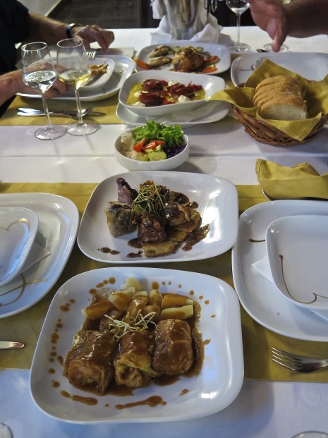 Tonight, for our pleasure, hmm we drank the Graševina and that was something to behold… now, not in order, medallions of veal, cabbage rolls (closest to us, which were amazing), steak en croute and ‘Herbie’s Dinner’ (which I may have rendered incorrectly) which Don assured us was an outstanding regional speciality and I can’t remember for the life of me what it was. We finished with some of the chateau’s palachinka, a fine digestive. I slept like baby.
On a fresh morning, the precursor to a hottish day, we had the most leisurely of breakfasts under this linden tree. Great coffee. It was sort of perfect. The door on the right is the entrance to the cellars, the door on the left to the feasting hall, a little piece of eastern Europe which could have been lot of places.
We were on our way further east 40 km to Vukovar but we took some time to have a splash in the Danube, a doughty river. Lord R on an embankment.
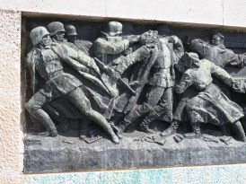
I was interested to see Vukovar because, with Srebrenica, it is one of the very serious sites of the 1990s Balkan wars. What would be left from scenes like this I wondered.
During this very muddled conflict (which I have tried to describe elsewhere), fighting broke out in Slavonia (eastern Croatia) in May 1991. In August, the predominantly Serbian Yugoslav People’s Army (JNA) launched a full-scale attack against Croatian-held territory of which Vukovar was the lynchpin.
Vukovar was defended by around 1,800 lightly armed soldiers of the Croatian National Guard (ZNG) and civilian volunteers, against approximately 36,000 JNA soldiers and Serb paramilitaries equipped with heavy armour and artillery. During the battle, shells and rockets were fired into the town at a rate of up to 12,000 a day. At the time, it was the fiercest and most protracted battle in Europe since 1945, and Vukovar was ‘the first major European town to be entirely destroyed since the Second World War’ (see below).
When Vukovar fell on 18 November 1991, several hundred soldiers and civilians had been killed by Serb forces. In one case at least ‘massacred’ is the term used by Croat commentators. Two hundred bodies were exhumed from a single grave. Subsequently most of the city was ‘ethnically cleansed’ of its non-Serb population — at least 20,000 inhabitants were expelled from the city — and it became part of the self-declared Republic of Serbian Krajina.
There are terrible stories about the 87-day siege, of starving women and children living in cellars and other underground dwellings, inevitable parts of the horror of war. I don’t know much about wars, but the story of the Serb combatants might be more unusual. This follows one account with convincing sources.
Serbia was never formally at war and no general mobilisation was carried out. An estimated 150,000 Serbs went abroad to avoid conscription, and many others deserted or went into hiding. Only 13 percent of conscripts reported for duty. Another 40,000 staged rebellions in towns across Serbia; the Serbian newspaper Vreme commented in July 1991 that the situation was one of ‘total military disintegration’.
Serb morale on the Slavonian battlefield was poor. JNA commanders resorted to firing on their own positions to motivate their men to fight. When the commander of a JNA unit at Vukovar demanded to know who was willing to fight and who wanted to go home, the unit split equally. One conscript, unable to decide which side to take, shot himself. A JNA officer who served at Vukovar later described how his men refused to obey orders, on several occasions ‘abandoning combat vehicles, discarding weapons, gathering on some flat ground, sitting and singing Give Peace a Chance by John Lennon.’
A tank driver, Vladimir Živković, drove his vehicle from the front line at Vukovar to the Yugoslav parliament in Belgrade, where he parked it on the steps in front of the building. He was arrested and declared insane by the authorities. His treatment enraged his colleagues, who protested by taking over a local radio station at gunpoint and issuing a declaration that ‘we are not traitors, but we do not want to be aggressors’.
But things changed: fresh (and more capable and determined, or ruthless if you like) leadership in the form of General Života Panić, and fresh ‘troops’, Serbian paramilitary volunteers: well armed, highly motivated, undisciplined, famously brutal. ‘Arkan’s (Željko Ražnatović) Tigers’ had arrived.
The commander of the southern JNA corps was videotaped after the decisive battle praising the Tigers: ‘The greatest credit for this goes to Arkan’s volunteers! Although some people accuse me of acting in collusion with paramilitary formations, these are not paramilitary formations here! These are men who came voluntarily to fight for the Serbian cause. We surround a village, he dashes in and kills whoever refuses to surrender. On we go in triumph!’
And the core of the city, with its unbroken history since neolithic times, was left in ruins.
The degree of destruction of the city is contested. For example an American historian who visited the city shortly after the decisive battle writes: ‘I want to correct a misstatement that has become an urban myth in the annals of the Yugoslav wars. Having visited Vukovar shortly after the conclusion of hostilities and several times since, I can assure you that the city was far from “totally destroyed”. To be more precise, only the relatively small downtown area was devastated. Although there was significant damage to outlying structures that were targeted by JNA artillery (every non-Orthodox church, the train station, the Eltz palace/museum, the water tower, among many others), most of the rest of the town was surprisingly intact.’ And I must say that’s how the pictures look to me.
But less contested is the damage that was done to the longstanding multicultural harmony of the city.
Some indication of its more recent demographic diversity can be gained from this table.
National structure of the population of Vukovar: | |||||||||||
Year | Total | Croats | Serbs | Germans | Hungarians | Others | |||||
2011 | 27,683 | 15,881 | 57.4% | 9,654 | 34.9% | 58 | 0.21% | 347 | 1.25% | 1,743 | 6.30% |
2001 | 31,670 | 18,199 | 57.5% | 10,412 | 32.9% | 58 | 0.2% | 387 | 1.2% | 2,614 | 8.3% |
1990 | 44,639 | 21,065 | 47.2% | 14,425 | 32.3% | 94 | 0.2% | 694 | 1.5% | 8,361 | 18.8% |
1971 | 30,222 | 14,694 | 48.6% | 9,132 | 30.2% | 60 | 0.2% | 835 | 2.8% | 5,501 | 18.2% |
1948 | 17,223 | 10,943 | 63.5% | 4,390 | 25.5% | 54 | 0.3% | 913 | 5.3% | 923 | 5.3% |
1931 | 10,242 | 5,048 | 49.6% | 1,702 | 16.6% | 2,670 | 26.1% | 571 | 5.6% | 215 | 2.0% |
1910 | 10,359 | 4,092 | 39.5% | 1,628 | 15.7% | 3,503 | 33.8% | 954 | 9.2% | 183 | 1.8% |
One commentator says: Before the war, more than 20 ethnic groups lived in Vukovar. Not only Serbs and Croats, who made up the majority, and those who identified as “Yugoslavs” (roughly 10 percent), but also Ruthenians/Rusyns, Hungarians, Ukrainians, and many others. Moreover, the citizens of Vukovar were proud of their multicultural city, and ethnic background was irrelevant in daily life and social relations. That is no more. The city’s children are now educated separately by ethnic group; the Cyrillic (Serbia’s choice of alphabet) on road and other signs required by Croatia’s constitutional protection of minority groups is regularly vandalised.
Vukovar had for centuries been an important port on the Danube with the interesting demographic history that that entails. It seems to have been the world’s heart of copper-smithing during the Vučedol culture of 3000-2200BC. At one time it had eight mosques to cater for its Ottoman population. At other times it has been home to the Romans (who for centuries used the Danube as a line of defence), Vandals, Goths, Huns, Avars, Slavic Russians, Magyars, Slovaks, Jews, Austrians and so on. But there is something about multiculturalism that really offends some people. They just hate it.
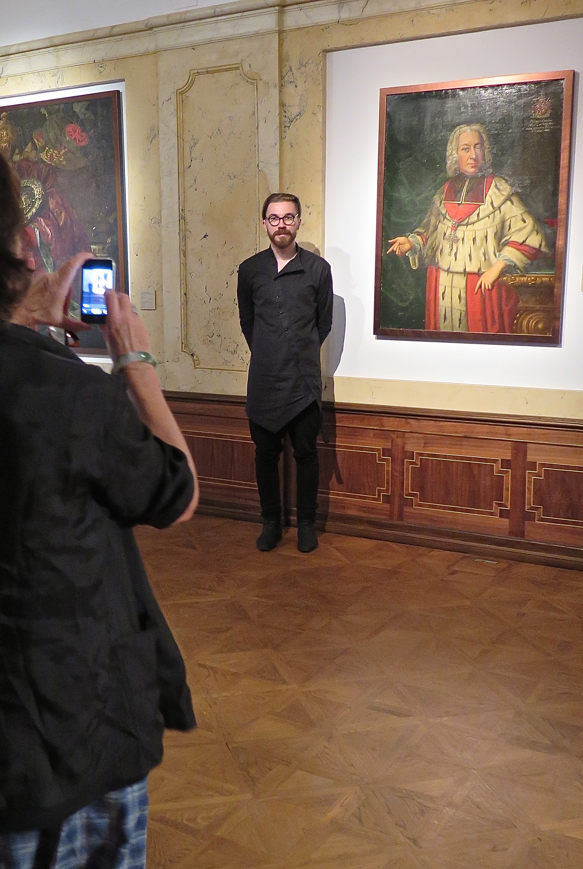
The history, but not the offence, was on display in the city’s wonderful museum. I’m not sure that I was looking properly or if we ducked through the side of the city — I might in fact not have credited just how complete the restoration of the town had been. This today, for example, is exactly the same view as the troubled ruins above.

The equivalent of $40m Australian dollars (kuna from the EU in fact) has been spent on the restoration of Castle Eltz, the building housing the museum. There are are still some pockmarks in the tower, but everything else was in pristine condition. And excellent.
 One reason for its interest is that the only reference to the recent troubles is some silent pictures in the top floor. The other floors are concerned with the region’s history from pre-historic times with consistently thoughtful and high quality exhibits.
Zoran, below, made a florid, arty and enthusiastic guide. He could have been dressed by Eastern Market which will make sense to no one but Myrna.
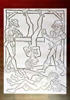 Just as it happens in the basement there was an exhibition about torture which I confess I had to be dragged away from.
There are just so many ways to use physical pain, most of which seem to be been employed since time immemorial, and most of which seem to have found willing employers.
Perhaps we need to be reminded of this when the US decides that water boarding — a very old form of punishment — is a perfectly acceptable way to force confessions and information out of prisoners.
To far happier moments. We had arrived in the middle of the Kopački Rit wetlands, ‘the greenest waters and forests in the whole of Slavonia’, at the junction of the Drava and Danube Rivers.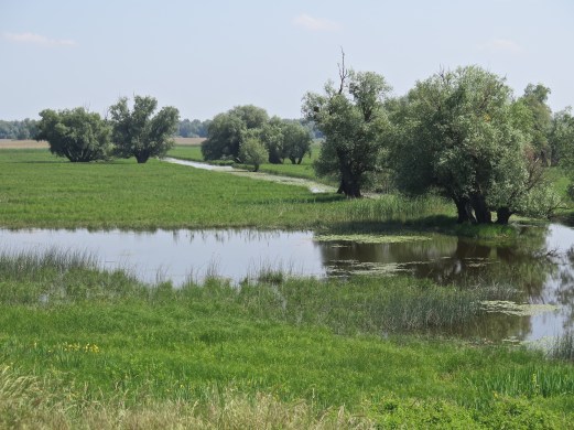 The border between Serbia and Croatia at this point is a long series of curlicues (the thin black line below), perhaps to share the best aspects of this highly fertile region. For reasons of convenience I’ve tipped this map over, North is on the left hand side. It’s just to illustrate what I mean, and you’ll get the point.
A highlight, and a superior photo of a highly photogenic subject.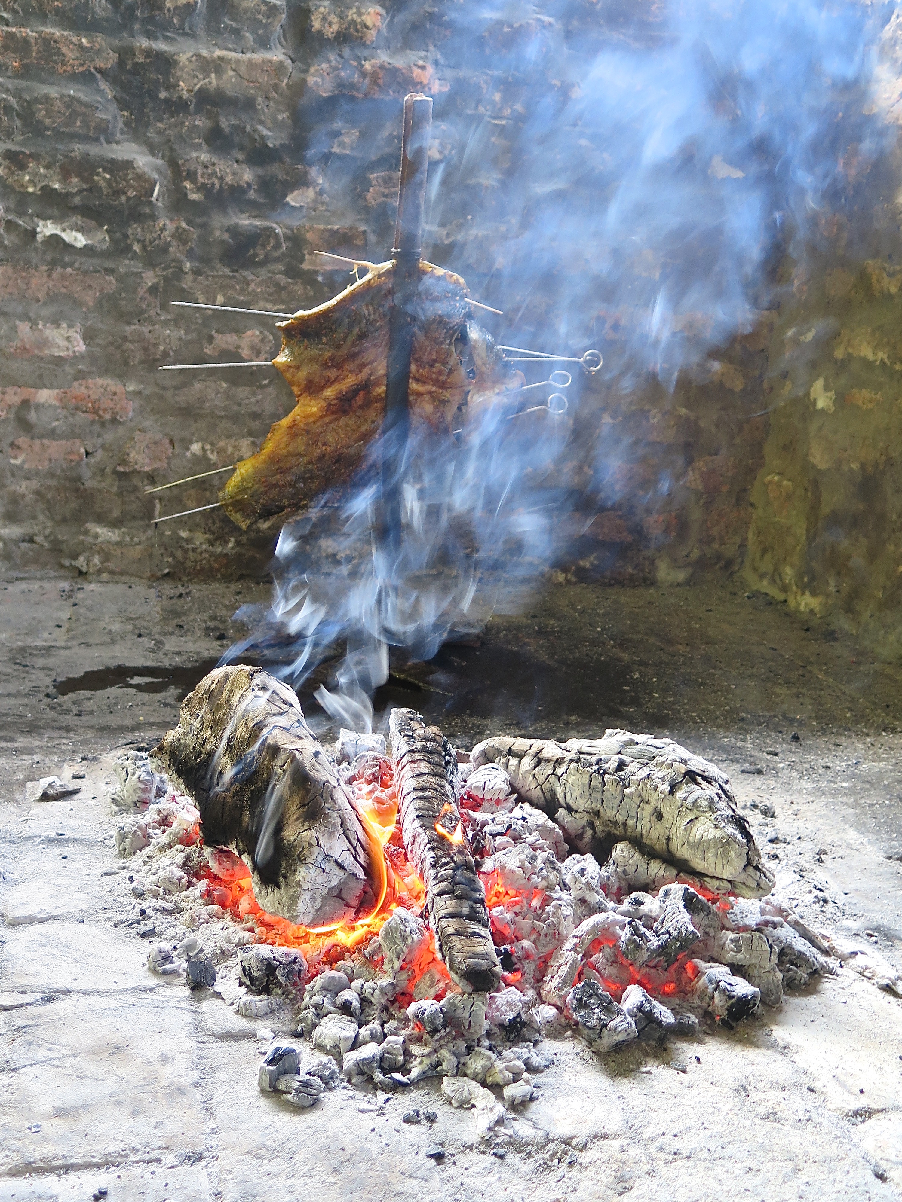 We had moved on to the Komoran Restoran, another of Don’s Specials. ‘Komoran’ means ‘gloomy’ in Hungarian, but I’ve spelt it wrong obviously. ‘Kormoran’ means ‘cormorant’ in Croatian, and that would be far more suitable because of its splendid setting in the middle of the wetlands. And we were having a major regional specialty. ‘In our region Catfish on Forked Branch and cooked in smoke is the most appreciated fish specialties’ (tourist info), and this was it on arrival.
 Don said it was even more special because it had been caught from the bottom of Danube in the muddy waters, and er hem I must confess that was how it tasted. (Look, you can’t go ooh ahh about everything. You’ve got to call it how you see it. The spuds were nice and the visuals outstanding. We were also entertained by some nesting and very familiar martins.)
It was 20 km, if that, to Karanac where we were to spend the night.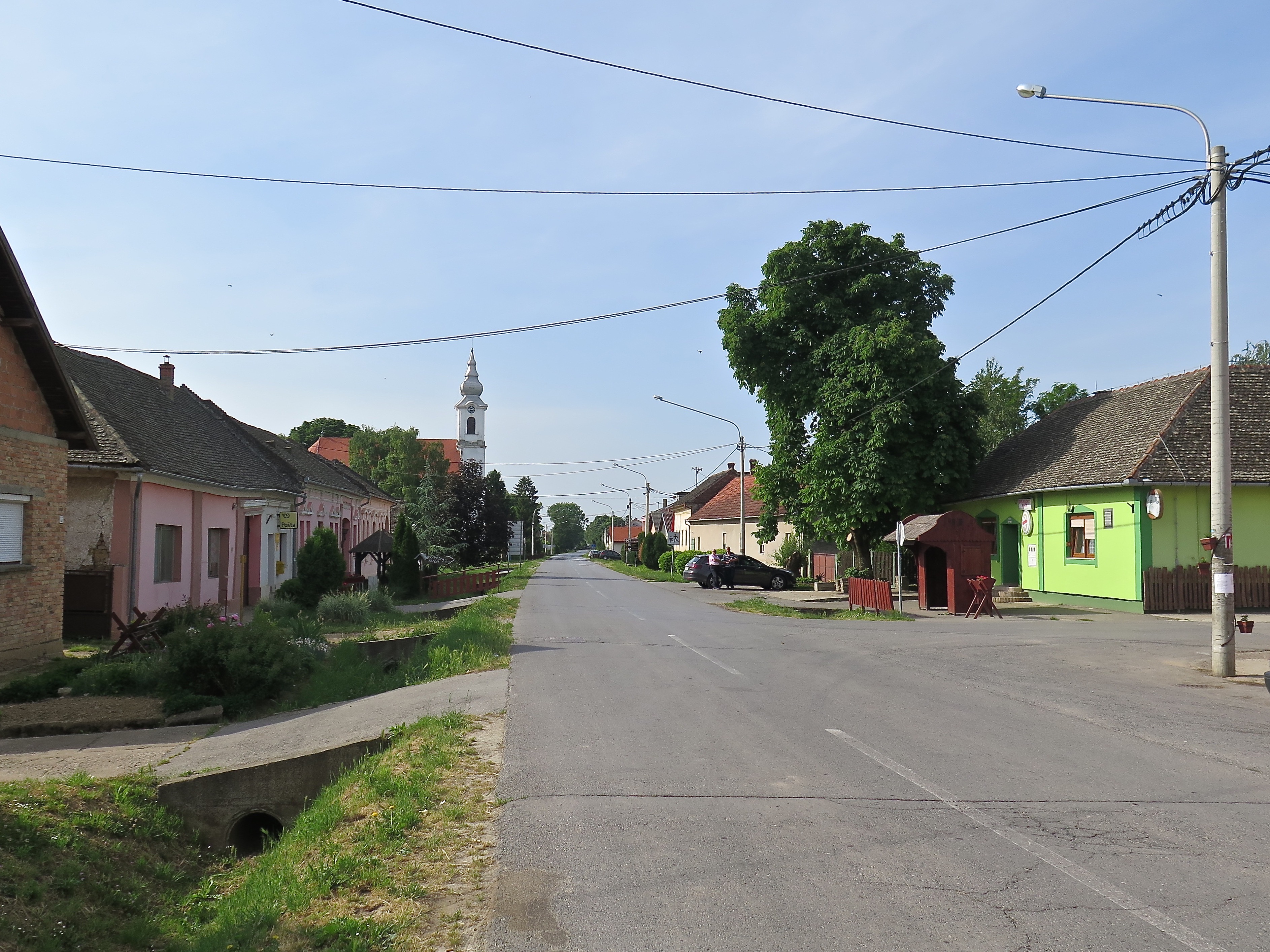 Karanac is an ‘ethno village’ which ‘has in the past few years become a magnet for numerous foreign and domestic tourists who enjoy the rich gastronomic and tourist offer of this area. In Karanac visitors can experience the feeling of far gone, past times, where each household had a story that was slowly carried on from generation to generation, keeping its authenticity and lifestyle far from the hustle and bustle of an urban area.’ Website publicity, but all true.
What that meant in addition was that we stayed at a mate of Don’s who was pumping up the tyres of this industry, that you could stay in a delightful cabin like this, 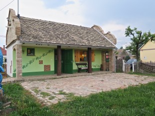 that you could trip over an offering like this in the footpath,
 that you could stay somewhere with a garden that would feed you most things you would want to eat,
 and that you actually could eat at the local pub.
  Paprika soup was the dish du jour, the highlight special and it was delicious.
It also meant that Don was in his element. Never looked better.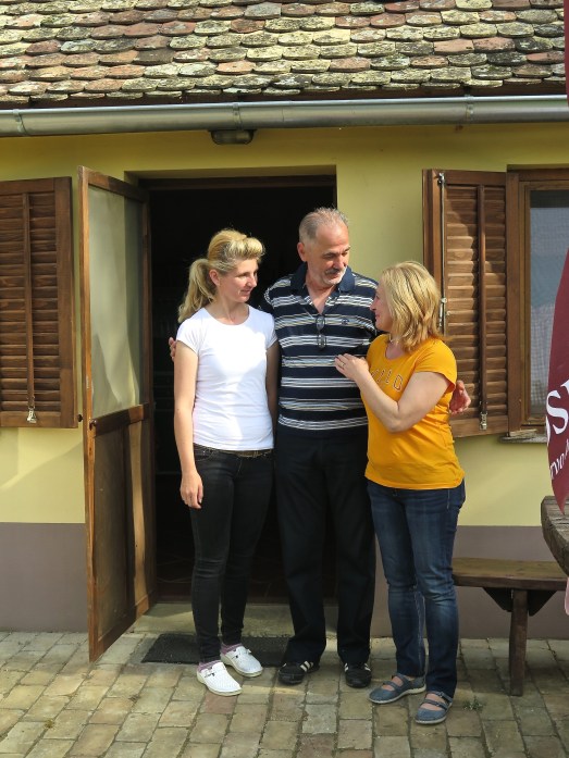 This was taken, a regretful farewell, after a most sumptuous all-star breakfast a lot of which had come out of the garden or from the chooks and cows in the paddock. This was a highly successful deviation.
We went further north up into the corner of Croatia to Batina where the Allies (a reminder, Yugoslavs and Russians, allies) crossed the Danube in the closing phases of the Second World War. How did they do that? A unit consisting mostly of soldiers from Vojvodina (now northern Serbia) crossed the river on rafts or fishing boats under cover of an enormous artillery bombardment of the German positions on the right bank of the river. The battle went to and fro as efforts were made to supplement the allied soldiers on this side of the river, until after 18 days all Germans between the two rivers, Drava and Danube, had been killed or driven out.

According to some historians the Battle of Batina was the biggest battle by number of participants, intensity of fighting, and strategic importance that occurred in Yugoslavia during the World War II.
South to Đakovo (with a ‘dj’) and its horses. The Stud Farm in Đakovo was established in 1506 which qualifies it to be among the oldest stud farms in Europe. Horses of the Lipizzaner breed have been bred in the Stud Farm since the beginning of the 19th century. I think the only other Lipizzaner ‘school’, a successor to this one, the original, is in Austria.
The horses trot, dance and jump and do clever formation things while you watch, delighted.  I’m not so much a horse person, but amongst our number were those who are.
 He knew what he was looking for.
 We had look at the cathedral, yes and no; its crypt, better.
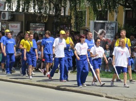
But then, suddenly, hordes of young people started appearing.
Hordes …
 It was the last day of school, and all the graduands had come into the middle of town, stopping it absolutely — but with no complaints, this was a significant cultural event — and with their umbrellas and their costumes they performed a lengthy quadrille (dance in fours). It was one of those moments that can happen when you’re travelling, completely unexpected but such a thrill to see.
They were so well drilled and well behaved. Youth and beauty, a joy to behold. I asked Don what happens next and he said, they go off and get drunk. Of course.
Back to Zagreb for a warm welcome from the family: Mirjana, Lucas, Ivan, Dina and Nika.
And that night — what can I say — another visit to the Restoran Trnjanska and its finest black lamb. The Grey Falcon had, as always, done his job.
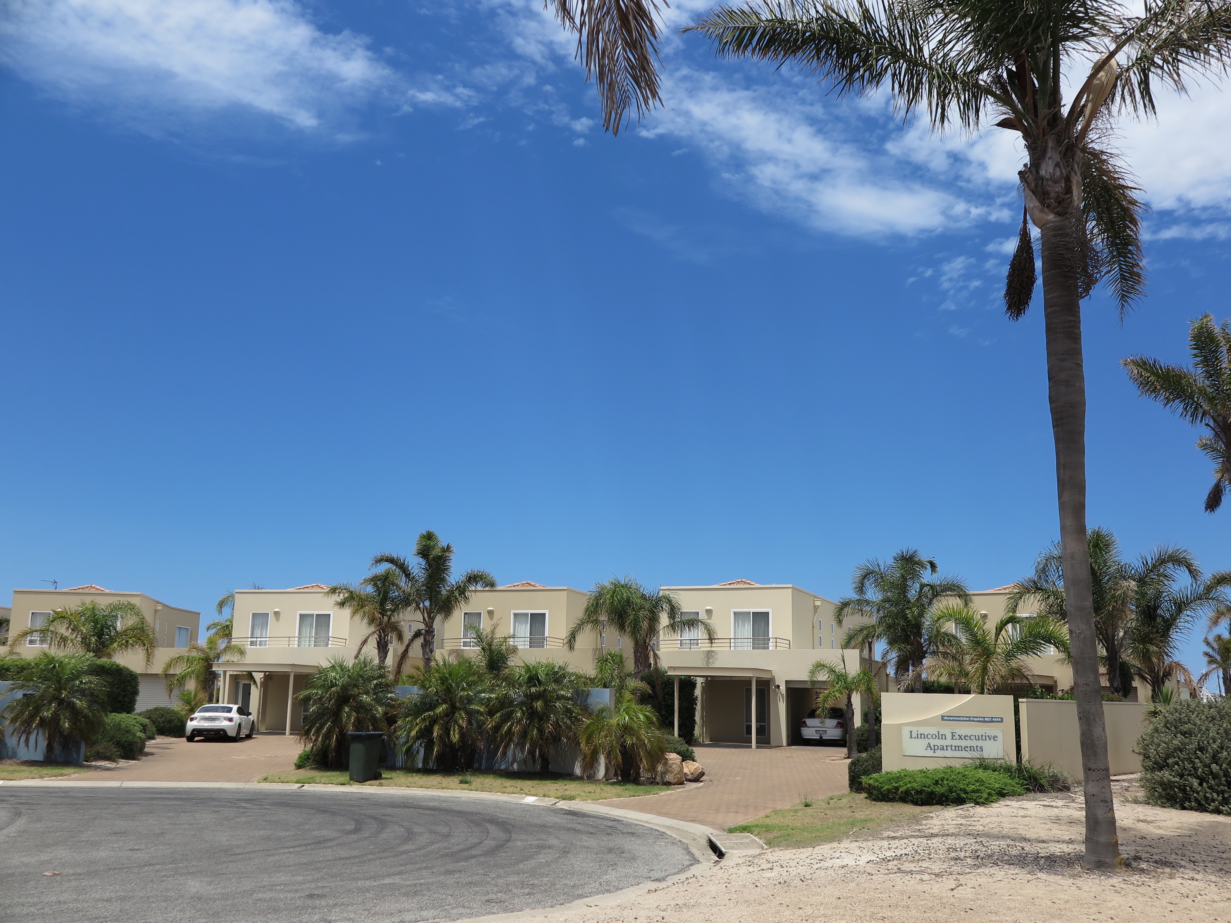
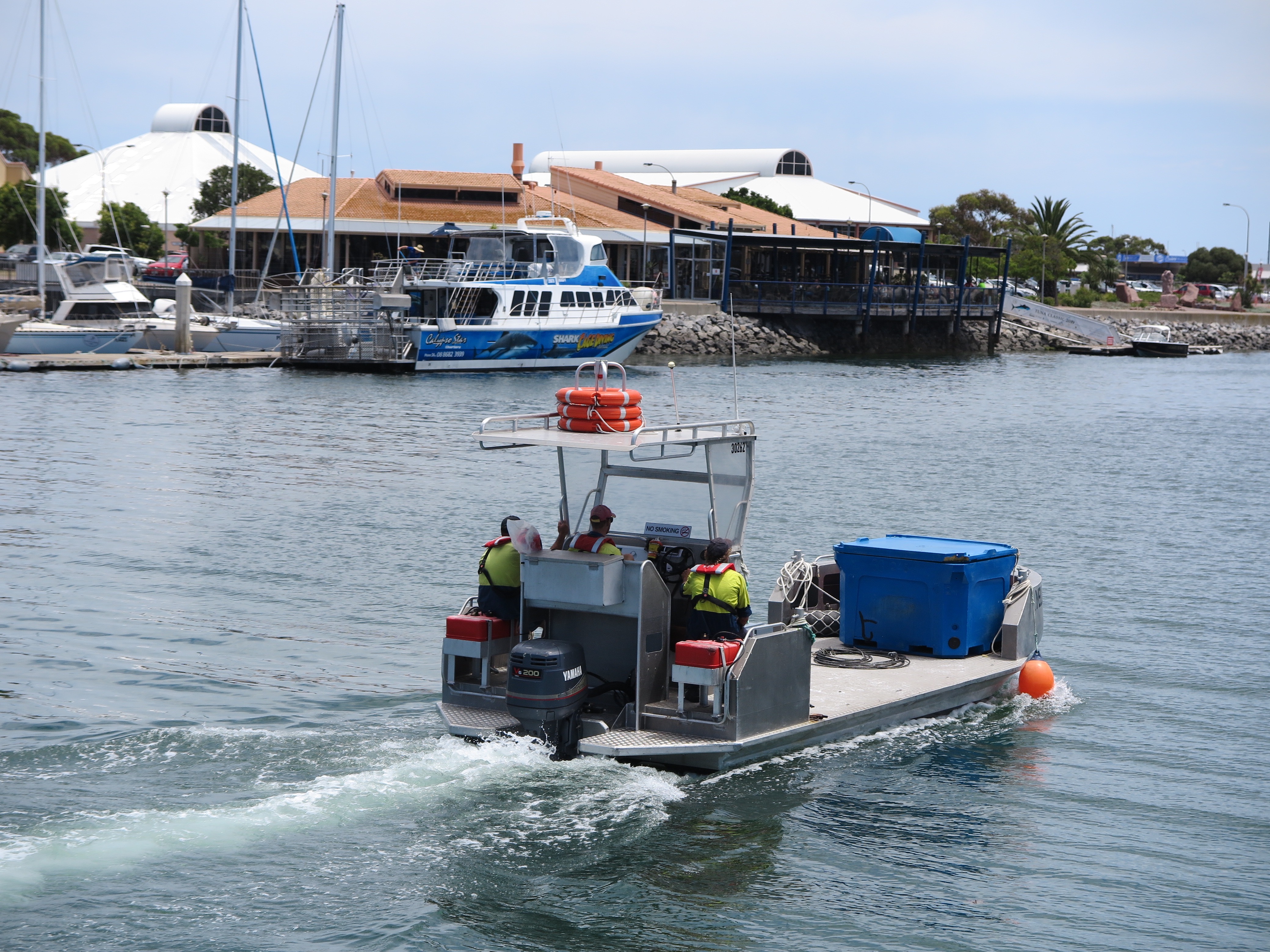
 ‘The Lukin family’s $289 million dollar Port Lincoln development has State Government approval, opening the way for up to 280 jobs a year during the next decade.
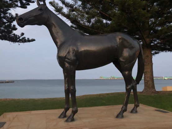 The Tuna Boat Owners Association who are also behind the cultural centre and its program, the art competition, the very fine local sports facilities, the Tunarama festival and most of the other things that happen in town, made a major contribution to the erection of this statue.
 We flew there. From Adelaide it’s a 650km drive of variable interest round the top of the gulfs. In the Saab 340 it took about 40 minutes.
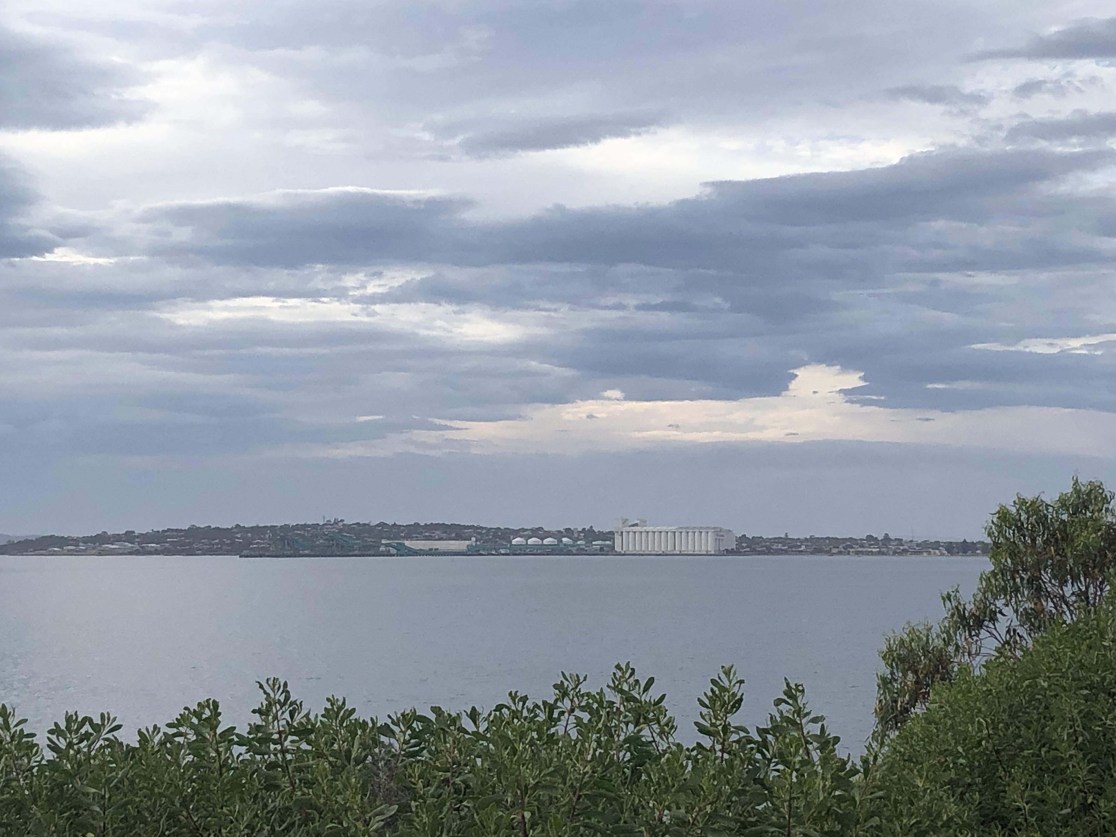
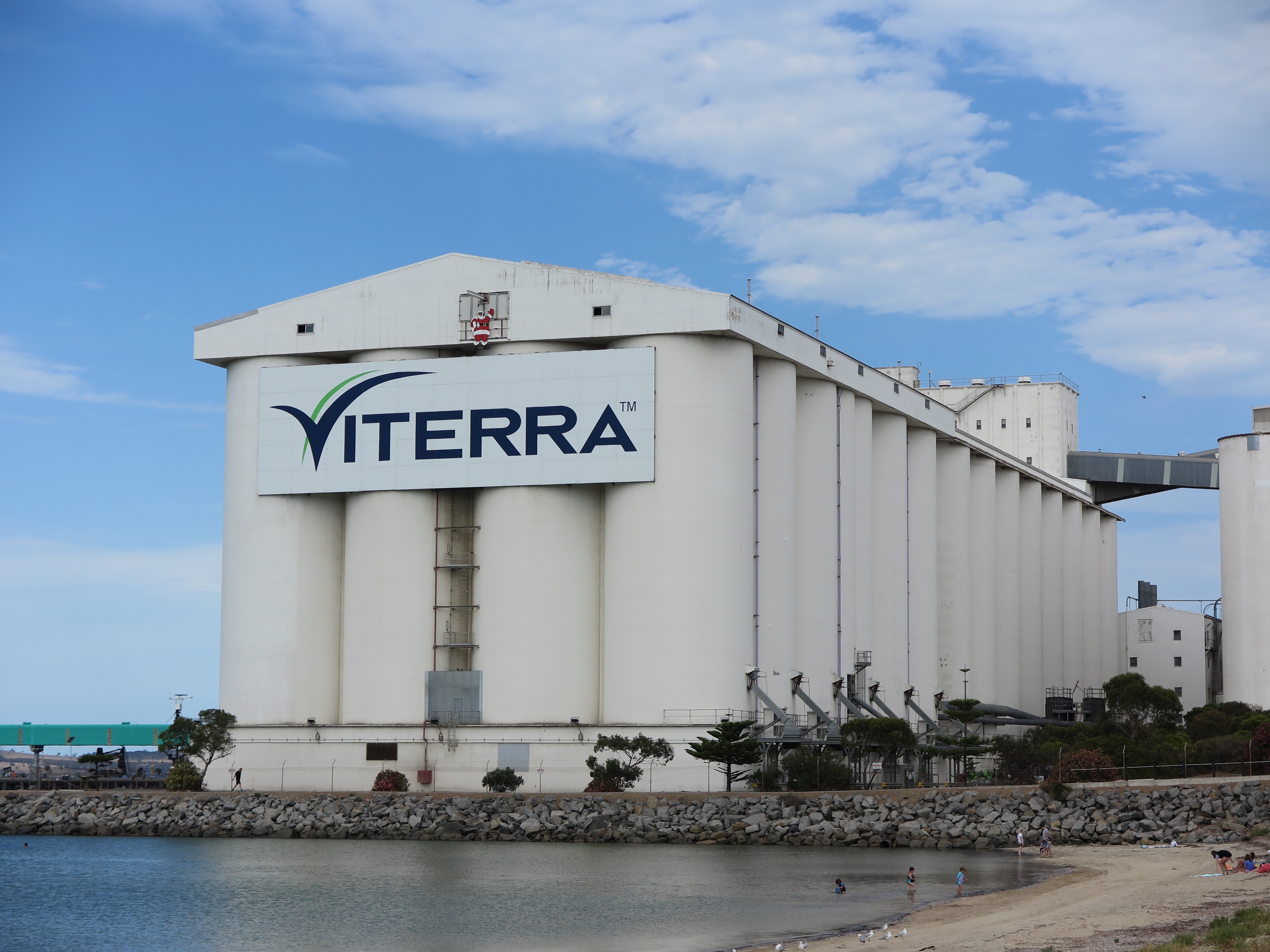 The grain &c. mostly comes in trucks these days. There was an endless and noisy procession of B Doubles doing a loop out through the bulk handler. Once it came by train. I wondered just how the line hooked up to Adelaide or anywhere else really. Maybe Whyalla. But it doesn’t, and didn’t. Its termini are just termini, two lines parked out on their own, finishing at the major centres of Thevenard and Buckleboo. Port Lincoln could, if you let it, feel very isolated.


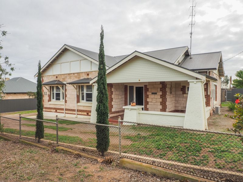

 This one was for sale: $670,000. It had a commanding view of the silos. Just incidentally, I would like to point to the four types of gardens in the four photos. There was a lot more of numbers 2 and 3, than 1 and 4.

 … complete with statuary on the corner which you mightn’t be able to see in the bigger pic. (But at left.) The name of the boat is ‘The Battler’, and you can get a very nice reflected view of the Yaris in the lounge room window.

 Get into it.
 The State Library in Adelaide where we found Sturt’s journals.


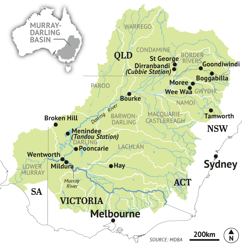 The Murray-Darling Basin covers a vast amount of territory in four states and the ACT, far more than most people imagine. In
 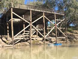 Bourke was once an important inland port. The evidence is still there. The paddle steamers with their cargoes of wool going south and supplies going north would tie up to the top rail of its
 Why is the Darling dry? Because of the very bad drought that has affected western NSW for some time. No argument. The Darling runs almost exclusively through arid country where evaporation eats up 94% of the rain that does fall.
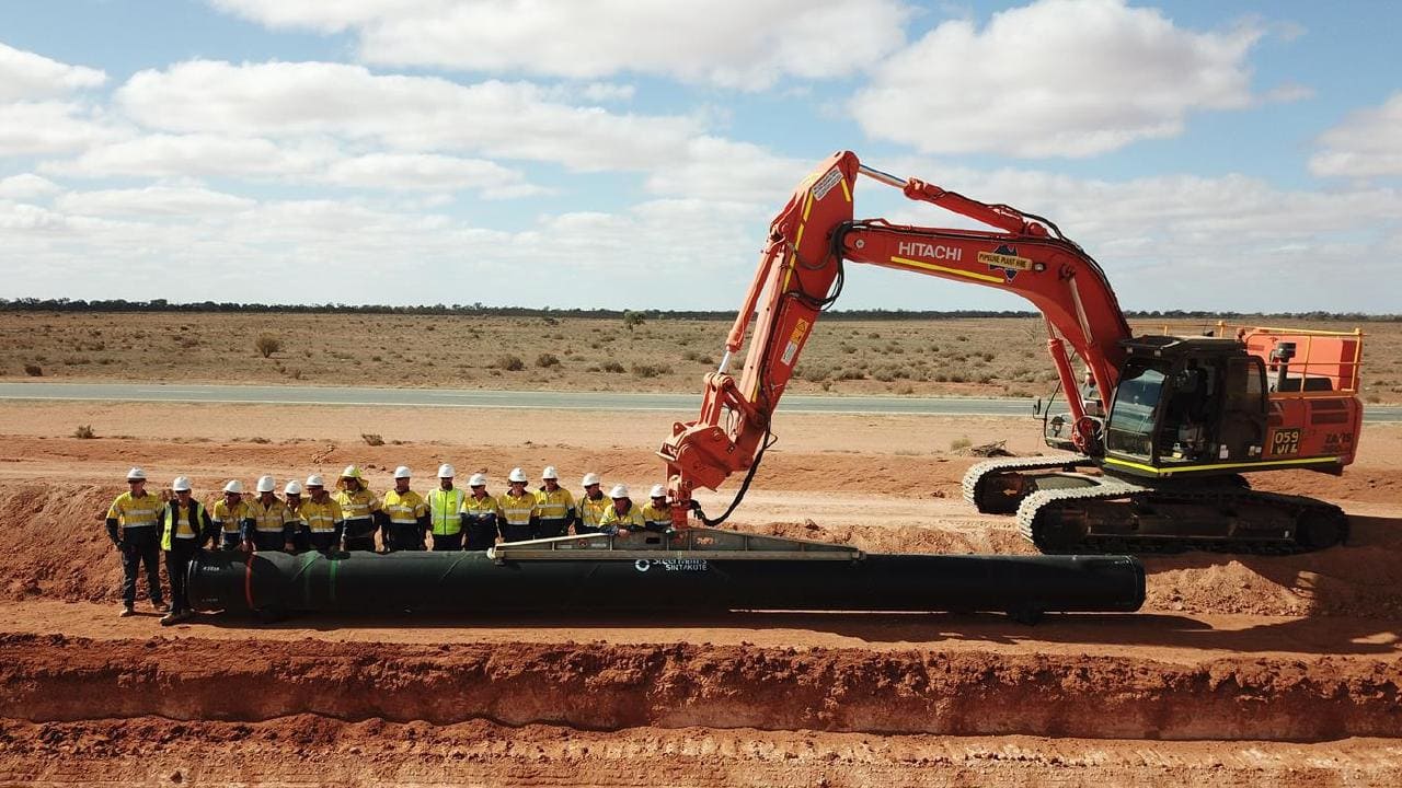
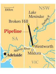 The lakes have also been the main source of Broken Hill’s water supply. (A modest proportion comes from captured rainfall and local natural aquifers.) Water has run through a 140km pipeline providing one important reason for maintaining good supplies of water in the lakes. That pipeline is ageing and needed about $110m spent on it to keep it in good working order. But that was not the decision of the NSW govt. It decided to build a new 270km pipeline from the Murray at Wentworth at a cost of $467m (also costing more than $25m annually, at least in the first four years, to run). 37.4 megalitres a day will be pumped from the Murray. A megalitre is one million litres. That would be 1.7 million litres an hour.
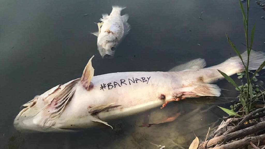
 Thus there is no need for the Menindee Lakes anymore (‘de-commissioned’), cotton growers can up their demands in the Darling headquarters, and the lower Darling doesn’t need to flow at all. All the flow can be used further north. That can happen. Mr Joyce has noted that this would be most beneficial, and that he thinks it should happen. The argument goes that the Lakes are sources of unsustainable levels of evaporation. At present it is intended to leave four of them with a puddlesworth each.
  This pic was taken at Truro, 30 kms from the lush vines of the Barossa (misspelt in an early edict from ‘Barrosa’, a battle the British lost in southern Spain in 1811). Just incidentally, for some unexplained reason people had started stringing up soft toys on fences near here.
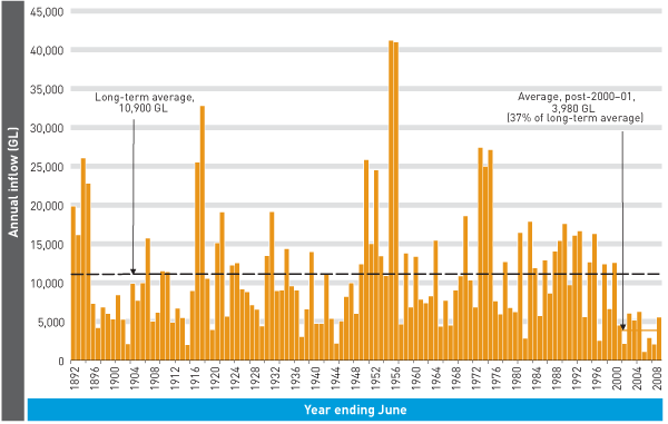 The caption notes that for 2000-08 the average is 3,980GL, one-third of the long term average.
 I would like to take as one text
  Her data on turbidity and unhelpful added nutrients like phosphorus show no special trend over the time series she has, and she pooh poohs the claim by the Wentworth Group (of distinguished scientists) that ‘vast numbers of 300-year old red gums are dying along the Murray floodplain due to extreme drought following a severely depleted river

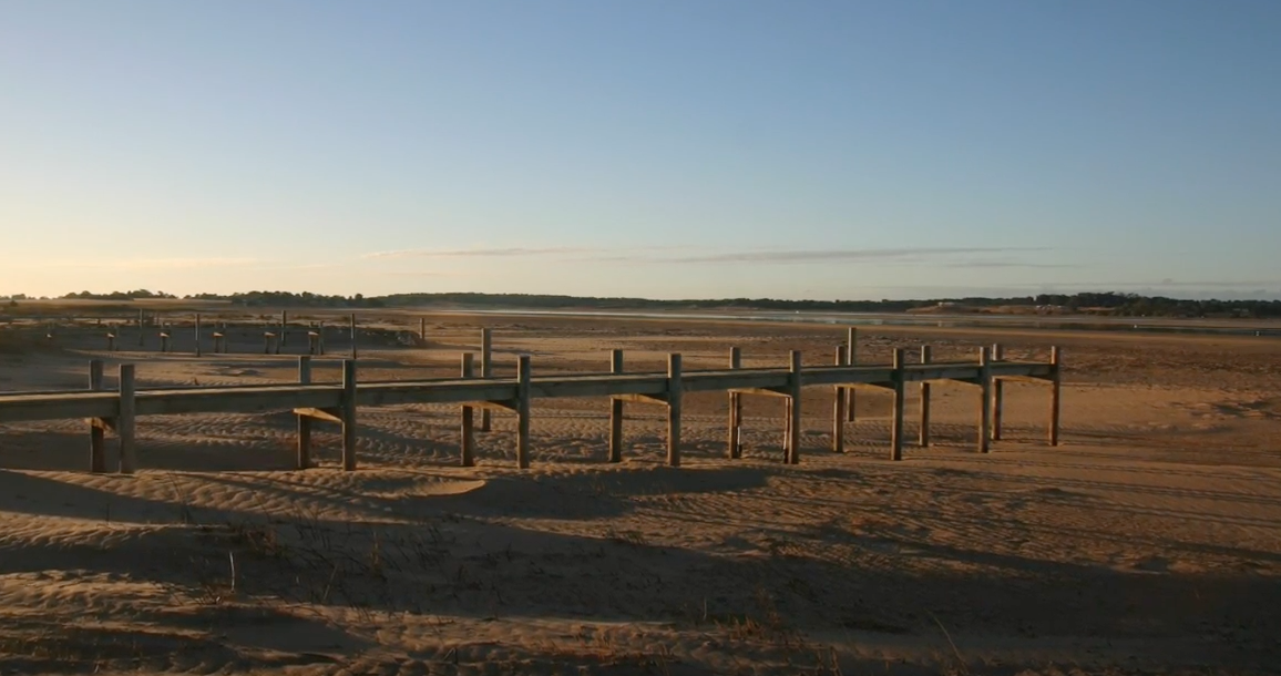
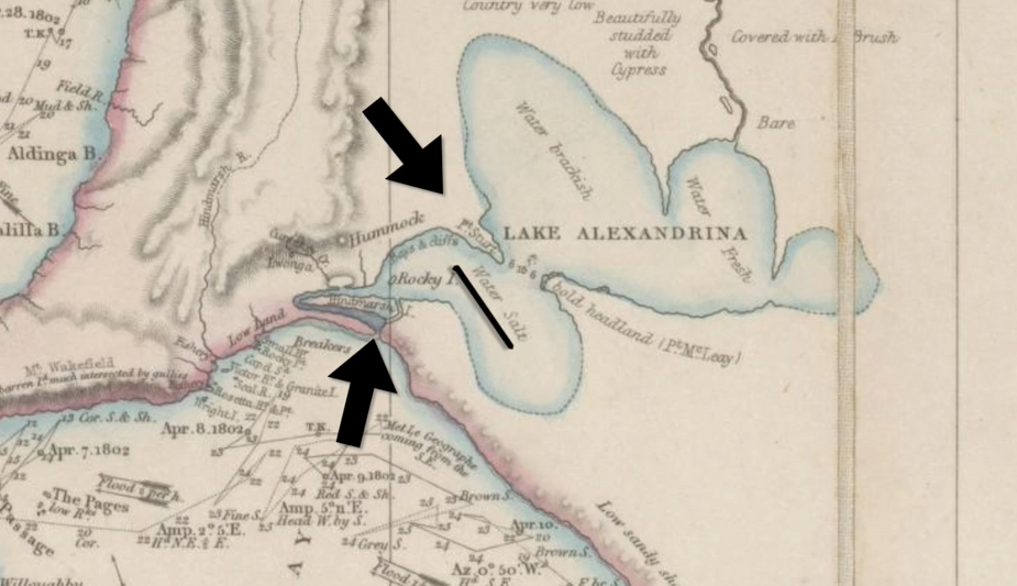
 As the Murray approaches the coast, it forms the terminal lakes of Alexandrina and Albert (the ‘lower lakes’) before dividing into five channels that flow into the Murray Mouth area.