
 Entry to the throne room can be from The [Latrobe] Valley of course, and there is nothing especially wrong with that, not per se.
However, this study in pastel is Loy Yang A Power Plant, operated by Alinta Energy and owned now by Hong Kong-based Chow Tai Fook Enterprises. It is the successor to Hazelwood, the ‘dirtiest’ power station not just in Australia but in the OECD. That includes any in Poland (joined 1996) where the emissions in the urban winter air can make your teeth grind. THE Least Efficient Power Station: 1.58 tonnes of CO2 emitted for every megawatt of electricity produced via burning (comparatively) wet brown coal. Emitting 18 million tonnes of CO2 annually, not to mention 1000 tonnes of boron, 77,000 tonnes of hydrochloric acid, 27,000 tonnes of oxides of nitrogen, 29,000 tonnes of other particulate matter including highly poisonous polychlorinated dioxins — all into the air.
Air borne pollution from the normal operations of each of the Valley’s three remaining coal-fired plants probably kills around 60 people a year in Gippsland, and makes many more sick.
That’s the bad news. Clearly.
 Beyond that I need to say that in The Valley’s Regional Gallery in Morwell we found a most intriguing collection of quasi-art, its International Triennial of Media Art. Something so special it stopped us for a hour longer than we had imagined it might. The Folded Geometry of the Universe at left, 3D and about 400mm long in reality, and formidably elegant. (Folded by Michael Gardiner in 2016.)
We were on our way to Tarra Bulga National Park, 40km south of Traralgon, to find the Tarra Valley Loop, a 25km walk.
The Park is a standing monument to South Gippsland as it once was. Not the manicured green bottoms full of rich red and black soils, upturned to accept the metre plus annual rainfall with tidy caterpillars of cyprus climbing over them … nor even the less immaculate and more typical mix of things:
 a herd of cows in the distance, a crease jammed full of exotic weeds, on the hill in the background a recently felled plantation (E. nitens, Shining Gums, which in the right circumstances, viz. right here right now, will grow three metres a year), a fringe left to both frame and moderate the horizon line. But in a region afflicted with drought, the lowest rainfall ever recorded for the first four months of a year, undeniably verdant pasture.
It wasn’t always like this. In 1840 Paul Strzelecki, a Pole after whom the area is named (so, Brian Taylor, let’s say it as it is: Sh-trz-let-ski) fought his way through the natural forest somehow. ‘Nearly impenetrable scrub interwoven with grasses and giant trees both upright and fallen and scattered in confusion’, he claimed. His party ate koalas and wombats to keep themselves alive until they somehow found their way to the marshy shores of Westernport Bay.
The trees were giants. One felled at Thorpedale was measured on the ground at 114 metres (375 feet). The biggest were ‘ringbarked’ by cutting a continuous notch an axe-head deep around the trunk thus stopping the transport of nutrients from the leaves to the roots through the phloem and cambium layers, resulting in a lingering but assured death. In his wonderful book The Bush, Don Watson who grew up here quotes a squatter writing: ‘After dinner I went with Jim to ring trees on Daves block I could ring an acre in 2 1/2 hours and Jim could take out the saplings in 2.’ Don comments: ‘ Eight hundred hours (320 acres by 2.5 hours) and a few days burning in summer putting paid to several million years of growth.’ A bit strong, but that’s the direction of travel.
 At the southern end of the Tarra Valley the ‘shack in the bush’ of past history is still in evidence.
I didn’t know what we were going to apart from a long walk just to see if we could, and the Tarra Bulga Guesthouse at Balook where I’d booked accommodation. Our hosts Nina and Peter had cooked and served 220 meals the previous day, a Saturday lunch, so it wasn’t completely unknown to the world at large. The number of fancy houses on their 10 acres along the Traralgon-Balook Road also said we weren’t in the middle of nowhere, although the sensational view from Mt Tassie rather suggested otherwise.
When we left the next morning it was raining softly but steadily — this year an unfamiliar and delightful experience.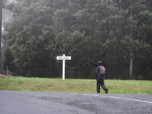
This walk has been carefully tailored by volunteers from the Grand Strzelecki Track Group to make the most of areas which are least changed by human intervention. But the length of the walk means that almost the first half lies outside the boundaries of the National Park.
But it still begins among big trees 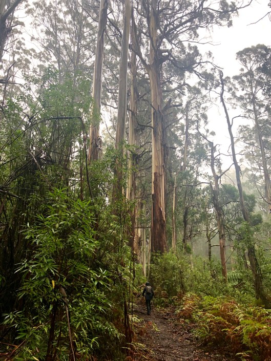 and heaving tangles of forest.
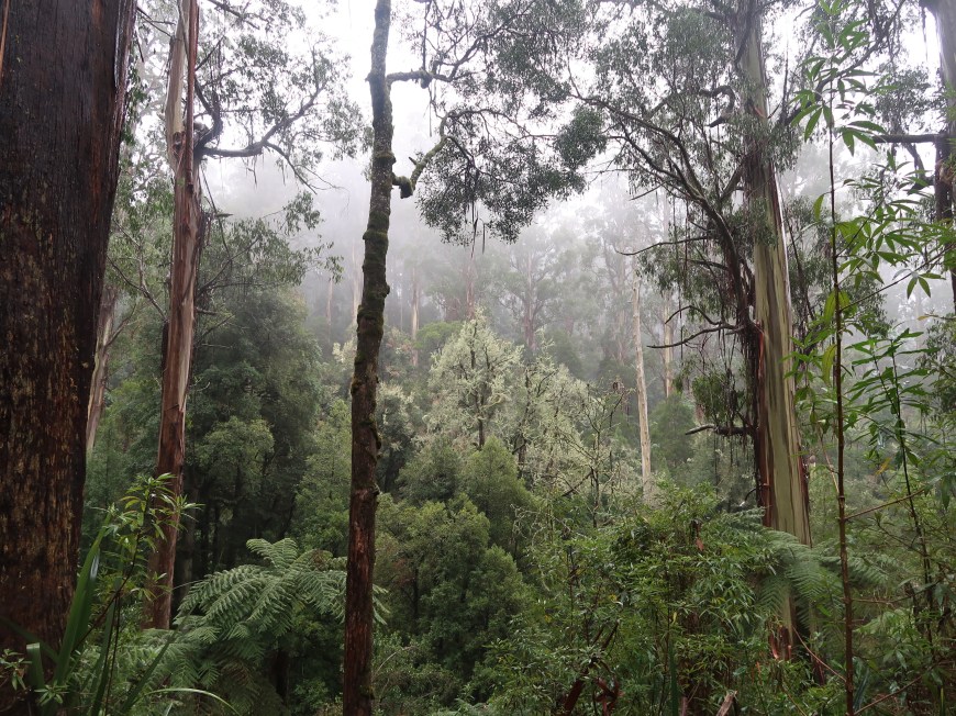 There are several sites of old homestead clearings
 and for some distance the impact of the Black Saturday fires (7 Feb, 2009) is evident. The new stands of Mountain Ash saplings are about 25-30m high — three metres a year that would make the rate of growth — but there was also this unusual forest of acacias, straight, jammed together and, perhaps as a consequence, very very tall.
 Some kilometres of plantations followed, all Nitens like these, with their typical cascades of bark.
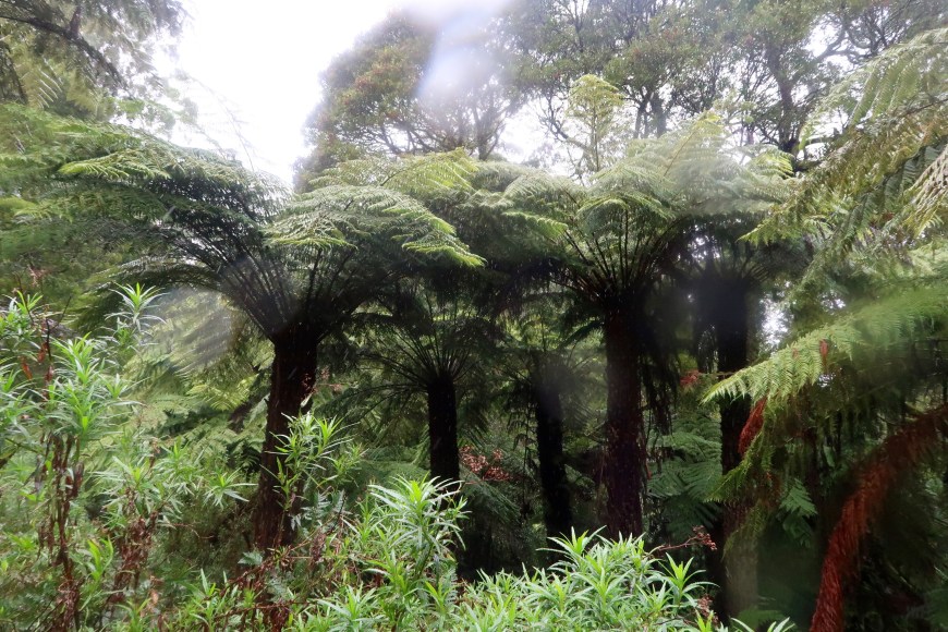
 After a fierce, concentrated and slippery climb up Duncan’s Track there is a section on the contour through lovely forest and fern trees, Butler’s Track (below). Great walking through little known history.
 Rain forests have fungi, especially if it has been warm, and Tarra Bulga was no exception. Wonderful things appeared, some with caps 350-400mms across, monsters, although these were more to be filed under Beautiful.

You cross the modest trickle that is the Tarra River through massive trees, and a dense understory with all manner of vegetation and moving creatures, lyre birds, wombats, black and swamp wallabies, kangas. The walk, 4 or 5km through and above the valley to a view of the far away coastline, is simply splendid, and then it’s a long slow climb mostly through protected forest back to Balook.
* * * * * * *
If patches of South Gippsland are memories of what the crown might have been — and on this experience they really are — what’s the jewel in this diadem?
From where we were you need to drive past the building below to get there. The old Yarram Courthouse built in in 1907, now an information centre and art gallery. The Victorian Heritage Register says: ‘unusual massing and roof form, displays considerable creative and technical achievement’. Indeed, but what’s the word for it? Stylish. Let’s go with stylish. Stylish in a way that might not, would not, occur today. Much appreciated. Thank you.
And you get here, a backwards tick. A NASA image of Wilson’s Promontory taken during the fires of 2009 during which about one-third of the Park, the brown areas, was burnt. This particular image has been included not because of the fires, but because it provides an establishing shot, an outline of The Prom. You can even see the northern boundary of the National Park across the Yanakie isthmus from Shallow Inlet. And because it’s striking.
People tend to take the same pics at The Prom.
Here’s a standard: waves gliding in at Norman Bay and Squeaky Beach from Mt Oberon at sunset.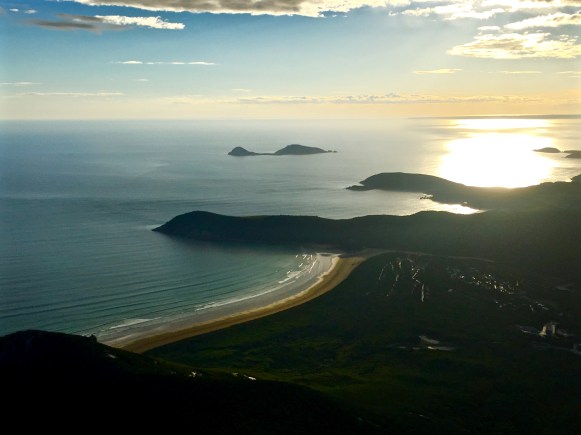 Here’s another: Tidal River looking up stream. Quite Japanese-y in the particulation, variety and harmony of its features: rock, wood and water.
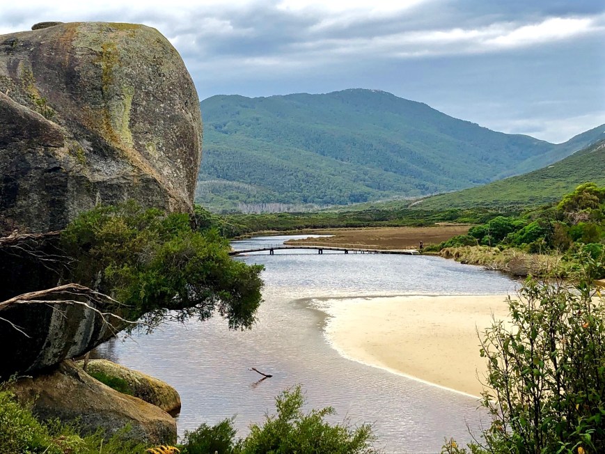 And another: the classic granite tors and orange lichen, in this case at Tongue Point.
 I’d like to say these photos and better versions of them do the place justice. But they don’t.
The Prom, people respond, a slightly wistful quality filtering into their voice. Mmm yes, The Prom. I know what you mean. Have you …? Of course. Yes. Of course we’ve been to The Prom. We used to go there … And an underlying note of knowingness, complicity in understanding what is implied, appears.
What is it we know? Because The Prom is indeed the jewel in the crown of South Gippsland. But why? What is it about The Prom that makes the shout ‘Hands Off’ so near unanimous? It’s something more practical than adoration, but these 505 square kilometres of ‘nature’ are special, catching and holding very tightly.
 It might be that the 30 kilometre drive from the park entrance to Tidal River is like an overture at the opera helping you to slow down and start looking, listening, tuning in, becoming more alert and sensitive to what will come. During that time you will have driven through six markedly different vegetation zones, some of them repeating, but each of them with their own diverting features.
It might be the fact that on that drive you will probably have already seen scores of emus, kangaroos and wallabies in the wild. Or it could be the greeting in the car park from the case-hardened wombats.
And The Prom’s delights are not hidden. The entry provides glimpses of its perfect beaches and its colours of aqua water with crisp white collars, the unusual grey-cream and sparkle of the granite tors, the violent orange of the lichen and the endless range of greens in the vegetation.
This time the flowers were out at Tongue Point. It was a garden; overplanted, but a garden. I hadn’t seen it quite like this before. But you must assume that, even though Tongue Point is not one of the popular walks, hundreds of thousands have. This is a pleasure widely shared.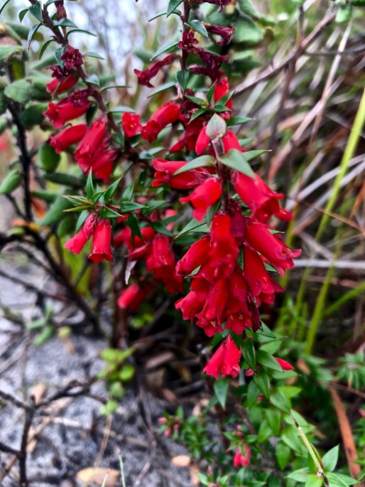
At The Prom you walk. Telegraph Saddle to Sealer’s Cove and back is a classic Australian day walk. It’s an oddity in that it runs in an almost straight line west-east and yet it’s got it all.
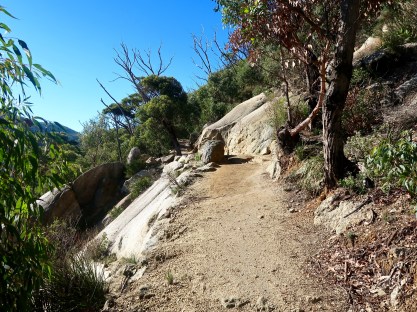 After a drive up to Telegraph Saddle you start reasonably high and walk along an undulating track through eucalyptus forest dryer than on the other side of the saddle.
A while ago now, floods caused sometimes huge landslips, in a dozen or so places destroying the track.
Parks Victoria has warmly thanked itself for its tireless efforts to renew the track at each of these sites. And they have, and its great, and no doubt they were tireless and in several spots brilliantly ingenious to be able to rebuild the track. Really. Salutations Parks Victoria.
Three kilometres to Windy Saddle where on this day the sun was out and bouncing off the surface of this perch at its highest point. The Prom is natural but ordered. A lot of people use it, the parts you are encouraged to use anyway, and they are well catered for. Then there’s the wonderful rolling descent through the wet side, downhill apart from a dip down into and up out of the creek valley at Ferny Glade.
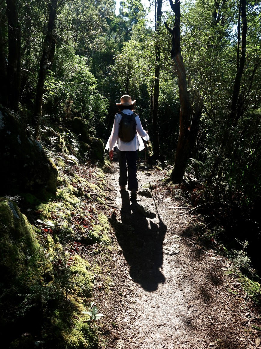 And then, with about 2kms to go to the Cove, you come to the swamp and the duckboard which will take you through it,
 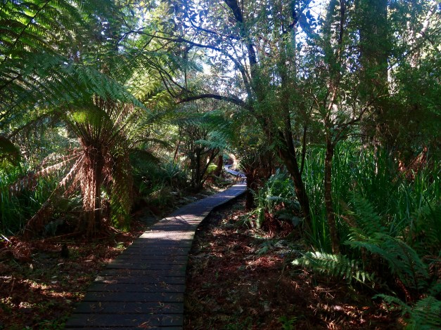 often suspended above the froggy, mossy waters of Blackfish Creek,
  which, surrounded by melaleuca, opens out onto something more like a real creek very close to the beach.
 Then you suddenly plunge out onto the Cove itself
 which, after an hour or two of enclosure, offers a massive inhalation of space.
With its suggestions of symmetry and its pure creamy sand, the beach is glorious. Stubs of a handful of old wharf piles blackened by the weather are a reminder that there have been timber gatherers here. In fact in 1854 Sealers’ Cove had a steady population of more than 60 (six women at the time). Those stubs are the end of a tramway of which there is now otherwise very little evidence.
The beach has been returned to its original inhabitants. Gannets, shearwaters, shags, sometimes an albatross and almost always muscular assertive Pacific Gulls, half as big again as ‘normal’ gulls and with blood red tips to their beaks.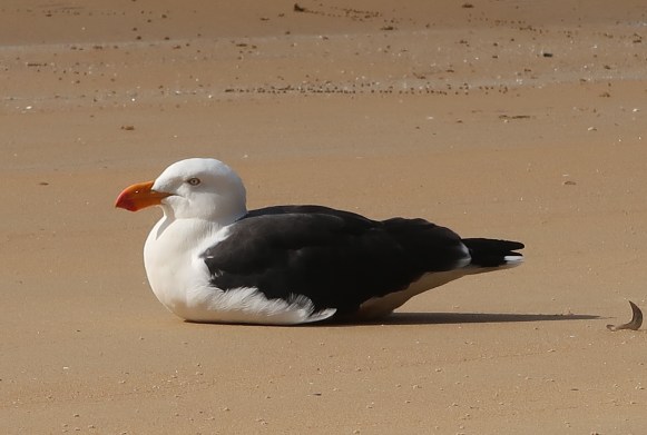 I went looking for the name of the tiny crabs that were everywhere, (I have just realised they are the dark dots behind the gull in the pic above) and failed. [Later: mictyris longicarpus, the Light-Blue Soldier Crab. Mr B. ‘Smartypants’ Findlay.] But I did discover that near the low-water mark the gastropods Dicathais orbita and Turbo undulatus, chitons of the genus Plaxiphora spp. and the limpet Patella peroni are common. Who knew? And who knows what these actually are.
I also found a list of fish common to its waters which deserve recording simply for their names: the large bastard trumpeter, old wives, magpie perch, wrasse Notolabrus, southern hulafish, vicious sweep, the toothbrush leatherjacket, herring cale, Odax cyanomelas and mado. Wouldn’t they all have a good time together, just simply introducing themselves. Hi … I didn’t quite catch your name?
 Returning to the crabs, they are about as big as your fingernail and toddle across the intertidal area in their thousands. But they are there one minute and gone the next. At a sign of danger, it takes them perhaps three seconds to bury themselves completely, although they do leave behind distinctive little balled mounds.
 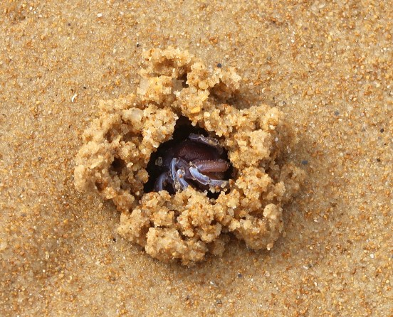 They dig lying on their sides. Swivelling all the while, the bottom four legs chew out the sand; the top four ball it and pass it out onto the beach. It is a process which is something to behold.
Like the rest of The Prom, just under the surface is all manner of life,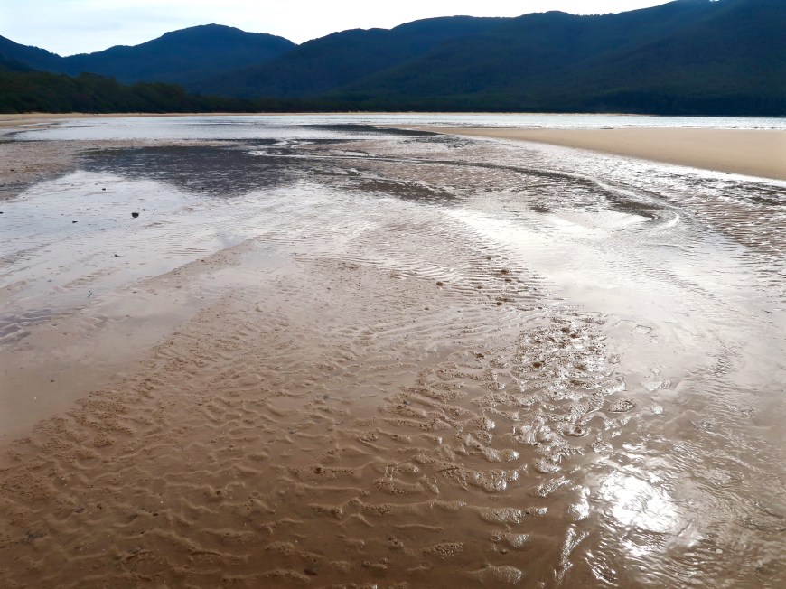 although not as much there once was.
In a single year (1804) an American ship took more than 600,000 seal skins from this area. The slaughter this entails is implied. Today in all the waters of southern Australia there would not be 600,000 seals. The timber getters lasted six years at Sealers’ Cove. They had exhausted the growth worth cutting. You’d think this might be a lesson in the zero-sum resource exploitation game. But at the time it must have seemed as though there would always be ‘plenty’ with both a small ‘p’ and a large. Interest transferred to stripping South Gippsland.
In essence the history of Wilson’s Promontory is one of thousands of years of exposure to nature’s furies — with the Koories [local Aboriginal peoples, mainly Brataualang and Gunai/ Kurnai] living in parallel with these forces — broken by a brief interlude of a century of exploitative use by Europeans, before returning to the domination of nature, says Geoff Wescott in his handbook to understanding The Prom (1995: 27).
In 1908 James Barrett wrote about the state of The Prom in The Argus: The Park is let on a grazing lease by the Government. It has just been burnt thoroughly from end to end. The fine timber at Sealers’ Cove has gone, and doubtless most of the native bears and other animals have gone with it. The scrub has gone. The Promonotory now presents a piebald appearance — green patches alternating with patches of blackened sand and bare charred timber … Either the national park is a park or a cattle run, it cannot be both. An end must be put to this ruinous vandalism.
It had been declared ‘a temporary reservation for a National Park’ in 1898, one of the first in the world, actually the second after Yellowstone which wasn’t called a National Park in its legislation. Despite this, grazing was not completely outlawed in its northern sections until 1992. Despite this, it is now a successful case of intelligent human intervention in the cause of natural preservation.
‘Natural’? What’s that?
‘Natural’ a very short time ago geologically meant The Prom was a chain of islands, even more recently a part of a land bridge with Tasmania used by Indigenous peoples. ‘Natural’? In some parts it is criss-crossed by tracks and roads. Tidal River has shops, cabins, camp sites, generators, fresh water and sewerage systems — without which it would be much harder to visit, and maintain. If it was just left, now, Coastal Tea-tree would probably create a vegetal mono-culture in its northern regions; introduced plants would thrive; foxes and other introduced predators would compete with and deplete native species. Uncontrolled fires, which appear to have become more frequent, would change and limit the range of plant species.
So. Intervention. Management. Control. Change. Providing great things but herding people into certain parts of the Park where their impact can be contained and limited, all the while educating them about appropriate behaviour. Fencing off the hoon tracks on Mt Oberon so they’re no longer used. Patrolling and servicing the more remote camp sites. This is why there are ballots for the 442 camp sites at peak periods. This is why there is not an 18-storey resort hotel.
These are not simple matters. But a balance seems to have been struck at The Prom that is both popular and successful, respectful of human interest and contact while at the same time ensuring that the exquisite natural environment is maintained.
And that’s why I think The Prom is the jewel in the crown. Because it’s an example of intelligent and diligent resource management, living proof that it can be done and done well. Salutations indeed Parks Victoria.

