Castlemaine
20th January, 2021

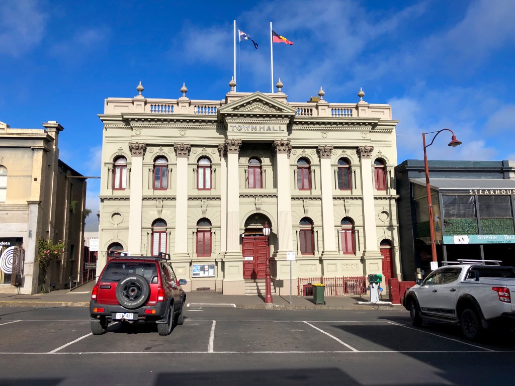
It’s a bit hard to know where the major entry to Castlemaine is because of the variety of creeks, gullies and ridges of which it is composed and the way, following the creeks, it meanders out to include Chewton, Campbell and Barkers Creeks. But someone has determined that the place to put a statue signifying entry is at the junction of Hargraves and Forest Streets with its chief aspect east towards the Melbourne (‘Mount Alexander’) road.
People say there is a higher proportion per capita of a) Ph.Ds, b) book clubs, c) unemployed clowns (professional), d) letter writers to ‘The Age’, and e) former teacher unionists in Castlemaine’s population than (why limit it?) anywhere else on earth. And why cavil? That would surely make it an interesting place to live. And read it how you like, but I’m pretty sure that this statue is a Doctor of Philosophy with a hipster moustache and beard imparting wisdom to his adherents while at the same time ignoring the chap at left caught in quicksand and, fist clenched in frustration, about to go under.
Another thing that Castlemaine specialises in is local historians, so it is to them you should turn if you want a serious and complete account of the town and surrounds.
Suffice it to say that it too is on Dja Dja Wurrung country. Squatters had already selected a great deal of the land round here before gold was discovered in 1851. (See more about that in the next blog). Dr William Barker (see?) owned the run where this occurred and left his name behind for the creek which runs north-south through the town roughly parallel to the major street also named after him. Europeans originally called the area Forest Creek after the creek which runs roughly east-west, and broadly defines the richest alluvial gold fields which have ever been discovered.
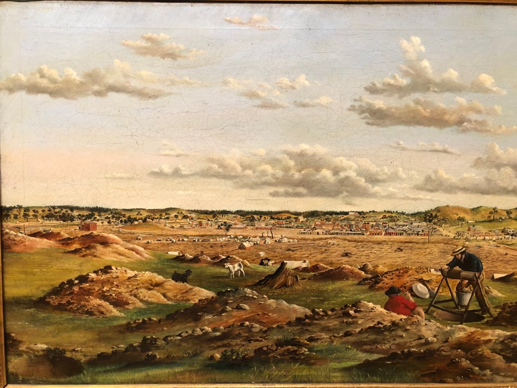
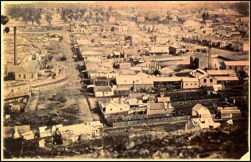
We are looking north over Forest Creek in this painting by Edwin Stocqueler, ‘Castlemaine from Ten Foot Hill’ (1858). It is interesting to note the number of brick buildings already erected. These things happen fast. Photos from the time (see Golden Point, also on Forest Creek, far below) indicate a much more blasted landscape. A little later, and only just a little later, ten or 15 years later, Castlemaine had its share of crushing plants, engine houses, shops and more orderly roads.
It had become Mount Alexander, somewhat confusingly for our purposes here, because shortly we are going to be climbing over ‘Mt Alexander’ some distance away. But anyway this is where the Mt Alexander Road which begins in Melbourne quite close to where we live was headed. Then in 1854, the local Goldfields Commissioner, Captain William Wright, renamed it ‘Castlemaine’ in honour of his Irish uncle who was a Viscount and possibly good for a quid or at least some career advancement. By choice, you’d change it to something different wouldn’t you?
There were ‘8000 people on the creeks’ by 1852, possibly the town’s largest ever population (7,500 in 1880; 6,757 in 2016). A gaol had been built there by 1853, another presence which has remained continuous. More crucially, the Castlemaine Football Club was established in 1859, making it the second oldest football club in Australia and among the oldest in the world. Ron Barrassi Senior (another one for you Kurt) came in from Guildford to play, and it was Dusty Martin’s last club before the Bendigo Pioneers and Richmond.
As a place to live, Castlemaine has great charms. You can see why immigrants from Melbourne are pushing up its property prices.
* * * * * *
After arriving at Vaughan Springs by foot we wisely decided to rest instead of the planned day on The Track — just to have a look around, a driving look around.
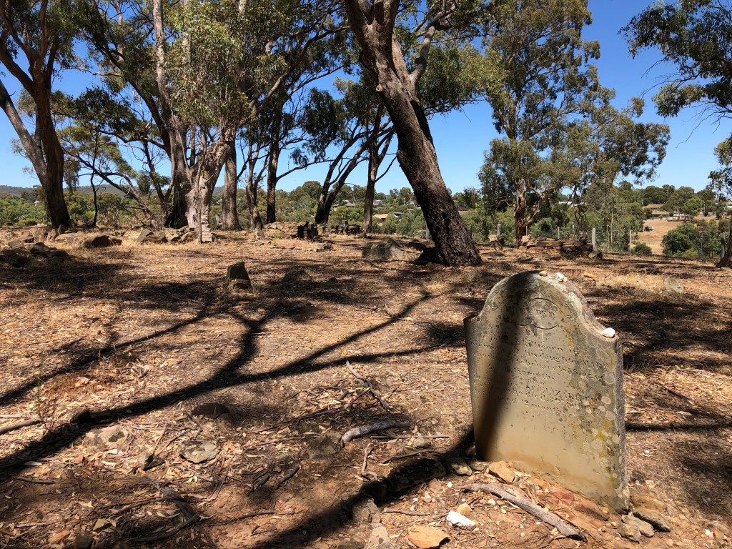
We began the day at Pennyweight Flat cemetery just out of town, an experience which I found deeply moving. The information board says: ‘1852-1857. This site is a rare surviving example of a Gold Rush cemetery. Shortage of water, contaminated water, poor diet and frequent accidents took a heavy toll of those who flocked to the diggings in search of their fortune. Those children who accompanied their parents and babies born on the gold fields were particularly vulnerable to the harsh conditions. Between 1852-57 about 200 bodies, including children and babies, were buried here at Pennyweight Flat on the fringe of the Mount Alexander workings.’
Walking round through the grey box looking at the graves, some marked and some not, many with a contemporary toy near the headstone, provided an acute emotional sense of how things might have been — more than anywhere else on The Track I think. I was very glad we went there.
Our drive continued through Fryerstown where we found this splendid piece of industrial archeology. Its plaque, erected by the Cornish Association of Victoria and the Rowe family with Cornish antecedents, says, inter alia: ‘The Duke of Cornwall’ Engine House erected 1869 for the Australian United Gold Mining Co. This plaque commemorates the Cornish heritage of the Castlemaine area, the engineers and miners and their families who with their skill and labour developed Victorian industries and communities.’
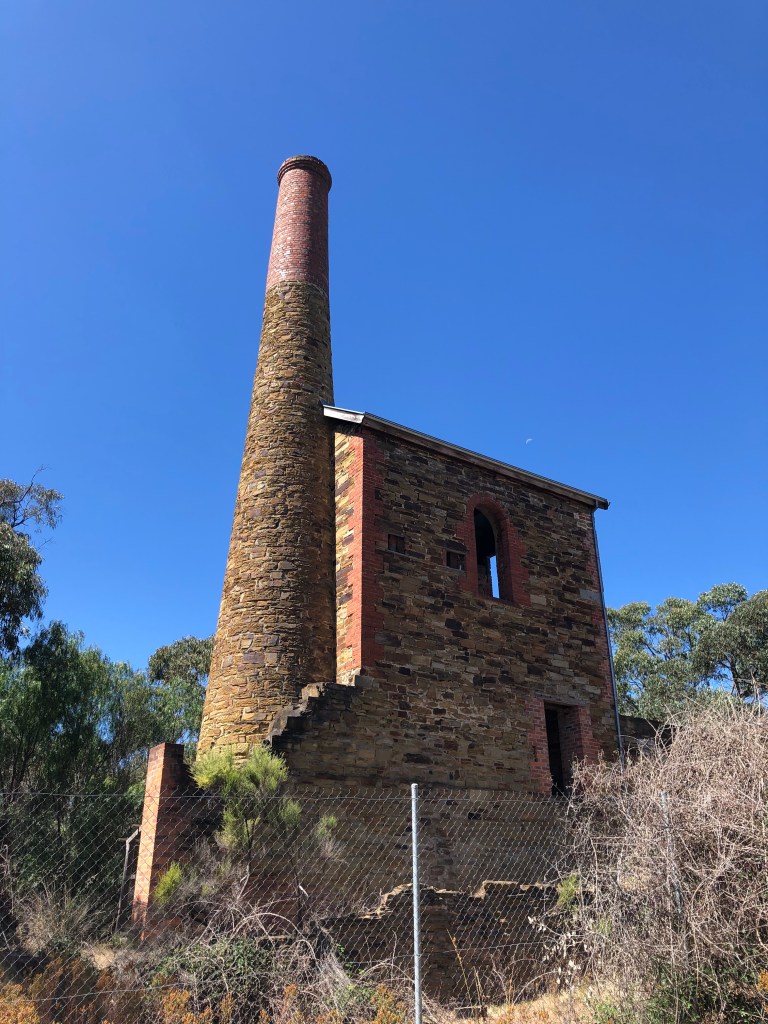
Chimneys like this with their voracious appetites helped to eat the local forests. The ‘engines’ could be used for many things. Later in this blog there is a description of one of the most common, providing the motive force for stampers (crushers) which turned quartz into ‘particles as fine as flour’.
We moved on towards Vaughan Springs. I wanted a more leisurely look at it, and also to check where the outlet track went. On the way we drove past Red Knobs, the product of a mining process known as hydraulic sluicing.

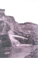
High pressure jets of water blast away large areas of earth to wash it down to be run through a sluice box. It was Arthur Bradfield and his sons George and Ray (one of whom is pictured at left) who blasted most of this hill away in the 1950s before being stopped by the Council because they were getting too close to the road. Ray Bradfield, now a local historian, has said they ‘made wages‘ at Red Knob.
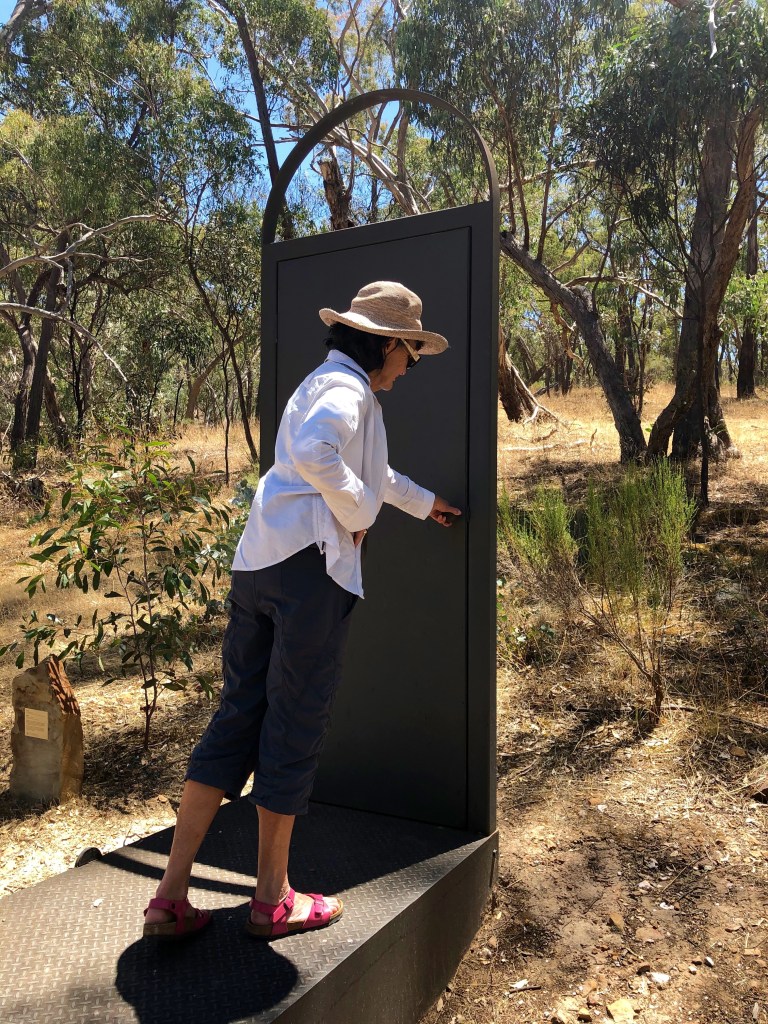
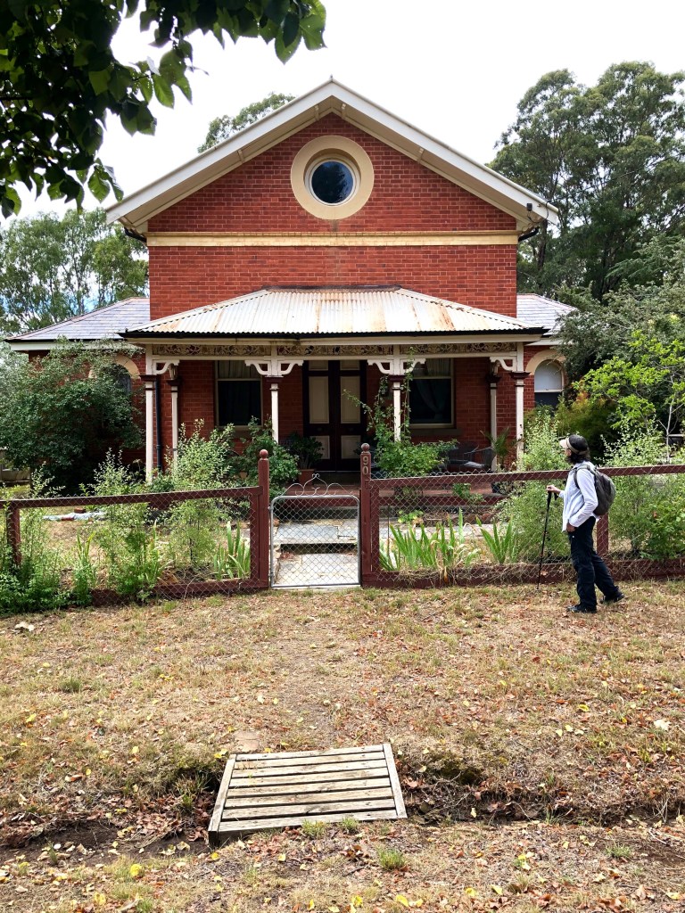
We also visited the Vaughan cemetery where we found this wonderful sculpture.
The cemetery also has a

but it is not the more renowned Vaughan Chinese Cemetery which is more or less over the road. This, however, is an important area for understanding Chinese participation in the gold rushes.
In 1861 ‘The Argus’, one of the colony’s newspapers, commissioned an inquiry into the state of the goldfields. ‘Two questions occupying a considerable share of public attention in the colony are whether the older fields are showing signs of exhaustion; and the second relates to the social condition of the miners engaged upon them.’ This inquiry was conducted over many months and became the prompt for and precursor to a Royal Commission. The product, written in brisk and lively language by J. Wilson & McKinnon, 78 Collins St East, offers the sort of detailed and luminous account which only eye-witnessing can provide. In its discussion of ‘Chinese on the Goldfields’ this document editorialises briefly about intercultural relations: ‘The conclusion at which I have arrived—that these people are a most valuable addition to our labourers on the gold-fields—is shared by all who look at the Chinese question, as it develops itself in Victoria, apart from the prejudices of race and the undefined and ignorant ill-will that is occasionally found to exist between peoples and tribes even not so remote from each other as Saxons and Chinese.’
Some extracts from the report on this topic:
“Guildford [a few kilometres from Vaughan, current population: 333] has long been the main Chinese village in the colony, some five or six thousand Chinamen, and one Canton woman, the wife of a travelled shipwright of that city, having formed the population of the ‘Camp.’

‘In this valley there had been rich alluvial diggings, but it had been well worked out by European diggers before the advent of the Chinese. Here the Chinese drew together, and, in large associated bands, they introduced the system of paddocking or benching (at left), stripping the [already worked] soil, taking out the wash-dirt bodily, and then restoring the ground to something like its first condition.
It is understood that many of these men were brought in by capitalists of their own nation, under contract to work for small wages for a fixed period, thereby gaining their emancipation. This, probably, was the case, but whether bond or free, ‘John’ [Chinaman, for some reason] was alike frugal and saving when he was out of luck or in debt, and equally enterprising and liberal when in good fortune.
‘Rapidly the camp grew, in regular lines of streets, narrow and primitive, but highly populous and busy … In the days of its greatest glory, ‘the Camp’ had its permanent theatre and circus performers, and in every street its temples devoted to Joss were numerous. All the arts flourished in it—down to the making of alloyed gold—as they did at home. The restaurants, the tea-houses, the gambling saloons, the cobblers’ stalls, the tailors’ shops, were as they are in Canton; and the student of Chinese language and literature, manners and customs, politics and laws, might have studied and graduated here as well as in Pekin [Beijing] itself.
‘There were shops for literature and shops for art; there were scholars to write your letters and interpreters to read them; there were doctors, and perhaps quacks, with peculiar rules of practice and medicines to suit—surgeons of whom it could not be said they did ‘too muchee sawee.’ At this period of its history, ‘the Camp’ was the frequent resort of strangers, who rambled through it, amused at the strange contempt the Chinese seemed to entertain for domestic comfort or privacy; the open, eager, constant, childish delight they took in their own forms of gambling; the simplicity of their faith in the divining rods of Joss; and the quaintness of all their motions, proceedings, and notions, their drama, their music, their song, their dress, and their banners.
‘Of late, however, ‘the Camp’ has been greatly shorn of its glories, and become but the semblance of what it was three years ago. Maryborough has drawn away a large portion of its inhabitants; Ballarat has possessed itself of its circus and theatre; and a thousand or two of the last who deserted Campbell’s Creek are now to be found on the old lead at McIvor [near Heathcote]. …
‘They have their own benevolent societies. To their relatives in distress they are kind, though to strangers of their own nation they show an apathy as peculiar to the race as that which they exhibit for their own sufferings and distresses. Of their honesty as diggers, in the observance of the regulations laid down by the authorities, I might quote numerous stories, as creditable to them as the oppressions practised upon them by miners of other nations are discreditable to the authors of those outrages.’
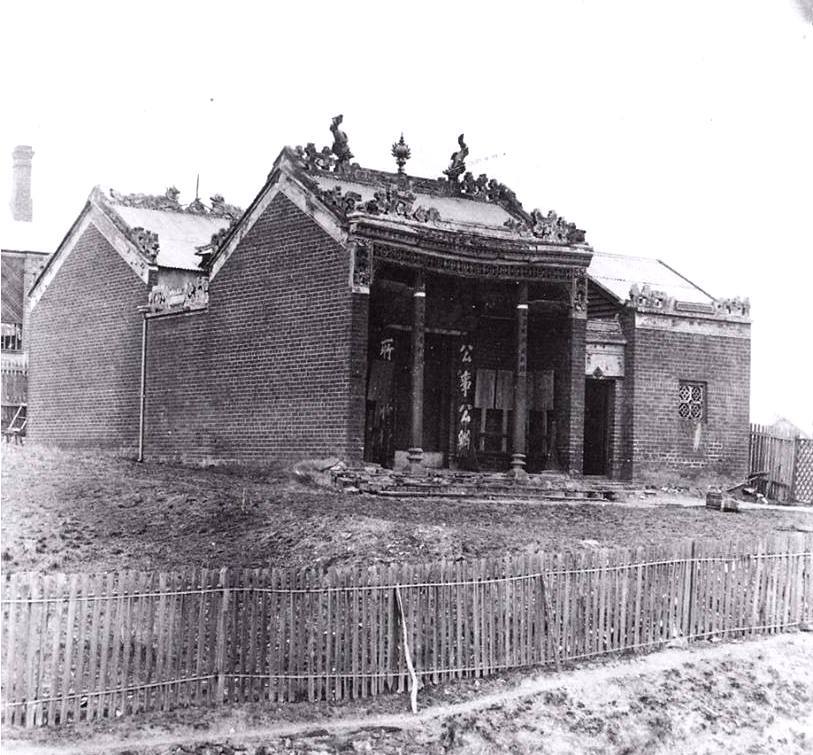
The religion of the Chinese diggers was conducted in ‘joss houses’, temples where ‘joss’, incense, was burnt. These seemed to attract the particular ire of European diggers and settlers. Twelve of these were built in Castlemaine.
At left is one which was built at Ten Foot Hill and in May 1908 was the subject of litigation.
The background: ‘Between 30 and 40 years ago the Chinese of Castlemaine built a Joss house on a portion of section 144, which building was still standing, though not in its pristine glory. It had been continually in the possession of the Chinese by themselves, by exercising acts of control, and by custodians and caretakers, and during the whole of that period there had been no cessation of possession on the part of the Chinese. It was not the only Joss house, as there was another one not far from it. The Joss house was the Chinese temple. The Chinese remained in undisturbed possession until seven or eight years ago. Mr Williams acquired, or professed to acquire, some sort of occupancy to the land on which the Joss house stood and proceeded to fence in about two acres, including the building.’
Mr Williams was Edward David Williams, businessman and politician, enriched from selling groceries in Lancefield and Ballarat, with extensive gold-mining investments at Castlemaine, Campbells Creek, Chewton and Fryerstown, had interests in dredging companies, was chairman of the Castlemaine mining board and — in 1908 — was Mayor of Castlemaine.
He himself failed to get rights to the land adjacent to his property on which the joss house stood, so he put in an application on behalf of his wife. Then a further substituted application was made to have the land put up for sale. It was advertised in the Government Gazette under the heading of ‘Land, Site of improvements by E. D. Williams’. Shortly thereafter his groom, William Noland, was observed removing bricks from the joss house (over two months, more than one thousand) which were used in building stables for the Williamses. Then Noland was seen digging up the flagstones at the entry to the temple and removing them in a cart belonging to Williams.
Williams then suggested informally to the Borough’s Surveyor and Sanitary Inspector, Egbert Lock, that he might think about making an inspection of the condition of the joss house at least partly because ‘There were bricks loose in the walls.’ Lock inspected the place and reported to the Council on 27th December (1907), recommending that it be condemned as unsafe and insanitary. The Council determined to have the structure removed or made habitable. ‘The minute book (produced) gives a correct version of what took place, and the minutes of the meeting were signed by the Mayor’, ie Williams.
Williams then proceeded to fence the whole of the property. Evidence was provided as follows.
‘Shortly after starting the fence Lee Pack [the representative of the Chinese owners] came to Williams and said, ‘ You fence in the Joss house? ” Mr Williams replied, “Yes, I have taken up the land as a residence area.” Lee Pack— “You take Joss house ?” Mr Williams— “No, I don’t want the old Joss house.” Lee Pack— “How we get in ?” Mr Williams— “I don’t want to interfere with you; I will put a gate there (in the north-west corner) for you.” Lee Pack—”No ; we want go in through main gate near stables like always.” Mr Williams—”No; I don’t want you to go through that way.” Mr Williams then erected a gate near the corner of Greenhill and Preshaw streets [which no longer meet], but never gave them the key as he only had one key. He altered the gate afterwards to a smaller size, and the key being left in the lock on one occasion disappeared. The gate had been locked ever since.
— Thanks to the ‘Mount Alexander Mail’ of 10 May 1908
Although the joss house is no longer there — of course, perhaps — I can’t tell you the outcome of the case. But I can tell you that Williams didn’t have long to enjoy the products of his larceny. He died early in the subsequent year.
* * * * * *
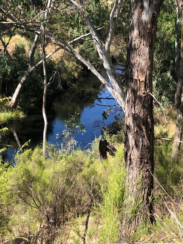
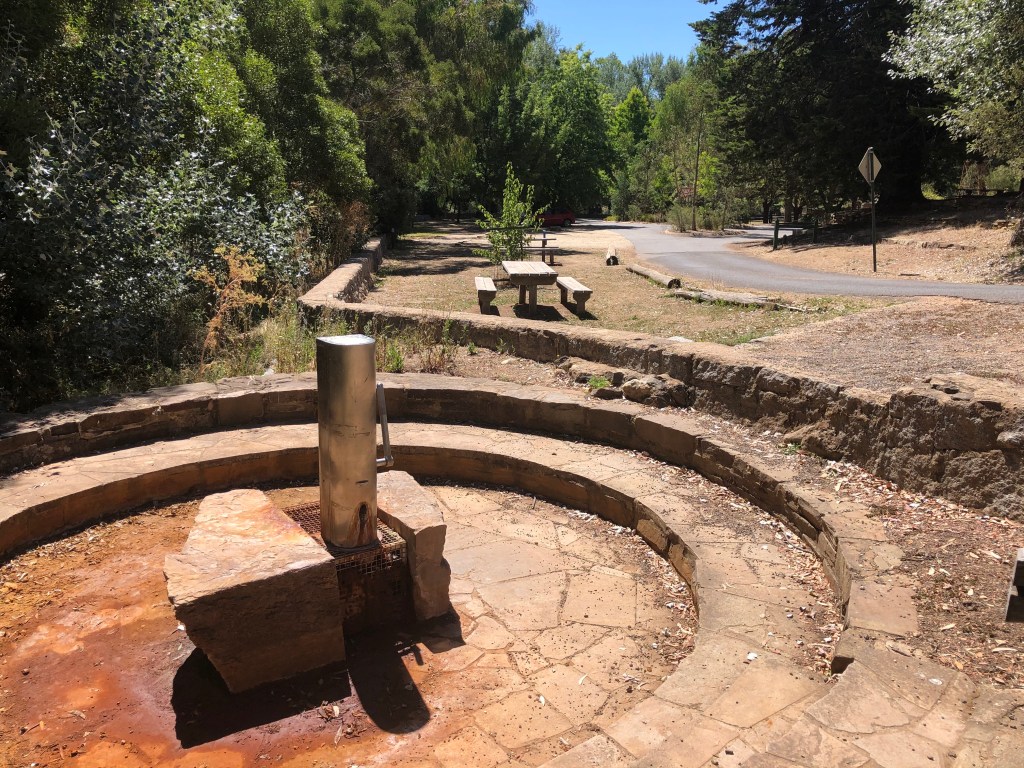
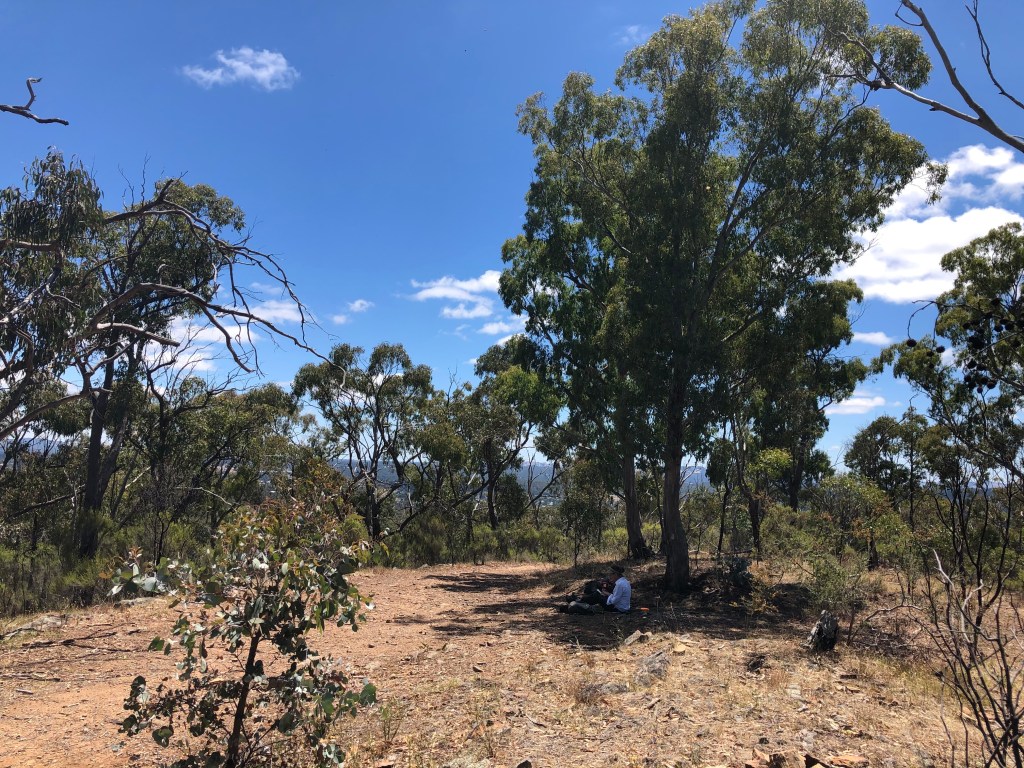
Pursuing our tour we decided we would like another look at Vaughan Springs. It does have an odd magnetic quality about it.

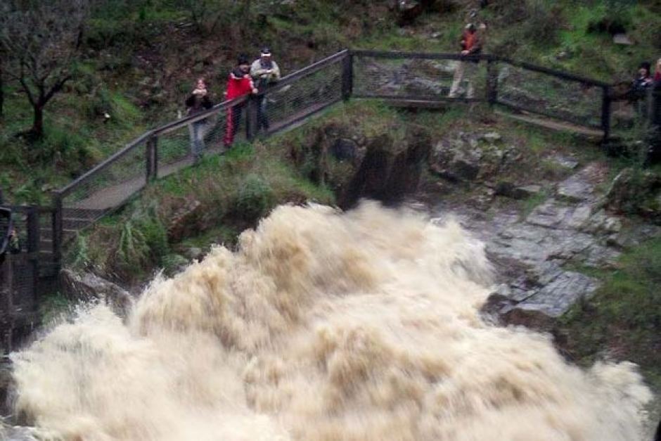
The weir — so small, so shallow — had become an impressionist painting. It was hot enough for Myrna to swim and for me to lie in the shade. And that’s where we began from ten days later when we came back to the Track.
Vaughan Springs to Castlemaine (the ‘Cry Joe’ or ‘Look out! Cops!’ Walk)

30 January 2021, mid 20s again. 21.14 km
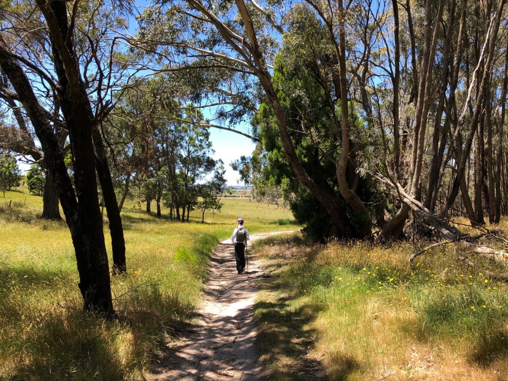
A taxi took us from Castlemaine to Vaughan. People seem to like to know these things. It was early and slightly crisp for the fine exit up through various levels of the Loddon valley, a really nice two kilometres. Low sun does have its aesthetic attractions.

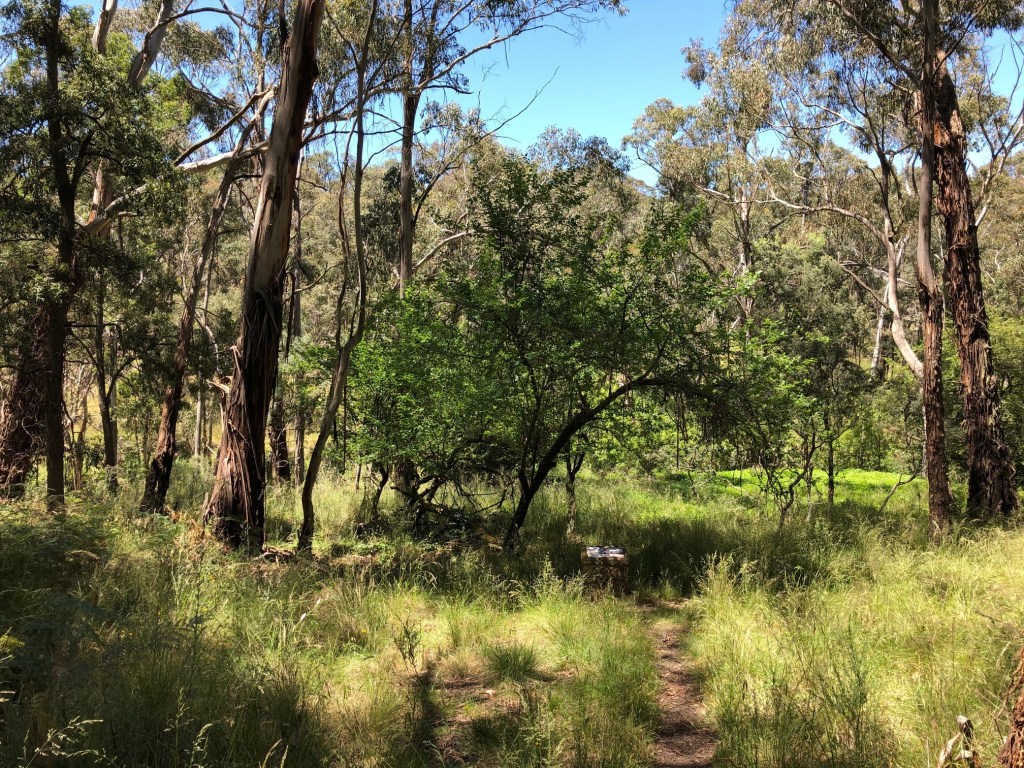
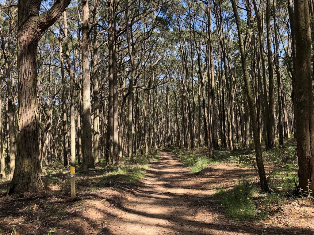
Almost all the country between Vaughan and Castlemaine has been powerfully influenced by mining one way or another, and if you want to see the consequences in all their various glories, this might just be the right leg of the Walk.
You get to the Chewton road and you’re looking at yet another one of those profoundly eroded gullies. At the top of the next rise you find a horseshoe-shaped hummock of earth which has once been an improbable dam.
At Deadman’s Flat/ Irishtown the diggers appear to have wanted to scrape all surface material off leaving this exposed bedrock with its remarkable patterns.


You couldn’t argue that this wasn’t sedimentary rock —at left in layers of mudstone and sandstone perhaps — with these strong colours. In real life the material in this photo is about 200mm from top to bottom. It extended just like this over 20 or 30 square metres. Assume the colours to be more vivid.
It was not all beauty. An alluvial pit, 10? 15? metres deep just a short distance further along had been turned into an informal rubbish dump.

And you can get sights like this another kilometre along just over the Campbell’s Creek Road …

… degraded soil, hosts of blackberries, poplars alive and dead, introduced weeds and grasses — all a bit sad really just there.
And then Fryerstown which once had a population of 15,000, a lolly shop, a boot factory (still there in form if not function) and, reflective of local priorities, 25 hotels. The population at the last census was 228.
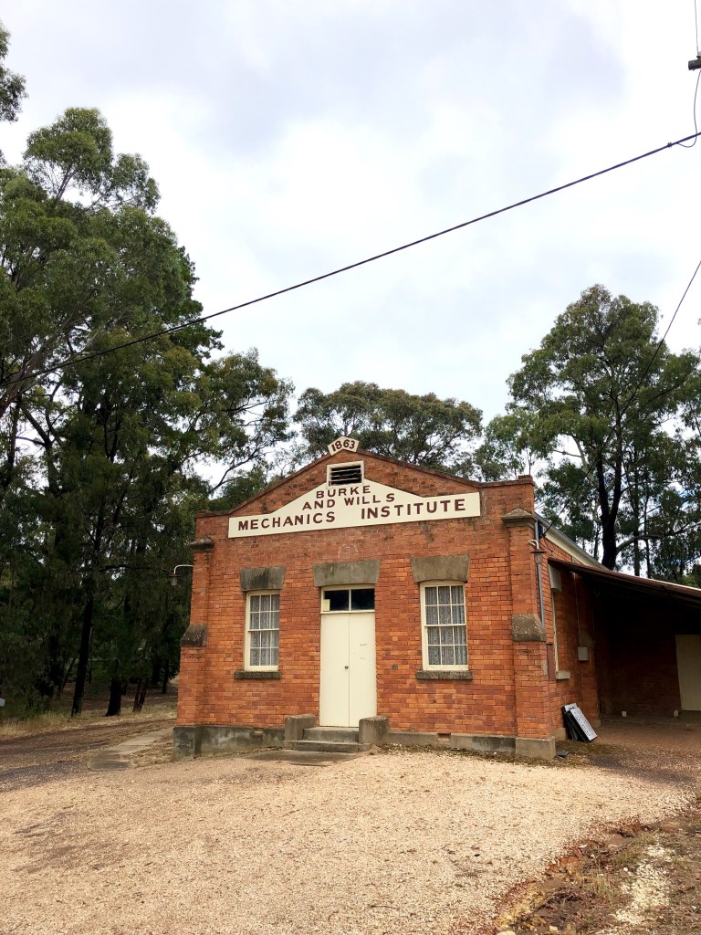
Two places of interest. The Burke and Wills Mechanics Institute (still being used; the board leaning up against the wall was advertising some community activity which has slipped my mind). Burke and Wills though … Like tens of thousands of others, they certainly did travel all the way up the Mount Alexander Road, but in the end they made a profound mess of things. They must have made quite an impression on the area or at least had a good local spruiker. The largest memorial in Castlemaine in one of its most prominent positions is for the expedition but primarily for Burke, the dullard nong who made most of the bad decisions. Ah well. The elegant building on the right is the old court house, now available for rental should you wish via Air BnB.
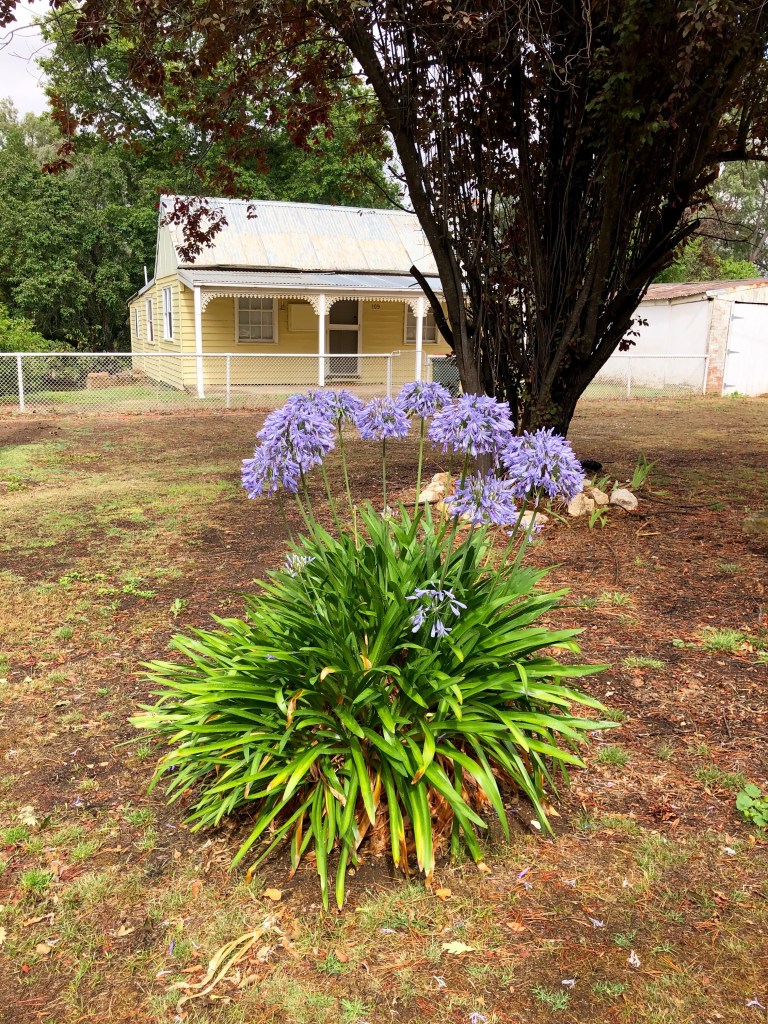
I have considered using this pic as the motif for the whole walk. No such thing is possible of course; it was too various. But it would nonetheless be a candidate. Castlemaine was awash in agapanthi, the ‘love (agape) flower’. Maybe they survive dry climates, and are pest resistant, colourful and easy to grow … in fact, unsurprisingly, yes and yes yes yes, but they are also notably non-indigenous. In New Zealand aggas are classified as an ‘environmental weed’ and only vigorous action by associations of gardeners has stopped them being added to the National Pest Plant listing (no propagation, sale or planting). They come originally from Africa but in several countries, Australia included, they are described as having been ‘naturalised’. I wonder in that case where they stand with taking the pledge. Still and all, without aggas Castlemaine and environs would be mightily diminished.
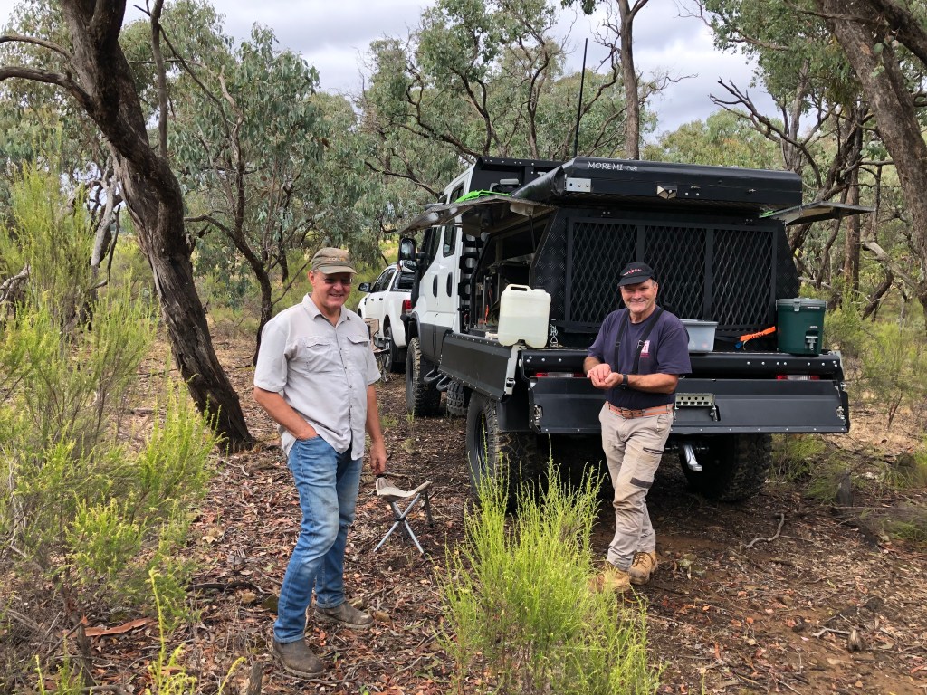
A couple of kilometres out of Fryerstown and well off road we came across these two blokes. They were memorable simply for being there. In 234 kilometres we saw one man digging for worms (Nerrina), one man yabbying (Barkstead), one man fossicking (Golden Gully), four (short distance) walkers and five cyclists keen to find a way to get off The Track (Sedgwick), two serious day walkers (Poverty Gully Race), and these two. That’s it. In 12 days of walking. They were also memorable for being so well equipped, so nice, so interested in us and what we were doing and the fact that they gave us everything they had found that day: a belt buckle (which could also have been a shackle), a dolls comb (maybe), two buttons (old) and (they said, see Heathcote Pursuit’s comment) a musket ball with a sprue from its mould. We found the stick pin nearby ourselves. Varena (Lithuania), the mushroom capital of Europe. Tell me what that was doing there?

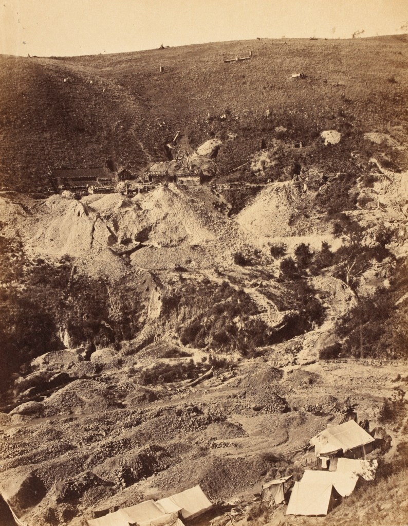
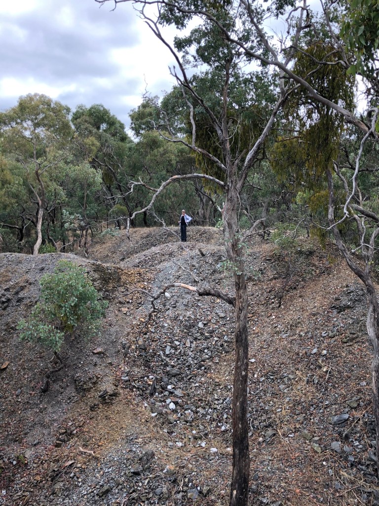
And then Spring Gully mine which operated for more than 80 years beginning in the early 1850s.

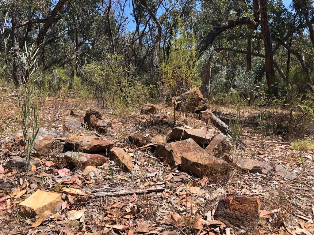
It announces itself (walls, diggings, collections of ashlared stone) a kilometre or so before you get into the thick of it. But there could be more ‘mine’ here than anywhere else on The Track. Here are bits of the massive mullock piles … today, his and hers.


This is the stone wall of the loading dock from which quartz was tipped into the stamping battery which would have been related to the four now decomposing massive blocks of wood in the foreground. Just nearby are the remnants of a fallen chimney, piles and piles of bricks stamped ‘Northcote’. There is a deep shaft 50 or so metres away with, like so many of them, a peppercorn tree growing in it. Dust mitigation is all I can find for a reason.
But how did these crushers produce gold? I find this very interesting, but I can understand why others mightn’t. If so, skip to the photo of Myrna sketching on top of The Monk. Otherwise this is the account to be found in the 1862 Argus study of the goldfields.
“In a quartz-mill the stone is reduced almost as fine as flour, by means of stamps. They are arranged in batteries of four, five, and six heads, driven by steam, the stamps being lifted by means of discs on a cam, so arranged as to make the stamps revolve. They work in iron boxes, with false moveable bottoms, the stone passing in on one side by a slide—fed by the weight of the stone, or by a feeder, whose ear detects, by the peculiar sound of the blow, when more quartz must be thrown in. On the other side of the box is fixed an iron grating, perforated with about one hundred and eighty holes to the square inch. The crushed quartz exits through this grating onto a ripple table, spread out in front, over which the whole of the crushed material passes, carried down by warm water let into the stamp-boxes. In the stamp-boxes a small quantity of mercury is introduced, and in grooves in the ripple-tables more quicksilver lies, into which the gold drops as it passes.
Abundance of quartz having been brought up, the work commences, and proceeds night and day, the men employed succeeding each other in shifts of twelve hours. A battery of twelve stamps can process from 150 to 200 tons of stone per week, according to the hardness of the material and the weight of the stamps. If the crushing is for a party of miners, one or more of their number will remain in the mill during the whole process of reduction and washing [wouldn’t they just], sometimes making his bed on the cover of the ripple-tables, to ensure that no product of their labour be removed. The ripples are cleaned of their quicksilver in the same way, and the copper-plates carefully washed down. The whole of the mercury having thus been collected and washed out from the quartz is taken from the stamp box.
The quicksilver is lifted in some pounds weight at a time, and placed in a clean porous chamois leather cloth. The ball it forms is squeezed with a muscular hand, and the thin fluid oozes in small white beads through the skin, falling into a bucket placed below.
More quicksilver is added from time to time, and squeezed, until the whole has passed through, leaving in the cloth a heavy white mass, called the “amalgam”, varying in size according to the quantity and richness of the stone crushed. The amalgam is the gold-coated mixture with quicksilver, and contains more or less of the precious metal, according as the gold is fine or coarse —that is, minutely disseminated through the stone, or occurring in it in large pieces or in small nuggets.
The amalgam is then covered in a retort, which is placed in a good charcoal fire, with the mouth of the pipe led into water. A few minutes of the heat suffices to drive the mercury from the gold in the form of a vapour, which passes through the pipe and is condensed in the water, leaving the red gold in the retort in a discoloured, strange-looking mass, which an easy process afterwards refines into the yellow gold so eagerly sought after in civilized life. There is nothing more to do but carry it to the scales.
The whole process is extremely interesting to a stranger, whose ears are not deafened by the heavy monotonous beat of the stamps, and who can watch with unshaken nerves the action of the hungry iron giants, whose cravings for more food are insatiable. There is no prettier picture to be found on the gold-fields than a neatly-arranged quartz-mill, nestled by its sheets of water, under the shelter of the evergreen forest, with its white steam escaping, and evidences of life and labour around it.
Just for interest: you can touch mercury, in fact you can drink it and it will pass through your system. But if you smell it … ‘the inhalation is likely to produce harmful effects on the nervous, digestive and immune systems, lungs and kidneys, and may be fatal’.
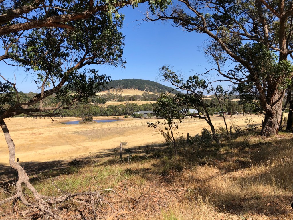
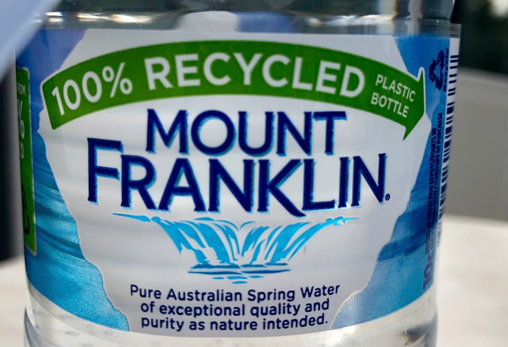
We climbed up The Monk a few hundred metres off The Track to have lunch. I think it is probably Tarrangower looming over Maldon on the horizon to the far left. I was hoping that it was Mount Franklin, after a short walk easily visible to the south from here — it is quite a landmark — but a long way away, suggesting how far we had come. At the base of this climb were the first I noticed of the very black ironbarks which begin dominating the forests nearer to Bendigo.
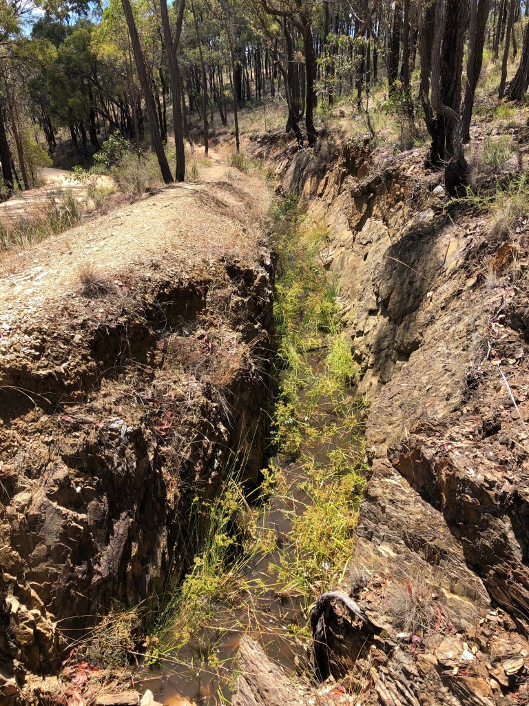

And then Poverty Gully Race: a spectacle of some proportions. It’s (mostly) very deep — the trench is anyway, about 1.5 – 2m — and it just goes on and on, a formidable bit of hand cut engineering. As noted above we met two people here, it was Saturday arvo, and both of them commented what a wonderful walk it is along the bank. The Guidebook says: ‘It contours tortuously for 2km around gully heads with a precipitous drop on the north side. Lots of rough patches with tree roots abounding.’ Might have been a bad day, although I must say I was glad to get to the reservoir, now full of exotic plants, which signalled not too far to go to downtown Castlemaine, iced coffee and a lot of water, at Tog’s Place.
Big day. Great day.
Specimen Gully to Castlemaine
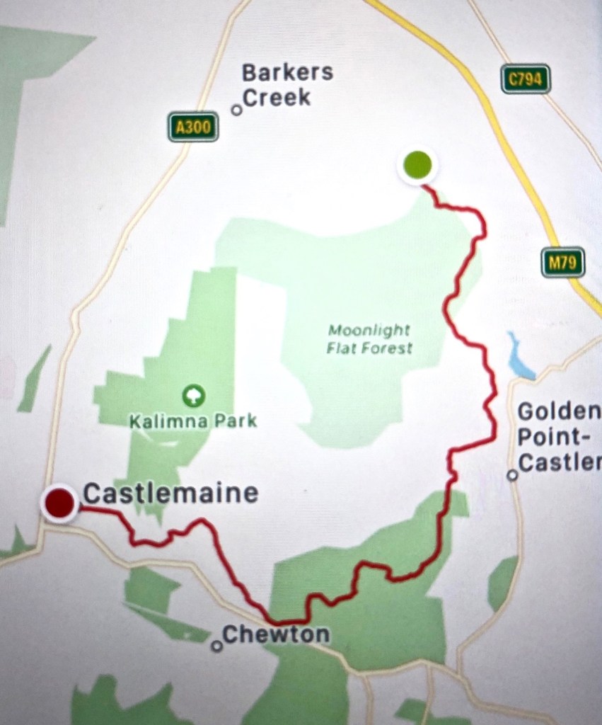
31 January 2021, cool morning and we’d finished by lunch time. 12.41km
A short day with one highlight to terminate this long long blog. But just before we leave Specimen Gully (early again), numerologists among you might be interested to note that yesterday’s walk was 21.14 km and today’s 12.41. No? Ok. Moving on then …
Just for convenience, we’re going backwards. Taxi out to Specimen Gully, from where we’ll start again in a fortnight’s time, walk back in to town where our car is. Not a long walk, just tidying up before going further north.
Ah the taxi. He’d been driving cabs here for a hundred years. As proof he was appropriately well-upholstered, possibly even to the point of it being a challenge to get in and out of the car. This was a 20 dollar ride from the middle of town and he didn’t know where we were going. Nor, not that it really mattered, why.
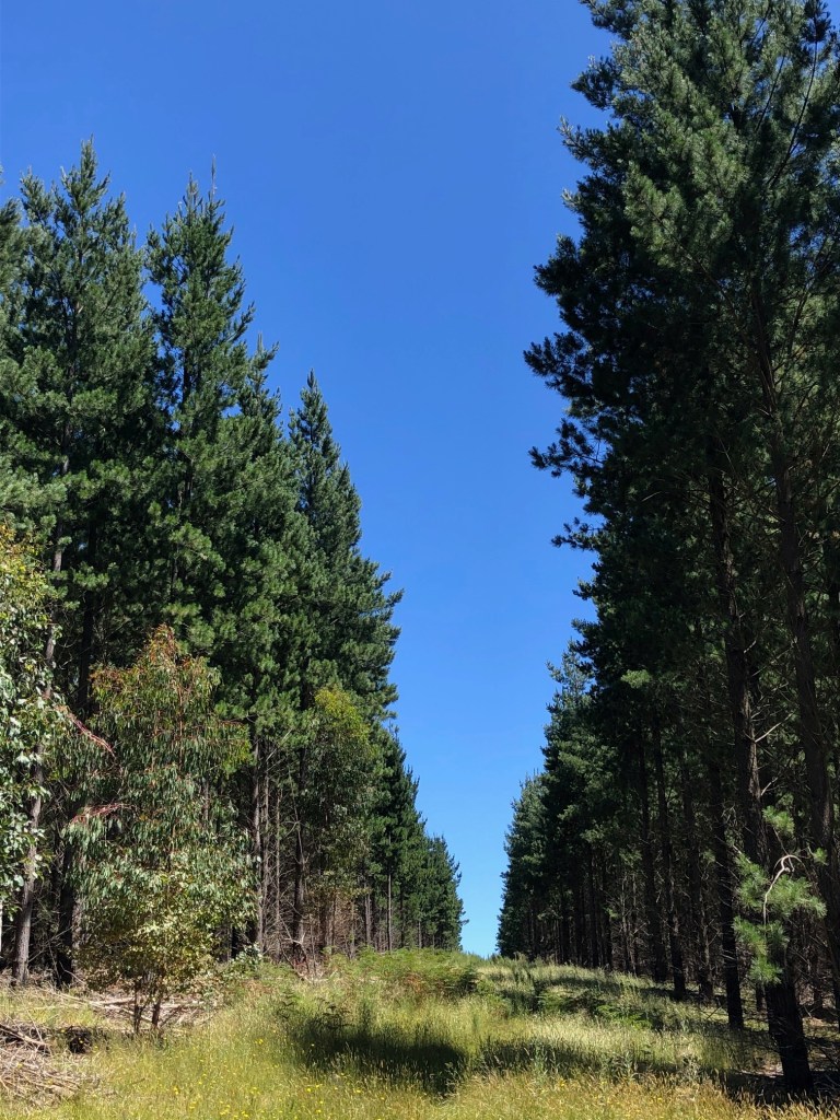
Specimen Gully … maaaaaaate. If you live in Castlemaine you’ve got to know about Specimen Gully. The next blog will explain why. Anyway we got there. Corner Specimen Gully Road and Swanton Track, walking through plantations of old pines — lovely in the morning. Then there’s this quite startling variation in the dirt road we’re on. The Guidebook: ‘There’s an extreme heavily rutted pitch’ which might be better expressed as ‘a heavily rutted extreme pitch’, and yes my word there is. It doesn’t go up vertically, but my goodness for a 100m or so it’s incredibly steep. I have no idea how they drive vehicles up there if they do.
There are tracks, vehicle tracks, everywhere through this neck of the woods. This is one of those areas near a biggish town that is heavily used for all sorts of purposes. It was Sunday morning and nearer town there were joggers and dog walkers, and twin cab maxis &c. (I’m not counting these as being on The Track. They were sort of ‘in town’.) But the first section was lovely — a stiff-ish climb and, once up, some views east across to Harcourt and Mount Alexander. Out of the pines we followed an easy gradient down past a number of Houses in the Bush to Golden Point
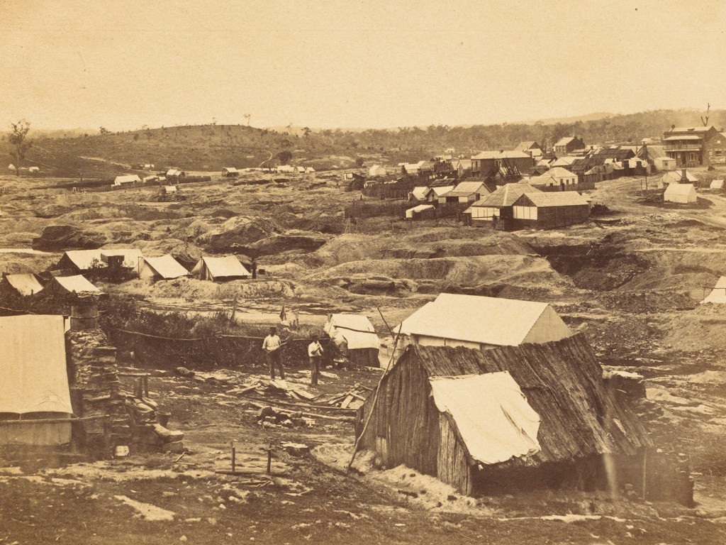
I have said already that Forest Creek is the site of the richest alluvial gold diggings ever found and Golden Point (still about 8km from Castlemaine proper) was one of its richest sections. It doesn’t look like this any more, but it’s still pretty chewed up.
It was a lovely morning and we were ambling along not taking photos, so to some degree it’s hard to remember. I can recollect turning right up Welsh Street but missing the Welsh Village. A group of joggers came down that hill. Then we hooked up with a race for a while, sauntered down a gentle hill found a set of steps, looked up and there was …

the Garfield Wheel, or really not the wheel but its monumental housing. This is the wheel. Just, wow!

And below this is it being built with a better look at its remarkable flume.
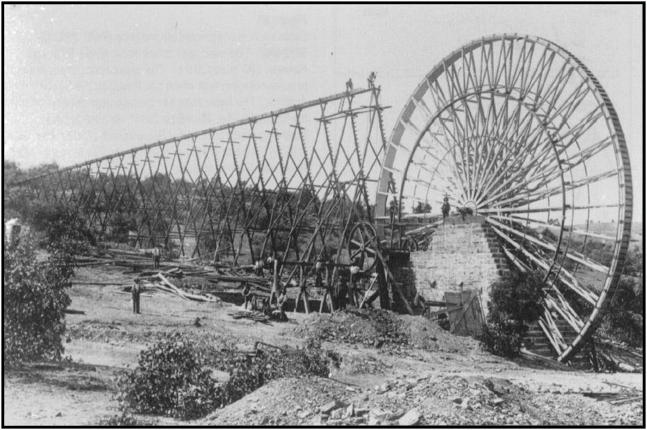
The Mining Surveyor’s Report said, inter alia: ‘The Garfield Company have confined their operations to re-erecting their crushing plant adjacent to a new water wheel of 70 foot [22m] diameter in form rather like a large wheel of a bicycle. The water to be obtained from the V.W.S. race [fed by the Coliban channel via the Expedition Pass Reservoir, see the next blog] carried by a flume 790 feet [240m] long, on a sapling frame from 20 to 58 feet high will fill 220 wrought iron buckets … The wheel revolves (according to the force of water) in 45 to 55 seconds driving a 15-head battery from 70 to 86 falls per minute. This process affords employment to over 60 men.’
As the company’s profits, initially very substantial, declined, the English investors who had stood up the money in the first instance decided to put it elsewhere. But that wasn’t what did in the wheel. On windy days the sheer size of the wheel rendered it useless, and the resulting wear on the cog gearing caused it to be shut down in 1903 and dismantled in 1904, giving it a life of 16 years, which for mining apparatus mightn’t be too bad. They had to move the stampers twice during that time because of ground subsidence underneath them. That would make sense wouldn’t it.
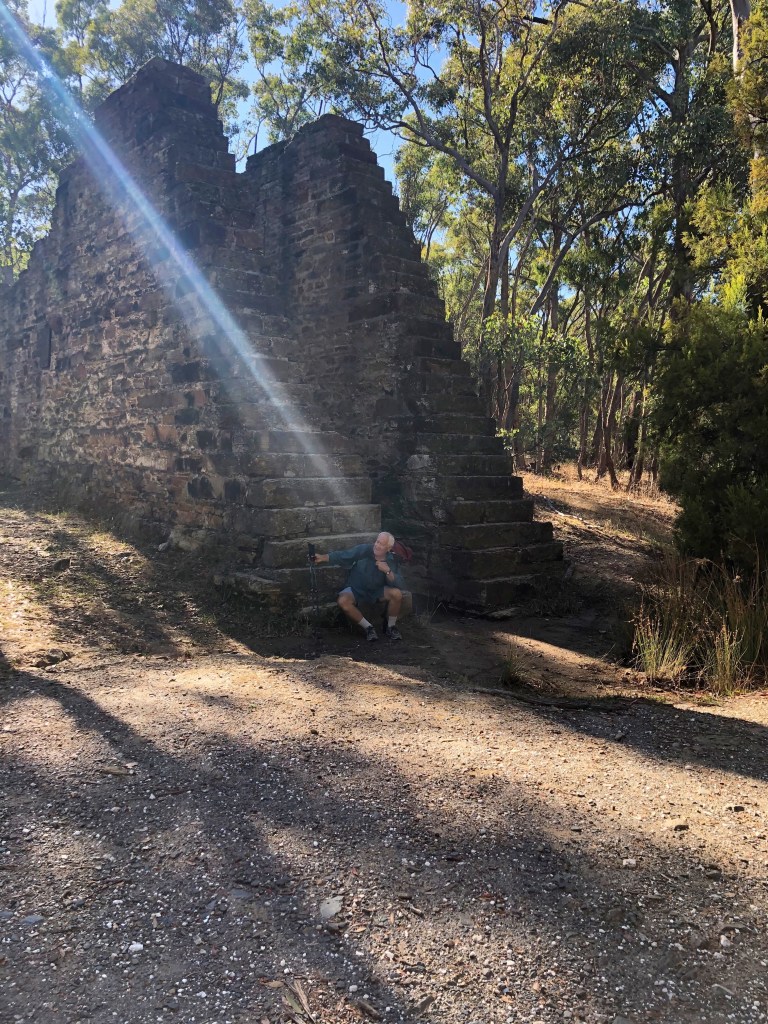
Just the stone supports are left today, with their very own shall we say spiritual quality.
We passed the Manchester Reef mine with its horizontal entrance and the pines of Moonlite Flat before hooking up again with the path along Forest Creek — almost back in Castlemaine by this stage.


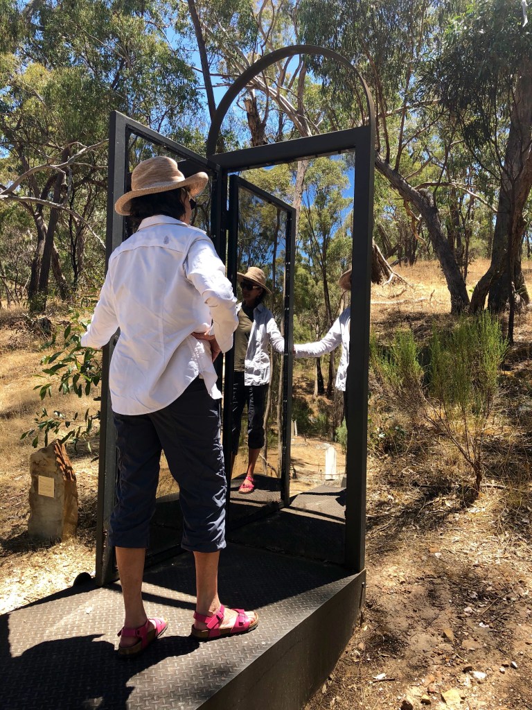
A little art on the way.
We had been watching the creek area getting more and more degraded as we got closer to town. But with a kilometre or two to go we noticed that the blackberries had been poisoned, then cleared out with a massive reveg planting program evident on both banks. Then we came to a Landcare sign saying how this program and the volunteers who do the work had been devoted to cleaning up this stretch of Forest Creek. Just before we got off the creek path to go into town, it looked like this.

What an estimable program Landcare is. It began in 1986 with a group of farmers near St Arnaud supported by Joan Kirner and Heather Mitchell (Warracknabeal farmer, then President of the Victorian Farmers Federation, and Rahda’s mum) and the Victorian Government. The late Rick Farley and Phil Toyne were the main lobbyists for it to become a national program. Launching the national version of the program in 1989, Bob Hawke said: ‘The degradation of our environment is not simply a local problem, nor a problem for one state or another, nor for the Commonwealth alone. Rather, the damage being done to our environment is a problem for us all — and not just government — but for us individually and together.‘
I wonder if we could get a politician, any politician, to say that today, and not just say it but act on it.