
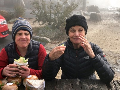
During the last relief from being locked down we visited the mountains. Jessie and Myrna climbed up Mount Buffalo’s Big Walk on a cold day with, apart from a few brief breaks, a heavy dripping mist clamped down on everything.
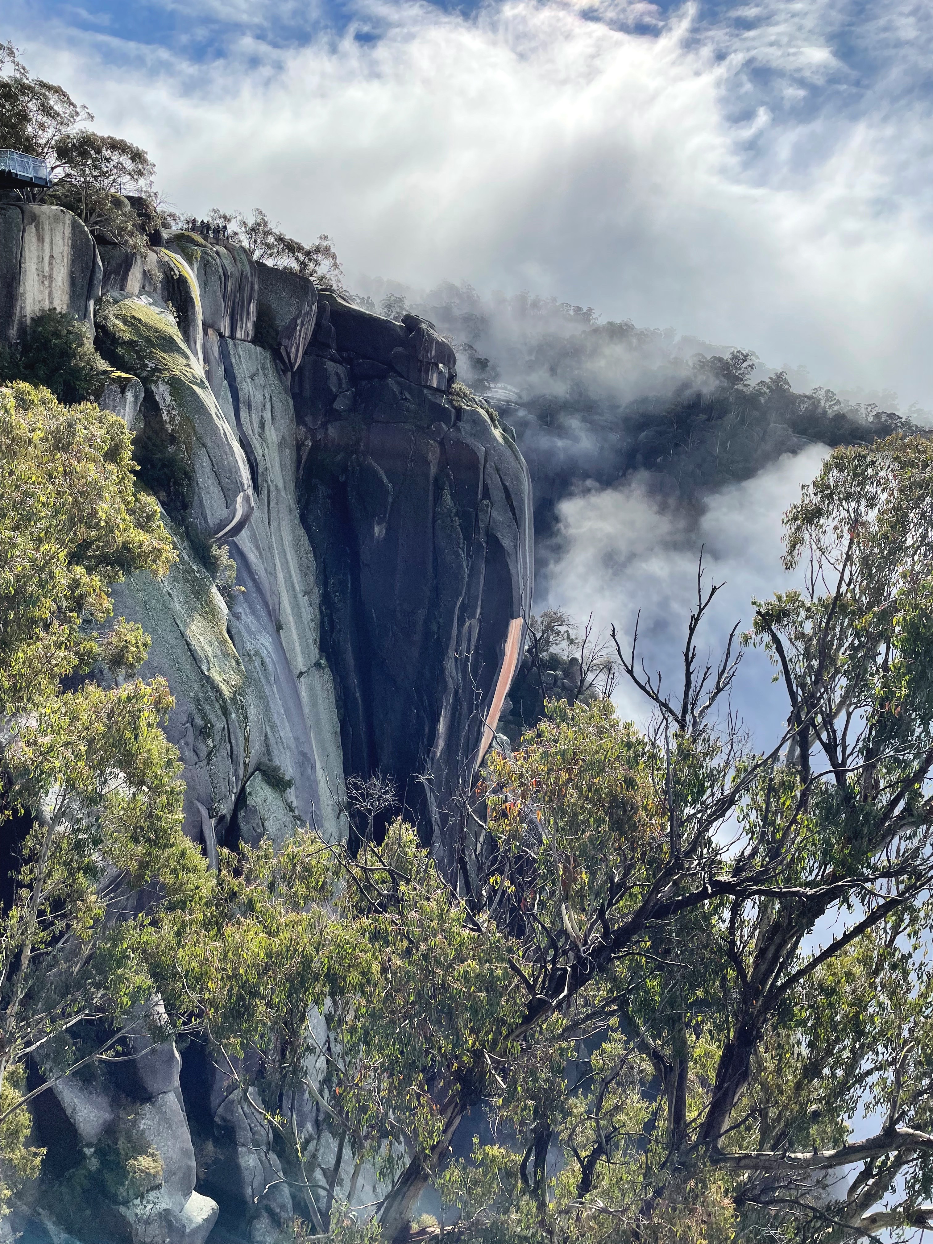
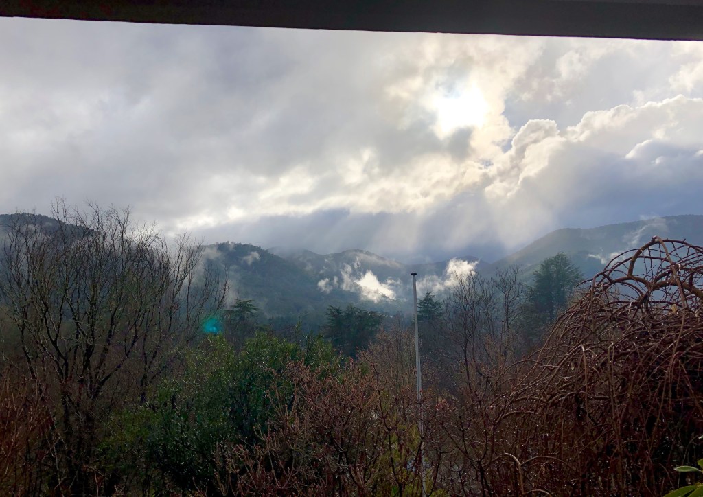
We were sitting having a late lunch (provided by the estimable Support Team) and across towards the Gorge was the brief revelation pictured below. Drama.
It’s Jessie’s photo with her flash new phone. Superb.
From the other direction Crystal Brook was spilling over the Gorge to another version of itself several hundred metres below.
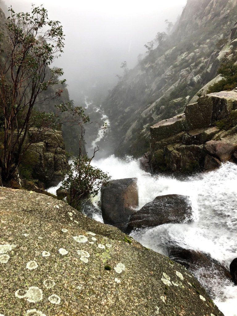
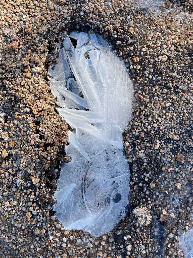
With the wrinkles and creases of its eddies, Crystal Brook drains Hospice Plain, sometimes under snow, more frequently under water but most often dry. This was an occasion.

Wet wet wet. Weather persons like to conjure up distress at the prospect of rain. ‘I’m sorry Pete. It’s going to be wet for the next few days.’ ‘But we can look forward to some better weather next week can’t we Jane.’ ‘Sure can Pete.’
From almost any point of view — almost, unless you’re a house painter for example — there’s nothing wrong with weather like this. We could start from the proposition that we couldn’t live without it and move from there. But stormy weather on a mountain is profoundly good for the soul as well.
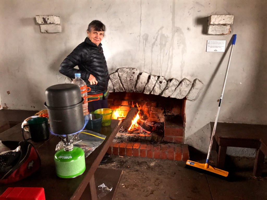
It could be suggested that the aesthetics of these conditions might be best enjoyed from snug interiors with good windows. Like this one in fact.
Or this one, with not one but two fires which we just happened to find in a shelter hut near the Chalet — a real surprise. Go Parks Victoria.

Or even from the warmth of a car.
But there’s nothing like being out in it.
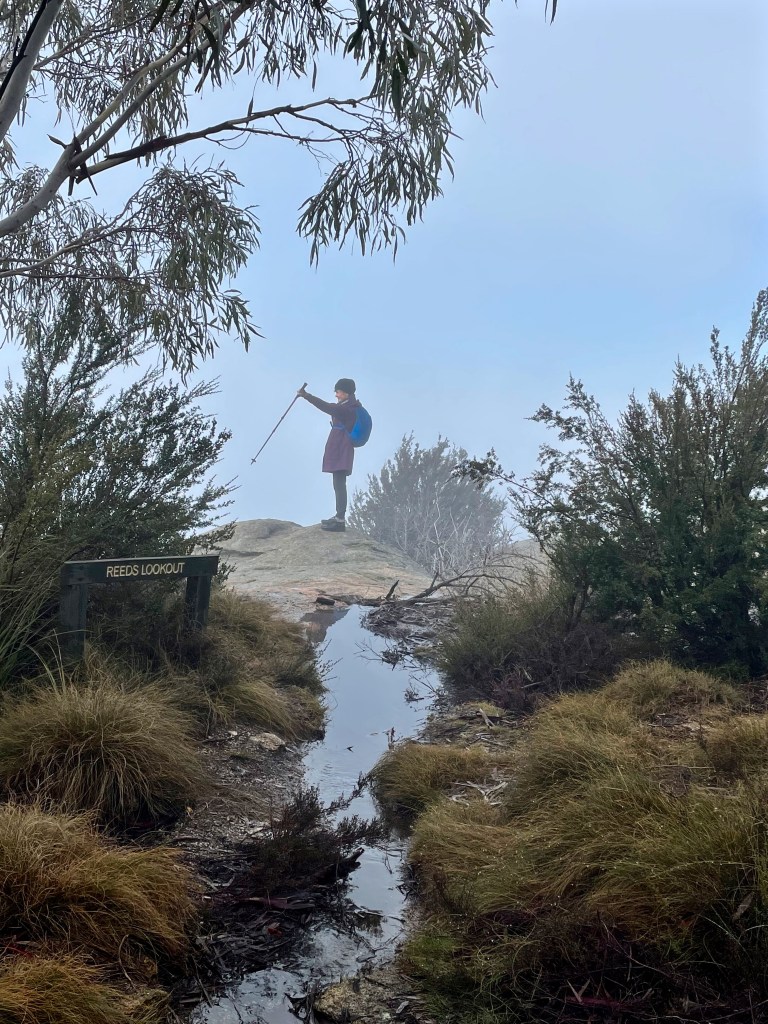


While the Support Team undertook rehabilitation at the Bright Gym next day, the Intrepid Adventurers went back up on the plateau for another long walk: Long Plain, Mount Dean, Dingo Dell, wet feet most of the way and a certain amount of snow and ice.
Another masterpiece from the new phone and its owner-manager.

And then on the way down it all cleared and suddenly there were the Buckland and Ovens Valleys in all their late afternoon shimmering splendour.

* * * * * * * *
Determined to make the most of the break in lockdowns we headed off to the Grampians almost as soon as we got home from the Alps.
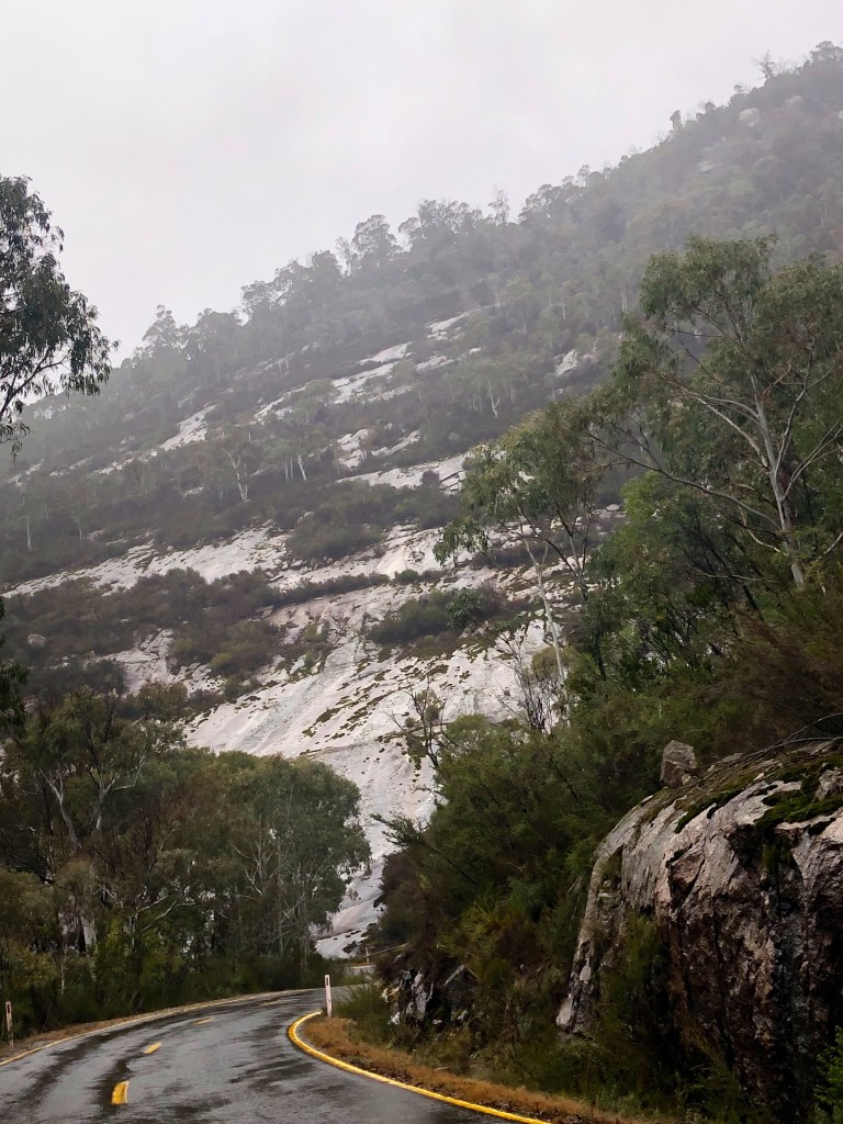
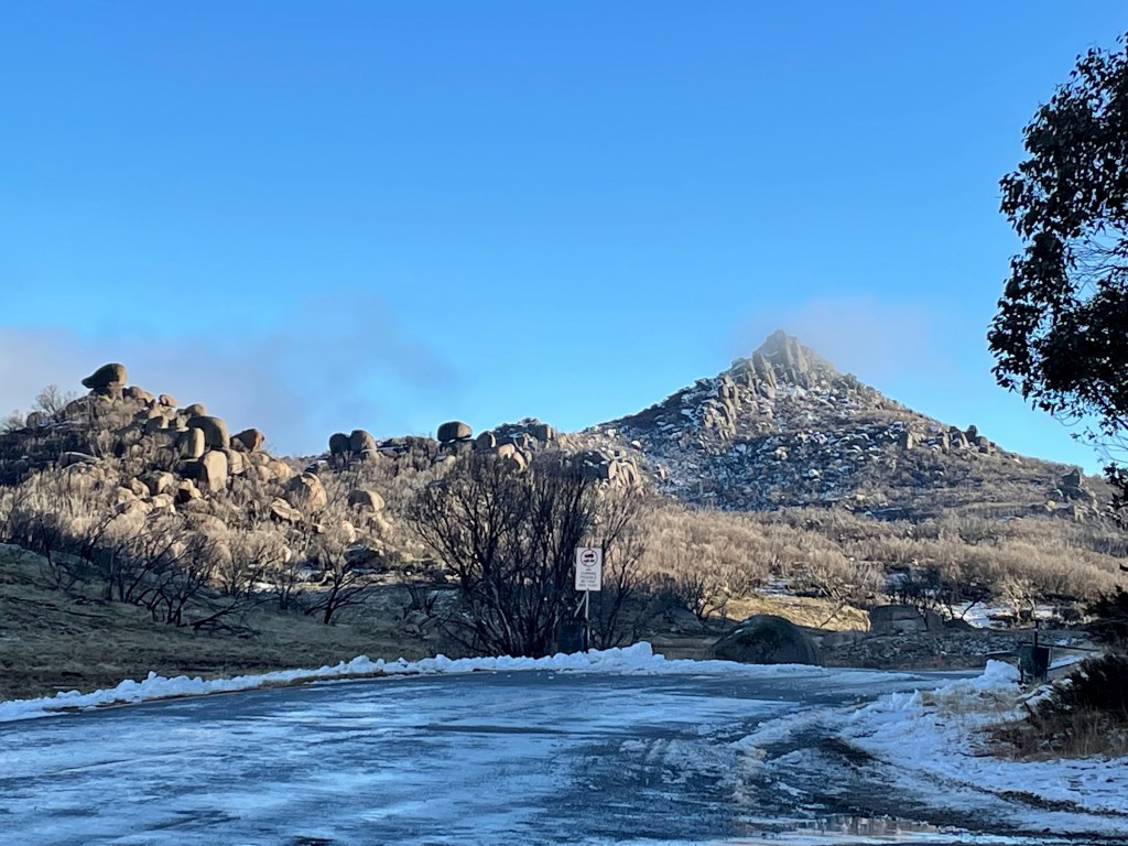
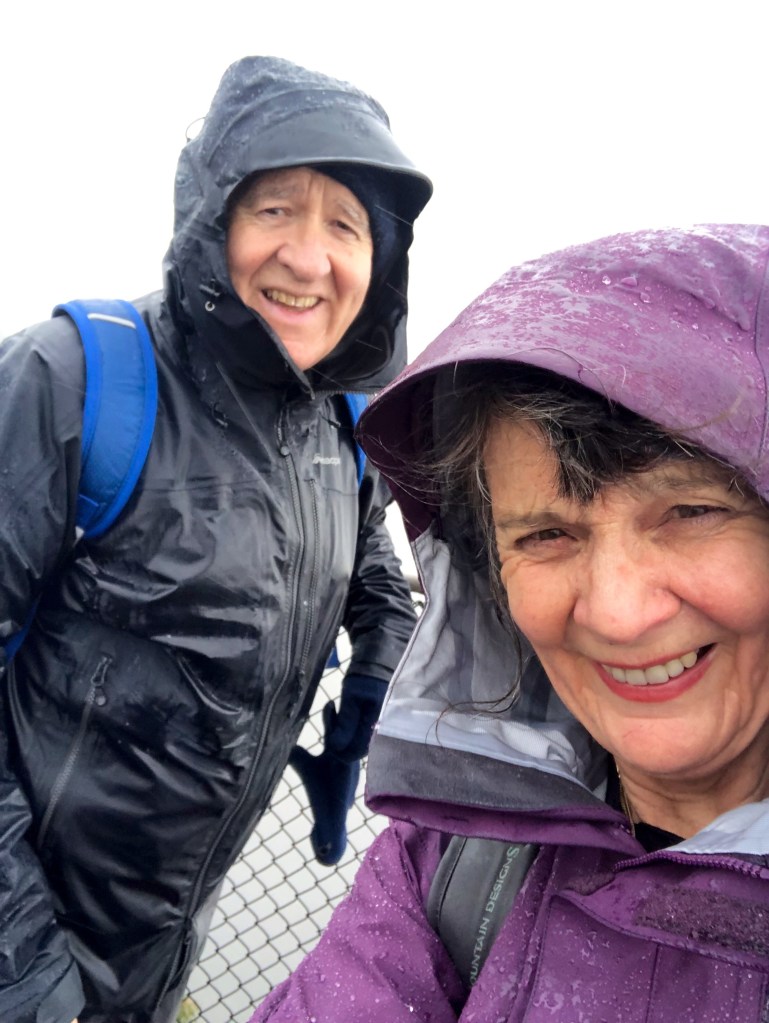
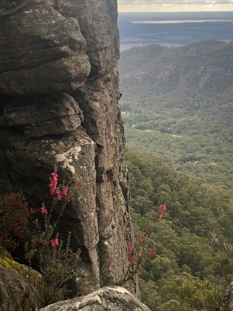
Weather? Yes of course. Wet. In this case, standing on top of The Pinnacle after walking from The Sundial, majorly wet in driving sleet. (Hmm ‘majorly’. You can think about that. Is he just trying to keep up with the young people I wonder?) And very very cold — freezing — just there, a big wind chill factor.
But not wet all the time.
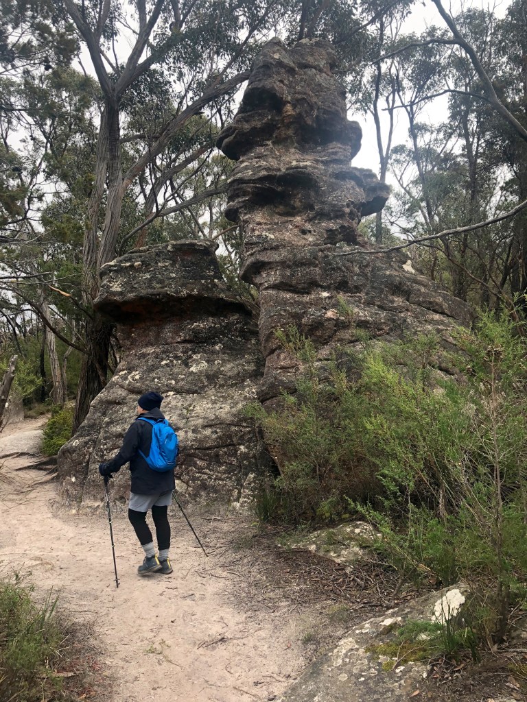
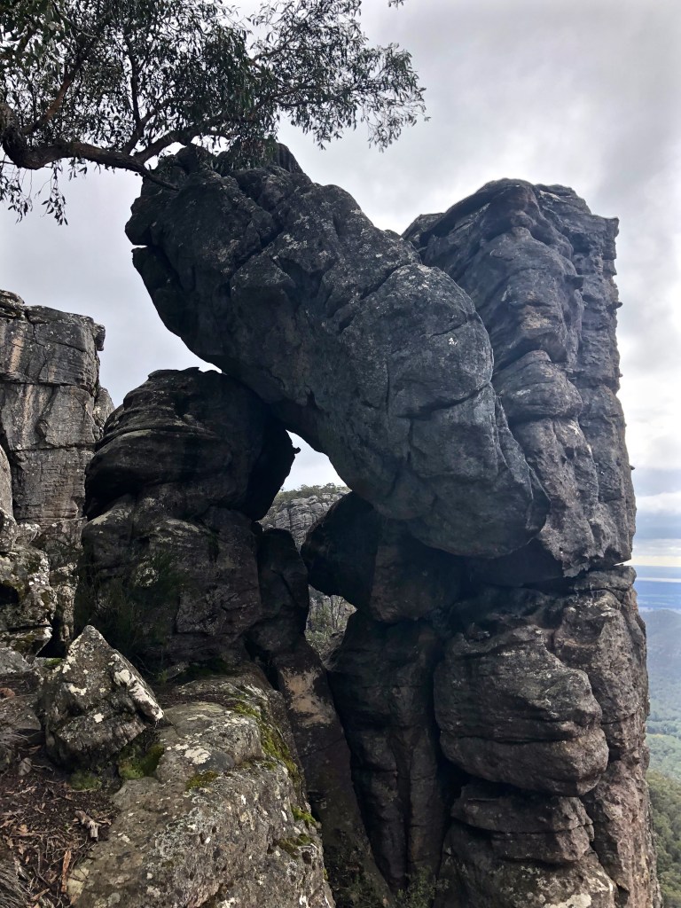
I have wondered about the tendency to look at rock formations and anthropomorphise them. (‘Anthropomorphism: the attribution of human traits, emotions, or intentions to non-human entities. It is considered to be an innate human tendency.’) This takes concrete form in the naming process, say as something domestic (The Flat Iron, The Cool Chamber) or otherwise familiar (Fallen Giant, The Alligator, Elephant’s Hide, The Grand Canyon). I’m sure that’s better than naming them after obscure — or famous — humans.
I have commented elsewhere about the tendency on Mount Buff to name everything: The Sarcophagus, The Piano, The Cathedral, the Monolith, Mahomet’s Tomb, Giant’s Causeway, The Leviathan, Whale Rock, The Sentinel, Og Gog and Magog etc etc etc. Perhaps not strictly anthropomorphism, but wandering round the ball park.
Maybe we need to do that, or maybe we used to, and, as nature has been experienced (and understood) at a rapidly increasing distance, that’s dropped off. I notice in the Grampians most of the signs that used to be attached to such formations have been taken away. Too cheesey perhaps? Too 1950s?
This cold day I found myself thinking whether formations like the one above have ever had a name, especially a Jardwadjali or Djab wurrung name? Perhaps they are too common in the Grampians to matter in that way. Perhaps only the really remarkable sites/ features/ spectacles (of which there are more than ample) received that sort of attention.
Just going on a bit randomly, if I call this a bus stop, or a group of friends lining up for a mass selfie, am I betraying something about myself? And should I quit right now?

Perhaps I should marvel from a more elevated non-verbal perspective. That’s probably right. So much thrilling to see everywhere you look.

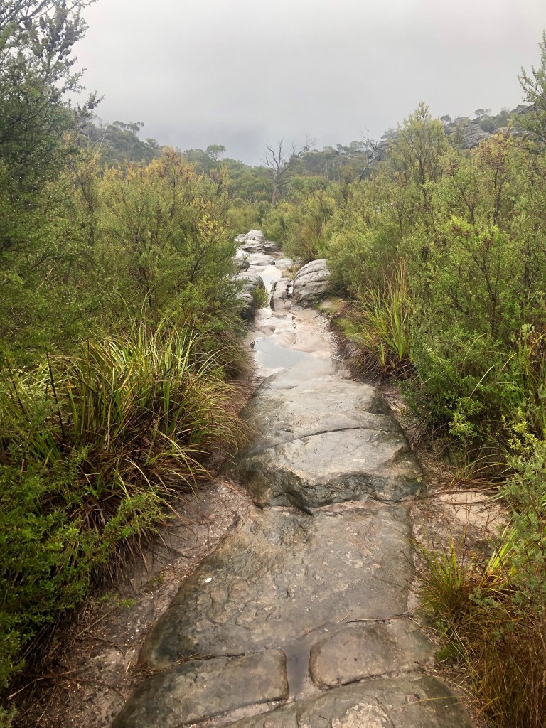
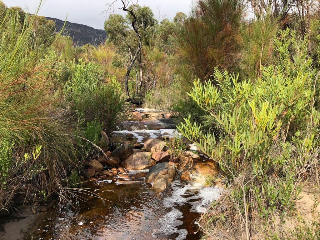
A lot of tracks become water courses after rain: they’re cleared, they’re often lower, they’ve often been chosen because they at are the bottom of two inclines. Or, in New Zealand, because you won’t care or notice the difference.

Even when they’re raised on rocky ribs like this one they hold water.

* * * * * * * *
The average annual rainfall on the eastern side of the Grampians is double that on the west. The next day we were thinking of a walk with Robert near where we were in the central Grampians. But the weather looked shocking, enough even to turn us back and barely worth a 90-minute drive from Horsham. However, he had an idea about a walk near Troopers Creek, and the further north we drove the more the weather improved. (‘Improved’. An unnecessary judgment right there.) The more the prospect of life-giving rain diminished. (Much better.) Can I say it turned out to be a lovely day? No I didn’t think so.
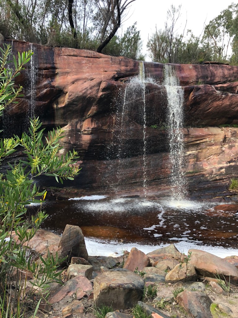
This track was a discovery: brand new and part of the very slowly evolving Grampians Peaks Walk, from Mt Zero, the northern tip, to Dunkeld in the south. There will be 100 km of new track as well as 60km of established trail and Parks Victoria thinks it will take 13 days.
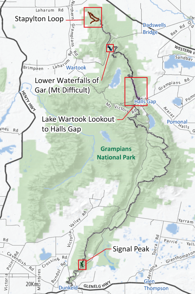
The part of this track that Robert knew about, ‘Lower Waterfalls of Gar (Mt Difficult)’, had just been opened, brand new, and very carefully and thoroughly constructed: ‘Troopers Creek’ to Beehive Falls below Budjun Budjun (Briggs’ Bluff). ‘Troopers Creek’ has a very new and well appointed camp site now. I have thought, known really, that Troopers Creek is about 4 km south of this site and that the creek that runs through it is really Dead Bullock Creek, but this is more of that name quibbling business.
It did have waterfalls and they were wonderful, running enough to justify the naming process, and, to me, completely unknown. We didn’t do it all — it was a Sunday arvo stroll — but what we saw was compelling.


This rather ordinary photo was taken from the car as we headed down Roses Gap Rd towards Wartook. It all reminded me again of what I wrote about the Grampians in my remembrance of when we lived there.

Much of the Grampians out of the tourist swarm has a very particular and striking flavor. It resonates with something that is difficult to describe. It’s incredibly particulated but of a piece; it works; but it’s not you, or me anyway. Both fragile and resilient; scrubby but graceful; worn out but enduring; brimming with life but a lot of that life is crepuscular or nocturnal.
What a place. Really.

More fabulous photos (and of course the prose). Were they all taken on Jessie’s phone? If so, must get one! Keep on walking …
Mate, it’s sad that you’ve been dropped to the Support Team.
Great pics though.
I agree about the weather; rain is good for us. As for the AFL, Dogs and Cats in the GF; Dogs to win.
How clever of you to get a walk in between two lockdowns! Terrific photos and observations-thank you.
I wonder how many tech heads would agree that 8 months old counts as a ‘new’?! 😄
Mate this blog isn’t for the easily distracted tech head. It’s for the mature reader with their 8yo and perfectly servicable phones. Your loving father.