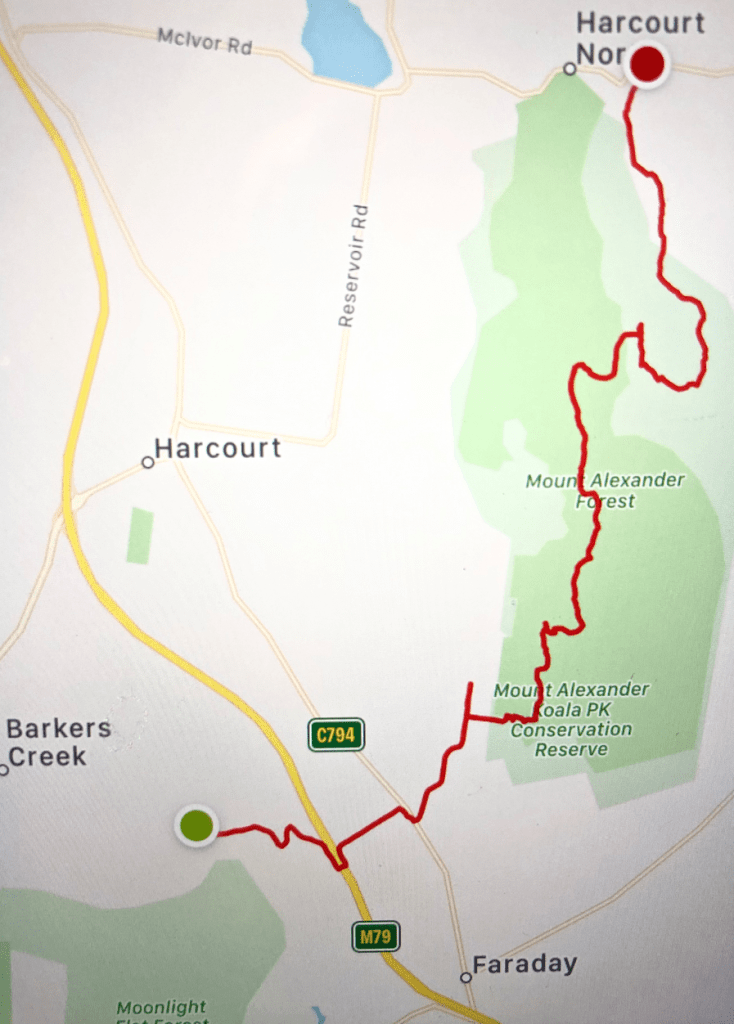
Specimen Gully to Harcourt North
12 February, 2021. A cool wet morning which cleared up to mid 20s. 16.37km
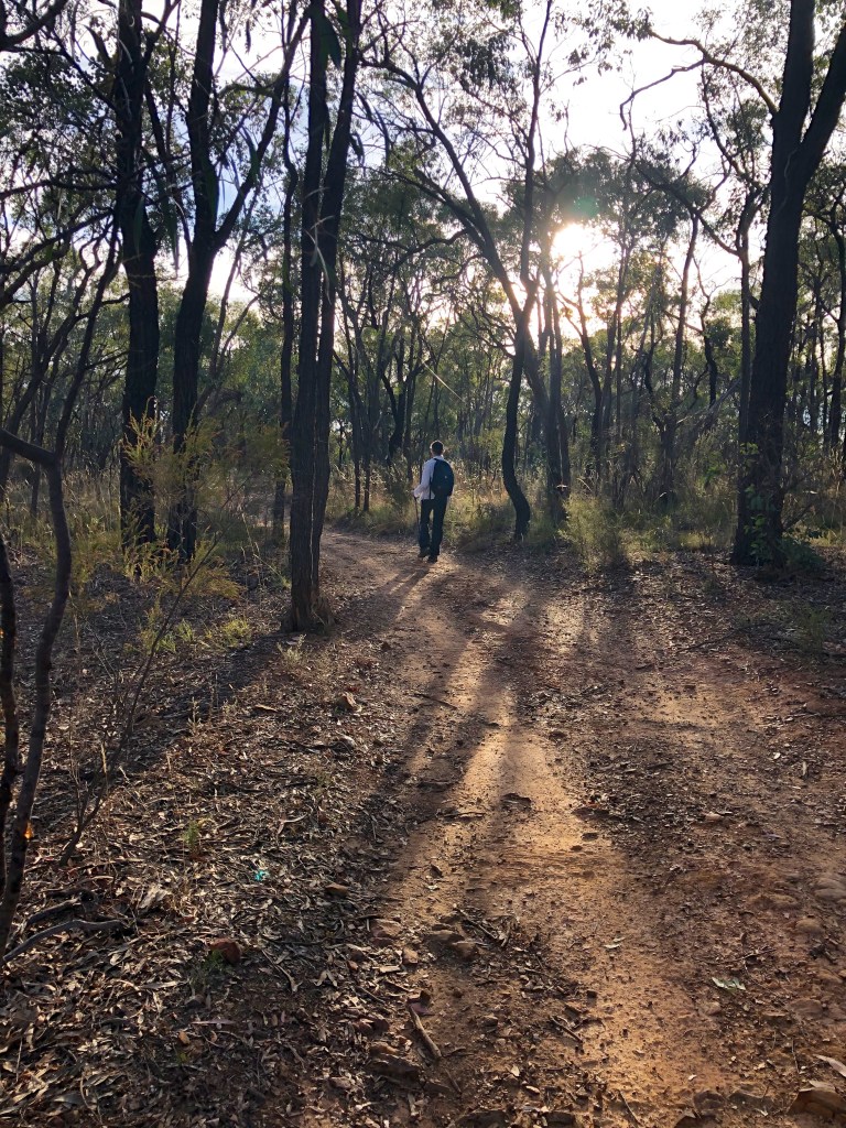
We started at Specimen Gully in misty rain.
When I asked the taxi driver to take us to the memorial for the discovery of gold she was nonplussed. I thought it was everywhere, she said. But she did know where Specimen Gully Road was and we had no trouble finding the right place.
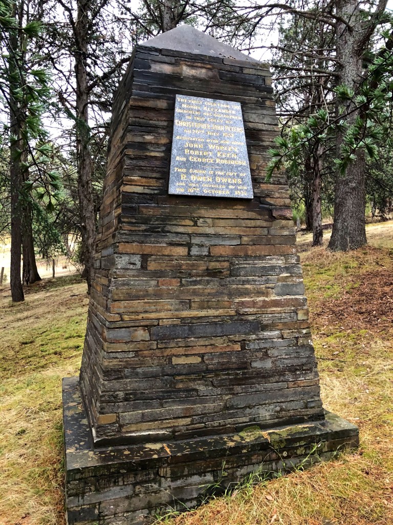
The plaque says:
The first gold from the Mount Alexander goldfields was discovered in this gully by Christopher John Peters on 20th July 1851.
Associated with him were John Worley, Robert Keen and George Robinson.
This cairn was the gift of R. Owen Owens and was unveiled by him on 10th October 1931.
Ah my goodness. It was a bit like the experience of seeing and reading Captain Cook’s actual journals.
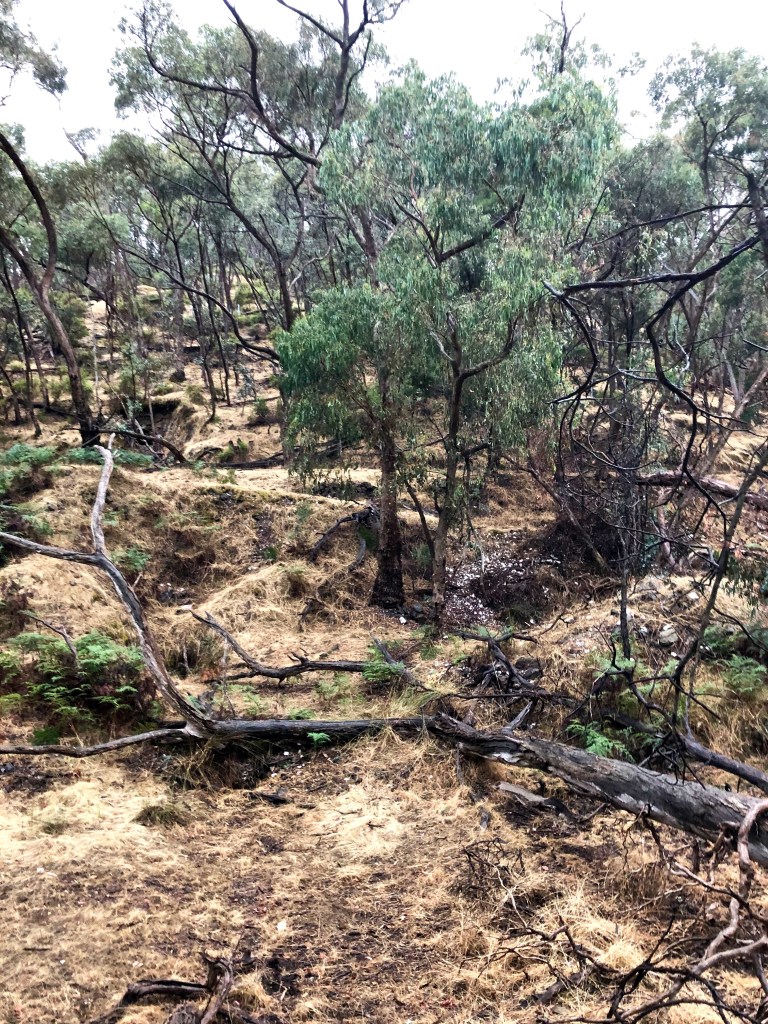
Look at it. You don’t know whether to laugh or cry. Where gold was found 170 years, four months and nine days before this picture was taken. Every millimetre of it worked over. It might have been the quality of the morning but I found my skin tingling with the gravity of it all. Or something. I’m not sure I have suitable words because those on offer seem to be about the condition — affected, moved, touched, struck, stirred — rather than the cause.
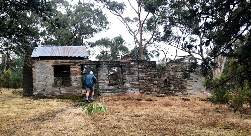
Memorial stone, cairn, Heritage slate hut.
I told the story in the first of these blogs. Whatever version you find, it’s the same, even the same words. It goes:
‘On 20 July 1851 gold was found near present-day Castlemaine, Victoria (Mt Alexander Goldfields) at Specimen Gully in today’s Castlemaine suburb of Barker’s Creek. The gold was first found by Christopher Thomas Peters, a shepherd and hut-keeper on the Barker’s Creek, in the service of [Dr] William Barker. When the gold was shown in the men’s quarters Peters was ridiculed for finding fool’s gold, and the gold was thrown away. Barker did not want his workmen to abandon his sheep, but in August they did just that. John Worley, George Robinson and Robert Keen, also in the employ of Barker as shepherds and a bullock driver, immediately teamed with Peters in working the deposits by panning in Specimen Gully, which they did in relative privacy during the next month.
‘When Barker sacked them and ran them off for trespass, Worley, on behalf of the party “to prevent them getting in trouble”, mailed a letter to The Argus (Melbourne) dated 1 September 1851 announcing this new goldfield with the precise location of their workings. This letter was published on 8 September 1851. “With this obscure notice, rendered still more so by the journalist as ‘Western Port’, were ushered to the world the inexhaustible treasures of Mount Alexander”, also to become known as the Forest Creek diggings. Within a month there were about 8,000 diggers working the alluvial beds of the creeks near the present day town of Castlemaine, and particularly Forest Creek which runs through the suburb today known as Chewton where the first small township was established. By the end of the year there were about 25,000 on the field.’
But that’s not it, is it? Christopher Peters — Chris, were diminutives in vogue then? I think he has to be Christopher — what does he know about gold? Unlike Hiscock finding his reef at Buninyong he wasn’t prospecting, he was tending sheep. He might have seen a glint in some quartz in the dry gully, somewhere he could have been dozens of times before. Specimen Gully is quite pronounced and runs for hundreds of metres. It could easily have been pyrites, fool’s gold. It’s not till you isolate a piece, try to bend it and it snaps that you can be certain otherwise. He would not have been formally well educated, but he could well have had a deep and thorough informal education, enough to be conscious of the possibility that what he was looking at was gold, possibly one surprise among the many that he encountered every day in this foreign land.
But what would he have thought? I’m rich? Or, just as possibly, I’m in trouble. A retired fossicker who recently found a 2kg nugget near Ballarat didn’t sleep for four days after his find, not so much disturbed by excitement as just disturbed. His life wasn’t going to be as it was. Christopher, quartz in hand, talks to his mates as they sit around their bark hut. July. Almost certainly quite cold and possibly wet. Their fire would be particularly smokey, inside as well as out. They’d be so habituated to the smell that they wouldn’t be bothered trying to wash it out of their clothes. Did he have a cup of tea? I think he would have, but I’m not sure if he would have had the stomach for the damper and mutton that was on the table.
Would they argue? Is it, or isn’t it? Who knows? Who could know? Was it Christopher? You would have to imagine that he was the most invested in the idea. But of course it’s an issue. They’re earning a few shillings a month while having contact with more than one squatter who seems to be making a good fist, and money, out of the new life. They’re conscious of class distinction, but already it’s not like it is in England. Already Jack has ratcheted several steps up the social ladder at the same time as his master has descended. Struggle is a great leveller. You could change your circumstances, and the medium was formidably simple: money. Nothing else. Just money. But still they laugh at Peters and the improbability of it all.
I think they would have gone for a look, maybe that night with a lantern. They wouldn’t have been able to help themselves. Is there any more there? When will we find out? How would we find out? I am thinking that John Worley might have been the smarty of the group, at the same time the most sensitive and the most conscious of the moment and impact of their discovery. He wrote the letter. But I think this night he would have been holding the lamp while Christopher got his chisel out and poked his way into the stone with increasing vigour and less care about the accumulating pile of cobbled quartz. ‘See?’, he might say. ‘It’s still there. It’s still running.’ They go back to the hut but no one sleeps. They talk sporadically all night.
Next day Robert Keen turns up with his bullock dray to haul some timber for fence posts back to the homestead. They tell him. He’s a mate but older and more mature than the other three. They respect his opinion. ‘What do you think Robert?’ He thinks. ‘Let’s get some tools.’ And then, after chipping out some more stone which still has those sparkling veins in it, ‘I think we should show Barker. It’s his run.’
As they go up to the homestead the four of them are gripped by anxiety each expressing it in their own way, Keen’s barely decipherable. Dr Barker meets them on the veranda. They’re not invited inside. ‘What?’ he says. ‘Give me a look.’ He looks long enough to give himself time to think, and one of the things he thinks is, I am making a mistake by spending so much time looking. My reaction should have been crisp and decisive. I should have just thrown it away immediately. ‘Fool’s gold Peters. Don’t you know fool’s gold? It looks a bit like gold, but you don’t find gold here Peters. There’s no gold here. Not in the colonies.’ He can’t keep the piece of quartz because it’s sort of theirs, so he throws it away, but not extravagantly. He has to measure between a short contemptuous throw that allows them to pick the stone up off the veranda and take it away with them and a long powerful throw during which he runs the risk of both executing the throw poorly and expressing his concern and uncertainty about the situation. ‘Now get back to work. I don’t want to hear any more about it.’ It is important that there is just a hint of geniality in his instruction — thanks for letting me play in this interesting game — because otherwise they’ll know it really is serious.
They walk off, each now convinced, if not equally, that what they have shown him is indeed gold. Of course they wait till they are out of earshot — Barker has gone inside, but probably not far so he can see what they’re up to — but then Christopher says quietly to Keen, ‘Can you find us some more tools?’ Keen says, ‘Yes.’
The homestead is on the creek (‘Barker’s’) at Harcourt North about 6km, a difficult 6km, from the find which in addition is about a kilometre and a half off the main track. There would be no special reason to go there. The four of them get a month’s digging in before O’Giles, one of Barker’s trusties, is sent to check just what is going on. There have been stories, and Peters and Worley haven’t been spending as much time near the homestead as usual. When he finds what looks like a busy camp, O’Giles says nothing but next day returns with Barker and six other men.
… and that’s where we were, looking at the skeleton of a cow on the other side of the road, in the middle of history.
* * * * * *
What a day this was.
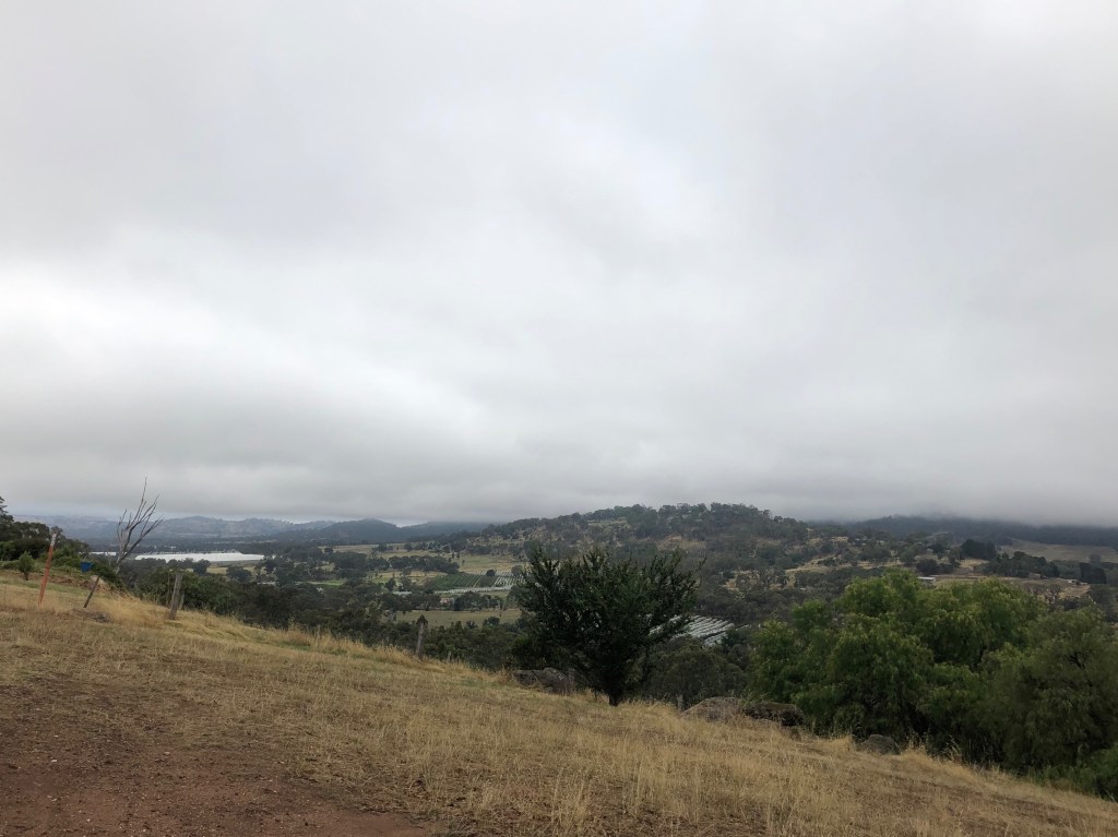
We’re up on the Barker’s Creek hill looking across the Faraday valley and its orchards to Mount Alexander (hidden in cloud) which from now on we are going to call Leanganook because that’s its name, the walk is called the Leanganook Track and we’ve already been calling lots of other things ‘Mount Alexander’.
Take 2 minutes 49 seconds to look at this. Click.
We’re going to climb up the well-rehearsed tracks on Leanganook up the southern side, sidling along the western side to the top, down east and then north to get ourselves to Sutton Grange Road where Graham and I have dropped our car. This is quite simply a great day’s walking. All day.
From Specimen Gully you climb up over the top of the hill where someone has built a house with somewhere near the last word in commanding positions. It’s well considered and not gaudy. I’m sorry I don’t have a photo. There seems to be a rather nice small stone house on the same property which Chinese purchasers or lessees can read about in their own language (租金 $260/周 on 2017年10月, 距离市中心106.55公里).
At the bottom of that valley is the Calder Freeway which you have to get across and there is a very helpful underpass for that purpose. A lot of attention has been paid to wildlife by the people who designed and built the Calder, much fencing, some crossings (not so many). I hope it’s effective. From the dirt roads on the other side we saw a paddock bounding with kangaroos. I counted 98, Myrna 86: the story of our lives really. There was a nice wooden crawl option for creatures with claws to get through the tunnel. To Faraday.

I’m not sure you can talk about Faraday without talking about Lindsay Thompson.
Lindsay Thompson was for a time Deputy Premier and the longest-serving minister (24 years) in Victorian parliamentary history. His parents were both teachers, his father dying when he was two and he was raised in difficult circumstances. However, he got a scholarship to Caulfield Grammar where he eventually became school captain and dux. This might surprise those of us who worked in education during his tenure (12 years) as Minister when his main quality seemed to be ineffectuality. He had also served for three years during the Second World War which was three years more than many of ‘us’ had.
But in 1972, my first year of teaching, the entire population of Faraday School, a teacher and six school children (all female), were taken hostage by a man called Edwin John Eastwood who demanded a $1m ransom to release them. Thompson personally took the ransom money to the prearranged site in Woodend. However the teacher and children had escaped from the van in which they were locked before that was necessary. Notwithstanding, he received a bravery award. Less well remembered is that five years later, after Eastwood had been released from jail he again kidnapped a teacher and a group of students, this time at Wooreen in Gippsland. Mr Thompson flew to Gippsland, again intending to offer himself in exchange for the hostages. But before he could do so, Eastwood was arrested in a shoot-out with police. The bravery of his intentions was again publicly honoured.
Once you get out of the tunnel you’re in the paddocks which was, this day, delightful. Then a series of dirt and gravel roads as you work your way across the foothills to the mount.
The highest point on Leanganook is only 744m above sea level, and it rises only a few hundred metres above the surrounding land, the fertile orchards and vineyards of Harcourt and Sutton Grange.
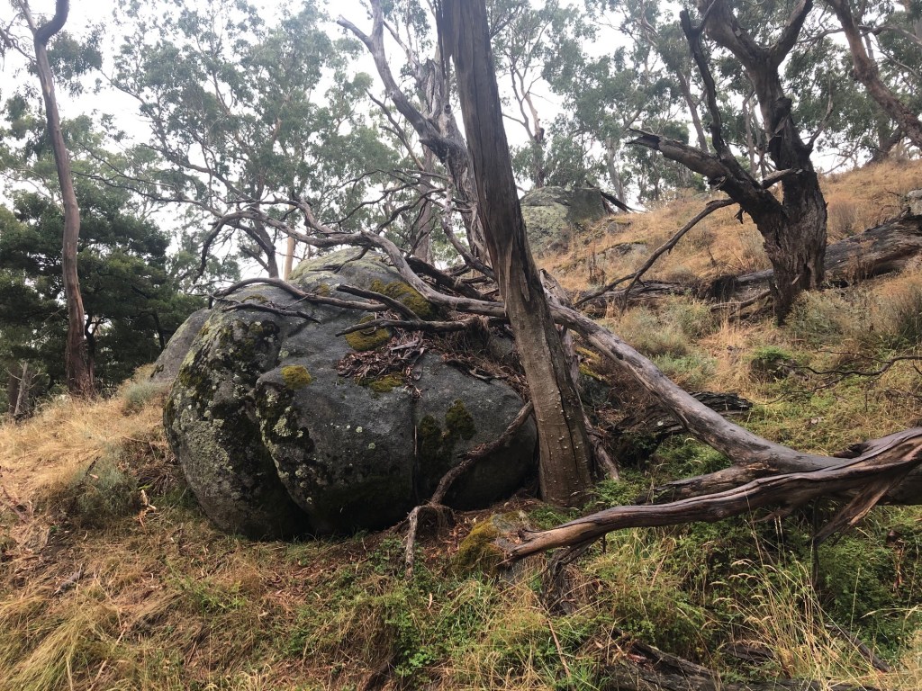
We’ve very definitely left gold country and its clays and gravels. These are rich granitic soils, and shortly, up the hill, we will get to the tors which provide clear evidence of this.
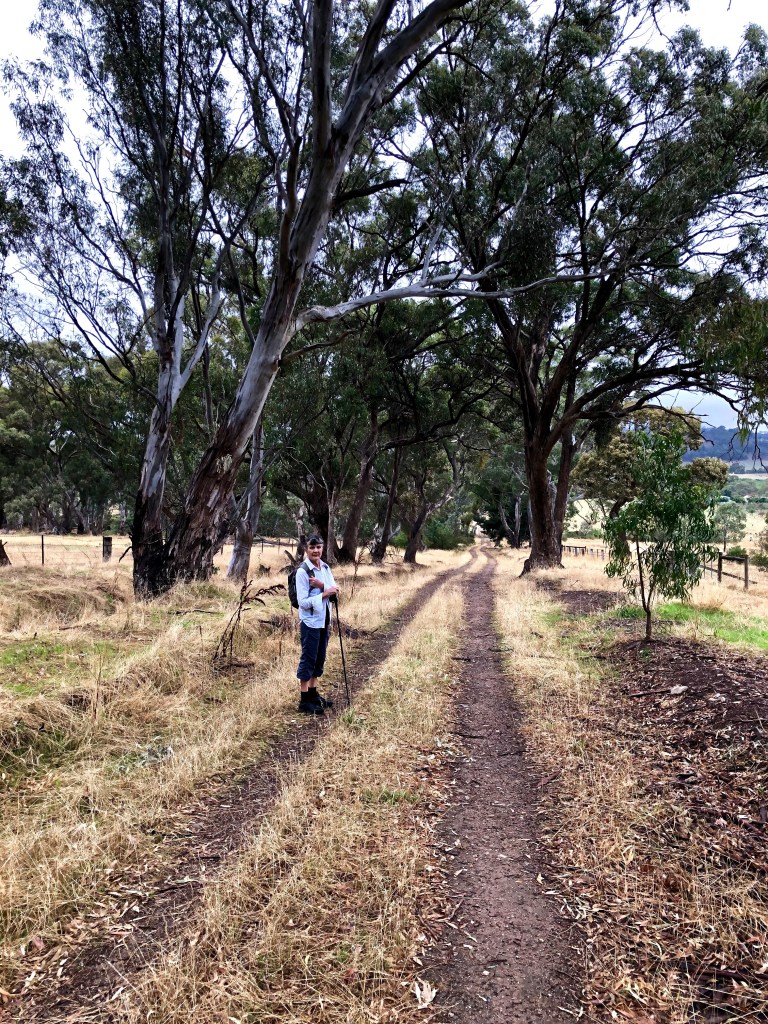
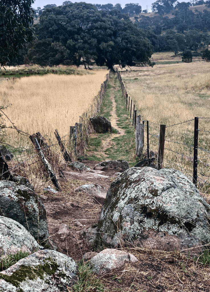
But first we need to climb over a stile

and follow our way along this easement which includes a simply magnificent red gum as well as the beginnings of the tors.
This pic is included for its characteristic qualities. ‘Yeah I know that’s what the waymark says, but…’

And then just up through the granite. Everyone takes the same pictures but it doesn’t mean they’re the wrong ones.


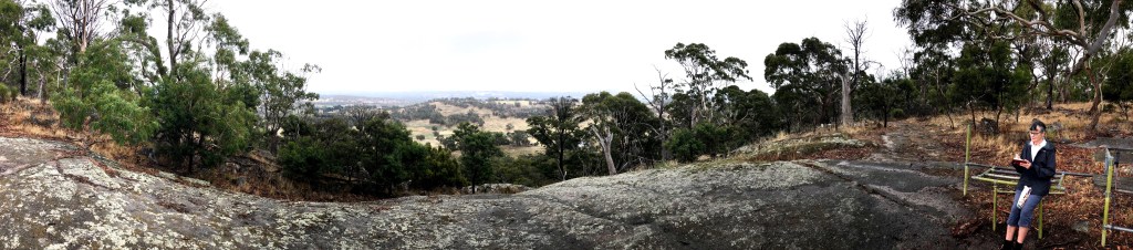
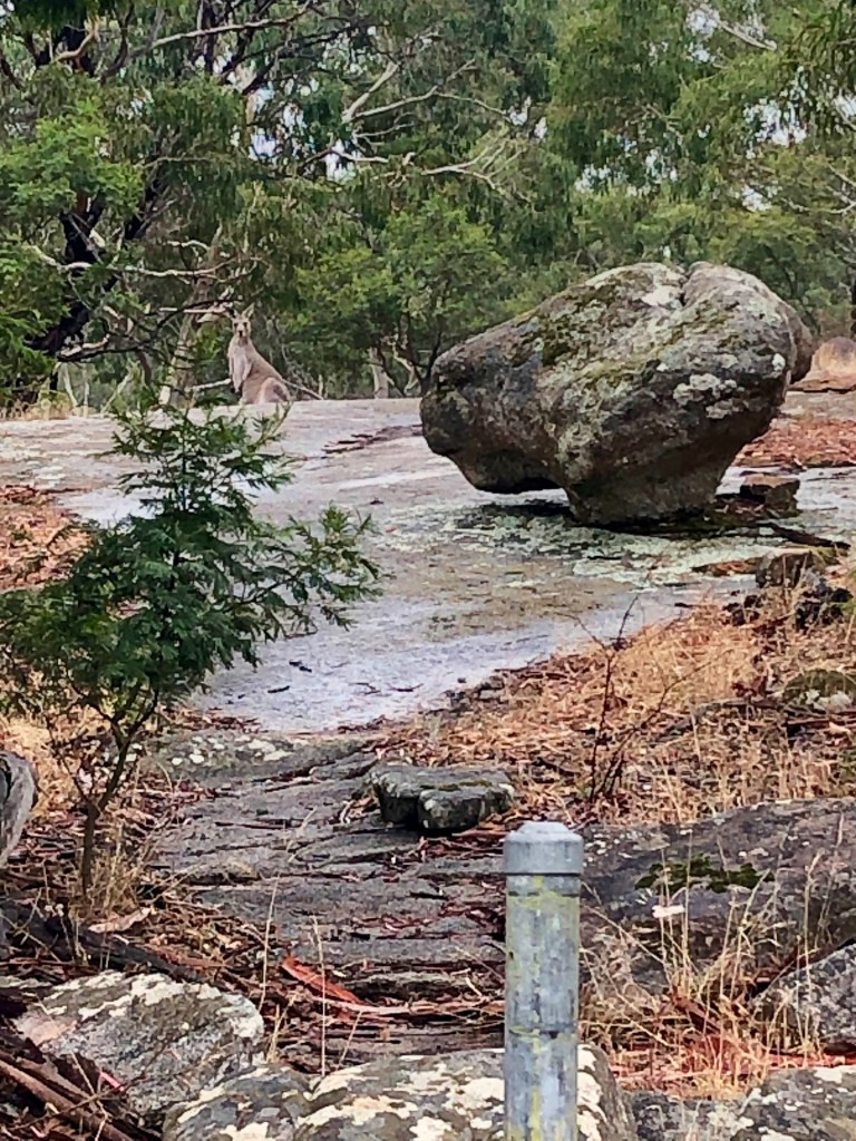
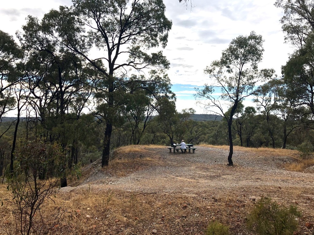
Ed’s seat (seen here being used by sketch recorder) is made out of fence railings originally intended to provide an enclosure/reserve for koalas. We have already noted way back near Creswick how effective such things are for keeping koalas in, here as elsewhere. But this granite platform provides a wonderful view due west to Mt Tarrangower and Maldon.

You will notice the cloud breaking up as it turned into a warm clear day. The sketcher was being watched at the time.
Stone photos. They just get bigger and more sculptural as you climb.


And the highlight, what whitefellas call Lang’s Lookout, but the Dja Dja Wurrung would have a much better name for it.
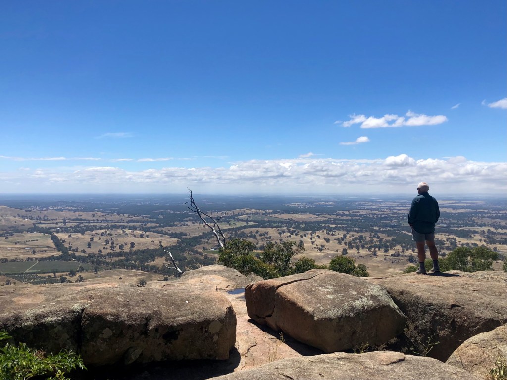
At the very moment Myrna took this photo her phone went ping. It was Dan. We had plans to walk somewhere near the edge of that horizon over the next two days, but Dan said no. It was going to be a hard lockdown for the next five days and we were to go home and await further instructions. So that’s pretty much exactly what we did.
But on our way down we saw something that was going to be our constant companion for the next 20kms: looking decidely wonky as it often did, here is a tiny portion of the remarkable Coliban channel.

Harcourt North to Sandhurst Reservoir

12 March, 2021. Mid 20s, mostly overcast. 21.87km
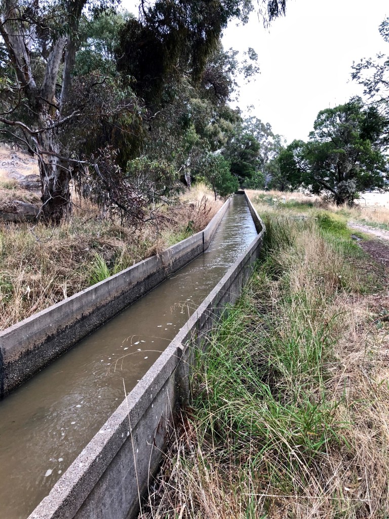
OK. That’s it really. Val and Maya dropped us off at Harcourt North and we followed the Coliban Channel for 20km to the Sandhurst Reservoir. And it’s a channel, so you wouldn’t expect much up and down would you? No, and that would be correct. But it’s a prodigious channel; it’s a remarkable channel; it’s a channel that makes so much possible. And I had never heard of it. And even after its company for a day and 20km, I was still finding it odd.
In this context why does it matter? For that we’ll turn back to ‘The Argus’ 1862 study of the goldfields:
One of the essential requisites in gold-mining is a constant supply of pure water. Whether the miner is simply a tub and cradle man, or a puddler, or a quartz-miner, the command of water all the year round is equally important. …Around Castlemaine it is no uncommon thing for the labours of the puddler and the tunneller to be suspended for four months in the year, for want of water. The Loddon ceased to flow above Newbridge for many months last year, and along its bed whole piles of washdirt were accumulated from the tunnels, only to be washed away in the first of the winter floods. … On Bendigo the want has been seriously felt for years, and, unfortunately, it has not been remedied by the formation of the Bendigo Waterworks Company, whose artificial lake, situated at the head of Kangaroo Flat, supplies sufficient water only for the domestic purposes of Sandhurst.
Unfortunately, the rivers that flow through those older fields are intermittent. Taking their rise in the Dividing Range, and flowing northwards towards the Murray, they carry down immense bodies of water in the winter; but their volume gradually diminishes as summer advances, until at last they lose themselves in the great plains south of the Murray, leaving dry channels to mark where rivers have been; or they resolve themselves into mere chains of waterholes, from which supplies may be drawn by the miners, but at an expense which exceeds the profit.
After giving consideration to artesian water, which would have the added advantage of providing a geological profile of the area where the bore was sunk, he refers to two major schemes which had been mooted, but focuses mostly on one — the one which will cost, initially, £254,000, about $62m today.
The Coliban water scheme has now been before the colony at intervals during the last seven or eight years. The simple proposition is this—water for sluicing purposes is much wanted in Fryer’s Creek district, around Castlemaine, and on Bendigo. …
It is proposed to meet that want by forming an immense reservoir near Malmsbury, at the point where the railway crosses the Coliban. Here would be stored a large portion of the storm-waters that are now wasted in the winter floods, and while the volume of the river itself would not be seriously diminished, a quantity of water would be retained sufficient to meet the requirements of the districts already named, and give employment to 6,000 or 8,000 miners. …
It is proposed to carry this supply to Sandhurst, by way of Elphinstone, or the Gap in the Mount Alexander range, known as Major’s Pass, and thence eastward of Mount Alexander, coming into the Bendigo Valley north of the Big Hill tunnel, in an open aqueduct of fifty miles long. …
The main questions are three—first, Is there a necessity for the work being done ? second, Can it be carried out? and third, Would it pay for itself? As regards the first question, I may say that I met with no one who doubted the utility of the plan. It is admitted that there are hundreds upon hundreds of acres of auriferous ground all along the line of the aqueduct not now worked for want of water. … Nor would the water be useful for mining alone. Whether carried through pipes, or in open channels, to the distributing reservoirs, the construction of a few filters, and the connexion of distributing pipes, would make it available for domestic use.
That the work could be constructed, and would secure the calculated supply, there is still less doubt. … That the supply of water would pay a very handsome profit to the state, seems to be equally clear; though I should be disposed to insist on that argument less strongly than on the more important one—the good which the scheme, if carried out, would do to the districts directly benefited, as well as the colony generally.
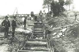
And so it came to pass. The Coliban was dammed at Malmsbury and 70km of gravity-fed channels took its water north. This scheme was surveyed and designed in 1863 by Irish engineer Joseph Brady who did all sorts of other clever things as well, and water flowed for the first time into Sandhurst Reservoir at Big Hill on the outskirts of Bendigo in 1877. Prodigious.
I haven’t forgotten about the Romans or that the Zaghouan aqueduct in Tunis, now about 2000 years old and lined with opus signinum, a rammed mixture of broken ceramics and lime and still completely water proof, runs for 90km and with some adjustments remains operating, nonetheless … prodigious. Most of Bendigo and Castlemaine’s water is still provided from this source. The Guidebook tells me that the whole Coliban system now includes 20 reservoirs and more than 500km of open channels. Prodigious.
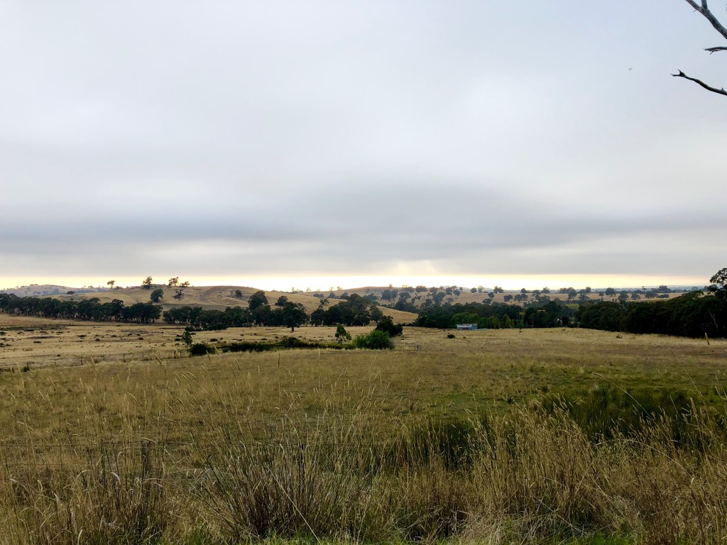

It was this sort of morning: overcast, the sun taking the game up to the clouds over on the horizon. For 5km or so, open on this side, the channel sidling along hills on the other. Red gum country, suffused this morning with birdsong and the heady smell of eucalypt blossom.
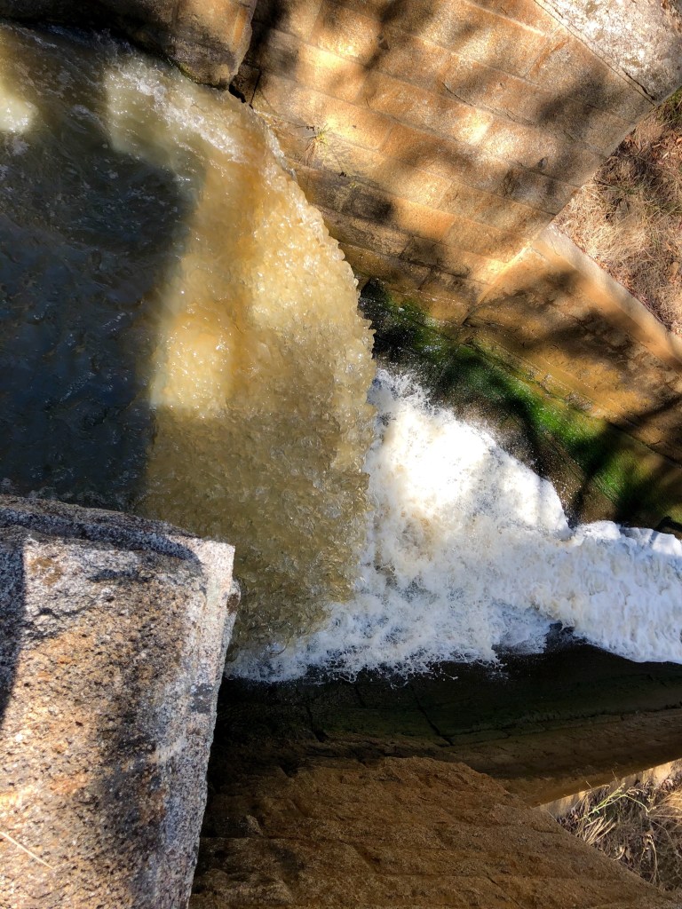
The water, about 30-45cms deep, was belting along in the channel. I dropped in a leaf which seemed to go about three times our pace. If that’s right, a bit of water, let’s call it Reg, which left Malmsbury promptly at 9 would be at Bendigo in time for a late lunch. But as we proceeded it was clear that there was both dawdling along the dug and weedy sections, and wild acceleration down falls and sharply angled races. So Reg’s actual movements would be slightly indeterminate, and it might be better if the lunch was wrapped and left in the fridge.
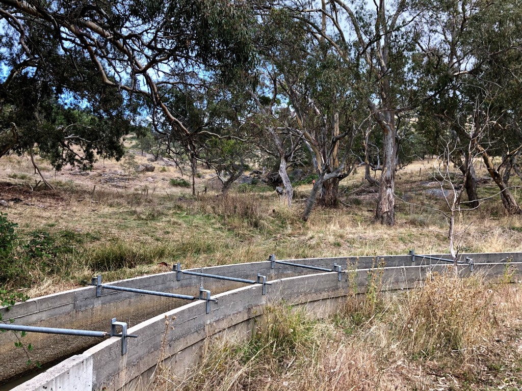
The channel turns corners, sometimes quite sharply. Not all the corners had bracing like this, but it would be helpful to keep the walls together in a situation where the soil, the weather, the vegetation and both the substance and motion of the water would be conspiring to open cracks.
I was interested in the daunting quality — and quantity — of the maintenance process. Here for example we have blackberries climbing in (and, just as it happens, looking back the way we had come, a useful cross section of the walking experience along the maintenance road).
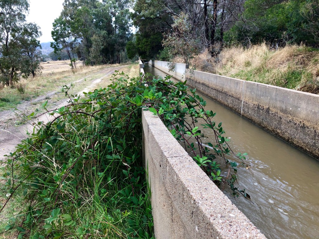
But, also completely by happenstance, looking back down the channel is a new section — remediation completed in 2019 of 2.7km at six different sites at a cost of $4.6m. Although there were only two significant leaks we noticed, there seemed to be ample opportunity for more renewal. This concrete is 60-70 years old and can’t be expected to last like the Roman efforts.
A lot of the channel sits on the ground in these concrete troughs, but a certain amount of it doesn’t.
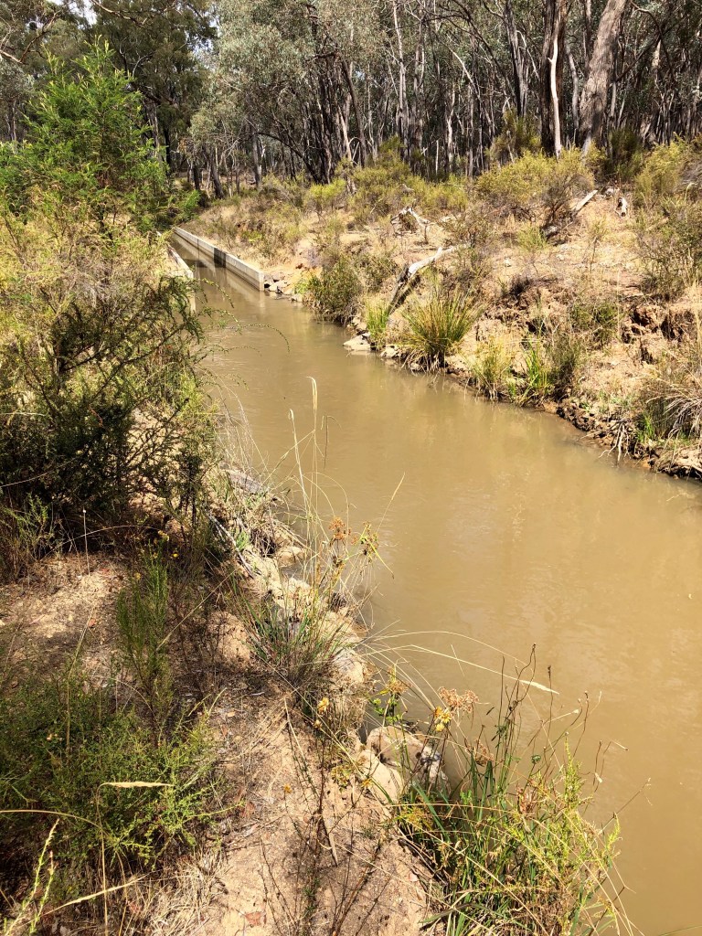
Some of it runs over rock and some of it is just dug through through soil and clay, and I did wonder about wastage and whether or not it might not be better enclosed to reduce evaporative loss and to keep weeds and wildlife out. We did find the bloated carcass of a dead kangaroo bouncing up and down on the wall of a low weir 10km further along. But then I thought of the cost. The Romans enclosed the Zaghouan aqueduct with large panels of sandstone, but they did have the advantage of slaves.
It also runs through two tunnels.

At the first of these, the Wirth, 623m long, there is is a very nice place to sit, a table made out of dressed granite with an equally suitable bench.
As we had a morning cup of coffee there, four very cheery and active older women came down the hill towards us, going onto the very short list of people we saw on The Track.
From the top of the hill there were good views south. Leanganook was obviously visible, but either here or on the next climb I am sure I could see Mt Franklin in the far far far distance.
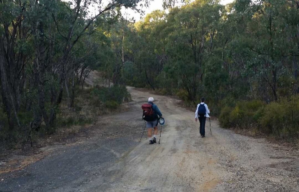
Three kilometres along you come to the next tunnel, Brennan’s, 453m long, and the track breaks up badly over the hill. At the top we encountered the five cyclists some of whom were desperate to get off The Track. When we got over the other side we could see why, a very degraded and difficult zig zag descent which would have been a real nuisance on a bike. They had to ride, or walk, their bikes, for another 8km to get to any bitumen but a lot of that ride should have been a pleasure along a flat dirt road. They were from Bendigo and had planned an interesting route roughly following the Goldfields Track but on quiet country roads rather than The Track itself for a three-day expedition to Ballarat.
A bit of excitement at Woman’s Gully, and shortly after at Cuneen’s Gully, taking about 50m out of the altitude.


The country had changed by now too, shifting back to stringy bark and box. We were moving back into gold country.

We found the reservoir, well down it seemed despite the best efforts of the channel which was still streaming into it. We found our way around the fence and through a tangle of tracks back to where we hoped our car would be, just near several sets of spectacularly layed rubber at the gated entry to the reservoir. And there it was. Hoorah.

Sandhurst Reservoir to Bendigo Central

13 March, 2021. Mid 20s again but overcast and very muggy. 16.75km
If you’re still with us, thank you for your patience. But this is it. Last day. The splendid Val has dropped us back where we left the car yesterday at the entrance to Sandhurst Reservoir, and it’s a short-ish leg into Bendigo, and therefore The End. And the walk is okay, but as is often the case of transitions into suburbia it’s not the walk of the century.

We’d got up early again, and this is the blazing Bendigo dawn.
I am sitting having breakfast on the balcony outside our motel room listening to the roar of endless twin cab maxis surging up and down the Midland Highway as the tradies go to work.
Scott Morrison would be proud.
This is where we are walking, dirt roads through the heavily tracked bushland of Bendigo Regional Park traversed with a lot of water races and more organised channels feeding and drawing from the reservoir we’d just passed and others. Classic Bendigo bush really. A sense of struggle. The patches of Ironbark come and go.

We had just walked through Map 32 of 33 in the Guidebook so the end was nigh. But first we met this fossicker in Golden Gully who said he was just as intent on cleaning up the bush as he was in finding anything of value. He hadn’t found anything of value but knew someone in Ballarat who had.


Diamond Hill is a landmark on the way in from the south.
Apparently it was called Diamond Hill because of the shape of a quartz bed in its summit. This is what’s left of that. In fact this area has been MINED. Did I read that 11 mines were built into the sides of this hill? I think I did.
But this was a cup of tea stop and 20 or 30m from the ravaged summit was a platform of tailings more or less transformed into a nice place to sit and do some more Angela Williams (do it everywhere!) School of Sketching.
It is possible that the most interesting thing about this point was that the view, essentially north, east and west, was full of trees. Just a few buildings obtruded.
It was not always thus.
* * * * * *
A quick digression. Bendigo. Odd name? Sure. From 1853 until 1891 the official name for the town was Sandhurst, after the British Military Academy for goodness knows what reason. But the locals, some of them anyway, had been calling it Bendigo since very early days of white intrusion.
But why Bendigo?
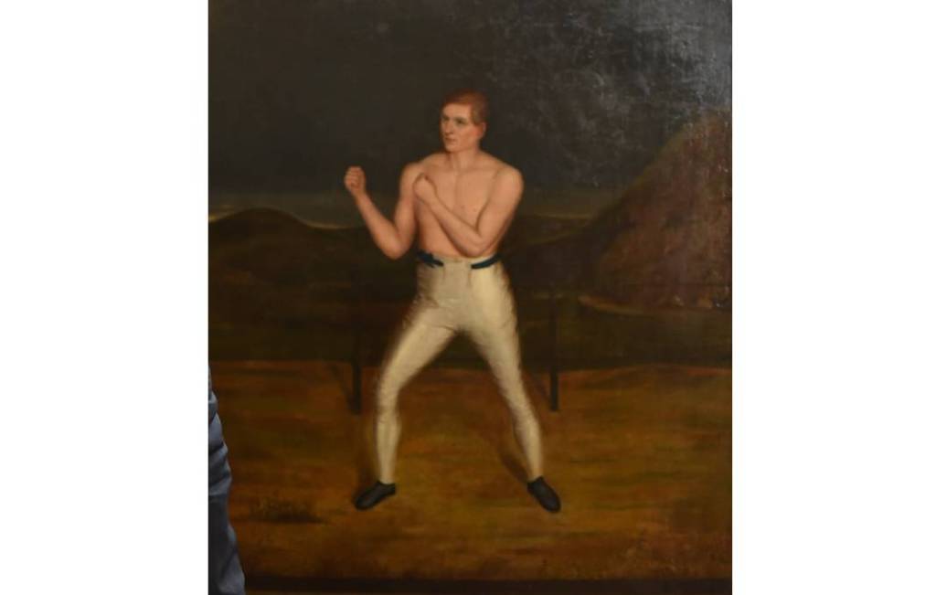
While one source says most assertively that it was named after a miner whose name was Ben Digo (mmm well… yeees), the received version is that the name came from the nickname of a shepherd who was also a boxer. And that that nickname was derived from the nickname of a famous English boxer — and Methodist local preacher — William ‘Abednego’ Thompson (at left).
Ah me. Keep following. Note it wasn’t Tom Myers who was called ‘Bendigo’. It was the nickname he gave to one his shepherds, whose actual name we don’t even know, who had a hut on the creek — so ‘Bendigo’s’ Hut on what became Bendigo’s Creek. But apparently we do know that ‘the shepherd with the nickname of “Bendigo” later ‘shot through to California when news of the gold rushes there reached Australia’. He wasn’t even around to appreciate his eminence. He ‘shot through’. Wonderful. People used to do that. Should be more of it.
Perhaps ‘Abednego’s’ pugilistic qualities were such that he could walk unaffected through fire (but then, why not ‘Shadrach’ or ‘Meshach’?). However to get to the naming of a Victorian country town we’ve got to make that step, then proceed to the next step, then the next tenuous step, then leap forward still teetering, then … .
More than anything else, this story might be about the randomness of the naming process and the way any collection of syllables can be attached to anything by popular usage. ‘The Bendigo Advertiser’, first published in 1854, never called itself anything else. A plebiscite to finalise the matter was held 28 April 1891 and resolved very much in favour of ‘Bendigo’. But Catholic churches in the region are still overseen by the Bishop of Sandhurst.

* * * * * *

Bendigo sits on 38 parallel waves of rock. The ripples, rising in anticlines where most of the gold was found, are about 300m apart for nearly 12kms, roughly east-west. The longer line ridges, often cut on the surface by creek beds, and attendant gullies run for about 30kms north-south.
In 1851 alluvial gold was discovered in many places here, especially along the Bendigo Creek. The Bendigo fields, mined above then below ground for 153 years, have been the most prolific of the eastern Australian fields and second only to the Boulder/ Kalgoorlie fields in WA in all-time Australian productivity.
Steam-powered machinery for reef mining and its products was being set up as early as 1855. By 1861 the Sandhurst mining district had 41,000 people spread through a score of mining settlements.
‘By the early 1890s [after two booms and two busts] the town was untidy, disordered, brash and with conflicting land uses right in the heart of the city. The early ethnic mining groups were overlaid by new social divisions of wealth and power. A wider range of housing appeared during the 1870s and 80s. The pattern of segregation was often a product of topography. The elite found hill tops to build on and cottages were found in low-lying gullies.’ (From a study for a Civic Heritage Overlay.)
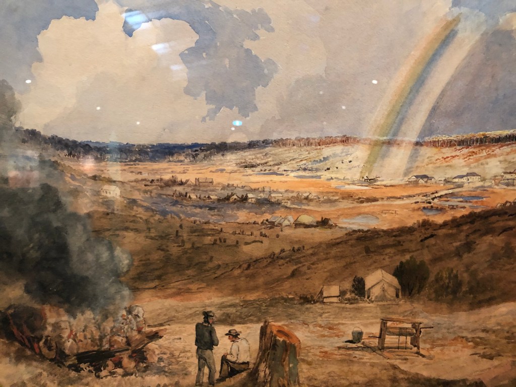
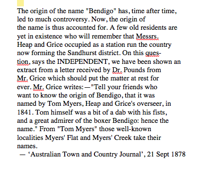
And here it is in 1886.
This substantial painting was done by James Edward Meadows for an exhibition in London extolling the successes of British colonialism. In a previous blog I queried Von Guérard’s depiction of Ballarat on the basis that he was in Germany at the time he painted it, but at least he had spent time in Australia. Meadows never left England.
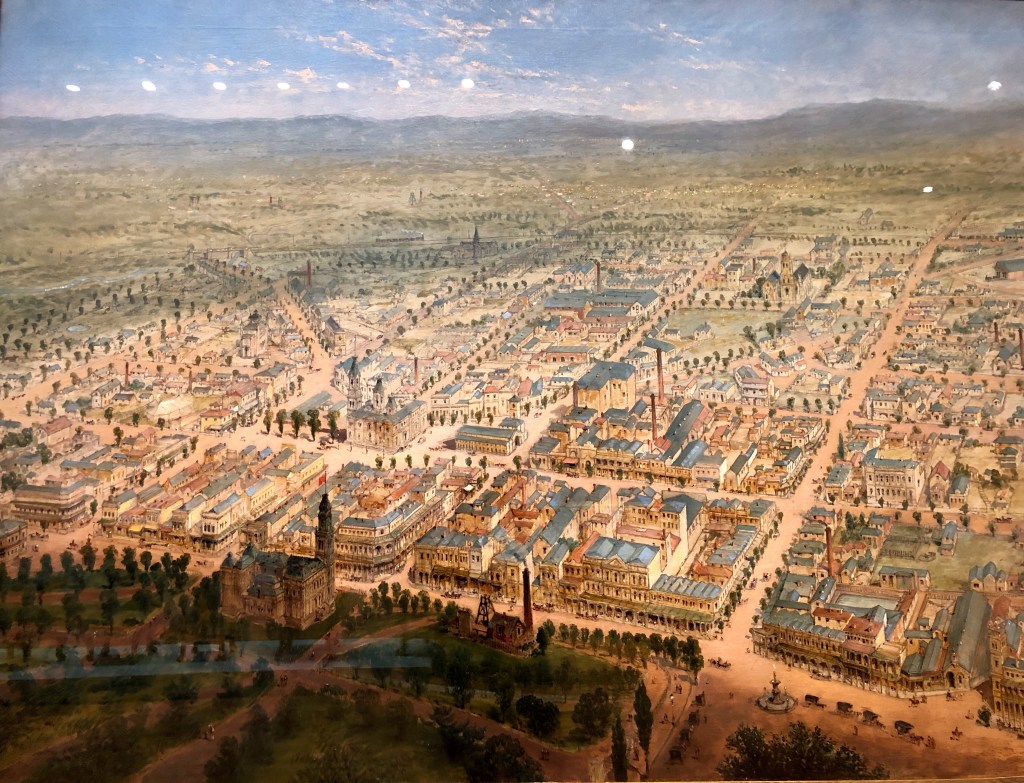
But, you know. Good job. Rosalind Park with a mine head and a crusher planted in it and the rather immoderate Post Office are in the foreground. The Shamrock and the Town Hall are there, as is the Alexandra Fountain down in the bottom right hand corner. You could never argue that Bendigo doesn’t have some grand building.

It looked like a prosperous gold town as we walked through its suburbs. Gentrification had been hard at work through the miners’ cottages however low-lying the gully in which they were located. But we found this house, ‘Derwenter’, in Belle Vue Road just around the corner from Val and Col’s.


I’d say late ’60s, early ’70s. Exterior of very plain concrete block that has weathered nicely, and I think if we went inside we would find an architectural style that had created an interesting flow between the opened-up living spaces. Completely unpretentious and I imagine a very pleasant place to live. But its distinctive feature is the way the house has been absorbed into this wonderful native garden, simply an extension of the bush we have just been walking through. The major colour palate of the whole is limited, but with a staggering range of variation on those major themes. It is tended, but not over-worked. It would manage the weather conditions without intervention much better than a garden full of exotics. I thought it was great. Perhaps this should be one of the iconic photos of the walk: how to live with nature.
The Guidebook — my now outdated version of it anyway — says at the Railway Station we would find a Goldfields Track Entry poster on the city side of the platforms.
Not on the city side; not on the Quarry Hill side. We couldn’t find it anyway. But nothing daunted.
From the start we had imagined that the walk really finished at Bendigo’s crossroads, the heartland, where Pall Mall, the extension of Macrae Street, a portion of the Midland Highway, meets View Street part of Mitchell Street named after the Major, leader of the first white intrusion through this part of the world. He and his cohort travelled — some would have walked — about 2,800km, and one day would have followed the next. You might think that he was also heroically going through ‘virgin territory’, ‘bush-bashing’ as we say today. But I have no doubt he would have spent quite some time following ancient roads, no waymarked posts, but clearly marked in their own ways if you were smart and sympathetic enough to be able to read them. Without being especially aware of it, we would have been too.
The GPS records, the ones which begin each chapter of these blogs, say we walked 234km in 12 days over four months. We were interrupted by Christmas and COVID, but that pace and distribution allowed us to savour what was on offer and to learn more about it: to say ‘Korweinguboora’, to look askance at the Red Knobs and puzzle over the pyrethrum daisy fields, to wonder what happened to Mount Franklin’s spring water, to get that big view north from Leanganook and, as though finding a landscape from a dream, having that arrival at Vaughan Springs. It was impossible not to think about the land, and its various forms of management and exploitation. It was also impossible not to marvel at the evidence of the frenzy that the prospect of finding gold had generated. Gold … whatever that’s for …
Now that they can’t travel overseas, a lot of people are discovering more about where they live, and we’re two of them. In so many ways, it was good, very good.