This is a greenie. You can tell. It’s the cunning alignment of the tailfeathers as much as anything. You should have seen the flight.
And this, the Macquarie Harbour end of the Gordon, is the sort of thing they like.

What’s there? Nothing.
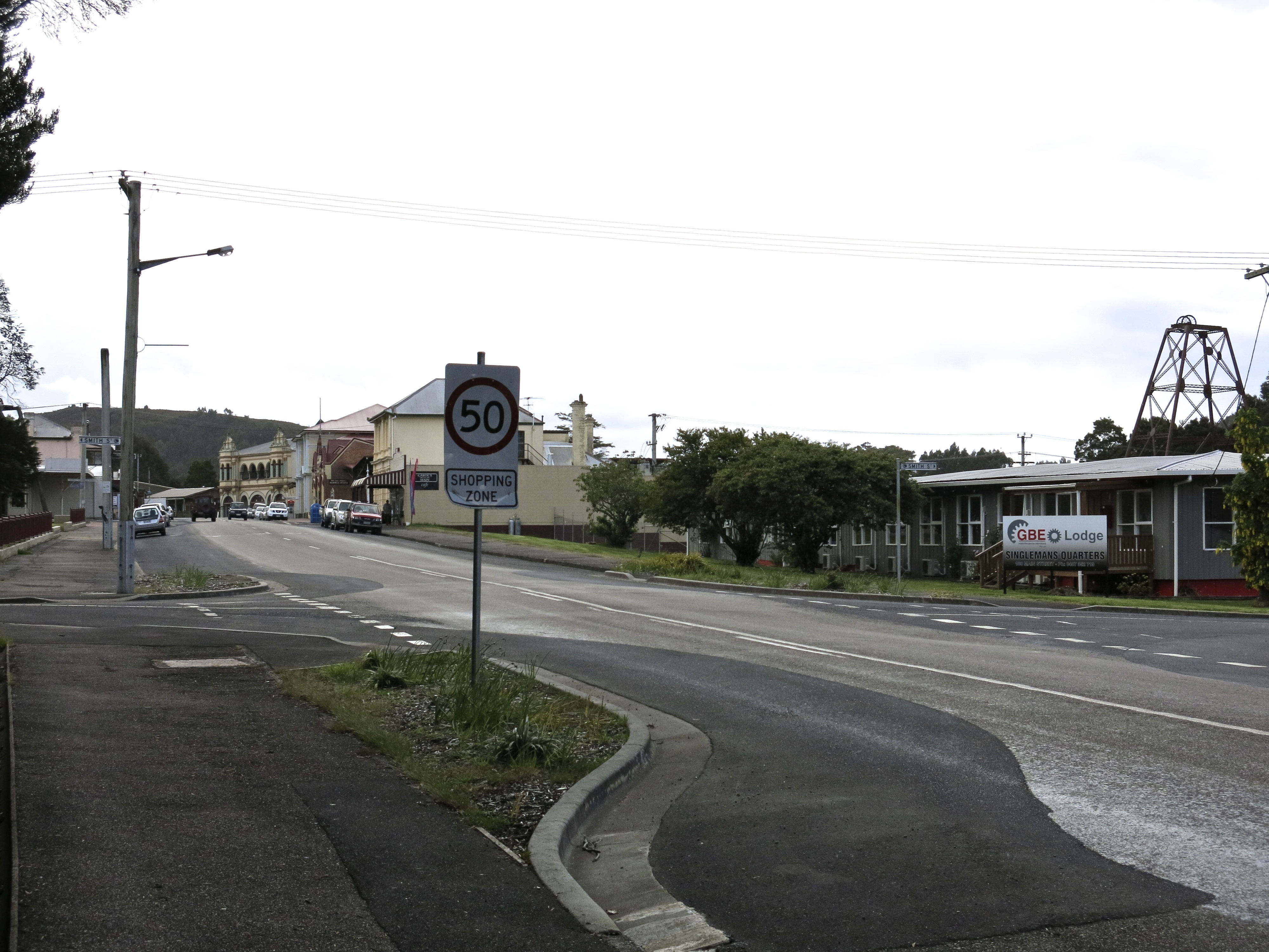
 But we come to Corinna across the Pieman River via human interpolation, a ferry. Although we hadn’t been there before, Corinna (the Aboriginal word for a young Tasmanian tiger, now as far as anyone knows extinct) has been here for a while. In 1883, the largest nugget of gold ever discovered in Tasmania (7.5 kgs) was found at nearby Rocky River producing a flurry of mostly disappointed activity, although 30,000 ounces of gold were taken out.
The Government Surveyor’s Report on the area in 1884 commented that: ‘These creeks have yielded some gold, but as the scrub is so excessively dense and almost impossible to penetrate, the results of the prospectors’ labours have up to the present time remained an unsolved problem to a very considerable extent.’ My father notes in the pages he wrote so admiringly about the west coast forest, There are many miles along the majestic Gordon River where it is impossible to land without cutting a place with an axe, and where you cannot continue without further cutting. Later, the Pieman River became a hunting ground for the Huon pine which grew along its banks. It isn’t found north of here.
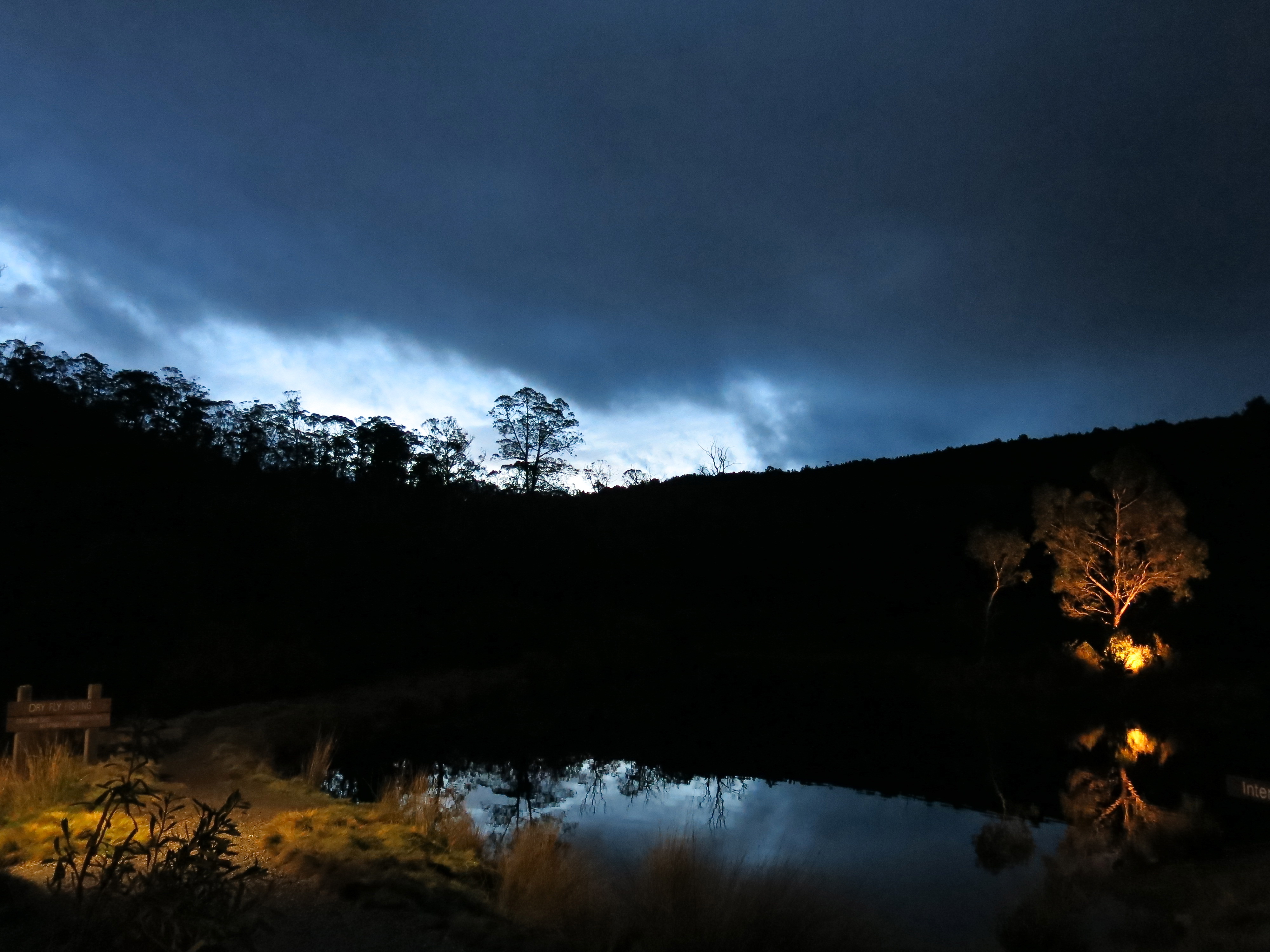
But now, and I quote from the brochure for the Wilderness Lodge where we stayed, ‘at Corinna, nature is the hero. The owners are committed to providing responsible access to the pristine wilderness and operating a sustainable and carbon neutral experience for visitors.’ That’s us. That’s what we like, and for a few days we plundered its considerable treasures.

We saw this rainbow kingfisher on the Whyte River walk, a chest stuffed full of gentle treats, one after the other, although I did hear another visitor say that it was hardly worth the bother. Just muddy really.  But take my word for it. If you’ve got your eyes open and your heart in the right place and functioning you won’t do much better for an easy 90-minute walk.
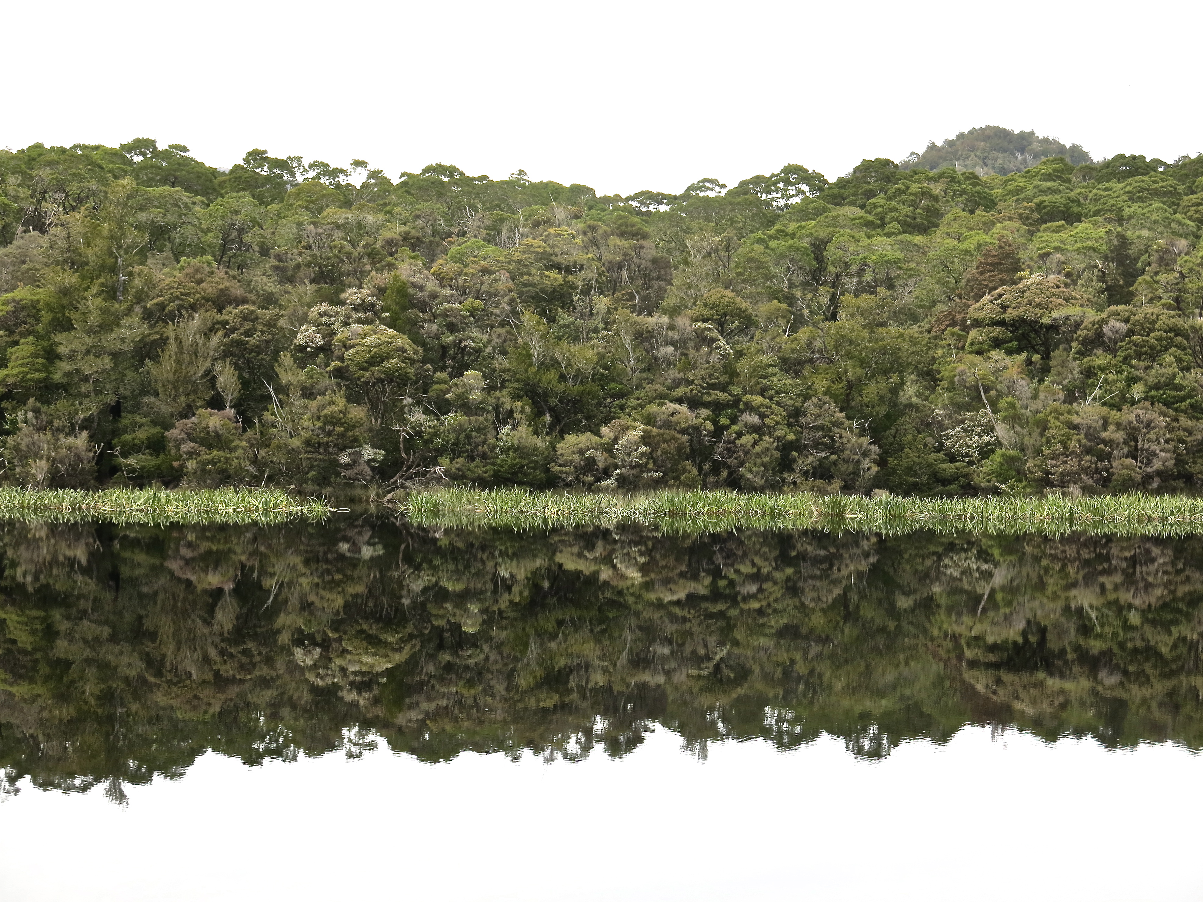
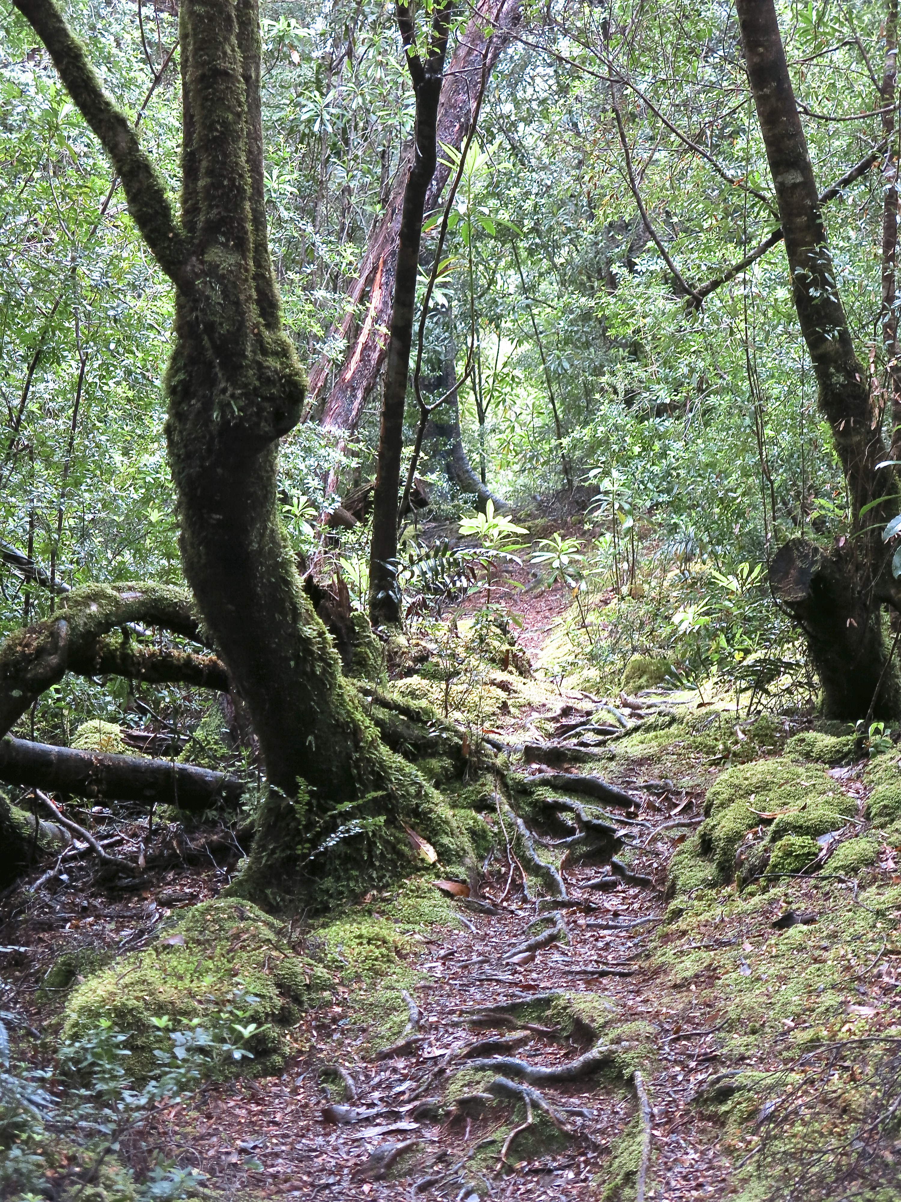
We scampered over the ridge to Savage River through nothofagus forest which as I’ve said before is a delight. There is little more comforting to the feet than four inches of nothofagus leaf litter. This was another particularly nice walk.
The Savage River was on this day poorly named and it was hypnotic watching it bubble past.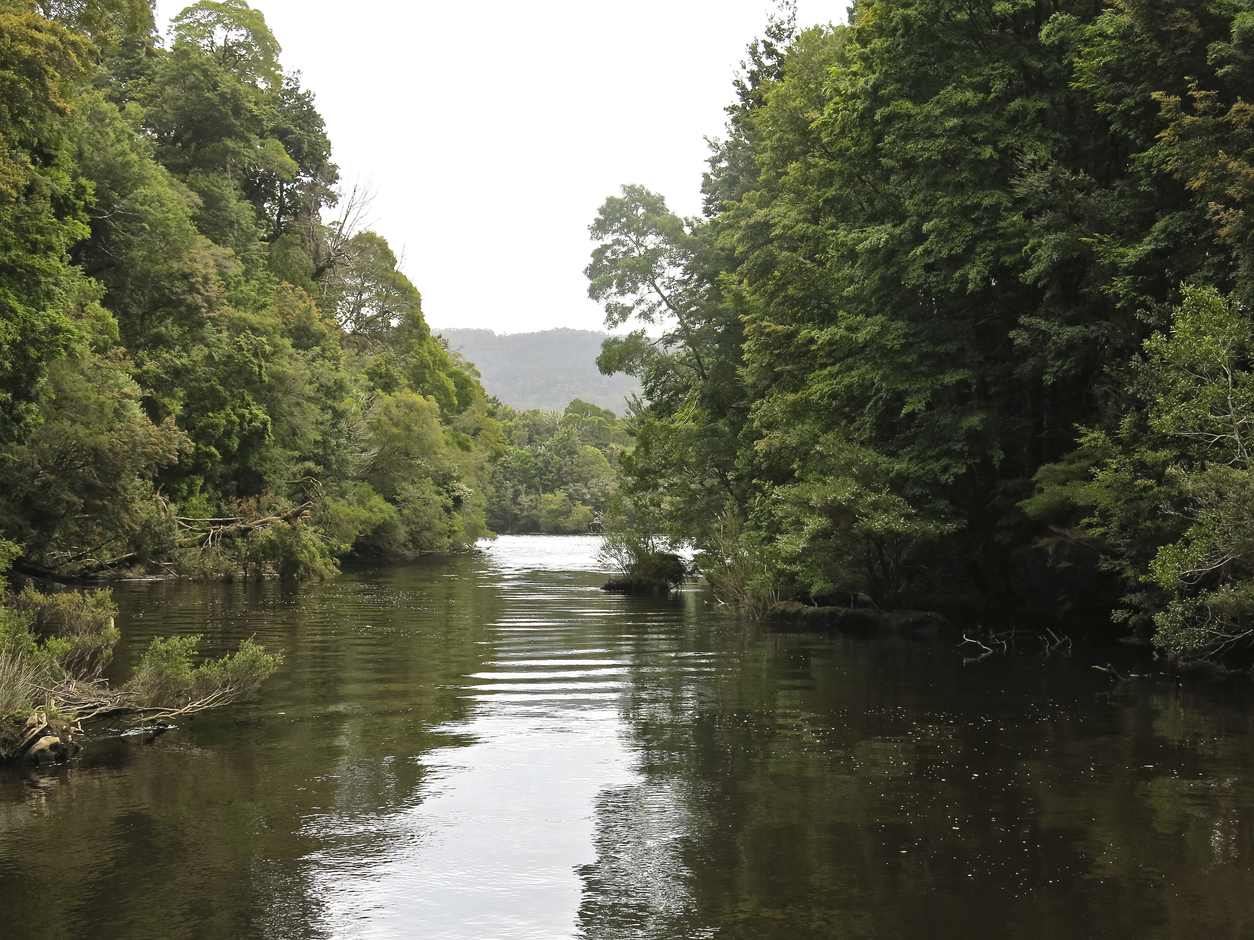
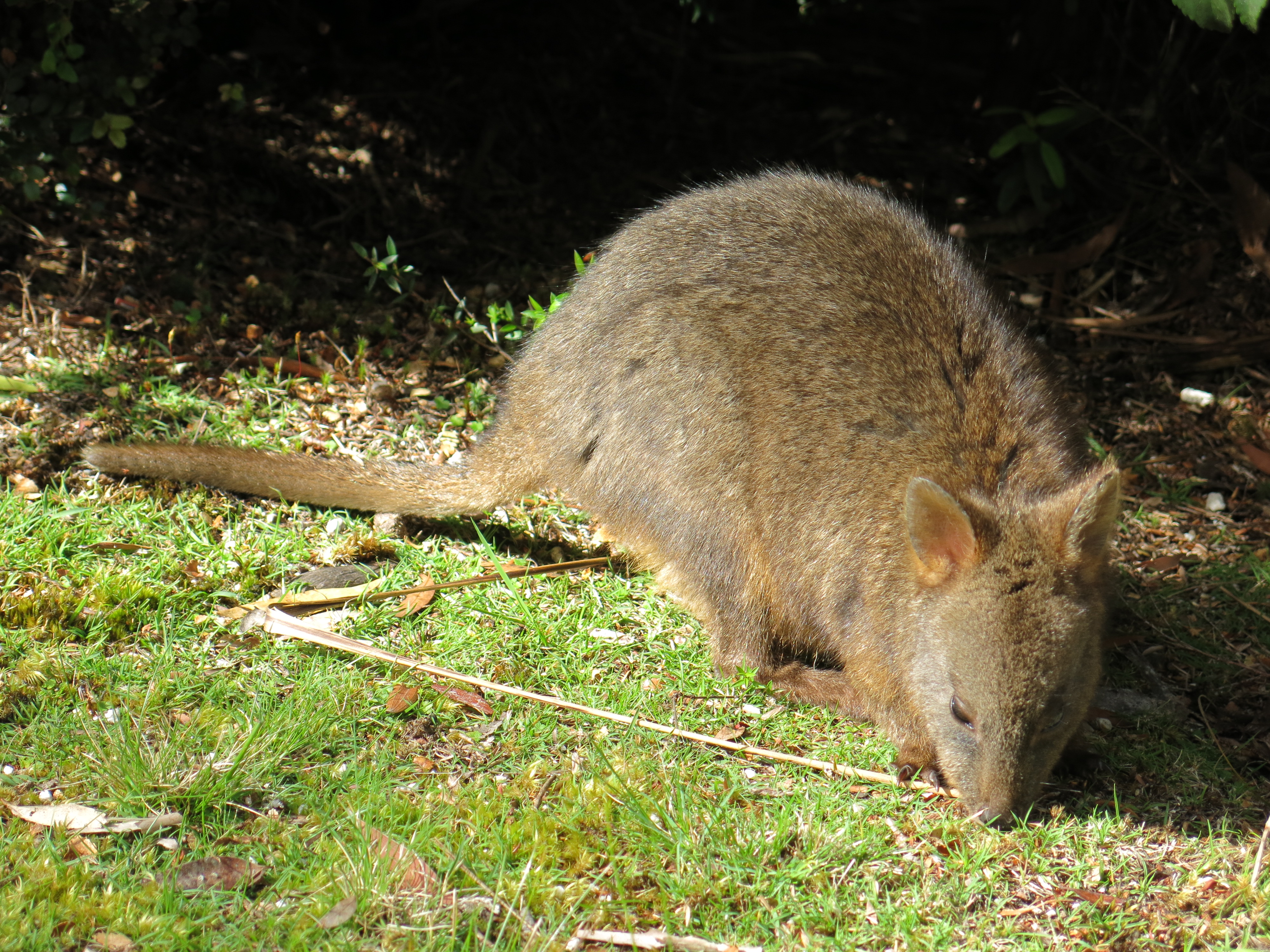 Pademelons fed happily and confidently, sea eagles entertained and god was in the appropriate place.
But the next day the weather turned. It was clear, mild and sunny and we climbed Mt Donaldson, a genial 500 metre rump with a generously graded track. (And these are some of the people who made this generously graded track, and in that weather too. Thank you Tasmanian Walking Track Services.) 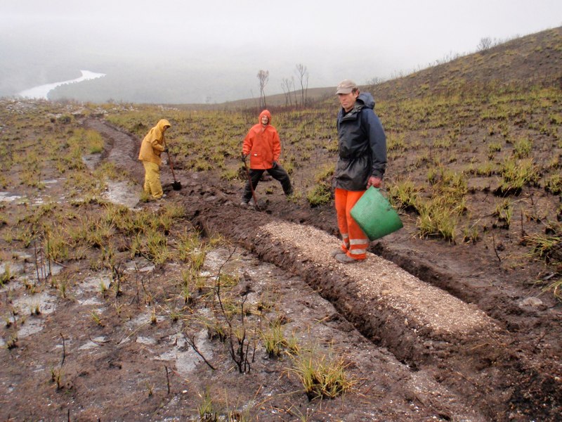
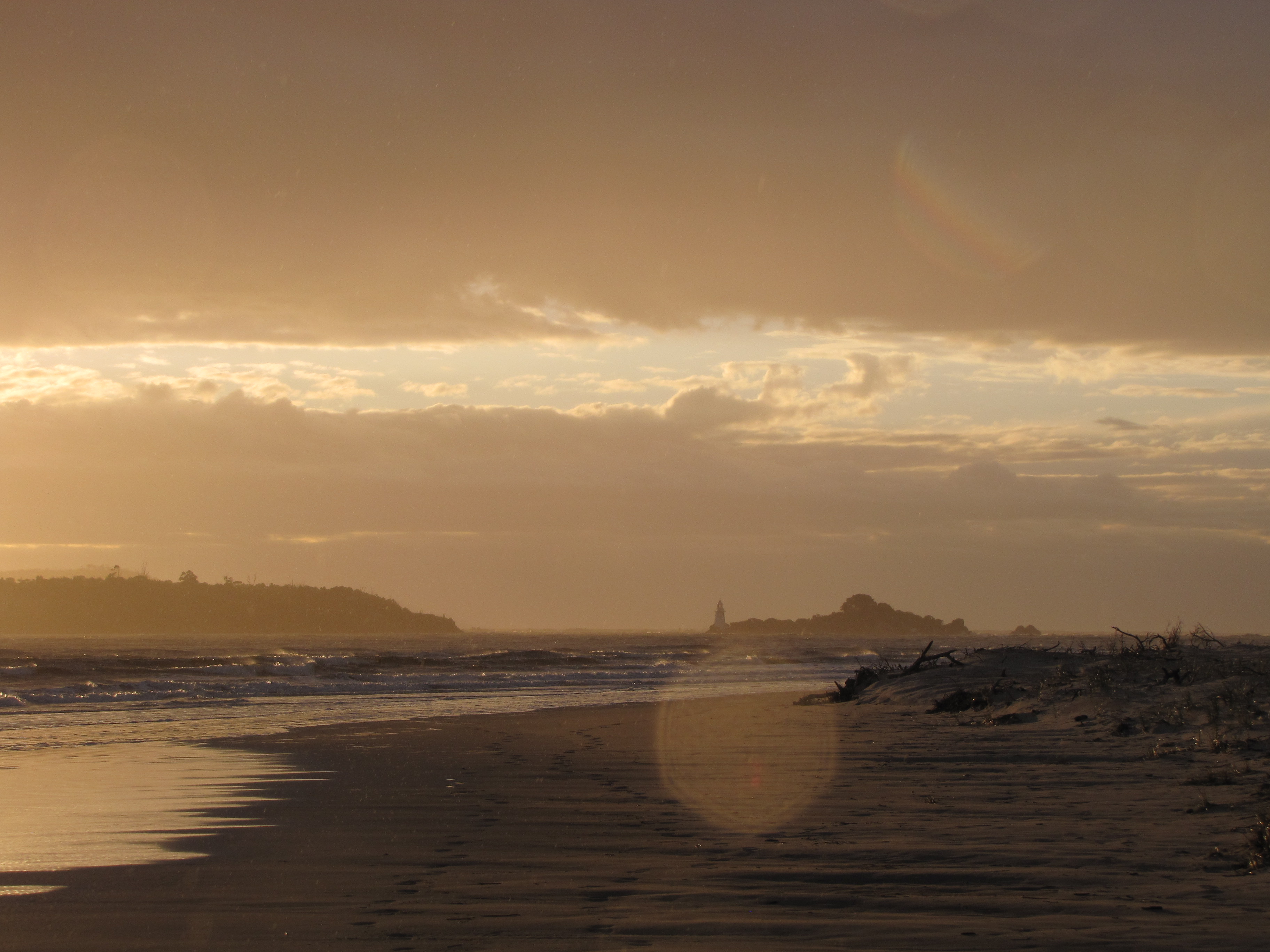
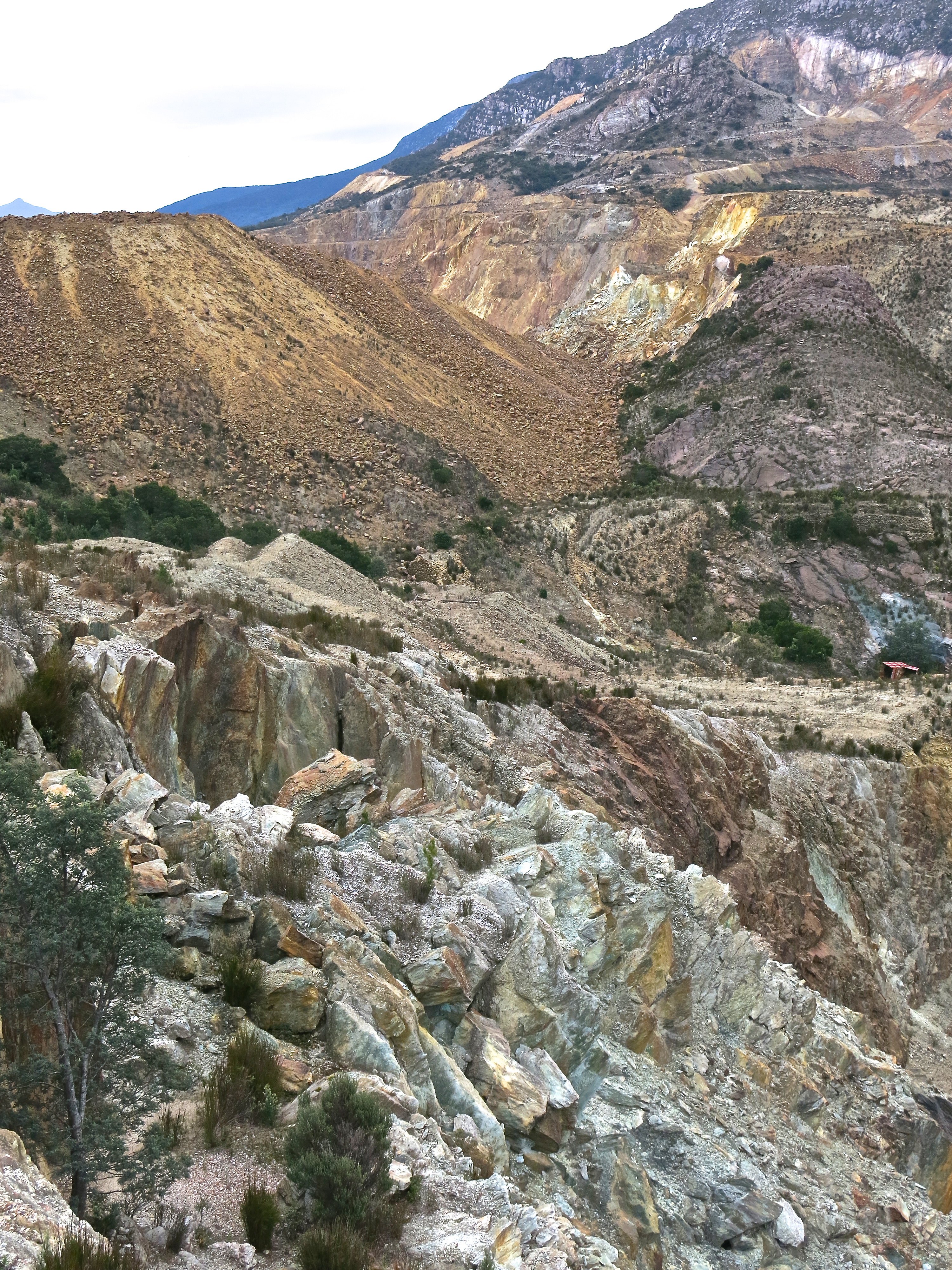
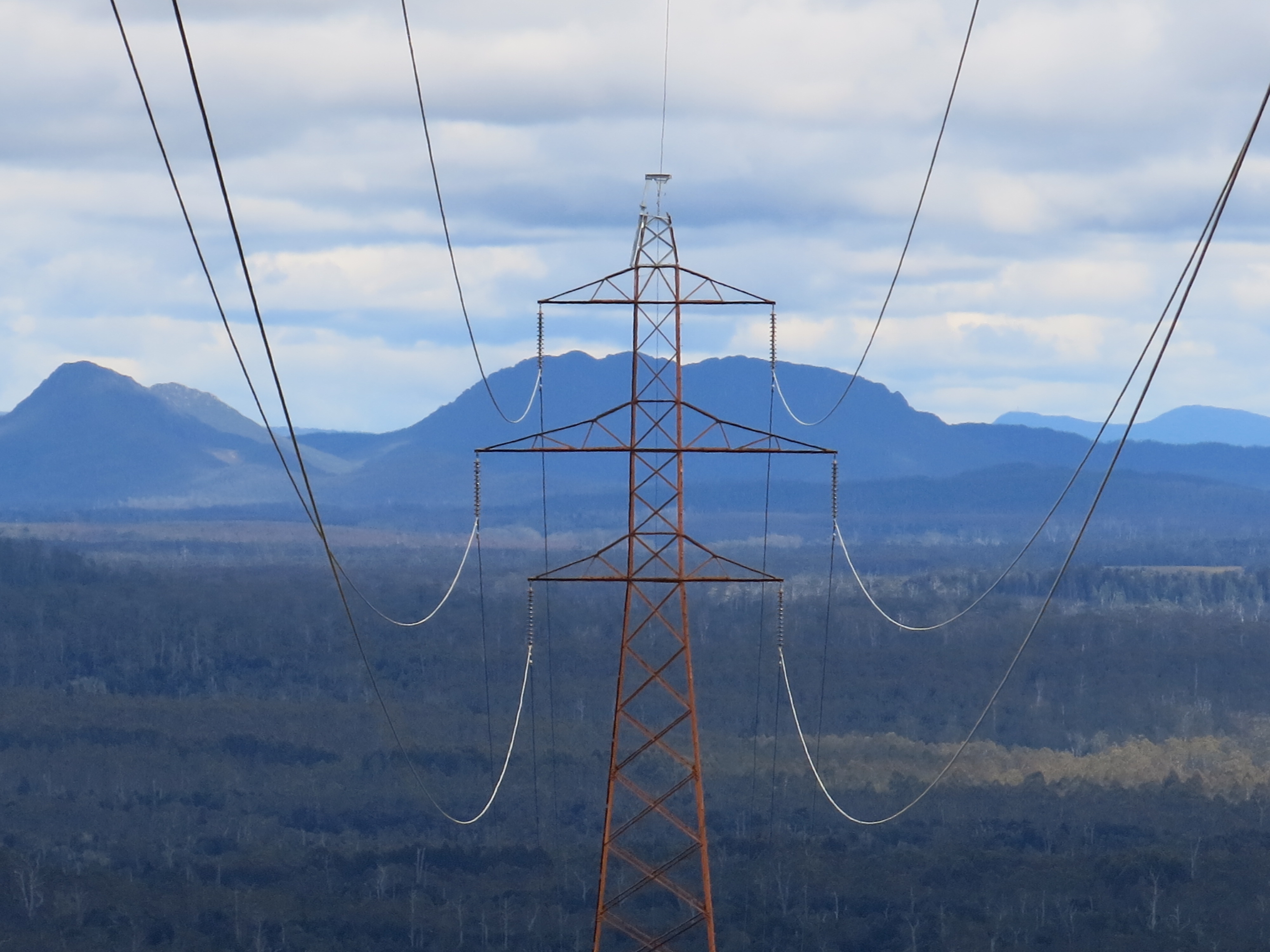
It was windy on top but the view was simply glorious, revivifying: the Pieman winding its way west out to the Southern Ocean, the Norfolk mountain range to the north, the peaks of the Cradle Mountain area over to the east and … er … the Savage River mine in mid ground. Ah yes, the Savage River mine … from which magnetite is piped as slurry 85 k.s to Port Latta near Smithton on the north coast, a most substantial feat of engineering. I can admire that. But it has prompted the incidental thought that appears below.
I don’t appear to have a photo of the mine; in fact the bulk of them from here appear to be taken up with Keith’s attempts to fly. However there were two other intrepid travellers, and that is the Pieman glimpsed in the background.
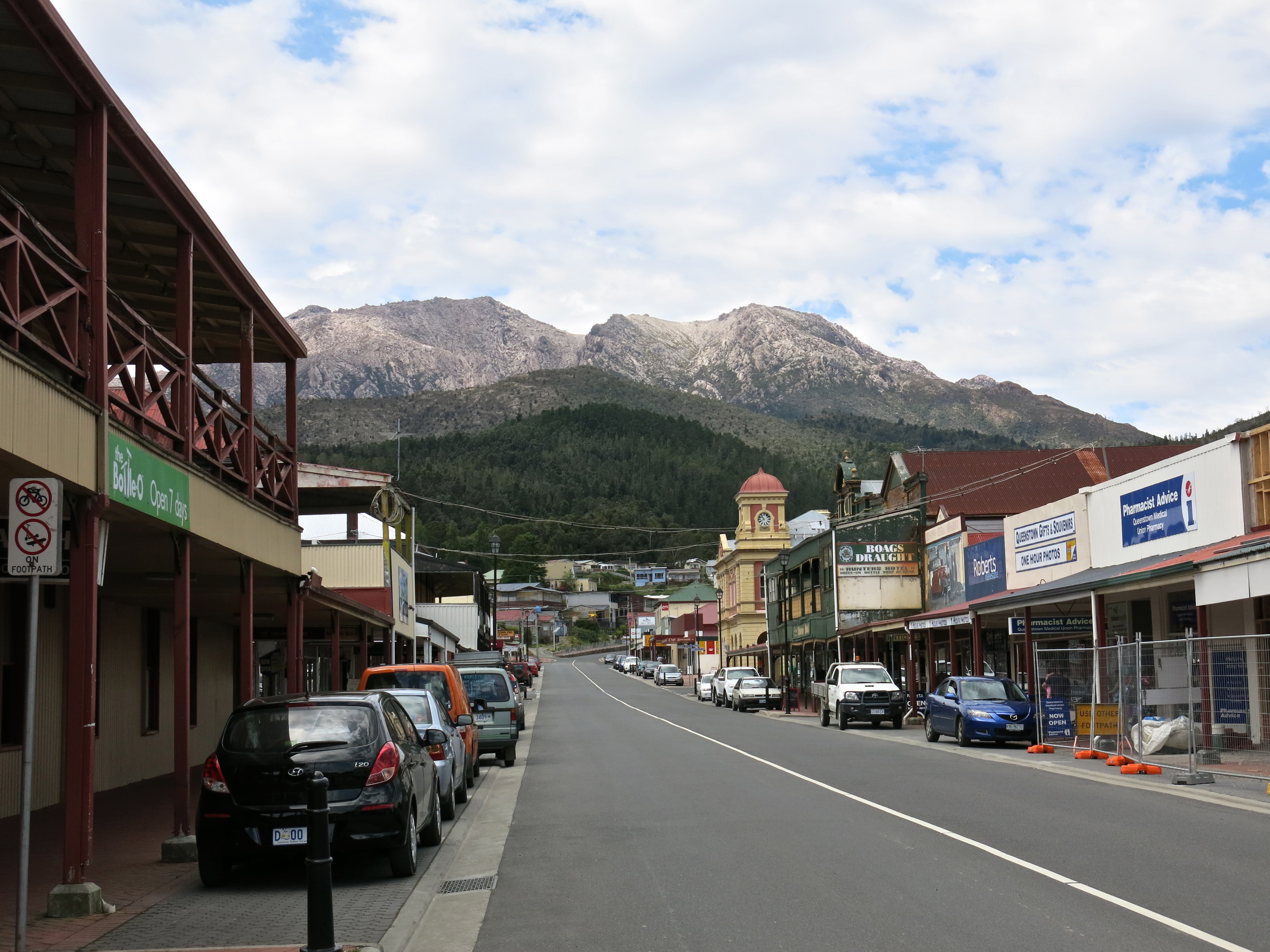
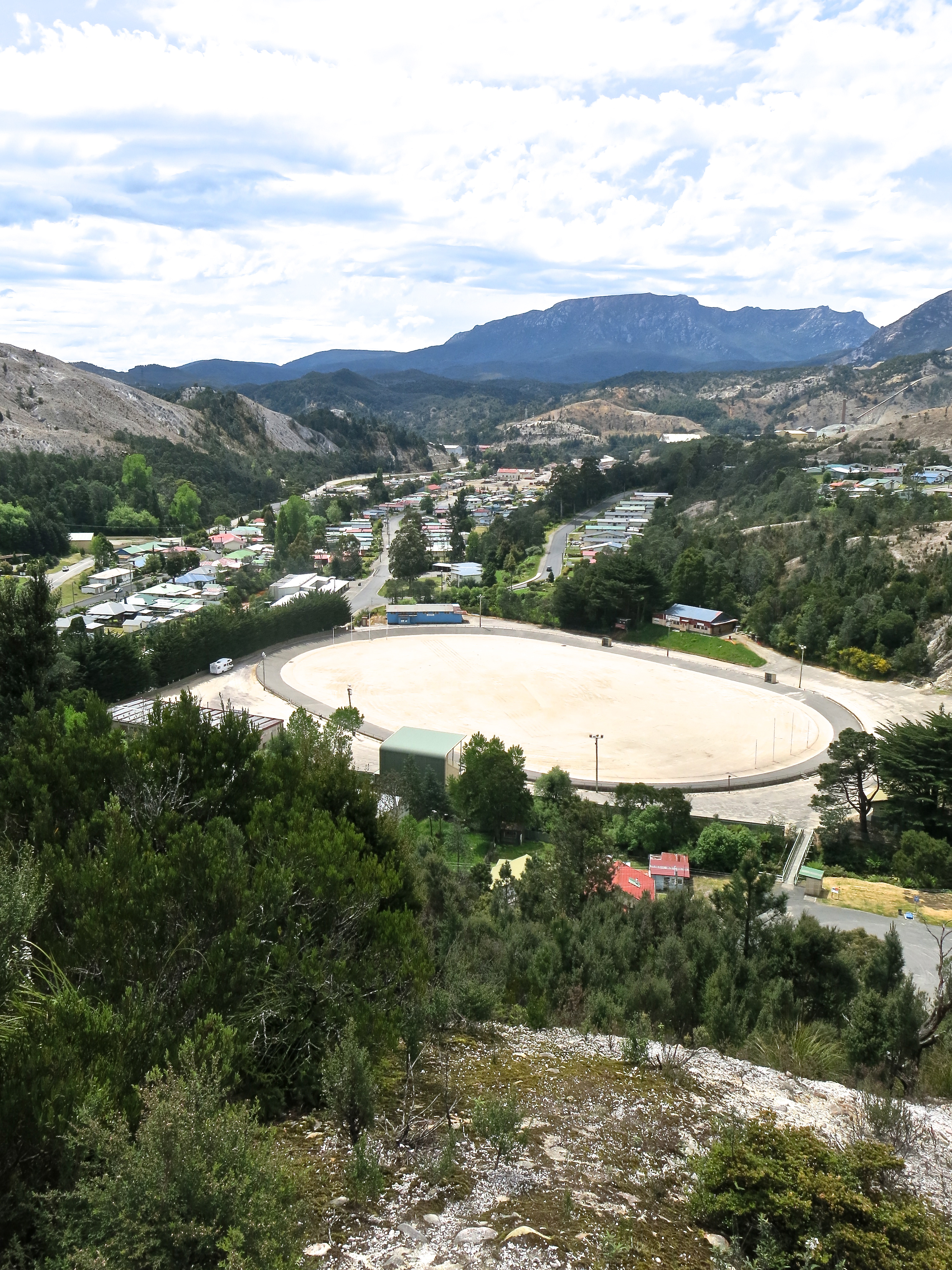
The incidental thought. It’s all very well to talk about vast tracts of wilderness but in fact Tasmania does not have vast tracts of wilderness. The area of the entire island is only 68,000 square kilometres. Its north-west, midlands and south-east have been extensively cleared for agriculture and pasture. Where Myrna and Gill are standing is about 10 k.s from Corinna. Corinna is 48 k.s from Zeehan. Zeehan is 40 k.s from Strahan. This is highly accessible ‘wilderness’. The fact that so few people drive down the Maydena Road to Mt Anne and Lake Gordon doesn’t mean you can’t do so even after having spent the night in Hobart. You can see a lot of Tasmania in 10 days travelling by car. There are only three major north-south routes. The quickest will get you from Hobart to Launceston in about two hours. By contrast, the Big Sandy Desert, another sort of wilderness on the big island to the north, is by itself 285,000 square kilometres in area. Wilderness is not, cannot be, pockets of trees populated with eco-lodges. And that should make you think about context, scale and prospective fragility.
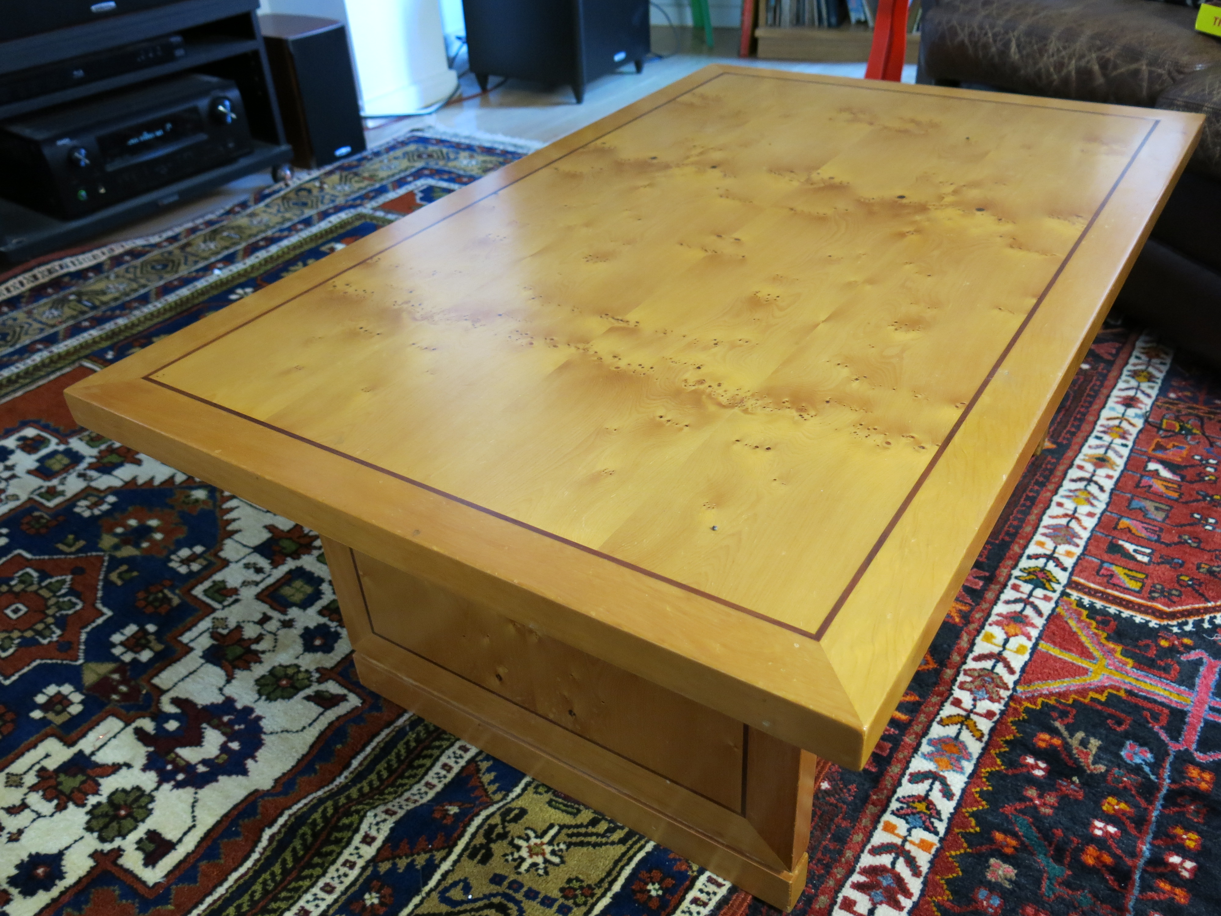
I’ve mentioned Huon pine. The table above, which I think was Myrna’s 40th birthday present, is made of Huon pine with some blackwood inlay. A day does not pass when I don’t admire it. (So many negatives. Sense: I really like it.)
I was hoping to find the photo we saw several times on the coast, once I think in Hamer’s Hotel at Strahan, of huon pine logs caught in a boom, thousands of them, but this is the best I can do.  Imagine these logs stretching almost across to the other bank, perhaps 50, 100 times as many. This photo was a reminder of how many were taken, what a very high proportion of those that were there. The 120 boats built at Sara Island during its convict period (only 11 years), some of which were upwards of 40 metres long, were all built from Huon pine.
 Although it can be found in the Huon, a delightful area (and river) south of Hobart, it is neither Huon nor pine. It is Lagarostrobus Franklinii, the sole species in the genus Lagarostrobos, and a podocarp, not a pine. Tightly grained and full of methyl eugenol which not only makes it smell wonderful but also makes it resistant to bugs and rotting, it was hunted along the waterways of the west coast for its ship building qualities.
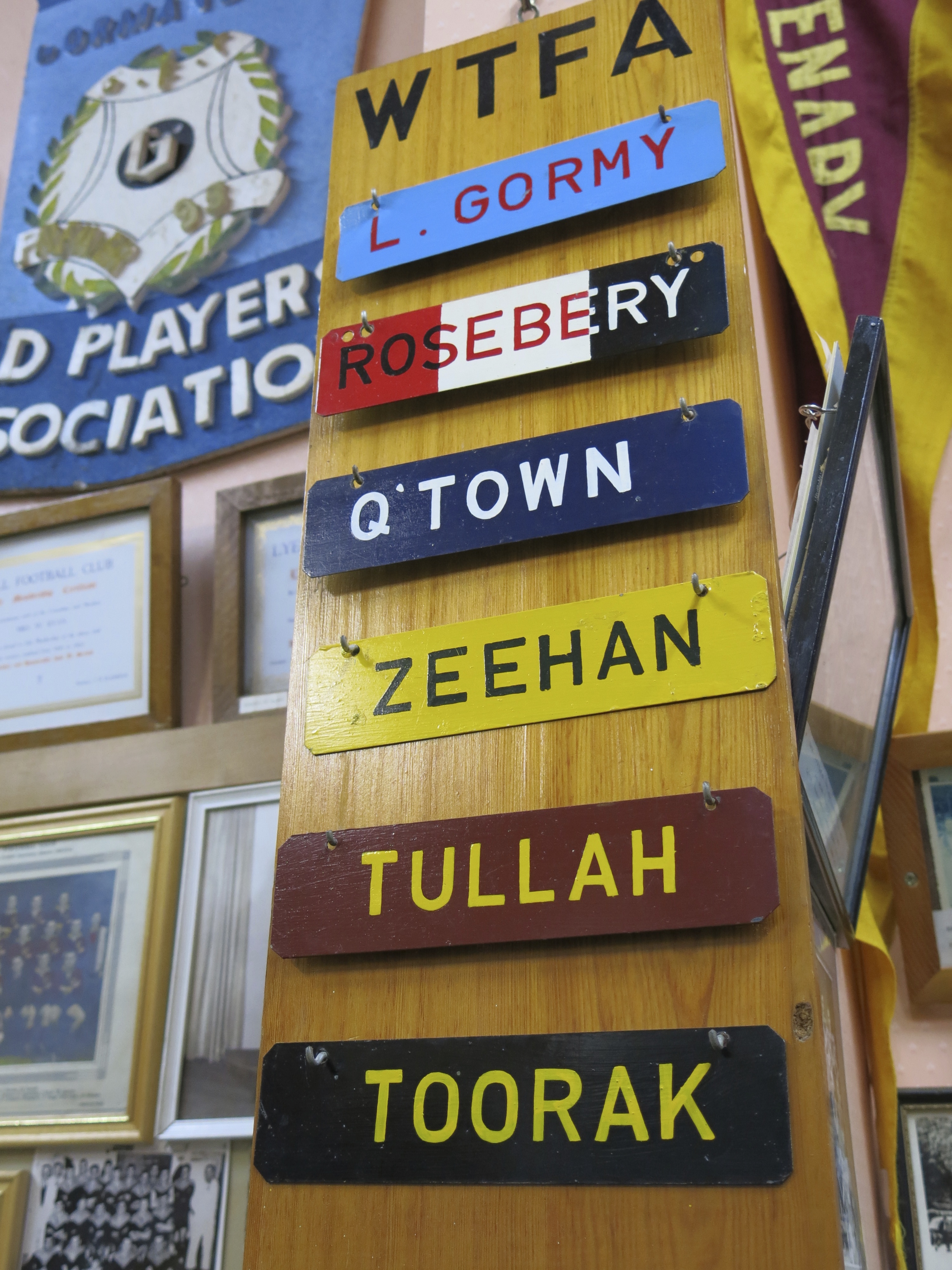
Another of my father’s stories, this time about workmen erecting poles for a power line through Zeehan. In order to set up one pole they had to remove a King Billy pine. They found that its roots had curled around the trunk of a Huon pine entombed beneath it. The pine’s wood was still perfectly sound and still strongly fragrant. Examination showed that the King Billy pine was more than 300 years old. No one could tell how long the other had lain beneath it. More recently on the Teepookana plateau out of Strahan a vast stash of ancient Huon pines has been found under the forest floor, up to eight layers deep, with the top ones being more than 1000 years old. A living stand of the trees has been found near Mt Read between Rosebery and Zeehan with the oddity that each of the trees is a genetically identical male that has reproduced vegetatively, that is asexually without seeds or spores. Although no single tree is that old, the stand itself has existed as a single organism for more than 10,500 years. To the right is a picture of one of those trees.
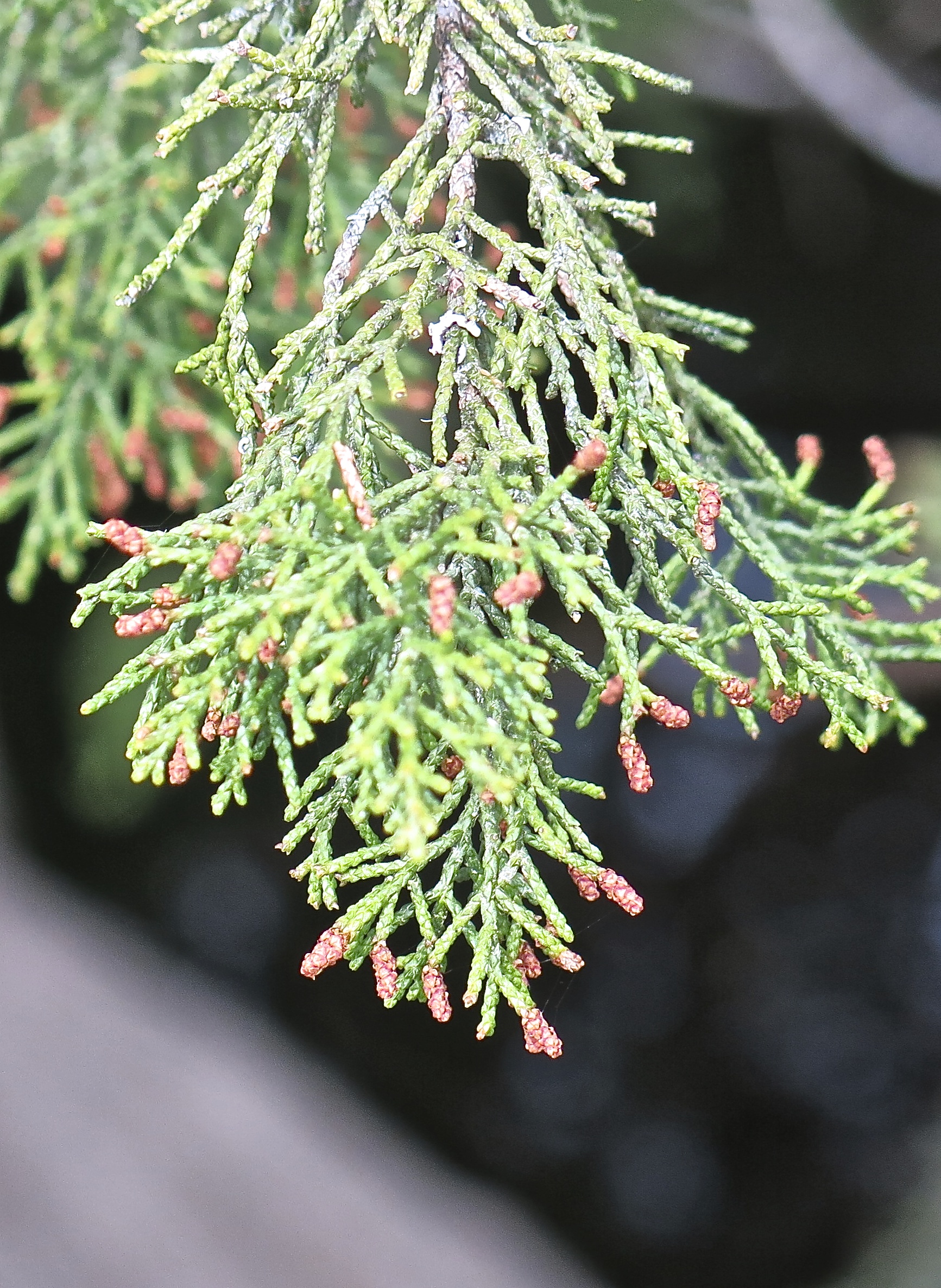 The ‘pine cones’ containing seed are themselves tiny, a couple of millimetres long, the red bits in this photo (which on my computer is pretty close to actual size). The tight grain comes from growth which increases the total girth of a tree between half and two millimetres a year. Reread that. Girth. Circumference. All the way round the trunk. Grows between half and two millimetres (small) a year.
Some of trees were substantial as indicated by this photo taken around the 1930s.  The logs were dragged by a range of means to the rivers — never far, it was too difficult, and anyway the trees grow along waterways — marked and then floated down to log booms. When you put big logs into small waterways they are inclined to clog up into jams, and the last task of the piners before they left their camps to return to Strahan for the winter was to work down the rivers breaking the jams up. But as the pining industry declined in the 1950s and 60s there were fewer opportunities for the workers to access the rivers, and the log jams became legendary. In August 2007 a huge flood roared down the Gordon and all its tributaries. Thousands of Huon pine logs cut two generations before were dislodged. As many of these logs as possible were salvaged. Over the next three summers 650 tonnes of timber were retrieved. (Thank you: huonpine.com. A tree with its own website!)
Today its genius is more widely recognized. The ‘birds’ eye’ in our table would once, and not so long ago, have qualified it for firewood. 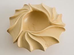 But the timber is now highly prized for high end woodcraft like the table and this rather glamorous carving.
If something is 1000 years old is it ipso facto valuable? I would say more likely than not. But beyond the fact of its age, valuable for what? It’s great that these wonderful uses have been found for the logs — and boles and branches, all grist to the craft mill — that have already been cut. There is a quarry full of them at Strahan. But what do you do about tree species that grow a millimetre in girth a year? How do you think about them? I think you’d have to say look after them very carefully, and I think there are few people in Tasmania who would argue.
Huon pine, like Darrel Baldock and Peter Hudson, has become a state icon. (What would you do if Christ came to Hawthorn? I think still leave Hudson at full-forward. Christ might be better value as a mobile target further up the ground. Forgive me. Non-Australian Rules fans will have to click on the link to understand. Even then it may be beyond comprehension.)
But what about the blackwood and the beech myrtle and the sassafras? Or for that matter the eucalyptus in the Styx and the Florentine? Or, dreaming even further, the rivers?
 After the mineral flurry and the eruptions of unkempt mountains on the west coast, as you progress east you find series of long ranges broadly oriented north-south culminating in the Arthurs which in their own delightfully perverse and magnificent way run, insofar as they run anywhere, east-west. In the valleys of these ranges, as you’d expect given the rainfall, are some of the wildest rivers in the world. On a world scale, not big. Wild.
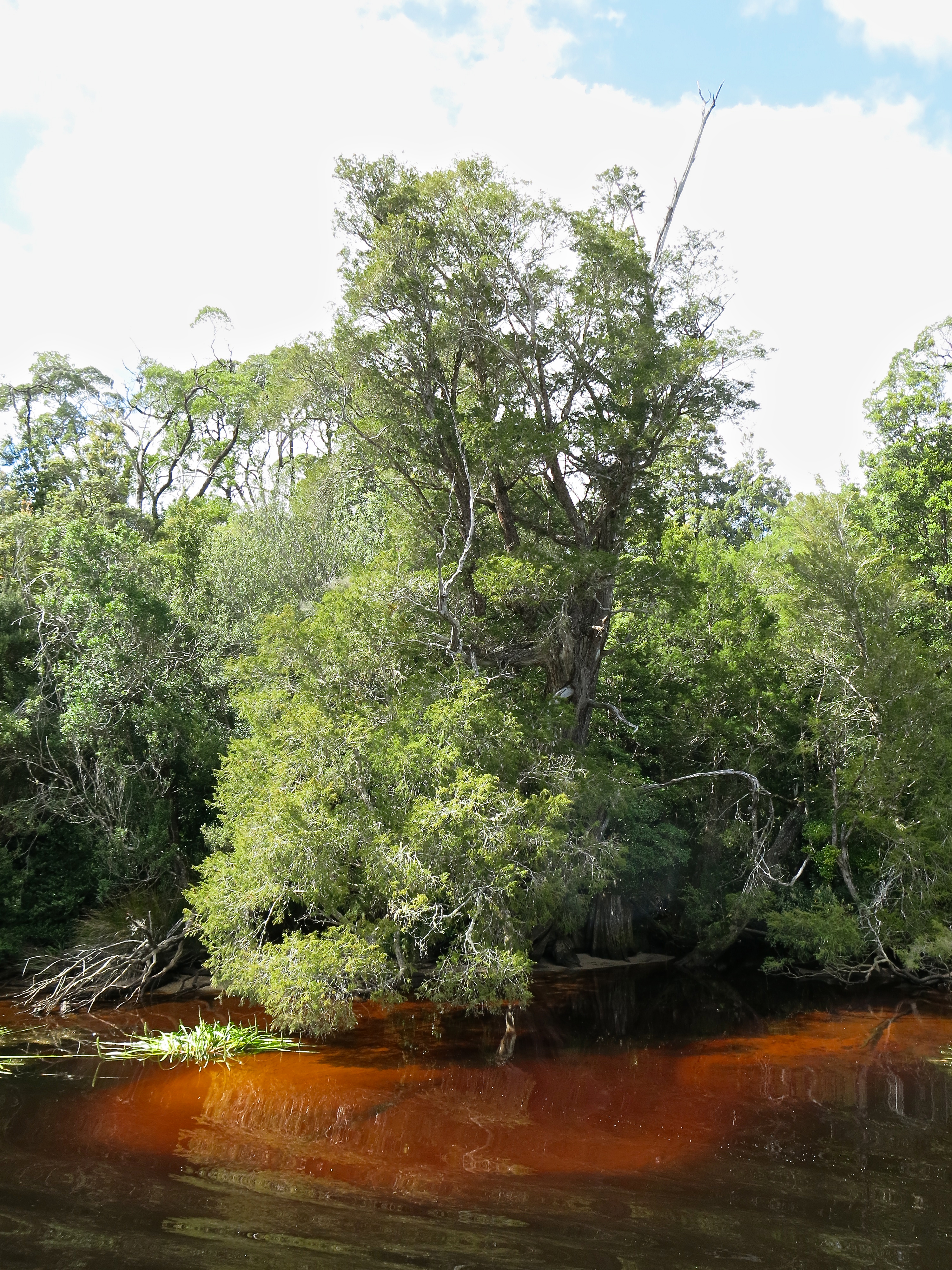
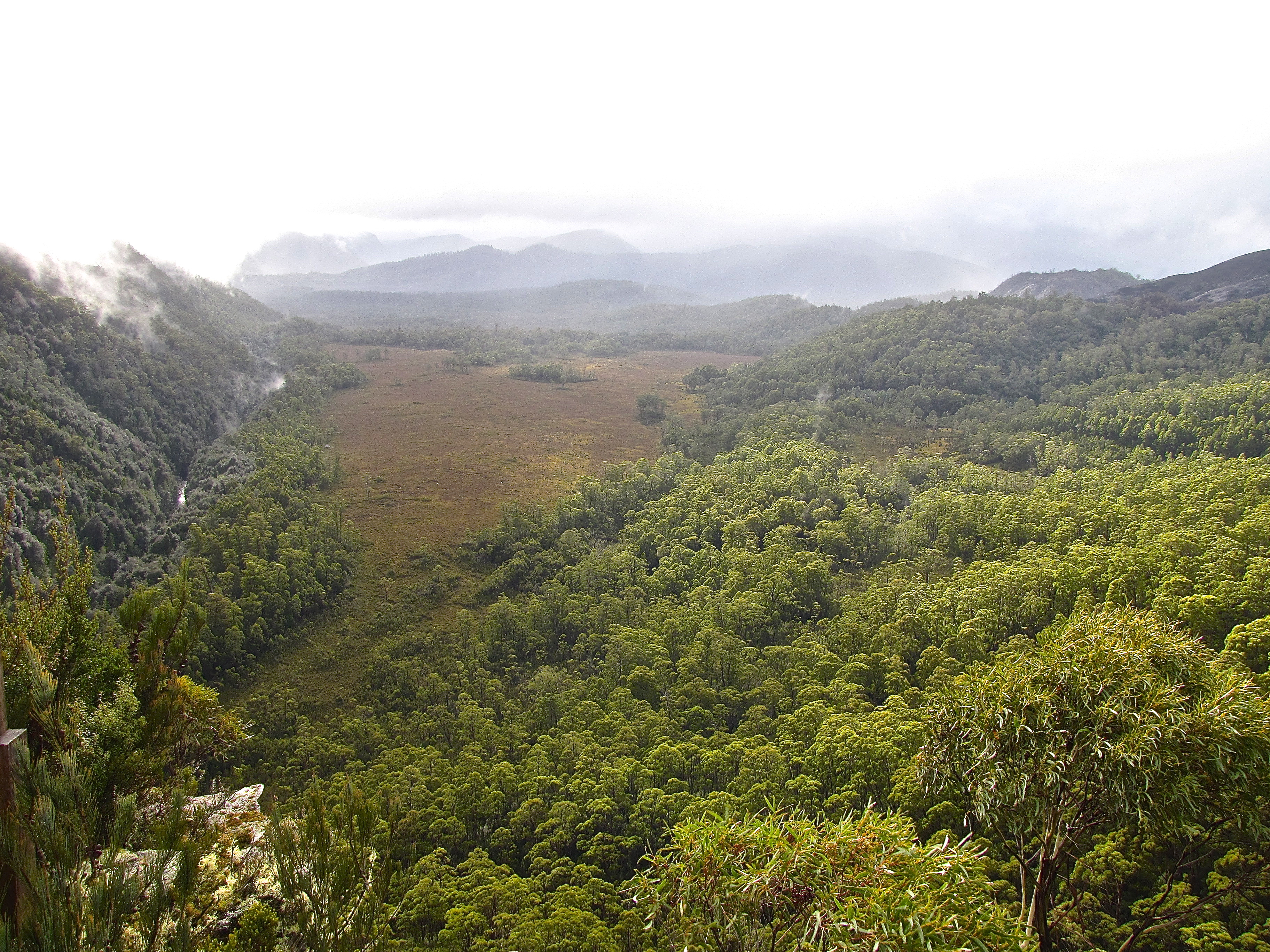 It’s the Collingwood above. I’ve been here a few times and always imagine dinosaurs hiding away in the forest just about to run, or whatever it is dinosaurs do, leap, glide, perambulate, across the button grass in this lost world.
It’s the Collingwood just above its confluence with the Franklin, and the Franklin provides a marker in Tasmanian history.
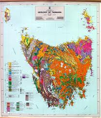
In  1978 it was proposed to dam the Franklin to generate further hydroelectricity. You can see the lakes on the map above. Many of these are artificial and at their walls are clusters of power stations that send power to industries such as the refinery on Hobart’s Derwent estuary, the largest such in the world, which refines zinc mined, among other places, from Rosebery near Zeehan. My brother John has an excellent view of it across the estuary from his house in Lindisfarne. When they bought it the estate agent suggested that a selling point was the glory of the refinery lighting up at night. It’s a pity that it left the estuary’s bed with a coating of heavy metals now being cleaned up.
Over the five years between the announcement of the dam proposal in 1978 and the axing of the plans in 1983, there was pungent and angry debate polarising the community and not just in Tasmania. Mainlanders bought in with a will, which would be one reason for the local support. On one side it was suggested that the construction of the dam would assist in bringing industry to Tasmania, on top of the jobs that it would create directly. The initial opinion polls showed around 70 percent support for the dam.
The protest movement, generated originally to fight the construction of the Lake Pedder dam and led by Bob Brown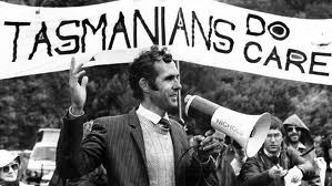 (at right, for many years the leader of the Australian Greens), thought otherwise. The photographs of Peter Dombrovskis and his colleague Olegas Truchanas, a good selection of which we had seen in the Launceston gallery, attracted significant public attention. In June 1980, 10,000 people marched through the streets of Hobart, demanding that the government not proceed with construction — the largest political rally in the state’s history.
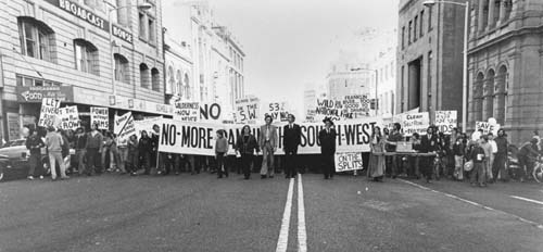 In December 1981 the state government held a referendum in an attempt to break the deadlock. The referendum gave voters two choices, one for a dam on the Gordon below Franklin, one for a dam on the Gordon above the Olga.
 And here is an excellent opportunity to mount a small soap box. ‘Begging the question’ has come to mean ‘encouragement to ask a question’. When I was at school it meant including an assumption in a question that was yet to be proved, a very functional and handy notion. When did you stop beating your wife? was the conventional example. I don’t beat my wife. Which dam do you want? I don’t want either. Forty-five percent of the voters voted informally; more than 30 percent wrote ‘No Dams’ on their ballot paper.
 In late 1982, Bob Brown announced that a blockade of the dam site would begin at Warner’s Landing on the same day that the UNESCO was due to list the Tasmanian wild rivers as a World Heritage site. During January 1983 around fifty people arrived at the blockade each day adding to the 2000 already there. A total of 1,217 arrests were made, many simply for being present at the blockade. Protesters impeded machinery and occupied sites associated with the construction work. Nearly 500 people were imprisoned for breaking the terms of their bail. This caused an overflow of prisons in the region.
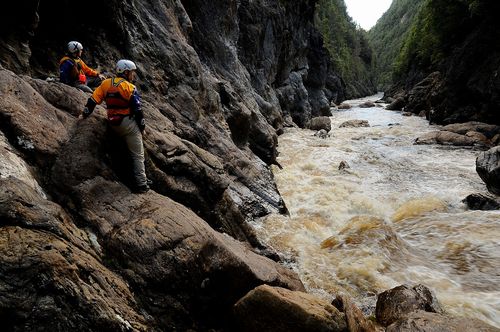 One of the people arriving was Keith Cumming (not in this photo, but it is rafters and it is the Franklin, to provide an idea of what it might be like). But while most of the protesters came upstream from Strahan, Keith had come downstream from Derwent Bridge after 21 days of rafting with, at one stage, the bottom of his raft split in two. While we’ve established he was and is a greenie, I’m not sure if he had any idea of what was happening at the other end, not anyway till a police boat hooked up and towed his raft away. That clarified things.
The federal Hawke government was elected a month or two later. Its platform included a pledge to save the Franklin. Dam building continued however and was only stopped finally by a High Court challenge which was won by a judgment of four votes to three.

That’s Keith revisiting the Franklin at Derwent Bridge.
At a surprisingly rowdy meeting for the 25th anniversary of these events in 2008, Hawkey said: ‘We are now faced with an unprecedented environmental challenge … As you listen to the arguments mounted today you see a complete replication of what was said back then in 1983. You can’t do this. It’ll cost jobs, cost economic growth. What’s the argument today? … What is the greatest obligation that politicians of any stripe have to families? It is that we take action to pass on to them a planet which is inhabitable, viable and enjoyable. Don’t play politics on this issue. It’s far too serious.’
I suppose I’m a greenie too. Mines fascinate me, I am full of admiration for farmers and I’ve used my share of timber, but my heart sinks when I hear about today’s ‘environmental initiatives’. There are so many of them just now: cattle back into the high country, awful and unnecessary, we’ve personally seen the impact and its dreadful; dredging near the Great Barrier Reef for a new coal port, crazy; commercial development of National Parks, a disaster; trying to reverse Tasmanian World Heritage listings, why? This is the environmental ‘direct action’ that is happening and that is real.
But my heart sinks even further when I read of things like plans to log the Tarkine, the area around and north of Corinna. These areas have already been logged. The lumber has gone. Fine timber — sassafras, beech, blackwood, even huon pine — is still there. But you could make a lot of jewellery boxes, and tables, from the specialty timber already felled and seasoned. My heart sinks not because of the fate of the forest so much, but because this is breaking something precious just to watch the expression on your opponent’s face. It’s brainless sociopathological behaviour. Nuts. Sick. Poisonous.
 It’s the Tasmania of Edmund Rouse who in 1989, as chairman of logging company Gunns (he was also, on Tasmanian scale, a media mogul), offered $110,000 to MP Jim Cox to cross the floor. The bribe was designed to thwart the Labor party from forming an alliance with the Tasmanian Greens. Justice was served. Rouse got three years and lost a lot of his grunt. Prior to this for some reason he was present at a Council of Australian Governments’ meeting held in Launceston. As Joan Kirner, then Premier of Victoria, rose to speak, he stood up and shouted at her, ‘Sit down girlie. We don’t want to hear from you.’ And kept shouting at her, without restraint. I wasn’t there, but at the time I was working for someone who was. Not in the same league as the bribe, but drink from the same bottle; and I fear just as Tasmanian as the decency of Bob Brown. You could think that courtesy, respect and generosity might be among the virtues espoused and realised by the conservative side of politics. But in practice you’d be wrong. OK … both sides of politics.
But Bob’s right. Don’t play politics on this issue. It’s far far too serious.
Finally, just for Keith. A pic of the Tasmanian waratahs that he enjoyed so much, 
and the Franklin with Frenchman’s Cap in the background.
Finally, something much more man-made.


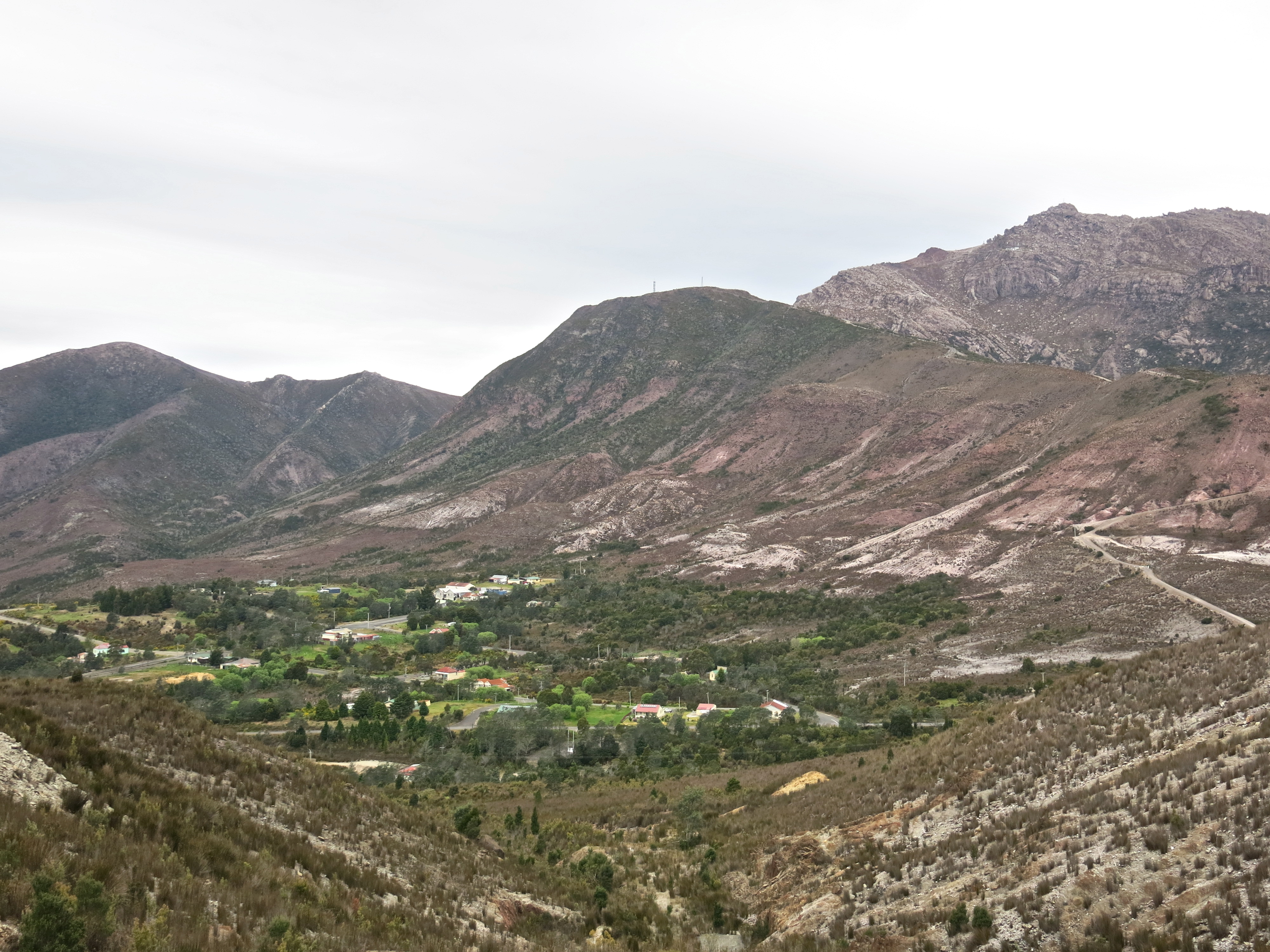


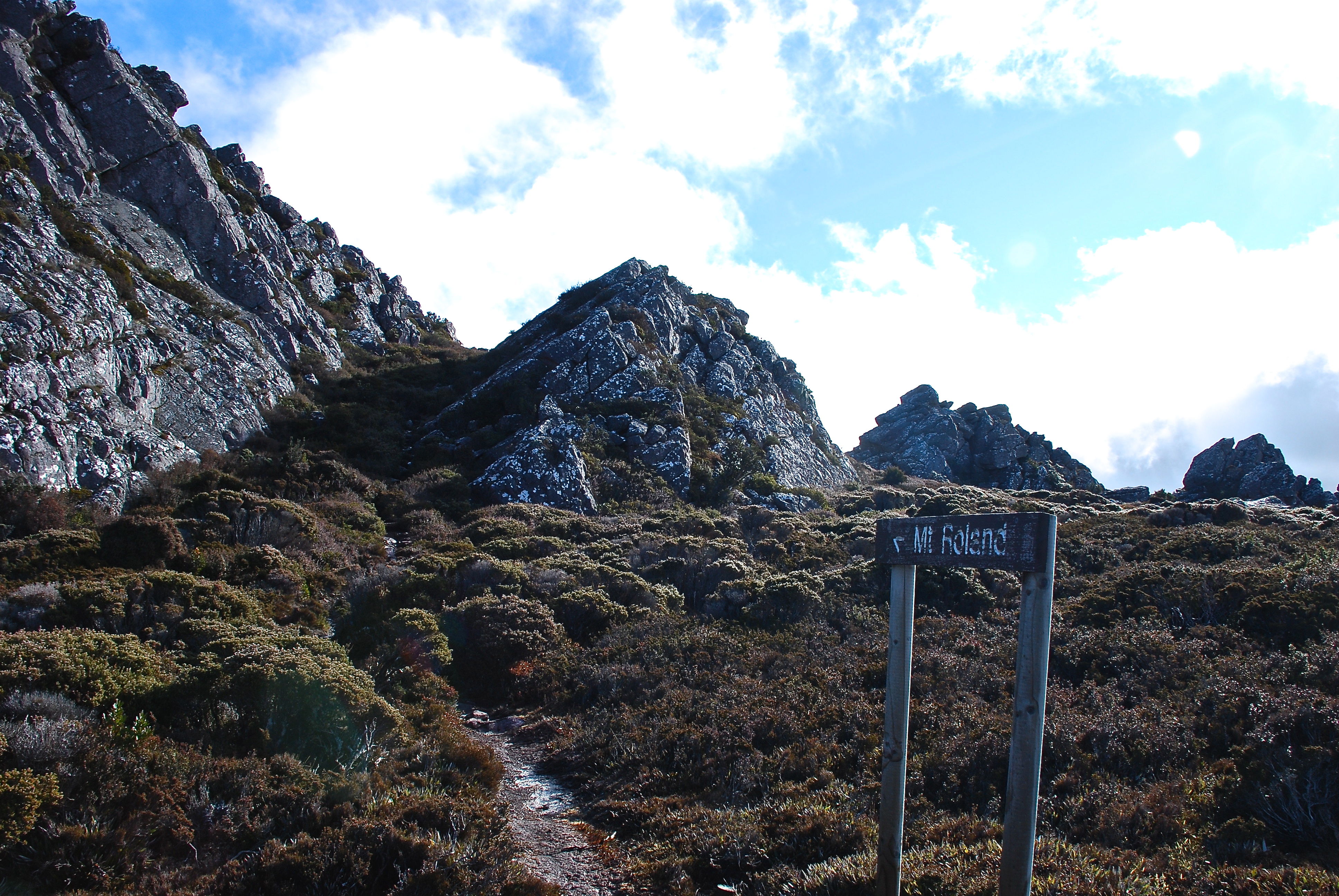
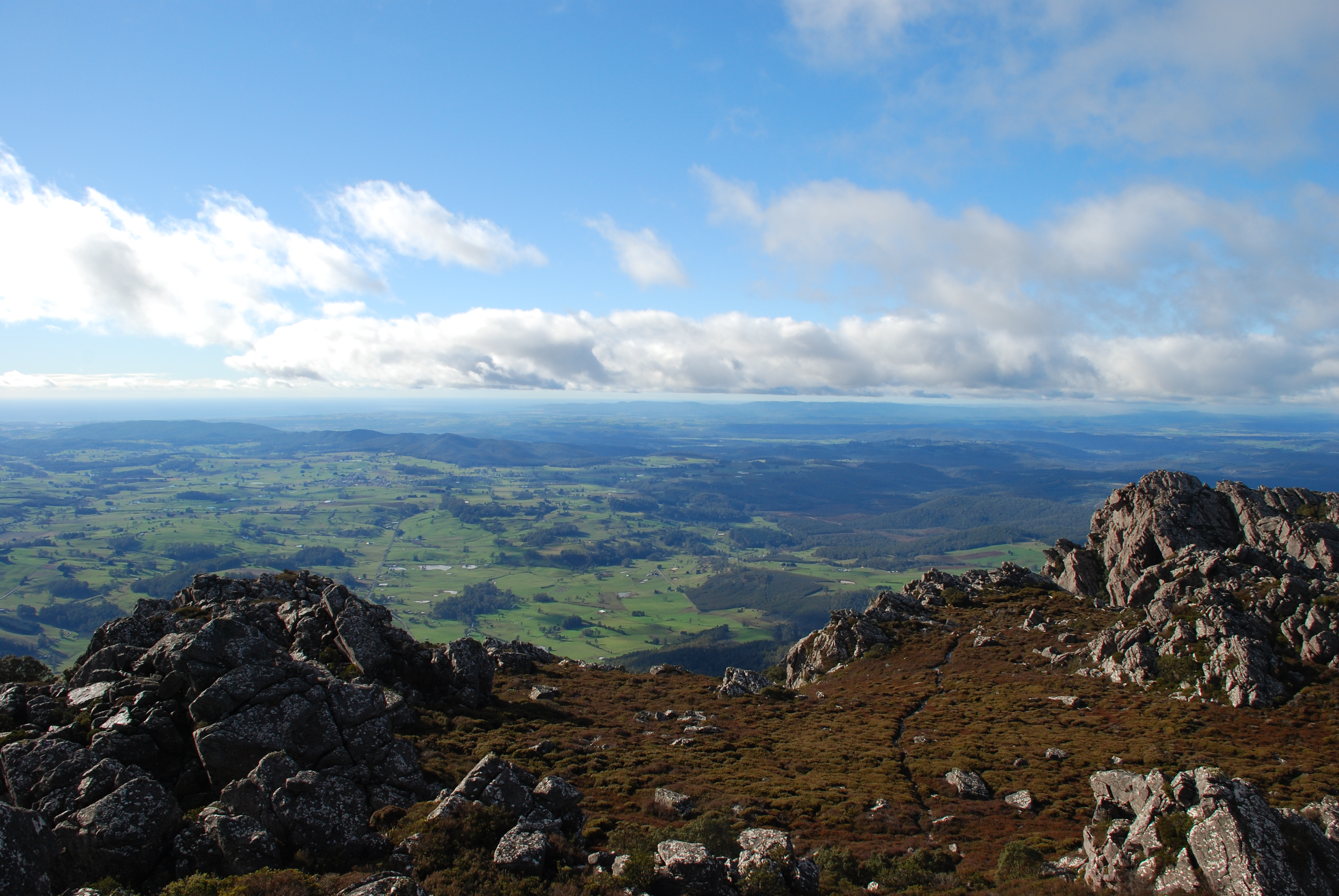
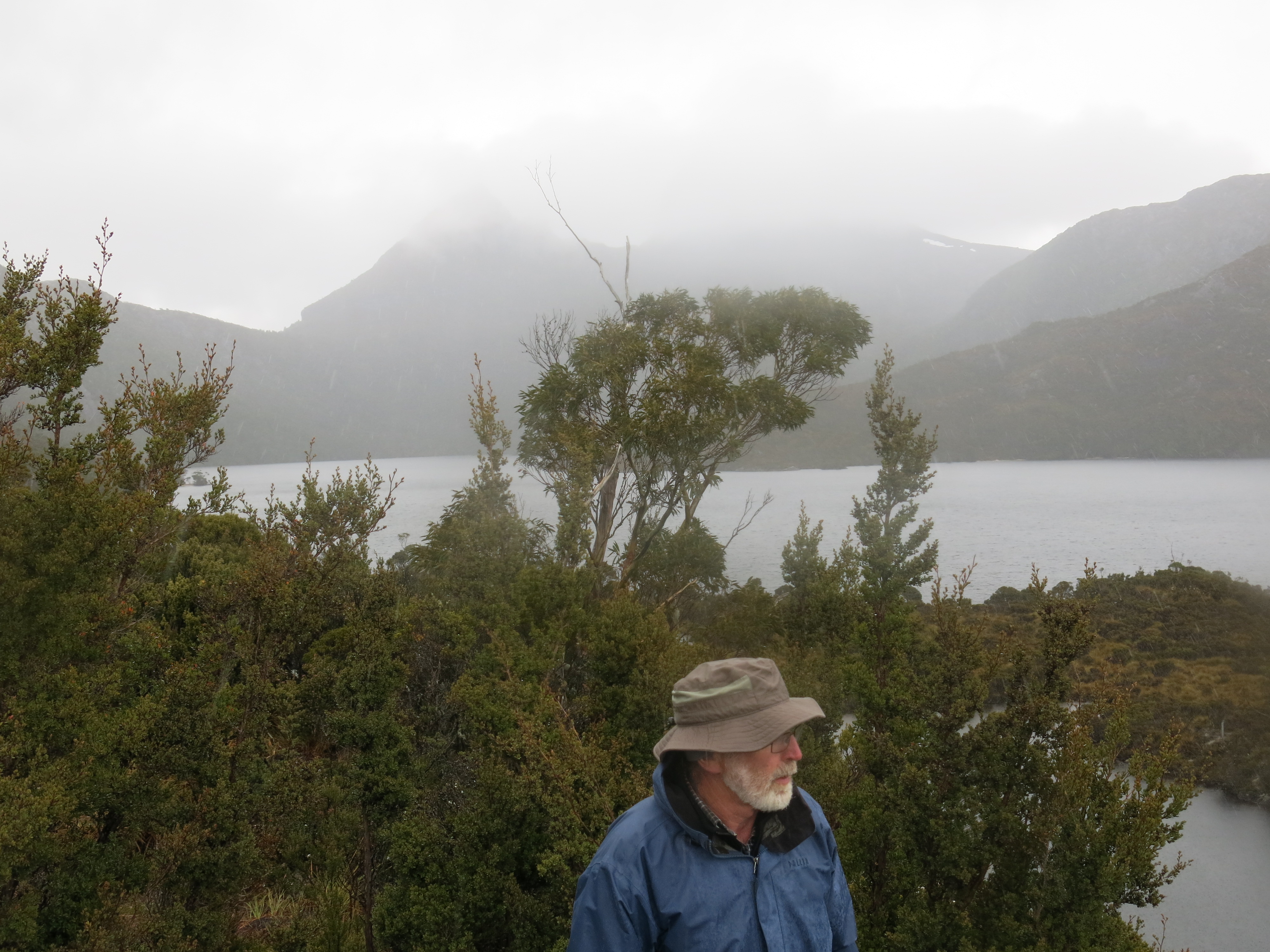
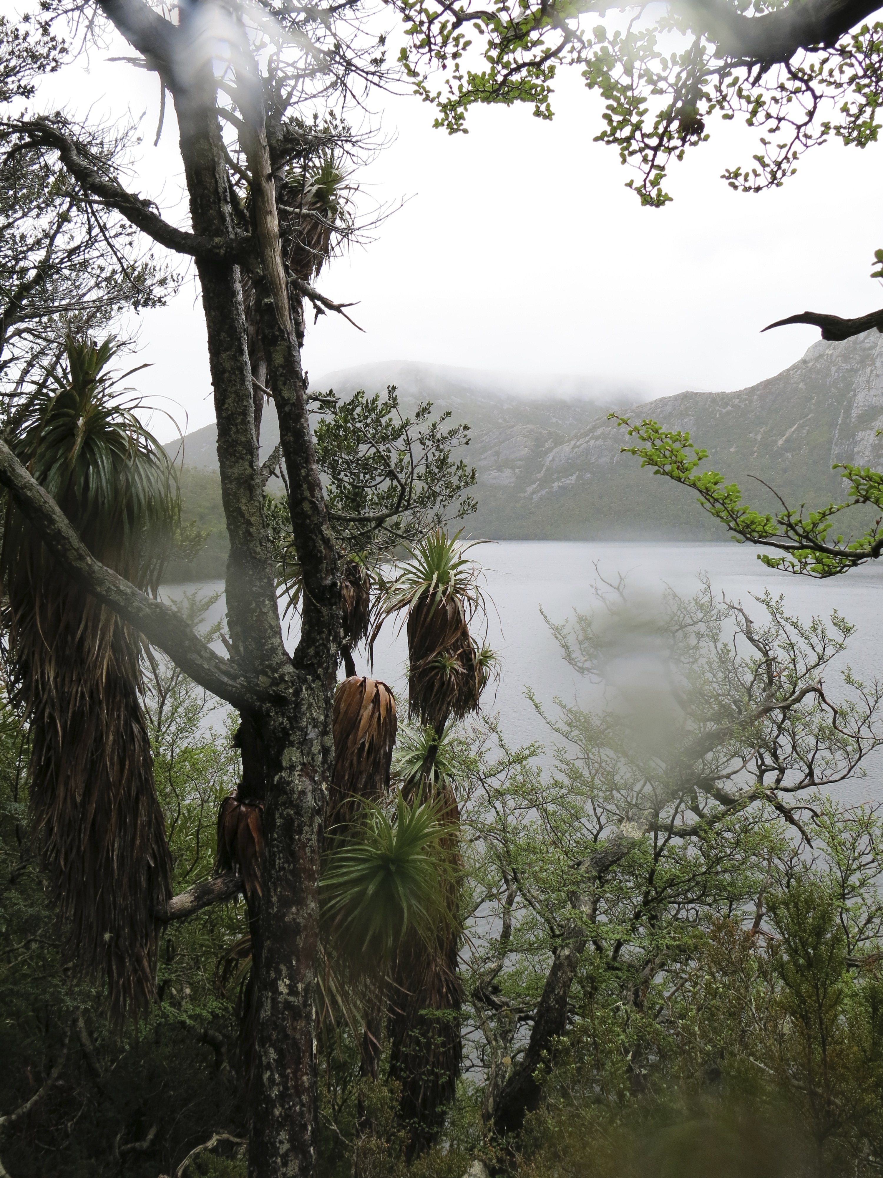
 We also wanted to revisit Mt Roland which features in late sun in the header to these blogs. We’ve made an effort to climb it four times, been rebuffed twice by late starts, daunting weather and bad knees, but were successful this time again. It disguised itself in cloud and constant drizzle, but in any weather it is a wonderful mountain.