

 One end of the Nakasendo (‘central mountain route’) trail is the Nihon (‘Japan’) bridge in Tokyo and the other is the Sanjo bridge in Kyoto. The trail linked the two capitals — political and imperial — in the Edo period (1603-1868).
The shogunate established five roads to link Edo (Tokyo) with the rest of the country to enable/encourage/force regional overlords to conduct the practice of sankin kotai, ‘alternate attendance’. This required the overlords to spend every alternate year in Edo. Even when they went back to their lands their families remained in Edo as hostages — a fairly thorough way of keeping an eye on things which is perhaps why the Edo period lasted so long. It wasn’t just control of the location and family of the overlords that kept them subject. The cost of travel kept them poor. But this process did lead to extensive road building. Sekisho (checkpoints) were established on all routes to constrain unauthorised travel.
Today some of the 530 kilometres of the ancient trail is hidden under modern roads and rail tracks, but there are still parts which have been maintained in their cobbled glory with some more like narrow goat tracks and very hard to imagine as a sub-regal highway. There were parts where it was hard to imagine even a sedan chair being navigable. These roads grew post stations which became clustered with ryokans and rather more grand hospitality for the grandees who were travelling.
We had to get back to Tokyo from Kyoto, and Oku (‘outside’/’outdoors’) Japan had just the thing: a five-day walk through some of the road less travelled, staying at ryokans in post stations on the way. Our luggage could by handled by takyyubin, a most efficient service which couriers parcels, luggage and so on from one place in Japan to another in 24 hours. We saw our bags again half way, but as it turned out we could have sent them straight to the airport hotel. Modern walking clothes dry overnight and the ryokans provided toiletries, slippers and yakuta.
On the dulcet night before we left Kyoto we dined sitting next to the Sanjo bridge looking out over the Kamo River. A version of Chinese food for some reason (location location location I fancy), where we had trouble getting across the idea of plain steamed rice, but the beer was excellent. And then we had to get to the starting point.
I’ve mentioned the issue with starting points elsewhere. Weeks before, looking at the track notes in North Melbourne — all 52 pages of them, unbelievably thorough, with pics — I thought how on earth are we going to all do this? It’s so complicated.
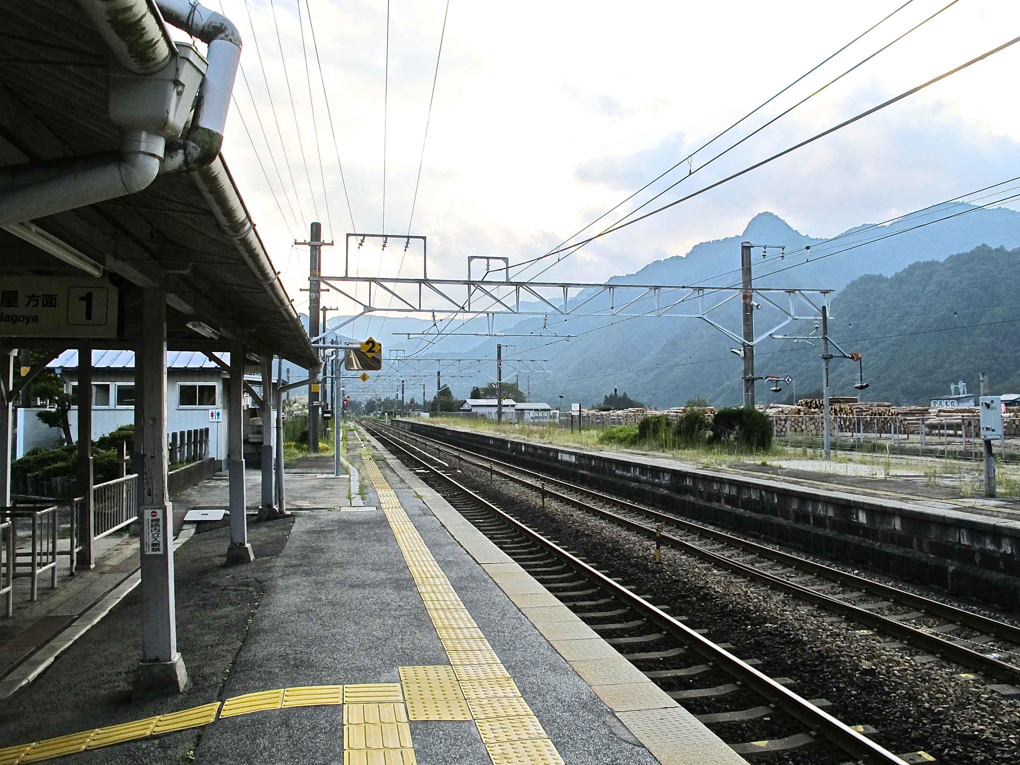
The first time we went through Nagoya Station I wasn’t any more confident. But after three weeks we had public transport fairly well under control. Shinkansen from Kyoto to Nagoya, work your way through the station and find the right platform for the semi-express to Nakatsugawa. At Nakatsugawa find the bus for Magome.  The result is pictured. Always a thrill to get where you’re supposed to be.
Magome to Tsumago
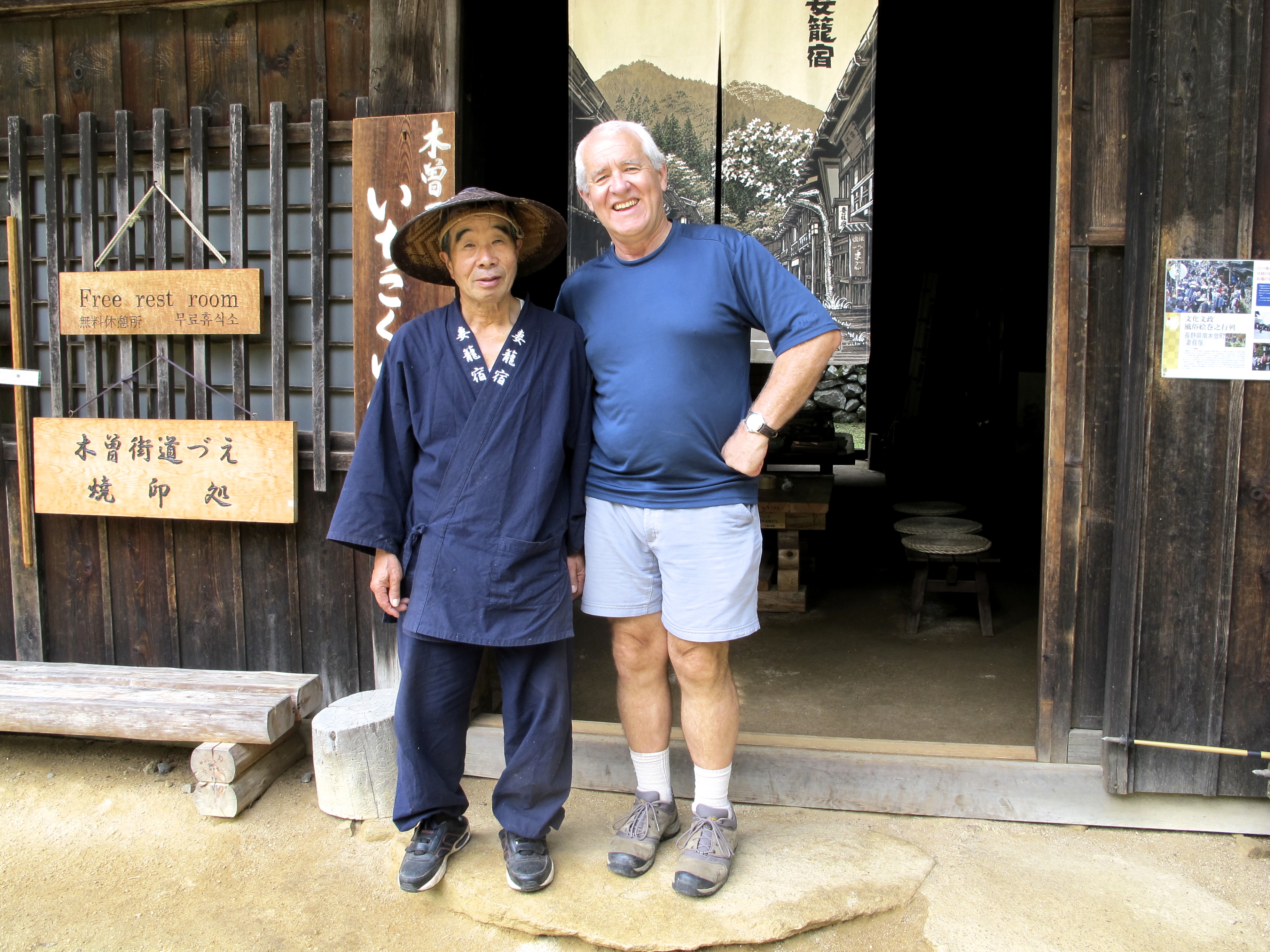
is a path very well travelled, about 9 k.s with a bit of a climb up to a pass cunningly named Toge (‘pass’). Magome is a well-patronised tourist town with a lovely view over to a range of mountains topped by Mt Ena at nearly 2200m. You could happily spend an hour or two there. But we were ready to get going. And look at us (in the main drag of Magome) — clearly ready for anything.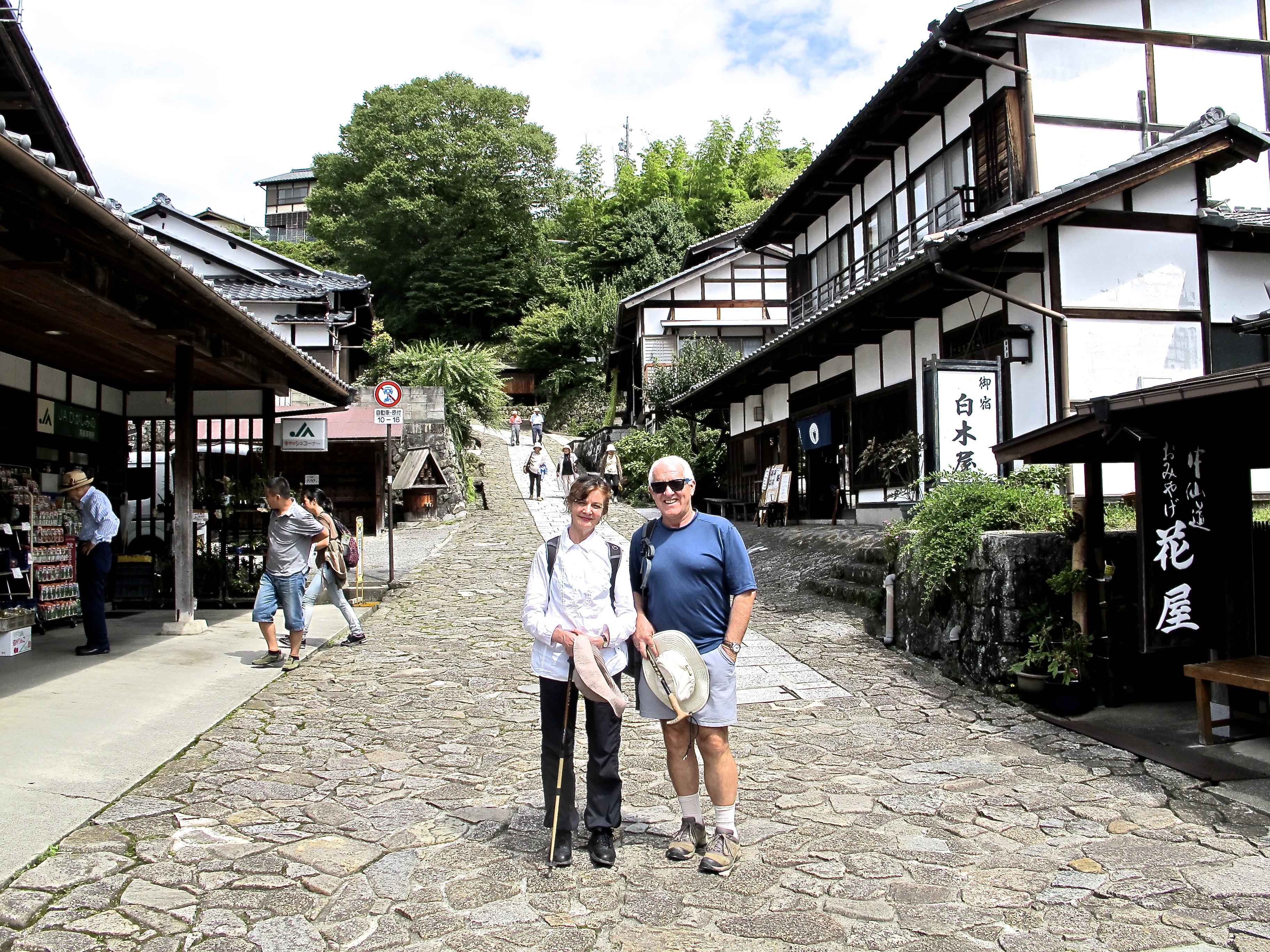
As it happens this pic was taken by a representative of the competition, British travel company Inside Japan (yes Inside and Outside, that would just about cover it) who was rushing ahead to check the route but walking on air over the fact that Tokyo had just been awarded the Olympic Games.
Nearly two pages of the notes are devoted to negotiating your way from this point to the top of the picture. Oku clearly don’t want their clients to be lost. The notes advise you to sample the noodles at a cafe near the top of the pass, and I can confirm the quality of the recommendation, although it had been a while since they had had Australians through.
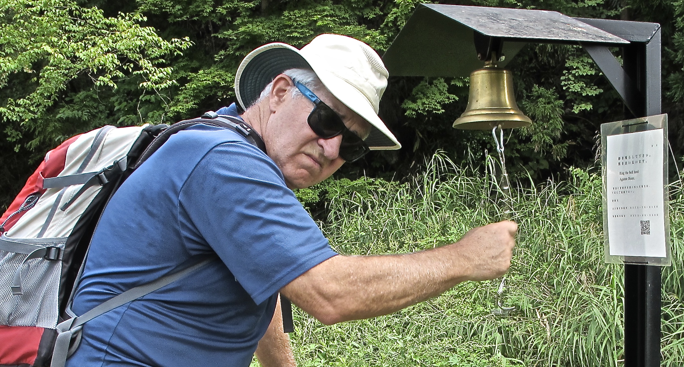
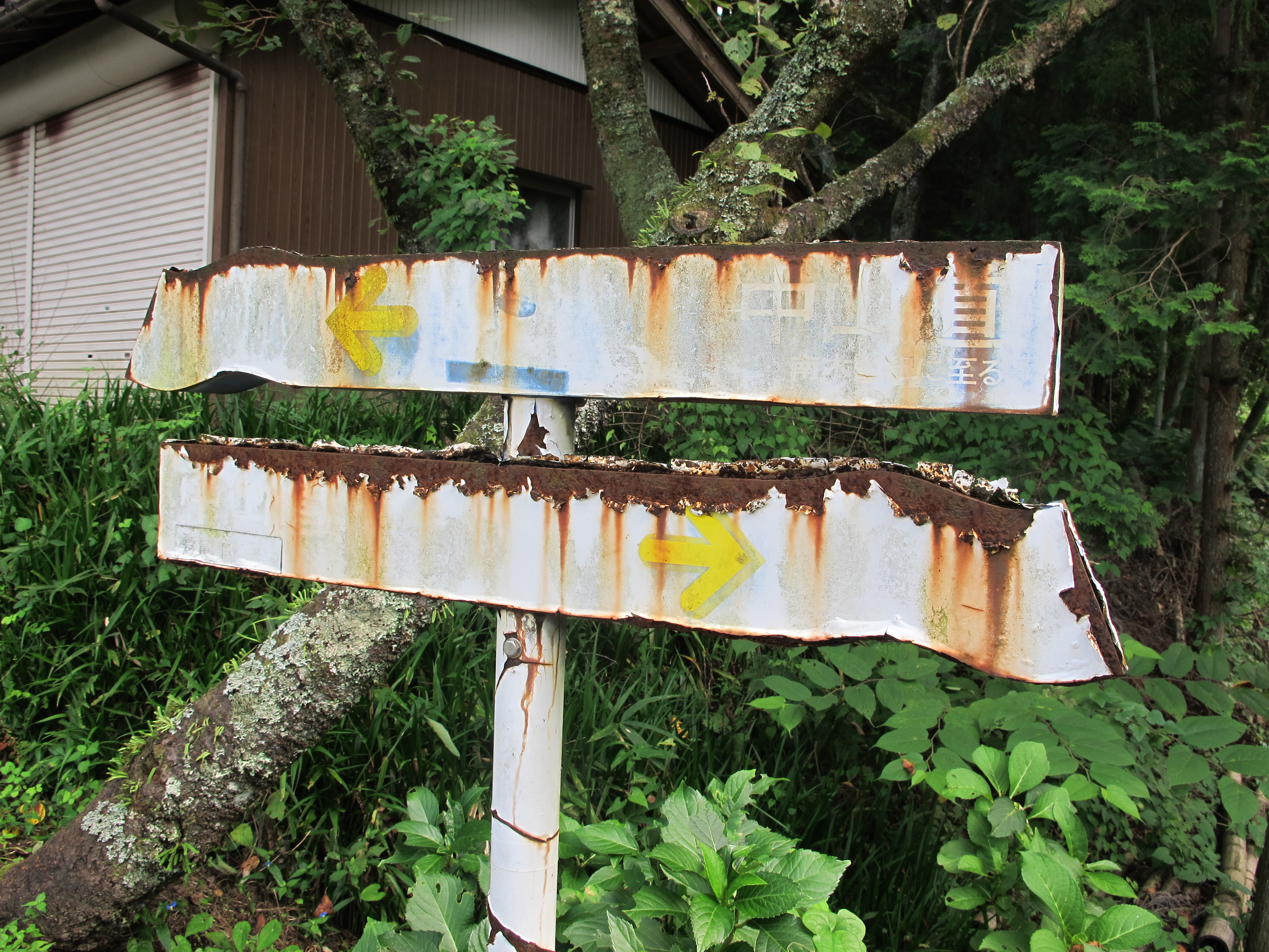
 There were a lot of warnings on this track. In fact, prima facie, it seemed like a real test of courage. Had the bear warnings of course, and every few hundred metres a bear bell to ring for the fools who hadn’t brought theirs along. I enjoyed them. But in fact we were more likely to be attacked by signage and rest rooms (16 in 8 k.s. Could this be a record of some sort?) than wild creatures. Signs for Tsumago-juku were everywhere, and really all the notes needed to say was ‘follow your nose’.
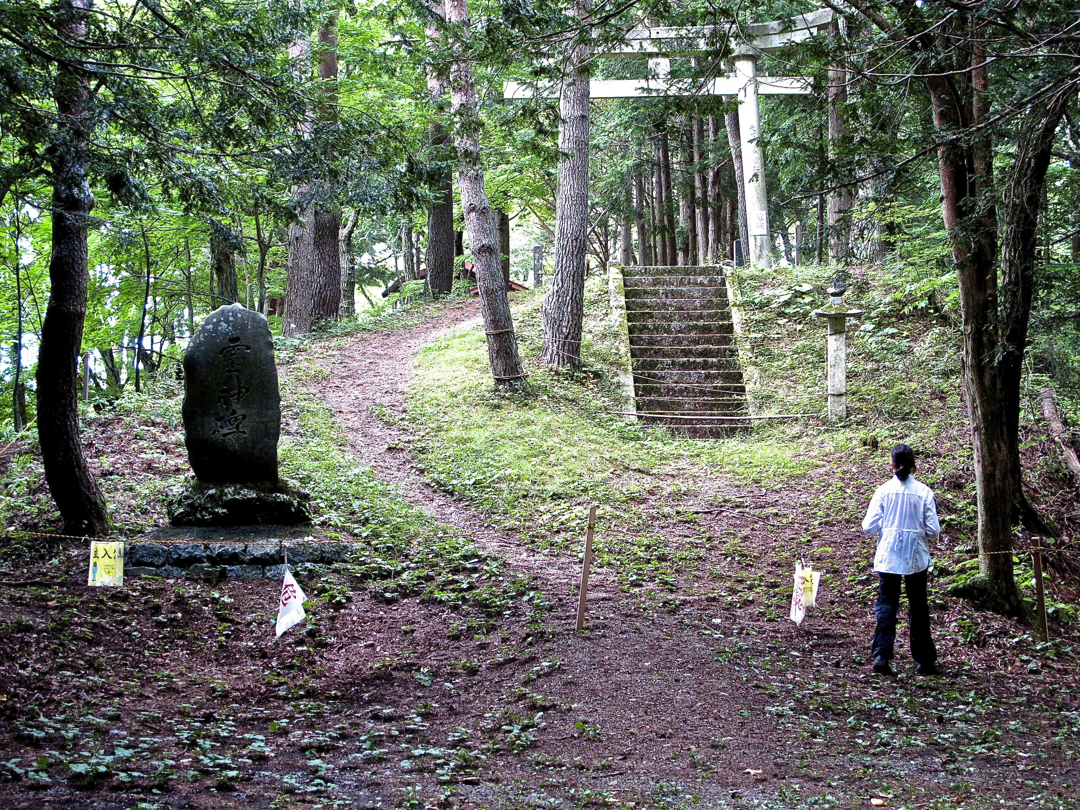
But there were some lovely swirls of forest and signs of what the trail may have once been like.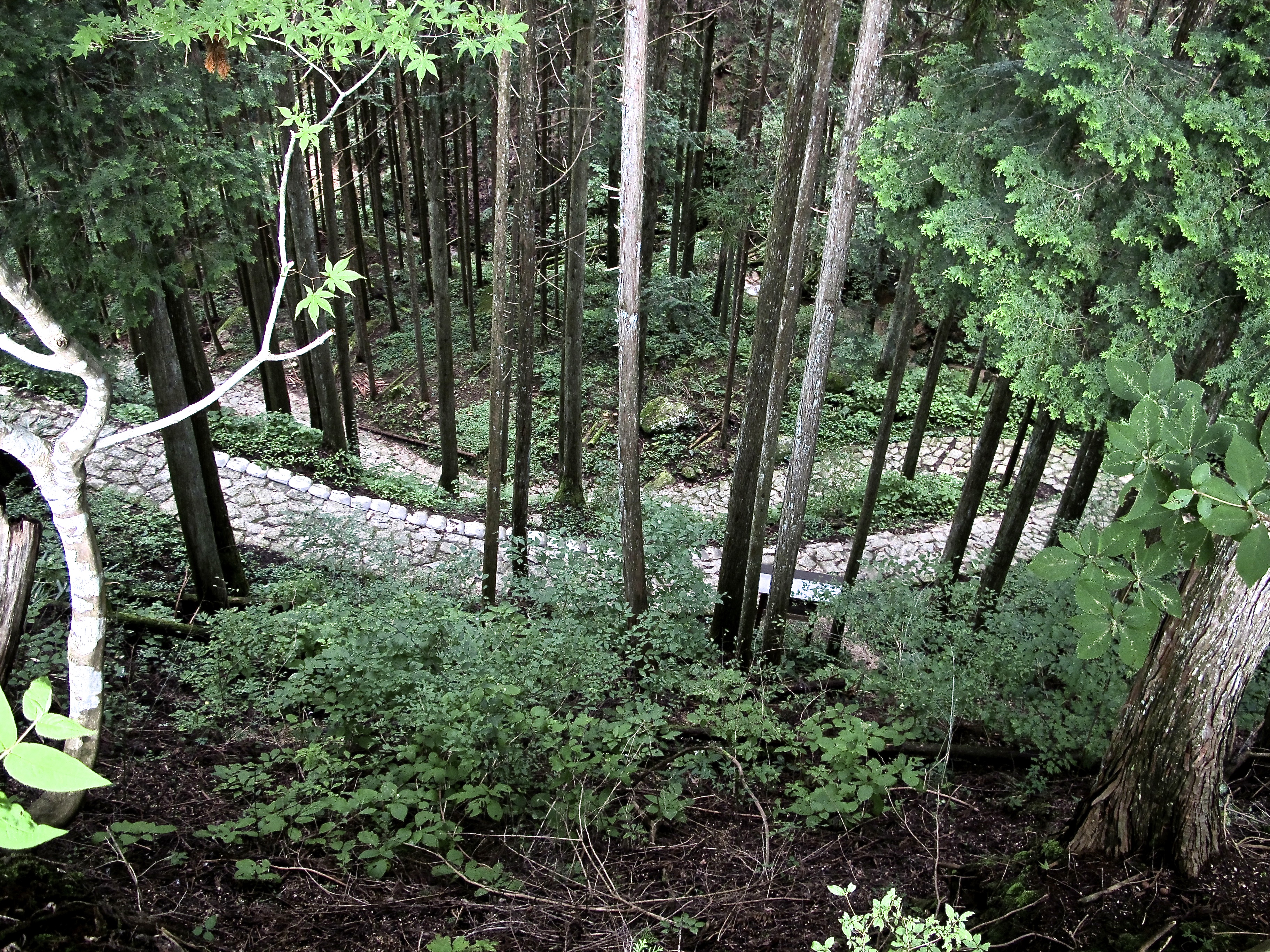

 We came across quite a lot of trees bound up like this. Why would that be?
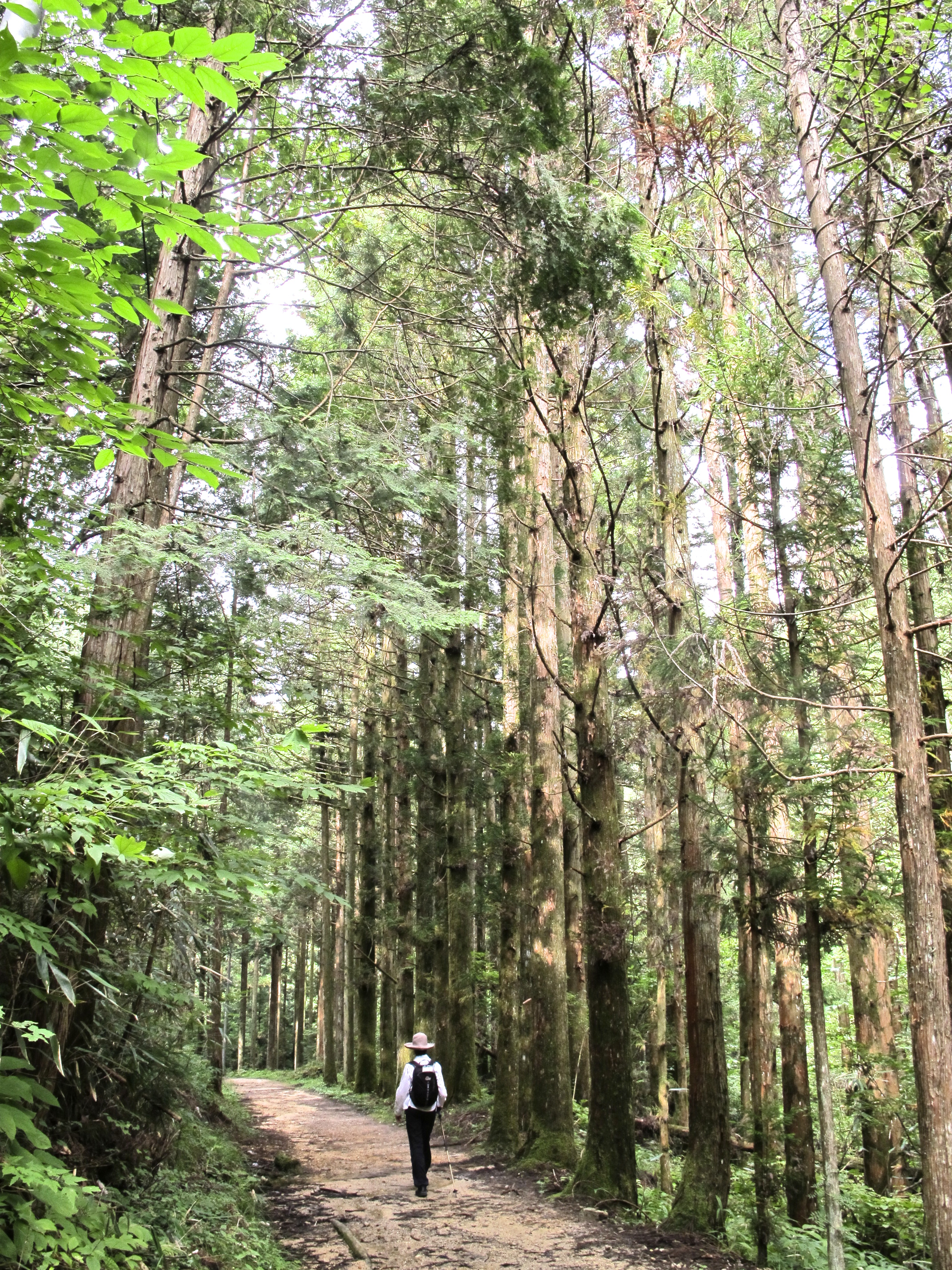
Other parts of the forest were quite grand and we tracked happily along on another hot and steamy day. 
 We did run into one cheerful bandit who in this ancient tea house provided us with two cups of green tea for which I ‘donated’ 1000 yen (10 bucks). The tiger. But as if you’d mind. A hundred or so metres off the track from here was a cherry tree which was supposed to be several hundred years old. I tried and failed to make a photograph of it interesting.
Event free, we just wandered on and after a few hours arrived at Tsumago, sweaty and cheerful. I might mention that we walked past a denim shop here which offered a jacket with Hokusai’s ‘The Great Wave off Kanagawa‘ embroidered on the back of it and other equally remarkable designs. Tsumago could have withstood much greater investigation but we were were having onsens.
Tsumago to Kiso-Fukushima

 As we bade farewell to our very warm and gracious host at the Daikichi Minshuku (she and her son cooked the meal pictured in ‘Food‘) the signage dropped off a bit and the rest rooms became less insistent.
It was a real walk this day, a genuine walk. Probably 20 k.s the way we did it, with an overall 400m gain including a real puffer for an hour or so up to the Nenouetuoge, the pass of the day. And it was hot hot hot, and steamy steamy steamy. Bright sunshine for most of the day, and we were very glad of forest shade.
There was also a time issue. Our final destination was Kiso-Fukushima but we were to get there via train caught at Nojiri. The early train went at 2.49; the later one at 5.31. The description of the ryokan in the notes suggested the desirability of an early arrival. No big deal, just something to keep in the back of your mind.
 The first stop was Nagiso to get some lunch. It was relatively early and I made the wrong choice about how to get across some railway lines to the shop and we noodled round there a bit. What did we buy? Two fantastic looking peaches that turned out to be rotten, some first grade monster apples, some Pocky (chocolate covered pretzel sticks for someone who likes such things), some shocking doughnut-like substances in individual cellophane wrappers. Mmm bad buying, but I think the best we could have done in the circumstances.
The climb then began, just steadily at first through a mix of forest and farm land. There were also plenty of downs so the total climb for the day was much more than 400m. But it was beautiful, and varied: and there was water all the way, yama no mizu, mountain water. Harvesting rice, a bamboo forest among other small joys.


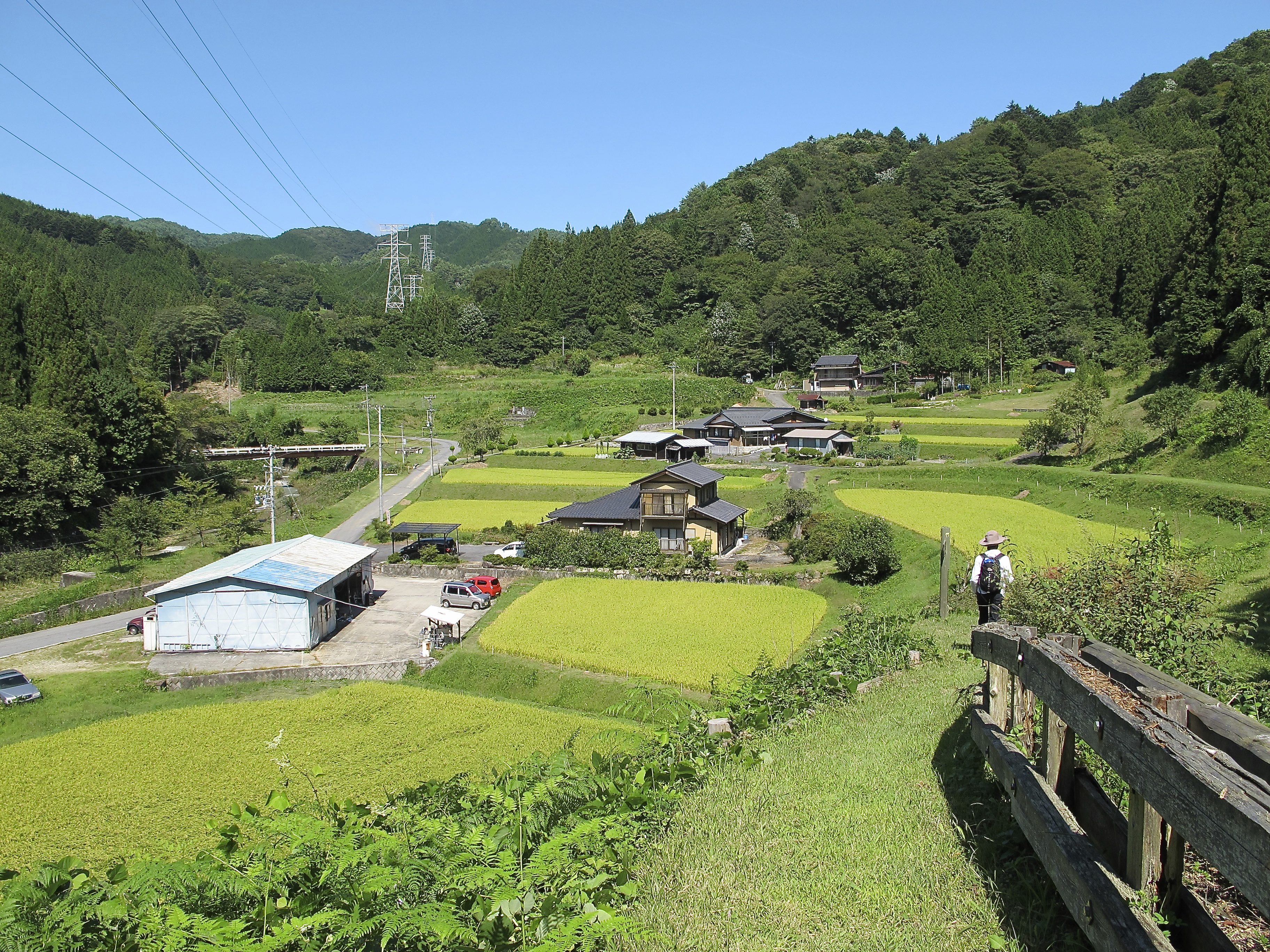
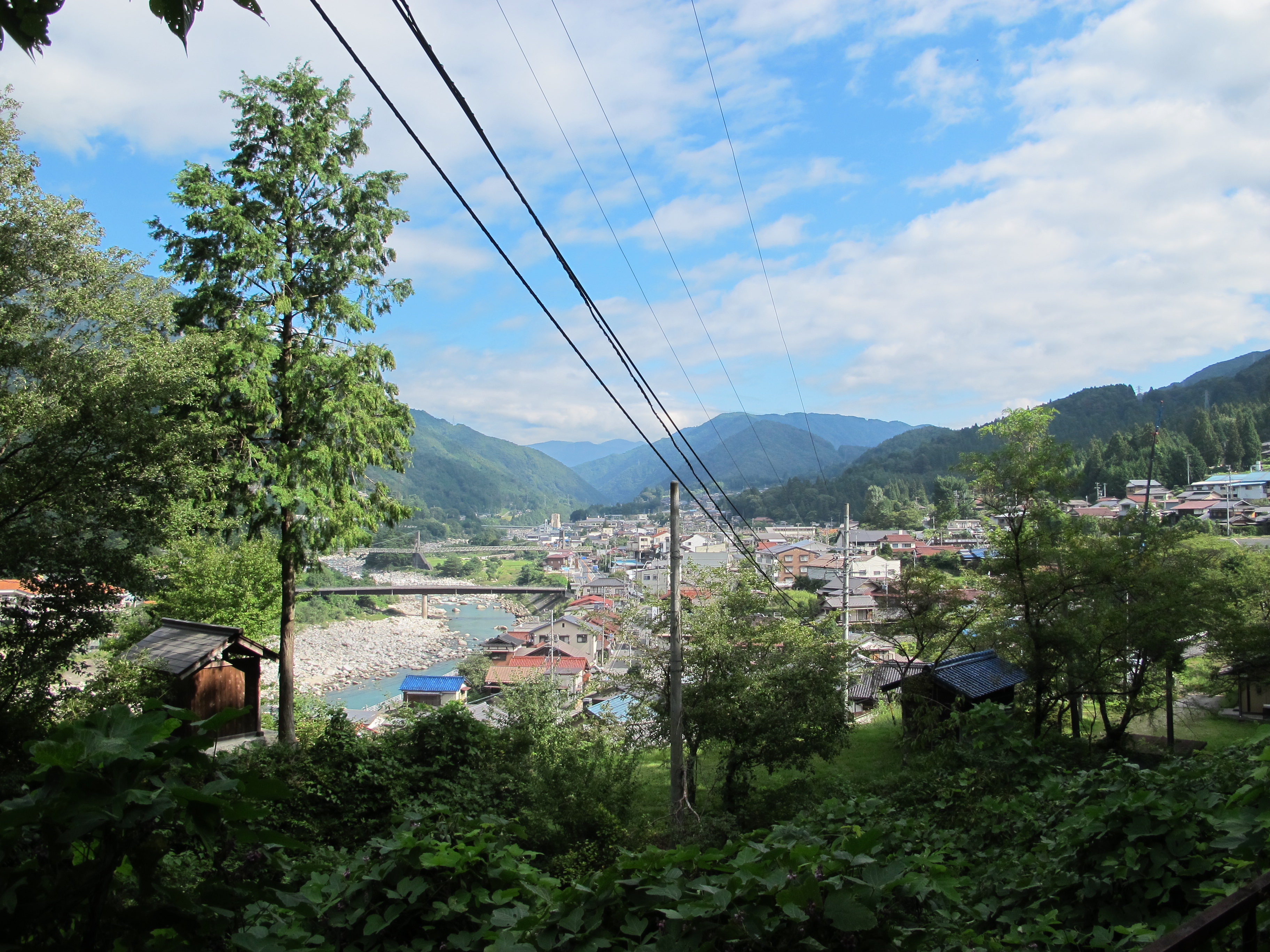
But, as the pics illustrate, not really remote. We were in fact walking up the Kiso Valley in its various manifestations.
 I’ll stick this thumbnail in here just as a reminder. Mernz is filling up with yama no mizu at the spot where a few moments previously I had tipped the contents of my pack into the creek, especially the track notes which were sodden, somewhat darkening my mood.
We weren’t that far from the top at this stage, 20 minutes maybe, and I’d done some sums and was reasonably confident we’d miss the early train by about 10-15 minutes. We popped out the top as one does, and there was a sign on an asphalt road saying Route 19 5.3 kilometres and it was 2.12pm. That road curled and it curled and it curled but we were going downhill on a gradient suitable for driving, the footing was firm, it was shady and we got up a Melbourne Cup pace. But there was a trick on the outskirts of Nojiri. We needed to get off the way to Route 19 and go to the station (still most of a kilometre away) and the route was signposted but looked discouraging. So a few moments of dither before we chose to go with the signage, and we missed the early train by four minutes. Bum.
A few other trekkers arrived from somewhere (but their train came an hour and a half before ours did. Damn! They were going down the valley and we were still going up). We watched the kids coming home from school on the train, I bought some beer (with the shop lady playing ‘Waltzing Matilda’ on her sound system for me), wrote my diary, read my book (on my iPad) and wiled away the hours and meditated on a great day of walking.
 Nojiri was a teeny tiny timber town. These towns we frequent … they’re all tourism, timber-getting or skiing. The train came and yes, this was the train that made an unscheduled stop and that I was sure Mr JR was going to have to apologise for. It was another ‘local’ and didn’t just stop in the middle of the route but everywhere else as well. But, lo and behold we arrived at Kiso-Fukushima (ski town) exactly on time.
Using my best Japanese, I rang the ryokan and solicited a lift. And, just as suggested by Oku, ten minutes later the van arrived to pick us up; ten minutes after that we were taking our boots off at a very stylish resort-style ryokan. It had chairs.
Kiso-Fukushima to Narai
‘One of the hardest parts of the Nakasendo’? No, not really. We went back into town after a leisurely morning (‘Fukushima in the region of Kiso’ for those who are thinking about that name in other sadder contexts) and caught the train to go further up the valley to Yabuhara from there climbing over the Torii-toge, the ‘gate pass’ mentioned in ‘Orange‘. It is at 1200 metres but you start a bit under 900, and it just seemed to go easily. Nicely graded track, well-signposted, everything in the right place. We had lunch, a more successful lunch, on the pass and found the torii. I think but I’m not sure that this is pretty close to the exact half way mark of the whole Trail.

 After the pass there was a ‘promenade’ staying up high but on the contour with views. We saw a snake and some monkeys and were joined by a couple of other walkers. Like Magome to Tsumago, it is a well-established and well known walk and we found ourselves with an English teacher from Nagano for company.
He began by apologising for the weather. This should not be happening. The summer was exceptionally late; there had been flooding rains; everything was topsy-turvy. Did we have climate change in Australia? I was able to assure him we did. We chatted on for 15 minutes or so. There was no hurry today.
We passed a site commemorating ‘one of the many attempts by the Takeda clan to break into the Kiso valley and fight against the Kiso clan in 1582. The invaders had 2000 samurai but were defeated and lost 500 men before retreating to their base. The 500 dead samurai are buried here. Cross a concrete bridge and then soon pass a rest area, the site of a former tea house.’
Sometimes such things resonated; sometimes they didn’t.
The descent into Narai was very pleasant, an easy mountain track popping out onto a road where we found a house with transparent skirts with which I was very taken. You’ll probably need to double click to see what I mean. And Narai.
Narai to Kuruizawa
Most of these places have been razed by bushfires and often quite recently. Yabuhara had for instance. You can imagine. Paper screens, wooden construction, open fires and all set into this dense forest. But Narai had somehow been preserved, and its main street, Nakasendo dori, looked like it ought to.
Our views about Narai were coloured by three things on arrival: a nice little museum devoted to folk arts and Narai history with a very friendly and helpful staffer; a series of gorgeous unobtrusive shrines set back into the forest wall; and a shop which had beautiful things we wanted to buy. It was a tourist town too, but I think not on the mainstream track. Good coffee, friendly people, interesting shops and a ryokan, quite Spartan, which we really liked. The entry to our room.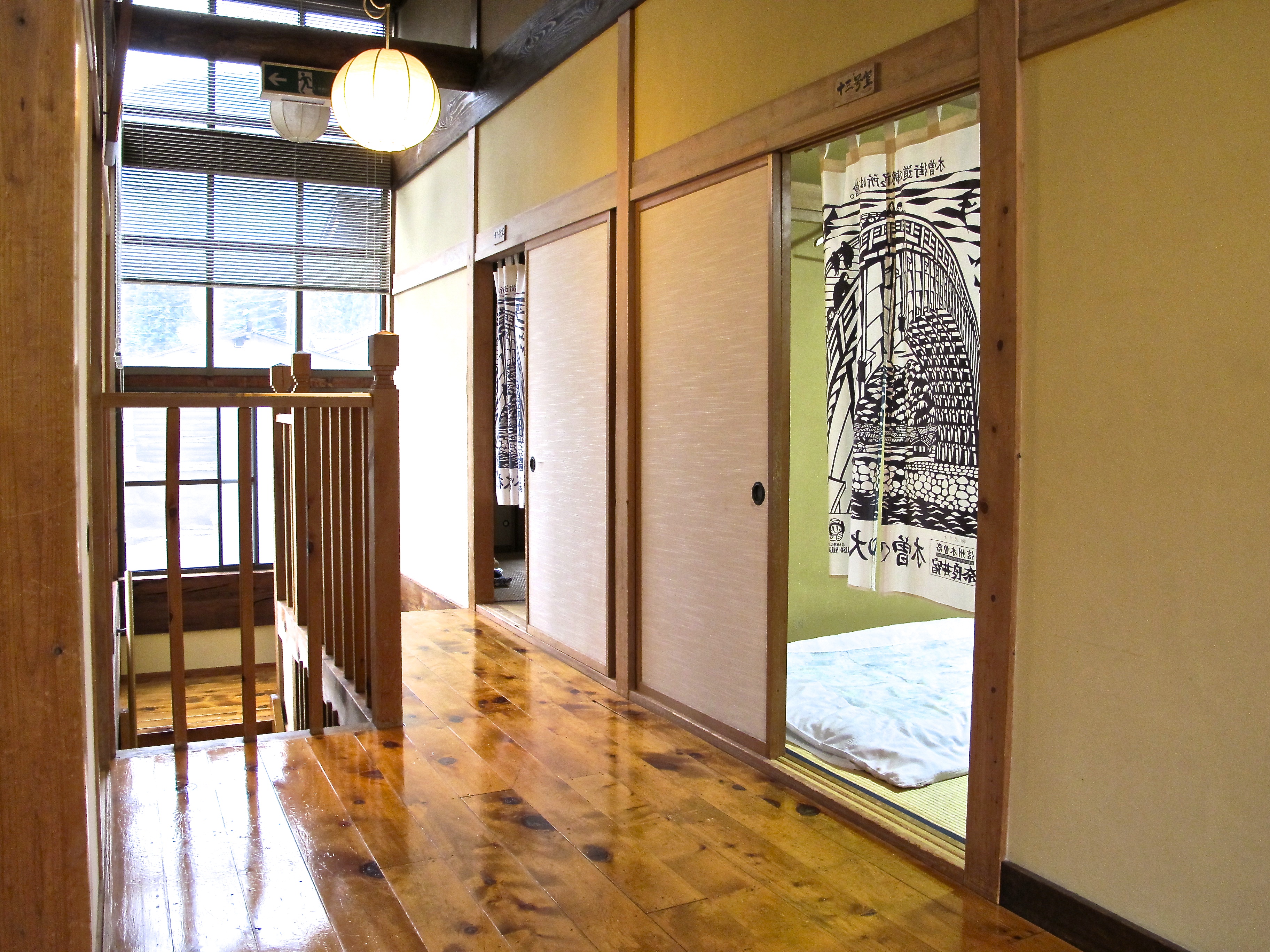
The food was great, again, and we dined with an older couple (our age that is) and a group of motorcyclists who were out on a ride. And did they have a good time! Drank a lot of beer, had the sleeves of their yukata rolled up and were ready to make a night of it. In the morning when we got up, they’d gone, and all we had to do was walk down the street to Kiso-Hirasawa, a few flat k.s following a river in spate, and then engineer our way through three trains to arrive at Kuruizawa.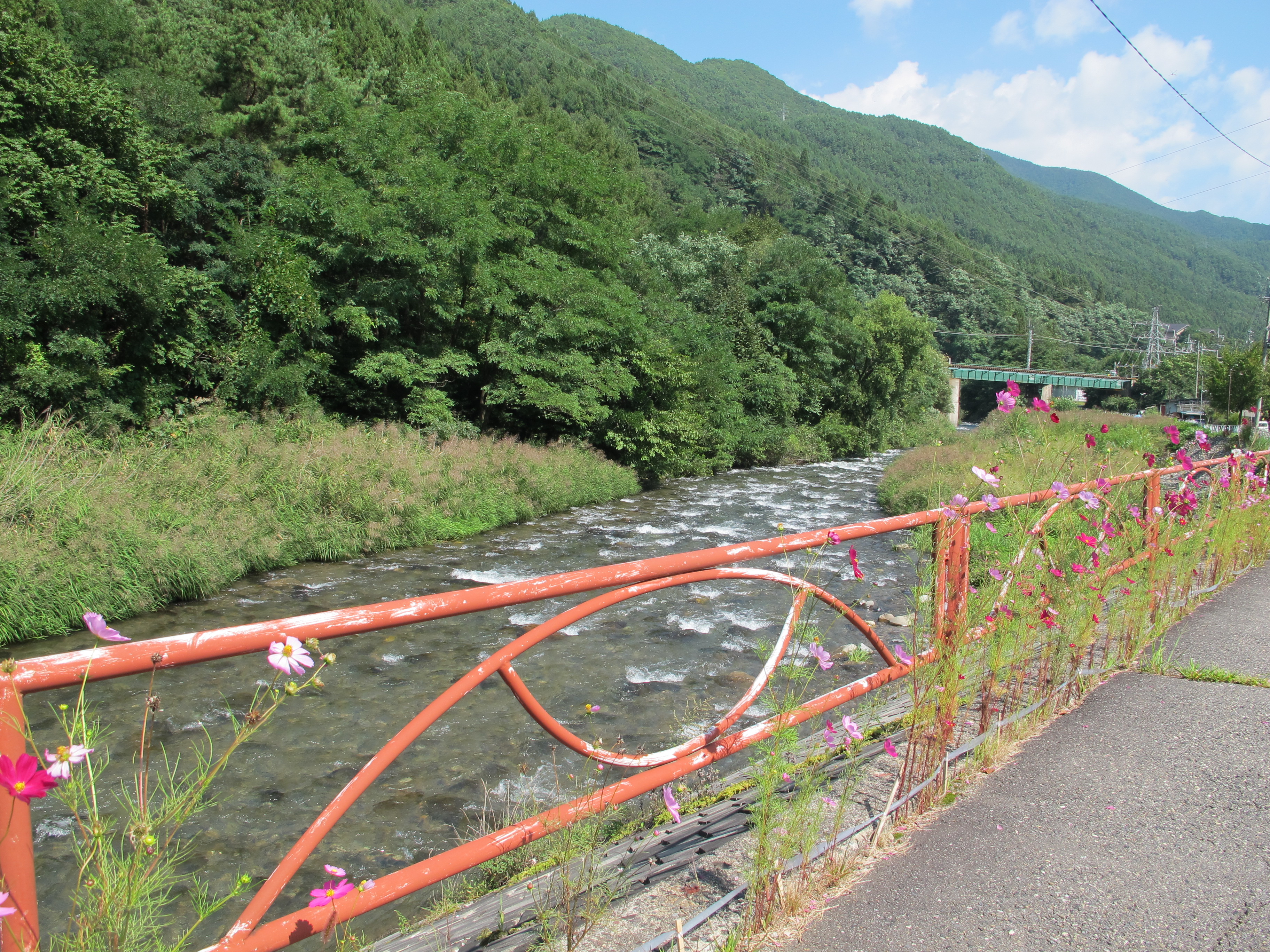

It was a beautiful day and joy filled our hearts. Kiso-Hirasawa is the epicentre, the hypocentre, of lacquerware production, something the Kiso area is famous for. Walking along a raised track above the town, it seemed that just about every building was connected to the trade one way or the other. So many lacquerware factories.
We wandered up to something that could have been a coffee shop, but wasn’t. It was a lacquerware outlet, a big one. So I sat on the step and waited till Myrna came out and told me to come inside and have a look. I roused myself and wasn’t disappointed: a place full of truly amazing lacquerware — tables, trays, bowls, boxes, ornaments, bracelets, pictures, anything you could think of, and all pretty fabulous.
Anything we bought I’d have to carry, but this was too good to miss. We bought some small things and a box about A3 1/2 size, and I worked out a way to tie this onto the back of my pack without doing too much damage to the pack, the box or to me.
By this time, when taking trains, the only sign I remained interested in was platform number. If we were on the right platform, regardless of how many trains came through or stopped, my watch would tell me if we were on the right train. We got a local from Hirasawa to Matsumoto which has a castle.
Then an express to Nagano, most of the way through tunnel, and then, bingo, we’re out in this densely populated brightly lit saucer in the middle of high mountains. Nagano: 1998 Winter Olympics, and a couple of very satisfying bentos.
Then a shinkansen from Nagano to Karuizawa. We’d been going north-westerly but then turned south-easterly towards the capital, quite a bit of travel, about four and half hours worth, and when we finally arrived at Kuruizawa, it was like ’emerging’, head out.
I had a plan whereby I’d have a reasonably clean shirt and socks to wear from the end of the next day’s walk through Tokyo to Narita. Myrna didn’t. So she thought she would try to buy something in this place we were arriving at. On the south side of the station, away from our destination a couple of k.s away, were the makings of a shopping centre, a fairly big shopping centre, which I didn’t really want to go to. I preferred to stay in the bush. So I persuaded her we’d find something on the other side, and she did — a bit nondescript, but it was clean and you could stick it over a singlet and look respectable.
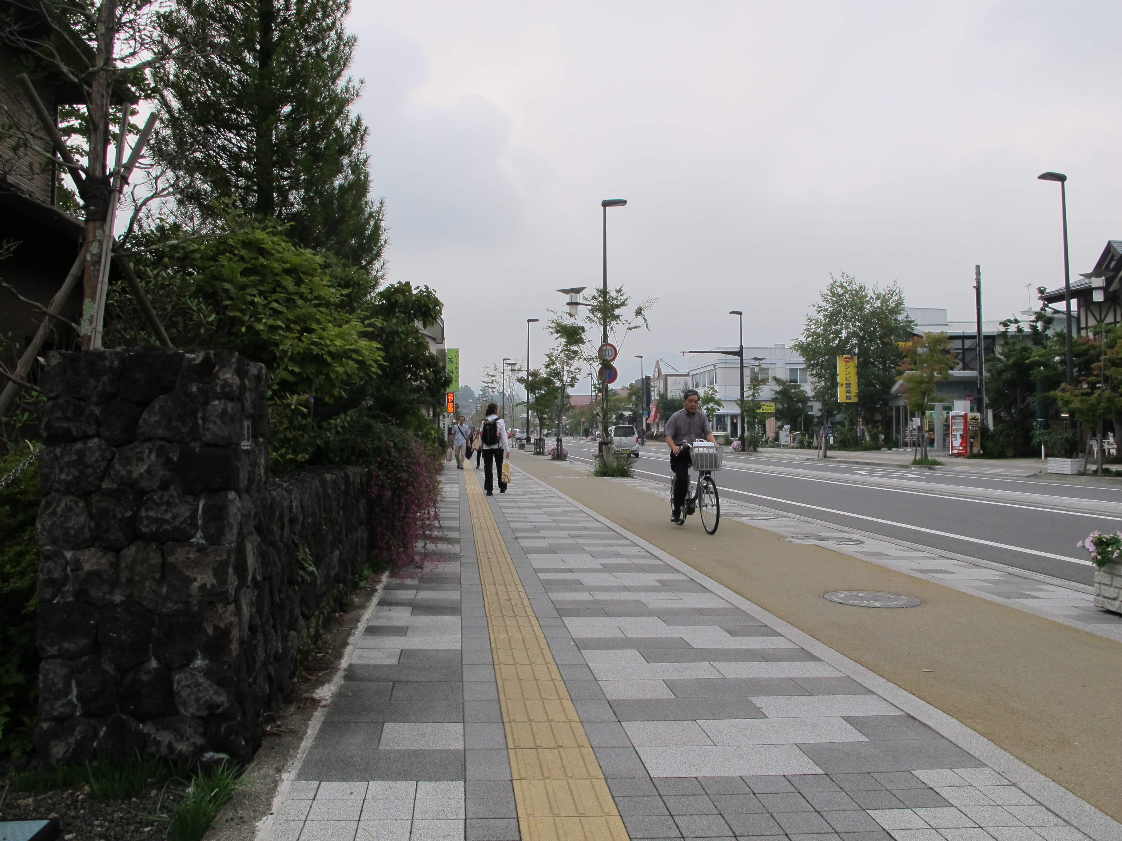 But while this was going on I was looking at Kuruizawa, eyes widening as I did so.
I was sitting outside one of the four branches (we found; there may be many more) of 
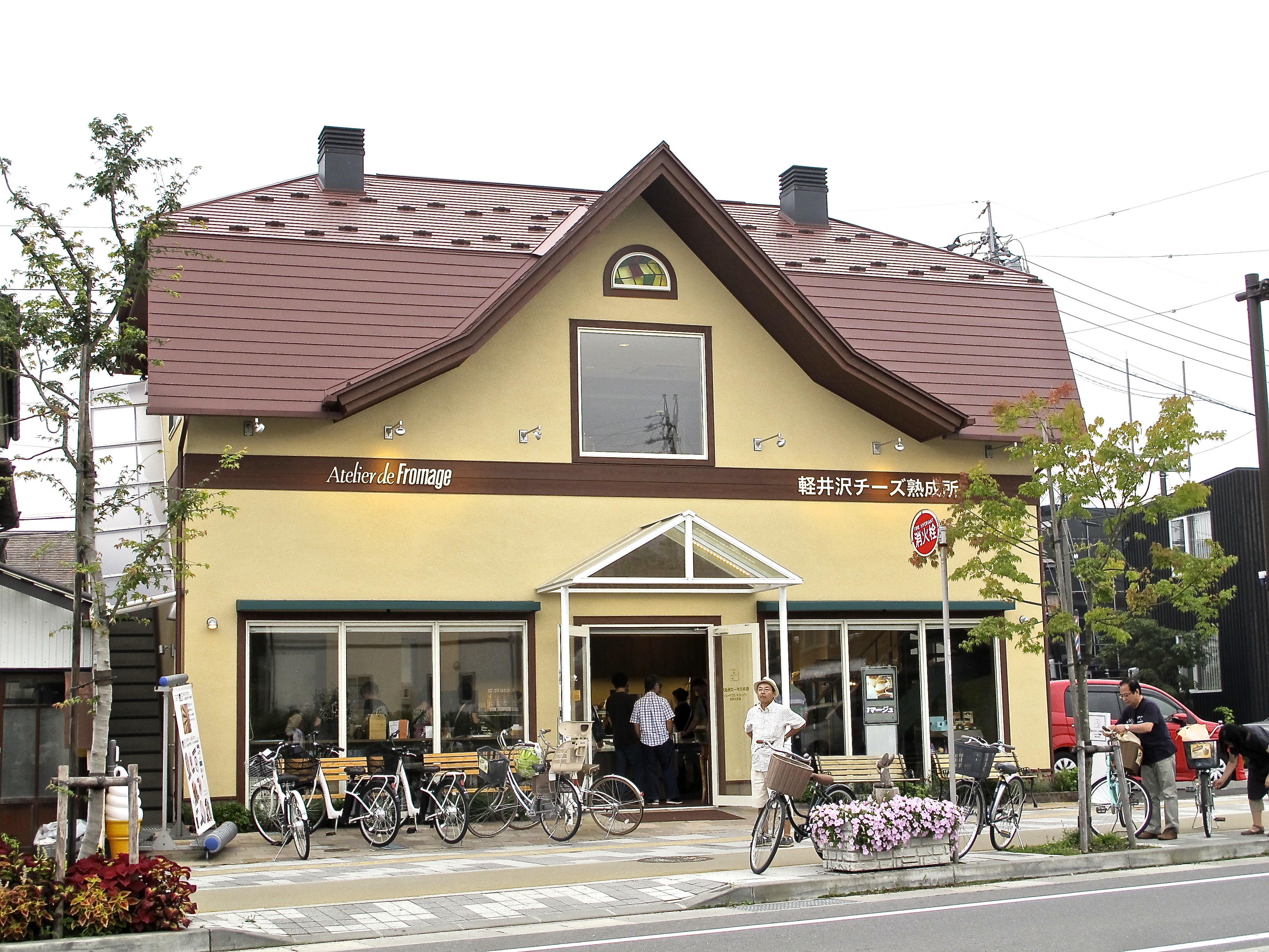 The Domestic Sausage Restaurant. Just over the road was the busy ‘Atelier de Fromage’. A cheese shop! In Japan! A cheese shop posing as French, in Japan!
Then I noticed the cars, predominantly Mercs but with a smattering of BMWs and Audis thrown in. We were sitting having coffee (quite nice, 6 bucks a throw) next to a young woman who had half a dozen huge shopping bags from fashion houses. The men were wearing Lacoste and Paul Smith, and they were bigger as though they had been eating cheese and playing golf on a golf course rather than a driving range.
Where on earth had we come to? Lorne coupled with Portsea via steroids with a man at the door keeping the riff-raff out. And here we were — two smelly tramps. Well … perhaps speaking for myself here …
I started laughing about then and thinking how much I needed to visit The Domestic Sausage.  Program somewhere below.
I should have read on in the notes. John Lennon and Yoko Ono came here every summer from 1977 until he died.
We wandered down the Romantic Highway and, yes that’s the name of the main street, veering right at the appropriate corner, and kazang, we’re in Chapel St and Toorak Road on a busy day.
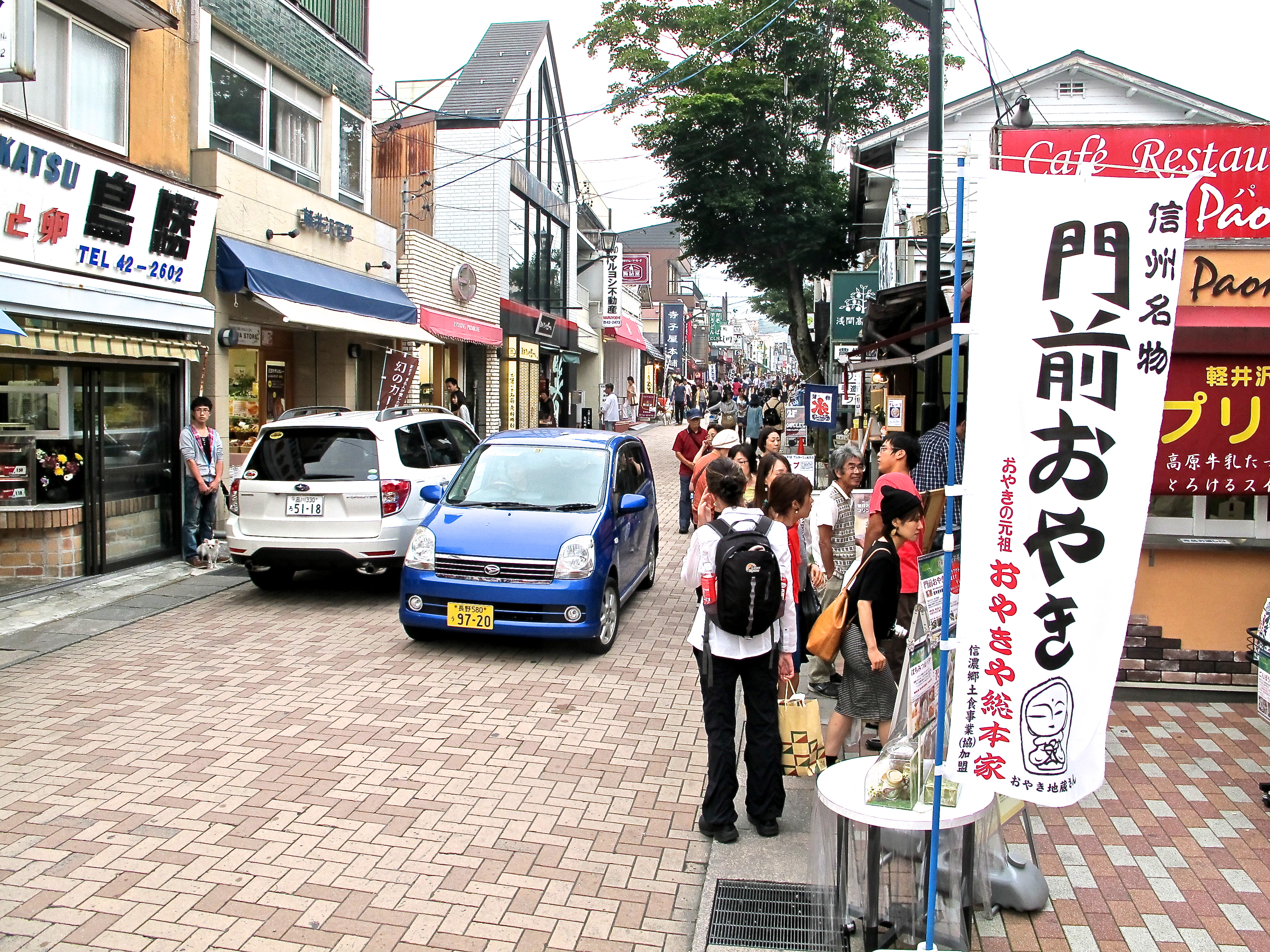
To remind you, this IS the Nakasendo Way.
Turkish rugs, art deco lights, water features, Italian gelato, rare prints, a shopping centre called ‘Church Street’, a contemporary art gallery, bridal shop bridal shop bridal shop, historic artefacts, brocade. Whatever else you need to fill up your house if it’s already full. I couldn’t believe it. After the scrupulous clarity and refinement of Narai, this! Money! Fat grumpy kids, big dads, X-ray mums, girls who probably said ‘OMG’ a lot and looked each other up and down before speaking.

 We found where they lived the next day (and where they go to church), but laughing away to ourselves, we walked the rest of the way to our ryokan thus giving us a two kilometre start towards our destination tomorrow (home really), which provided blowfish for dinner, which had a washing machine, and by a country mile the most comfortable futon I have ever slept on. And a big TV with channels in English (I watched Madmen), and muesli and pancakes for breakfast — of course — and, oh I could go on. Kuruizawa had emphatically crept into the window here and set up house.
No hard core ryokan this one.
Kuruizawa to Narita
Fifth day, and a day of great interest.
 The morning was foggy and damp as we climbed up through the forest to the pass, named again inventively ‘Toge’, the dividing point between Gunma and Nagano Prefectures.
We had been following this family all morning. I chatted away with the dad. He had spent quite some time working in California in the fresh fruit business, a line he was pursuing here.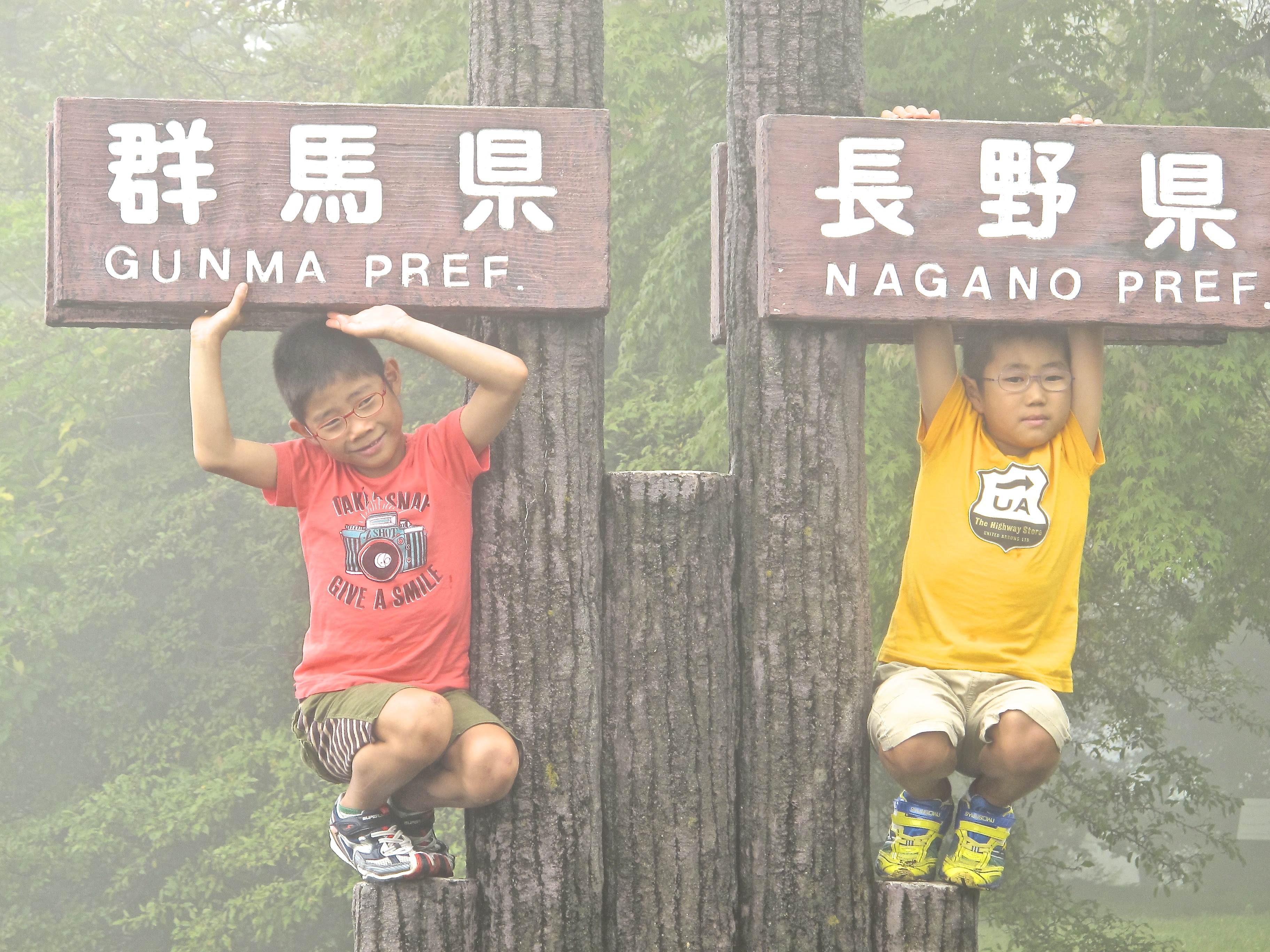
There was a choice of path at the top of the pass or really a couple of hundred metres along where you might not expect it to be. The dirt road, the intuitive choice, went on veering right, but the track notes said keep left. 52 pages and all that can be managed is ‘keep left’. We’re nervous at this crucial moment.
With four elderly Japanese walkers we discussed what this meant. There was a goat track off to the left not much more than a footprint wide. That couldn’t be the Nakasendo could it? I said yes and off we went with Myrna casually despairing. But after about 12 minutes (we’d allowed 10) we hit a stream that we had to cross, and there it was in the track notes. So we plunged on.
This was another sort of walking experience. The most remote part of the track it is claimed. Bears a certainty.
That said, it was nothing like the western end of the Larapinta trail or the Wonnangatta Valley or south-west Tassie or for that matter the Great Sandy desert where you can go a hundred kilometres and the likelihood of encountering anyone is so close to zero it doesn’t matter. In fact to see anyone on most of our Australian walks is a rarity, but there were a few hours here where we couldn’t hear traffic and when we were walking through deep dark woods.
For a third of this section of the walk you are following the top of a complex ridge line and that’s the meat of it really. You are rarely head out of the forest — nothing to see here, just the tangled and often unlikely forms of the forest. If this blog wasn’t so long I would include a photo here of a 50 metre tree growing almost horizontally across a gully. There were fine topographical opportunities for banditry, for example, the track narrowing to two or three metres with large cliff falls either side. The occasional outcrops of rock would hide the mountain bandits, the sanzoku.
All of which made the following encounter more surprising.
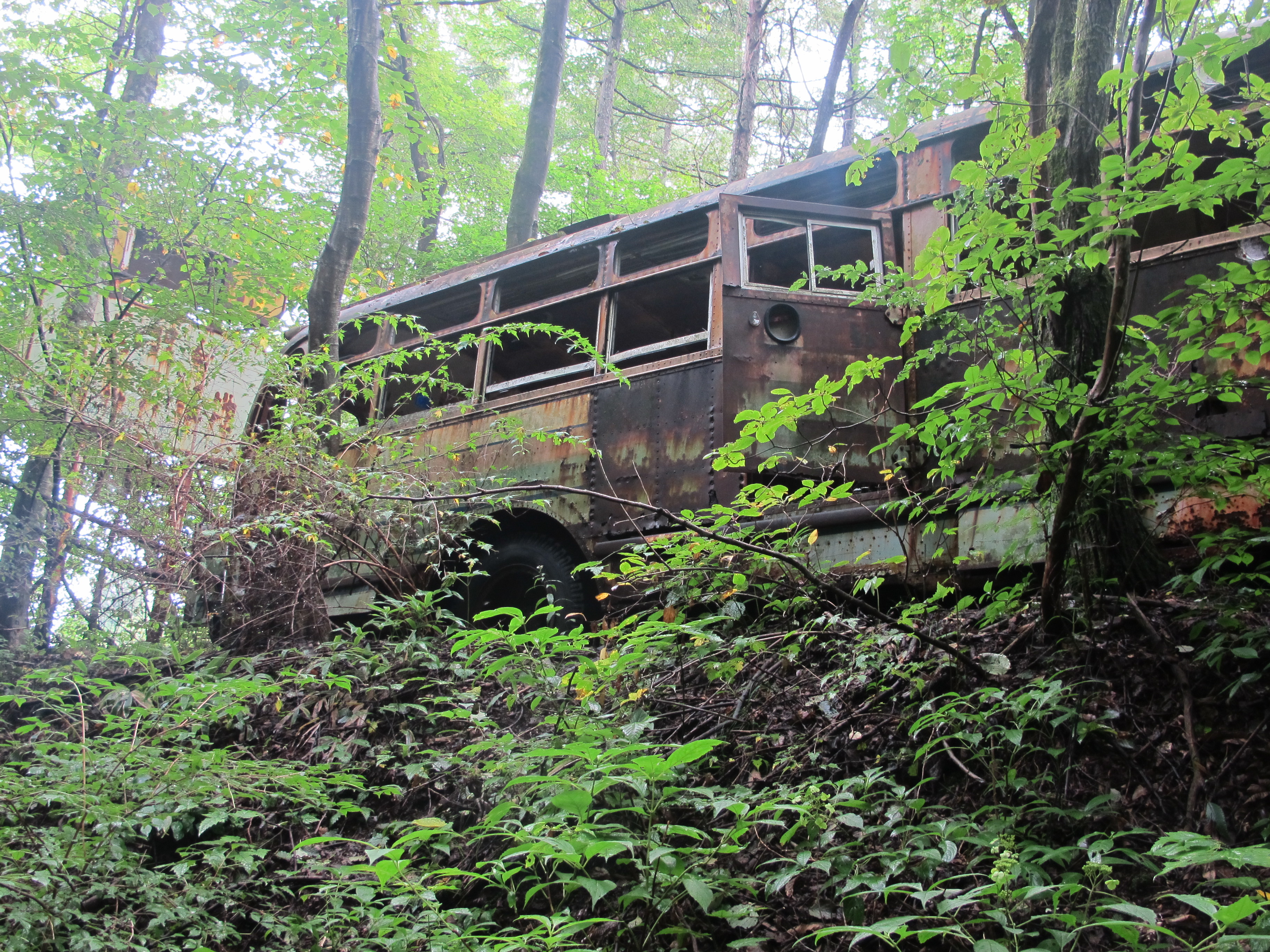
Yep. It’s a bus. Abandoned. Next to a school. Not too small, maybe five classrooms. Abandoned. Near three small houses and a tea house right on the route. Abandoned. It was quite eerie, as un-Japanese as the cheese shops of Kuruizawa. We stopped for lunch shortly after but were driven down hill by the mosquitoes and — new thing, but how correct in context — leeches. So we stood on the side of the road disrobing and picking them off much to the interest of passing motorists.
[I can’t write much more or the blog shell will explode and refuse to save. There was more. For an idea of how the ridge walk looked try this, number 13 of ’13 Beautiful Things’.]
Almost immediately we found ourselves in a long unused railway tunnel with a couple of km of lovely flat straight ex-track with startling volcanic crags above us to bring us to one version of the end, the Yokokawa Station. We found ourselves in the middle of a walking club, members of which were delighted by our participation generating approx. 80 high-5s and hand shakes.
But it was over, and early. We got our local to Takasaki an hour and a half ahead of schedule, and three train rides and a half hour bus ride later we were standing at the smorgasbord at the Narita Radisson watching, courtesy of the hotel’s smorgasbord, slightly shocking and faintly disgusting feats of consumption.
The end. It’s a very fine walk.
TO READ ABOUT TEN DAYS OF WONDERFUL WALKING ON SHIKOKU’S PILGRIM’S TRAIL CLICK RIGHT HERE.
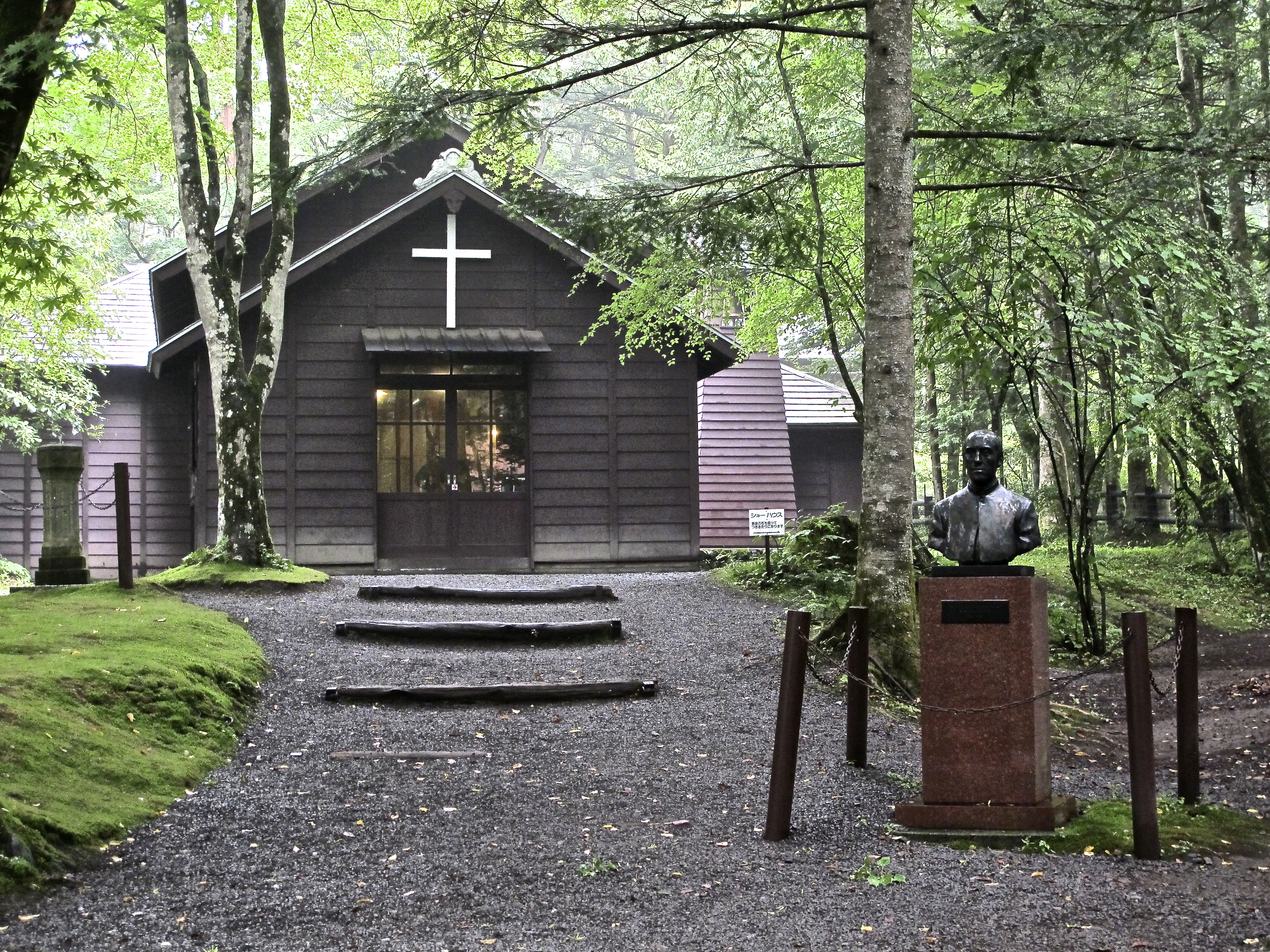
The Yokokawa sekisho (check point).


What a great walk and a great tale! Well told!
Pingback: 13 Beautiful Things (#10) | mcraeblog
Pingback: Food (#7) | mcraeblog
Pingback: Two walks (#8) | mcraeblog
so lovely to read you blog, its like re-living it! did the naksendo in October 🙂
Pingback: #1 Finding the Entrance | mcraeblog
Really interesting and great photos. I hope to walk Tsumago to Nojiri without track notes, in April this year. Do you think I will get lost?
Hi Fran. Thanks for your kind comments. Track notes … probably not. But I wouldn’t go without a map I could read and a keen nose for directions. As with most walks once you get going you’re fine and will be until you meet a choice that must be made. From memory there are three or so of these on this track where some additional support might be valuable. Good luck and have a great walk.
Pingback: Blog 99 | mcraeblog