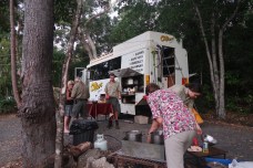
One of our guide Meakan’s great photos. This is another one.

The blue-winged kookaburra, a northern variety. Every morning they would wake me at dawn or just a little before with their throaty cries that try so hard but never actually emerge into a laugh. Happy sure, but not riotously so.
That night in Cooktown I had been woken by what I thought was the dimp dimp dimp of a mobile phone alarm. Dimp dimp dimp dimp dimp. It went on and on till I decided to take action and go and stir up the owner. I knew just who it would be and I was going to provide her with a piece of my mind. But it wasn’t coming from a tent. It was coming from the bush, a bird. It didn’t stop, not immediately anyway, but somehow that made it okay, the beginning of a very good day.
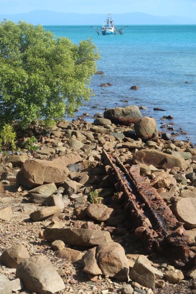
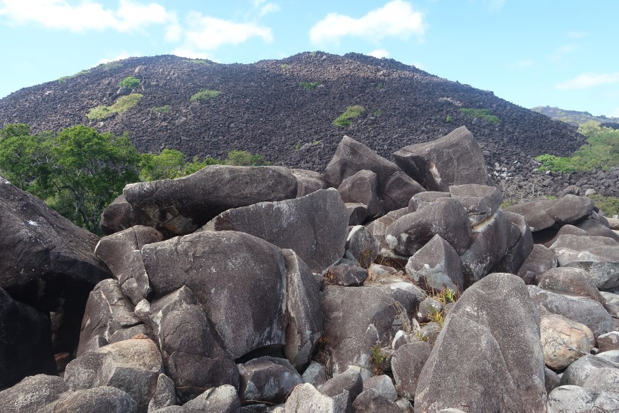 Black Mountain, 20 km out of Cooktown, a huge tumble of unusual granite boulders, and one of our party did take a tumble, grazes and blood everywhere, but he remained otherwise unscathed.
I was looking forward to seeing the (Aboriginal) Quinkin rock art at Split Rock. It was a pleasant short walk off the track.

 People who read books to children might recognise the source of Percy Trezise and Dick Roughsey’s Quinkin series with the wicked Imjim, the generous and helpful Timara and Turramulli the giant Quinkin. Reportedly there are better preserved paintings in the ranges nearby but the ones we saw were at least a taster. It’s a bit hard to see but that’s an Imjim on the right below for sure. The tail is the giveaway.
We are some distance from rain forest here. For a start we were travelling through lake land.
 It didn’t look wet (this is a filched photo), but sometimes it is — very wet. With only about 2.7 percent of Australia’s land area Cape York produces more run-off than all of Australia south of the Tropic of Capricorn, which is to say 65 percent of the country.
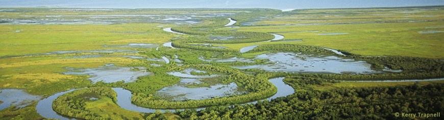
 It is also an area remarkable for its wild rivers. Nowhere in the world is there such a concentration of these rapidly disappearing natural features. The Normanby, Hann, Kennedy and Morehead systems, for example, drain into Princess Charlotte Bay, the large bite taken out of the eastern coast (and an important habitat for dugong, at left). The Jardine further north is the largest perennial river in Queensland.

There are more than 120 riverine lagoons in the Rinyurri/ Lakefield National Park. In the wet they are absorbed into waterways. In the dry the water and the wildlife depending on it become concentrated in particular locations. So you get these remarkable aggregations of bird life like the magpie geese above and the black swans below. Hundreds of bird species. Freshwater crocodiles enjoy feeding on them.
We came to Lakeland Downs, an oddity, quite a lot of land under cultivation in the middle of nowhere. I didn’t take any photos and no one else seems to have either. A further oddity is that Clyde Foyster, sand mining tycoon who cleared 8000ha. of bush here in the 1960s and put in bores for year round water supply, called his ambitious spread Lakeland — not after the lake land, but after William Lakeland, a gold prospector.
It went bad — problems with supplies, failure to take into account the poor quality of the soils, unforeseen pests and diseases — and he sold it in 1974 to someone else who wanted to have go. What was there when we were there? Maize, sorghum, might have been some bananas, other types of fruit and perhaps some sandalwood, a long term proposition, a few other bits and pieces — but enough to support a town of 200.
We went through tiny Laura (popu. 80) — famous, but mainly for being ‘the end of the line’ — and on past Old Laura homestead. Derelict, but with its Queenslander shape intact.  This is downstairs of one in better nick in Coen, Coen’s museum in fact. Spare.
 A few hours drive away, what’s left of Breeza homestead.
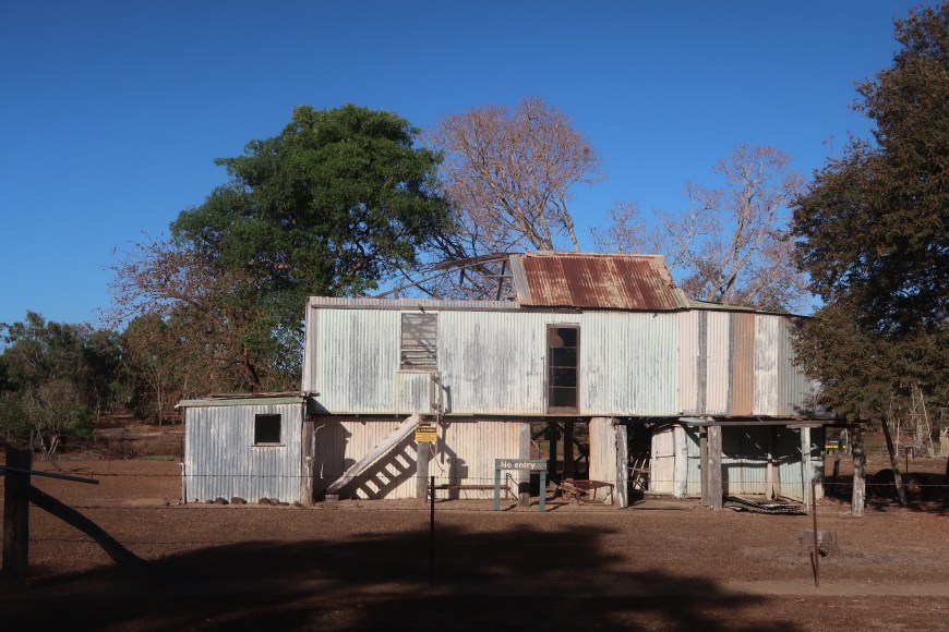
These buildings are up off the ground for purposes of air circulation, to provide some cool shade in the understorey but also, I read, because the insect layer here stops about 1.5m off the ground. There would be enough to annoy you here without insect infestation as well.
I asked the truck to stop so I could take the photo of Breeza. I like the sculptural mass of these old buildings and the patina and colours of the weathering. They belong in the landscape in a way which I’m sure was never consciously intended. And they’re important memorials — and rare. Rare to the point of being tourist landmarks. Just left, they murmur and croak about hard times and struggle, remnants of something tried that hasn’t worked — not just here anyway — isolated versions of one line of history for which in this part of the world there is not much evidence. People have lived and worked here. Whitefellas. Blackfellas adapted rather better … and left far fewer traces.

What we were doing was driving through the tropical savannah which covers northern Australia, a quarter of the country. Open enough to allow grasses and scrub to grow. Monsoonal enough to keep things alive; also monsoonal enough to leach the shallow soils each year. And red. An ideal climate and environment for the oxidisation of iron which attaches to clay particles. We were driving through rust. (Below, vivid in the late light at Archer River.)
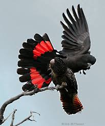
 Kalpowar Crossing in Rinyirri National Park was one of my favourite camping spots.
One of the reasons was that we arrived at the same time as a huge flock of red-tailed black cockatoos. I had no idea that there could be so many in a single flock. They wheeled and swooped and turned and wheeled again. They were simply magnificent.
Another was that we were five days away from phone reception and five days away from the nearest grog shop. Although the latter had been attended to with enormous care. (‘How many have you got left in the Eskie? Four?’ ‘Nah six. … Seven! And I’ve got another two slabs in the truck.’)

A third was that the Normanby River flows next to the camp site. Flowing water (with a crocodile warning sign), and surprise — fossils. And — call that a guide! THIS is a guide. Meet Rick, the Old Hand, who was showing Meakan and Hayden the ropes.
I don’t know the name of what we were looking at, but it was a good one.
And we came to the Nifold Plain.
One of the interesting things about the Nifold Plain is that I can’t find anything about it. It’s not in the books; it’s not in Wikipedia; in fact it’s scarcely on the internet. But after ten or twelve hours of savannah, it was striking.
 A naturalist would exclaim over the diversity of environments in Cape York. Myself, less so. I am inclined to go to sleep when in motion and a passenger. After 40 minutes in the truck I’d jolt awake and seem to be looking at exactly the same thing I’d been looking at when I nodded off. But this was different. A bit of a thrill.
These structures generated a hot fizz of local interest in the ant world.
Ants, mate. Extraordinary. Did you know that some species farm aphids, eating the honeydew the aphids release from the ends of their alimentary canals? They milk the aphids by stroking them with their antennae, a process you can watch right here.
Some species build rafts and bridges, sometimes out of the dead bodies of their colleagues. Some Cape York ants propagate plants which they then use as their homes. The epiphytic host plants secrete a chemical which allows the ants to determine just where to drop the seeds which they have collected. Then, for purposes of fertilisation, the ants poop on the seed.
Others farm fungi having domesticated it to their purposes 65 million years ago. Attine ants cultivate species of fungi that don’t produce spores, which means they can’t spread their own seed.
They started this farming in the rainforest, but domestication happened in drier climates like deserts or savannahs. In these climes, the fungi grew best inside the comparatively moist underground colonies that their ant overlords created. Over time, this turned into an inability to grow outside of the nest, because they were genetically incapable of doing so. And similarly, the ants lost the ability to make a key amino acid, asparagine, which the fungus provides them. And voila: mutual dependence.
But I hear some shrieking in the background.
Yes these are ‘magnetic’ mounds, but they are not anthills. They are termite mounds. And termites are not even in the same biological classification Order as ants. Ants have antennae with elbows, waists and pointy noses, and they can see. Termites don’t, and can’t.
Termite mounds house a colony and provide protection for the colony to breed, care for the young and store food. Individual termites are not all the same, but belong to different castes that have different roles. These castes include the winged ‘reproductives’ that are males and females capable of breeding; and sterile males and females that are divided into ‘soldiers’ and ‘workers’. Reproductives that successfully mate are the founders of new colonies and become the king and queen. Usually there is only one queen in a colony, but Amitermes laurensis (named after Laura Station in Cape York) may have many queens in each mound.
 ‘Magnetic’ mounds are tall, thin and wedge-shaped with the longer axis oriented directly north-south. The one at left is a dramatic and fairly rare example of what all of these mounds are like. In the morning the sun shines full on their eastern face. At this stage the western face is not only in shade, but also insulated from the hot eastern face by the thick, solid core of the nest.
There can be up to 8°C difference in temperature between the two surfaces. In the afternoon the reverse happens and the western face becomes much hotter than the eastern. At midday, the hottest part of the day when no shade is cast, only the thin upper edge of the mound is presented to the sun so minimum heat is absorbed. We know that the termites shift from one side to the other away from the heat.
So ‘solar’ mounds perhaps rather than ‘magnetic’ mounds. Either way, remarkable.
We got back on the main road north (‘The Peninsula Developmental Road’) at Musgrave. Musgrave was the headquarters for building the telegraph line which allowed direct communication from Laura (and therefore Brisbane) to Thursday Island. To deal with the climate, the poles were galvanised iron affairs freighted from England (still in good shape today!) and galvanised wire weighing 120kgs per kilometre. It took two years (from 1883) just to survey and clear a route. It opened in 1887 but required constant maintenance, not least because the local Aboriginal people found they could smash the ceramic insulators to make excellent cutting tools.
This is the Telegraph Station today, still with its wooden shutters to keep out spears, its corner gun turrets from which to shoot at intruders, stairs and water tanks built in the interior of its hollow square kept safe out of the way of marauders. This was the provision for life in the whitefellas’ wilderness.
‘Maybe less interesting’, I wrote in my journal, ‘for its past rather than its very active present. Christ, there’s lot of traffic here.’ Plenty of grey nomads certainly, but heaps and heaps of trucks, on their way to Weipa and back mainly, but elsewhere as well. Today this is how supplies get to where they are supposed to go. Still a dirt road, and just the one, but with a lot of work happening on it.

At left a Land Cruiser at Archer River where we spent a night. A victim of The Wet: trying to cross a creek, swept off into the main flow, pulled out some time later.
 If you want to follow the Old Telegraph Track directly you can. It contains 13 river crossings, one of which is Gunshot Creek which hardy souls wanting to test their 4WD driving skills look forward to. You enter here.
We didn’t go that way. We went off to Portland Roads, Chili Beach and Lockhart River.
 And here’s the thing. One thing anyway. Across this vast expanse — we drove 2069 km over 11 days, one way, Cairns to The Tip, coming home on the ‘barge’ — even if you have a very well equipped 4WD the places you can go are well-defined and limited. You don’t go wandering; you stick to the track and, if you have an expansive tour like ours, you will go to a version of Everywhere.
And if you start casting through the horde of images on the net, you will find they are pretty much of the same things, down to the angle of the photo. At right a case in point, with me bullying Hayden to be a witness figure for a bit of derelict machinery at Wenlock River goldmine. You’ll have no trouble finding a hundred or so pics of the same bit of rusted junk/ important historical artefact. This suggests that in Cape York Every traveller goes Everywhere, and that Everywhere has surprisingly limited features and dimensions.
It requires a certain type of patience that applies right through the outback. I have no doubt the people who live in places like this are deeply affected by their environments: a different attitude to time for example, horizons at once endless and at the same time very narrow. Conversation might mean something different, and there will be, is, endless disdain for the opinions and attitudes of itinerant visitors and other outsiders.
A version of this also applies to people who travel these tracks for pleasure. Their most important destination is nowhere, somewhere no one has ever been before. Very hard to get there of course.
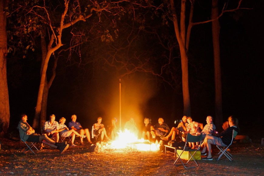
But there is a seduction in the stillness in the early evenings — which close in very fast here, we’re in the low latitudes — perhaps with the crackle of a fire, the ziiiip of another Goldie opened, a quiet, and unsophisticated, joke. You don’t think about this country and its history. You feel it. And if you talk about it, scrubbing at its surface, you tell stories of where you’ve been — and where you’re going next. Gear. Roads. Camps. Equipment. Roads. Camps. Gear. Even if you’re not asleep, you’re certainly in bed by 8.30. The Eskie needs to be sorted out before 6 the next morning to get the full benefit of the chill at 4.00.
 So … Portland Roads, Chili Beach and Lockhart River.
 Portland Roads was a big surprise. (Named by Cook: ‘Portland’ for the Duke of Portland, ‘roads’ meaning somewhere safe for ships to lay up.)
During the last World War there were, we were told, 7000 American soldiers, tucked off the sides of the road between Lockhart and Portland Roads. Portland Roads was the port for supplies to the Iron Range airfield near Lockhart River, also built by the US Army.
There are remnants of this time: rusted tracks, sleepers, wooden pilings where the wharf would have been.
But today Portland Roads looks like a very very small and quite beautiful seaside resort. There’s a public phone, a cafe, some shacks, accommodation for rent. It did seem like we might have discovered nowhere.

 That was what Edmund Kennedy found. There is a plaque here that almost tells his story.
Edmund Besley Court Kennedy J.P. on 13 November 1848 while exploring in Cape York Peninsula left Carron, Wall, Douglas, Niblet, Taylor, Carpenter, Goddard, and Mitchell near the mouth of Pascoe River [just north of Portland Roads] and sought succour at Cape York. En route he was fatally speared and 3 men died. Aborigine Jackey-Jackey sole survivor of advance party reached waiting ship ‘Ariel’ which rescued survivors Carron and Goddard at Weymouth Bay on 30 December.
Kennedy himself seems to have been a decent and capable man, somewhat unlucky in his adventures. He made two expeditions into the interior of NSW and Queensland looking for the ‘big river’ that must flow into the Gulf of Carpentaria, in both cases finding he had to turn south-west to follow Cooper’s Creek and the Barcoo. Monster if failed efforts, both of them.
Some indication of just how difficult the Cape York expedition was can be gleaned from the fact that after nine weeks they had travelled 60km from the coast and just 20km north of their landing point. They had sheep (sheep!) and carts which were abandoned almost immediately in mangrove swamps and bogs. ‘The storeman was found to have stolen food from the supplies. He was demoted to labourer’. That would have sorted that out.
 North of the Pascoe River, seven months in, Costigan, one of the four remaining in the advance party, accidentally shot himself. Luff (‘Luft’ in one memorium) and Dunn were left to look after him and, despite searches of the area not long after, no trace of them was ever found. Having crossed the appallingly difficult bogs of the Wet Desert, Kennedy was just 30km from Cape York when he was speared in an attack that is described as ‘not to have been directly provoked’. (As illustrated by an anonymous contemporary, at right.) Jackey-Jackey buried his body, but it was gone when he led the rescue party from the ‘Ariel’ back to the site. In all, ten of the group of 13 died.
The memorial in Sydney’s St James Church suggests that Kennedy fell, sacrificially ‘in the 31st year of his [life — so young all these ‘explorers’] to the cause of science, the advancement of the colony and the interest of humanity. Flebile principium melior fortuna sequatur’ (‘An unhappy beginning followed by better fortune’. More accurately: In optimam partem ab initio infelix secuta est finis. ‘An optimistic beginning followed by a shocker.’)
After the colonial government honoured his remarkable efforts with a silver breastplate and an honorarium of £50, neither of which he ever took up, Jackey-Jackey died aged 21 after falling into a camp fire, reportedly drunk. He wasn’t from the Cape. He grew up in what we now call the Hunter Valley in NSW, a Wonnarua man, and hence he would have been almost as much foreigner here as Kennedy, but much better at living off the country.
His name was actually Galmahra/ Galmarra. But the term (spelt more usually) ‘Jacky-Jacky’ entered the language, and as Shane Maloney writes: ‘For whites it was a generic dismissive, denying blacks their individuality and hence their dignity. To blacks it meant a collaborator, the subservient native complicit in his own people’s dispossession.’
 ‘Unmissable’ Chili Beach looked like a tropical beach should: bright white sand, palm trees, along a long curved beach.
However at the shore line was a thick rope of coral spawn drying in the sun producing an extraordinarily pungent smell that sent me back to the truck.
Notable also was the amount of rubbish left by the ‘independent campers’. At most of the places you might want to stop in the Cape, river crossings, truck bays, lookouts, were empty cans, grocery packaging, nappies, smokes packets — the things self-contained, independent travellers have to leave behind I guess. At Coen, huge trailer loads of rubbish arrived when we were there. Someone had been cleaning up.
I must say that wasn’t true of the campsites — near here Cooks Hut in the middle of dense rain forest — that we used.
Lockhart River. I went there first years ago and arrived in the middle of a party that seemed to involve the whole town. One of the guys told me it was the Rasta capital of Australia and he had a red yellow and green rastacap and a cigar-sized spliff (he would want me to say) to prove it.
We were staying in the visitors’ quarters and the early part of the night was punctuated by noise associated with moving drunks into the lockup over the road to sober up. But about 3.00 I was awakened by what I thought was heavy rain. It turned out to be 20 or 30 ‘leather’ (furless) dogs running down the lino in the corridor before turning left through our room, out the window and onto the veranda.
From this later brief visit Lockhart seemed no longer the wild west town it had been then. The new school building looked schmick, and we paid a visit to the art centre home of the Lockhart River Art Gang. At the time some of its members and its manager Enoch Perazim (a very slick operator from Papua New Guinea) were preparing for a major exhibition in Houston and other American cities. Amazing. This tiny isolated speck with its 20 artists is a player in world art.
 Cheryl Accoom is one of them. She’s 25 now, but at 17 had already exhibited internationally. “I was born in Cairns and I grew up in Lockhart with my Nana, I went to school in Lockhart, my great Grandmother was a painter at the centre and she told me to come and paint at the arts centre. So first I came as a cleaning lady, but I started painting here and I liked it. My paintings are about colours and how those colours say what I am feeling. I would like to keep painting. I feel happy when people buy my paintings.” A most merciful relief from more carefully tutored artspeak.
Art Gang art is distinguished by the brilliance of its colours as well as its local reference.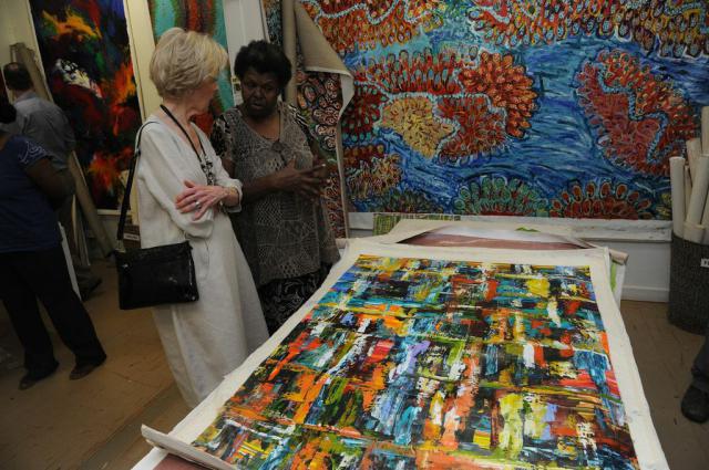 It’s an Irene Namok lying down, with Josiah Omeenyo on the wall. It will cost you a five-figure sum to buy either.
 Art lover trying, and failing, to leave the Lockhart River art gallery at the appropriate departure time.

 Cape York is an important destination for serious birders. On the Lockhart Road we saw a female Eclectus Parrot. Just. It’s the red dot, and a big deal. I’m not sure just how the spotters came to spot this one, at left, about 60-80 metres away — beyond the clear comprehension of my telephoto lens anyway — mostly staying at home in its hole. Much prized in New Guinea for their colourful feathers, females look like the photo on the right. Males are a brilliant green.
 Then from one side of the Cape — it’s narrowing — to the other. Weipa.
This beach is bauxite. If you mash up that gravel into powder and heat it to 200°C in a pressurised solution of sodium hydroxide, remove the waste and heat the resultant crystals in a rotary kiln at 1000°C you’ll have aluminium oxide. But if you want to build a plane, there are more steps and a great deal of electricity involved.
Getting hold of bauxite here is not, in mining terms, onerous. You scrape off the overburden, often just a metre or two, if that, then dig and cart the next few metres and send it off in a ship. It’s as simple, and difficult, as that. Then you put the overburden back and say, Wow! Good as new. But as Rick the Old Hand says, what in the meantime has happened, just for example, to the water table? That mining process will happen across several thousand square kilometres near here.
Weipa, at present, is a flourishing regional centre, by far the biggest town in the Cape. We did washing, internet, grog purchase and mooching around here with the sounds of a rodeo, which I would love to have gone to, as well as gun shots providing a soundtrack to the night. We did go on a first class ‘ecological’ boat tour; birds and creatures in the open air with a cool breeze. It wouldn’t be a blog about FNQ without a croc pic. I’m not sure why crocs get people so excited. This one was just waking up for the season. Moving but sedentary. There were dozens of birds in near proximity fishing and preening without anxiety.
It was an issue. Here we were at a great beach or river, it’s 35°C, and we can’t swim. Crocs! Somewhere. Possibly. Invisible. But … you know … risk management. Fruit Bat Falls was one place we could swim. Given to evaluative reactivity, Myrna thought it was the best ever. It might have been the relief, and she may well have forgotten those fabulous gorges in the Kimberley, but it was a delight.
Moreton Telegraph Station, with Emma who had recently arrived from Cambridge in the currently Disunited Kingdom. This is a cafe/ shop/ rest area/ ex-Telegraph Station, and the bits and pieces tend to describe it and its function quite well. A couple of pies of uncertain age in the pie warmer, a serious effort to make good plunger coffee. The odd relics pinned to the walls, insulators plonked on the bench. The T-shirts for sale. There would be some dusty postcards on the back wall with the jokes about women/ wives/ blonds nearby. Did I mention this was hard country?
Emma hadn’t been to the Tip yet. It would be a full day there and back. But she had plans. What did she make of it so far? ‘Most amazing experience ever. People are so friendly.’
 In a highly competitive field the five or ten km before the Jardine River won the prize for Absolute Worst Corrugations Ever. They were so bad they almost stopped the truck. Other people had veered off the road and set up their own hoon tracks which had become just as bad. They were ferocious, but we eventually got to the crossing. Our truck is the second vehicle in this picture. Ferry crossing: $110. With trailer: $145. There’s a lot of fuss about this.
I have mentioned that the Jardine carries the most water year round of any river in Queensland. Last year it rose so high in the wet that the ferry which at the time was cable-anchored to a series of trees some distance up on the bank behind where I’m standing, came adrift and began the journey downstream. The climate/ weather here has an impact on EVERYTHING.
We looked at crashed plane bodies and old bits of mining machinery and various evidence of World War II and a derelict communications tower. I think I took this snap at Injinoo Beach. Maybe it was Roonga Pt. Maybe I was a bit off the air. BUT you could run the country with these two.
Meakan and Hayden, on this trip apprentice guides/ hosts/ cooks; on the next trip fully-fledged guides etc. The souls of amiability and courtesy, they were reason enough to go on the tour. Hayden was a driver, mechanic, had been a butcher, knew his way around most mechanical and electrical things, nature enthusiast, charming, fit, delightful. Meakan, dirt bike rider, photographer, with a spectacular singing voice, had been a nurse, was a cook, charming, fit, delightful — the very flower of Australian youth, bless them.
 We had set up camp for several nights at Seisia Beach, Bamaga’s port. This was the evening view from the beach with the islands of the Torres Straits stretching out well past the horizon. We’d got to the far far north. The Tip was 38km away, and I wasn’t sorry. It had been very good, but somewhat ironically I was enthusiastic about getting out of confined spaces.

 We went to Thursday Island which deserves it’s own story. And we went to Somerset which does too, but you’re less likely to come across it.
(On this inferior map, Somerset as a whole is the red area. Somerset settlement was in the bay off the passage on the north-eastern tip. Albany Island off the coast. The Tip itself is the northernmost point. Prince of Wales and Horn Islands off to the north-west.)
* * * * *
In the previous blog I mentioned the Jardine boys ‘shooting their way from Bowen to the Cape’. Well, they kept right on shootin’ …
 John Jardine left his home in Scotland in May 1839 funding his move to Australia by selling his Captain’s commission in the Dragoons. He tried farming near Wellington in NSW but failed and got a government job, Commissioner for Crown Lands. Ten years later he was retrenched leaving him with ten dependents and no occupation.
He moved to Queensland and in 1861 was appointed as Rockhampton’s Police Magistrate and Gold Commissioner. When the new settlement of Somerset was established near the tip of Cape York in 1863, he became Police Magistrate and with his third son, John, erected the first buildings there.
 But the story is really about his eldest son, Francis Lascelles Jardine, the legendary Frank.
His obituary in the chief newspaper of the time described him, on its front page, as ‘A wonderful and truly remarkable man, an amazing specimen of strong and vigorous manhood … who truly blazed the trail.’ He was also known by at least some of the area’s original inhabitants, the traditional owners as we now would say, as Debil Debil Jardine.
 This is his grave at Somerset Beach. It is both small and square. Frank was buried upright. This could be because ‘he bowed his head to no man’, or because it was the only way to deal with the corpse of such a dangerous man.
When his father was posted to Somerset, it was typical of the family, Frank especially, to look for an angle to turn a profit. Beef cattle seemed a good bet at the time. The increasing number of passing ships needed reprovisioning; the ‘hungry Dutchmen’ of Batavia might be persuaded to trade. So for several peppercorns the family purchased land surrounding the planned settlement. Frank and his brother Alexander decided to overland 42 horses and 250 cattle from Bowen to Cape York, around 2000km through country mostly unexplored by Europeans, accompanied by four whites including a government surveyor, and four Aboriginals.
 They left 14 May 1864 and arrived at Somerset ten months later with, according to various accounts, 25 horses and 200 cattle, 15 horses and 120 cattle, or 12 horses and 50 cattle — and according to all accounts in tatters, starving, living off bush turkey eggs, wearing ‘emu feather caps’ to ward off the rain, and were led to their final destination over the last two days by a group of Cape York natives who had been sent out to find them. ‘Alicko, Franko, Jocko, tobacco,’ their finders famously greeted them. (‘natives’: Torres Strait Islanders and Aboriginal people, very distinct racial groups as a rule, intermingle to some degree at the top of the Cape.)
They had crossed 12 major rivers including what was later named the Jardine. Five months in, they lost more than half of their food supplies (‘520 lbs of flour, all the tea, all the jam apples and currants’ among other things) and a lot of their ammunition in a grass fire (possibly lit by local Aboriginals). They had watched stock go mad and die from drinking salt water. Along with dozens of other completely improbable adventures, perhaps hysterically, and not in the ‘funny’ sense, they had chased Aborigines disguised as trees — running — for two miles. They had crossed what Frank designated the ‘Wet Desert’: vine, scrub, bog, mangroves.
 Their stock had wandered off. Endlessly. There had been bitter arguments about where they were between the Jardines and Richardson the surveyor who seems to have decided as a result to be silent for most of the journey.
They had not factored in The Wet, and on Christmas Day 1864 it began raining and didn’t stop from Camp 67 to Camp 91. Violent tropical rain, not Scotch mist or the titatattatat of the English Downs, but the sort of rain that leaves you wet to the skin through four layers of clothing in half a minute. No celestial navigation was possible of course.
In a typical story, the advance party of Frank, Alick and Eula spent three days covered in a thick layer of beef fat against the cold and the mosquitoes waiting to find a way across flooded Cowal Creek.
It would have been thoroughly revolting.
For their efforts the white members of the party were lauded to the skies. Frank and Alick were elected fellows of the Royal Geographical Society and provided with a major grant. The Queensland government offered to reimburse elements of the cost of the expedition but Frank turned it down because the venture’s purposes were for private profit, evidence regularly cited of his integrity (‘a delicacy and nobility of sentiment as rare, unfortunately, as it is admirable’). In fact a year or two after when things had turned down his father sought reinstatement of the offer.
The Australian Dictionary of Biography, a generally sober affair, suggests that ‘[the exploration party] was constantly harassed by Aboriginals’. Today that might be considered an odd perspective. ‘They fought their way through the wild myalls (‘uncultivated Aboriginals’) of the north’, writes Ion Idriess in 1947.
‘Two blacks dropped, blood welling from the small holes drilled in their foreheads. Their companions, howling in superstitious awe at this demonstration of the white man’s magic broke and fled into the heavy scrub. ‘”Nice shot Alex,” Frank grunted. “Same to you”, Alex grinned and they returned to the chores of making the camp’ (from The Rifle and the Spear, Lack and Stafford, inter alia an account of this expedition published in 1968).
How many Aboriginals were killed by the Jardine party is uncertain. Frank counted his own tally at 47 and that of the party at over 200. They were certainly responsible for one of the three recorded major massacres of native Australians, all of which as it happens took place on or near our route: Palmer River, Battle Creek and Mitchell River.
The Jardine party came upon a large tribe fishing on the Mitchell River’s banks. Unsure of their situation the men swam across to the opposite bank to get their spears. Some were thrown. ‘The natives at first stood up courageously, but either by accident or through fear, despair or stupidity, they got huddled in a heap, in, and at the margin of the water, when ten carbines poured volley after volley into them from all directions, killing and wounding with every shot with very little return. … About thirty being killed.’ (Frank’s words in his journal) Sixty-nine rounds were fired, so it could well have been more.
Anyone who has written about this has not described the likely state of mind, the murderous but also absent state of mind, of someone who has been walking/riding for several months in unknown country not being entirely sure where they were going, hungry, tired, blanked out, full of strange and unaccustomed mental processes, attacked by paranoia and other fears, a gun sitting between you and death … although perhaps that’s what Patrick White’s Voss is about. This is in no sense meant to be exculpatory, but what was going on was in no sense Boys Own fun.
 What happened subsequently when Frank’s belly was full, when he had a comfortable bed to sleep in at night next to his Samoan Princess wife, Sana Sola (at left), eating off the silver dinner service he had had created from Spanish doubloons found in a coral reef nearby, when he had a pearling business with the Premier of the state as his under-the-counter partner, when he had gained complete control of the military garrison at Somerset … now that could be seen as Boys Own fun.
Frank’s father remained in his role as Commissioner until December 1865 when he returned to his old office at Rockhampton. But in 1866 Frank returned to settle on a station on the outskirts of Somerset settlement. He was appointed Police Magistrate in 1868 and remained in the area in various roles, official and private, until he died of leprosy in 1919, five decades during which there was a constant undercurrent and occasional breaking waves of violence and repression.
A documented example. The Gudang people whose land Somerset had claimed had chosen to make themselves useful to the settlement, laboring, fishing and gardening in return for concessions of food and clothing as well as protection from tribes to the south and the Badu people in the strait to their north. As a result the tribe generally had good relationships with the colonists, until one member was reported to have stolen a tomahawk. Jardine determined that a public whipping was suitable punishment. The Gudang were shocked at this and two marines were subsequently speared, one dying later. Jardine organized a reprisal party which shot and killed five Aboriginal men and a young boy, and made a proclamation that for the future no native was to come within the perimeters of the settlement on pain of death.
Frank himself personally ‘executed’ two of the four Aboriginals who had taken part in the expedition north with him for stealing weapons. There is also well-documented evidence of him shooting to kill at intruders on Albany Island across the narrow strait from the deck of his house. By all accounts he was an excellent shot.
In 1873 he was recalled Brisbane to be the subject of a government investigation, not for his treatment of the native peoples, but because of the highly suspect nature of the intertwined relationship between the government’s and his own private interests. (Inquiries are only ever held into the interests of the inquirers.) For example, he was the seller, auctioneer, sole bidder and finally owner of a government boat. The buyer fortuitously managed to get it for quite a good price. This boat became very useful to his bêche de mer harvesting interests, interests whose labour force seems to have been made up almost entirely of indentured workers in contravention of Queensland’s Kidnapping Act (1869) specifically designed to stop such ‘blackbirding’. One of Frank’s responsibilities was administration of that law. This investigation came to nothing, Frank said he didn’t; no one said he did. The principal witnesses against couldn’t afford the trip to Brisbane and no one stepped forward to help them.
These were lurid times embroidered with myth and legend as well as baffling hard facts. For example he probably did not pick up children and bash their brains out on tree trunks. It seems unlikely that he was responsible for the genocide of the original inhabitants of Prince of Wales Island — it was more likely measles. It also appears he did not a) kill or b) support Wini or Weenie, the cannibal Barbarian White Man King of Badu.
However the public record indicates that he was a frequent and vociferous proponent of ‘stern measures to contain the blacks’. He did establish a ‘fortress’ at his new holdings, ’Bertie Haugh’ (after his sons) on the Ducie River, with loopholed walls, 50 rifles and three 12 inch swivel guns. And he did provide advice that black corpses should be branded because, if they were, native people would never go near anything with that brand on again.
The Colonial Secretary provided these reasons (in 1861) for the establishment of Somerset: ‘A port of refuge; a store depot; a coal port; a control post over the Aborigines and Torres Strait islanders; a centre for geographical research, missionary enterprise and colonisation; a military defence post; a sign of the influence and prestige of Great Britain and, with highest hopes, the future Australian Singapore’.
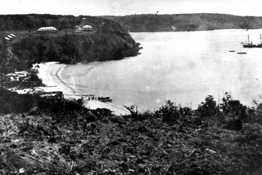 (Above, Somerset settlement (the big building is the barracks) and bay with Albany island in the background.)
Port Essington (about 200km as the crow flies from today’s Darwin in the Northern Territory) had been a disappointment. It was urgent to have a port in northern Australia, but Somerset was not a good choice. The Albany Strait from which one would enter the harbor is narrow, has difficult and strong currents and is subject to steady south-westers for much of the year making harbouring difficult. A marine barracks was built, a hospital, quarters for a naval surgeon and the lieutenant in charge of the marines and three cottages for married men as well as the Government Residence (into which Frank and family moved after the marines left). At one time Governor Bowen thought it showed promise as a site for a sanitorium.
Over time the buildings all gradually fell into disrepair until Frank’s copra plantations and gardens and the big house were all that was left.  Finally the big house (above) was burnt down in 1960. Officially ‘vandals’ are held to be responsible.
There’s not much left there now except a memorial to the ‘Coming of the Light’, the arrival of Christianity in the Torres Straits, Frank’s grave, Sana’s grave and a memorial to Major Herbert Somerset ‘Boy’ Vidgen, Frank’s grandson, ‘Last of The Real Pioneers’.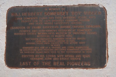
This is colonialism in all its naked glory. The isolated outpost. Seat of government 2800km away. Supplied by ship three times a year. Protected by soldiers and guns. No road contact or telecommunications till 1887. No supervision. The Big Man. The Tower of Power. An Autocrat with a huge sense of entitlement and an invincible belief in the rightness of his own views and actions. ‘Hard but fair. Cruel to be kind. Etc.’ Constant unrest. The conflict between private and public interest, often realised as private interests being funded from public sources. The struggle between military and civil authority. Constant unrest. The second wave of invasion, more domestic than the first: the missionaries, the graziers and pastoralists, the shopkeepers, the tradesmen, the miners, the tourists and their providers, but still an invasion soaking up most of what’s precious — as well as some of what isn’t, and there’s plenty of that — from the original cultures. That second wave of the invasion … it is still underway up here.
Now go and read Heart of Darkness and tell me that it’s a work of fiction. (And yes, there are credibly confirmed cases of cannibalism on and near the Cape, a lot of them.) Mistah Kurtz — he not dead.
[Steve Mullins’ Doctoral dissertation ‘The Pioneer Legend of Frank Jardine’ was fine reading on this topic. Frank’s own account of the expedition is seminal.]
* * * * *
38km to Pajinka, the locals’ name for The Tip.
I hadn’t realised in my ditsiness that this was the main reason a number of my fellow travellers had come on this tour. They wanted to have been to The Tip. The mood became infectious.
It was the usual slog over corrugations through wetter savannah and some rain forest, past a derelict holiday resort being eaten at great pace by vegetation. But the car park was clear and the path to the beach short. My buddies went for the lure like greyhounds.
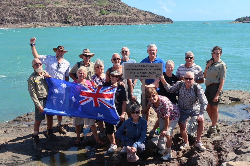
And lo and behold, there it was. The TIP! Pajinka. Cape York. York Island on the left. Eborac Island (Latin for ‘York’) on the right. (A theme is emerging.) Those islands will have proper names too, TSI names, but I don’t know what they are. As far as I know, not far, the tiny strait between doesn’t have a name.
 Just as we arrived, a tinny (a small aluminium boat, how you get round in this area) shot through — most appropriately.
I was moved. I didn’t try to help myself. Quite moved. Teary-eyed moved.
It was a beautiful day; the sea was aqua and sparkling; the islands were an elegant surprise; the entry point was along a lovely beach. The Tip itself was clearly demarcated and hadn’t been destroyed by tourists — just a modest sign, and a few plaques glued to the rocks professing love, devotion, excitement, resolution and surrogacy for the pain of those who hadn’t made it.
Whatever ‘it’ was, we had.
* * * * *
Well that’s gone on forever hasn’t it. Apologies. 2069 km worth.
Next day we donned our hi-vis vests and set off on this ship, the ‘barge’ which delivers goods all along the coastline, the only way of getting things in or out during the Wet. Two most uneventful days back to Cairns.
We left people sitting on the beach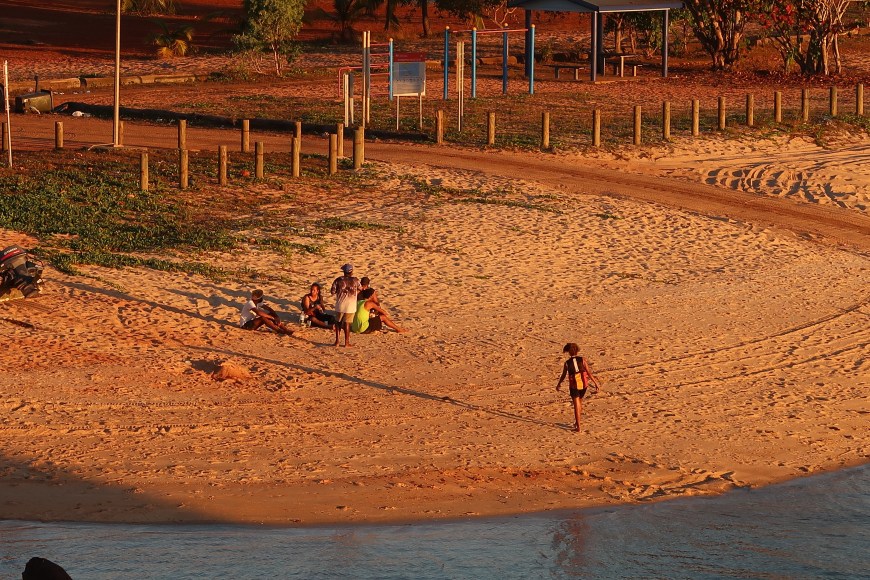
and a guy staring at the fish at from Seisia pier.
They’ll still be there when you arrive.

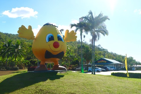
 (Real one at left, at rest on a shower partition at Bamaga.) Under maintenance. Presumably to get that thick layer of gold leaf burnished to full lustre.
 Every year the Queensland towns of Tully and Babinda compete for a more modest version of the Golden Gumboot, signifying the country’s highest rainfall. Tully holds the record for the highest ever annual rainfall in a populated area of Australia (7.93 metres — 312 inches — in 1950), but Babinda has held the trophy now for several years. It can be seen here in the Post Office window.
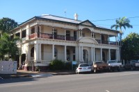
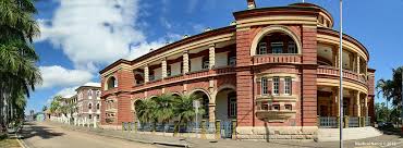 All this is embedded in one of the nicest collections of colonial architecture in Australia, big pastel and white buildings (except for the old Customs House at left) with high ceilings and deep loggias in their upper storey exteriors.
  The best strip of these has been turned into nightclubville with extravagant and outback-shameless promises of what its hostesses can and will provide for cashed-up FIFO (fly in fly out) mine workers.


 I like that there aren’t many tourists, except for the ones on their way to Magnetic Island five or so km off the coast.


 We found Wallaman Falls 30 km from Ingham and even closer to Trébonne. (Where do you live? Verygood. Yes I know, but …)
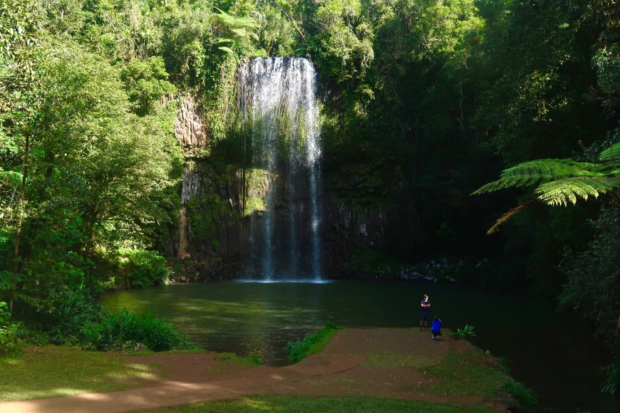

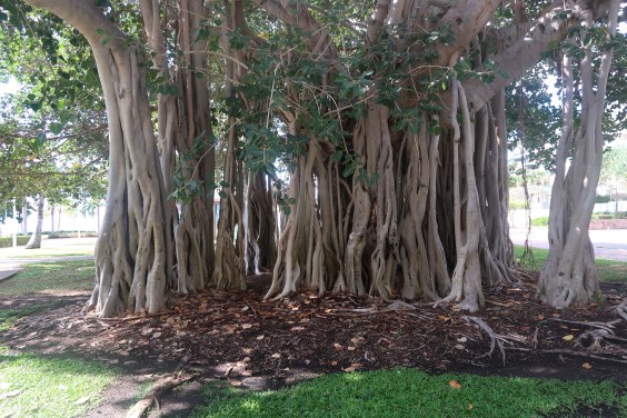
 To my surprise up on the Tablelands we found some very tall bull kauri tucked away in the rain forest along with two huge ficus consummating a long term relationship.


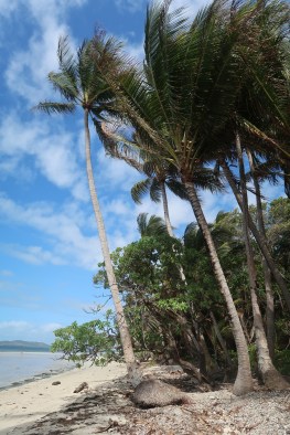
 Cooktown. Literally a breath of fresh air. It blew the roof off our poorly-pitched tent twice during the course of our night there.
  I have far more to say about Cook than can be included here, but a most remarkable man — his diaries of the next few months are hair-raising. He didn’t ‘discover Australia’ and didn’t pretend to have. After, again, so nearly coming to grief several times sailing north in and out of the Barrier Reef, and after another 850 km as the crow flies, he landed on what he called ‘Possession Island’ (at left, with memorial).