
The Sailors Creek Circuit

18 January 2021, mid 20s again. 14.14 km
A classic walk. No self-respecting guidebook to walks in Victoria would leave it out. Easily accessible entry, comfortable length, but you don’t have to do it all. There are three or four places to get off and go back to the Hepburn Springs-Daylesford Road or more directly into Hepburn Springs. It’s straightforward. You’re just following Sailors Creek which you can do either side. I think the educated preference is for the eastern side: you get higher and the views are longer. Interesting features. Well maintained. Depending where you start and how far you want to deviate from the track, there are three, four or five mineral springs, two of which are sure to be running. The end, going in our direction, is the gardens and terracing surrounding Hepburn Bathhouse & Spa and, if you’re so inclined and have made a booking, the pools, the baths and the attentions of the Bathhouse itself.
We have arrived at a place, a pot of gold swathed in warmly non-discriminatory rainbow colours, which now makes its living out of your comfort and pleasure.

What to say? Queen Victoria memorial fountain, cnr. Raglan and Howe Streets. Erected in 1902 via public subscription including proceeds from a well-attended performance of H.M.S. Pinafore. Made out of rubble and concrete it was in a bad state of disrepair by 1991 and so we are looking at a copy about 30 years old, the male caryatids looking determined if a little unhappy to support their dish, the women simply resigned to their lot. In the background a hotel with cast iron lace, a period feature. But from here we are within striking distance of dozens of food shops or, as one might say in Daylesford, providores, and ambitious restaurants — we are looking towards Kadota, but as well The Lake House, Frangos, the Farmer’s Arms, Sault, Larder, Bistrot Terroir, and on — as well as some less aspirational but still mostly satisfying. Because we are in Daylesford, and that’s what you have in Daylesford.
And in Daylesford (with Hepburn Springs, although you’d never say it out loud locally, the northern suburb) you also have a sybaritic range of health spas, therapy centres, sanitariums, meditative retreats, masseurs, cosmeticians, and manifold operations promising to both excite and relax your senses, often at the same time. And then there’s the antique shops, the markets, the Convent, the lake, the botanic gardens. Both scale and style are right. As Alla Wolf-Tasker (Ms. The Lake House) says in a recent advertising supplement: ‘There are no large brands here. This is a region of small local makers and growers. When you visit local establishments, it’s often the artist, the restaurateur, the winemaker, the brewer, the baker saying hello’, or in the case of the Himalaya Bakery and Cafe the person making the corned beef and salad roll you’re going to eat at Breakneck Gorge.
Let’s get moving. The day will have gone and you’ll still be sitting at the all-day breakfast place thinking about whether you’ll have another short macchiato with almond milk on the side.
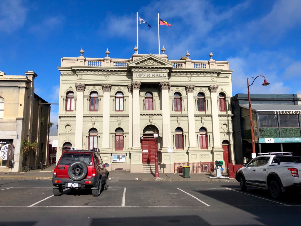
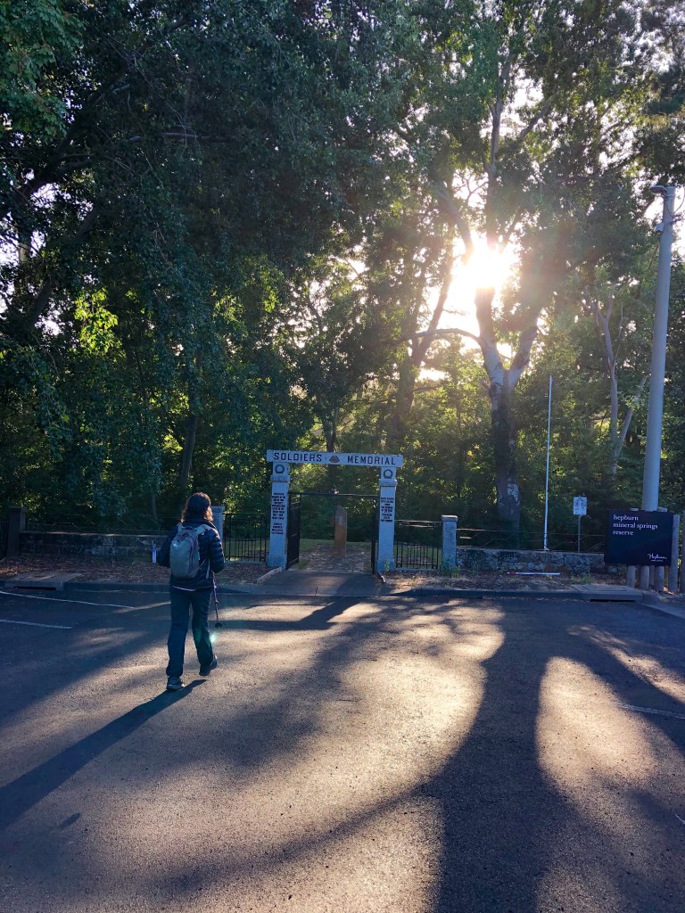
Our motelier (Hepburn Springs Motor Inn: rooms 7.8, service 9.9; more on her below) had driven us back into Daylesford and dropped us at the Town Hall, another one of those best-foot-forward gold era buildings. We strolled down Raglan St and got back on the Track at Tipperary Springs.

This is a good example of how well this track is waymarked. In 210 km I can think of only two places where the waymarking left any uncertainty. Pretty remarkable, and another incentive to try your hand for at least bits of The Track.

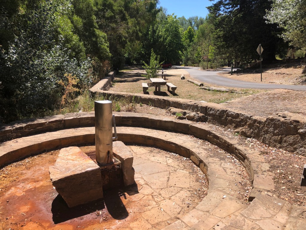
Tipperary Spring. ‘ … the best spring in the district, next to Hepburn.’
Quite effervescent with high levels of total dissolved salts, bicarbonate, inorganic carbon, calcium, sodium, potassium and iron.
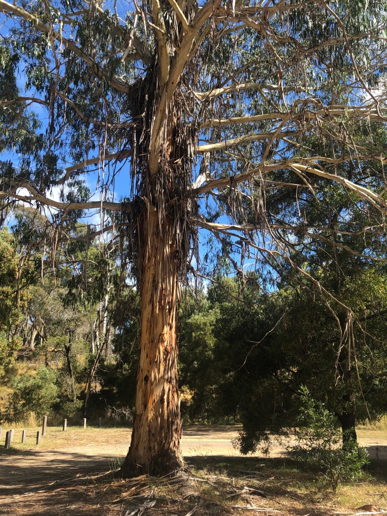
In the clearing at Tipperary Springs is this striking tree which I am going to designate E. viminalis. When I consult my copy of Eucalypts of the Mount Alexander Region (Slattery, B., Perkins and Silver, and highly recommended) I find that viminalis is Latin for ‘like a willow’ and refers in this case to the way the foliage weeps. They are sometimes called ribbon gums, and here there are a plethora of bark ribbons. I also find that the common name, Manna Gum, is derived from white nodules exuding from insect holes in the bark which are, or perhaps were in the past, relished by Aboriginal people — manna.
But whatever it is, it’s a superb tree.
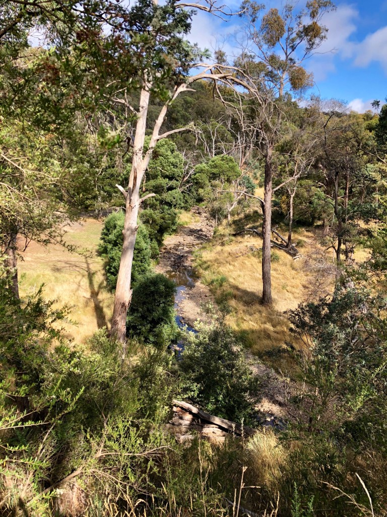
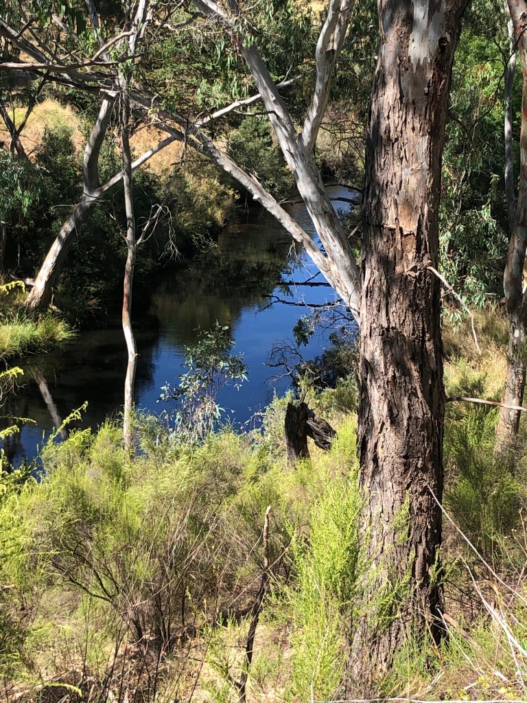
Looking back over the creek: a characteristic view. Heavily forested bank on the other side, the creek, somnolent, finding its way through the rocks. I think I like this walk best in winter when the valley is often full of mist and rain. But I don’t think I’ve ever seen Sailors Creek running hard, although it can as a picture below illustrates.
This is what it’s like where we are.

Unless it’s like this …

… with a cloud of everlastings floating down the hill. It would be Egg and Bacon if it were closer to Spring.
But wherever you look, closely, there is the prospect of something quite exquisite.


There are several reminders of gold along the way. The shaft (at left) of the old Mistletoe Mine is about 2m square, heavily fenced off and housed in a decaying corrugated iron shed. But, along with its tailings and mullock, it’s there, caged, moodily brooding.
Closer to Bryce’s Flat all the signs of diggings begin to appear, but they pretty much stop there …
… before starting again at the party trick of this stage of the walk, The Blowhole.
The area around The Blowhole had been closed for three years before the Victorian LABOR GOVERNMENT provided $250,000 to stabilise the area and build a new set of stairs and viewing platform. Now it’s open again, and just so you know who’s who and what’s what about opening the repairs, MARY-ANNE THOMAS, LABOR MEMBER FOR MACEDON gets in the front of the ‘Ballarat Courier’s’ pic while the Parks Victoria folk who have probably done or at least supervised and had a part in designing the work melt into the background. But unless you’ve got a very keen eye for the detail of khaki jackets, I’m not sure you’ll recognise Mary-Anne when you see her next. You might in fact consider this a picture of low-key banditry taking a rather static selfie in the bush. Anyway an excellent job has been done (and thanks Mary-Anne, AND DAN (LABOR)).

So what’s The Blowhole?
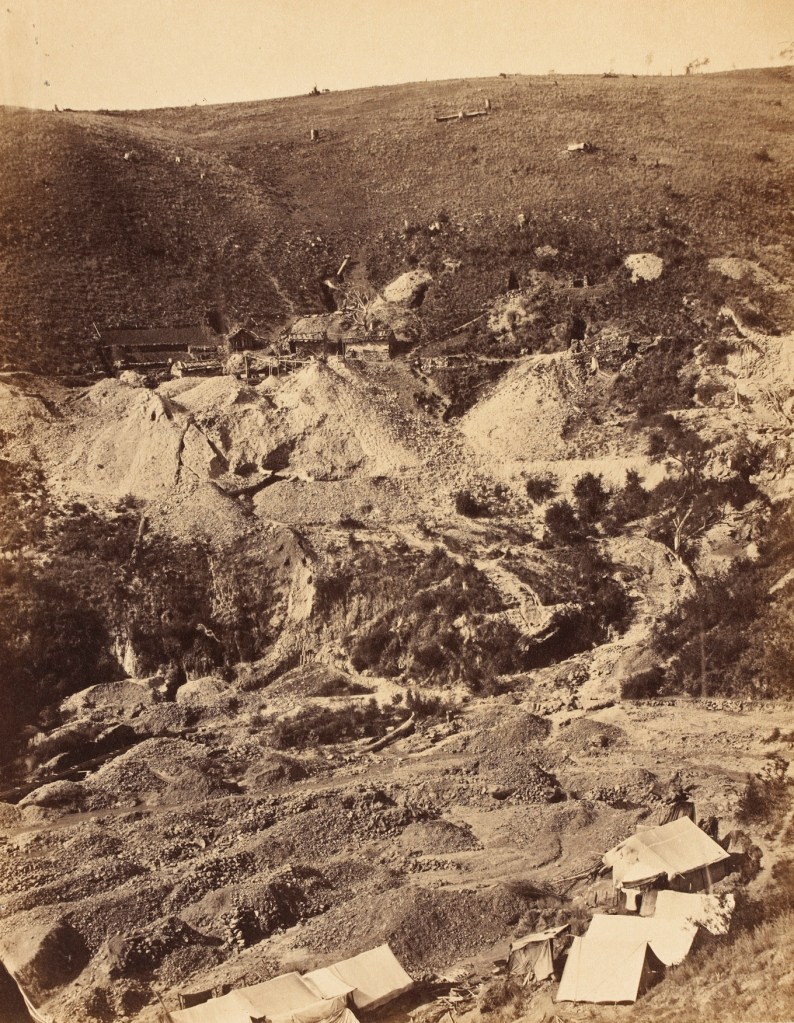
Just a bit further north, Sailors Creek seems to break into Jim Crow Creek and Spring Creek. The Jim Crow gully (at right, Raintree’s photo, 1854, devastation) was very heavily worked for gold and a group of miners, European and Chinese, decided there must also be gold to be found a bit south and that there was an attractive opportunity for getting at a creek bed which they could dry out. Sailors Creek takes a big loop right at this point, so to divert the water, they blasted and dug a hole through a rocky spur to make a much more direct route for the creek. That dry loop was very intensively worked over without much profit leaving behind The Blowhole as something of an oddity in Victorian goldfields mining, something now just to exclaim over.
I have never seen anything remotely like the situation at left, but it was flood damage that shook up the rock strata and maybe left this memento.


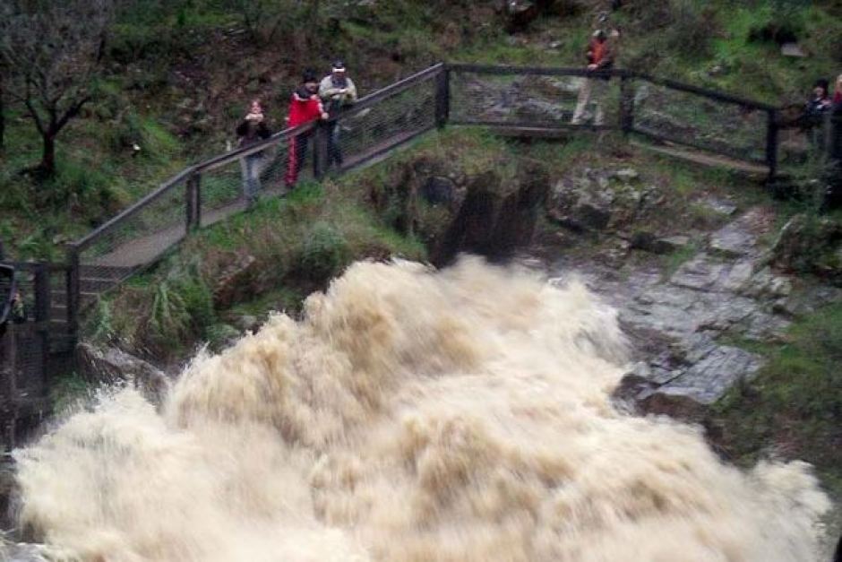
If you look at the water in this photo, in which intrepid photographer taking photo of tree trunk jammed in Blowhole has scaled cliff face, you will note just how fast the creek was flowing.
A lot of walkers get off the track at The Blowhole, but the northern section of the walk repays investigation. The gully walls get steeper and much deeper which does make the walking harder but, just for example, you can poke your head up over the lip of the gully wall (here called a gorge) and have a look at the Hepburn Recreation Reserve which you otherwise might miss. That’s important. Despite a score of visits to Hepburn Springs I never knew it existed. We also found a metre long brown snake sunning itself on the path before rushing off to its next appointment, and the backside of a rash of grand designs along Main Road including a 5-Star hotel (‘Clifftop at Hepburn’. Marvellous). Golden Spring was dry and being repaired, but just nearby was this superb creature. Fabulous or what? In his or her absolute prime.

To finish the day you cross the creek and climb up through the Baths. And, after that big pump up in the intro, it was actually quite hard to find anywhere to eat: in Hepburn Springs/ Daylesford! Outrageous. It’s the COVID.
Hepburn Springs to Vaughan Springs

19 January 2021, began round 20, low 30s by the time we got there. About 28 or 29 km.
[This particular map is not very helpful, although it may indicate a state of mind. The battery in my phone and hence the GPS conked out at the Porcupine Ridge Road crossing. I began conking out shortly thereafter. We finished near the second ‘d’ in ‘Guildford’.]
It began at 5.45am which is well before the time I start functioning. Hours before. A long day was ahead. The guidebook’s distance is 28 km and that’s plenty, but we always seem to wander a bit beyond official distances. It was going to get hot as well, so good to get as much distance under your belt by lunch time as possible. Plus we needed our car at the other end because we were moving accommodation from Hepburn Springs to Castlemaine. I asked the excellent motelier at the HS Motor Lodge if she would consider following me to Vaughan Springs and then bring me back so we could make all that work, and she most obligingly agreed.
And so it was we both drove off before the sun rose. The road out of Hepburn takes you up a steep hill past a thick assortment of 4- and 5-star hotels clustered for easy access to the Baths before topping out at a lookout, Jackson’s Lookout. There was a Track waymark right at that point. We were going to start the morning with a climb up to a lookout. Eeeeeeeeeeee. Then the bitumen swirled up and down through the gullies before meeting up with the Midland Highway which because of its seniority in the road world tends to have had its ups and downs ironed out. We veered left of Mount Franklin through paddocks with early sun just slithering over them, the noise of the cars enough to disturb the herds of kangaroos. The Mount with its odd basin haircut of pines loomed as a shadow. By the time we got to Guildford I was starting to think, mmm this seems a very long way. After we turned right and had dodged around a bit to get to Vaughan I was pursing my lips and breathing deeply. Hmmm … it was going to be a big day. This was all new country for us and I hadn’t really got a feel for its contours and distances.
And then something strange happened. We’d got past the Chinese Cemetery at Vaughan and some confusing Track waymarking (for the mountain bikers who also use a modified version of the Track) and had arrived at Vaughan Springs, and as we passed under the rustic arches at its entrance and followed the curves of the drive I thought, I’ve been here before.

Exotic deciduous trees, rotunda, two mineral springs one working, a weird fenced area which turns out to be a (very short) race track, toilet block with slate facing, 1920s recreation reserve masonry with thick thick mortar joints and not much attention to symmetry or style, a weir on a river, (in my memory, a big river), a paddling pool at its edge with 2″ galv pipe around the sides to hang on to … and that black box right in the middle of the picture. Because I think in that black box there is a miniature train, which had carriages which you could ride on. And 65 years ago my wish to go for a ride – only in a short circle mind you – was denied. Were all those memories so precise and sharp because of a perceived injustice? Quite possibly.
Vaughan Springs eh! Once known as ‘The Junction’, once a Chinese market garden with rich alluvial soil carried by the Loddon which runs through it, once a weekend venue for hundreds and just occasionally several thousand day trippers. Once, ice creams, footraces, egg and spoon contests, beauty contests, sack races, market stalls, queues to swing into the weir on the rope. Bloody hell. Was that where we were going to end up today? How amazing. Just as much history as the gold. I found a shady tree to park the car under and climbed back in with my driver. On the way back we discovered that she had been a senior administrative assistant of an education program I had begun, and that this experience had influenced her decision to leave Hepburn shortly to go to work in a remote Aboriginal community. As Henry James says: ‘Really, universally, relations stop nowhere.’
The return trip didn’t seem much shorter, although the kangas had got friskier and seemed to have multiplied. We were walking at 7.20.
The entry to this part of the walk is wonderful: through this gate, downhill to the bridge spanning the upper levels of the creek gully, and then onto the tarmac of the roads and car parks of the Baths surrounded by carefully tended lawns and gardens. It was a bit early to be testing mineral water so we ignored the springs and found the Goldfields Track signage on the fence line of the reserve, the manicured calm before something a bit more unruly.
Up through the Locarno Gully (below, which has its own mineral spring) on a track with quite a generous grade for a gain of 130m or so in a kilometre.
This area was burnt in the 2019/2020 fires which must have terrified Hepburn Springs and Daylesford. So close. Robert Walls was one of the people who had his house saved at that time.
We dodged off onto the little spur road at the top of the hill and climbed the lookout — doing The Track properly you see, later in the day we may have had quite a different idea — but the promised views were negligible, treed out. You cross the Back Hepburn road and edge along the Dry Diggings forest on a dirt road with Mt Franklin (Lalgambook) visible ahead to the north. It becomes a feature of the walk as you sidle past it to the east and then gradually look at it receding further and further into the southern distance. That happens in a day and provides a sense of just how far you really are walking. But Golden Summers or what?

We were heading for that swathe of bush in front of us, the Elevated Plains (which is a place name) part of the Hepburn Regional Park and were immediately back in the gully hill gully hill of gold country and almost equally immediately found ourselves following Beehive Gully: shafts, water races, mullock heaps all over the place. But most prominent was this poster child for The Eroded Landscape, 10-15m deep and running like some mini-Grand Canyon for most of a kilometre, trees, sometimes huge, dangling on the edges with most of their roots exposed.

Not beautiful, but unquestionably a spectacle, the sort that primitive versions of mining leave behind. Sophisticated modern versions offer something different: the problems are more carefully disguised.

Out past the Chocolate Mill on the Midland Highway and then backwards a kilometre along its side to the landmark snazzy letterboxes at the junction with Sawpit Gully Road. We seemed to have gone so far: but, one-fifth of the way. However Sawpit Gully Road, a gently undulating gravel affair for 3 km and then a pleasant dirt road after that, provided a chance to make up some time as well as things to look at because this was the land of the grand design, Toorak dreamings transported to the rural setting.
This house, either number 1 or number 2, was the only modest dwelling we saw on Sawpit Gully Road. I checked the property pages and it looks a bit like if you want 20 hectares or some such you pay north of half a million, and if you want a house on that block appropriate to the context you will need to think about beginning at three times that much. And you’ll need a dam about as big as a lake, and quite possibly your very own earth-moving equipment. An hour and a half from Melbourne where the mother ships probably are, what are you thinking?

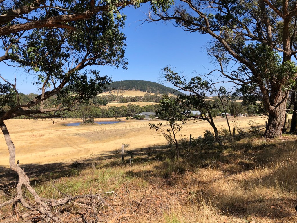
We’re looking over the top of one of these with Mt Franklin in the background. (Just incidentally you can see the change in aspect I mentioned earlier. We’re a little bit short of due east now.) And we’re walking along a ridge between the Middleton and Tarilta Creeks, both of which would flow about as voluminously — and regularly — as Sailors Creek.
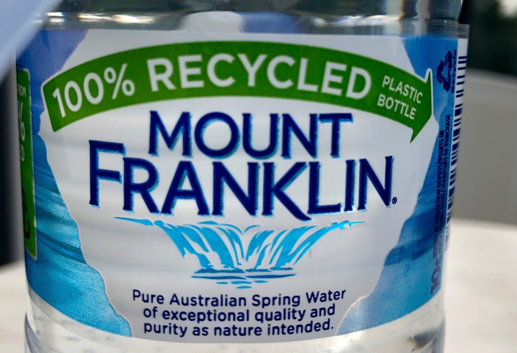
You’ve drunk the water, now see the hill: what spell has Mount Franklin cast?
“People also ask: Is Mount Franklin water from Mount Franklin?”
“The water in Coca-Cola Amatil’s Mount Franklin doesn’t come from Mount Franklin, as the name implies. Coca-Cola actually sources its water from various springs across five different states, one of which is in Queensland, more than 1800km from Victoria’s Mount Franklin.” To which could be added (from an academic study): ‘While the water associated with “Mount Franklin” brand lives on under the ownership of Coca Cola Amatil and has become nationally iconic and incredibly profitable to the Coca Cola company, no water has been extracted from the original site [about 10km north at the junction of the Midland Hway with Limestone Track] for approximately 35 years. The “Mount Franklin” mineral spring is no more and the area has become an overgrown and forgotten eyesore on the side of the Midland Highway.’ Another study: ‘In the late 1980s a water bottling company purchased [the land this spring is on], put a bore down into a saline aquifer and destroyed the spring. This was environmental vandalism.’
On another day we climbed to the top of Mount Franklin and wandered round its cone and, sure enough, saw no signs of tapping either spring or other artesian water. Even so I’m not sure why you’d want it to come from Mount Franklin. What is it about this modest mountain and its surrounds?
The on-line ‘Goldfields Guide’ says: ‘A gorgeous and peaceful campground rests within the scenic crater of an extinct volcano at Mount Franklin. Bordered by conifer forest, the crater has been decorated with ornamental trees such as Silver Birch, White Poplar, Sycamore and Californian Redwoods. A large, central lawn area is surrounded by a ring of campsites with picnic tables and wood fire barbecues. A toilet block and water tank/tap is located close to the entrance of the campground.’ All true. I can vouch for that. But would that draw you? There were 40 or 50 people camping or picnicking when we were there. Perhaps seclusion.
This Guide also notes that: ‘Mount Franklin was created by a volcanic eruption about 470,000 years ago. The crater … is one of the deepest in the Central Highlands. Lava flow from Mount Franklin and other volcanoes in the area had buried the gold-bearing creeks that would become the “deep leads” sought out and excavated by gold miners.’ And so that’s what a ‘deep lead’ is. I had wondered.
It seems to have always had some fascination for Europeans. Squatters called it ‘Jim Crow Hill’ connecting it — and its nearby creek — somehow with the racial segregation laws of the United States. It became Mt Franklin in 1843 after Superintendant La Trobe climbed it with Sir John Franklin, then boss of white Tasmania. Its eastern side in particular became a mining site in the 1850s until 1870, when the crater was set aside as a recreation reserve surrounded by another substantial area reserved as State forest. In a story on endless repeat in the historical cycle, deals were done to excise two large areas of the reserve for farming. Another repeat: this generated a public outcry which strengthened preservation (till today) of the remaining reserve. But introduced animals — first farm animals, later rabbits — destroyed much of the indigenous land cover. Then in 1944 a bushfire destroyed most of the remnant native vegetation and a decision was made to replant with the exotic species which are all too evident today.
This has a fairly precise parallel with the treatment of the indigenous population, the Gunangara Gundidj clan of the Dja Dja Wurrung people. Good evidence suggests that Lalgambook (‘smoking grounds’, suggesting immensely long contact) was an important cultural site and that frequent and large ceremonial gatherings took place there. How widely was that understood in 1840, … or today?
In 1840, the government took over Mount Franklin and the surrounding area for the Loddon Aboriginal Protectorate Station. Initially there was to be an inner reserve of one square mile (258 hectares) on which ‘every effort was to be made to induce [the “protected” Aboriginal people] to engage in the pursuit of agriculture or other regular labour.’ This was within another area with a five-mile radius which was set up for the purposes of hunting which was explicitly anticipated to be temporary as the habits of diligent European labour took hold. The purpose of this, as with the three other protectorates established round the time was ‘to safeguard the natives from encroachments on their property, and from acts of cruelty, of oppression or injustice’, with a longer term goal of ‘civilising’ them. Ah, the irony, the irony.

And the customary sad story, rigid with inevitability, plays out. The hub of the protectorate was established at Larne-ne-barramul, ‘the place of the emu’, what is now called Franklinford just on the other side of the Midland Highway from the mountain. A homestead, church, school and several out buildings were constructed. One commentator thinks that ‘Franklinford provided a very important focus for the Dja Dja Wurrung during the 1840s where they received a measure of protection and rations, but they continued [as you might imagine, hindsight makes things so wonderfully clear] with their traditional cultural practices and semi-nomadic lifestyle as much as they could.’ From time to time there were at more than 200 Aborigines living at Franklinford, however, in 1850 when the protectorate was finally closed there were only 20-30 there. In the subsequent years only one family, pictured below, remained.

One of these dignified and composed people is Tommy Walker, the last Dja Dja Wurrung person at Franklinford who eventually walked off to Coranderrk.
Another sad story plays out via the man in charge, Assistant-Protector Edward Parker. He was appointed to this role from his home in London by people who were equally distanced, geographically and otherwise, from this reality. A history of his life and times (Holst, below) describes three phases of his identity:
- vigorous but poorly informed idealism. An active campaigner against slavery, he trained to be a Methodist minister but violated the terms of his probation by marrying (albeit the daughter of a Congregational minister). After arrival in Australia he set up initially near Sunbury so he wasn’t too far from Melbourne and wrestled constantly with his employers about regulations, supplies, payment and the nature of his role. (Parker also spent time elbowing away Sievwright, another Assistant-Protector and former policeman, from pressing his attentions on his wife.)
- learning about politics while fighting to set up and consolidate his operation. Among the endless other issues, the five squatters with adjoining ‘properties’ kept encroaching on the protectorate’s land or at least disputing its boundaries leading at times to violent altercations. Parker was slow to set up a school despite this being ‘of the highest priority’ (it began in 1849 and closed in 1864, a short life), but he was able to set up a semi-functional community. Two of his sons describe his relationship with his protectees as respect bordering on reverence. This is contested. He appears to have been scraping off quite a lot of money from the products of the protectorate (which included lime from the Franklin aquifer destroyed by Coca Cola) for his personal benefit. But …
- he ended up a member of the Victorian Legislative Council, a magistrate, a fellow of the Royal Society of Victoria and the holder of a very extensive property once known as the Loddon Aboriginal Protectorate. In 1850 he was granted the pastoral lease for the land it occupied amounting to 62 square miles (16,000 hectares) as well as retention of its equipment, stores and stock. He occupied this land as his own for 25 years. In his will he described his occupation as ‘landholder’.
[To read more: Heather Holst (2008) ‘Save the People’: ES Parker at the Loddon Aboriginal Station Aboriginal History Vol 32]
A footnote: ‘On 26 May 2004 Susan Rankin, a Dja Dja Wurrung elder peacefully reoccupied crown land at Franklinford in central Victoria, calling her campsite the Going Home Camp. Rankin asked the Victorian Department of Sustainability and Environment to produce documents proving that the Crown has the right to occupy these lands. According to the 2 June 2004 ‘Daylesford Advocate’, local DSE officers admitted they “cannot produce these documents and doubt that such documents exist”.’
• • • • • • • •
After that long digression, back to the people puffing their way along the Track on an increasingly warm day. After crossing Porcupine Ridge Road we found ourselves in open forest busy with regrowth.

It would have provided a field day for identification of juvenile eucalypt leaves.
We were walking north through the southern section of the Castlemaine Diggings National Heritage Park at this stage. The area would be called Glenlyon even though we’re five or six kilometres from the town, like so many of these Central Highlands townlets, picturesque and attractive. We visited, really just for purposes of orientation, on the day 100mm of rain fell in a few hours. I didn’t know then that the town began its life as an experiment in Christian socialism. It’s better known these days for its wine.

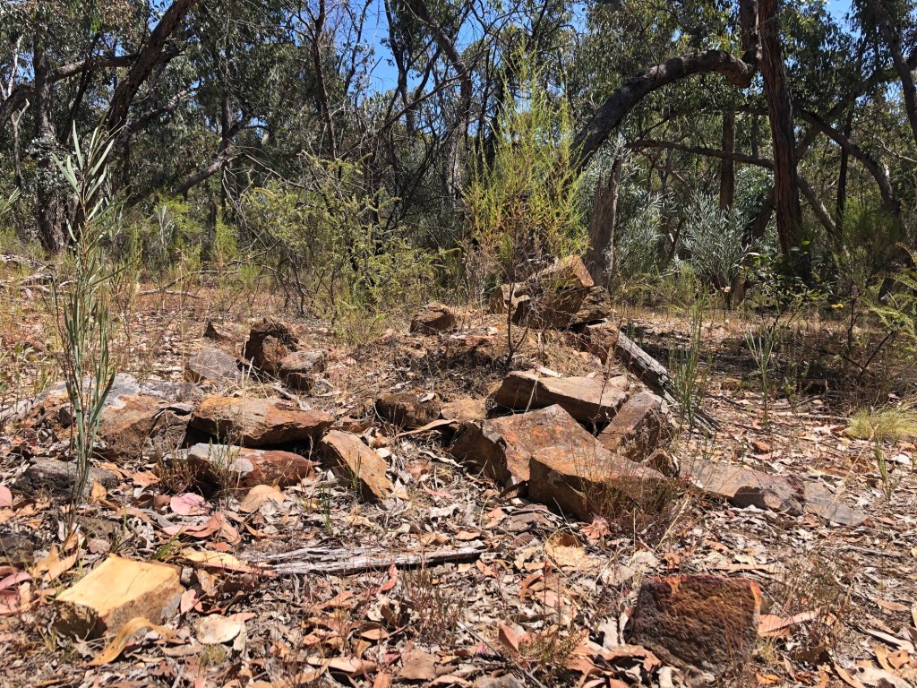
Around the time we came to Brown’s Gully the signs of human intervention were becoming more pronounced, even to things like this, a pile of handily squared-off stone, in this case natural, in others the work of a chisel and a mallet. But these have been busy diggings.
Sebastopol Gully was not far ahead, like Forest Creek and Specimen Gully nearer Castlemaine, a very rich Mt Alexander digging. Also nearby is Italian Hill, Irish Flat and, perhaps as a necessary consequence, Fighting Gully. Claim jumping would be only one reason why altercations broke out in groups of men from all over the place tense with gold fever.
I wish I’d been more alert to this stretch of the walk. There was regular evidence of both vertical and horizontal mining, plenty of hills to climb just here, empty water races, heaps of tailings, eroded gullies. At one of the bigger digs, Tubal Cain mine, you find the old mine dam now full of reeds standing out from the rest of the landscape. (Tubal Cain, תּוּבַל קַיִן, descendant of the biblical Cain and, according to biblical record, the first blacksmith). I was too tired to chase up the other evidence of this venture.
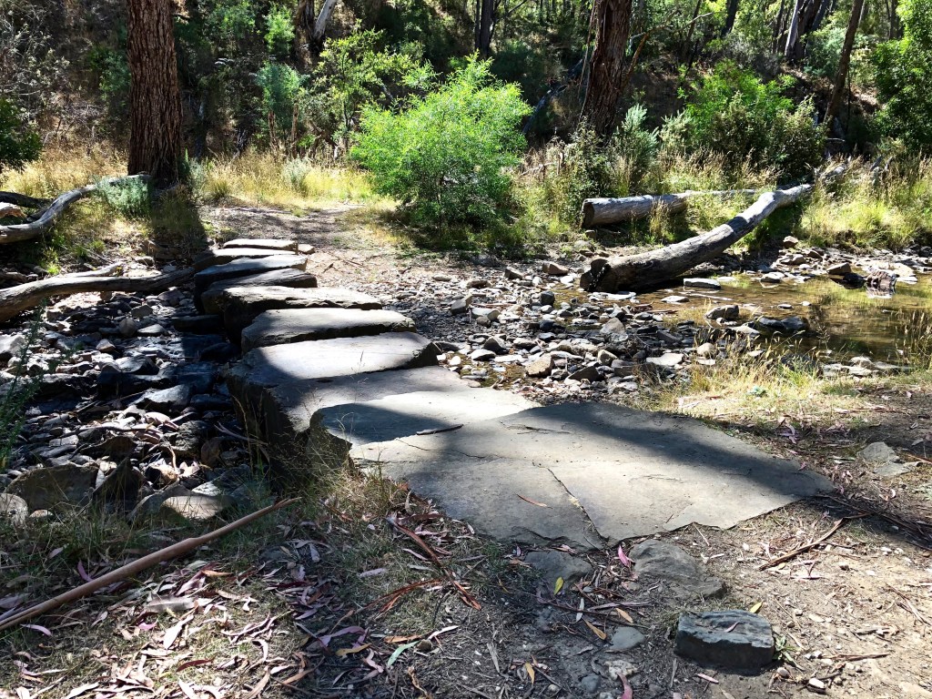
The scenery changed quite regularly, and the Track allows 5-600 metres along (another) Sailor’s Gully Creek which was refreshingly cool and flat as well as being full of open shafts like this one.

The Guidebook says ‘you will find a long uphill section to Gurr Track with under two kms to go to Vaughan Springs’, … that would be approx 5mm less than two kms. That’s how it felt anyway.

It’s very hard to photograph ‘steep’ or ‘high’ so you’re just going to have to imagine it. But you might like to chafe your thighs a bit first, bash your feet around, stand on your tip toes in the sun and avoid any sort of liquid refreshment for a day or two. You’re just not as alert as you should be, more just one foot in front of the other. Even after we got onto Gurr’s Track there were things I should have been looking at that I didn’t see.
Plus there were quite a few false dawns in these last kilometres. I thought I could see the weir at Vaughan Springs several times before I was eventually walking across its wall. Long hot days can do that to you. But this too is some fabulous walk.
I got my head under this spring, the Lawson, and, ignoring its internal redemptive qualities, luxuriated in its bracing temperature. I got properly wet and thought, given that it is going to start in the mid-30s next day, we (meaning I) probably won’t want to walk the next 20kms into Castlemaine immediately. Not straight away. Not just then. We could just enjoy a day in another of these wonderfully interesting towns.
In the far distance under a tree is the small red Audi, unmolested and waiting. Just near the miniature train, just … well look, I should have been allowed … don’t you think, no but really … Yeah I know I didn’t have any money but I was only six. Other kids were … not fair.
