Cornelia Parker is a major figure in the British art world. It was a coup for Sydney’s Museum of Contemporary Art to mount the first major retrospective of her work. And a challenge.
Her most famous work is this one — a shed (full of shed-like material) blown up by members of the British Army caught mid-explosion.
Cold Dark Matter: An Exploded View 1991 (with all the bits and pieces suspended from a grid on the ceiling).
Not everyone’s cup of tea. Among the bits and pieces here are the remnants of a violin. One observer at least has recoiled in horror at this discovery. You never know just how people will react do you, just what will catch their eye.
* * * * * *
I had never heard of Ms Parker and as usual didn’t have my brain quite in gear as I entered the exhibition. I saw this.
That looks interesting I thought. Bits of dirt suspended from the ceiling. Very carefully I should add. I rather liked it. It had a rather superior sort of stillness about it and the shadows provided another dimension.
I read the label. The name of the work is ‘Subconscious of a Monument’. The bits of dirt, ‘desiccated clay’, have been dug out from under the Tower of Pisa — dug out not for the purposes of art but engineering — which as a result leans less than it used to. One question, perhaps the first: Uh huh … so errr … why did she do that? The second: what should we think?
Immediately next to it is this video.
A Palestinian resident in Jerusalem speaks about his family’s work of making crowns from thorn bush cuttings. In peak months he sells several thousand. His hands and those of his son are pitted with the endless cuts and piercings that come from the work. They seem to be sitting on seats out of a wrecked plane. His son is completely impassive.
Self-described, the man himself is simply a businessman making a living. He sees no irony or complexity in what he is doing. But we can. It’s hardly possible to avoid. He’s a Palestinian/ it’s Jerusalem/ they are selling crowns of thorns to Christians/ it’s a business/ and so on and so on … There are a series of big stories attached to these ideas. And is THAT art?
I was getting more interested. There was the suggestion of a particular sort of British mind at work. British? Not British. English. The sort of Englishperson who loves games and unravelling webs of knowledge. Stephen Fry.
Round the corner is her ‘Magna Carta’, a 13m long embroidery for an Oxford College and the British Library to celebrate the 800th anniversary of its signing. In fact, a 13m long embroidery of the Wikipedia entry for ‘Magna Carta’ on 15 June 2014, the 799th anniversary, exact right down to the references (about a quarter of its total length) and the illustrations.
The particular section at left, about 200x150mm, took 400 hours, and a great deal of skill, to embroider.
It’s an interesting reminder that Pope Innocent III was involved in the advent of the very English Magna Carta. England was mixed up in Europe a long time before the EU came along.
So far so dramatic. Good, but just as people were doing, you could walk past it pretty easily without paying much attention. The idea of the Magna Carta mightn’t mean much on a Sydney summer afternoon.
But the more assiduous viewer then reads that, to rub in its theme of legality, most of the piece was hand-stitched by 33 convicts. All sorts of celebrities contributed bits and pieces. Germaine Greer did two sentences. Jarvis Cocker stitched ‘common people’ the name of one of his songs. Julian Assange did one ‘freedom’, Edward Snowden did one ‘liberty’. Several senior justices of the British High Court contributed (‘justice’, ‘denial’ and ‘delay’). One sentence was stitched during his visit to Guantanamo Bay by a human rights lawyer. The work includes a tea stain from a prisoner’s cup and a spot of blood from Guardian editor Alan Rusbridger (‘contemporary political relevance’) who accidentally pricked his finger while sewing.
Like the Pisa clay piece, an understorey (and an under story) has been built. Literality, but with a twist. Awaiting discovery. And embroidery.
* * * * * * *
From time to time Ms Parker likes smashing things up to reconstruct. (See, for example, the shed above.) ‘Re-Presenting’ she calls it, in the sense of looking at things in another way. She has described such things as ‘cartoon deaths’, the sort of thing that might happen to Tom or Jerry, while pointing that, even if this has been smoothed out and disguised in the finishing stages, sculptural practice usually entails a certain amount of violence.
For ‘Thirty Pieces of Silver’ she drove a steamroller over items of silver — cutlery, food service, trays, musical instruments, vases … she’s ‘drawn to things with a past’ — to create what she now describes as thirty ‘pools’ which have ‘become almost natural objects’. They were there at the MCA suspended in patterns, ‘pools’ I guess, properly. Thirty of them.
In a 1992 piece, ‘Words that Define Gravity,’ Parker wrote a dictionary definition of ‘gravity’ out longhand, and then magnified and replicated each of the words in cast lead and threw them off top of the chalk cliffs of southern England. To complete the work, she collected the lead words, mangled by the fall and left with chalk impressions, and suspended them on threads just above gallery floor level. ‘The words were made illegible by real gravity’.
She returns to ideas to enlarge them. In 1997 Parker exhibited Mass (Colder Darker Matter), suspending the charred remains of a church that had been struck by lightning in Texas while she had had a residency there. Eight years later, Parker made a companion piece, Anti-Mass, using charcoal from a Kentucky church which had been destroyed by arson. She discovered when she went to look at what had happened that in the US the cause of burning churches is rarely lightning, especially when they have largely black congregations. She also discovered a group of white Americans who make it their job to help those churches get rebuilt. Strings of narrative attach to these pieces.
Her work is also often fun. She has made a collection of ‘faces of Jesus’ occurring in unlikely places, on a piece of tortellini and in oil stains found on the floor of car parks for example, or this one in the end of a Kit Kat. Something of a triumph. (And, it must be said, this is observation of the keenest order.)
* * * * * * *
So what do we have here then?
We know that she is absorbed by found objects. But she likes the back of things, the underside, what’s left when you take things away (like the War Room, at left, what’s left when you stamp out millions of poppies for Remembrance Day), what things are like before they’re constructed (the beginnings of a pistol in Sydney). She likes oppositions (embroideries with antonyms, one set of words on one side, the other on the reverse, both showing through); she likes comparisons and measurements (wire drawn from the silver in a melted teaspoon to the length of the height of Niagara Falls for example). She likes the attachment of stories and consequences (the Magna Carta).
She offers an invitation to join in these rather strange perceptual journeys. Things can be seen this way, she says. Fun isn’t it. And interesting. And challenging. And sometimes beautiful, or if not beautiful, at least deeply satisfying.
She describes herself as a grasshopper, but I don’t think any other creature, bird insect animal, has a mind quite like hers.
She is an original, an oddity that I can’t help thinking of as English, with the directness and confident self-exposure of an upbringing in the shires and, paradoxically, with feet squarely planted on the ground (while her eyes are darting round). It might be an unusual form of common sense on view.
The works can be easily read; you’re not tested by establishing the meaning but by the profusion of meanings. You can have a look at her (good, strong, immensely active) mind at work but you’ll have to bring your own game. In that regard they can sometimes seem a bit like a general knowledge quiz, (speaking as someone who believes emphatically in the general knowledge quiz). It might be that set of demands that make it art, the clincher anyway.
There is also a firm and attractive morality at work. It might seem political, but it’s not. Something far more fundamental is in play. I liked that.
The White Rabbitmust be one of the most interesting galleries in Australia.
It’s private. It’s free. It used to be a Rolls Royce showroom. It has a tea house attached which has recently extended itself to serving scones besides boa (dumplings). And it only exhibits contemporary Chinese art — in most instances owned by the proprietors of the gallery, Kerr and Judith Neilson, now divorced but still hopelessly rich (think billions).
I only mention this because the strong implication of many of the pieces we saw was that this might not be such a good idea.
Entry point. A bronze, covered in car duco, four metres high: Red Memory — Asking God. Tagline: ‘The pig symbolises the speed of growth of China today with its raw gluttony, greed and avarice.’ (Chen Wenling still lives in Fujian and he can still/ is allowed still make sculptures like that.)
Superfluity — having too much, abandoning traditional values, becoming immersed in materialism and commerce and the rapacity that engenders — was a recurring theme in this massive retrospective of the owner’s favourite works.
Like this.
And this.
But it wasn’t all consumed with consumption. Some of it was simply strange.
These are two separate works, but the combination adds a certain frisson. The balloon inhaled till it was fully inflated and then exhaled before inhaling again. A near life-size taxi nearby did something similar.
In a lot of the work there was an undercurrent of … what? Threat? Something to knock you off balance certainly.
Even in pieces as apparently anodyne as this.
The conventions of the portraiture are venerable, hundreds of years old: pale, calm, settled, face slightly tilted, expression only to be found in the half open mouth and the way her hands are clasped — perhaps a certain wistfulness. But her uniform indicates that she is a member of the Red Guard which, during the Cultural Revolution, was responsible for all manner of unspeakable violence. That might or might not be the point.
Life is considered a tangle where at least some of the threads will be unknown quantities. This is only a small portion of the work. And yes, they’re people — in the work as a whole perhaps several thousand. Wherever one can see an expression it is the surprised fear of calamity.
Perhaps this wonderful calamity …
A coloured bronze casting. Interest wherever you choose to look. Every face, every posture, contains a story, even that of the bloke we can’t see over the back having a pee. This is awash in circumstance: full of aspects, full of responses, full of well understood and imagined humanity. There it is — don’t shy away — that’s what life is.
Or this sculpture, a three-dimensional rendering of a school photograph. The artist is the woman far right third row. Is it the fact that it is drained of colour that makes it unsettling? White is the Chinese colour of death.
You look at it once and think, oh yeah. Wow. Very smart. Mmm actually so clever. Beautiful work. So smart. In fact how the hell did she do that? Then you look at it again … and you’re unsettled. And you look again to try to work out why. You peer closer. But they are looking at you with their blind eyes just as hard as you’re looking at them. They’re silent. But they’ve started whispering to you. And what is it they’re whispering? They’re saying you think you know what this is, but actually you’ve got no idea. Better go look at something else before you start freaking out.
* * * * *
My companions found these works generally ‘hard’ and ‘bloodless’, with little sign of the artist and their feelings. I don’t know that I disagree with that. But I felt far more positively about them.
One thing shrieking from each work is the quality of the craft. On the top floor there was a pile of stones about 3m. wide adjusting itself with occasional heaving motions. Not a great work, but you couldn’t argue with the capability and thoroughness of the construction. And the taxi crash is a bronze! From memory it is about a metre and a half wide, and yet all that detail has been captured in a casting.
They were remarkably inventive — although perhaps it might seem like that because they are generated from another culture — and there was very little cheap about any of them.
This might have been the most obvious of them all.
‘W’ Bush and Wen Jiabao, ‘vulgar officials who pretend to be refined and cultured’, surrounded by icons of China’s rural past (the flowers) and grand cars suggesting the industrial cashed-up present. But even these are stunning embroideries and there’s something rather remarkable about the cast and pattern of highlights in the faces.
But I look at the whole and think that these are works that have been done by grown-ups.
They seem to be built on vast mounds of digested experience of humanity, not simple, not clear, but digested with heedless Chinese juices. This is not the art of comfort or fellow feeling or admiration. There is a toughness about it all that separates it from easy looking. This is art where the nerve endings have been tempered, possibly quite harshly. (One formidable example, an installation with ‘slave workers’ hanging upside down as slabs of meat waiting to be butchered.)
Finally, there is the weird fact that these exist at all, that they can exist, and in such a sophisticated form.
The first time we went to China 32 years ago, we went looking for art in Beijing and found it, on the customary overwhelming scale — a national competition with 1000s of contributors from all over the country. There were lots of nods to scroll art: waterfalls, exotic rock formations, teeny-tiny old people with a wooden staff and a conical hat and loads of this or that, mist, cloud, a dragon. But really most of the pieces would not have looked out of place at the Camberwell Rotary Art Show. Horses, pretty girls, land and sea scapes, boats at anchor, wizened relatives or just random old people. (Not babies. Why don’t people do babies?)
Then six years ago we found 798, the new arts precinct in a middle ring suburb of Beijing — and the revolution had occurred.
This is party members holding up a huge bundle of yuan, renmimbi, ‘the people’s money’. That’s what makes a party! And there was this utterly memorable tank made out of leather …
It’s the fearlessness of the work that’s so surprising. The sedition in 798 — and at White Rabbit — was more trenchant and more obvious than the crowd behaviour in Xinjiang. But somehow, who knows how, they get away with it.
Maybe that’s what we are looking at. That’s the grown-up edge, the constant awareness that art really can be a very serious and adult business indeed.
Scott of the Antarctic. I have a fixed memory of seeing him years ago in Latimer Square over the road from where we were staying rather than next to the river nudging the CBD as he now does, and apparently always has. I remember how his gloves looked weird as though suffering from some sort of gigantism, and that there was an odd stump affair holding up his back leg. I do. Clear as crystal. Memory (shakes head), traducer …
Now I also discover that the statue, sculpted by Scott’s wife, Kathleen, was never finished. The ‘stump’ is helping to hold the whole shebang up. The gloves were to be reworked. (Good idea. They add a hint of jocular insincerity to what is clearly intended to be a serious work.) It was commissioned in 1913, started (in Italy, the war) in 1916 and the ribbon was cut in 1917 in the understanding (hers) that further work would occur. It never did. (1917?! During the war to end all wars. Just how far away from Europe is New Zealand, and for that matter just how big a deal was Scott’s expedition?)
I also remembered, correctly, that the inscription includes a late extract from Scott’s diary.
I do not regret this journey, which shows that Englishmen can endure hardships, help one another, and meet death with as great fortitude as ever in the past.
May I suggest reference to Fintan O’Toole’s Heroic Failure for further insight into this specifically English form of masochism, that of building an identity out of the romance of defeat. Amundsen got to the Pole (and back, losing no one) 33 days earlier because he was better equipped, better organised, more experienced and less full of, what can I say, lordly self-engrossed bullshit.
Christchurch’s relevance is that Scott left from Lyttleton, nearly but not quite a suburb, and Kathleen was travelling there to meet him when she learnt of his death.
He fell off his plinth breaking both legs on the 22 Feb 2011, along with a lot of the rest of the city, in what could only be called a catastrophe. But now, … he’s back! Gloves and all. We were there, quite incidentally, for the re-installation ceremony.
The statue looks north to what was in 1917 the key civic buildings. And now eight years later? Everything back? Sorted?No. Still work to be done. Fortitude still required.
* * * * * *
A catastrophe.
The earthquake destroyed or rendered unusable 90 percent of the 600 or so CBD buildings. 12,000 other properties registered damage exceeding $100,000. More tellingly, 185 people died.
If you want an idea of scale, today’s papers are full of horror about the possible dollar cost of the Australian 2019/20 bushfires. Could be as much as $1.2 or even $2 billion. Horrific. But not long ago the NZ Reserve Bank estimated the total construction cost of the rebuild in Christchurch to be about $40 billion, $16 billion for each of residential and commercial construction and around $7 billion for infrastructure. And that is the construction cost. There are so many other costs involved. (I don’t want to spoil my point about the magnitude — and concentration — of what happened in Christchurch, but in Australia, for example, the unimaginable damage of what is happening this very day to the natural environment and its constituents can never be quantified.)
A lot has happened in eight years. We were there in 2015 and I thought then that it looked at least partly like a gigantic building site. The motifs were chain link fences, blasted heath car parks loosely covered with grey road metal, public art and shipping containers.That was then;this is now. It’s not over yet by any means.
On the more recent visit our favourite coffee shop, the C-One, was still there, still standing, but like a monumental outrider rather than a molar in a set of teeth.What was it serving? And this is important.
Top left below are Lamingtons w/- white chocolate, coconut and [I quote] ‘a hypodermic berry syringe’. But just below the Banoffie Pies and the Custard Squares and to the right of the Caramel Walnut Brownies and the Marshmallow Caramel Slice are the Hemp Raw Balls (bottom right): w/- walnuts, almonds, linseeds [sic], sunflower seeds, dates, apricots and prunes [the entirety, just in case it’s not clear] dipped in vegan chocolate, pumpkin seeds, cranberries and Kako Samoa (refined sugar free, dairy free, vegan, gluten free, contains nuts). By some lights extreme sure, but up to the minute, the very instant in fact. NZ scones might have gone off, and tragically we think this is possible, but there is no obvious impediment to the boundaries of innovative edibles.
Four years ago this plaque was embedded in the seats along the footpath outside.Is that what has happened? I don’t know. But the view from that seat in 2015 was this.And now it’s this.Back, and going: and I am pleased to say including corgius intactus. They survived.
Miro restaurant (a much more interesting chocolatey red than appears here), which had for several years housed squatters, is another example of fastidious restorationwith very stylish interiors.
There are some interesting new buildings but not as many as I thought there might be. Bouncing on huge isolators, this is an extension to the main hospital. The ‘X’ feature on the right is a structural member.
I thought this was wonderful.Ōtautahi: the place/home of (Te Potiki) Tautahi, the Maori name for the place where some of Christchurch is now, specifically near the fire station next to the river some distance from this building. But why this is so striking is that we are looking at a flat surface (with two obvious indents where the balconies are). It used to be a flat cream brick wall, and now it isn’t. L’oeil is certainly tromped. Just wonderful. And part of the new groovy area which was never far from here. Maybe that’s the Amundsen approach to recovery.
As might be obvious this was one of several beautiful days (i.e. before it got to -4C in Dunedin), and Hagley Park, undamaged by the quake, was as glorious as ever. Perhaps it doesn’t make sense to talk about a recovery from something that never happened, but this massive park in the middle of the city must be some sort of ‘recovery’ salve for the body politic.
Recovery is a complex notion. It might be assumed that it means return to a prior state. If so, there is no recovery and never will be from a natural disaster. Things will not be the same. The flavour of life, the form and colours of the background, social and economic as well as topographical, will have changed forever. I didn’t talk to enough people to get any idea about what they thought had happened but, even eight years after, the local paper ‘The Press’ still has plenty of column space for earthquake-related issues.
So over its centuries of life what has this magnificent tree seen?
The answer of course is nothing. Not a cracker. Trees can’t see. When SmoCo, the Australian Prime Minister talks about ‘the terrible threat that nature provides to this country’ he seems to be suggesting that, if not vision, ‘nature’ has agency and for that reason needs confinement, punishment even, a damned good thrashing! This is the sentiment getting a strong run in Australia’s Murdoch media — we must burn everything down to avoid everything being burnt down.
The real reminder should be that the only part of ‘nature’ that is capable of generating a threat is humankind. Only we can construct that as an idea. ‘Nature’ — if that’s what we call the climate, the vegetation, the landscape and its animal, bird and insect populations, the seas and rivers, the environment of which we are a part — may contain threats, but it doesn’t make them.
‘Threats’ come from the idea that humanity’s task is to subdue nature and ‘have dominion over it’. If subdue means damage we’re going well. ‘Achieving dominion over nature’, a very strange idea in itself, will never occur; and only people who haven’t experienced droughts, earthquakes, fire, wind or marine storms would assume otherwise. This is the irony of the anthropocene age: we can make a first class mess of things, but we can’t control them.
This is where Scott (of the Antarctic rather than the Shire) and his ilk come in handy. They have words for confronting the implacability of ‘nature’: resolution, fortitude, backbone, fibre, pluck, dauntlessness. And those words are helpful to some degree. Who could complain about someone displaying fortitude?
But in terms of recovery efforts, if I had to choose I’d be turning myself inside out to make sure Amundsen was in charge.
For all those Chalet honeymooners (John and Jo, Gil and Mem among them), and Bax and Ede who know a good lookout when they see one.
* * * * * * * *
From its other side, the west, the European explorers Hume and Hovell thought this looked like reclining buffalo. Its ‘Horn’ is to the left and its ‘Hump’ in the central area. A buffalo? Mmmm well no. Not really. That said I’m not a European explorer and it is no longer 1824. But according to current usage it is Mount Buffalo, one of the most interesting and certainly the most romantic of the Victorian alps. I know a dozen couples who had their honeymoon at the Chalet. That’s one reason, but there are so many more.
The Taugaurong and Minjambuttu peoples, indigenous to the area, far more appropriately called the mountain Dordordonga, The Friendly Mountain. They spent their summers on its plateau feasting on the Bogong moths which bred there gathering in their millions on rock walls and in crevices.
From time to time in the past I have wondered how you might prepare Bogong moths. In my imaginings I haven’t got much beyond plucking one off the wall, popping it into your mouth and justcrunching it up. Wrong.
First, build a fire on a flat rock then, when it is suitably hot, tip a netful of moths dipsy from smoke inhalation on to said rock stirring all the while until the wings and down are removed. Place in coolamon and winnow to remove dust and wing remnants. Pound remainder until a cake or lump is formed, ‘like unto dough made from smutty wheat mixed with fat. The bodies are large and filled with a yellowish oil resembling the taste of a sweet nut. The first time this diet is used by the native tribes violent vomiting and other debilitating effects are produced, but after a few days they become accustomed to its use and then fatten and thrive exceedingly upon it with such excellent results that aborigines assemble from all parts of the country to collect [the moths] from these mountains.’ The lump didn’t last a week without spoiling unless it was smoked in which case it would last quite some time.
For this information I am indebted to the notes of Robert Brough Smith, geologist and amateur anthropologist, who observed this happening in the mid-19th century.
Another visitor round that time as a member of Baron Von Mueller’s survey party was Russian-born artist Nicholas Chevalier. This painting, The Buffalo Ranges (1864), won first prize (£200, good money) in the very first acquisition competition held by the National Gallery of Victoria where it can still be seen.
This reproduction is a very ordinary rendering of a wonderful painting distinguished by the care and precision of its detail, brilliant control of depth and utterly reliable management of colour, none of which can really be discerned here but you get the idea.
The Argus said at the time: ‘There is an alpine chain, snowclad, dark, as belongs to the sublime and precipitous, and full of the grandest reminiscences of the old world. Clad with verdure to the line of almost eternal snow, it affords us a distinguishing feature in the varied beauties of Australia Felix. Mr. Chevalier has not before painted a better or more characteristic picture; the rich foreground surrounding the old water-wheel — especially the rock-work, with its fine lichen clothing — is a beautiful piece of painting. In the centre there is a grove, which displays in a very brilliant manner the effect of the sylvan sunlight peculiar to our clime. The mountains are almost verdure-clad to the top, and the scene as a whole, almost reminds one of Chamounix [sic]. A watercourse, most beautifully introduced, supplies a defect in Australian landscape; and life is given to the picture by the bullockteam in the foreground.’ (Quite incidentally, this review has as much to say about attitudes to mountains and being just barely ‘at home’ in the Australian landscape as it does about the picture.)
The hut is the home of a farmer, Albrecht Durer Watson (now there’s a name), and his wife Margaret at One Mile Creek let’s say oooh… about a mile out of Porepunkah. (‘Porepunkah’ is a Hindi word for ‘gentle breeze’. Thomas Buckland, the first selector of land in the area and whose cows were the first Europeans to find a way up onto the Buffalo plateau, had arrived from several years in Calcutta.)
The painting is of the view from the north, the approach, the easiest way — there is no easy way — of getting up on to the plateau. Just how accurate Chevalier has been can be gauged from this pic from the extravagantly fertile Buckland Valley behind the foothill that, from the north, usually gets in the way.
We were off to do The Big Walk — and yes that is its name, no correspondence will be entered into — which among other things includes zigzagging across the rock slabs on the right above. We can’t see its beginning but this is most of the route.
You start at the National Park entrance, the Eurobin Creek camp ground.One way is about 12 km with a height gain of 1100m in 9km. We usually go up and come down again; appropriately, a Big Day.
The walk divides quite nicely into four parts fairly equal in length if not time. The first is the climb up to 7 Mile Spur. For 2km it varies between steep and very steep, puffing around slippery creek spurs.You gain height quickly,but it’s a stiff way to start the morning. When you get to the fire track along the spur it’s a relief that section is over.Then 600m to the road crossing at the hairpin bend. The trip by road to The Chalet is almost twice as far as the walk.
The second section is still up — it’s all up — but it begins by cantering along the eastern side of the ridge the road follows through Messmate, Yellow Gum, Sallee and Candlebark forest with the first views of the alps to the east.That is Feathertop in full snow, the Razorback Ridge to Mt Hotham to its right. As you climb, these views just keep getting more expansive, better and better. You cross the road three more times and come out at Mackey’s Lookout.By this time you’ve got to 960m asl, about 2/3 of the height gain, and you’re noticing it. It’s time for a cup of tea.
The third section begins here: a series of zig-zags across the rock slabs below the top of the face. By my count, 31 corners 16 zigs and 15 zags, head out all the way, on a track that reminds me in places of the ‘road’ that the Austrians forced the Montenegrins to build so that they could haul their artillery up to the top of the cliffs above Kotor (at left).
Prime walking.
There had been rain — and snow melt — so therefore a number of random streams, and one big one which isn’t this one, were spilling down the rock faces.And just as it looks, perfect weather. Marriott’s lookout. Who wouldn’t enjoy this?
This rock signals the the fourth section — the last of zig-zags and a long traverse west through quite dense alpine ash forest before turning sharply left back some distance across the lip of the face and around the inset of The Gorge. The track got wet,then a bit snowy,then quite snowy.This area was fiercely burnt during the last bad summer fires (2009) and is now coming back. One of the hazards here was saplings, hundreds of them, bent in a U-shape like animal traps over the track, their upper foliage trapped in snow banks. No damage to the trees, but entailing a lot of ducking and weaving to get through them, not to mention regularly going plop up to your crotch in one of the many voids under the icy surface.
We got to the highest point (Bogong on the horizon above), still about 2 km from the Chalet. It would be one hour to get there through deep snow and one hour back to where we were, even before the hour back through the snow that we had already done. Four hours through snow, and we would be doing the final hour of the walk in the dark. So, sorry but no. Thwarted but not dismayed, we scuttled/ scurried/ stumbled (Myrna’s generous choice of terms for my gait) back to the car. What a walk. You could call it a Big Walk.
But we needed to see the Chalet. You always need to see the Chalet, if only to be reassured that Australia’s largest wooden building is still there. We went the next day. (And just look at that weather!)
From the first, Europeans found something seductive about Mt Buff. Look at them at the turn of the last century. (Just the two colours available for hand colouring.)
The mountain was clearly defined — not part of a range — and visible if not necessarily accessible in a way the more remote alps aren’t.
Everyone had his or her own reason for liking it, and for that reason the social history of Mount Buff is a microcosmic version of perhaps any social history.
From his trip here in 1853 Baron Von Mueller added 78 previously uncategorised species (of the 480+ present on the mountain) to his plant collection. E.T. Dunn, who called the plateau ‘a garden of the gods’, thought it the most interesting place geologically in Victoria. Thomas Buckland (and many others) was pleased to use the plateau as a place to graze his cattle during summer. Henry Carlile thought it would be ideal for a hospice. Carlo Catani was interested in the technical problems of design and engineering associated with building and transport in an alpine environment (so comparatively rare in Australia). Hilda Samsing made a going concern and a living out of the need for hospitality as the number of visitors grew. Harold Clapp pursued his idea that the mountain would be the perfect destination for train travellers, Bert Keown and Ollie Polasek for skiers. Sir Russell Grimwade and Sir George Kerferd thought it might be an important place to preserve. Sir Rupert Clarke (and a long list of others) thought it would be a good place to develop and make some money out of.
‘Guide Alice’ Manfield (above, in her scandalous trousers) and her brother Jim just seem to have fallen deeply in love with it.
A range of interests like this is never easily accommodated. The opportunities for conflict between conservationists and developers are obvious. But it might not be as clear that they emerged as soon as Bill Weston built a log cabin on the lip of the cliff face in 1879 for a group of Melbourne doctors who were enthusiastic bushwalkers. Was this the government’s business or a private concern? Should the upper reaches of the mountain be made accessible for anyone who was interested? Could the various aspects of the mountain be ‘monetised’? Fascinating how these issues are constant over time.
Gold had been found in the Buckland Valley and prospectors searched for a time among the granite tors of Buffalo’s plateau, but mercifully they were distracted shortly after by the finds at Beechworth.
In 1898 1166 acres of the current Park around Eurobin Falls was one of the first areas in Australia to be declared a ‘temporary natural reserve’. Another 9355 acres were added in 1945 to what was then formally declared a National Park. But this didn’t put an end to cattle grazing on the plateau, ruinous to the indigenous flora. It wasn’t until 1958 that, via at best a semiformal agreement, no more grazing licences were issued. You could confidently imagine the reason would be to conserve the plateau’s indigenous flora and fauna. That would have been a factor, but the most telling reason finally was that cow shit was making a mess of the golf course!
Early in the 20th century a vituperative war broke out between two transport companies vying for the right to transport passengers up the hill: initially horse carriage vs. motor charabanc, later bus vs. bus. Under the strain of cutting prices, both went broke. (At left, bent Sir Tommy Bent, Premier of the day (1908) opens the road.) Then there were the backdoor means (‘It wasn’t even discussed’, complained Jim Neville the distressed previous licensee) by which Victorian Railways acquired the rights to the Chalet in 1924.
A Cabinet Minute of 1914 describes Mt Buff as the ‘premier tourist resort in Victoria’: more transcendent than Lorne, more accessible than Wilson’s Promontory. People came, slowly at first, fashionably in the 20s and 30s, and then, when people had private cars and the road up the hill was sealed, in a rush.
For just a look or for a fortnight, they were on their way to The Chalet.
Opened in 1910, the Chalet is the earliest surviving example of purpose-built tourist accommodation on an Australian snowfield, second only to the Kosciusko Hotel in New South Wales, which opened one year earlier but which was destroyed by fire in the early 1950s. Prior to the involvement of the Victorian Railways, the natural beauty of the area was of recognised tourist value and many dignitaries, including the Governor of Victoria, made the journey to experience its beauty and majesty or to indulge in winter and snow sports. It should be emphasised that it is not a hotel, but is a guest house, with the emphasis on shared and public, versus private, facilities. It is of the most significant heritage value to the state of Victoria. (Mt Buffalo Heritage Action Plan, Allom Lovell and Assocs for Parks Victoria. 2002.) And in fact it has National Trust Heritage Overlay.Ah The Chalet The Chalet. It brings a smile to my face just thinking about it.
Our first holiday after our first daughter was born was a few days in Bright: a pig in a very cursory poke, unknown destination, just getting out of town. During that sojourn, one of the things we found — out of the blue so to speak — was Mount Buff and its chalet, and really you do have little choice but to go ooh ahh. Still. But that was 40 years ago when The Chalet was a going concern. It’s a smile now qualified.
Our kids learnt to play croquet on the front lawn, worked over the games room, swam in the pool, did the walks round Lake Catani. I think the last time we stayed as a family we might have had the Royal Suite, spec’d up for a visit that never came from the Duke and Duchess of Somewhere or Other. For dinner we would have had the soup which started every main meal and the roast which always followed in the semi-glittering dining room. We would have looked at or perhaps just walked past oblivious the displays of cups, medals and shields, pairs of skates, crossed skis, trophies of other competitions, other times, and poked our heads discretely round into the ballroom, barely noticing the bevelled mirrors and dark panelling, ambling around the endless corridors in which to get thoroughly lost. What a place. It had it all.The family at leisure in The Chalet’s piano lounge. At its peak the Chalet had a sauna, spa, gym, billiard room with four tables, games room, ballroom, dining room, café/ canteen/ gift shop, several lounges inc a smoking lounge and a TV lounge, drying room, tennis courts, golf course, swimming pool, small oval for cricket, croquet lawn, and activities centre (ski and toboggan hire) along with accommodation for about 240 guests and perhaps 35 staff. But until 1983, no bar. No licence, no bar. Which didn’t stop people bringing their own. Norman Banks was one of the people escorted off the mountain for alcohol-induced excessively rambunctious behaviour.
It didn’t begin like that. At right is Henry Carlile’s hospice, a very early building at a site which, with its 650m sheer rock wall, was a magnet for many ambitions.
Building The Chalet proper was a major government decision. The first design was for a granite castle replete with crenellations, finials and a tower. Didn’t happen.
By 1910 a large wooden structure had been built. The exterior was weatherboard with no interior lining. The roof had been built, against all advice, of bitumen slates which tore as the green timber in the roof (just cut from the trees on the plateau) expanded and contracted, and so leaked as a matter of course. The builder, John Duncan McBride, had warned of all these issues. Before work began, he offered to correct them by adding just £500 to his initial tender of £3195, and today we would have had a granite building.
There was no electricity, just slightly spooky, in the sense of dangerous, gas lighting. No lighting at all in the bathrooms or toilets occasioning some difficulty. There was no heating except for fire places in the lounges. A regular of the day, Dr Wilkinson, recalled that, ‘…the only public room was the lounge which had sixteen doors. The present ballroom was the dining room then. Guests had to come to meals with rugs and overcoats on. They would then rush through their dinner in order to get back to the fire. The southern wing where there was no lounge was known as “Siberia”.’
Did this stop them coming? No it did not. During one weekend of the winter of 1921 it had 163 paying guests, three times as many as pictured here.
It was run by Victorian Railways from 1924 till 1985. VR’s Chair, Harold Clapp (whose father had overseen the introduction of tramcars to Melbourne’s streets) had seen the success of luxury resorts run by railway companies at the ‘end of the line’ in the US and UK — St Andrews, Banff, Yosemite, the Grand Canyon, Yellowstone. He was sure he could make Mt Buff work for the resort, for the government and for his company. During that time for several decades staff wore VR uniforms, a train whistle blew for dinner held in what was officially designated the ‘Railways Refreshment Canteen’ where you arrived with your ticket for entrance. For some years there was also a curfew, because of the inherent lurking danger.
Who stayed at the Chalet? Well … in its day, the Who’s Who of Victoria: the Myers, the Brockhoffs, the Gadsdens, the MacRoberstons, the Grimwades, Sir Macfarlane Burnet, the Victorian Cabinet, the Prime Minister, various Governors. The German Ambassador and his staff were regulars for a time. Guests were required to dress for dinner, men in dinner suits, women in evening gowns. The photos above in the piano lounge and below in the ballroom are neither fake nor staged. That’s how it was.
There is a story in Dan Webb (yes, Danny, that Dan) and Bob Adam’s wonderful book The Mount Buffalo Story 1898-1998 —from which I’m stealing copiously — about a gang of 280 workers on ‘the susso’ (sustenance living wage provided during the Great Depression for public works) nearly freezing to death living in tents in deep winter on the other end of the plateau building the road to The Horn while High Society danced its way through the evenings at The Chalet.The evening hours, which are given over to music, song, dancing and other indoor amusements, must not be overlooked when packing for a holiday at The Chalet on Mount Buffalo, and a dinner frock or gown of the semi-evening order is necessary. It would be as well to include a costume suitable for a fancy-dress ball. Victorian Railways Magazine June 1924 illustrated with this photo.
In 1938 the Railways sought and received significant government funding for expansion and renovation of the building: another storey added to the front wing, two new major wings, some private bathrooms, carpet (!!), more effective internal lining, establishment of the ‘Royal Suite’ and so on.
After the Second World War The Chalet found a new clientele. Migrants and displaced persons from Europe, many of them Jewish, found a comforting reminder of their homelands in the mountain charms and old-fashioned service of The Chalet. Year after year families returned for their summer holidays, and ‘many courtships took place under the watchful eyes of parents and elders in the ballroom’. (It’s Dirty Dancing all over again.)
In the 1970s VR believed that old age pensioners could be persuaded to fill spare capacity during traditionally quiet times of the year. Entitled to one free country rail journey each year, many began choosing Mount Buffalo Chalet as their destination. The occupancy rate soared to the extent that in 1979 plans were drawn up for the refurbishment of the kitchen and stores, a café and better staff accommodation.
The Victorian Tourist Commission ran it from 1986 until 1993 when, like a lot of other things in Victoria, this task was put out to private tender. Several companies tried their hand.
It was during that time that I had the distinction of booking the entire complex, 235 guests for a night and two days. It was part of an effort to encourage Bright, Myrtleford and Beechworth schools to work together. The food was great, the sessions were interesting. We had a band and the ballroom shook with memories of decades of pleasure and sociability. A great time was had by all. While there were some green shoots, it failed of course because I didn’t have anything much else to offer them but a great night at the best that Victoria could offer. Their local.
And in 2007 The Chalet closed.In the 61 years VR had run The Chalet it had made an annual profit twice; in the last five years it cost the Government $2m. In the ’50s and ’60s the average occupancy rate was 70-75 percent which I would have thought was pretty good, but 85 percent was the break even point, and there was the conventional resort problem of feast (Christmas, Easter, school holidays) and famine (the rest). Staffing was always an issue because more than half had to live on the mountain and, until the 80s, staff accommodation and living conditions were quite primitive.
And then there was upkeep on a wooden building, never well built in the first place, in an alpine environment. The degree to which it decayed in the five years from 2007 to 2012 was hard to believe. One would peer in through the picture windows down the panelled walls to the ballroom and the still vaguely glamorous front lounges, past the rotted weatherboards, destroyed guttering, termites in the piers of the foundations, fire escape staircases falling off the building, galvanised iron roofing flapping.
The big tor was still just past the cafe entrance. No one had bothered to shift it.
And the warning sign was still on the pool to make sure unruly and dangerous behaviour in the water was limited.
In 2011 Parks Victoria developed a new plan which involved demolishing two-thirds of the building, new car park, day use centre including a cafe (which was to open in 2013; I’m waiting), fixed up gardens … that sort of thing. That would do me.
The front wing has now been restored to some degree. The foundations are right, the roof and cladding have been done up and that part has had a coat of paint. It looks okay.
But it needs noise inside it: chat, advice, plans, laughter, admonitions, toasts, speeches, stories of the day and of any day. Any day ever.
But that might be it. Is it history, dead history now? The idea of the guest house, finished? While Woolies and the IGA and the Bright Brewery 1300m below are swarming with customers, don’t they want to come up the hill any more? Don’t they want to test the Buffalo’s magic to see if it’s still there? Do they even know that that’s on offer? Is it on social? Has it been Insta-ed?
Why did they used to come?
They wanted to look at The Leviathan.
They wanted to climb, stand and sit on The Monolith.
(A passion appears for naming inanimate geographical features, especially rocks: Edinboro Castle, The Sarcophagus, The Piano, The Cathedral, the Monolith, Mahomet’s Tomb, Giant’s Causeway, The Leviathan, Whale Rock, The Sentinel, Og Gog and Magog and on and on. I’m calling it marketing.)
They wanted to sit or stand on any rock. (Pulpit Rock in this instance. Might be a man thing although there is one photo of Guide Alice lying down with half her body over the edge where the guy at the top is standing.)They wanted to throw snow at each other, and go tobogganingand skating on artificial Lake Catani, hectares of water a metre or two deep (which no longer freezes).
Maybe that’s over. Maybe the $86m plan for a new 99-room eco-lodge is the way to go. But maybe the punters won’t like that either. Maybe the charms of Mount Buff for the masses belong to another time, another culture. I’d hate to think so but it could be true. Not umm … interactive enough. Insufficient spectacle.‘A Garden of the Gods’. Coming back from a walk to the South Wall, The Egg delicately balanced on the left horizon, The Hump in the background.
That same day we drove down the road towards The Horn, and a climb up The Cathedral and The Hump looked distinctly inviting. Basically up a snowy track for a couple of kilometres to each point with, as customary, the views getting better all the time, until from the top of The Hump the whole of the plateau is visible.
Weren’t quite prepared. This is what the gentleman’s intrepid snow explorer wears these days. You can come straight from Collins St.Whereas the lady explorer’s today wear has gone a little more NorthFace. (At The Cathedral)
And then from the top of The Hump —
from The Cathedral to The Horn, about 5km as the crow flies, with long views to elsewhere.
You won’t run into cattle any more. The bush has swallowed the golf course utterly. The tennis courts can’t be far behind. The Oval is a lovely anachronism. A certain number of opportunities, defined by the season, remain to throw snow at each other. How much longer that will be true I can’t say.
On the flat to the right of The Cathedral where this video begins is the most important Aboriginal site on Mt Buffalo. It was a major burial ground, the most sacred of sites to the local Indigenous people, and perhaps that’s the right place to leave this excursion — a cycle perhaps, leaving this enthralling area to people who have a genuine handle to guide their appreciation of it. We’ve walked a lot here, across and around the top as well as up the front, and I can remember very few encounters with other walkers. Maybe it needs to be left for the sort of quiet meditation that walking engenders. Maybe.
[Trump] urges us all to shake loose the surly bonds of civilised conduct: to make science irrelevant and rationality optional, to render truth obsolete, to set power free to roam the world, to lift all the core conditions written into the social contract – fealty to reason, scepticism about instincts, aspirations to justice. We then, at last, will be restored to the primordial American state of nature – free to consume, to pillage, to destroy, to wall out our neighbours and to hate people for living in shitholes.
I saw The King (aka ‘Promised Land’) at the last Melbourne Film Festival. I thought it was one of the best films I’d ever seen. It had a lot of quirkiness built into its attempt to rope together scores of apparently disparate elements — images, words, music — thoroughly eclectic, ‘an onslaught’ one critic calls it, but so sweetly edited.
Mid-film, the maker, Eugene Jarecki, sitting in a Phantom V Rolls-Royce which once belonged to Elvis turns to his road crew chief Wayne Gerstner who is driving and asks: ‘What do you think I’m doin’ with this movie now?’ Gerstner replies: ‘I don’t know what the hell you’re doin’ with this movie … and I’m not sure you know what you’re doin’ either. That’s what’s scary.’ He mulls a moment. ‘Some sort of comparison of the rise and fall of Elvis with the rise and decline of America.’
Bang. Got it in one.
A foundation conceit is driving Elvis’s car, purchased for US$400,000, the single most expensive element of the production, through key places in Elvis’s life: Tupelo, Memphis, Hollywood, Las Vegas and populating these places with voices from his past and the present. In the rear passenger seat we have contributions from a dozen sets of musicians, ranging from Emi Sunshine, a 10 year-old shouter of high distinction who sings with her family band, to a group from the Stax Academy which is devoted to teaching black kids the magic arts of vocal entertainment. They sing ‘Chain of Fools’ mesmerisingly. John Hiatt begins weeping. ‘Sitting in this car and getting the sense, you know, just of how trapped he was. He was just a poor mama’s boy from Mississippi.’ He then plays and sings, ‘Wind don’t have to hurry’, a most affecting song.
A heap of people offer their commentary, among them Elvis’s best friend when he was young, a girl he went out with as a teenager, his hairdresser, his foremost biographer Pete Guralnick, and Chuck D (from rappers Public Enemy), Mike Myers, Emmylou Harris, Rosanne Cash, Ashton Kutcher and Alec Baldwin all of whom illustrate their capacity for keen insight and unabashed self awareness. Ethan Hawke, who co-produced the film and seems to be something of an Elvis scholar, makes notable contributions.
James Carville, Bill Clinton’s chief strategist during the successful years, also appears. Early in the film we have a shot of Mike Tyson destroying an opponent with one punch over Carville saying: ‘They say Tysonhit you so hard he changed the way you taste. It’s the same with Elvis. America never tasted the same after he hit it.’ True, absolutely true, and one good reason why you’d make this film.
I loved it, but many of the pundits of the American media didn’t share my view. [I think it has only been released to film festivals. It has not run in Australian cinemas. You can get it with the customary effort from Google Play.]
He is interested in showing how Elvis represents the ‘American Dream’ and exemplifies the ‘American story,’ as part of a larger goal of showing how America went from Elvis to Trump. But the movie does so in painfully simplistic terms, with encyclopaedia-style snippets of history, authentically pained but insubstantial musings on “how we got here,” and an odd reliance on the comments of celebrities who lack any particular Presley connection, and who end up stifling the genuine insights of non-celebrity subjects who do. As a result, ‘The King’ isn’t so much a diagnosis as it is a part of the mediascape that it decries. — Richard Brody New Yorker
Elvis Presley’s instrument, a voice so singular that it was recognized instantly all over the world, provides a haunting counterpoint to the ideas set forth in Eugene Jarecki’s “The King.” But this documentary feature is fascinating and infuriating in unequal parts, the latter far outweighing the former, since Mr. Jarecki’s instrument is a shoehorn. With an insistence that borders almost comically on obsession, he forces the singer’s life into a larger theory of national decline — the American Dream is dead, and Elvis is the emblem of its passing. — Joe Morgenstern Wall Street Journal
The New York Times was kinder but not a great deal more insightful. Pete Travers in Rolling Stone phoned 500 words in from some far away place.
But it’s not the American Dream with which the film is concerned. It’s America itself. As I read it, during the course of the film Jarecki becomes aware that he is using Elvis’s story to talk about the trajectory, and impending end, of the American Empire. As James Carville says: ‘We are so fucked, you have no idea.’
* * * * * * * *
Elvis began his life as struggling white trash. Gladys kept things together. Vernon didn’t. Elvis was three when his father went to gaol for eight months for forging a cheque, part of a pattern. They lived in this two-room house in Tupelo that Vernon built before moving to one of three houses designated for whites in a Negro district of heavily segregated Memphis. America is just emerging from the Great Depression at this point.
Was he Latin? Part Black? Sioux? No. His mother was Scots-Irish with a distant hint of Norman French and his father, from whom he got at least as much of his looks, German-Scottish. That velvet sensuality just emerged from some magical genetic collusion.
You can infer the real colour of his hair from the photos above: auburn, copper, chestnut, even dirty blonde. He was the kid who built his teenage quiff from pomade and jet black shoe polish with a christening of rose water. He dyed his eyelashes till he died. He was the kid who, in his teens, carried his guitar around in its case at school, the one who other kids called a hillbilly, who was shy, who did okay at school except in music which he failed. That last might be too much: apocryphal. I’d rather it wasn’t true really. I can see all the rest: the sloe-eyed outsider with music in his veins, frequenting gospel halls and listening obsessively to Mississippi Slim on Radio WELO and other stations that played ‘race music’. At 12 he was invited by Slim (whose brother knew Elvis at school) to perform on air. The first time he was too shy; the second he quavered his way through a gospel song.
He spent some years failing auditions, often apparently on the basis that he was neither one thing nor the other, a genre shape-shifter. Almost certainly hoping to be noticed, he paid the Sun Studios to cut two songs for his own use: ‘My Happiness’ and ‘That’s when heartaches begin’. One of the studio’s minions made a note, ‘Good ballad singer. Hold.’ And hold they did. For 18 months. This was no overnight sensation. Overnight came later.
When the call finally came he spent the day in the studio singing ballads with Scotty Moore and Bill Black, and it just wasn’t working. Sam Phillips, the boss, was looking for ‘a white man who had the Negro sound and the Negro feel. I find one of those and I’ll make a billion dollars.’ At the end of the day’s recording, round 11 at night, the musicians were sick of it and started mucking round. Elvis began playing Big Boy Crudup’s ‘That’s all right‘. ‘Sam had the door to the control booth open … He stuck his head out and said, “What are you doing?” And we said, “We don’t know.” “Well, back up,” he said, “try to find a place to start, and do it again.”‘
Empires are founded on disruption of the established order. Disruption and, in time, transformation. Think of the American War of Independence, a lightning bolt into the heart of class-based societies everywhere. Or, more proximately, World War II ending with the US as the only cashed-up country in the world. That’s the clear beginning of the American Empire.
But neither is that beginning an overnight sensation. It stands on the shoulders of 150 years of growth, development, influences and contributions, until a point is reached where it is not even a bit speculative to say: This is how it is now. We’re in charge. Not soft diplomacy, but a tidal wave of steely fact crashing down on your head. You don’t even bother telling people you’re the big dog. You just are. It has happened. It’s over. Think of the Romans in Gaul, the Ottomans in the Balkans, Saladin’s forces in Jerusalem. And, don’t let me distract you but, the Chinese today.
Elvis could croon, he liked ballads, he sang gospel, but at this stage of his career he chose to sing and play something else: rockabilly, rhythm and blues, rock n roll — your choice of term. But it wasn’t like anyone else. It was a disruption. ‘Before Elvis there was nothing’, said John Lennon. Bob Dylan agreed. ‘Hearing him for the first time was like busting out of jail.’
This is a force of nature at work. Too hot for Nashville’s Grand Ol’ Opry for example. They politely declined a second performance. And, if the alternative is Bing Crosby or Frank Sinatra, this is an earthquake; maybe why Frank, or someone ghosting for him, wrote in a trade magazine: ‘[rock and roll] is brutal, ugly, degenerate, vicious. … It fosters almost totally negative and destructive reactions in young people. It smells phoney and false. It is sung, played and written, for the most part, by cretinous goons. … This rancid-smelling aphrodisiac I deplore.’
The FBI was sent a memo from a Catholic Archdiocese saying : ‘Presley is a definite danger to the security of the United States. … [His] actions and motions were [while performing] such as to rouse the sexual passions of teenaged youth. … After the show, more than 1,000 teenagers tried to gang [sic] into Presley’s room at the auditorium. … Indications of the harm Presley did just in La Crosse were two high school girls … whose abdomen and thigh had Presley’s autograph.’
This is happening over 18 months. The ‘overnight-ness’ figures only after appearances on national television, firstly on the Milton Berle Show which accorded him his first number one hit, ‘Heartbreak Hotel’, and then, famously, on the Ed Sullivan Show (Ed at left with El) where it was suggested that to accommodate the impressionable sensibilities of American youth the star would only be shot from the waist up. Sullivan had suggested that Elvis had ‘got some kind of device hanging down below the crotch of his pants — so when he moves his legs back and forth you can see the outline of his cock. … I think it’s a Coke bottle. … We just can’t have this on a Sunday night. This is a family show!’ But the evidence makes it obvious that they shot the lot, Coke bottle or not. Strangely, on his third appearance on Ed Sullivan they did only shoot waist up. It is believed that Colonel Tom Parker, his manager, insisted. To help with publicity.
On one occasion early in his career he was forced to sing ‘Hound Dog’ on TV to a stationary and only semi-alarmed but keenly alert dachshund. But this is a young man at the peak of his powers. He could do any damned thing. Like Mehmed II entering Constantinople, he surged past those sorts of impediments without even noticing. He seems to have been most annoyed by being referred to as ‘Elvis the Pelvis’, but even then it was only ‘silly’, a vague irritation.
He didn’t even have to ‘move’, but he did. At 21, one year after his debut on television, he was one of the most famous people on earth. Sticking with our parallel, there are moments when empires simply take fire, indomitable. Resistance suddenly looks so terribly out of date.
In a discussion of cultural appropriation, the film provides clear evidence that the dance moves in ‘Hound Dog’ — parallel knee waggles, up on pointed toes, hip shakes — can be readily found in black performance of rhythm and blues. Identical. It quotes from Public Enemy’s rap ‘Fight the Power’: ‘Elvis was a hero to most/ But he never meant shit to me you see/ Straight up racist that sucker was/ Simple and plain.’ Van Jones, a journalist and shaker in the Obama administration notes that we never found Elvis in the middle of a human rights march. And perhaps crucially that it was Big Momma Thornton who sang ‘Hound Dog’ first and some would say — not me — best. Where’s her credit line? Where’s her payday? But it’s Chuck D., the rapper who performs the Public Enemy lyrics above, who says: ‘Listen. The entire American experience is cultural appropriation.’ Hound Dog? A traditional African American field song? Not as such. Written in 1952 by two young New York Jews, Jerry Leiber and Mike Stoller.
Empires hoover up everything: money, ideas, art, culture. Frankly, who cares where they come from? If you want to be where the action is, where the patronage is, where the stimulation is — the Medici’s Florence, Louis XIV’s France, Queen Victoria’s England, ’60s America — you will find endless threads of influence. In Elvis’s case you will find the manifold musical forms present in his environment growing up — bluegrass, hillbilly, gospel, the blues, rhythm and blues — in evidence right through his career. But he made something special out of his own version of them. And, frankly, frankly, anything else … go looking if you want to.
Then he was called up.
The song ‘G.I. Blues’ comes from the film G.I. Blues which isn’t made till after he left the service in 1960. I’ve included it here simply as a marker, although it’s not too bad, one of the shuffles that fill up his oeuvre, especially the film music: huggabuh huggabuh huggabuh chuggabuh huggabuh chuggabuh. But let’s be clear, it’s not rock n roll; and the audience is nodding appreciatively and swaying rather than screaming and presenting their abdomen for signing. And just as a side note, you can also look at this, and all of Jailhouse Rock among other things, and wonder if his appeal is not primarily androgynous.
Elvis, who even before going into the Army had signed a deal with Paramount for seven pictures, was being managed. Elvis could have largely continued his career just wearing a uniform, but it appears that he and the Colonel agreed, if for differing reasons, that he should be in so far as it was possible a ‘normal’ soldier. The Colonel didn’t mind. On two weeks leave, Elvis recorded a stache of songs which the Colonel released strategically to keep the legend alive while Elvis was serving , among them ‘Wear a Ring around Your Neck’, Hard Headed Woman’, ‘One Night’, ‘(Now and Then there’s) A Fool such as I’, and ‘A Big Hunk of Love’, all monster hits.
But apart from discovering the value of amphetamines prescribed to mask the tedium of guard duty, Elvis was ‘normalised’ (certainly when compared with Muhammed Ali when he faced the same issue). When he returned to civilian life he seemed to have been rehabilitated for and by the commentariat and the authorities. He’d ‘grown up’ and become ‘one of us’. As one of the contributors to the film notes: ‘He left this city as James Dean and he came back somewhat as John Wayne.’ (That happens to empires too, the civilising influences of maturity rubbing their more rabid edges off.)
As is well known, he spent most of his stint in the army at Bad Neuheim in Germany where he also met the 13 year-old Priscilla later to be his wife. Apart from three concerts in Canada in 1957 this is the only time that Elvis left the United States.
We could talk about insularity, the insularity and self-absorption which tends to mark one strand at least of imperial thinking and behaviour. But it is more likely that Elvis would have been perfectly willing to tour like artists with an international reach commonly do. In 1968 he said: ‘Before too long I’m going to make some personal appearance tours. I’ll probably start out here in this country and after that, play some concerts abroad, probably starting in Europe. I want to see some places I’ve never seen before.’
Why didn’t he? Probably the Colonel (above at left), whose name was not ‘Tom Parker’ but Andreas Cornelis van Kuijk, a Dutch citizen and an illegal immigrant to the US, a fact which would probably have been uncovered if he had left the country, and he wasn’t letting Elvis go anywhere on his own. Voila! Elvis’s own Dutch East India company, a parasite (the first manager to do a 50/50 split on all earnings) on the body host.
But like his country, Elvis loved guns. He admired the US military and in his own indirect way supported its growing presence around the world — at this time especially in south-east Asia, the war that Ali had railed against.
And then immediately on discharge there were the films.
The films. Ahhh the films. He had managed to break back into gaol.
31 of them, made between 1956 and 1969, often three a year: not a recipe for cinema of the highest quality. And I don’t know whether you will instantly recall Spinout or Easy come, easy go, or even Stay away Joe, tagline: ‘Elvis goes West, the West goes wild. And that’s no Sitting Bull’. In that film Elvis plays an ‘Indian’, a Native American, for the second time. But unlike in Flaming Star, the other one, a tenable film in which Elvis’s acting plunges more than millimetre deep, his Cherokee character is a combination of all available stereotypes of dodgy Injun shiftlessness.
And this makes it distinctive because his characters are far more commonly outsiders who conquer. The American Dream achieved. He is commonly set up against shysters and smarmy double dealers who represent an out-of-reach and predatory class defined by wealth, institutional authority and/or age.
Most commonly, always, there is a woman (women sometimes) at the center of the film who is/are the prize. Wild in the Country — in which ‘Elvis Presley sings songs of love to [separately, three for the standard price of one] Hope Lange, Tuesday Weld and Millie Perkins’ — is the only film where he is required to display much in the way of brain. A grizzled sage (versions of whom turn up with regularity) tells him, unaccountably, that he’s got a knack for writing.
These films, written by algorithm, are for kids (young teenage girls more precisely) and fans who are willing to abandon their adulthood. I was a kid once. The first time I took a girl out it was to go to ‘Blue Hawaii’. We watched this.
So resoundingly memorable that it was the featured item at the Travellin’ Winklers’ wedding, sung beautifully as it has been so many times since. What a song! An alluring arms-wide-open invitation to join in, and sinnnngg — ‘… some things were meant to be. Taaaaake myyyyyy hand …’ But a great song in a rubbish film. Check out the clumsiness of the cut at 0.40 and the staging which requires everyone (Joan Blackman is The Girl) to become statuary, grinning for 2.40. You might as well turn the picture off and just listen.
These films propose the hero as a bundle of unbuttoned and glamorous id driven by (fairly genial) instinct and emotion — loose, untamed. But the dormant volcano erupts only at unfairness, wrong doing and infringements of the character’s freedom. He might have a motor bike but it won’t be black; he might have a leather jacket but it will not have a skull and crossbones on the back. He will not have tatts and, just as in real life, he will be disarmingly polite and honest.
Paradoxically the real hero is a very organised, highly sophisticated and coldly calculating commercial machine. Not all of Elvis’s films made money but the bulk of them did. The Colonel was making money. Everyone was making money.
When given a choice, well … as Ethan Hawke memorably puts it in the film: ‘Elvis at every turn picked money. “Should I stay at Sun records? Well, there’s more money at RCA, I’ll go to RCA. Should I take this big, giant movie contract, even though I don’t have any creative control? Well, it’s the biggest movie deal ever, let’s take it. Should I go on tour like I want to or should I take the biggest offer a live performer’s ever had in Vegas?”‘
But of course everyone was taking the money. That was what you did. As Mike Myers observes in the film: ‘You used to link the US automatically with democracy, but now it’s capitalism.’ The US had turned into the greatest money-making machine ever. Finance, technology, manufacturing, agriculture, resource development, entertainment all supported by brilliant logistical systems and augmented by a genuine respect for research and development: a package of unfathomable proportions, enough to flood the world with its goods and services. Frederick Taylor’s principles of ‘scientific management’ which had been so influential were being questioned and superseded by Peter Drucker’s more sophisticated insights (especially on the importance of intellectual work), but all the machinery was still in place. Order, direction, focus, discipline, data, careful marketing, strong supply chains, hierarchical management systems, well fed but tame unions — all underpinned by the motivation and confidence that success breeds along with loyalty to the underlying idea.
This is an empire in full stride, wonderfully confident of its own perspectives and direction. Even if it wasn’t always true, you could (and even more so, should) assume that next year would always be better than this, and that your children would grow up to be happier, or wealthier at least, than you were. Tight, orderly, the procedural rituals of cultural control were generally well understood and observed.
Organisation Man might have chafed from time to time at the nature and rewards from his work. (Organisation Woman was at home cooking, hanging out the clothes and looking after the next prodigious generation.) But at root he must have felt that what was good for General Motors was good for the USA. Had anyone ever had it so good? Suck it up and get on with it. In Elvis’s case, 31 times.
However, you might note the bookend years for these films: 1956 and 1969. Between them, an earthquake in popular youth culture was taking place which Elvis may well have had a hand in starting but the Beatles were its most visible form. The story goes that in the early film years the Colonel used to put Elvis under a blanket so the car could get past the massed girls when he wanted to leave the studio. He was still doing it in 1969, but it was to hide the fact that there were no girls. The soundtrack for ‘Speedway’ released in late 1986 reached No.98 on the Billboard Hot 100.
Ignoring any of that, the films were making Elvis sick: in mind, body and soul; and he finally said no, or at least, let me do something else, something I want to do. (What were the children of the empire saying? Much the same thing.)
The 1968 TV concert ‘Elvis’ was the comeback. The Colonel wanted an hour of Christmas songs. Elvis and the show’s director Steve Binder dodged that marshmallow bullet. Jon Landau, who knows about these things, wrote: ‘There is something magical about watching a man who has lost himself find his way back home. He sang with the kind of power people no longer expect of rock ‘n’ roll singers. He moved his body [clad at times in skin tight black leather] with a lack of pretension and effort that must have made Jim Morrison green with envy.’
It had it all. I remember it. I thought I’d turn on the TV to watch this old tart to see what he had and could only agree with John Robertson: ‘He conjured up the vision of a performer who could be all things: a flirtatious teenage idol with a heart of gold; a tempestuous, dangerous lover; a gutbucket blues singer; a sophisticated nightclub entertainer; a raucous rocker.’
And NOTHING was better than the big finish, ‘If I Can Dream’. Play it again. Play it as often you like, and see if it doesn’t affect you each time.
He’s got a catalogue of these anthems — How great thou art, The Impossible Dream, Lord this time you gave me a mountain, My Way, I just can’t help believing, The wonder of you, You’ll never walk alone — huge vocals over towering feats of orchestration. Celine Dion and Whitney Houston, eat your hearts out. But this might be the pinnacle. It’s a better song.
Here’s a story about it.
America was in the midst of an upheaval in 1968. The Civil Rights movement was in full swing and our world and culture were changing. Within a short span of time, two leaders were assassinated. Dr. Martin Luther King was assassinated April 4, 1968, in Memphis – Elvis’ hometown. Robert Kennedy, a US Senator who strongly supported human rights and social justice, was killed two months later, on June 6.
In the spring of ’68, Elvis was working on his upcoming TV special, ‘Elvis’. After seeing the news about Kennedy’s death on TV, Elvis spent a night with the show’s director,Steve Binder, and his friends, talking about the assassinations. The conversation was heartfelt and honest, and Binder went to the show’s Musical Director Billy Goldenberg and songwriter Earl Brown and asked them for a powerful, meaningful song that would close out the show. Because the special was slated to air in December, the producers and Elvis’ manager,Col. Tom Parker, had planned to end the show with a Christmas song, but Binder had other ideas.
On June 23, 1968, Elvis recorded ‘If I Can Dream’ in several impassioned takes, even though it is said that the first take Elvis gave was perfect. The King gave such a powerful performance that some band members were taken aback, so blown away by Elvis’ performance that they had to do several retakes to improve their own performances.
But it was after the band and backup singers were sent home that Elvis gave an even more astonishing performance as he re-recorded the vocals. He had the lights turned off and fell to his knees on the concrete floor, giving himself completely to the song. After those takes, Elvis went to the control room and had his chosen take played repeatedly before he gave it his blessing. He told Binder, ‘I’ll never sing another song I don’t believe in’.
That’s a story. An innocent story really. But lurking in the background, regardless of Elvis on his knees singing, we have the highest quality made-to-measure sentiment manufactured more or less overnight. Power, resources, capability all thrown at it, from the lonely trumpet opening to the tinkling glockenspiel and the powerhouse synthesized organ; from the massed backup choir to the final anguished plea, even to the humble ‘Thank you. Good night’ to a silent (stunned? respectful?) audience. These people know how to put on a show. They are the best. The entertainment industry had long overtaken agriculture as America’s international trade staple.
All empires need a sustaining myth. It may be that the American empire was the first to make it secular. We’re trapped in a world/ That’s troubled with pain/ But as long as a man/ Has the strength to dream/ He can redeem his soul and fly. The American Dream: If I want it enough, I can have anything I want, I can be anything I want. Riiiiiight Now! A declarative flag pointing the way on a buoy floating in the sea of optimism that sometimes startles and surprises visitors to the US.
It’s also about individualism. It’s the ‘man’ (sorry women, these days you do too) who has the strength to dream, to redeem his soul and fly. Whereas if we sing (just as emotionally) ‘Wider still and wider shall thy bounds be set/ God, who made thee mighty, make thee mightier yet‘, the ‘thee’ is plural — ‘us’, ‘the nation’, ‘the empire’.
And so when The Individual (say the President maybe …?), the one we’re counting on, the one in the spotlight, betrays their weakness …
… the nation shivers.
This clip is one of the reasons I wanted to write this blog. It was recorded in Rapid City, South Dakota, two weeks before he died. (South Dakota! How are the mighty fallen …) In the film we don’t see the bumbling first minute available here. The rest is used to run under the end credits, along with clips, among other things, of Bill Clinton embracing Monica Lewinsky, the initial bombing of Baghdad in the Iraqi War, Sesame Street’s Cookie Monster, OJ Simpson gesturing with the too small gloves, a crowd at a pre-Presidential Trump rally chanting ‘Build the wall’.
Wheezing, sniffing, sweating, unfocused, pasty, scarcely intelligible as he mumbles and mixes up words and yes, fat. Still self-aware enough to laugh at this version of himself, to ask the audience, ‘How’re you like it so far?’ And then he starts playing, and glory be, that voice! Some atavistic memory kicks in which allows him to hit the right keys, hammering them, maybe with a bit of incipient madness, enough at least to make you look through Contacts for the doctor’s number. The thick satin voice hits all the notes, or near enough. He can still drive to the top of the crescendo without slipping backwards, although it’s someone else’s voice who finishes it off for him. The vibrato is still there along with the bel canto embroidery. He can still do it. Somehow. Christ knows.
I am transfixed by this performance. Spellbound. It is perhaps, against all possibilities, commanding, but hanging all the way off the question: is he going to make it? Can this very sick man do this? And a second order question — who let him get this way?
He seems to have died straining at stool as they used to say, trying to resolve chronic and extreme constipation brought on by the opioids in his system. Initially it was claimed that the cause of death was cardiac arrythmia, something I’ve enjoyed myself. Further investigation found 14 different types of prescription drugs in his system, ‘ten in significant quantity’. His doctor George Nichopoulos was exonerated of criminal liability for the death. However, ‘in the first eight months of 1977 alone, he had [prescribed] more than 10,000 doses of sedatives, amphetamines, and narcotics in Elvis’ name.’ His license was suspended for three months.
As it happens, prescription drug overdoses killed more than 79,000 people in the US last year, an increase of about 15% from the year before. A majority of the deaths — just over 49,000 — was caused by opioids. Not gun violence, not car crashes nor AIDS have ever killed as many people in the US in a single year.
Since Elvis died in 1977 the gulf between America’s super-wealthy and its struggling masses has grown dramatically. Graceland is a small suburban cottage compared with modern executive mansions. At the height of his fame, Elvis earned $1.2m in a year; Amazon’s Jeff Bezos makes more than that every hour. In 2017 the 350 wealthiest Americans owned more wealth than half of all Americans combined. More than 70 percent of that wealth wasn’t made ab initio but built on inheritance. That doesn’t have the makings of aristocracy; it is aristocracy, dynastic plutocratic aristocracy. And that has all the makings of dissension and the splitting of the body politic that we seem to be witnessing.
An article in the ‘Washington Post’ (10/6/19) states that one in three American 18 to 34 year-old men are unemployed and at or near the poverty line, the new ‘lost boys’ and perfect fodder for all sorts of nuttiness including the mass of ‘incels’, involuntary celibates, yes those, the ones that spend their lives trying to make women’s lives hell.
I’d like to throw in a personal KPI that I adhere to, and often use, as in: ‘You don’t trust science? Do you ever drive over a bridge?’ There are 612,677 bridges in the US. In 2018 59,387 were, according to the Federal Highway Administration, ‘structurally deficient’ with at least one key structural element in poor condition.
You can only make suggestive generalisations about something as gigantic as an empire, but without even mentioning misadventures on foreign affairs or decline in manufacturing or R&D or technological leadership, those sorts of things are pointers to decline.
Trump’s Presidency fits this state of affairs like a finger inserted into something that a finger fits really well. (When you clicked on the clip above did you see Trump? Whispering incoherently and gesturing oddly? I started doing this and now can’t stop.) He is governing on personal whim and bullshit.
Harry Frankfurt in his 2005 philosophical study On Bullshit: “[The bullshitter] does not reject the authority of the truth, as the liar does, and oppose himself to it. He pays no attention to it at all. By virtue of this, bullshit is a greater enemy of truth than lies are.” Viewed thus, Trump — and his mates — are the personification of bullshit. And that’s the danger for all of us. That and his hopeless narcissism and insularity, his short-sightedness and selfishness.
We are watching a formidable attack on Enlightenment values (see the epigraph far above), those strange but important attachments we have tenuously made to civilised human social behaviour. Rush Limbaugh, a radio host/commentator who currently has a weekly audience of around 13.25 million unique listeners, has described journalism, law, the academy and science as ‘The Four Corners of Deceit’. Not every American listens to Rush Limbaugh and not every American listening to Rush Limbaugh believes that, but how is it that that can even find a place in public discourse and influential public discourse at that? These are fragile entities so easily destroyed, and generally by narcissism and insularity, short-sightedness and selfishness.
Can this be the country that gave us the Marshall Plan, the most civilised response to catastrophe there has ever been, the country that gave us the League of Nations, UNESCO, the World Health Organisation, service clubs, the Peace Corps, the country that made it a principle that corruption should be rooted out and never allowed to flourish (not least because of the way in which it stuffs up commerce)? And, on the surface at least, the idea that rational process was something to be pursued assiduously and relentlessly?
Empires don’t collapse over night. It took The Holy Roman Empire 500 years to slide completely off the shelf. The Ottomans were alive as long as Albania was paying tribute (1922), but that was centuries after everyone else had stopped caring. Brexit could be considered to some degree as a shout from the grave from the vestigial remnants of an Imperial British past. You can walk, albeit carefully, around the streets of London or through the home counties and still comfortably imagine a time when the sun did not set on the red bits of the map. It’s still there: it’s just that everything else has changed.
Is the US still a GREAT Country? Of course it is. Obama and Hilary were right, not Trump. The GDP is, if not burgeoning, just fine at present; the Dow Jones Industrial Index is healthy; the military might is still intact and shored up by inconceivable amounts of annual funding. India and China might be catching up, but Silicon Valley is the cutting edge of digital progress. New York and LA are still the ultimate destinations for people who want to develop and show off their talent. There are scores of millions of civilised thoughtful people among its population who are concerned about the daily maintenance of Enlightenment values.
It is a great country, a massively great country. But maybe it might not be the GREATEST country any more: a big dog sure, but not the biggest dog in the yard. Maybe there’s another big, and hungry (and hugely energetic, and disciplined) dog unfettered by ‘freedoms’ and ‘rights’ in the yard which might be pinching the food. (What the …! Bolto, get the gun.)
The US is a great country, a massively great country. But apparently it can be thrown off course by a few thousand illegal migrants entering by foot from the south, those drug-addled gangsters that pick the fruit and tend the houses, pools and gardens of rich Californians. And if so, I’m sorry to say, that’s not a great country.
When they begin failing, empires thrash about, still trying to assert themselves and confirm notions, their own and those of spectators, of their unassailable power. A perceived change in social (domestic, local, national) circumstances, especially a weakening of position, produces uncertainty and insecurity and a desperation to defend what is already no longer the status quo. We might see this realised soon in Iran. I hope not.
Now, especially, in this connected and accessible world, the scale of such changes is tectonic with the capacity to engender that insecurity and uncertainty on a world-wide basis. Everywhere. Like in Hungary, Poland, Turkey, India, Italy and all those other places where the Hard Man has suddenly sprung up for reasons that are hard to pin down. Is it in the hope that such people will provide protection from those inexplicable but troubling tectonic rumblings?
Jarecki says: ‘I found myself saying, “It’s like we all woke up one day and discovered we were Fat Elvis. We had been young and beautiful once, but now we were addicted to all manner of quick fixes – consumption, carbohydrates, drugs, vanity, violence. Elvis did all of that, and look where it got him.”‘
Maybe we have both been wrong to drag Elvis into it. Where did it get him? His output still earns well … money at least. US$40million last year, not to be compared with Michael Jackson’s $400m but that was a special case. El came in Number Two. Appreciation? I read a news story today that said if you were younger than 35 it was very unlikely you would have ever knowingly heard an Elvis track. Look on my Works, ye Mighty, and despair! The remnants of the empire turn out to be impersonators, almost always from the Fat years, who are allowed to congregate in Parkes (smaller than Geelong and more rural) once a year.
Even after all that, you have no control of what is left. Destiny rolls on, even in that nation which built its identity first and foremost on being a republic — and where Elvis was The King.
Addenda
• I have strayed a fair way from the film to follow my own route to thinking about these issues. Jarecki’s take is much more elegant and diffuse, partly because as I have said already I think he was changing his mind about the precise meaning of what he was looking at during the making of the film. That might be what the critics are complaining about.
But he may well have also been being cautious about his audience and their sensibilities. I’ve done far more shoehorning here than Jarecki allowed himself. He gives you a pretty free go to think what you like. But I’m not an American. I suspect that it could well be important for the citizens, including the articulate, smart and liberal citizens, any citizens, of the dominant country in the world to consciously or unconsciously repress ideas about a decline to Number Two or worse. But Trumpsters chanting ‘Lock up Hilary’… what are they shouting but: ‘We’re going down the gurgler and I’m really worried about it. Give me a bigger gun. I want to shoot some Venezuelans. Someone. Anyone. That’ll make me feel better.’
An honest effort to think hard about what’s going on is not something I would usually complain about. Particularly when the material, and the dialogue of the art, could be so rich. I think the critics might have had trouble with the nature of the chosen medium of expression (chasing an interesting parallel and looking out for where the bits knock together, and of course parallel things don’t knock together but you know what I mean). They might have been disappointed in the lack of stiffness in the connections in what is being proposed (and what I am proposing about the nature of empires, most seriously if it matters). But it’s not an allegory. It’s not even an extended metaphor. Not everything Elvis did is reflected in the trajectory of the American Empire (or even the American Dream as they keep misplacing it), or vice versa.
It’s just adventurous (and artistic) play which might pay off or not. You hope there’s an audience for that.
• Big thanks to Russ Maddock for helping me get the clips off YouTube.
• In 2012 the spiderParadonea presleyiwas named in Elvis’s honor. That’s surely something.
Entry to the throne room can be from The [Latrobe] Valley of course, and there is nothing especially wrong with that, not per se.
However, this study in pastel is Loy Yang A Power Plant, operated by Alinta Energy and owned now by Hong Kong-based Chow Tai Fook Enterprises. It is the successor to Hazelwood, the ‘dirtiest’ power station not just in Australia but in the OECD. That includes any in Poland (joined 1996) where the emissions in the urban winter air can make your teeth grind. THE Least Efficient Power Station: 1.58 tonnes of CO2 emitted for every megawatt of electricity produced via burning (comparatively) wet brown coal. Emitting 18 million tonnes of CO2 annually, not to mention 1000 tonnes of boron, 77,000 tonnes of hydrochloric acid, 27,000 tonnes of oxides of nitrogen, 29,000 tonnes of other particulate matter including highly poisonous polychlorinated dioxins — all into the air.
Air borne pollution from the normal operations of each of the Valley’s three remaining coal-fired plants probably kills around 60 people a year in Gippsland, and makes many more sick.
That’s the bad news. Clearly.
Beyond that I need to say that in The Valley’s Regional Gallery in Morwell we found a most intriguing collection of quasi-art, its International Triennial of Media Art. Something so special it stopped us for a hour longer than we had imagined it might. The Folded Geometry of the Universe at left, 3D and about 400mm long in reality, and formidably elegant. (Folded by Michael Gardiner in 2016.)
We were on our way to Tarra Bulga National Park, 40km south of Traralgon, to find the Tarra Valley Loop, a 25km walk.
The Park is a standing monument to South Gippsland as it once was. Not the manicured green bottoms full of rich red and black soils, upturned to accept the metre plus annual rainfall with tidy caterpillars of cyprus climbing over them …nor even the less immaculate and more typical mix of things:a herd of cows in the distance, a crease jammed full of exotic weeds, on the hill in the background a recently felled plantation (E. nitens, Shining Gums, which in the right circumstances, viz. right here right now, will grow three metres a year), a fringe left to both frame and moderate the horizon line. But in a region afflicted with drought, the lowest rainfall ever recorded for the first four months of a year, undeniably verdant pasture.
It wasn’t always like this. In 1840 Paul Strzelecki, a Pole after whom the area is named (so, Brian Taylor, let’s say it as it is: Sh-trz-let-ski) fought his way through the natural forest somehow. ‘Nearly impenetrable scrub interwoven with grasses and giant trees both upright and fallen and scattered in confusion’, he claimed. His party ate koalas and wombats to keep themselves alive until they somehow found their way to the marshy shores of Westernport Bay.
The trees were giants. One felled at Thorpedale was measured on the ground at 114 metres (375 feet). The biggest were ‘ringbarked’ by cutting a continuous notch an axe-head deep around the trunk thus stopping the transport of nutrients from the leaves to the roots through the phloem and cambium layers, resulting in a lingering but assured death. In his wonderful book The Bush, Don Watson who grew up here quotes a squatter writing: ‘After dinner I went with Jim to ring trees on Daves block I could ring an acre in 2 1/2 hours and Jim could take out the saplings in 2.’ Don comments: ‘ Eight hundred hours (320 acres by 2.5 hours) and a few days burning in summer putting paid to several million years of growth.’ A bit strong, but that’s the direction of travel.
At the southern end of the Tarra Valley the ‘shack in the bush’ of past history is still in evidence.
I didn’t know what we were going to apart from a long walk just to see if we could, and the Tarra Bulga Guesthouse at Balook where I’d booked accommodation.Our hosts Nina and Peter had cooked and served 220 meals the previous day, a Saturday lunch, so it wasn’t completely unknown to the world at large. The number of fancy houses on their 10 acres along the Traralgon-Balook Road also said we weren’t in the middle of nowhere, although the sensational view from Mt Tassie rather suggested otherwise.
When we left the next morning it was raining softly but steadily — this year an unfamiliar and delightful experience.
This walk has been carefully tailored by volunteers from the Grand Strzelecki Track Group to make the most of areas which are least changed by human intervention. But the length of the walk means that almost the first half lies outside the boundaries of the National Park.
But it still begins among big trees and heaving tangles of forest.There are several sites of old homestead clearingsand for some distance the impact of the Black Saturday fires (7 Feb, 2009) is evident. The new stands of Mountain Ash saplings are about 25-30m high — three metres a year that would make the rate of growth — but there was also this unusual forest of acacias, straight, jammed together and, perhaps as a consequence, very very tall.Some kilometres of plantations followed, all Nitens like these, with their typical cascades of bark.After a fierce, concentrated and slippery climb up Duncan’s Track there is a section on the contour through lovely forest and fern trees, Butler’s Track (below). Great walking through little known history.
Rain forests have fungi, especially if it has been warm, and Tarra Bulga was no exception. Wonderful things appeared, some with caps 350-400mms across, monsters, although these were more to be filed under Beautiful.
You cross the modest trickle that is the Tarra River through massive trees, and a dense understory with all manner of vegetation and moving creatures, lyre birds, wombats, black and swamp wallabies, kangas. The walk, 4 or 5km through and above the valley to a view of the far away coastline, is simply splendid, and then it’s a long slow climb mostly through protected forest back to Balook.
* * * * * * *
If patches of South Gippsland are memories of what the crown might have been — and on this experience they really are — what’s the jewel in this diadem?
From where we were you need to drive past the building below to get there. The old Yarram Courthouse built in in 1907, now an information centre and art gallery. The Victorian Heritage Register says: ‘unusual massing and roof form, displays considerable creative and technical achievement’. Indeed, but what’s the word for it? Stylish. Let’s go with stylish. Stylish in a way that might not, would not, occur today. Much appreciated. Thank you.
And you get here, a backwards tick.A NASA image of Wilson’s Promontory taken during the fires of 2009 during which about one-third of the Park, the brown areas, was burnt. This particular image has been included not because of the fires, but because it provides an establishing shot, an outline of The Prom. You can even see the northern boundary of the National Park across the Yanakie isthmus from Shallow Inlet. And because it’s striking.
People tend to take the same pics at The Prom.
Here’s a standard: waves gliding in at Norman Bay and Squeaky Beach from Mt Oberon at sunset.Here’s another: Tidal River looking up stream. Quite Japanese-y in the particulation, variety and harmony of its features: rock, wood and water.And another: the classic granite tors and orange lichen, in this case at Tongue Point.I’d like to say these photos and better versions of them do the place justice. But they don’t.
The Prom, people respond, a slightly wistful quality filtering into their voice. Mmm yes, The Prom. I know what you mean. Have you …? Of course. Yes. Of course we’ve been to The Prom. We used to go there … And an underlying note of knowingness, complicity in understanding what is implied, appears.
What is it we know? Because The Prom is indeed the jewel in the crown of South Gippsland. But why? What is it about The Prom that makes the shout ‘Hands Off’ so near unanimous? It’s something more practical than adoration, but these 505 square kilometres of ‘nature’ are special, catching and holding very tightly.
It might be that the 30 kilometre drive from the park entrance to Tidal River is like an overture at the opera helping you to slow down and start looking, listening, tuning in, becoming more alert and sensitive to what will come. During that time you will have driven through six markedly different vegetation zones, some of them repeating, but each of them with their own diverting features.
It might be the fact that on that drive you will probably have already seen scores of emus, kangaroos and wallabies in the wild. Or it could be the greeting in the car park from the case-hardened wombats.
And The Prom’s delights are not hidden. The entry provides glimpses of its perfect beaches and its colours of aqua water with crisp white collars, the unusual grey-cream and sparkle of the granite tors, the violent orange of the lichen and the endless range of greens in the vegetation.
This time the flowers were out at Tongue Point. It was a garden; overplanted, but a garden. I hadn’t seen it quite like this before. But you must assume that, even though Tongue Point is not one of the popular walks, hundreds of thousands have. This is a pleasure widely shared.
At The Prom you walk. Telegraph Saddle to Sealer’s Cove and back is a classic Australian day walk. It’s an oddity in that it runs in an almost straight line west-east and yet it’s got it all.
After a drive up to Telegraph Saddle you start reasonably high and walk along an undulating track through eucalyptus forest dryer than on the other side of the saddle.
A while ago now, floods caused sometimes huge landslips, in a dozen or so places destroying the track.
Parks Victoria has warmly thanked itself for its tireless efforts to renew the track at each of these sites.And they have, and its great, and no doubt they were tireless and in several spots brilliantly ingenious to be able to rebuild the track. Really. Salutations Parks Victoria.
Three kilometres to Windy Saddle where on this day the sun was out and bouncing off the surface of this perch at its highest point. The Prom is natural but ordered. A lot of people use it, the parts you are encouraged to use anyway, and they are well catered for.Then there’s the wonderful rolling descent through the wet side, downhill apart from a dip down into and up out of the creek valley at Ferny Glade.And then, with about 2kms to go to the Cove, you come to the swamp and the duckboard which will take you through it, often suspended above the froggy, mossy waters of Blackfish Creek, which, surrounded by melaleuca, opens out onto something more like a real creek very close to the beach.Then you suddenly plunge out onto the Cove itselfwhich, after an hour or two of enclosure, offers a massive inhalation of space.
With its suggestions of symmetry and its pure creamy sand, the beach is glorious. Stubs of a handful of old wharf piles blackened by the weather are a reminder that there have been timber gatherers here. In fact in 1854 Sealers’ Cove had a steady population of more than 60 (six women at the time). Those stubs are the end of a tramway of which there is now otherwise very little evidence.
The beach has been returned to its original inhabitants. Gannets, shearwaters, shags, sometimes an albatross and almost always muscular assertive Pacific Gulls, half as big again as ‘normal’ gulls and with blood red tips to their beaks.I went looking for the name of the tiny crabs that were everywhere, (I have just realised they are the dark dots behind the gull in the pic above) and failed. [Later: mictyris longicarpus, the Light-Blue Soldier Crab. Mr B. ‘Smartypants’ Findlay.] But I did discover that near the low-water mark the gastropods Dicathais orbita and Turbo undulatus, chitons of the genus Plaxiphora spp. and the limpet Patella peroni are common. Who knew? And who knows what these actually are.
I also found a list of fish common to its waters which deserve recording simply for their names: the large bastard trumpeter, old wives, magpie perch, wrasse Notolabrus, southern hulafish, vicious sweep, the toothbrush leatherjacket, herring cale, Odax cyanomelas and mado. Wouldn’t they all have a good time together, just simply introducing themselves. Hi … I didn’t quite catch your name?
Returning to the crabs, they are about as big as your fingernail and toddle across the intertidal area in their thousands. But they are there one minute and gone the next. At a sign of danger, it takes them perhaps three seconds to bury themselves completely, although they do leave behind distinctive little balled mounds. They dig lying on their sides. Swivelling all the while, the bottom four legs chew out the sand; the top four ball it and pass it out onto the beach. It is a process which is something to behold.
Like the rest of The Prom, just under the surface is all manner of life,although not as much there once was.
In a single year (1804) an American ship took more than 600,000 seal skins from this area. The slaughter this entails is implied. Today in all the waters of southern Australia there would not be 600,000 seals. The timber getters lasted six years at Sealers’ Cove. They had exhausted the growth worth cutting. You’d think this might be a lesson in the zero-sum resource exploitation game. But at the time it must have seemed as though there would always be ‘plenty’ with both a small ‘p’ and a large. Interest transferred to stripping South Gippsland.
In essence the history of Wilson’s Promontory is one of thousands of years of exposure to nature’s furies — with the Koories [local Aboriginal peoples, mainly Brataualang and Gunai/ Kurnai] living in parallel with these forces — broken by a brief interlude of a century of exploitative use by Europeans, before returning to the domination of nature, says Geoff Wescott in his handbook to understanding The Prom (1995: 27).
In 1908 James Barrett wrote about the state of The Prom in The Argus: The Park is let on a grazing lease by the Government. It has just been burnt thoroughly from end to end. The fine timber at Sealers’ Cove has gone, and doubtless most of the native bears and other animals have gone with it. The scrub has gone. The Promonotory now presents a piebald appearance — green patches alternating with patches of blackened sand and bare charred timber … Either the national park is a park or a cattle run, it cannot be both. An end must be put to this ruinous vandalism.
It had been declared ‘a temporary reservation for a National Park’ in 1898, one of the first in the world, actually the second after Yellowstone which wasn’t called a National Park in its legislation. Despite this, grazing was not completely outlawed in its northern sections until 1992. Despite this, it is now a successful case of intelligent human intervention in the cause of natural preservation.
‘Natural’? What’s that?
‘Natural’ a very short time ago geologically meant The Prom was a chain of islands, even more recently a part of a land bridge with Tasmania used by Indigenous peoples. ‘Natural’? In some parts it is criss-crossed by tracks and roads. Tidal River has shops, cabins, camp sites, generators, fresh water and sewerage systems — without which it would be much harder to visit, and maintain. If it was just left, now, Coastal Tea-tree would probably create a vegetal mono-culture in its northern regions; introduced plants would thrive; foxes and other introduced predators would compete with and deplete native species. Uncontrolled fires, which appear to have become more frequent, would change and limit the range of plant species.
So. Intervention. Management. Control. Change. Providing great things but herding people into certain parts of the Park where their impact can be contained and limited, all the while educating them about appropriate behaviour. Fencing off the hoon tracks on Mt Oberon so they’re no longer used. Patrolling and servicing the more remote camp sites. This is why there are ballots for the 442 camp sites at peak periods. This is why there is not an 18-storey resort hotel.
These are not simple matters. But a balance seems to have been struck at The Prom that is both popular and successful, respectful of human interest and contact while at the same time ensuring that the exquisite natural environment is maintained.
And that’s why I think The Prom is the jewel in the crown. Because it’s an example of intelligent and diligent resource management, living proof that it can be done and done well. Salutations indeed Parks Victoria.
He was in his best smart casual clothes, had a bit of product in his hair and just for one minute he looked shy. But for one minute only. Because this was the boss, the tour guide, the director, the man. He was, of course, going to make it work. It was within his power, well within.
We’d had to talk him into coming to Belgrade to pick us up. That could have been unfair. He was quite big enough to look after himself, in fact a potent brew when roused. But I don’t know what it’s like crossing the Croatian border into Serbia, driving a rented car and needing to offer a paper thin even if true reason if asked — picking up some Australian friends to drive them back through Eastern Croatia to eat, drink and make merry. You could get some arsehole on the gate who wants to refight the war; or you could, as we later discovered, run into a cheery squat young woman with a large pistol on her hip who simply wanted to wish us a good day.
You don’t know, and of course Don wouldn’t say, what he might have been thinking. Far too practised at this game to say; just waiting to play the cards as they are led. Or as Lord Rowland would say hands flying up in the air, eyes rolling, ‘Don. It’s Don. You know Don.’
As it happened, nothing did happen. He was there, we had had a few days of investigation of the White City and beyond, so we were there too. We even knew where to take him for dinner, Dwa Jelena (Two Deer), to offer him the chance to run through what might be wrong with the cuisine. Or the wine. Or the company. But no. It was a party, a fine reunion. Hoorah. I’d forgotten what huge fun we had together.
A new chapter had begun.
From Belgrade it was the same vast expanse of the Pannonian Plain, laser-levelled for agriculture, that we were passing through as when we went to Sremski Karlovci with Joci, but the green protuberance of Fruska Gora (‘The Frankish Mountain’, a reference to ancient borders) was to our right rather than our left. Don may have driven us along the ridge of the national park for reasons of picturesque-ity … I can’t remember. We didn’t dawdle; I do remember that. We had crossed the border into Croatia (the agreeable woman mentioned above) before lunch time.
We arrived at Ilok, more specifically at Stari Podrumi (‘Old Basements’, probably Cellars really) a winery/ accommodation spot where the solid doors closed with a satisfying ‘climp’ and the windows were the complex European type which open in several directions if not necessarily at the same time. Suddenly Croatia rather than Serbia. Out our window I could see the Danube, on one side Srbija; and on the other Hrvatska. We were just into Croatia. A couple of hundred metres. But it felt like a long way further than that.
We’d got a bit starey-eyed as this photo suggests, a bit tired, and I could have had a sleep — but I didn’t, and of course I was just as glad. There’s a lot to engage with here at this junction of worlds, not to mention the appetising consequences of some of the most fertile soils in Europe.
The feasts began immediately.
Lunch was Paprika Fish Stew, followed by (at left) two types of pike — rolled in beer batter and chunks deep fried — with catfish in a seeded batter of some sort, accompanied by an award-winning Iločki Podrumi gewurtztraminer. Whatever anyone else thought, I believed it was important to make the most of staying at a superstar winery.
After lunch we had a tour of the cellar with a young woman who spoke excellent English and besides being delightful had answers to all our questions. Quite good going really.Her name was Maria. I think she stayed with us as our guide to the church, the fort and other highlights of the town. I hope we gave her a good tip.It was just near here that our vehicle pulled over and we had an encounter with strawberries, the best strawberries I have ever eaten. They were startlingly good: plump, as big as a baby’s fist but not inflated artificially with hormones, crimson, with a strong inviting smell and irresistible flavour. Powerhouses of the genre.
And this was all before our trip to Principovac for dinner. Don knows how to pack an itinerary.
‘Near the centre of the historic town of Ilok, on the landscape hill offering stunning views of Ilok, Srijem and Backa, lies the Principovac Castle and Estate that was built in 1864th as summer residence of the Odescalchi family – The Dukes of Ilok, who stayed here during hunting seasons and grape harvestings. Whether you are a true wine connoisseur or you’re on just your way to become one, when you taste the royal Traminer and Graševina from Principovac in different styles you’ll realize that wine is here much more than a profession – it is a lifestyle.
‘Inside the restored castle of Odescalchi family is the Principovac restaurant, which has rich gourmet offer – new age cuisine that is based on indigenous ingredients, flavours of the Croatian Danube and Slavonia prepared in a sophisticated way serving each course with a glass of wine chosen from our rich wine offer.’
Weddings, parties, anything. Four-star accommodation, golf, team building, tennis and badminton courts, playgrounds for children, aquarium, ‘8 km of wine roads ideal for running, romantic walks, bike rides, moped rides or electric car rides’. Exhausting even thinking about it.
We dined at the restaurant with the ‘rich gourmet offer’, and on our own. I’m not 100% sure that the staff thought our presence was preferable to getting home for a big feed of strawberries, but it was all just fine.Tonight, for our pleasure, hmm we drank the Graševina and that was something to behold… now, not in order, medallions of veal, cabbage rolls (closest to us, which were amazing), steak en croute and ‘Herbie’s Dinner’ (which I may have rendered incorrectly) which Don assured us was an outstanding regional speciality and I can’t remember for the life of me what it was. We finished with some of the chateau’s palachinka, a fine digestive. I slept like baby.
On a fresh morning, the precursor to a hottish day, we had the most leisurely of breakfasts under this linden tree. Great coffee. It was sort of perfect.The door on the right is the entrance to the cellars, the door on the left to the feasting hall, a little piece of eastern Europe which could have been lot of places.
We were on our way further east 40 km to Vukovar but we took some time to have a splash in the Danube, a doughty river.Lord R on an embankment.
I was interested to see Vukovar because, with Srebrenica, it is one of the very serious sites of the 1990s Balkan wars. What would be left from scenes like this I wondered.
During this very muddled conflict (which I have tried to describe elsewhere), fighting broke out in Slavonia (eastern Croatia) in May 1991. In August, the predominantly Serbian Yugoslav People’s Army (JNA) launched a full-scale attack against Croatian-held territory of which Vukovar was the lynchpin.
Vukovar was defended by around 1,800 lightly armed soldiers of the Croatian National Guard (ZNG) and civilian volunteers, against approximately 36,000 JNA soldiers and Serb paramilitaries equipped with heavy armour and artillery. During the battle, shells and rockets were fired into the town at a rate of up to 12,000 a day. At the time, it was the fiercest and most protracted battle in Europe since 1945, and Vukovar was ‘the first major European town to be entirely destroyed since the Second World War’ (see below).
When Vukovar fell on 18 November 1991, several hundred soldiers and civilians had been killed by Serb forces. In one case at least ‘massacred’ is the term used by Croat commentators. Two hundred bodies were exhumed from a single grave. Subsequently most of the city was ‘ethnically cleansed’ of its non-Serb population — at least 20,000 inhabitants were expelled from the city — and it became part of the self-declared Republic of Serbian Krajina.
There are terrible stories about the 87-day siege, of starving women and children living in cellars and other underground dwellings, inevitable parts of the horror of war. I don’t know much about wars, but the story of the Serb combatants might be more unusual. This follows one account with convincing sources.
Serbia was never formally at war and no general mobilisation was carried out.An estimated 150,000 Serbs went abroad to avoid conscription, and many others deserted or went into hiding. Only 13 percent of conscripts reported for duty. Another 40,000 staged rebellions in towns across Serbia; the Serbian newspaper Vreme commented in July 1991 that the situation was one of ‘total military disintegration’.
Serb morale on the Slavonian battlefield was poor. JNA commanders resorted to firing on their own positions to motivate their men to fight. When the commander of a JNA unit at Vukovar demanded to know who was willing to fight and who wanted to go home, the unit split equally. One conscript, unable to decide which side to take, shot himself. A JNA officer who served at Vukovar later described how his men refused to obey orders, on several occasions ‘abandoning combat vehicles, discarding weapons, gathering on some flat ground, sitting and singing Give Peace a Chance by John Lennon.’
A tank driver, Vladimir Živković, drove his vehicle from the front line at Vukovar to the Yugoslav parliament in Belgrade, where he parked it on the steps in front of the building. He was arrested and declared insane by the authorities. His treatment enraged his colleagues, who protested by taking over a local radio station at gunpoint and issuing a declaration that ‘we are not traitors, but we do not want to be aggressors’.
But things changed: fresh (and more capable and determined, or ruthless if you like) leadership in the form of General Života Panić, and fresh ‘troops’, Serbian paramilitary volunteers: well armed, highly motivated, undisciplined, famously brutal. ‘Arkan’s (Željko Ražnatović) Tigers’ had arrived.
The commander of the southern JNA corps was videotaped after the decisive battle praising the Tigers: ‘The greatest credit for this goes to Arkan’s volunteers! Although some people accuse me of acting in collusion with paramilitary formations, these are not paramilitary formations here! These are men who came voluntarily to fight for the Serbian cause. We surround a village, he dashes in and kills whoever refuses to surrender. On we go in triumph!’
And the core of the city, with its unbroken history since neolithic times, was left in ruins.
The degree of destruction of the city is contested. For example an American historian who visited the city shortly after the decisive battle writes: ‘I want to correct a misstatement that has become an urban myth in the annals of the Yugoslav wars. Having visited Vukovar shortly after the conclusion of hostilities and several times since, I can assure you that the city was far from “totally destroyed”. To be more precise, only the relatively small downtown area was devastated. Although there was significant damage to outlying structures that were targeted by JNA artillery (every non-Orthodox church, the train station, the Eltz palace/museum, the water tower, among many others), most of the rest of the town was surprisingly intact.’ And I must say that’s how the pictures look to me.
But less contested is the damage that was done to the longstanding multicultural harmony of the city.
Some indication of its more recent demographic diversity can be gained from this table.
National structure of the population of Vukovar:
Year
Total
Croats
Serbs
Germans
Hungarians
Others
2011
27,683
15,881
57.4%
9,654
34.9%
58
0.21%
347
1.25%
1,743
6.30%
2001
31,670
18,199
57.5%
10,412
32.9%
58
0.2%
387
1.2%
2,614
8.3%
1990
44,639
21,065
47.2%
14,425
32.3%
94
0.2%
694
1.5%
8,361
18.8%
1971
30,222
14,694
48.6%
9,132
30.2%
60
0.2%
835
2.8%
5,501
18.2%
1948
17,223
10,943
63.5%
4,390
25.5%
54
0.3%
913
5.3%
923
5.3%
1931
10,242
5,048
49.6%
1,702
16.6%
2,670
26.1%
571
5.6%
215
2.0%
1910
10,359
4,092
39.5%
1,628
15.7%
3,503
33.8%
954
9.2%
183
1.8%
One commentator says: Before the war, more than 20 ethnic groups lived in Vukovar. Not only Serbs and Croats, who made up the majority, and those who identified as “Yugoslavs” (roughly 10 percent), but also Ruthenians/Rusyns, Hungarians, Ukrainians, and many others. Moreover, the citizens of Vukovar were proud of their multicultural city, and ethnic background was irrelevant in daily life and social relations. That is no more. The city’s children are now educated separately by ethnic group; the Cyrillic (Serbia’s choice of alphabet) on road and other signs required by Croatia’s constitutional protection of minority groups is regularly vandalised.
Vukovar had for centuries been an important port on the Danubewith the interesting demographic history that that entails. It seems to have been the world’s heart of copper-smithing during the Vučedol culture of 3000-2200BC. At one time it had eight mosques to cater for its Ottoman population. At other times it has been home to the Romans (who for centuries used the Danube as a line of defence), Vandals, Goths, Huns, Avars, Slavic Russians, Magyars, Slovaks, Jews, Austrians and so on. But there is something about multiculturalism that really offends some people. They just hate it.
The history, but not the offence, was on display in the city’s wonderful museum. I’m not sure that I was looking properly or if we ducked through the side of the city — I might in fact not have credited just how complete the restoration of the town had been. This today, for example, is exactly the same view as the troubled ruins above.
The equivalent of $40m Australian dollars (kuna from the EU in fact) has been spent on the restoration of Castle Eltz, the building housing the museum. There are are still some pockmarks in the tower, but everything else was in pristine condition. And excellent.
One reason for its interest is that the only reference to the recent troubles is some silent pictures in the top floor. The other floors are concerned with the region’s history from pre-historic times with consistently thoughtful and high quality exhibits.
Zoran, below, made a florid, arty and enthusiastic guide. He could have been dressed by Eastern Market which will make sense to no one but Myrna.
Just as it happens in the basement there was an exhibition about torture which I confess I had to be dragged away from.
There are just so many ways to use physical pain, most of which seem to be been employed since time immemorial, and most of which seem to have found willing employers.
Perhaps we need to be reminded of this when the US decides that water boarding — a very old form of punishment — is a perfectly acceptable way to force confessions and information out of prisoners.
To far happier moments. We had arrived in the middle of the Kopački Rit wetlands, ‘the greenest waters and forests in the whole of Slavonia’, at the junction of the Drava and Danube Rivers.The border between Serbia and Croatia at this point is a long series of curlicues (the thin black line below), perhaps to share the best aspects of this highly fertile region. For reasons of convenience I’ve tipped this map over, North is on the left hand side. It’s just to illustrate what I mean, and you’ll get the point.
A highlight, and a superior photo of a highly photogenic subject.We had moved on to the Komoran Restoran, another of Don’s Specials. ‘Komoran’ means ‘gloomy’ in Hungarian, but I’ve spelt it wrong obviously. ‘Kormoran’ means ‘cormorant’ in Croatian, and that would be far more suitable because of its splendid setting in the middle of the wetlands. And we were having a major regional specialty. ‘In our region Catfish on Forked Branch and cooked in smoke is the most appreciated fish specialties’(tourist info), and this was it on arrival.Don said it was even more special because it had been caught from the bottom of Danube in the muddy waters, and er hem I must confess that was how it tasted. (Look, you can’t go ooh ahh about everything. You’ve got to call it how you see it. The spuds were nice and the visuals outstanding. We were also entertained by some nesting and very familiar martins.)
It was 20 km, if that, to Karanac where we were to spend the night. Karanac is an ‘ethno village’ which ‘has in the past few years become a magnet for numerous foreign and domestic tourists who enjoy the rich gastronomic and tourist offer of this area. In Karanac visitors can experience the feeling of far gone, past times, where each household had a story that was slowly carried on from generation to generation, keeping its authenticity and lifestyle far from the hustle and bustle of an urban area.’ Website publicity, but all true.
What that meant in addition was that we stayed at a mate of Don’s who was pumping up the tyres of this industry, that you could stay in a delightful cabin like this, that you could trip over an offering like this in the footpath,
that you could stay somewhere with a garden that would feed you most things you would want to eat,and that you actually could eat at the local pub. Paprika soup was the dish du jour, the highlight special and it was delicious.
It also meant that Don was in his element. Never looked better.This was taken, a regretful farewell, after a most sumptuous all-star breakfast a lot of which had come out of the garden or from the chooks and cows in the paddock. This was a highly successful deviation.
We went further north up into the corner of Croatia to Batina where the Allies (a reminder, Yugoslavs and Russians, allies) crossed the Danube in the closing phases of the Second World War.How did they do that? A unit consisting mostly of soldiers from Vojvodina (now northern Serbia) crossed the river on rafts or fishing boats under cover of an enormous artillery bombardment of the German positions on the right bank of the river. The battle went to and fro as efforts were made to supplement the allied soldiers on this side of the river, until after 18 days all Germans between the two rivers, Drava and Danube, had been killed or driven out.
According to some historians the Battle of Batina was the biggest battle by number of participants, intensity of fighting, and strategic importance that occurred in Yugoslavia during the World War II.
South to Đakovo (with a ‘dj’) and its horses.The Stud Farm in Đakovo was established in 1506 which qualifies it to be among the oldest stud farms in Europe. Horses of the Lipizzaner breed have been bred in the Stud Farm since the beginning of the 19th century. I think the only other Lipizzaner ‘school’, a successor to this one, the original, is in Austria.
The horses trot, dance and jump and do clever formation things while you watch, delighted. I’m not so much a horse person, but amongst our number were those who are.He knew what he was looking for.
We had look at the cathedral, yes and no; its crypt, better.
But then, suddenly, hordes of young people started appearing.
Hordes …
It was the last day of school, and all the graduands had come into the middle of town, stopping it absolutely — but with no complaints, this was a significant cultural event — and with their umbrellas and their costumes they performed a lengthy quadrille (dance in fours). It was one of those moments that can happen when you’re travelling, completely unexpected but such a thrill to see.
They were so well drilled and well behaved. Youth and beauty, a joy to behold. I asked Don what happens next and he said, they go off and get drunk. Of course.
Back to Zagreb for a warm welcome from the family: Mirjana, Lucas, Ivan, Dina and Nika.
And that night — what can I say — another visit to the Restoran Trnjanska and its finest black lamb. The Grey Falcon had, as always, done his job.
Three words actually. Dinko ‘Dean’ Lukin is the actual name, a bit of Croatian blood swirling round in the background there, the first and only Australian to win a gold medal in weightlifting at the Olympics, and not just any gold medal — the super Super Heavyweight Division, Sooooper Heavyweight, cream and ice cream, three big scoops, on your plum pudding — 138 kgs himself on that day in 1984 in Los Angeles. Beat the American with a final clean and jerk of 240kgs, a personal best.
Sure the eastern bloc countries stayed home but that’s their choice, and you might have forgotten his golds in the Commonwealth Games both sides of his Olympic triumph. Tonga, Fiji giving it their finest. The dramatic eyebrows didn’t do it by themselves but they played their part. He liked to lift angry. Don’t we all. He lifted his 240 after his brother had slapped his face. Hard.
After his competitive life he decided to drop weight and was so successful the circumference of his waist became smaller than either of his thighs at their fabulous peak as he became an elegant multimillionaire property developer and, with the publication of TheDean Lukin Diet, a best-selling author.
He has a son Dean Jnr, (in the middle below) an accountant and a bit of a hard charger with very large images in his forward vision.
‘The Lukin family’s $289 million dollar Port Lincoln development has State Government approval, opening the way for up to 280 jobs a year during the next decade.
The project includes a 300-500 block housing development in two residential areas on the 118ha site, as well as a major wharf revamp and an industrial precinct. Lukin Corporation chief executive Dean Lukin Jr said it was the largest regional development in South Australia for many years.’ (Adelaide Advertiser 8/8/14)
This development includes a golf course shaped like a shark, and designed by? Of course, The Shark. (at left, Dinko Dean on the right. See what I mean about the eyebrows. Perhaps you can’t. They’re a bit like The Joker in Batman.)
Dinko Dean’s father, Dinko Snr, was a major figure in the development of Port’s bluefin tuna industry (current turnover round $420m annually) most importantly by beginning the process of catching tuna in the wild and then farming and fattening them in pens for sale, mostly to Asia. He made a fortune. He also left his first wife Ann in 1993 causing ructions in the business which as a result closed for a time and in 1996 met his second wife, Lakanna, a 29 year-old Thai woman who was working in a local restaurant. She changed her first name to Lukina because it meant ‘belonging to Lukin’ in Croatian. We’re deep in gossip now, but as you might possibly anticipate there was trouble over the will. Big trouble.
But Dean Lukin … mate … wouldn’t you wanna get a bit involved with where he grew up?
Two more words. Made up words this time. Makybe Diva.
Triple Crown. Three Melbourne Cups. In A Row. 2003. 2004. 2005. Over the distance may well make Winx, international Horse of the Year 2018, look a bit ordinary. That might be a bit like comparing Marcus Bontempelli with Dame Margot Fonteyn but you get the idea.
Owner: Tony Santic, a bit of Croatian blood swirling round in the background there. That would be Tony of ‘Tony’s Tuna’, a very major Port Lincoln concern selling marine produce throughout the world. On his staff at one time he had Maureen Dellar, Kylie Bascomb, Belinda Grocke, Dianne Tonkin and Vanessa Parthenis.The Tuna Boat Owners Association who are also behind the cultural centre and its program, the art competition, the very fine local sports facilities, the Tunarama festival and most of the other things that happen in town, made a major contribution to the erection of this statue.
Port Lincoln, not to be missed.
* * * * * * * *
We flew there. From Adelaide it’s a 650km drive of variable interest round the top of the gulfs. In the Saab 340 it took about 40 minutes.
We hired a Yaris. There was nothing wrong with it apart from the suspension, road holding, transmission, engine and brakes.
The airport is 14 km from the town, looking for a suitable bit of flat land I guess. The first view across Boston Bay is slightly disconcerting. Did the silos have to be that big, I mean THAT big, you wonder.At Port Lincoln we worship at the temple of Ceres. (Note the Santa installed above the ‘R’ below. Viterra might be a Canadian company but they’re making an effort.) Round the back Lord Gypsum has his own premises.The grain &c. mostly comes in trucks these days. There was an endless and noisy procession of B Doubles doing a loop out through the bulk handler. Once it came by train. I wondered just how the line hooked up to Adelaide or anywhere else really. Maybe Whyalla. But it doesn’t, and didn’t. Its termini are just termini, two lines parked out on their own, finishing at the major centres of Thevenard and Buckleboo. Port Lincoln could, if you let it, feel very isolated.
But it doesn’t. It feels like a going concern. It has a population of about 16,000 and is the ninth biggest town in South Australia. (Quick quiz: Adelaide is obviously number one. Tell me four of the other seven. OK, three then. See the end of this blog for an answer.) And it’s well lubricated with money.
As far as I could tell Port Lincoln comes in two parts: Traditional (or Classic) and Contemporary (or Deluxe).
Traditional: Liverpool Street
Foreshore:
Foreshore, groovy place:
Foreshore, special occasion:
Foreshore, another special occasion. The Tunarama Festival’s highlight, the tuna throw:
Foreshore, safe swimming:
Foreshore, also safe swimming. With that very gentle shoreline gradient of the South Australian gulfs, it’s a long way to get your calves wet with the tide out. And yes it is a municipal bulldozer doing something unfathomable further down the beach.
Eyre Peninsula gateaux. No surprises here:
Houses: A couple of defining aspects of traditional South Australian domestic architecture. 1. A colour scheme of rust and sandstone, or maroon and ochre if you like. 2. Brick with masonry infill. A keenly illustrative example:
Also. Suburban versions.
And more up market:This one was for sale: $670,000. It had a commanding view of the silos. Just incidentally, I would like to point to the four types of gardens in the four photos. There was a lot more of numbers 2 and 3, than 1 and 4.
But then you go round Kirton Point, and another world emerges — Deano World. You’ve left Boston Bay and are almost in Proper Bay. And that is its real name. Advisory nomenclature: that’s where you should park your boat, and that’s where they do park their boats. A small part of the tuna fleet.
And if you’re lucky enough to be an owner with a fishing licence …… complete with statuary on the corner which you mightn’t be able to see in the bigger pic. (But at left.) The name of the boat is ‘The Battler’, and you can get a very nice reflected view of the Yaris in the lounge room window.
Just by going round the point, we’ve suddenly arrived at the Gold Coast.
Collective noun for palm trees. A surfeit.The white building at the back here is the new municipal swimming pool and leisure centre (gym). Forget the shark proof pool on the foreshore, you don’t need to swim in the sea any more. In front is a pub with pokies, and a boat that says:Get into it.
* * * * * * * *
I had chosen a motel on the beach unwittingly in what I am calling the Traditional part of town. And there we found Del Giorno’s where we ate very well. From the most extensive menu:
DINKO TUNA STEAK: char grilled, with sautéed cherry tomato and chimmichirri sauce 34
and
KING PRAWNS LUKINA: Western King Prawns on house made potato rosti, fresh avocado, cherry tomato and coriander, with chilli 37
But we also went to Coffin Bay.This is a surrogate for a photo. ‘Wake’ by Sally Kunze: $1200. It could have won the Annual Port Lincoln Art Competition, on show when we were there, but didn’t. The people running the show told me there were more than 60 artists living in and around Port Lincoln. But it’s here because that’s what Coffin Bay, with its oyster beds, looks a bit like. In addition, while there is trouble finding something interesting to do with the foreground, the sky’s good.
South Australia has got a thing about food and drink, of course, and if you eat and drink badly there you will have had a run of appallingly bad luck. I had a great meal at Amalfi in Adelaide, but I think the best meal we had was in Coffin Bay. (Population: 611. Speaking only English at home, 97.8%. Most common response for religion: No Religion 64.3%.)
Matthew Flinders named the Bay, but not ‘Coffin’ with its lugubrious overtones. You might imagine one of his sailors dying and being buried there just for example.
He named it Coffin‘s Bay after Sir Isaac Coffin, a British baronet who was the naval attache at the port where Flinders’ ship ‘The Investigator’ was fitted out. Thinking about it, that probably doesn’t do a thing for the lugubrious overtones. I wonder if Sir Isaac spent much time on the topic.But all this would probably be news to anyone who has spoken of Coffin Bay or its produce in the last 50 years. (At left MF doing compass work just outside the Archway named for him.)
It is famous for its oysters which, with Sydney Rock and Tasmanian, round out the holy triumvirate of Australian edible molluscs. I am inclined towards Sydney Rock myself, with that bit of extra flavour generated by all the pollution.
We had some oysters but not at Coffin Bay’s 1802 Oyster Bar and Bistro where we lunched. We had Heirloom tomato salad with whipped goats curd, pickled fennel, wild rocket salsa and sourdough; House-smoked fish pate with fennel lavosh and pickled baby vegetables; and King George whiting escabeche, lightly fried and cooked in charred orange juice, with potato fondant, cavalo nero and heirloom carrots; washed down with a Clare Valley reisling. And, while it might sound just a bit SA hipster-ish, it was a feast.
I’d say, even if you’re not a fan of weightlifting or if you happen to miss the Tunarama Festival, its still worth going to Port Lincoln. It’s another world.
* * * * * * * *
SOME OTHER PHOTOS FROM SOUTH AUSTRALIA THAT I LIKE
Strathalbyn, in the middle of the Fleurieu Peninsula and in the middle of a drought.
The State Library in Adelaide where we found Sturt’s journals.
From a distance it could be a weaving. But it’s not. Just blue dots, and your eyes. A wonderful piece of work. ‘Tali. Sand Dune’ by Ken Kunmanara, who is from the APY Lands and who died at Mutitjulu, part of the circuit, in 2018. The most excellent Art Gallery of South Australia.
Pirie Street, Adelaide late at night. The City of Adelaide, Light’s block (roughly 3km x 2km) enclosed by gardens, has a most desirable and deeply unusual mix of domestic and public buildings, light industry, coffee shops, Main Street shopping, units, historic terraces, institutional buildings, hotels and other sorts of accommodation, laneways, major thoroughfares, clubs, galleries, restaurants and everything else that could make life interesting. And you CAN live there. It’s a living city.
Simon and Mags at Maggie and Colin Beer’s farm near Nuriootpa. Could have bought, you know, jams and chutney, Pheasant Farm Pate, but didn’t. We were too late for lunch. Much as I love them, looked and left.
At the gate of Bethany vineyards, the oldest in the Barossa. Without trying, we’d sort of been following these Tour Downunder chaps around and, suddenly, we had a chance to see them. They went past in a blur of colour and with a remarkable whirring noise. Most exciting. Richie Porte with his cheeks blown out at the front. Didn’t do any good. Again.
Terrific silo art at Waikerie. A yabby on the left by Jimmy DVate and a series of ideas on the right.
South of Robinvale, table grapes covered with dozens, in sum thousands, of hectares of plastic sheeting. What do they do with that when they finish? All so we can avoid one of the really deleterious effects of climate change, i.e. having grapes with a bit of brown on them.
* * * * * * * *
The Ten Most Populous towns in South Australia: In order, Adelaide, Mt Gambier, Whyalla, Gawler, Port Pirie, Bridgewater, Port Augusta, Murray Bridge, Port Lincoln, Mt Barker, Victor Harbour, Aldinga.
Population of South Australia: 1.67m. Population of Adelaide: 1.32m.
‘Most of the effect of climate change will be felt through water.’ (Sir Nicholas Stern in his major report for the UK Government The Economics of Climate Change)Somewhere over there between the two dredges (on this day wearing red) is the mouth of the Murray. Despite having a collection area of 1.1 million square kilometres, one-seventh of Australia, bigger than France and Germany combined, and collecting on average half a million gigalitres of water annually from the Basin as a whole — a stupendous amount, one gigalitre is a billion litres — not enough water flows to the end of the Murray-Darling river system to maintain a gap in the coastal dune enabling access to the sea. The dredging process costs $6m annually. Staggering isn’t it.
It has in the past closed entirely. In 1981, even before the Millennium Drought had kicked in, both branches — Goolwa (to the left) and Coorong (to the right) — had silted up and, as you can see in the picture above, the ‘entrance’ is an exposed sand bar.
* * * * *These pelicans are fishing at Blanchetown lock, Number One (of 26), closest to the mouth, after the barrages. Their catch will eventually be affected by the disastrous fish deaths round Menindee.
* * * * *
There are three stories here, all complex. All have the makings of a tragedy, the tragedy that the news right now is circling around — catastrophe today, forgotten tomorrow. But the story in the end will be told by the mouth of the Murray.
The Murray-Darling Basin covers a vast amount of territory in four states and the ACT, far more than most people imagine. In a blog in part about the floods in Toowoomba in Queensland I mentioned that the rain that fell in town during those floods could prospectively have endedupin Lake Alexandrina 2795km away: it’s downhill all the way.
But it wouldn’t today.
THE DARLING
It wouldn’t today because in many places the Darling is dry. Between 1945 and 2008 (years at the end of two almighty droughts) there were never any ‘no flow events’. It was always a flowing river continuous from above Bourke to Wentworth where it meets the Murray.
At present where it’s not dry it is often de-oxygenated because of lack of flow, or covered in blue-green or the more dangerous red algae. Those factors will all kill fish (in their millions as it turns out) and the many other creatures which depend on that water, including the people who pipe it into their homes at Walgett (not the dry Namoi any more but bore water), Brewarrina (average annual water bill $1972, the highest in the NSW) and Wilcannia, all significant Aboriginal communities, all already significantly disadvantaged.
Bourke was once an important inland port. The evidence is still there. The paddle steamers with their cargoes of wool going south and supplies going north would tie up to the top rail of itswharf (at left). They could and did (if not for long) ply the length of the Darling and the Murray and from time to time steam out through the mouth to reach Adelaide.
But at Bourke now, and I remember the shock I got when flying in for the first time, they grow cotton, hundreds of thousands of acres of cotton, one of the thirstiest agricultural crops in one of the hottest and driest parts of this country. Representatives of the industry assure us that this is done in a highly efficient manner and that the product is of surpassing quality.
Why is the Darling dry? Because of the very bad drought that has affected western NSW for some time. No argument. The Darling runs almost exclusively through arid country where evaporation eats up 94% of the rain that does fall.
But a second reason is that cotton farmers — operating at all the black dots north of Pooncarie in the map above — have re-engineered the landscape to harvest every available flow. Two cotton-producing companies, Webster Ltd and Peter Harris Inc, have rights to 70% of the water in the headquarters of the Barwon-Darling. More than 80% of water taken from this region is unmetered. There have never been any prosecutions for water theft here. The Queensland government believes in very light touch regulation, whereas, in this arena, the NSW Govt aided and abetted by Barnaby Joyce when he was Federal Minister for Agriculture and Water Resources just seems straight out baldly corrupt.Damming floodwater at Cubbie Station.
Cubbie Station (see map above, near Dirranbandi, Qld) was formed by buying up 51 properties with their accompanying water rights to be the largest irrigated farm in the world today. It’s storage on the Culgoa runs for 28 kms. It has rights to 460,000 megalitres of water — more than the aggregate of every other water user downstream in NSW! — enough to grow 200 square kilometres of cotton.
That could be the case — but as well as the fuss the publicity of these facts has caused, there hasn’t been enough rain to make harvests of anything like this sort, to the extent that the property was put up for sale and sold in 2013 to a Chinese corporation. It seems true that there is no water at all in Cubbie’s storages at present. But there is a great deal, harvested according to a generous interpretation of the law, in the dams and storages of other cotton growers in northern NSW.
And then there was Barnaby Joyce’s brokerage of the Federal Government’s buy back of water rights from Tandou Station (near Menindee, also owned by Webster’s, chief executive Chris Corrigan) in two tranches totalling $112m. The government paid twice the going rate per litre for what is described locally as ’empty buckets’, water rights which are nominal only and never likely to be accessible except during major floods when most people have plenty of water. So $112m was spent on something which will have no possible benefit for downstream users or the general health of the river. Good money if you can get it, and top work thank you Barnaby.
Given the ferociously political nature of these issues, to be even-handed, if you want to read howMichael Murray, the general manager of Cotton Australia, responded to a particular set of criticisms by Sarah Hanson-Young, click here. In terms of lessons in media management it is worth noting how he dodges all the fundamental questions by focusing on specifics. He doesn’t for example have much to say about the appropriateness of cotton-growing for Australia. That is taken as given. He has recently said, “As an industry, we are growing very tired of being ‘the whipping boy’ for all the problems that are being brought on by this crippling drought”.
The ABC research unit offers the following. ‘In 2008-9 … whilst urban water users faced severe restrictions … and the vast majority of the [Murray-Darling] Basin was enduring the peak of the worst drought in living memory, the cultivation of cotton and rice consumed 981 gigalitres of water. This figure equates to the combined water consumption of Sydney, Melbourne and Adelaide (990 gigalitres) over the same period, to produce a crop with a combined value of less than $650 million, in a year when the gross value of national agricultural production was in excess of $46 billion’.
So, number one, the drought. Sure. But two, crazy use of the water driven by politically protected upstream commercial interests. And then there is three: the NSW government’s policy regarding the lower Darling, ‘de-commissioning’ the Menindee Lakes, a casual eco-catastrophe.
‘De-commission’. What a word. The five Menindee Lakes provide a buffer for the Darling, holding prospectively large amounts of flood water which can be released when river flows decline maintaining the health of the lower Darling as well as providing their own natural ecologies, an intriguing destination for Outback travellers and the lifeblood of Menindee, a small local community.
The lakes have also been the main source of Broken Hill’s water supply. (A modest proportion comes from captured rainfall and local natural aquifers.) Water has run through a 140km pipeline providing one important reason for maintaining good supplies of water in the lakes. That pipeline is ageing and needed about $110m spent on it to keep it in good working order. But that was not the decision of the NSW govt. It decided to build a new 270km pipeline from the Murray at Wentworth at a cost of $467m (also costing more than $25m annually, at least in the first four years, to run). 37.4 megalitres a day will be pumped from the Murray. A megalitre is one million litres. That would be 1.7 million litres an hour.
This is a pic of the last pipe going in. It’s done. Thus there is no need for the Menindee Lakes anymore (‘de-commissioned’), cotton growers can up their demands in the Darling headquarters, and the lower Darling doesn’t need to flow at all. All the flow can be used further north. That can happen. Mr Joyce has noted that this would be most beneficial, and that he thinks it should happen. The argument goes that the Lakes are sources of unsustainable levels of evaporation. At present it is intended to leave four of them with a puddlesworth each.
And the Murray?
‘Taking the city’s full allocation from the Murray will not have any effect on the river, according to Broken Hill water policy expert Stan Dineen. “That will have no impact,” Mr Dineen said. “It is only a small amount. [That’s up to 10 gigalitres or 10 thousand million litres a year]. They could lose that somewhere and wouldn’t even notice.”‘ (SMH, 17/4/18)
And that’s the second story: the Murray. What sort of shape is it in?
* * * * *
THE MURRAY
The Murray also runs in part through an arid landscape. This pic was taken at Truro, 30 kms from the lush vines of the Barossa (misspelt in an early edict from ‘Barrosa’, a battle the British lost in southern Spain in 1811). Just incidentally, for some unexplained reason people had started stringing up soft toys on fences near here.
But it’s almost gibber, stony desert. Truro hill is the last before the endless plains of the north, and somewhere down there in the haze the Murray is ambling, sedentary, often doubling back on itself as though uncertain of its destination, unable to make up its mind.
Not my photo of course, but a very good indication of the nature of much of the river’s course.
Unlike the Darling it doesn’t live off flood waters. It rises in the Australian Alps, nominally at Cowambat Flat not far from Mt. Kosciuszko, living off snow melt and the water that alpine swamps and peat and moss beds hold. The volume of its average annual flow is 10,900 gigalitres, but this is one of these cases where the idea of ‘average’ is plainly unhelpful. Recorded flows 1892-2008:The caption notes that for 2000-08 the average is 3,980GL, one-third of the long term average.
How was it looking a week or two ago? Pretty good, even if there were a few too many jet skis for my taste.
But then hell hath no fury like debates about the Murray River.
Its water maintains huge irrigated industries, from dairy to wine (annual output of primary production round $4.5billion, Basin total round $8b). Then there are the countless millions (one estimate: $345m annually) spent by tourists.
But as well its ‘valley’ contains several thousand ‘key environmental assets’, like the Barmah forest, a small flood plain area believed to be very special to the local Yorta Yorta people, 16 wetlands (of a total of 32,000 in the Basin as a whole) protected as highly important under the international Ramsar convention along with more than 110 species of birds and animals which are threatened with extinction.
And then there is the small matter that in dry years it provides most of Adelaide’s potable water as well as maintaining the towns and industries of South Australia’s lower lakes, Albert and Alexandrina.
There are stakeholders growing out of your stakeholders, all sure that Armageddon will follow if their slice is cut more thinly.
So in we wade.
I would like to take as one text Myth and the Murray: Measuring the real state of the river environment by Jennifer Marohasy published as a ‘backgrounder’ by the Institute of Public Affairs in 2003. According to the ABC’s Michael Duffy: ‘She is the best-known proponent of evidence-based science [apparently a special sort] in the country.’
Ms Marohasy has good scientific credentials and this is her conclusion:
‘We have all heard about the declining health of the Murray River, including poor water quality, dying red gums and threats to the continued survival of the Murray cod — this is the popular view in urban Australia. Along the river, communities believe that the end of commercial fishing, a substantial restocking effort, improvements in on-farm practices and the construction of salt-interception schemes have resulted in a healthier river. The available evidence supports the local view and suggests that, with the possible exception of native fish stocks, the river environment is healthy.’
On salinity she provides evidence that suggests that there is no long term trend in salinity levels in the river as measured at three important locations (significant ‘take off’ points). She ventures beyond the river to its floodplain in a discussion of the impact of irrigation on the groundwater salinity which had destroyed the life of vast tracts of land between Kerang and Robinvale.
135,000ha of land were salt-affected in 1995. Thanks to massive effort, both public and private, the anticipated growth of the salt pans to 175,000ha (with the implementation of the restitution plan; 325,000ha without) has seen them actually reduced to less than 10,000ha.
We need good news, and that’s important news. One thing it means, which she seems to gloss over, is that if you put your back into a problem with some keen thought and common concern you might be able to fix it.
Fish: she acknowledges the take has reduced mightily since the early 20th century when it was common for the annual catch of Murray Cod to be in the order of 1500 tonnes. In 1928, there were 1300 commercial fishermen operating on the Murray. This had started to become economically unviable by the 1930s due to declining fish numbers. In 1993 the number of commercial fishers was down to 28 and now there are none. But, she says, the number of Cod and Silver Perch going up and down the Torrumbarry fishway has been reasonably steady over the 10 years for which she had data (1992-2002).
Her data on turbidity and unhelpful added nutrients like phosphorus show no special trend over the time series she has, and she pooh poohs the claim by the Wentworth Group (of distinguished scientists) that ‘vast numbers of 300-year old red gums are dying along the Murray floodplain due to extreme drought following a severely depleted riverflow’. She persuades herself this is not true because the method of assessment was visual and not sufficiently rigorous, but also because the annual remedial flows that now flood the Barmah Forest (above) are correcting the problem.
She has also found a research paper that suggests rather courageously and against the flow of conventional wisdom that: ‘It is well documented that the Aboriginal presence, far from having a benign impact on the landscape, resulted in the extinction of many animal species and maintained the Australian flora, particularly in semi-arid regions, in a fire-mediated sub-climax.’Her conclusion is that the Barmah Forest only exists because of the control on Aboriginal seasonal burning which resulted from European occupation.
I’d like to believe her conclusion, just as she would like me to. Stay calm. We can put aside grounds for concern: everything is okay. The $13b assigned to correcting the problems of the Murray-Darling Basin is yet another example of irrational and futile government waste. And as far as she goes, she’s convincing and she does have some good points to make.
However, in typical IPA fashion, she begins her paper with a swipe at the CSIRO, the Wentworth Group and other collections of scientists (who swarm around this topic) and bureaucrats, accusing them of not listening to the locals who know and love their river, of relying on trivial evidence and then making it lean in an ideological direction thereby producing deceptive results unnecessarily catastrophising the facts. But if making a case for a pre-existing point of view is a sin, she’s standing in a bucket of guilt which goes well up past her withers.
In two moves that are typical, Ms Marohasy says: one, there is a category mistake. The bad guys treat the Murray as though it was a wild river. It is not, and hasn’t been for more than century when they started up the big pumps near Mildura.
While the Australian Bureau of Statistics report gives the impression that the ‘degradation’ to the Murray River by way of ‘salinity, loss of fish species and algal blooms’ is caused by water diversions leaving too little water in the river, a total water balance is not provided to enable a comparison of the amount of water extraction with the amount of water stored by the dams. In reality, as a consequence of the increase in government storage capacity (i.e., dams) over the last 50 years, the water level in the main stem of the river is unnaturally high for much of the length of river, most of the time.
She also offers a fairly well-rehearsed photo of the Murray to show what it can be like, ‘naturally’: the bed of the Murray at Koondrook downstream from Swan Hill in 1914.
There are five or six of these photos. They were all taken in the drought years 1901, 1915 and 1923, and are all immediately downstream of major irrigation outtakes which were hard at work.
But she’s quite right to argue that beginning with the idea that all engineering works should be removed from the river (there are more than 3000 dams on the rivers in the Basin) is nonsense, but it’s hard to find examples of this notion expressed, especially in government publications. It’s the proverbial straw man.
The second move is to say, there are no hard data. All these scientists at work, but they don’t know what they are doing. They are making conclusions from models and projections the terms of which are usually wrong. A typical complaint:No data are provided to establish an actual link between diversions and river health, and no other measured statistics are provided to give an indication of actual river health.
Well, the clear fact is that those scientists are hard at work. Marohasy’s paper was published some time ago (2003) and maybe there has been massive outcropping of research publication since that time, but a contrary document published in 2012 from one of her bêtes noires, the Cooperative Research Centre for Freshwater Ecology, has a source list of more than 3000 references to support its contentions, starting at ABS/ABARE/BRS (2009) Socio-economic context for the Murray-Darling Basin descriptive report and finishing at Zukowski S, and Walker KF (2009) Freshwater snails in competition: alien Physa acuta (Physidae) and native Glyptophysa gibbosa (Planorbidae) in the River Murray, South Australia. Those references are all related to her topic.
The CRCFE paper is not concerned with agriculture or tourism. It is A Review of River Ecosystem Condition in the Murray-Darling Basin. Its conclusion: Significant degradation of all systems examined.
The authors also point out that:Water dependent ecosystems are complex, dynamic networks with multiple feedback mechanisms that will respond to changes in either the physical or biological environment or the movement of material between components of the system in ways that can be difficult to predict. This places ecosystems in a similar category to the stock market or the human brain. This complexity affects our capacity to clearly ascribe causality to system changes, especially in situations where there have been various applications of multiple interacting pressures applied to the system.
The CRCFE paper makes specific conclusions about particular areas and one is the Coorong and Murray Mouth.
The Coorong and Murray Mouth is the only estuary within the Basin and therefore a critical window on cumulative change evident across the Basin, particularly in the lower sections. …The primary cause of decline across the Coorong, Lower Lakes and Murray Mouth has been identified as reduced inflows, changed magnitude and frequency of flooding exacerbated by drought.
The evidence of the relationship between reduced inflows and declining ecological condition has been well documented and researched. The Coorong and Lower Lakes are listed as a Ramsar Wetland of International Importance, with an Ecological Character Description benchmarked for 1985 when the site was listed. In preparing the Ecological Character Description clearly stated that the character of the site at the time of listing was already ‘seriously degraded’.
The overriding driver of the condition of the Coorong and Lower Lakes is altered hydrology. Reduced flow volumes, reduced frequency and duration of medium-sized flood events in spring, and increased risk of the Murray Mouth closing are the main factors implicated in observed environmental changes at the site.
Half way along the Coorong last January (2019).
THE MOUTH
As the Murray approaches the coast, it forms the terminal lakes of Alexandrina and Albert (the ‘lower lakes’) before dividing into five channels that flow into the Murray Mouth area.
At the river’s end, the Murray water either flows into the sea or enters the Coorong, a system of tidal lagoons and coastal dunes that stretches approximately 100 kilometres southeasterly from the mouth.
The actual mouth of the river is a relatively narrow, and at time restricted, tidal inlet that flows between a much wider gap in the coastal dunes. This channel is the only open ocean link for the river, and also forms the only connection between the sea and the saltwater lagoons of the Coorong.
The Murray Mouth forms part of the Coorong National Park, and the entire Murray estuary is listed as a Ramsar Wetland of International Importance. Although the environment of the estuary has altered significantly due to European settlement, the lower lakes, Murray Mouth and the Coroong continue to be areas of outstanding national and international conservation value, especially as a habitat for birds. Stormboy for example.
These are the facts as presented by Bruce Thom, Chair at the time of the National State of Environment Committee.
One [Murray-Darling] Basin Plan objective is for the mouth to “remain open at frequencies, for durations, and with passing flows, sufficient to enable the conveyance of salt, excess nutrients and sediment from the Murray-Darling Basin to the ocean”. A target for the mouth was for it to be open without the need for dredging in at least 95% of years. But this target is far from being met; more realistically we estimate that the mouth will require dredging in at least 95% of years.
But how permanently was the Murray mouth open away, or over time was it periodical, and therefore something we don’t need to worry about? Was the mouth open or not, for example, when Sturt came on it in 1830? A vocal and vehement group surrounding Ms Marohasy say, no. He had trouble getting through the mud flats, and the opening was closed. But from Sturt’s journal: ‘The entrance appeared to me to be somewhat less than a quarter of a mile in breadth. Under the sand hill on the off side, the water is deep and the current strong. … The mouth of the channel is defended by a double line of breakers.’ The natural closure of the mouth may well be possible, but this is not the evidence I would choose for confirmation.
But, some say, that issue is only a symptom. We need to get on to the real problem. ‘The blocked Murray mouth has become a symbol of greed, and unsustainability. This has spurred water reform. But this is misguided and ignores history and the nature of barrier estuaries.’ This comes from the ‘Myth and the Murray Group’. Where they want to focus attention is on the estuarine nature of the lower lakes. Are they a changing transition zone between salt and fresh water influenced by tides, wave patterns, seasons, floods, droughts, or are they and have they always been fresh?
In 2006 water levels in Lake Alexandrina fell precipitously from 0.85 metres above sea level to -1.10 metres below. There was simply not enough water in upstream dams to keep both Lake Alexandrina and the adjacent smaller Lake Albert supplied with adequate water. And this is what the Goolwa Channel looked like.So why didn’t the sea rush in to accommodate this variation in levels?
Because of the Barrages. The five Goolwa Barrages, 7.6 km of them in total, were constructed in order to reduce salinity levels in the lower reaches of the River Murray, Lake Alexandrina and Lake Albert. From the 1900s, with the advent of increasingly large irrigation schemes, landowners along the lower reaches of the river strongly urged the construction of these barrages, primarily to keep the water fresh in the lower reaches of the River Murray, as well as Lake Albert and Lake Alexandrina.
Work commenced in 1935 and was completed in 1940. Their impact is to cause an increase in water level of approximately 50 cm as far upstream as Lock 1 at Blanchetown (274 km from the mouth).
So, from one perspective anyway, ‘instead of being a healthy estuarine ecosystem of 75,000 ha, characterized by mixing of brackish and fresh water with highly variable flows, the barrage construction has transformed the lakes into freshwater bodies with permanently raised water levels and distorted ecology’.
The first part of this view is confirmed by early maps. Like this one, the first: John Arrowsmith 1838.
The area behind Hindmarsh island is clearly labelled ‘salt’ and the middle of Lake Alexandrina ‘brackish’. (You may note that the mouth figures, open, on this map.)
But there’s another equally vehement point of view.Contrary to what many believe today, salt water intrusions into the lake environment were not common until after 1900 when significant water resource development had occurred in the River Murray system(Sim and Muller: A Fresh History of the Lakes to the Mouth 1800-1935). This study describes the sense of South Australian injustice at the consequences of the Victorian and NSW irrigators and essentially makes a historical case for the existence of the barrages. They were essential for a fair water deal for South Australians, and even so Victorians could take less out of the damned Murray.
And as Bruce Thom writes they provide major contribution to the closure of the mouth. The tidal basin pre-barrages was approximately 100 square km and post-barrages around 10. As a consequence the power of the tidal exchange was greatly reduced. Along with this reduction and the progressive extraction of river flows upstream, sand from the sea began to accumulate at the river mouth. The river started to choke such that in the early 1980s and again during the millennial drought it closed. Sand from alongshore and offshore was feeding into the entrance so that dredging was required. We now know that only major flood flows such as occurred in late 2010 can flush the sand from the entrance. Massive sand volumes within the entrance have further weakened tidal flows and the sand keeps coming once flood flows subside.
So, should we prop up an artificial freshwater environment which generates these negative consequences? The people building the housing development and marina at Goolwa think so. So do the people working the farms which surround the lakes. So do the citizens of Adelaide whether they realise it or not, because only this way can the fresh quality of the backup supply of their drinking water be guaranteed.
Or should we join the climate change deniers who have chosen to make the estuarine nature of the lower Murray an issue, and open the barrages, especially the Mundoo barrage which lines up with the mouth and which would help significantly with scouring to keep the entrance open? The silting of Lake Alexandrina would be significantly reduced. It might even help to save the Coorong.
What’s the official line? This is from a paper ‘All about the barrages’ published, but not endorsed by (!, so cautious), the Murray-Darling Basin Authority in 2011 and updated in 2017. The ‘Key Messages’:
There are different opinions on whether the Lower Lakes were predominantly freshwater, estuarine or saline before European settlement. However, the weight of evidence shows that the Lakes were mainly fresh, with short periods where some flows from the sea entered the Lakes.
The barrages are not the only cause of ecological change in the Lower Lakes; decreased flows from upstream usage has a big impact.
Removing the barrages might have some limited environmental benefits, for example, preventing acid sulphate soils in the Lower Lakes area during severe droughts. At the same time though, this would allow sea water to flow in causing drastic changes to the ecology. It would not return the environment to a ‘natural state’ without significant reduction in upstream water usage. A natural estuarine environment – where substantial quantities of fresh and sea water mix – would only be returned if the natural end-of-system flows were returned.
Removal of the barrages would not reduce the need for freshwater flows into the lakes, which are not simply ‘lost’ to evaporation, but rather flush salt from the entire system and also provide base flows for water delivery and environmental benefits along the entire river.
The authors point out that:
It is true that the construction of the barrages has significantly changed the ecology of the Coorong, Lower Lakes and Murray Mouth; particularly in times of drought. However, simply removing the barrages would not reinstate these original ecosystems. Firstly, we must factor in the effect of the development that has already taken place in the Basin. Water used for irrigation, agriculture and drinking has significantly reduced flows from what would have been the natural situation, and it is not practical or desirable to stop these activities.
And neither it is. But …
* * * * * * *
It wasn’t me, said the Minister.
As the Minister travelled past residents with placards in hands, the wash from the speed boat stirred up the dead fish causing the crowd to cover their noses.
After avoiding the 150 protesters gathered, Mr Blair met with a select few in a different spot 400 metres upstream amid a heavy police presence.
‘It stinks, it’s rotten, it’s putrid. And it’s not just in the river, it’s in our water systems through town,’ chairperson of the Menindee Barkandji Elders Group Patricia Doyle said. ‘When you shower you can smell this water. Drinking this water? It’s awful’.
Darryn Clifton from the Darling River Action Group said Mr Blair was being disrespectful. ‘A good mob of people turned out here today to listen to what he [Mr Blair] had to say and he came here and said nothing.’
A spokesperson for the Minister later denied there was ever an official event organised with locals. Minister Blair said he had not been responsible for the water flow levels.
“We have taken water, put it back into agriculture, so we could look after you and make sure we don’t have the greenies running the show basically sending you out the back door, and that was a hard ask,” he said in the recording.
“A couple of nights ago on Four Corners, you know what that’s all about? It’s about them trying to take more water off you, trying to create a calamity. A calamity for which the solution is to take more water off you, shut more of your towns down.”
* * * * * * *
And what about the Coorong? What will happen to it?
The Coorong gets gradually more salty as it runs more than 100 kilometres from the north lagoon down to the south, and as that happens the biodiversity changes too.
“As you come down that gradient the biodiversity changes from being lots of little fishes at the top end, and when you get to the south lagoon there’s just one fish left. In hyper saline water, three times as salty as the ocean, it’s really salt tolerant,” Mr Paton said. “Some people would know it as whitebait, but it’s hardyhead. There’s one prominent invertebrate, it’s a little chironomid, and there’s one key aquatic plant, a plant called Ruppia tuberosa. Only three living things. …
If you have settled views with relation to Jerusalem and want to stick with them, I’d avoid going there. Stick with your prejudices. That may be more satisfying in the longer term. Otherwise …
A Gentleman with four proteges in hats/kippas in the lobby of the King David Hotel (see somewhere below) with what its Swiss designer believed to be ‘Biblical’ decoration.
Fifty shekels. Where are you going? Okay yes. 50 shekels. I’m here. You’re here. I’ve got a car. Taxi? Of course. This is a taxi. You want to get to the hotel. I will take you. Why are you waiting? Sure my son is in the front seat but I am taking him to music lessons. Electric piano on the back seat is nothing. That is his. It can sit on him. What is your hotel? Sure I know it. You give me 50 shekels and I will take you.
Fifty shekels (20AUD). Probably should have been more like 15, but he had our cases jammed violently into the boot before I could take more than one deep breath. It’s that On Arrival Thing that you discard after use and try never to think of again. It had happened at Urumqi too, just the same. Whaddayado? He’s here. We’re here. Who wants to fight over 10 bucks? What am I? I’m tired. We’d left Tashkent at 2.30 in the morning and spent a bad short night on the plane. We had to wrestle with the security at Ben Gurion airport. We want to get to the hotel. The light rail terminus is somewhere here, but the bus station looks like a bomb site and I can’t see anything that looks like a light rail terminus. Plus we’ve just done some heavy duty public transport on the bus from Tel Aviv, the number 893 I think, otherwise unspecified, a strangely informal and anarchic experience. Maybe once you’ve been brought up Jewish it is assumed responsibility for public order has been internalized and minimal supervision is required. That’s how the bags went into the bowels of the bus; and that’s how they came out. A version of egalitarianism. Help yourself. But get on with it.
So. He takes us. The meter doesn’t get any exercise. Of course. In the front of the small car his young son does sit arranged around a large electric piano keyboard. He dumps us, congratulating us for our choice of destination on the curb of a main-ish road, frantic with traffic like all Jerusalem’s narrow arteries. Where’s the hotel? Down there.
Yeah, well it wasn’t. We were somewhere near but it took us another 15 minutes to actually find it on the other side of the road from where we’d been directed — our very fine hotel with a perfectly adequate room and a huge terrace just for us, completely charming, sympathetic and helpful gay receptionists and a breakfast of simply unparalleled splendor. Really and truly. (Pictured, about one half of the premium food that was on offer at breakfast.)Good enough in fact for our fellow guests to take huge platefuls of same off to their rooms to eat later.
But there. We had arrived in Jerusalem.
* * * * * *When we arrived I thought for whatever reason — maybe that sharp hard light — that it looked a bit like Sydney without the harbour, ripples of low white tower blocks, spread for kilometres over the hills, especially their peaks, glarey in the heat.
The next day on our way to the National Museum we found Toorak, Camberwell and Glen Iris.
But we also came across signs like this.For 15 years Lehi — also known, especially among British newspapers, as the ‘Stern Gang’ after its leader, Avraham Stern — was responsible for an underlying rumble of tit-for-tat direct action including the bombing of various British administrative buildings in Jerusalem and the massacre of several hundred Palestinians at the village of Deir Yassin. (Palestine was a British protectorate as a consequence of the carve up of the Middle East after WWI.)
In one of those weird turn-ups infecting this part of the world, after its formation Lehi, an organisation of Jewish freedom fighters, sought alliances with Nazi Germany (and, as it happens, Fascist Italy) believing they were a lesser enemy of Jews than the British. To this end, the Ha’avara Agreement was consummated in 1933.
The deal was to fight alongside the Nazis against the British in return for the transfer of Jews from Nazi-occupied Europe to Palestine. After Stern’s death in 1942, the new leadership moved their allegiance for a time to Stalin’s Soviet Union. Both Germany and Russia deported significant numbers of Jews, somewhere between half a million and a million, to Palestine.
Around this time a British High Commissioner said to David Ben Gurion, leader of one of the Jewish militias and first Prime Minister of Israel: ‘If you temper your activity it is likely that we will grant Jews independence in Palestine’, to which Ben Gurion replied: ‘You are mistaken sir. Independence is never granted. It is taken.’
One person’s terrorist is someone else’s freedom fighter: a truism, never more relevant than this very day.
After dining at Nagila, a vegetarian restaurant where we ate very well, we walked home through Fitzroy. (Hmmm you’re sure? Okay. A version …)
* * * * * *
Control of Jerusalem since the birth of Christ
0 – 390AD Romans (polytheism, Christian after 313)
1260 – 1291 A battle front between Mongols and Mamluks (?)
1291 – 1517 Mamluks (Islam)
1517 – 1917 Ottomans (Islam)
1917ish – 1948 British (Christian)
1948 – present State of Israel (Jewish)
Aggregate (approx.): Muslim — 1090 years; Christian — 440 years: Polytheistic — 313 years: Jewish — 70 years
It is not a good idea to conflate political control with religious affiliation, nor to assume that religious affiliation is anything like universal among any group of people. What we’re looking at here is ‘churn’. Churn, and for complex reasons which can as often be metaphysical as bellicose.
* * * * * *
Jerusalem is the Holy City, yet it has always been a den of superstition, charlatanism and bigotry; the desire and prize of empires, yet of no strategic value; the cosmopolitan home of many sects, each of which believes that the city belongs to them alone — the house of the one God, the capital of two peoples, the temple of three religions. …
Jerusalem has a way of disappointing and tormenting both conquerors and visitors. Every visitor in all ages arrives with a vision of the authentic Jerusalem and then is bitterly disappointed by what they find, an ever changing city that has been destroyed and rebuilt many times.…
Holiness requires not just spirituality and faith but also legitimacy and tradition. … and nothing makes a place holier than the competition of another religion.
No other place evokes such a desire for exclusive possession. Yet this jealous zeal is ironic since most of Jerusalem’s shrines, and the stories that go with them, have been borrowed or stolen, belonging formerly to another religion. The city’s past is often imaginary. … Most but not all conquests have been accompanied by the instinct to expunge the taint of other faiths while actually commandeering their traditions, stories and sites.
From Simon Sebag Montefiore’s book Jerusalem: The Biography. Montefiore, a distinguished writer and historian is a member of the British Jewish family who could claim to have done more than any other group to establish Israel as a nation state, especially Sir Moses Montefiore (1784-1885) a towering figure in this process and, with his relatives the Rothschilds, in British history more generally.
In more recent times, the Six Day War in 1967 was a marked turning point in Israeli history with a major impact on Jerusalem. In essence Jewish forces destroyed the Egyptian airforce and pursued its ground armies across the Sinai Peninsula to the Red Sea. Some of the land taken during this time has been retained for an expanded Israeli state. (Palestinians refer to this time as an-Naksah ‘The Setback’, and the 1948 partitioning when more than 750,000 Palestinians left Israel as al-Nakbah, ‘the Catastrophe’.)
As part of the Jewish victory spoils in 1967, East Jerusalem was reabsorbed into the city’s municipal boundaries for the first time in 19 years, and Jews returned to the Old City from which they had been expelled by the Arab Legion (among other anomalies, largely populated by Chechen soldiers with British officers) in the aftermath of the 1948 Arab-Israeli War.
After the 1967 annexation, each religious group was granted administration over its holy sites. For the first time since 1948, Jews could visit the Old City of Jerusalem and pray at the Western (‘Weeping’) Wall, the holiest site where Jews are permitted to pray. Jews remained barred from praying on the Temple Mount although they were allowed to visit. Jews also gained access to the Cave of the Patriarchs in Hebron for the first time since the 14th century. Previously they had only been allowed to pray at the entrance.
The success in the 1967 war generated a world-wide wave of enthusiasm for the Homeland among Jews and support arrived in all imaginable forms. We visited one of these. Jerusalem’s Israel Museum is a world class institution with stunning exhibits.
How could a country of 8.5 million (2 million in 1960) which is 70 years old have such a thing? Read the tags. ‘Donated by the Glimcher family, New York’, ‘by Ada and Gerry Morgenstein, Austin Texas’, ‘by the Schleimann Consortium, Chicago’ and so on. You can see, and feel, how the money has poured in, the vast nation-sized sums of money.
It was here we found this, the Tel Dan stele.Dating from around 900 BC, it provides in ancient Aramaic the first reference outside the Bible to the House of David, slightly weirdly highlighted in white on this stele fragment.
For the sake of interest, it says:
And the King of Israel entered previously into my father’s land. Hadad made me King. And Hadad went in front of me, and I departed from the seven [……]s of my kingdom, and I slew [seventy] kings, who harnessed thou[sands of cha]riots and thousands of horsemen (or: horses). [I killed Jeho]ram son of Ahab King of Israel, and I killed Ahaz]iahu son of [Jehoram king] of the House of David. And I set their towns into ruins and turned their land into desolation … etc etc. That’s how things rolled in those days.
Nearby, the same age, is this magnificent wall panel, a relief decorated with cuneiform of genies flanking a palm tree suggesting the bestoyal of abundance on the kingdom. It comes from Nimrud, capital for some time of the ancient Assyrian empire and 20km from what is left of Mosul. In 2015 the quite substantial remains of Nimrud were first looted then demolished by bulldozer and explosives by the Taliban. That’s how things roll in these days.It was donated by Baron and Baroness de Rothschild, Paris.
Support is multi-lateral. On one of the walls of the buildings backing onto the Weeping Wall plaza above me in this photo is a sign saying ‘Colel Chabad, Free Kitchen for the Needy, Sponsored by the Luxenberg Family N.Y.’.
One of the most interesting sources of this support was, and remains, the community of Evangelical Christians in the USA who believe that two of the pre-conditions for the Judgement Day were met by the outcomes of the Six Day War: Israel was restored, and Jerusalem was at last fully governed by Jews. Somewhat perversely, after a complex set of events which can now be anticipated, including St Michael fighting the Anti-Christ on the Temple Mount, the outcome will be the conversion or destruction of the Jews, the Second Coming and the Thousand Year Reign of Christ. [Does this in any way help to explain how Donald Trump might come to be re-elected?]
* * * * * *
Fifty shekels. Where are you going? Okay yes. 50 shekels. I’m here. You’re here. Taxi? This is a taxi. Yeah another one. This time outside the museum. We could have walked but it was very hot.
The nature of the deal is such that we both know it’s a rook, if a very low key one. That’s all on the table sitting up, barking. But that’s part of its attraction. We should be pleased if not honoured to be involved in such a transaction, lying back into it, enjoying the frisson of the interaction. The Law is irrelevant, nothing. It’s between us, one human to another. That’s the only way the deal can be made to mean anything. Is he going to get what he wants? Sure. Are we going to get what we want? Sure. Is it going to cost more than it should (Should? What is ‘should’? Pffft)? Most certainly. But for the difference, to accommodate and explain the difference, he’ll add colour. In addition we are going to get entertainment, advice, philosophy.
How old do you think I am? Don’t know. I was born in 1965. Look at me. Do I look like I am 53 or do I look like I am an old man. Mmmm hard to say. I live in Jerusalem. I live under pressure every day. I am an old man. I have seen many things, but like everyone in Jerusalem I live with a weight on my shoulders which is never removed. The missiles? Rockets? Maybe. But I live with the weight of history, all the weight of history that the rockets are a part of. How about moving? What, am I moving? How can I move? I am a Jew living in Jerusalem.
He was most engaging and, as far as his own circumstances went, had a real perceptive sharpness, the keenest eye. I doubt whether he would have had much interest in the nature of other people’s experiences, but he would have been interesting to talk to for longer.
In his lifetime Israel’s Defence Forces have been involved with: 1964–1967 War over Water (control of the Jordan’s resources), 1967 Six-Day War (the Big One),1967–1970 War of Attrition (hostilities in the Sinai), 1968 Battle of Karameh (vs the PLO), 1973 Operation Spring of Youth (raid on PLO in Lebanon), 1973 Yom Kippur War (major war with three Arab states fought largely in the Sinai and Golan Heights), 1976 Operation Entebbe (hostage rescue), 1978 Operation Litani (PLO in southern Lebanon), 1982 Lebanon War (same), 1982–2000 South Lebanon conflict (with the Christian militias against the Palestinians in the Lebanese religion-based civil war), 1987–1993 First Intifada (Palestinian uprising), 2000–2005 Second Intifada (Palestinian uprising), 2002 Operation Defensive Shield (invasion of Palestinian areas for the purposes of counter-terrorism), 2006 Lebanon War (vs Hezbollah), 2008–2009 Operation Cast Lead (Gaza Strip: Palestinian deaths c. 1200; Israeli 13, four from friendly fire), 2012 Operation Pillar of Defense (Gaza counter-terrorism), and 2014 Operation Protective Edge (Gaza counter-terrorism: 2000+ Palestinians killed, 8000 homes razed, 89,000 damaged; 34 known tunnels destroyed, two-thirds of Hamas’ rocket arsenal used or destroyed).
I haven’t included the number of missiles fired by Hamas and Hezbollah at Jerusalem: a lot. This is some weeping sore that Jared Kushner is going to sort out for us. Knowing all that, however, helps to explain the palpable tension which sometimes crept into the experience.
Our driver dropped us at the Jaffa Gate, its walls pock-marked either side with bullet holes from the 1948 war.
The Holy City looked hot, bright and glarey.The Jaffa Gate is quite small and, for defensive reasons, L-shaped in plan view. What we are looking at is a massive anachronistically paved area which flows from a large break in the wall. Both are consequences of the wish of German Emperor Wilhelm II to enter Jerusalem in 1889 astride his horse just as the Crusaders did in 1099. Just as an aside, such was the slaughter in 1099 blood is described as being calf deep which I can’t believe if only because of the slope of the site. I am however inclined to believe an account which suggests that six months after the bloody entry by the Christians the city still stank quite literally from the carnage. All inhabitants were killed.
We ran the gauntlet of the touts and plunged into David St visible at the end of this plaza. I have just noticed that in this photo you can also see the Mount of Olives with the tower on top of it in on the horizon. We plunged in looking for some sustenance. We went for a menu without prices — salad, hummus, felafel and granita — in a somewhat derelict shop at the butt end of an alley. It was, you may say, satisfactory.* * * * * *
In an article in the British Journal of Psychiatry ‘Jerusalem syndrome’ (2000, 176, 86-90), Bar-El and others identify and describe a specific syndrome which can emerge in tourists to Jerusalem with no previous psychiatric history.
A previously mentally balanced person becoming psychotic soon after arriving in Jerusalem is the most widely evident type of this disease. A distinct pattern of behaviours is noted.
Anxiety, agitation, nervousness and tension.
Declaration of the desire to split away from the group or the family and to tour Jerusalem alone.
A need to be clean and pure: obsession with taking baths and showers; compulsive fingernail and toenail cutting.
The need to shout psalms or verses from the Bible, or to sing hymns or spirituals loudly.
A procession or march to one of Jerusalem’s holy places.
Delivery of a sermon in a holy place. The sermon is typically based on a plea to humankind to adopt a more wholesome, moral, simple way of life. Such sermons are typically ill-prepared and disjointed.
Paranoid belief that a Jerusalem ‘agency’ is after the individual, causing their symptoms of psychosis through poisoning and medicating.
The authors report 42 examples of such cases studied over a period of 13 years. Critics subsequently have pointed out that Jerusalem has around 3.5 million tourists each year and although several hundred are admitted to mental hospitals, the proportion is no higher than other intensively visited sites.
However when David Ben Gurion returned to Jerusalem in 1948 he did describe the population as ‘20 percent normal, 20 percent privileged, and 60 percent weird’.
* * * * * *
Breakfast this morning hadn’t been quite up to its usual standard, a little bit ragged and we couldn’t get a proper coffee for some reason. Ah, of course … that would be Shabbat. The Sabbath.
And the LORD spoke unto Moses, saying: ‘Verily ye shall keep My sabbaths, for it is a sign between Me and you throughout your generations, that ye may know that I am the LORD who sanctify you. Ye shall keep the sabbath therefore, for it is holy unto you; every one that profaneth it shall surely be put to death; for whosoever doeth any work [melakha – מְלָאכָה] therein, that soul shall be cut off from among his people. Six days shall work be done; but on the seventh day is a sabbath of solemn rest, holy to the LORD …. Wherefore the children of Israel shall keep the sabbath, to observe the sabbath throughout their generations, for a perpetual covenant. (Exodus 31: 12-17)
It had begun the day before. It was about 2pm and we wanted to go for walk round the Ramparts. Closed. ‘Madam’, the security chaps said, ‘Madam, the word is “closed”. Don’t you know the meaning of the word “closed”?’ And it was closed because of Shabbat which according to the letter of the law begins a few minutes before sunset on Fridays and finishes a few minutes after sunset on Saturday. During that time Orthodox Jews refrain from melakhot, 39 categories of activity. Over the years there must have been some tremendous fun sorting these out. Decades could have been spent on a single sentence, careers made and destroyed by the employment or removal of a single word.
On a less domestic scale this means a lot of things stop (in Jerusalem, not in Tel Aviv): restaurants close, shops and businesses close, no public transport. This is Jaffa Street, the main street, about 3pm on Shabbat.Just round that visible kink in the road there was a coffee shop open, non-kosher, probably run by an Arab or a Palestinian. As we sat there I watched a Jewish family with two young children playing with policemen’s horses before a portly middle-aged Orthodox Jew appeared and began chastising them. I couldn’t understand the language of course, but I did understand his tone and the way they slunk off. You’re supposed to be at home.
Between that point and and the 15 minutes required to walk back to our hotel we were accosted three times by young Orthodox chaps policing the streets asking in a somewhat threatening manner where we were from and if we were Jewish.
About 35 percent of the Jews who live in Jerusalem (65 percent of its population) describe themselves as Haredi, or ultra Orthodox. Haredim average 7.6 children per family, are not likely to participate in the workforce, can avoid conscription, and are disinclined to accept secular authority — a challenge therefore to govern. About 19 percent of Jerusalem’s Jews describe themselves as ‘secular’ (cf. 45 percent in Israel as a whole and 64 percent in Tel Aviv).
At 9.45pm we were starving and thought the restaurants must be open again by now. Surely. But no. That would be the chronological religious insurance policy that we might call the Shabbat Spill Over Effect. In the course of going back to check the vegetarian restaurant we liked, we found an Ethiopian restaurant next door which was open.
One interesting thing about this was that there was a lot of noise coming from a back room. I poked my head around to look and on the telly it was Uruguay v. Portugal (2-1, Ronaldo goes home) being watched by a crowd of young Haredim both using electricity and getting stuck into the grog. That’s certainly not work of course.A second thing was the food. It wasn’t a complete novelty. We’ve been initiated into the delights of this type of African food previously, but there it was in a lane off Jaffa Street, Jerusalem. Mind you, there have been Jews in Ethiopia for at least 15 centuries, so perhaps not a real surprise.
The third was that the only other people in the section of the restaurant where we were sitting was a family, a couple with an 18 year-old girl, from East Bentleigh, Melbourne, Victoria, Australia. Remarkable enough in itself. They were also Christian Jews — luminously alive (the 18 yo evidently less so) with the fact that they were Christian Jews — and ScoMo-like wanting to testify to the fact. They had brought 80 other Australian Christian Jews to Jerusalem where a world-wide conference of Christian Jews was being held. (Should that be Jewish Christians perhaps? I’m going with what they said.) They were in fact co-organisers of this conference, and the woman of the party was aglow with the experience.
Christian Jews, eh. Why not? Although that’s not everyone’s view. We shared a cab getting back to Ben Gurion airport with a stubby and mature ‘Holocaust Educator’ from Houston Texas who, when we mentioned this, said, ‘What are Christian Jews? You can be Christian. You can be a Jew. Nothing else.’
* * * * * *
About 37,000 people live in the Old City of whom only about 3,000 are Jews. Before 1967, of course, there were none. Jews were banned from living there. Now there are about 6,000 Christians, but more than 70 percent its population is Muslim.
The Muslim Quarter is not generally much frequented by tourists. It has wider streets, less clutter generally, several schools. We were there because we’d wanted to avoid the crowds and to go out through Herod’s Gate to the Arab shopping centre outside the Old City, at left, quite a different proposition to the main Jewish shopping centre a kilometre away.
The Muslim Quarter, or this part of it anyway, also has a different flavour. Rather than being the backdrop for exotic religious theatre there is a clear sense that people really do live here.
The young chap in the pic above gave me a light but cross punch in the back when I was taking a photo of what I imagine to be his school (at left). To which I say, quite right. Tourists probably should stay where the tourists are rather than invade more private precincts. He was more convivial a little later when we bought a granita from his dad.
It was a bit the same when we got something to eat at Uncle Moustache Resturant,a bit prickly at first and then when he discovered we were Australians he became the soul of polite and generous hospitality. And they were very good meals: kebbe (lined up on the side of his fryer), felafel, salad, bread and the best hummus I’ve ever tasted. Cost? Minimal.
A little later we were poking round, still in the Muslim part of the Muslim Quarter, and I saw this erm … neck garment in a shop window. It took my fancy. Who would buy such a thing? Under what circumstances? An intending Cleopatra maybe? Our mate here was only too happy to explain. He had sold two recently, one to an American who came in and didn’t even haggle, just slapped his card down on the desk. Sold. Bang. US$1200 just like that.
He asked me if I liked it. In my most cautious and culturally sensitive fashion I said I thought it was teetering on the edge of being startlingly awful. He said they were his sentiments exactly, and we had bit of a giggle about selling such things.
We had quite a chat, about religion among other things. He didn’t much care for it one way or the other and didn’t feel any compulsion to change his view, a happy atheist, perhaps one of many, swimming along in this religious ocean. He was a lovely guy. In September this year he intends to complete his scuba diving certification near Cairns on the Great Barrier Reef.
Just nearby:
Look at the mountain peak. Spicy. Fabulous.
* * * * * *
This photo contains a number of Jerusalem-y items.
A bit of archeology: King OG’s finger (That’s what it says. ‘High monolithic pillar, abandoned because of cracked rock. End of Second Temple era. Discovered 1871’). A bit of kitsch: a fibre glass Lion of Judah. A bit of nationalism: a flutter of Israeli flags. A bit of climate: random banks of air conditioners (Jerusalem is not in Europe, nor is it European. In so many ways it is in the Middle East.) And a bit of security/ control: that’s the wall of Jerusalem Prison.
* * * * * *
It was hot. We’d seen the things we had on our list and thought we’d like a swim. Clearly you don’t go to Jerusalem just for a swim, in fact there seemed to be an acute shortage of accessible pools. But then there’s no Nobel Prize for swimming is there, and the beaches of Tel Aviv are not so very far away. The 50m Jerusalem Pool was closed in 2014 after a community campaign that lasted for six years and ended in a judgment by the Israeli Supreme Court. It was replaced with a block of luxury units.
While the presence of a YMCA in Jerusalem caused just a moment’s pause, that it had a pool made perfect sense. Our route took us through a delightful park and within shouting distance of Mr Trump’s new Embassy in Gershon Agron St. We went down George Eliot St and George Washington St to get to King David St, a very grand commercial and institutional thoroughfare, and we found the YMCA okay. It looked something like this, except that that is 80 years ago, and black and white.
It’s not a model. That is the real building. I tried to take a contemporary picture of the tower but I couldn’t, partly because it is so high but also because there were thick stands of trees in the way.
Here’s Elias Messinas in the ‘Jerusalem Post’ describing it:The historic YMCA building on King David street is a truly inspirational architectural jewel in the city, built in 1933 by American architect Arthur Loomis Harmon of Shreve, Lamb and Harmon, the architect of the Empire State Building in New York City. The building is a mix of styles, combining stories from the Bible, the New Testament and the Koran, and local architectural historic styles that characterize the city – Herodian, Byzantine, Mameluke, and Ottoman – in its rich decoration. Interior and exterior. For architects and architecture students it is a great site for inspiration, exploration, and sketching —and so indeed it is.
It also says quite a lot about American architecture of the early/ mid 20th century. Hugely ambitious with a presentiment that if you could draw it, it could be built. The interiors in particular are a statement of this sort.
In 1924, Archibald Harte, General Secretary of the International YMCA, raised one million dollars for the construction of this building. Perhaps representative of a time when the US was at the apogee of its idealistic creativity and wealthy open-handedness, Harte had a startlingly detailed vision for a permanent YMCA building in Jerusalem. For years, he cultivated donors who shared his vision of a ‘Sermon in Stone.’
After seven years of construction, the new Jerusalem YMCA was dedicated in 1933 with Lord Appleby’s words: ‘Here is a spot whose atmosphere is peace, where political and religious jealousies can be forgotten and international unity be fostered and developed.’ Harte retired to his home on the shores of Galilee which, in due course, he bequeathed to the Jerusalem International YMCA as an international conference facility.
There were a few tricks to get to the pool. We needed to walk through the hotel, the rest of the building, at which you are welcome to stay, although: ‘Some guests commented the rooms were small & dated, and that maintenance could be improved. Some guests also said the bathrooms were small & cleanliness could be improved’. But, hey, you are downtown in Jerusalem in a city landmark. Quit moaning.
Down the stairs round the back and into the entrance, all recently refurbished and very nice. This was going to be a very pleasant swim. Myrna went to pay.95 shekels each. 40 bucks for a swim! Each! How could that be? You can stay for a whole day; you can use the spa; you can sit around … But we just a want a swim for half an hour. Up and down a bit and we’ll be out. No. Is there like a pro rata thing for a short time? No. But this is the YMCA. Creating opportunities to grow in body, mind and spirit; making a positive difference by providing opportunity to each and every person to be healthy, happy and connected. You know, ‘each and every’, ‘connected!’… We’re even members at North Melbourne. Surely … etc. etc. He got sick of us. Shutters down. Clonk. Well that’s the price. Flat and square. Just so very final. The Hard Man of the Jerusalem YMCA. 95 shekels each. Phoooof.
We sat and thought. We had walked some distance and it was hot and a swim really would be quite nice. Aha. Is there a concession maybe? Old people? By the time we’d had this stroke of genius he’d gone and been replaced by a pleasant young woman. Yes indeed there was a concession. 10 shekels. That sounds more like it. 10 shekels. Even erring on the side of generosity. Let’s go. Two people, that will be 170 shekels. Whaaat? 70 bucks! Oh the concession is 10 shekels, not the price of the ticket. Mmmmmph.
I was starting to really feel like a swim, so I said bloody hell okay let’s do it: two old people concessions paying a fortune please. Here’s her Seniors Card and I’m obviously very old. And she said, ah in five minutes time it’s women only for the next two hours.
This is what we missed. Nice, but, even if the Israeli Squad trains here, its still only a pool.
We repaired over the road to the King David Hotel for some lunch to salve the wounds from the battering we had given ourselves.
The King David is another Jerusalem landmark. (See the photo beginning this blog.)
In 1929, Palestine Hotels Ltd. purchased 4.5 acres on Jerusalem’s Julian’s Way, today King David Street. There are photos (above, 1931, from the back, now with a terrace and dramatically re-landscaped) which indicate that it was nakedly out on its own. The only other building nearby was the YMCA (after 1933, but actually visible in part to the left in this photo). I might say that like a lot of buildings in Jerusalem, it is built out of limestone threaded with pink, ochre and a strong chrome yellow, providing an exquisite visual effect.
From its earliest days, the King David Hotel has hosted royalty, often in flight from their kingdoms: for example, King Alfonso XIII of Spain, forced to abdicate in 1931, Emperor Haile Selassie of Ethiopia, driven out by the Italians in 1936, King George II of Greece, who set up his government in exile at the hotel after the Nazi occupation of his country in 1942. They all lived there on a more or less permanent basis. During the British Mandate (1923-48), the southern wing of the hotel was turned into a British administrative and military headquarters.
On July 22, 1946, the southwestern corner of the hotel was bombed, an attack led by Irgun, another Zionist paramilitary group — 91 people died and 45 people were injured. An earlier attempt to attack the hotel had been foiled when the more ‘official’ Jewish forces learned of it, and warned the British authorities.
When the British Mandate expired (? I have no idea of the correct verb; ‘was relinquished’ perhaps?) in 1948, the building became a Jewish stronghold and an important venue for politicking. It also, just as it happened, was right on the armistice line that divided Jerusalem into Israeli and Jordanian territory. So from your room you could reach your arm out more or less into No Man’s Land. In a gesture of confidence, when East Jerusalem was annexed by Israel following the 1967 Six-Day War, the hotel added two floors.
The last ten US Presidents have all stayed there. And Prince Charles. And Madonna. But none of them appeared to be there while we were ordering our smoked salmon and beer for the terrace. Similar price level to over the road but it was food and delicious and the service was exemplary. We were overlooking the hotel’s back garden and its 50m pool which looked extraordinary. Our waiter thought it might be 200-300 shekels for a swim down there. We let it go.
For dinner that night we had sushi and Maccas at the food court of a supermarket/ medical centre built into the heart of a military post in the Israeli countryside. Russia beat Spain on penalties. Next day we were in Montenegro.
* * * * * *
This is where this series of blogs began, the Muslim Street in Xi ‘An. China.
On our first night in Jerusalem we had eaten our vegetarian meal and needed a bit of a wander round before sleep. A random path took us west towards some noise and suddenly we found ourselves in the Mahane Yehuda markets, even while winding down brimming with noise and vitality. The little bar/ eateries were going full tilt with crowds clustered around TV sets with the soccer on (England v Belgium, 0-1), some people watching, some people not, most engaged in rowdy conversation. Pastries, confectionary, halva, fruit, vegetables, spices, shashlik, two dozen sorts of meat in bread, groceries, pies and other baked goods, but above all drinks and noise.
It was just so like Xi ‘An 6720km away. The hats were different but not by much, only by about 50mm of raised collar.It struck me many times on this trip, that regardless of nationality, ethnicity, religion or any other barrier, how hard it is to stop people socialising. Among other things commerce crosses all borders and, as that smart American gentleman quoted at the very start wrote, when it stops we’re in trouble. Soldiers become the substitute.
The prospect of making money will take people on all sorts adventures as will simple human curiosity. These things often exist in combination as I am sure they must have in Zhang Qian, the first recorded person to make the long and extraordinarily arduous journey from eastern to central Asia, and back again with a new family, an injection of Sogdian or possibly Uyghur into the Han population. Did anyone object I wonder? Was it a subject of gossip at court, or was his standing so elevated that convention and politesse put a plug into the mouths of the rakers and purveyors of muck?
Romeo and Juliet relies on an archetype of transcendent relationships: amor vincit omnia, romantic attraction conquering by taking no account of, disregarding, the artificiality of social barriers. At every national/ ethnic/ racial intersection on the Roads, and of course elsewhere, there is muddle of inter-relationships, extending far beyond borderlands. It’s everywhere.
And that was as true of the various forms of religion which had been our constant companions, from the impossibly paradoxical attitude to Islam in China — celebrated wildly in Xi ‘An, subject to a vicious crackdown in Urumqi — to the furious muddle of religiosity manifest in parts of Jerusalem. What did Simon Montefiore write? Most but not all conquests have been accompanied by the instinct to expunge the taint of other faiths while actually commandeering their traditions, stories and sites.
Religions ought to be studied in school. Ought to be, … but not as taught by people from ACCESS Ministries’ Christian Religious Education. So much can be learnt from the study of various religions, from the extraordinary insight into human motivation and marketing genius of the Roman Catholic church to the phenomenal talent for narrative embroidery of Japanese Shingon Buddhists. If we want to understand human nature, they provide some of the most accessible entry points.
And we would also find this.
Everywhere too is a history of dominant groups trying to change that muddle of inter-relationships, trying to tidy up and get things in a bit of order. Push them out, pull them in, stick those ones in gaol, kill them over there, shift that annoying border — trying to assert rights of ownership to property through often spurious longevity or history, or even religious edict. This of course is just as human as commerce and curiosity. You could call it the triumph of the irrational, except that that gives rationality a standing that might be hard to justify.
What is left in our formal histories is the big events and the big names — Darius, Alexander, Baldwin, Chinggis Khan, Temur the Lame, Stalin, Mao — all killers, all generators of cataclysm, all disruptors, the people who asserted their dominance through conquest and separation, the people who buggered things up properly. They must get their run in any history of the Silk Roads, but another and just as real historical story, here and elsewhere, is what happened despite them.
Swapping stories, exchanging items of clothing, going on visits, providing guests with food and shelter, doing deals: that’s more like it. There are thousands of differently coloured tracks contributing to what was never single highway, just a great swarm of activity moving indiscriminately but animated by all the things that make us human. That’s what we had been part of.


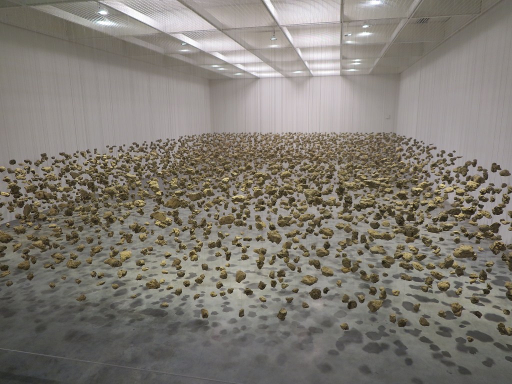


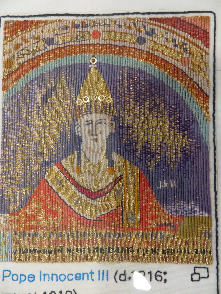


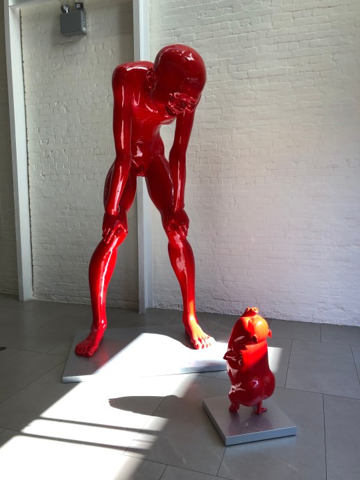

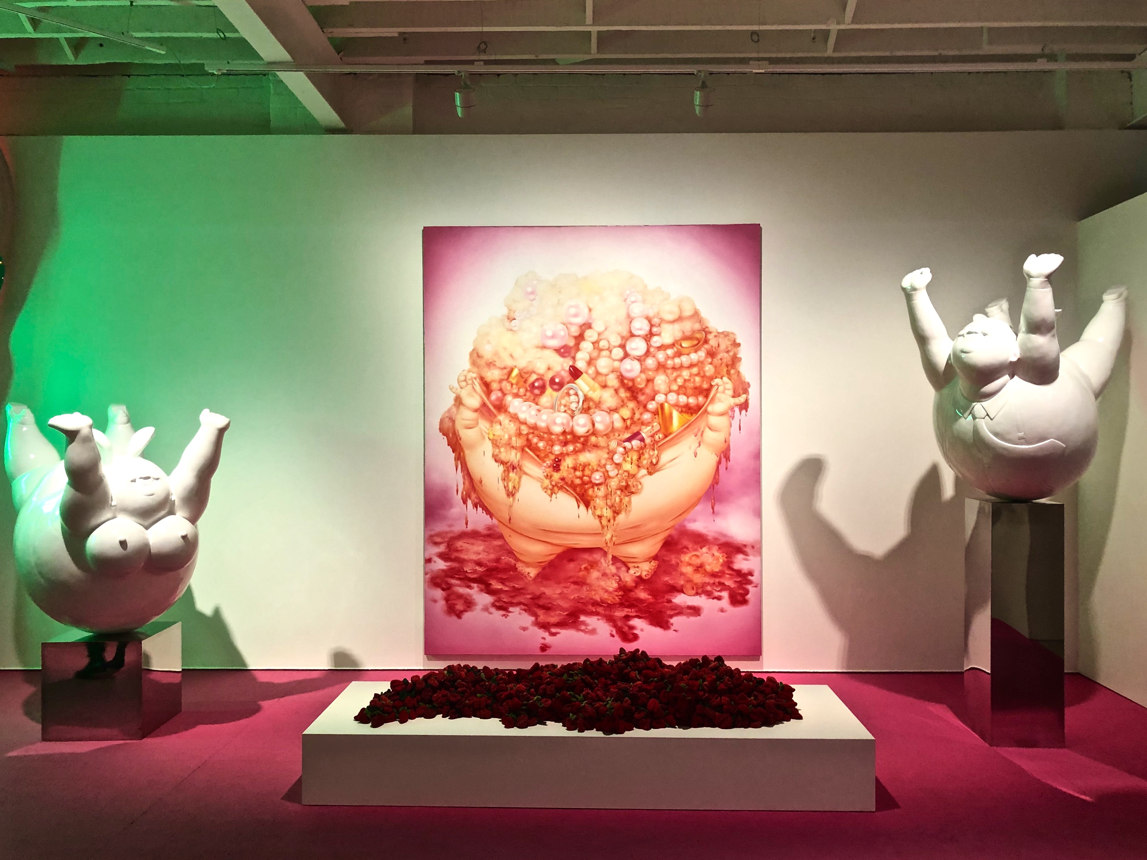


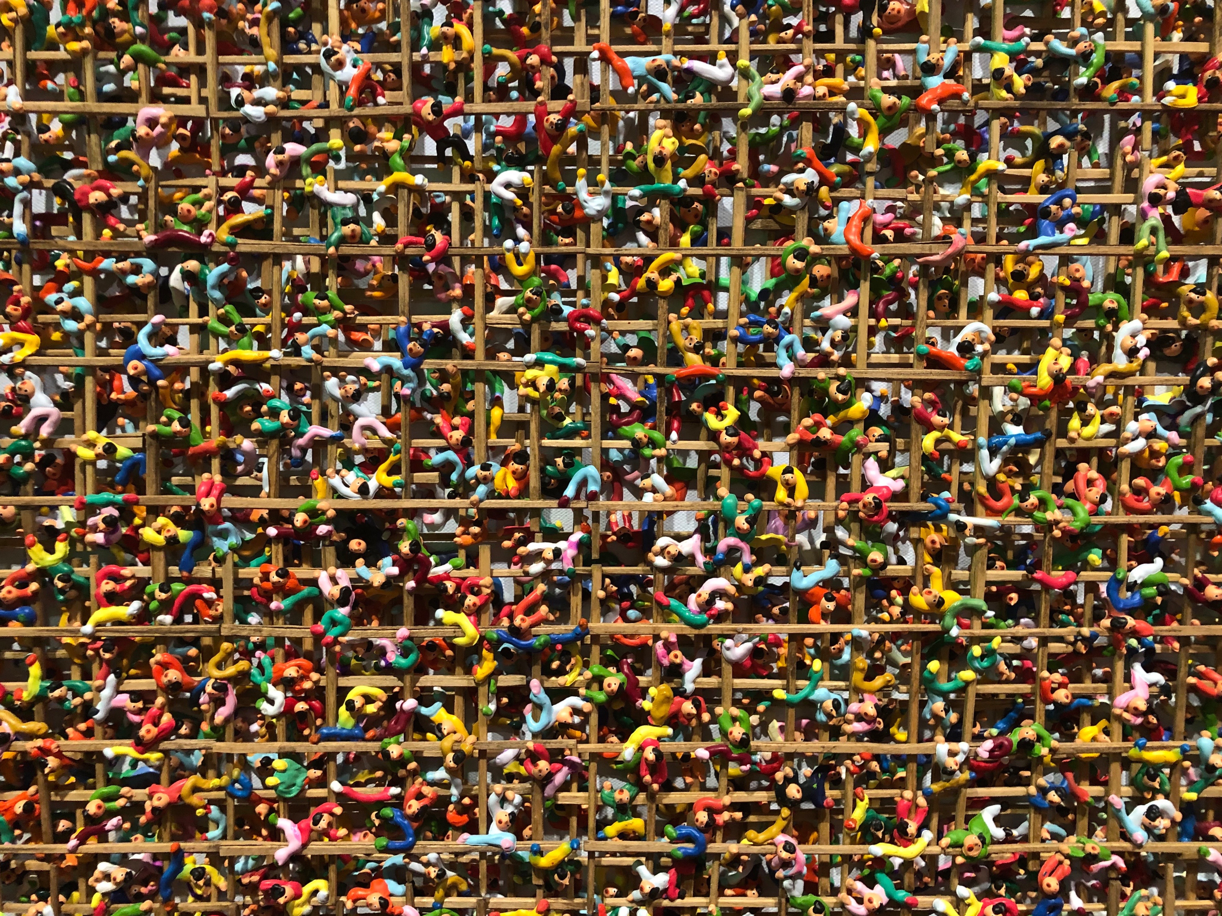
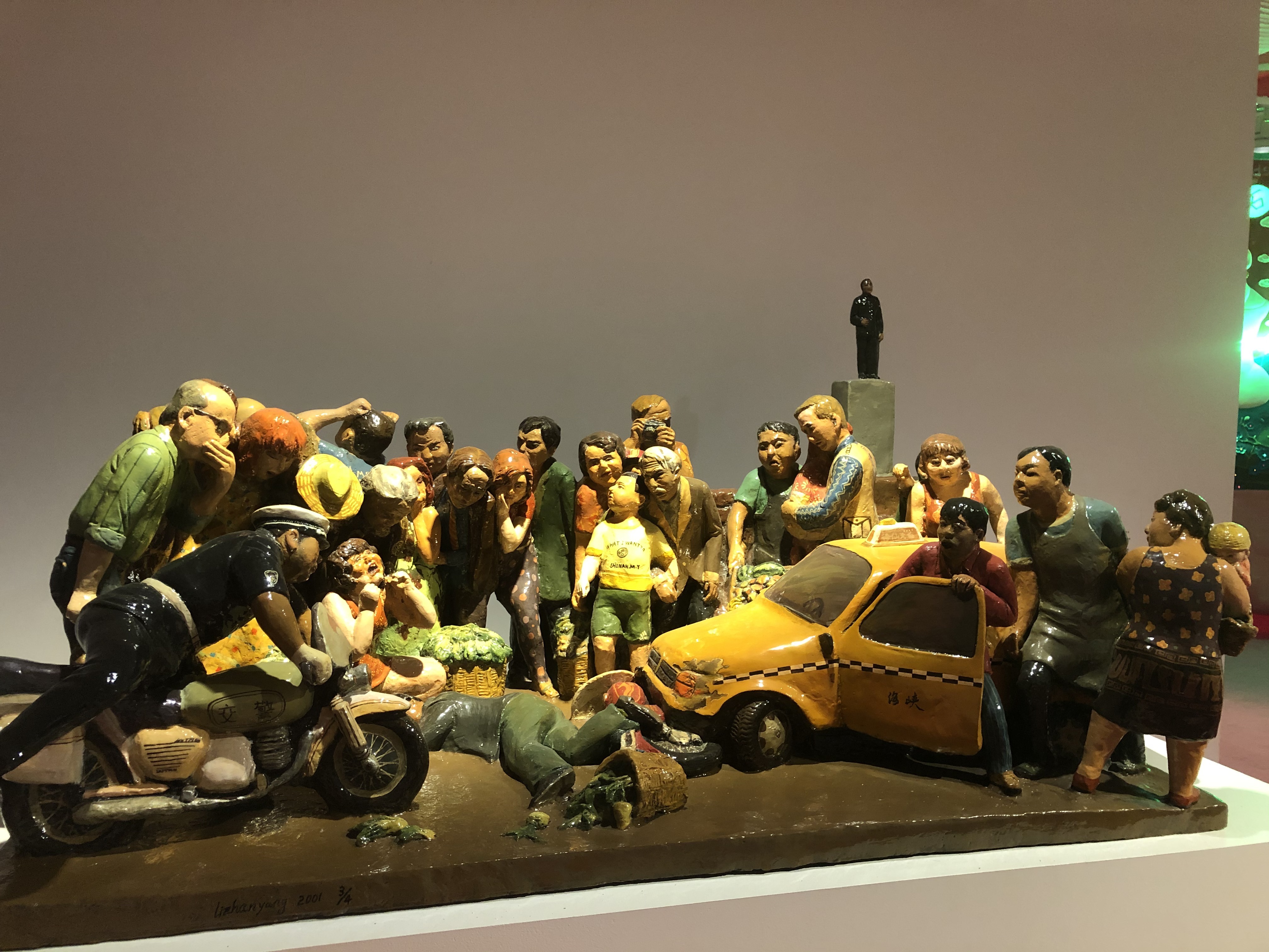


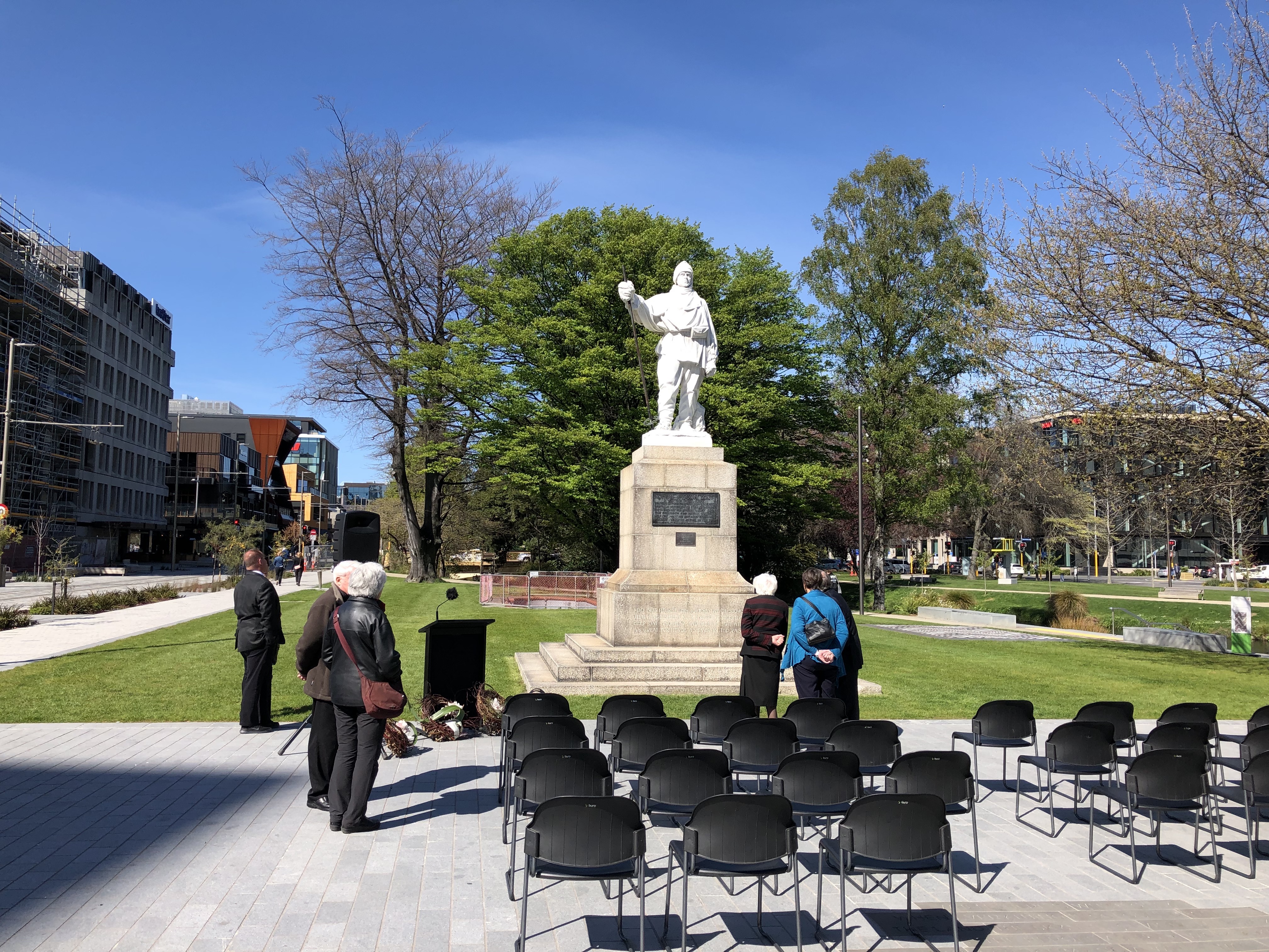
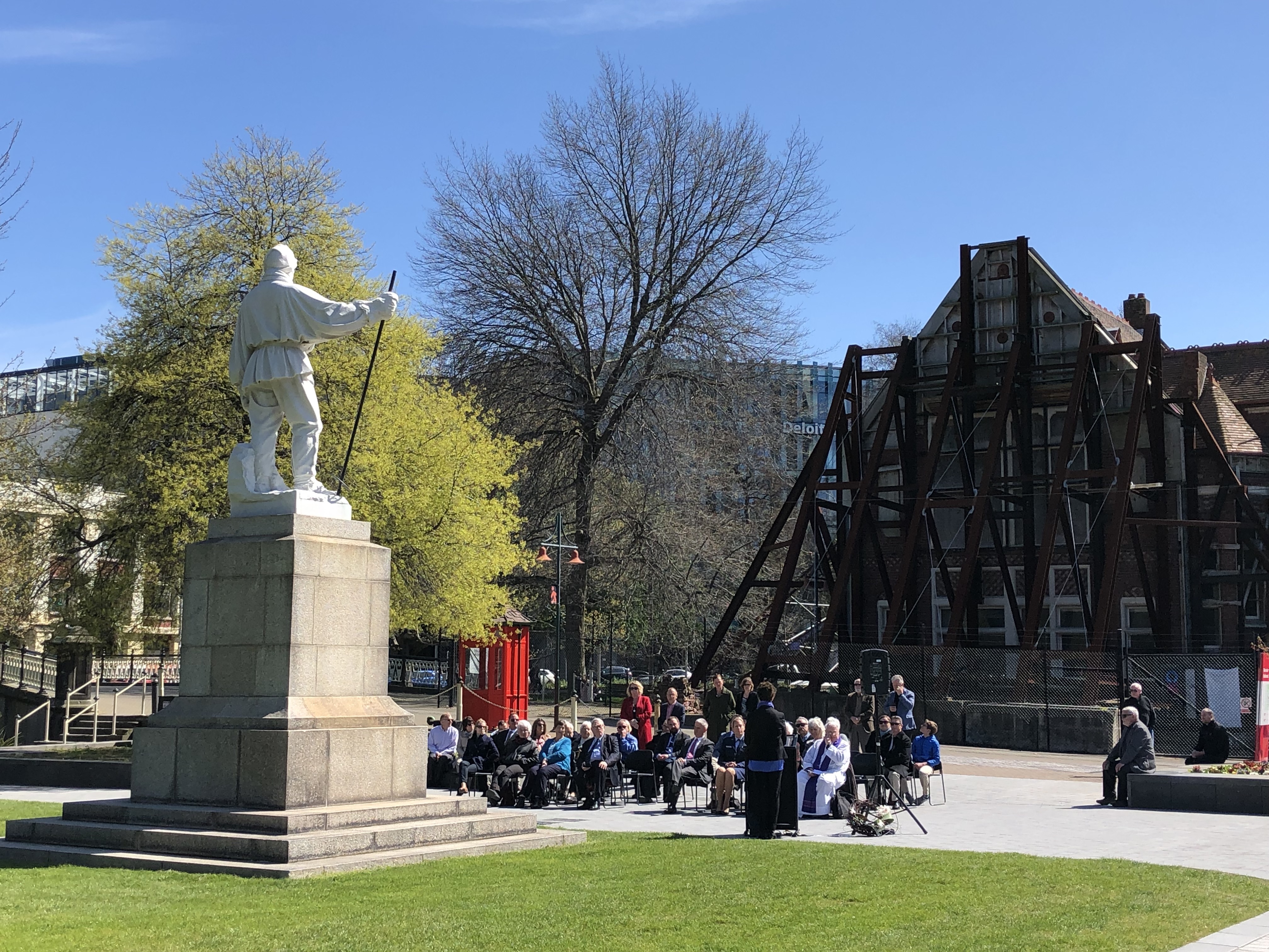 No. Still work to be done. Fortitude still required.
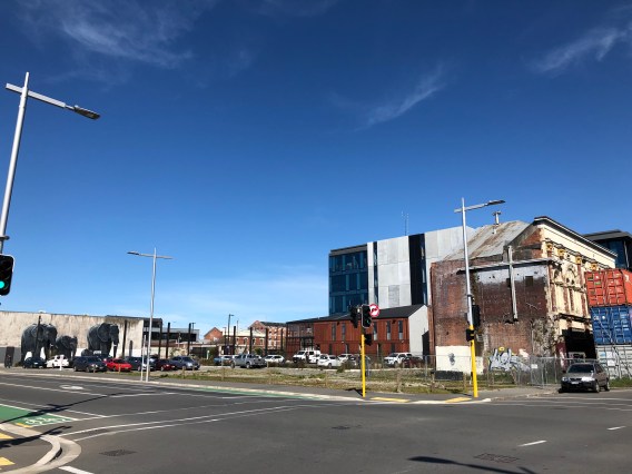 this is now. It’s not over yet by any means.
 What was it serving? And this is important.
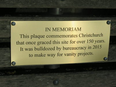

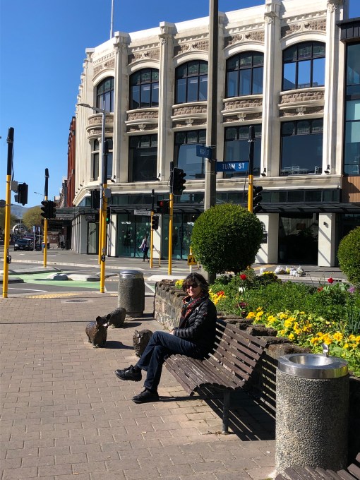


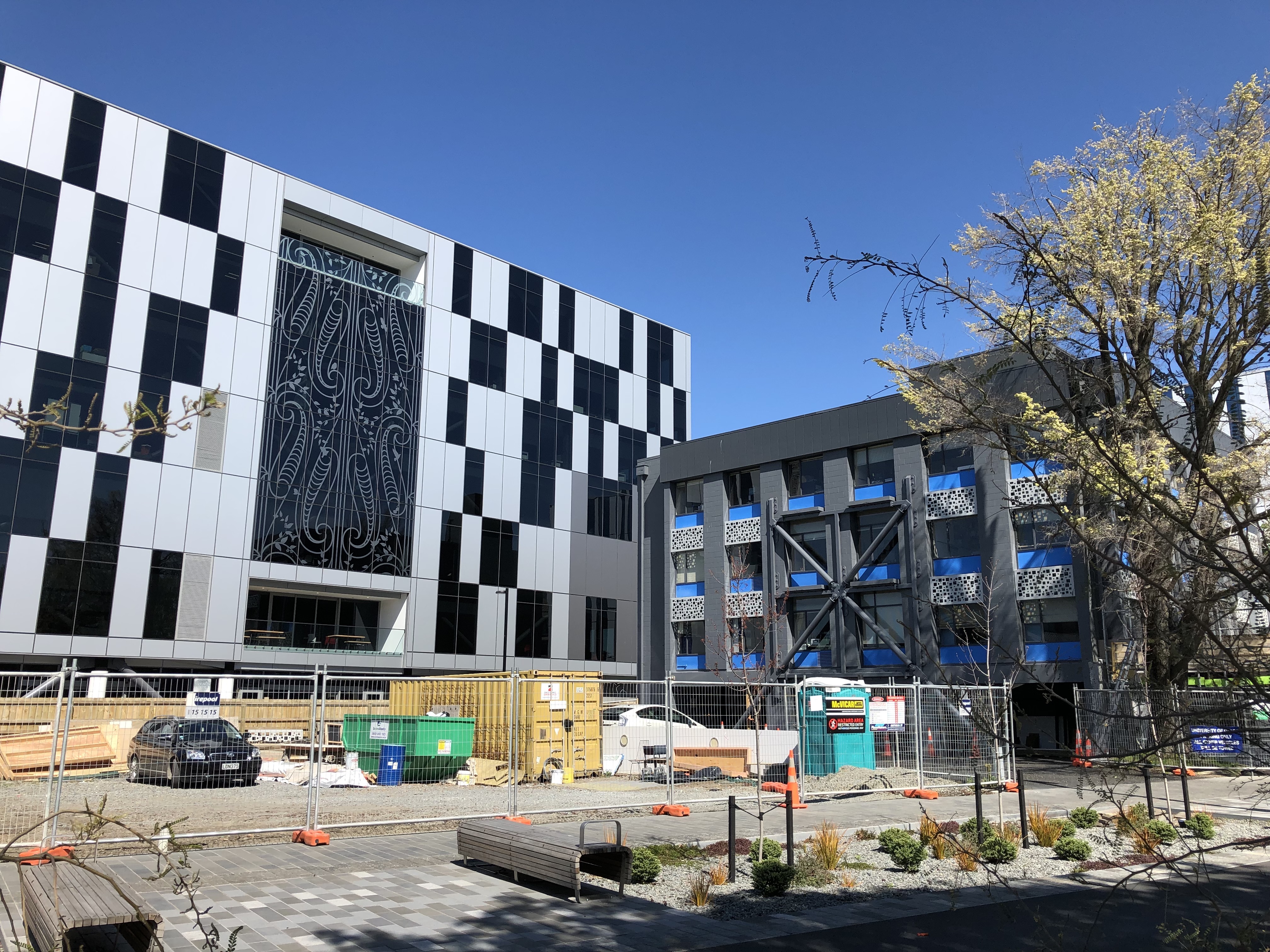
 Ōtautahi: the place/home of (Te Potiki) Tautahi, the Maori name for the place where some of Christchurch is now, specifically near the fire station next to the river some distance from this building. But why this is so striking is that we are looking at a flat surface (with two obvious indents where the balconies are). It used to be a flat cream brick wall, and now it isn’t. L’oeil is certainly tromped. Just wonderful. And part of the new groovy area which was never far from here. Maybe that’s the Amundsen approach to recovery.
 and Hagley Park, undamaged by the quake, was as glorious as ever. Perhaps it doesn’t make sense to talk about a recovery from something that never happened, but this massive park in the middle of the city must be some sort of ‘recovery’ salve for the body politic.
 So over its centuries of life what has this magnificent tree seen?
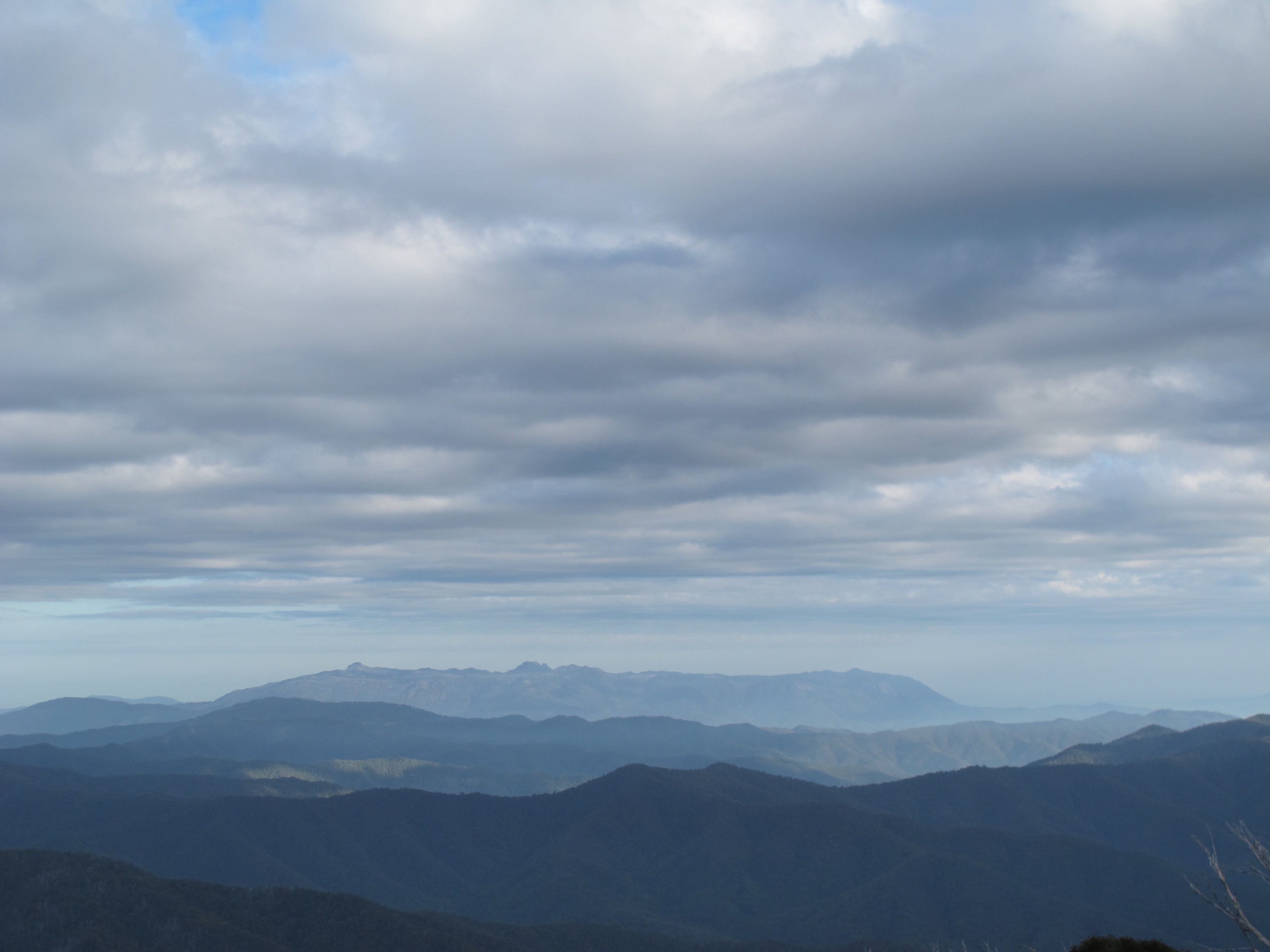
 From time to time in the past I have wondered how you might prepare Bogong moths. In my imaginings I haven’t got much beyond plucking one off the wall, popping it into your mouth and justcrunching it up. Wrong.
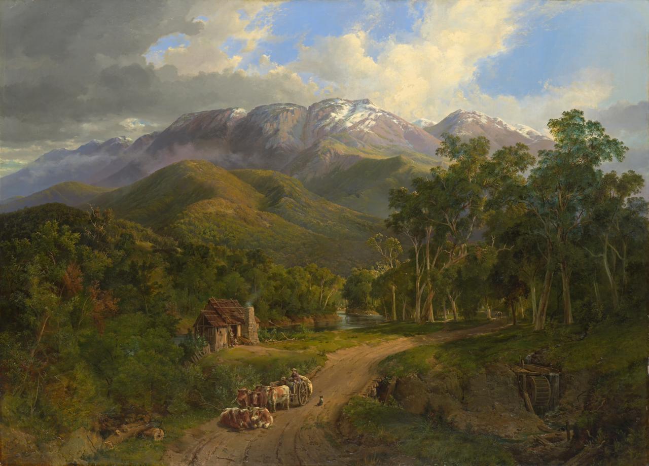

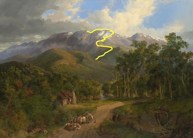
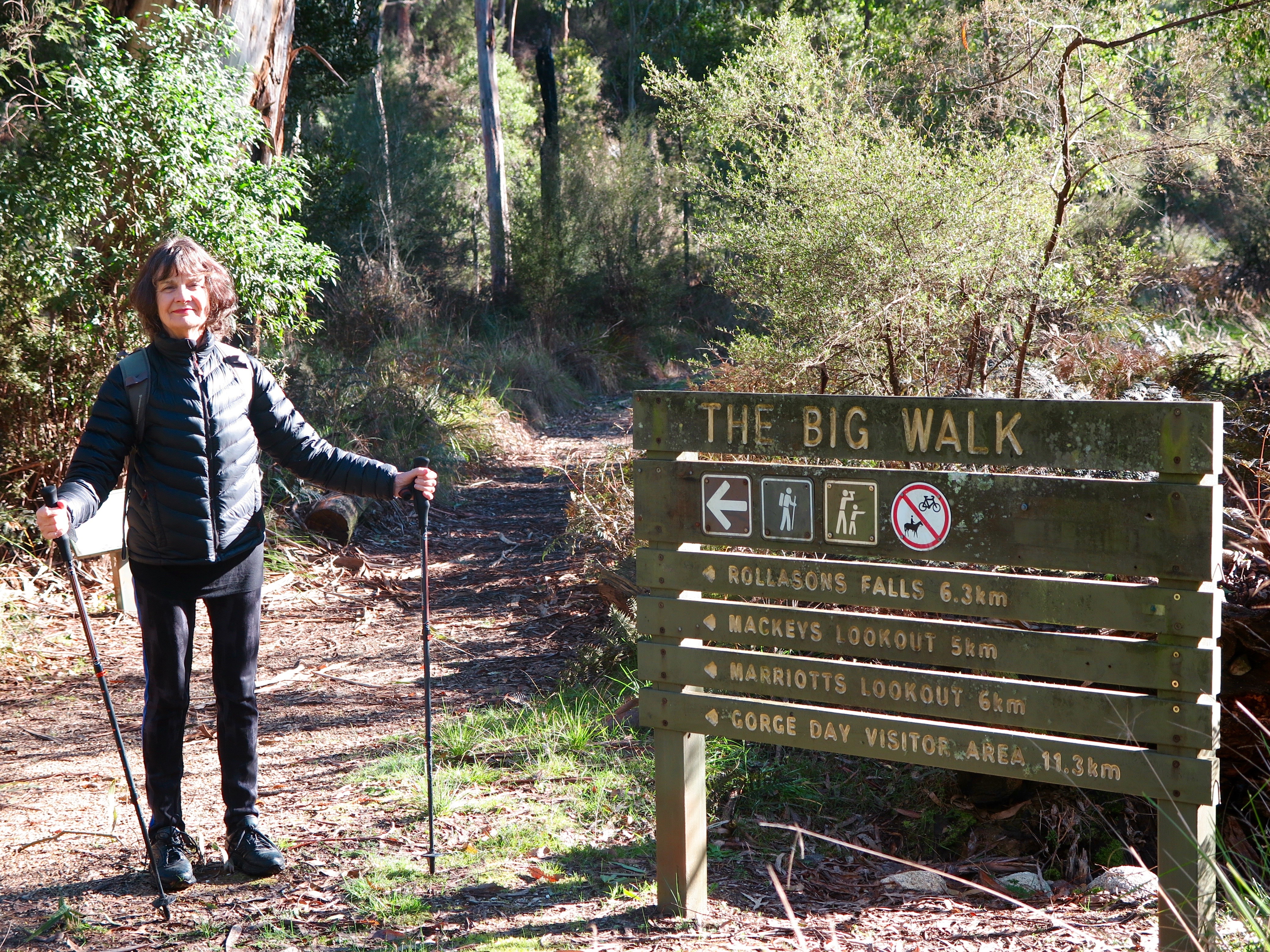
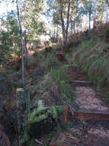
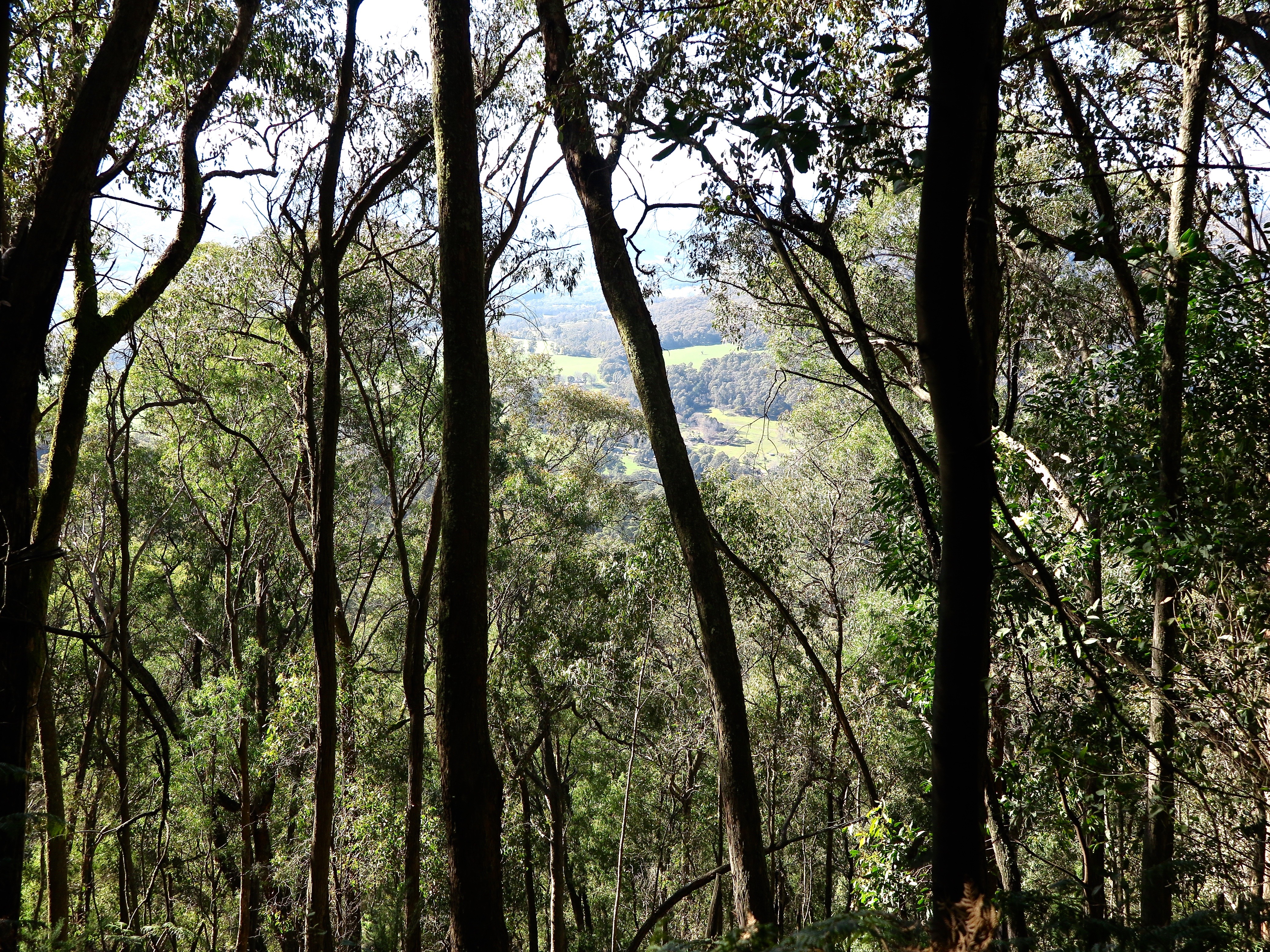
 Then 600m to the road crossing at the hairpin bend. The trip by road to The Chalet is almost twice as far as the walk.
 That is Feathertop in full snow, the Razorback Ridge to Mt Hotham to its right. As you climb, these views just keep getting more expansive, better and better. You cross the road three more times and come out at Mackey’s Lookout.

 By my count, 31 corners 16 zigs and 15 zags, head out all the way, on a track that reminds me in places of the ‘road’ that the Austrians forced the Montenegrins to build so that they could haul their artillery up to the top of the cliffs above Kotor (at left).
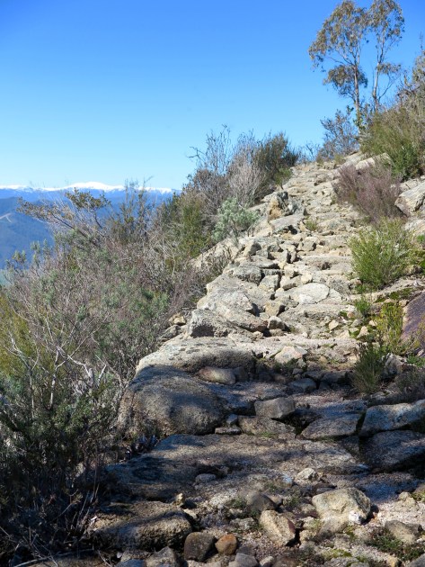
 And just as it looks, perfect weather. Marriott’s lookout. Who wouldn’t enjoy this?
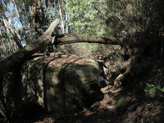 This rock signals the the fourth section — the last of zig-zags and a long traverse west through quite dense alpine ash forest before turning sharply left back some distance across the lip of the face and around the inset of The Gorge. The track got wet,
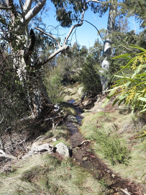 then a bit snowy,
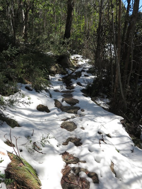

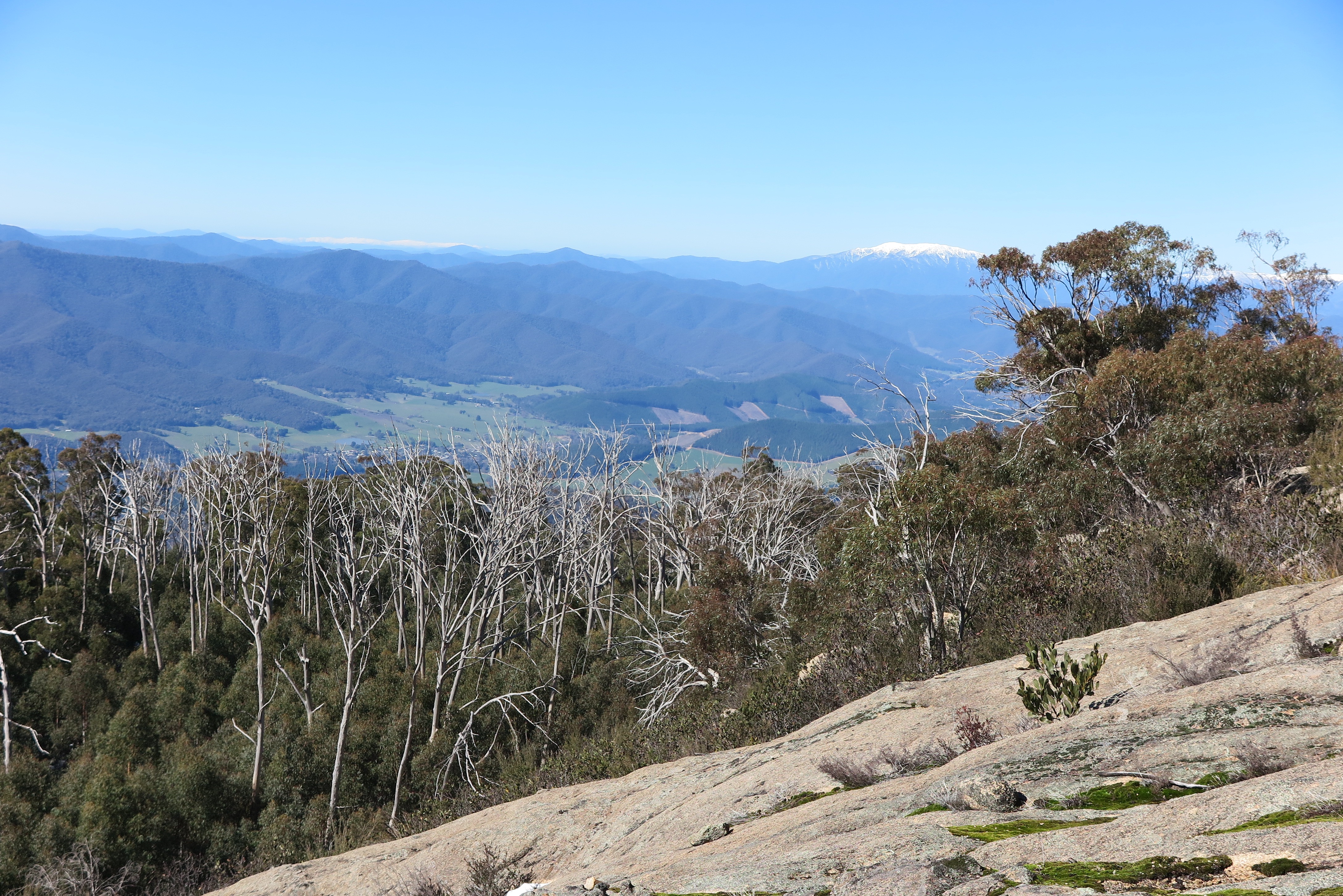 We got to the highest point (Bogong on the horizon above), still about 2 km from the Chalet. It would be one hour to get there through deep snow and one hour back to where we were, even before the hour back through the snow that we had already done. Four hours through snow, and we would be doing the final hour of the walk in the dark. So, sorry but no. Thwarted but not dismayed, we scuttled/ scurried/ stumbled (Myrna’s generous choice of terms for my gait) back to the car. What a walk. You could call it a Big Walk.
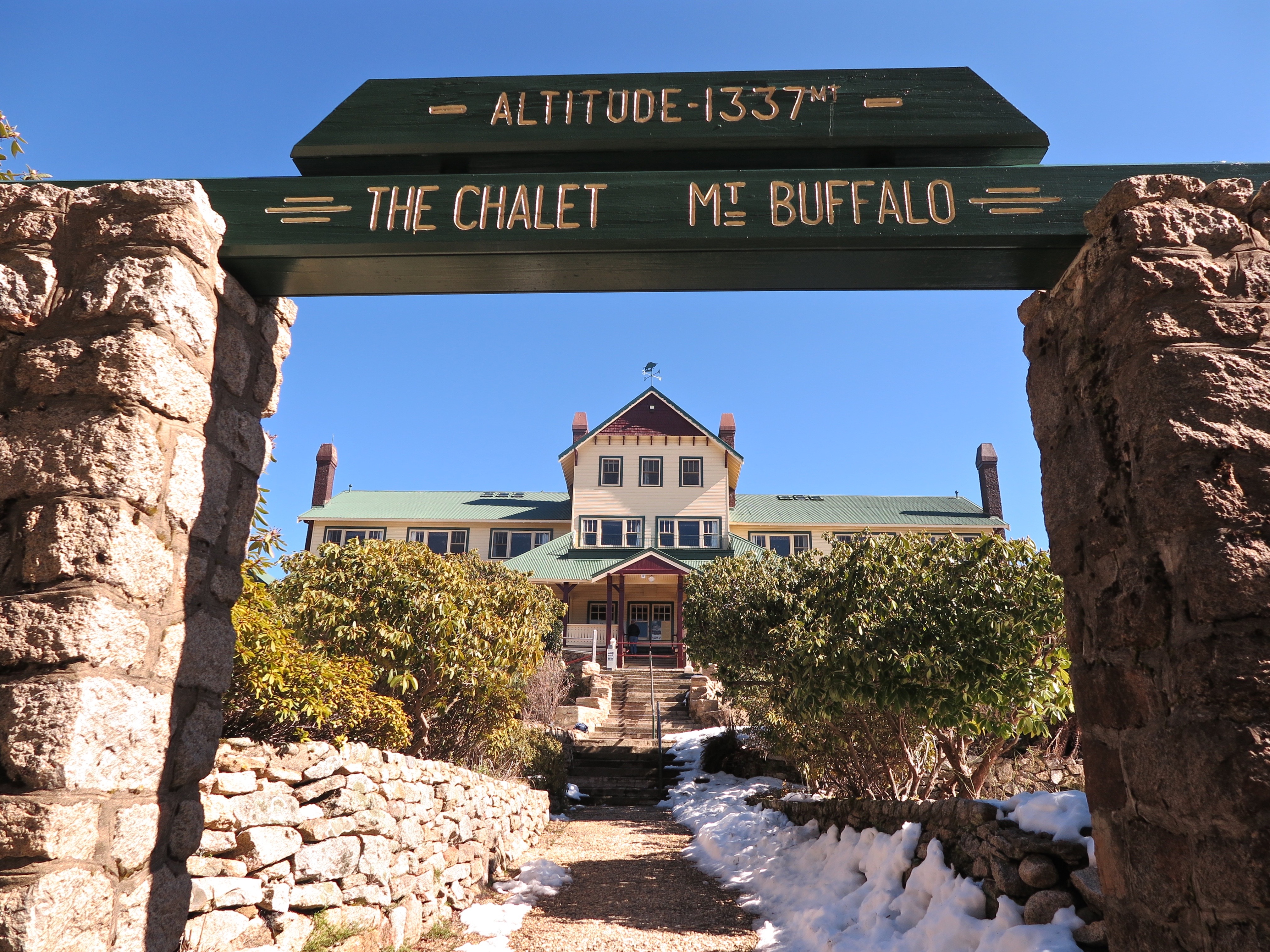
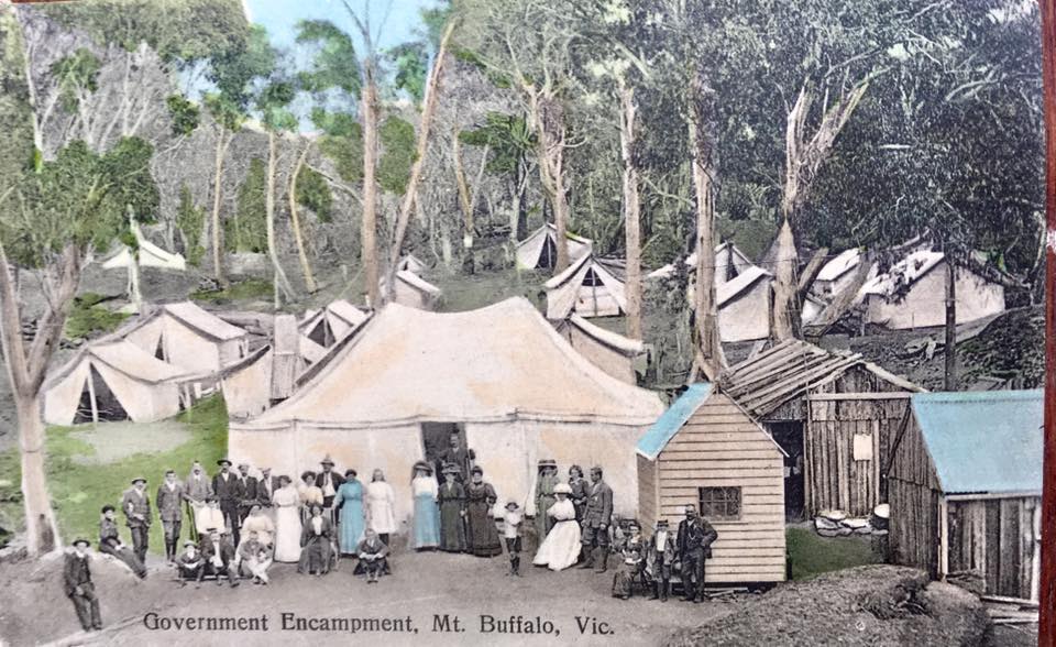
 From his trip here in 1853 Baron Von Mueller added 78 previously uncategorised species (of the 480+ present on the mountain) to his plant collection. E.T. Dunn, who called the plateau ‘a garden of the gods’, thought it the most interesting place geologically in Victoria. Thomas Buckland (and many others) was pleased to use the plateau as a place to graze his cattle during summer. Henry Carlile thought it would be ideal for a hospice. Carlo Catani was interested in the technical problems of design and engineering associated with building and transport in an alpine environment (so comparatively rare in Australia).
  Hilda Samsing made a going concern and a living out of the need for hospitality as the number of visitors grew. Harold Clapp pursued his idea that the mountain would be the perfect destination for train travellers, Bert Keown and Ollie Polasek for skiers. Sir Russell Grimwade and Sir George Kerferd thought it might be an important place to preserve. Sir Rupert Clarke (and a long list of others) thought it would be a good place to develop and make some money out of.
 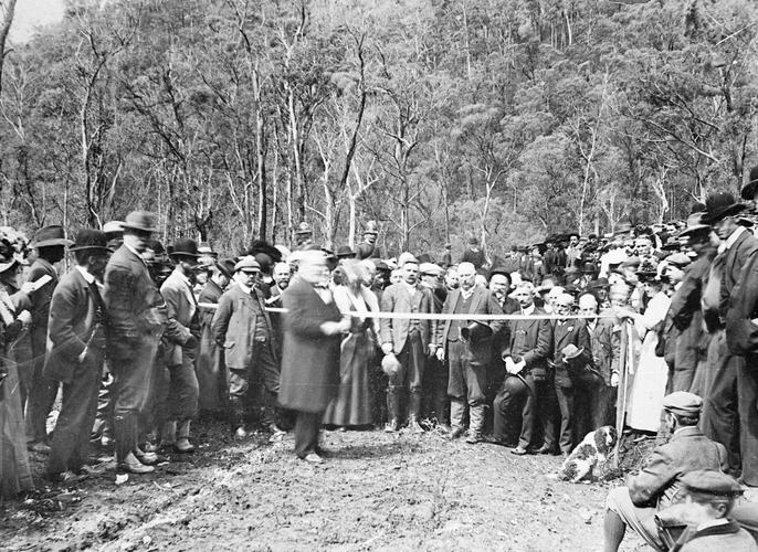 Early in the 20th century a vituperative war broke out between two transport companies vying for the right to transport passengers up the hill: initially horse carriage vs. motor charabanc, later bus vs. bus. Under the strain of cutting prices, both went broke. (At left, bent Sir Tommy Bent, Premier of the day (1908) opens the road.) Then there were the backdoor means (‘It wasn’t even discussed’, complained Jim Neville the distressed previous licensee) by which Victorian Railways acquired the rights to the Chalet in 1924.
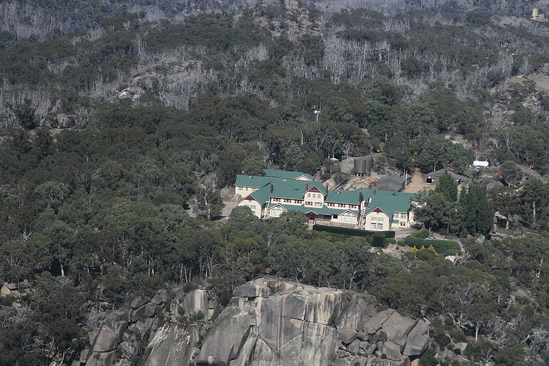
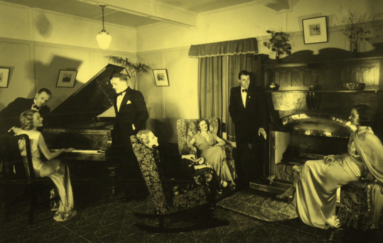 The family at leisure in The Chalet’s piano lounge.
 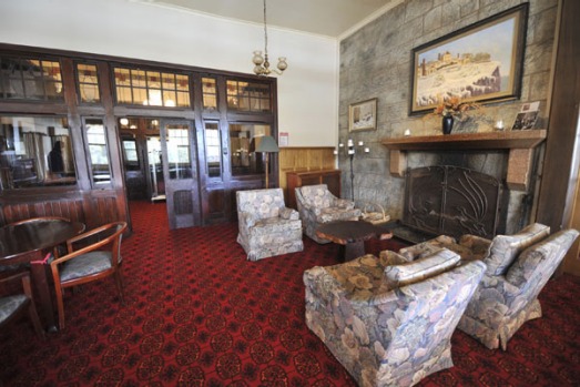 But until 1983, no bar. No licence, no bar. Which didn’t stop people bringing their own. Norman Banks was one of the people escorted off the mountain for alcohol-induced excessively rambunctious behaviour.
  It didn’t begin like that. At right is Henry Carlile’s hospice, a very early building at a site which, with its 650m sheer rock wall, was a magnet for many ambitions.
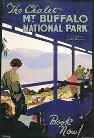 Who stayed at the Chalet? Well … in its day, the Who’s Who of Victoria: the Myers, the Brockhoffs, the Gadsdens, the MacRoberstons, the Grimwades, Sir Macfarlane Burnet, the Victorian Cabinet, the Prime Minister, various Governors. The German Ambassador and his staff were regulars for a time. Guests were required to dress for dinner, men in dinner suits, women in evening gowns. The photos above in the piano lounge and below in the ballroom are neither fake nor staged. That’s how it was.
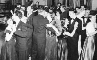
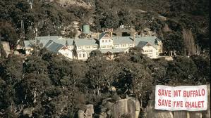 In the 61 years VR had run The Chalet it had made an annual profit twice; in the last five years it cost the Government $2m. In the ’50s and ’60s the average occupancy rate was 70-75 percent which I would have thought was pretty good, but 85 percent was the break even point, and there was the conventional resort problem of feast (Christmas, Easter, school holidays) and famine (the rest). Staffing was always an issue because more than half had to live on the mountain and, until the 80s, staff accommodation and living conditions were quite primitive.
 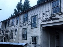 And then there was upkeep on a wooden building, never well built in the first place, in an alpine environment. The degree to which it decayed in the five years from 2007 to 2012 was hard to believe. One would peer in through the picture windows down the panelled walls to the ballroom and the still vaguely glamorous front lounges, past the rotted weatherboards, destroyed guttering, termites in the piers of the foundations, fire escape staircases falling off the building, galvanised iron roofing flapping.
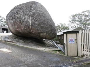

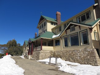
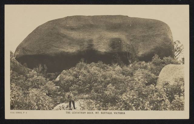
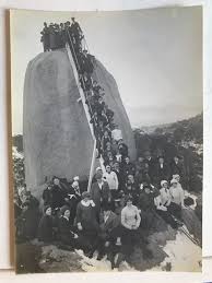 They wanted to climb, stand and sit on The Monolith.
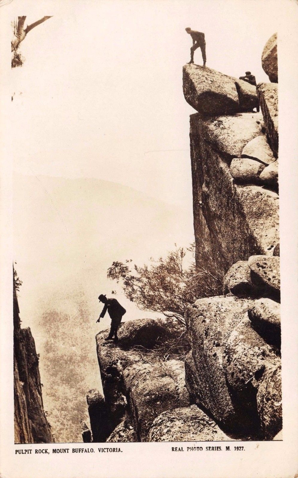 They wanted to throw snow at each other, and go tobogganing
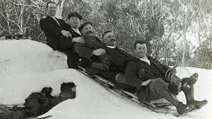 and skating on artificial Lake Catani, hectares of water a metre or two deep (which no longer freezes).
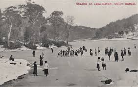
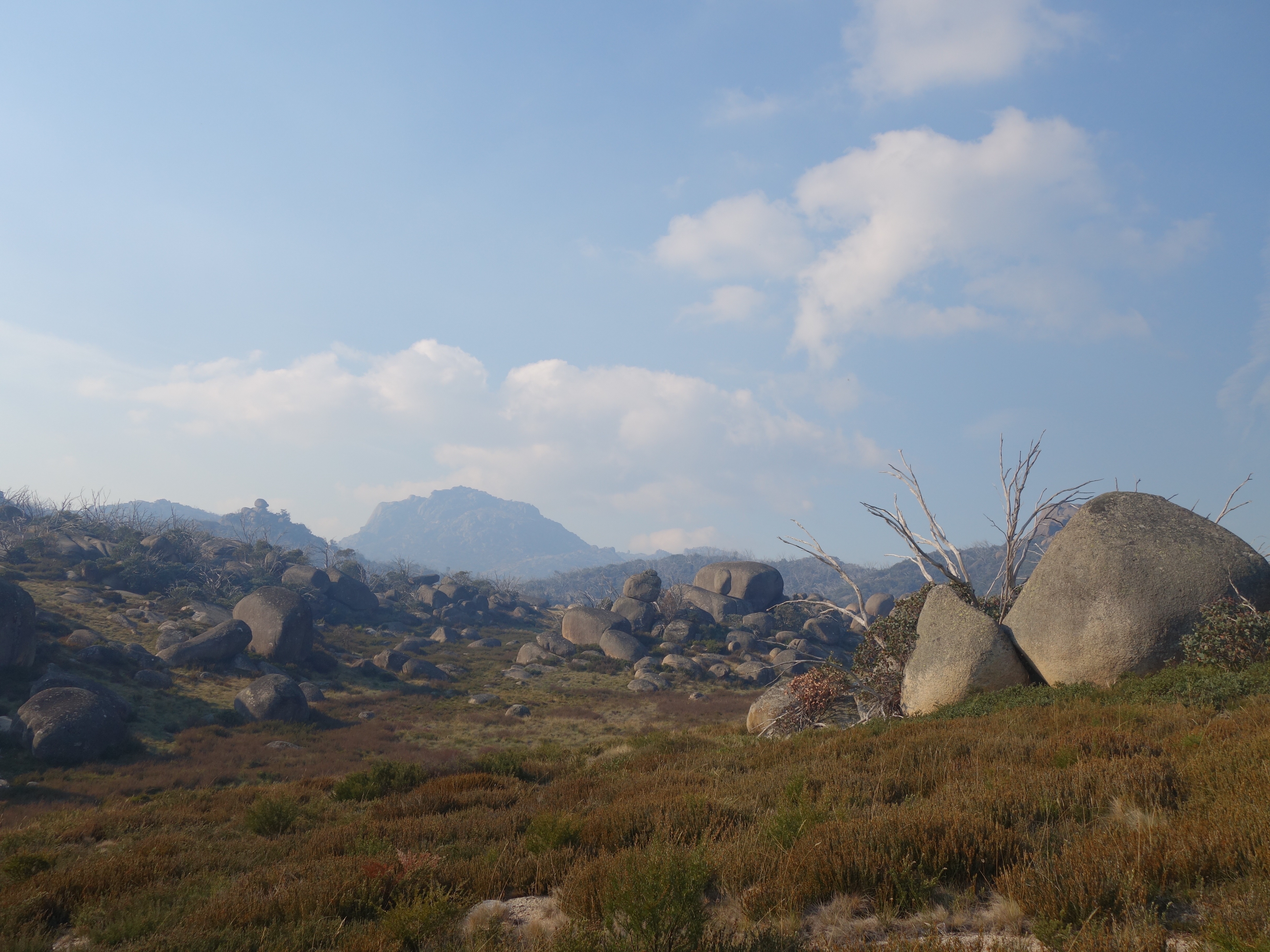 ‘A Garden of the Gods’. Coming back from a walk to the South Wall, The Egg delicately balanced on the left horizon, The Hump in the background.
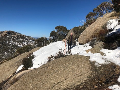
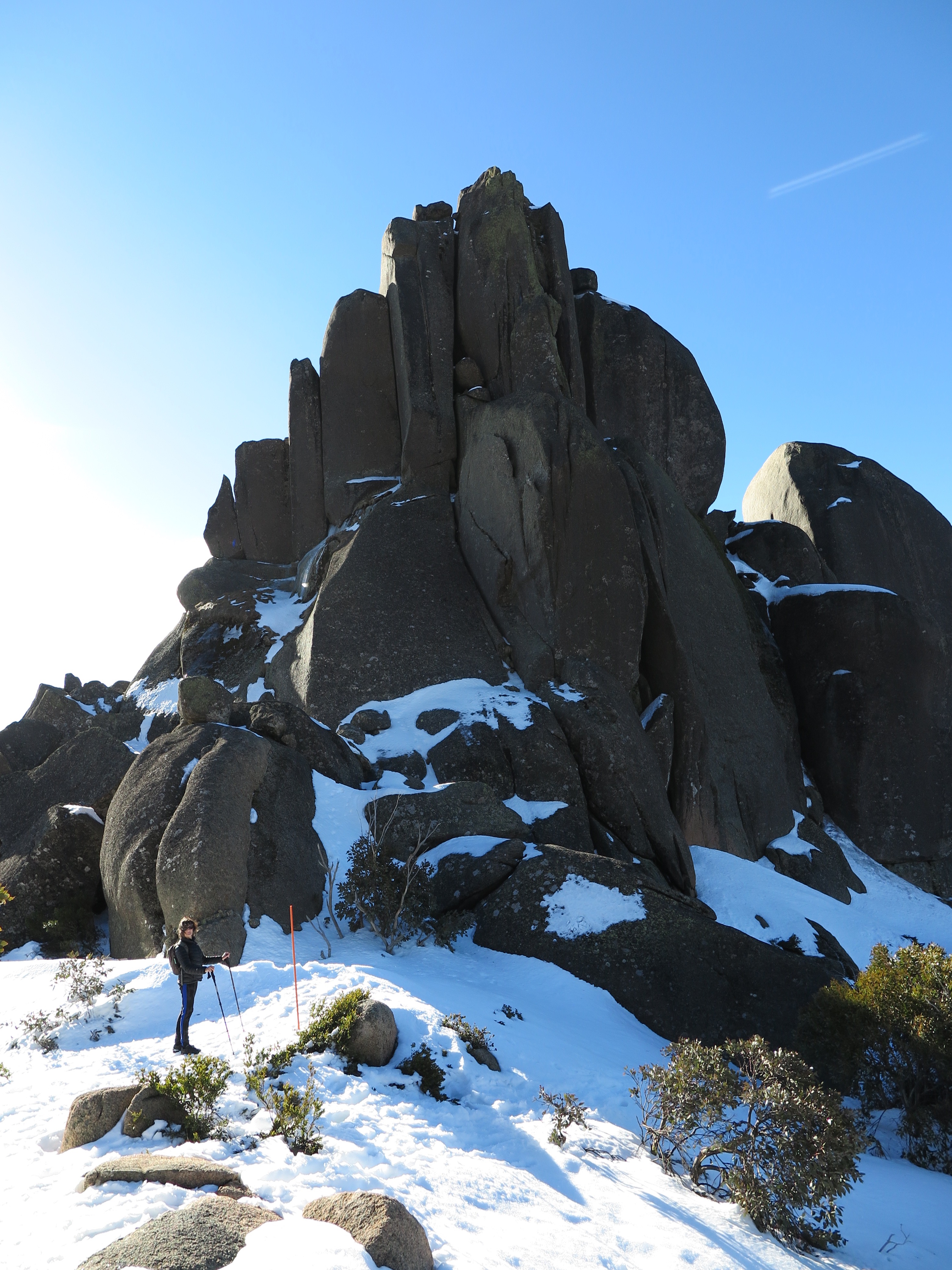
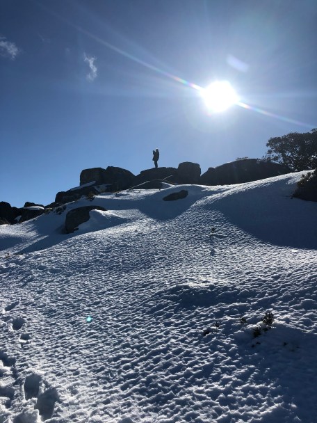


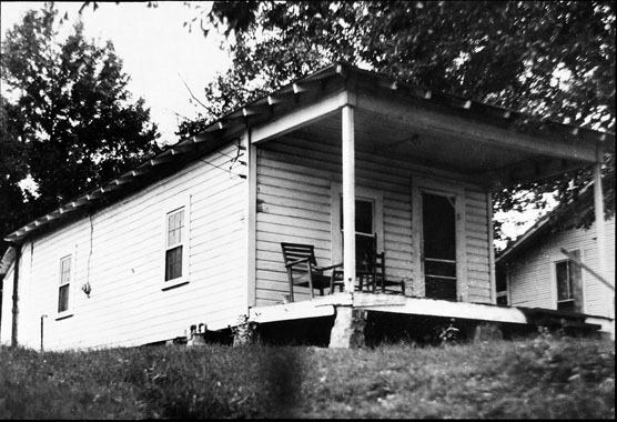 Elvis began his life as struggling white trash. Gladys kept things together. Vernon didn’t. Elvis was three when his father went to gaol for eight months for forging a cheque, part of a pattern. They lived in this two-room house in Tupelo that Vernon built before moving to one of three houses designated for whites in a Negro district of heavily segregated Memphis. America is just emerging from the Great Depression at this point.
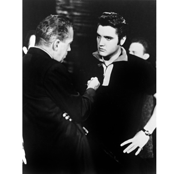 This is happening over 18 months. The ‘overnight-ness’ figures only after appearances on national television, firstly on the Milton Berle Show which accorded him
  Elvis, who even before going into the Army had signed a deal with Paramount for seven pictures, was being managed. Elvis could have largely continued his career just wearing a uniform, but it appears that he and the Colonel agreed, if for differing reasons, that he should be in so far as it was possible a ‘normal’ soldier. The Colonel didn’t mind. On two weeks leave, Elvis recorded a stache of songs which the Colonel released strategically to keep the legend alive while Elvis was serving , among them ‘Wear a Ring around Your Neck’, Hard Headed Woman’, ‘One Night’, ‘(Now and Then there’s) A Fool such as I’, and ‘A Big Hunk of Love’, all monster hits.
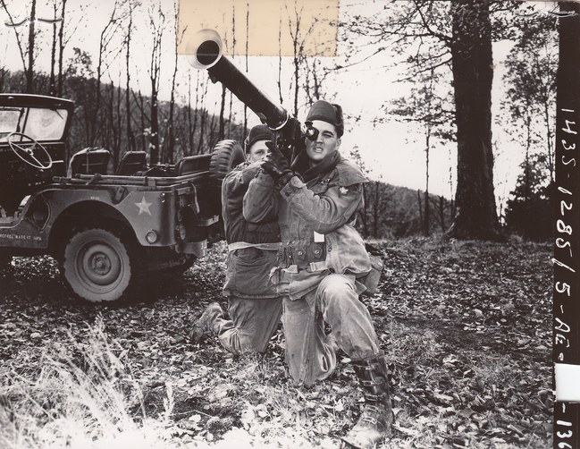
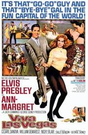 31 of them, made between 1956 and 1969, often three a year: not a recipe for cinema of the highest quality. And I don’t know whether you will instantly recall Spinout or Easy come, easy go, or even Stay away Joe, tagline: ‘Elvis goes West, the West goes wild. And that’s no Sitting Bull’. In that film Elvis plays an ‘Indian’, a Native American, for the second time. But unlike in Flaming Star, the other one, a tenable film in which Elvis’s acting plunges more than millimetre deep, his Cherokee character is a combination of all available stereotypes of dodgy Injun shiftlessness.


 Entry to the throne room can be from The [Latrobe] Valley of course, and there is nothing especially wrong with that, not per se.
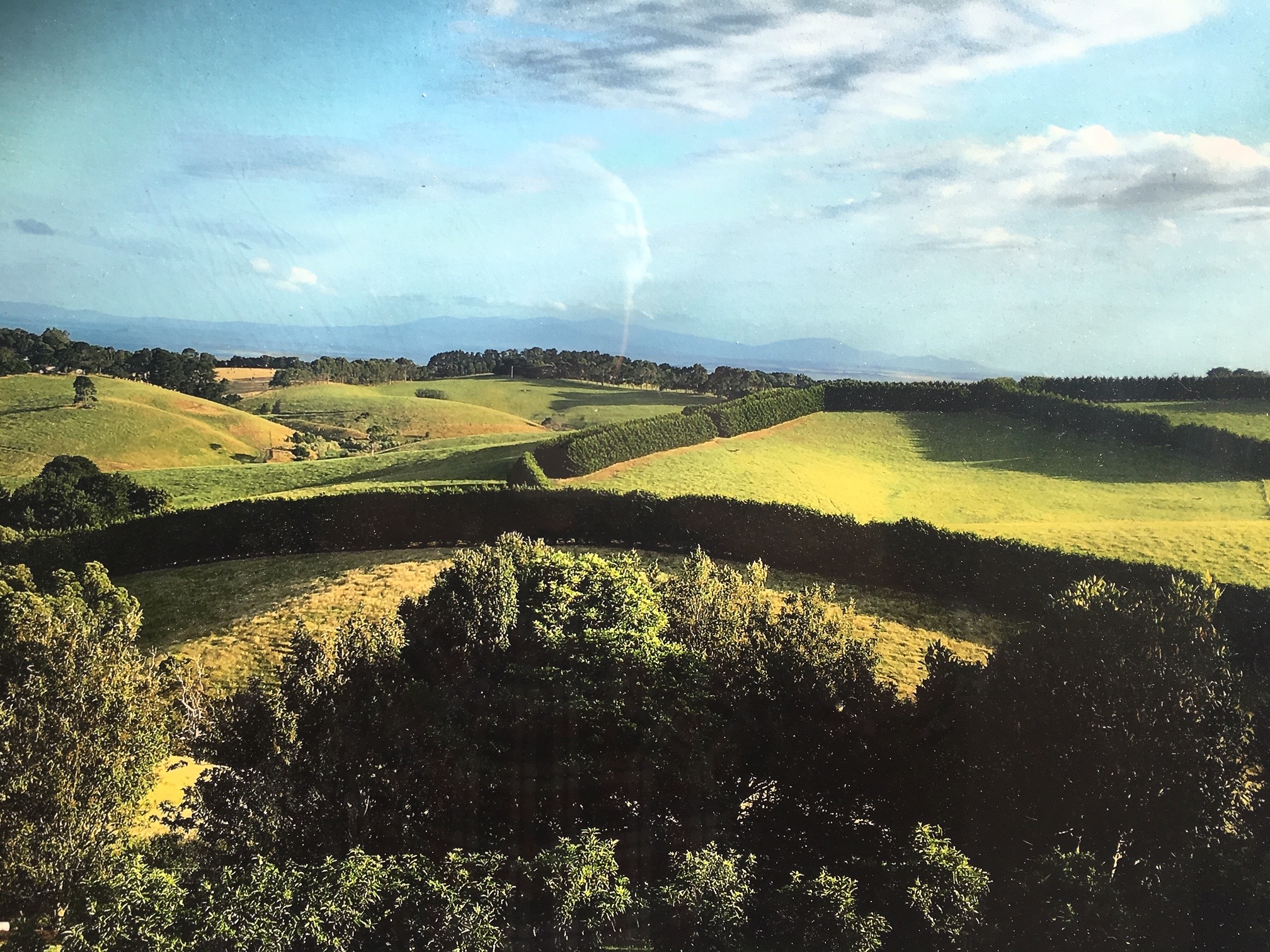
 At the southern end of the Tarra Valley the ‘shack in the bush’ of past history is still in evidence.
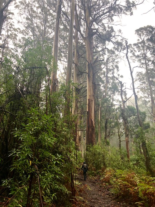
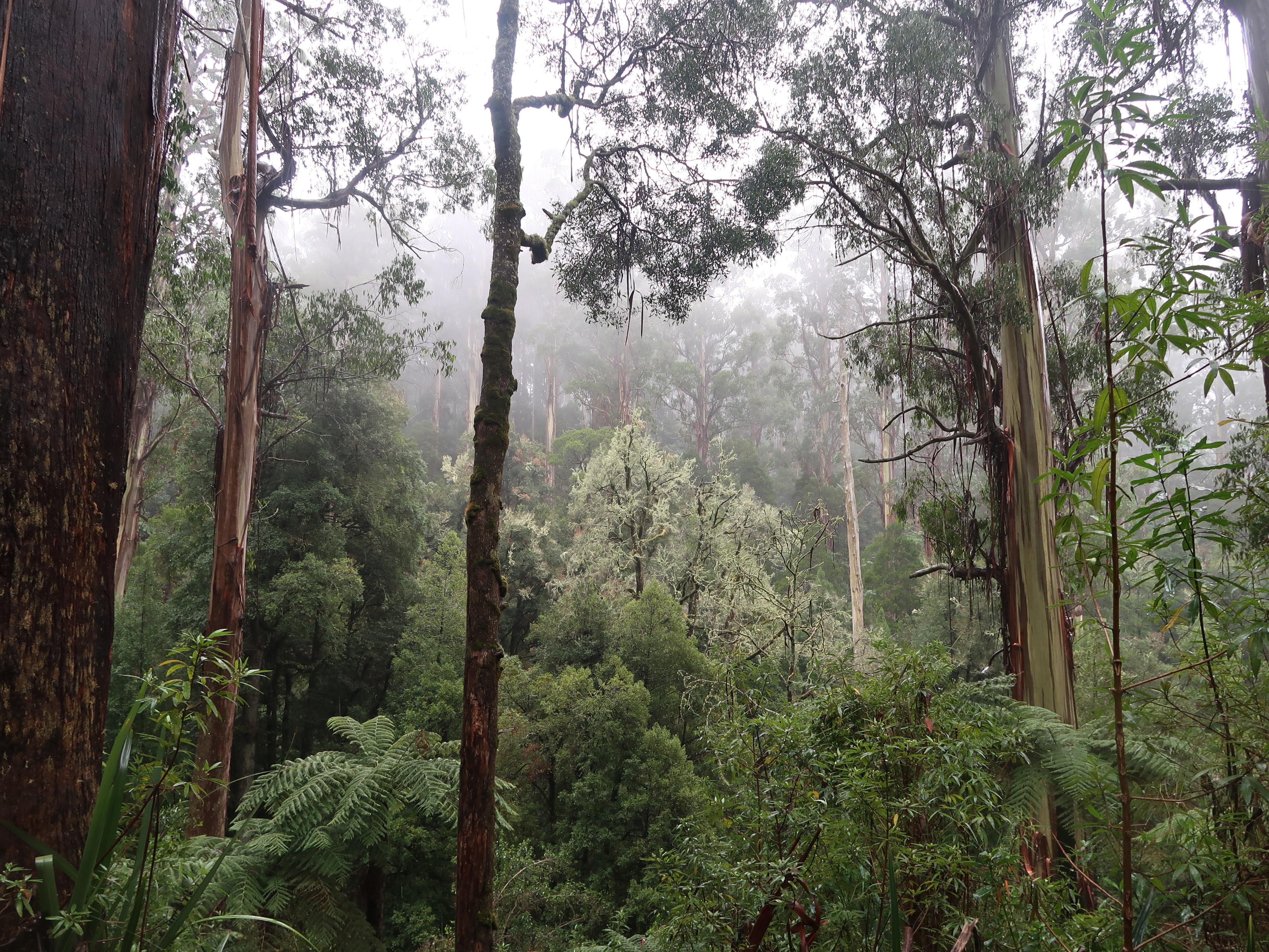 There are several sites of old homestead clearings
 and for some distance the impact of the Black Saturday fires (7 Feb, 2009) is evident. The new stands of Mountain Ash saplings are about 25-30m high — three metres a year that would make the rate of growth — but there was also this unusual forest of acacias, straight, jammed together and, perhaps as a consequence, very very tall.
 Some kilometres of plantations followed, all Nitens like these, with their typical cascades of bark.
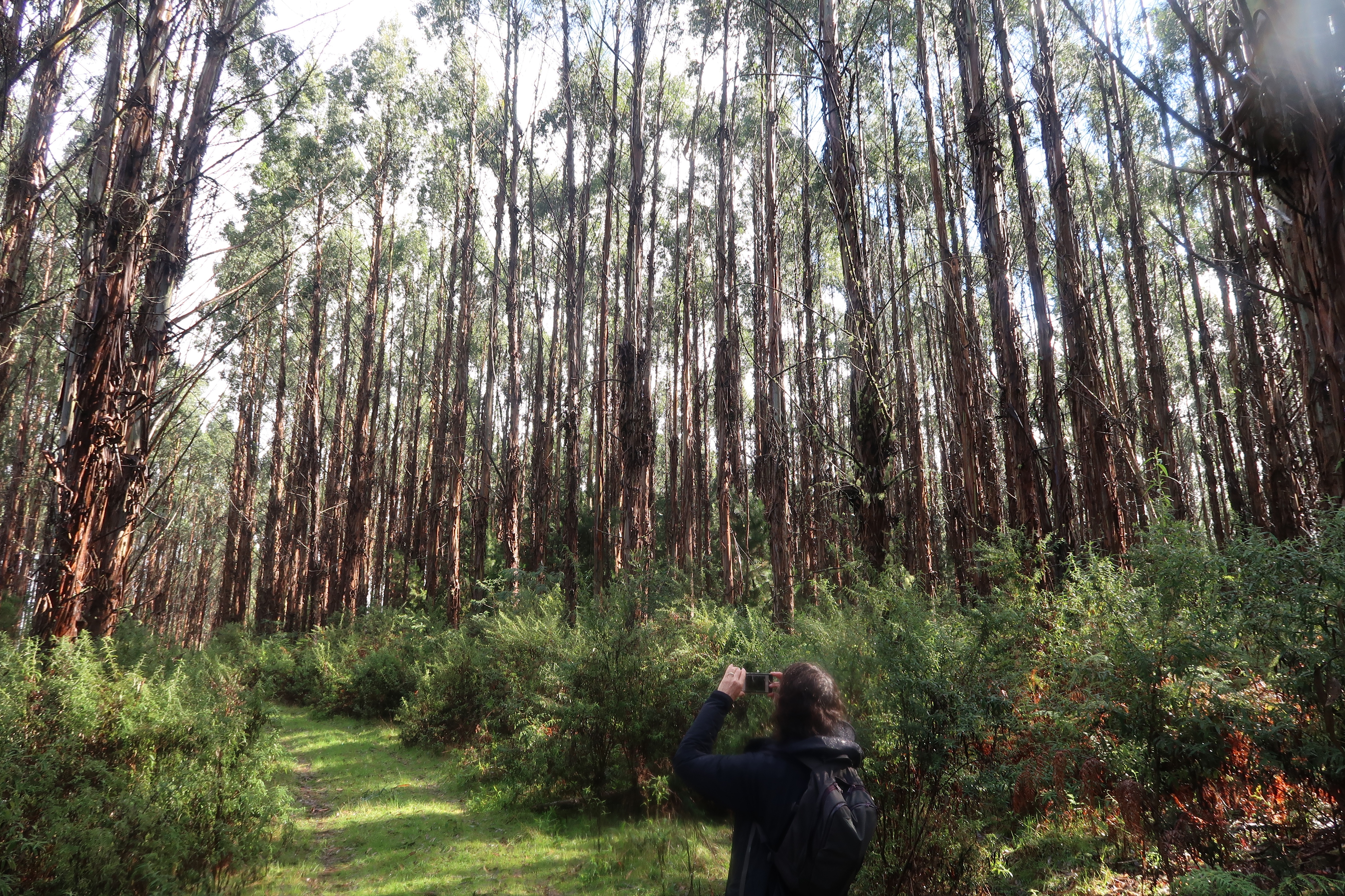 After a fierce, concentrated and slippery climb up Duncan’s Track there is a section on the contour through lovely forest and fern trees, Butler’s Track (below). Great walking through little known history.
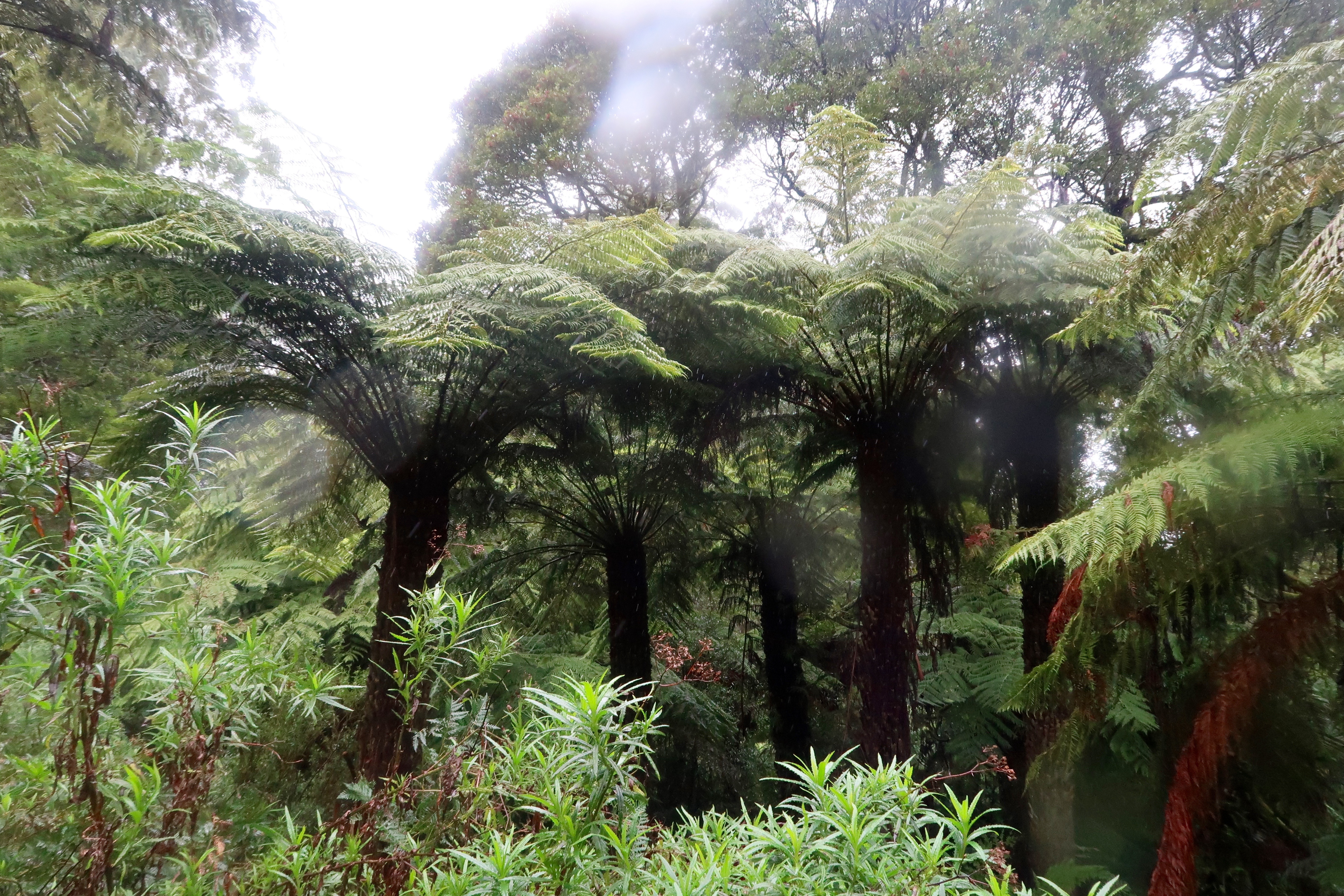
 Rain forests have fungi, especially if it has been warm, and Tarra Bulga was no exception. Wonderful things appeared, some with caps 350-400mms across, monsters, although these were more to be filed under Beautiful.

 A NASA image of Wilson’s Promontory taken during the fires of 2009 during which about one-third of the Park, the brown areas, was burnt. This particular image has been included not because of the fires, but because it provides an establishing shot, an outline of The Prom. You can even see the northern boundary of the National Park across the Yanakie isthmus from Shallow Inlet. And because it’s striking.
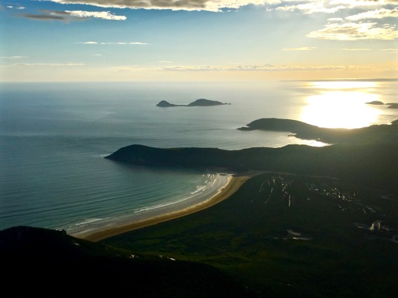 Here’s another: Tidal River looking up stream. Quite Japanese-y in the particulation, variety and harmony of its features: rock, wood and water.
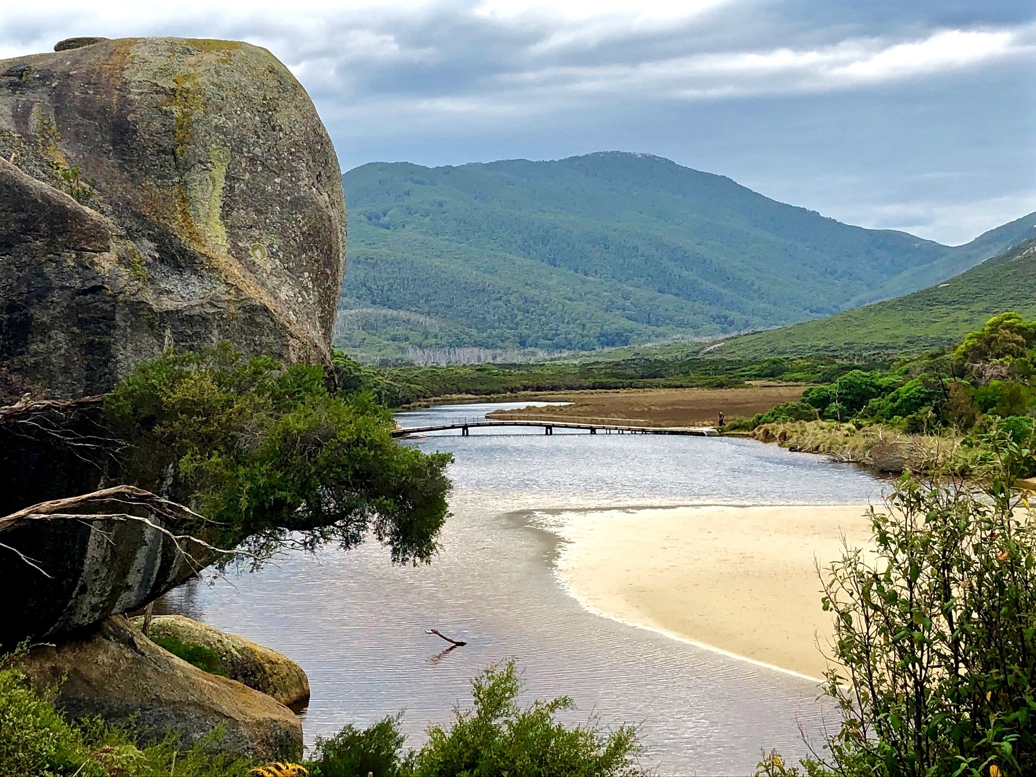
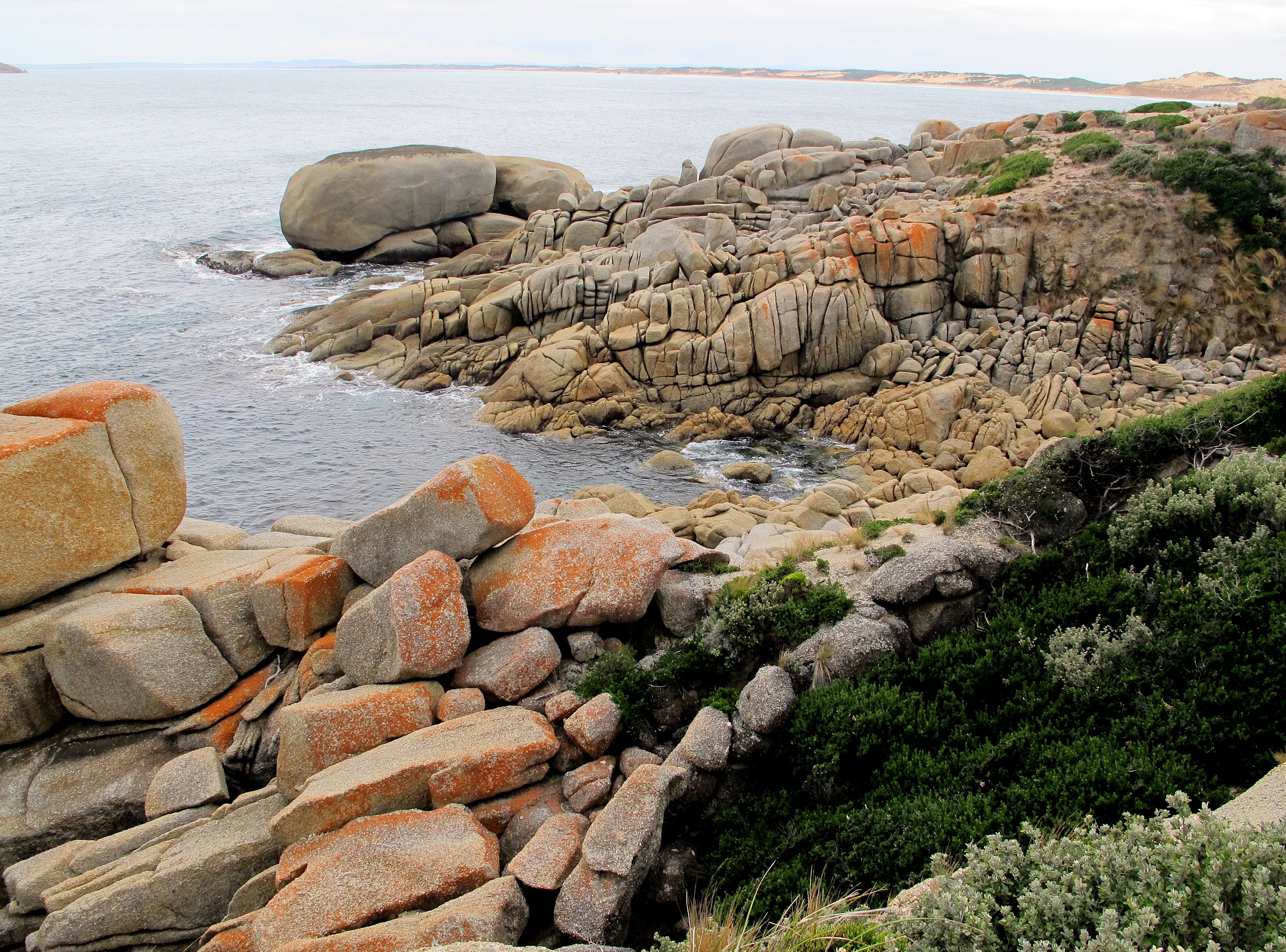 I’d like to say these photos and better versions of them do the place justice. But they don’t.
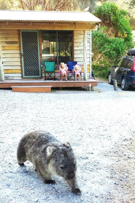 It might be that the 30 kilometre drive from the park entrance to Tidal River is like an overture at the opera helping you to slow down and start looking, listening, tuning in, becoming more alert and sensitive to what will come. During that time you will have driven through six markedly different vegetation zones, some of them repeating, but each of them with their own diverting features.
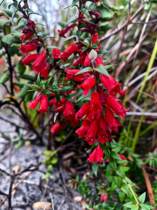
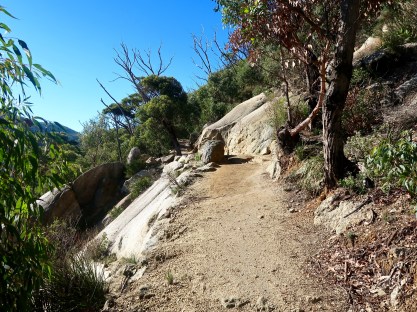 After a drive up to Telegraph Saddle you start reasonably high and walk along an undulating track through eucalyptus forest dryer than on the other side of the saddle.
  And they have, and its great, and no doubt they were tireless and in several spots brilliantly ingenious to be able to rebuild the track. Really. Salutations Parks Victoria.
 often suspended above the froggy, mossy waters of Blackfish Creek,
  which, surrounded by melaleuca, opens out onto something more like a real creek very close to the beach.
 Then you suddenly plunge out onto the Cove itself
 which, after an hour or two of enclosure, offers a massive inhalation of space.
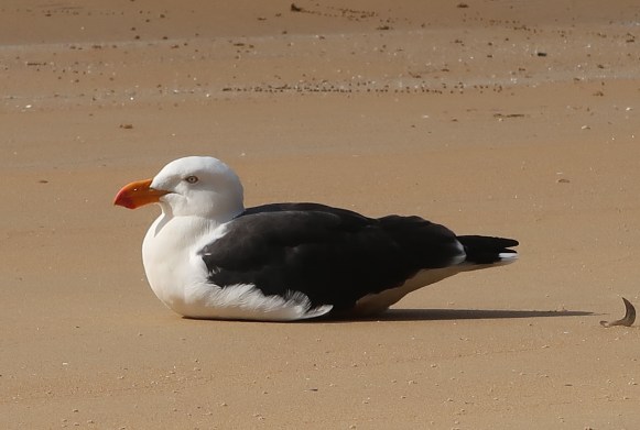 I went looking for the name of the tiny crabs that were everywhere, (I have just realised they are the dark dots behind the gull in the pic above) and failed.
  Returning to the crabs, they are about as big as your fingernail and toddle across the intertidal area in their thousands. But they are there one minute and gone the next. At a sign of danger, it takes them perhaps three seconds to bury themselves completely, although they do leave behind distinctive little balled mounds.
  They dig lying on their sides. Swivelling all the while, the bottom four legs chew out the sand; the top four ball it and pass it out onto the beach. It is a process which is something to behold.
 although not as much there once was.
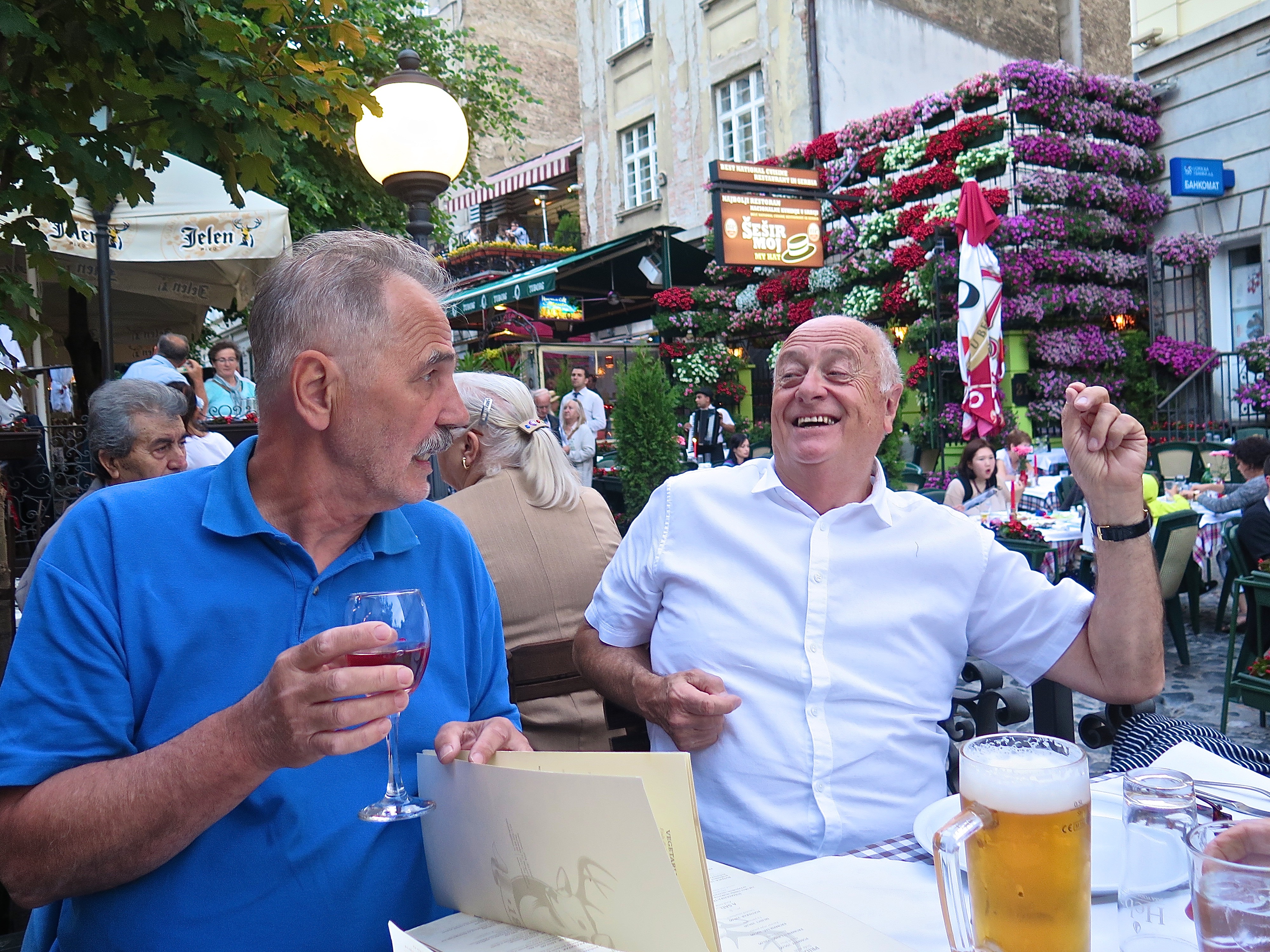
 We arrived at Ilok, more specifically at Stari Podrumi (‘Old Basements’, probably Cellars really) a winery/ accommodation spot where the solid doors closed with a satisfying ‘climp’ and the windows were the complex European type which open in several directions if not necessarily at the same time. Suddenly Croatia rather than Serbia. Out our window I could see the Danube,
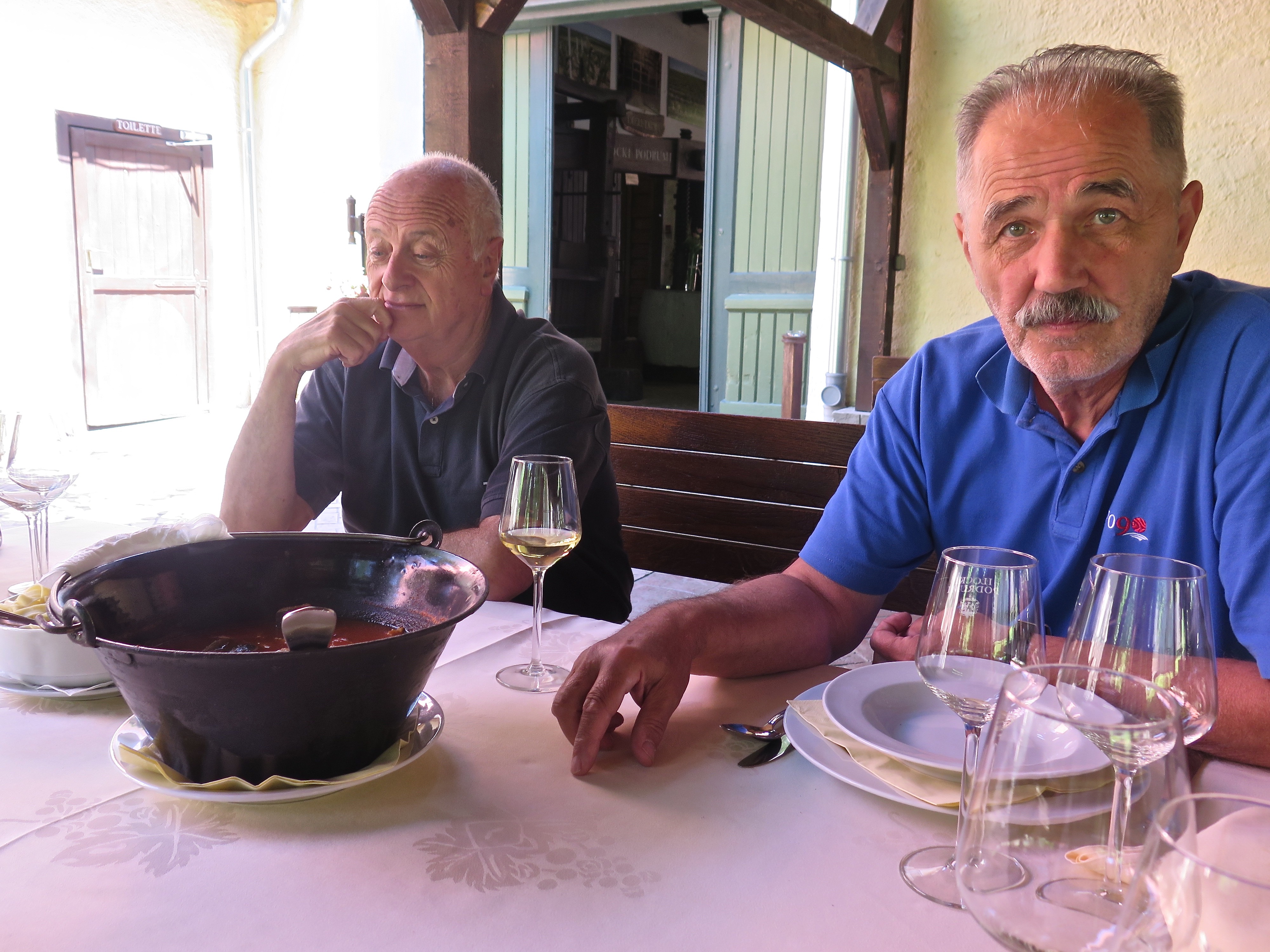
 Lunch was Paprika Fish Stew, followed by (
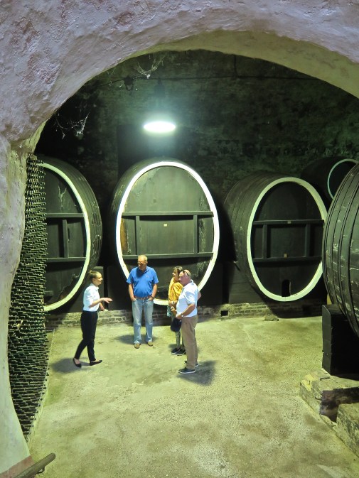 Her name was Maria. I think she stayed with us as our guide to the church, the fort and other highlights of the town. I hope we gave her a good tip.
 It was just near here that our vehicle pulled over and we had an encounter with strawberries, the best strawberries I have ever eaten. They were startlingly good: plump, as big as a baby’s fist but not inflated artificially with hormones, crimson, with a strong inviting smell and irresistible flavour. Powerhouses of the genre.
 ‘Near the centre of the historic town of Ilok, on the landscape hill offering stunning views of Ilok, Srijem and Backa, lies the Principovac Castle and Estate that was built in 1864th as summer residence of the Odescalchi family – The Dukes of Ilok, who stayed here during hunting seasons and grape harvestings. Whether you are a true wine connoisseur or you’re on just your way to become one, when you taste the royal Traminer and Graševina from Principovac in different styles you’ll realize that wine is here much more than a profession – it is a lifestyle.
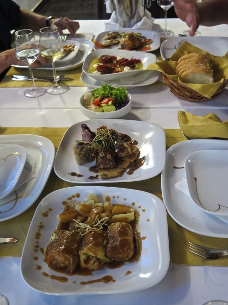


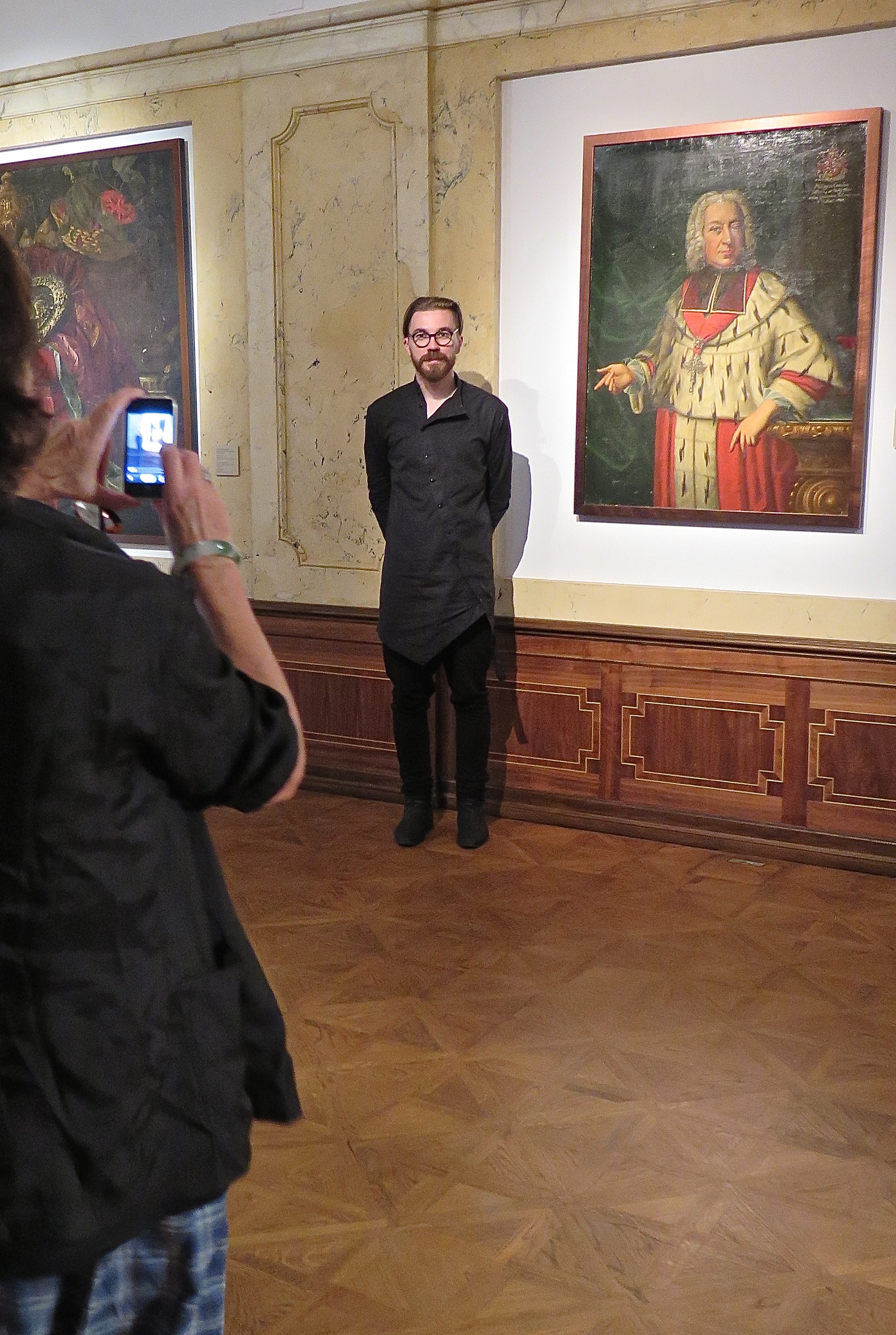
 The border between Serbia and Croatia at this point is a long series of curlicues (the thin black line below), perhaps to share the best aspects of this highly fertile region. For reasons of convenience I’ve tipped this map over, North is on the left hand side. It’s just to illustrate what I mean, and you’ll get the point.
 Don said it was even more special because it had been caught from the bottom of Danube in the muddy waters, and er hem I must confess that was how it tasted. (Look, you can’t go ooh ahh about everything. You’ve got to call it how you see it. The spuds were nice and the visuals outstanding. We were also entertained by some nesting and very familiar martins.)
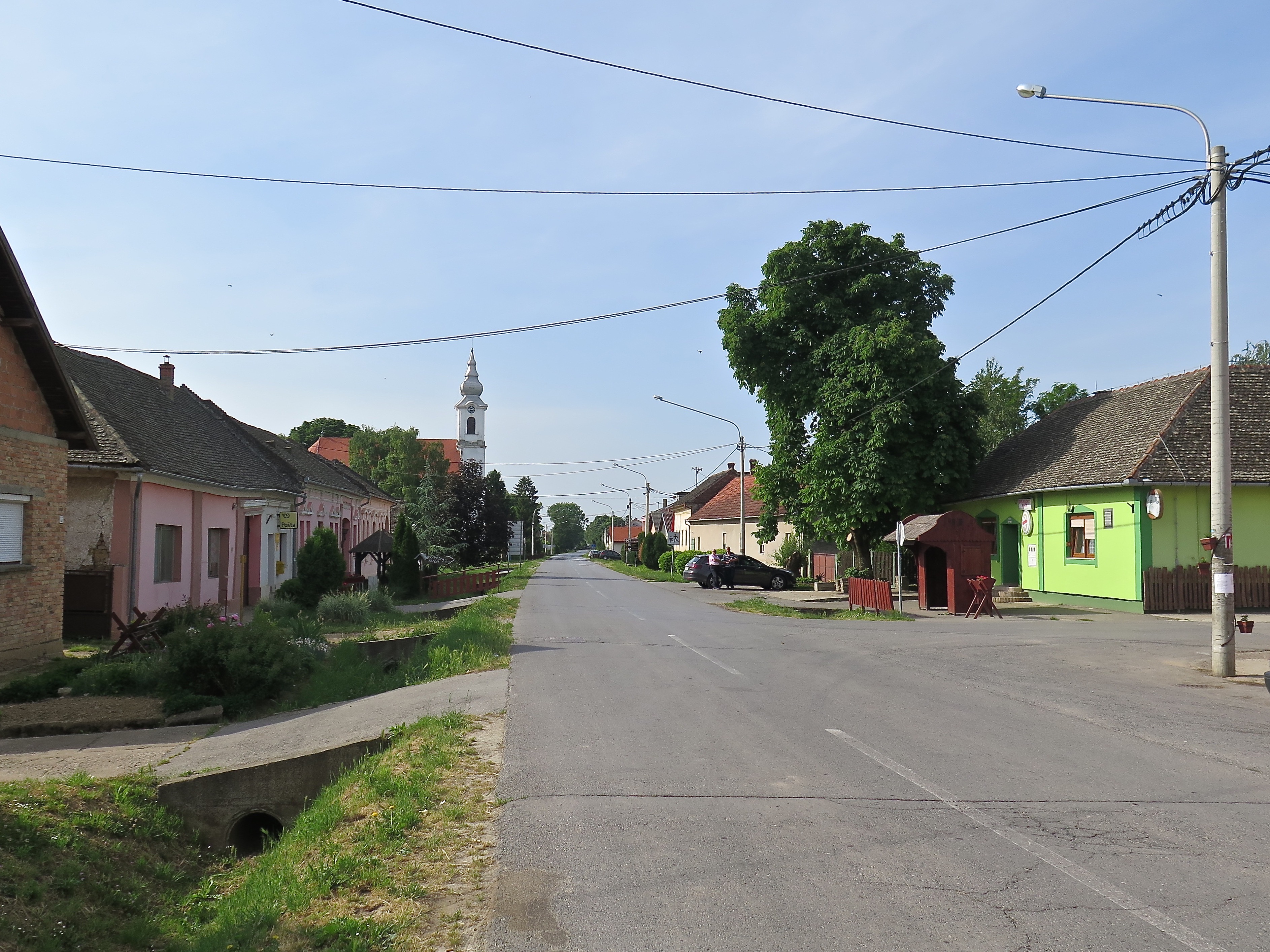
 that you could trip over an offering like this in the footpath,
 and that you actually could eat at the local pub.
  Paprika soup was the dish du jour, the highlight special and it was delicious.
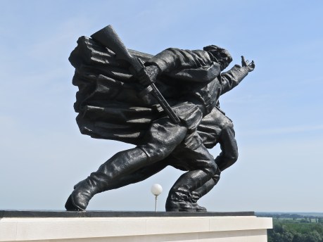


 He knew what he was looking for.


 ‘The Lukin family’s $289 million dollar Port Lincoln development has State Government approval, opening the way for up to 280 jobs a year during the next decade.
 The Tuna Boat Owners Association who are also behind the cultural centre and its program, the art competition, the very fine local sports facilities, the Tunarama festival and most of the other things that happen in town, made a major contribution to the erection of this statue.
 We flew there. From Adelaide it’s a 650km drive of variable interest round the top of the gulfs. In the Saab 340 it took about 40 minutes.
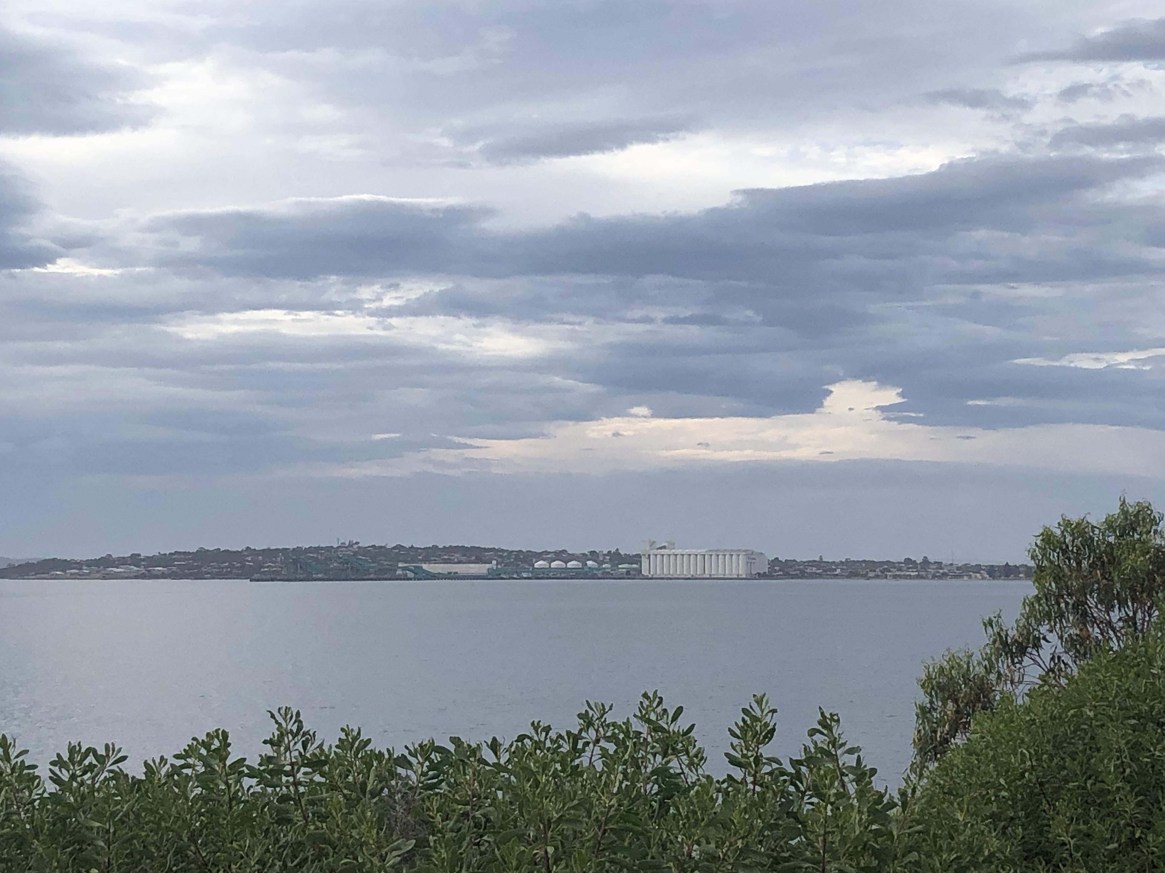
 The grain &c. mostly comes in trucks these days. There was an endless and noisy procession of B Doubles doing a loop out through the bulk handler. Once it came by train. I wondered just how the line hooked up to Adelaide or anywhere else really. Maybe Whyalla. But it doesn’t, and didn’t. Its termini are just termini, two lines parked out on their own, finishing at the major centres of Thevenard and Buckleboo. Port Lincoln could, if you let it, feel very isolated.


 This one was for sale: $670,000. It had a commanding view of the silos. Just incidentally, I would like to point to the four types of gardens in the four photos. There was a lot more of numbers 2 and 3, than 1 and 4.

 … complete with statuary on the corner which you mightn’t be able to see in the bigger pic. (But at left.) The name of the boat is ‘The Battler’, and you can get a very nice reflected view of the Yaris in the lounge room window.

 Get into it.
 The State Library in Adelaide where we found Sturt’s journals.
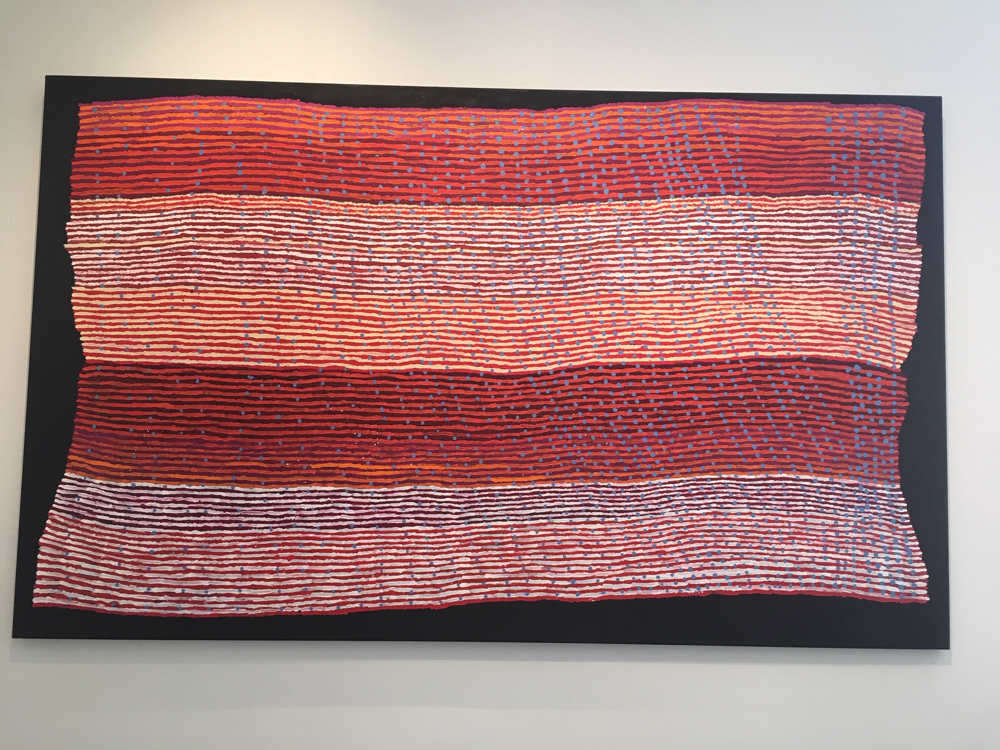


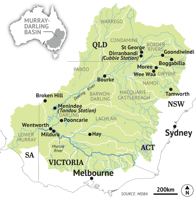 The Murray-Darling Basin covers a vast amount of territory in four states and the ACT, far more than most people imagine. In
  Bourke was once an important inland port. The evidence is still there. The paddle steamers with their cargoes of wool going south and supplies going north would tie up to the top rail of its
 Why is the Darling dry? Because of the very bad drought that has affected western NSW for some time. No argument. The Darling runs almost exclusively through arid country where evaporation eats up 94% of the rain that does fall.
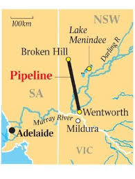 The lakes have also been the main source of Broken Hill’s water supply. (A modest proportion comes from captured rainfall and local natural aquifers.) Water has run through a 140km pipeline providing one important reason for maintaining good supplies of water in the lakes. That pipeline is ageing and needed about $110m spent on it to keep it in good working order. But that was not the decision of the NSW govt. It decided to build a new 270km pipeline from the Murray at Wentworth at a cost of $467m (also costing more than $25m annually, at least in the first four years, to run). 37.4 megalitres a day will be pumped from the Murray. A megalitre is one million litres. That would be 1.7 million litres an hour.
 Thus there is no need for the Menindee Lakes anymore (‘de-commissioned’), cotton growers can up their demands in the Darling headquarters, and the lower Darling doesn’t need to flow at all. All the flow can be used further north. That can happen. Mr Joyce has noted that this would be most beneficial, and that he thinks it should happen. The argument goes that the Lakes are sources of unsustainable levels of evaporation. At present it is intended to leave four of them with a puddlesworth each.
  This pic was taken at Truro, 30 kms from the lush vines of the Barossa (misspelt in an early edict from ‘Barrosa’, a battle the British lost in southern Spain in 1811). Just incidentally, for some unexplained reason people had started stringing up soft toys on fences near here.
 The caption notes that for 2000-08 the average is 3,980GL, one-third of the long term average.
 I would like to take as one text
  Her data on turbidity and unhelpful added nutrients like phosphorus show no special trend over the time series she has, and she pooh poohs the claim by the Wentworth Group (of distinguished scientists) that ‘vast numbers of 300-year old red gums are dying along the Murray floodplain due to extreme drought following a severely depleted river

 As the Murray approaches the coast, it forms the terminal lakes of Alexandrina and Albert (the ‘lower lakes’) before dividing into five channels that flow into the Murray Mouth area.


 Good enough in fact for our fellow guests to take huge platefuls of same off to their rooms to eat later.

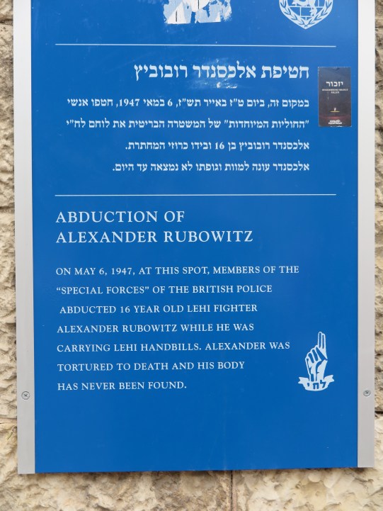 For 15 years Lehi — also known, especially among British newspapers, as the ‘Stern Gang’ after its leader, Avraham Stern — was responsible for an underlying rumble of tit-for-tat direct action including the bombing of various British administrative buildings in Jerusalem and the massacre of several hundred Palestinians at the village of Deir Yassin. (Palestine was a British protectorate as a consequence of the carve up of the Middle East after WWI.)
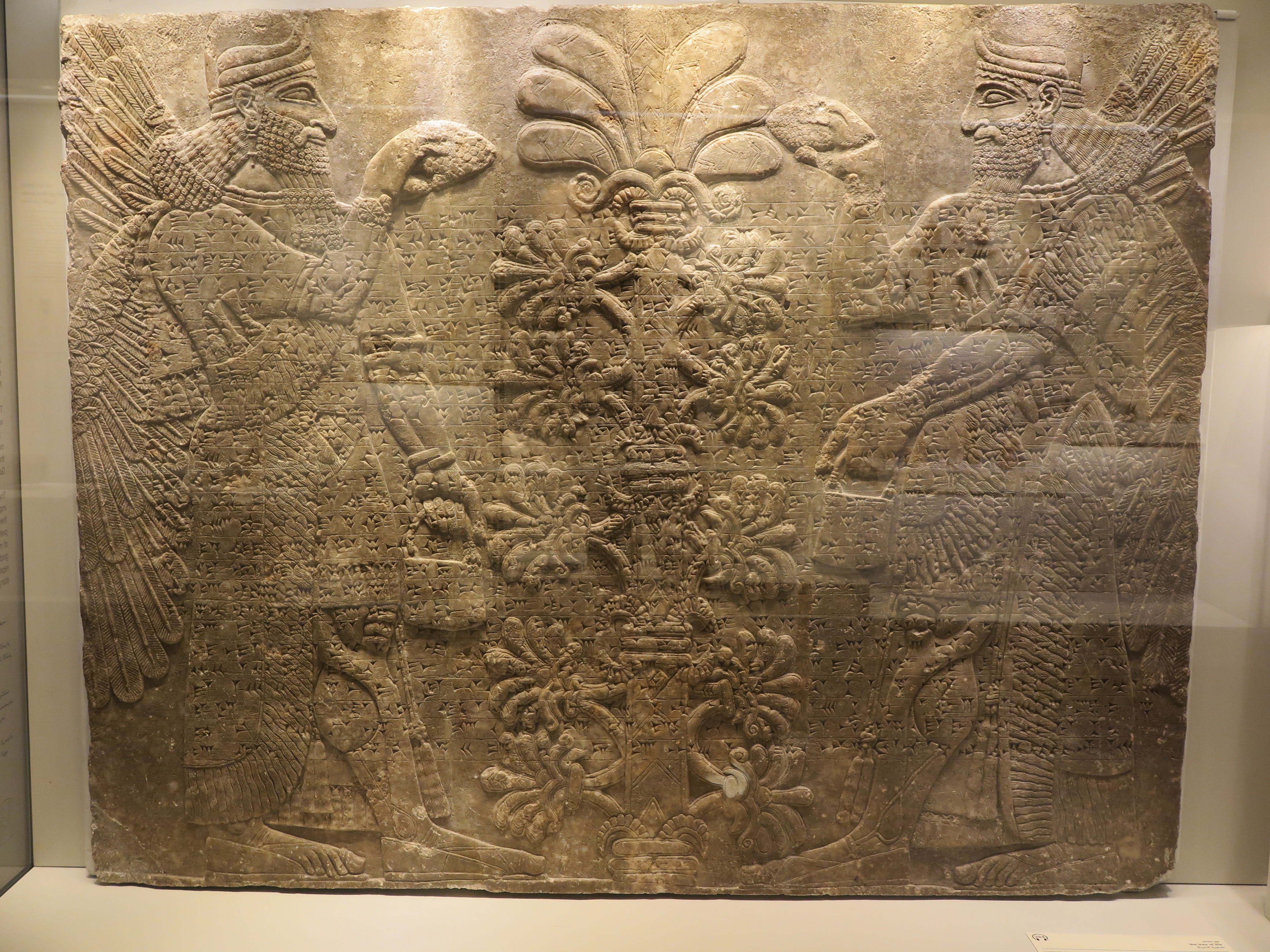
 Support is multi-lateral. On one of the walls of the buildings backing onto the Weeping Wall plaza above me in this photo is a sign saying ‘Colel Chabad, Free Kitchen for the Needy, Sponsored by the Luxenberg Family N.Y.’.
 * * * * * *

 The Muslim Quarter is not generally much frequented by tourists. It has wider streets, less clutter generally, several schools. We were there because we’d wanted to avoid the crowds and to go out through Herod’s Gate to the Arab shopping centre outside the Old City, at left, quite a different proposition to the main Jewish shopping centre a kilometre away.
 Look at the mountain peak. Spicy. Fabulous.

 stories from the Bible, the New Testament and the Koran, and local architectural historic styles that characterize the city – Herodian, Byzantine, Mameluke, and Ottoman – in its rich decoration. Interior and exterior. For architects and architecture students it is a great site for inspiration, exploration, and sketching —
 In 1929, Palestine Hotels Ltd. purchased 4.5 acres on Jerusalem’s Julian’s Way, today King David Street. There are photos (above, 1931, from the back, now with a terrace and dramatically re-landscaped) which indicate that it was nakedly out on its own. The only other building nearby was the YMCA (after 1933, but actually visible in part to the left in this photo). I might say that like a lot of buildings in Jerusalem, it is built out of limestone threaded with pink, ochre and a strong chrome yellow, providing an exquisite visual effect.