

A NASA image of New Zealand’s South Island, Te Waipounamu (‘the place, or waters, of greenstone’ — NZ jadeite — which can be found all along the beaches of the west coast). Stewart Island, Rakiura, is just visible off the coast to the south. The protrusion lower right is the Otago Peninsula where Dunedin can be found. Christchurch, Hanmer Springs and Kaikoura, which all have their own stories, are hidden by cloud.
It was taken from well above the earth on July 11, 2003. Winter. The Southern Alps are picked out in snow. (And, just by the way, the fault line of the two tectonic plates meeting on the island looks like it has been drawn with a ruler.) In their southern half you can see the lakes — in spots, a shimmering and authentic turquoise — which the snowmelt drains into: Tekapo, Pukaki, Ohau, Wahea, Wanaka, Wakitipu, Te Anau.
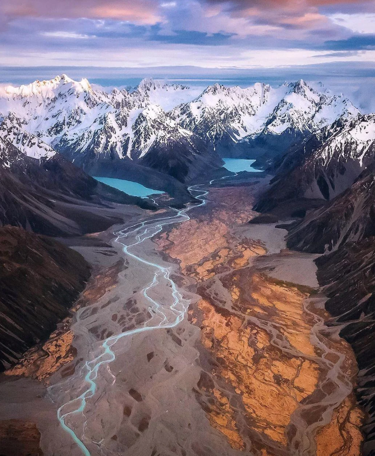
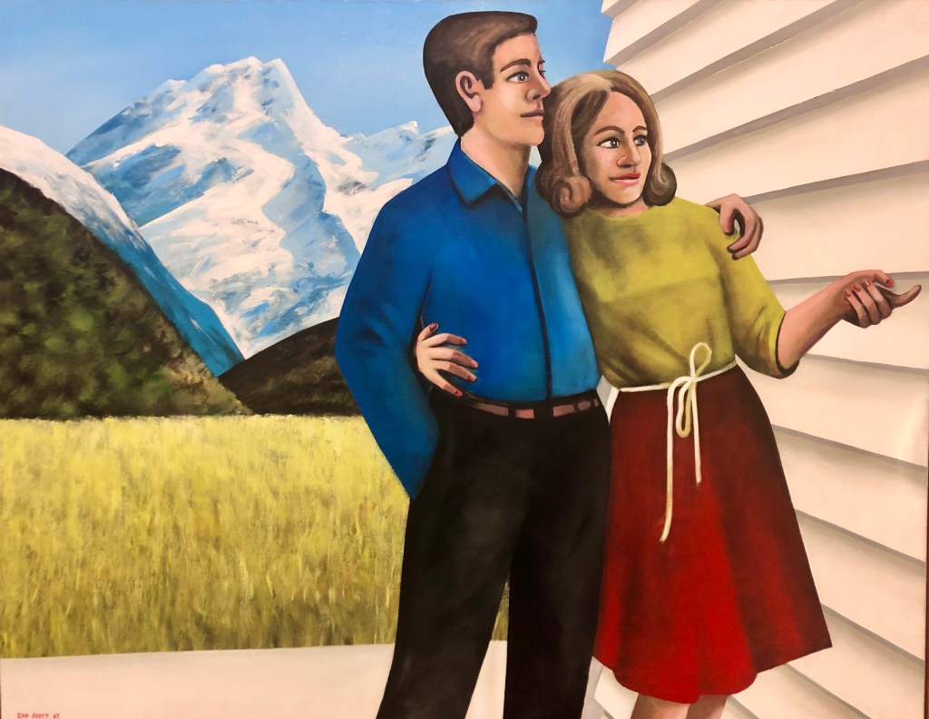
Not my photo either. It was taken by Meghan Maloney who loves her country’s landscape with a keen-eyed passion. There was no caption but I think it is Lakes Hooker and Mueller in the Southern Alps near all 3724m. of Aoraki/ Mt Cook. If that’s right it won’t be far from Mount Sefton just out of the pic to the left. The painting above is to some degree ironic. Mount Sefton is a loooong way from most places.
Many of these rivers and lakes are remnants of glaciers. Below from McKinnon Pass, is the Clinton Valley, the first full day of the Milford Track. Its classic glacial U-shape is text-book obvious. With an average annual rainfall of more than 7 metres, it generally rains 200 days or so a year here. One of the regular highlights of the walk — along the bottom of one glaciated valley, steeply up over this pass, then down to the base of another one following the Arthur River — is the water cascading down the valley walls.

In summary: mountains, hilly, lots of ups and downs. Everywhere. Expect them to the point of not even thinking about it.
* * * * * * *
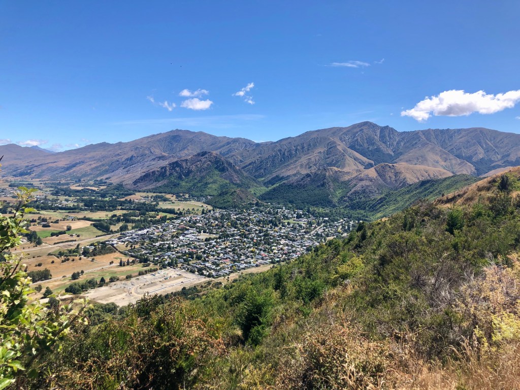
This time we arrived at Frankton airport which services Queenstown, itself built into one wall of Lake Wakatipu with scarcely any flat land, and these days, with endless traffic. The feature of arriving here by plane is that as you land you slide along one side of a mountain range with, first time anyway, the near certainty that at least one wing is going to be removed.

The runway is just to the left of the lump in the mid ground. The Remarkables, the mountains referred to, are in the background.
This was the view from our kitchen window. Island weather.


Just incidentally, for those overwhelmed by Queenstown’s crowds, there is a nice sequestered shingle beach where the peninsula thins out to the left of the pine tree plantation. Swimming isn’t completely implausible.
But the entertainment was climbing (on a domestic scale). At Arrowtown it was a choice of Big Hill or Tobin’s Track. To break ourselves in we went for the latter. Easier.
It turns out there’s more to Arrowtown than the main street of the old town. From where we were standing in this photo we could hear with great clarity the playground noise from the school near the oval. I can report that to get the kids back into class they use music instead of a bell.
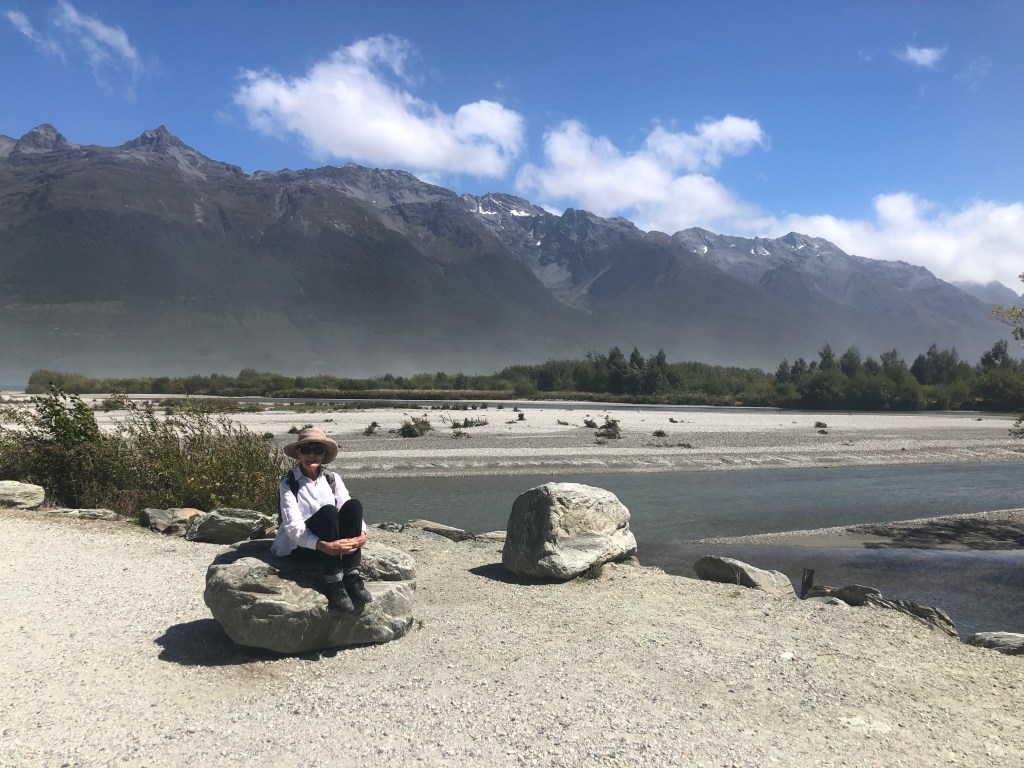
At Glenorchy we might have been (and were) walking on the flat but still surrounded by striking mountains.


The first two are sections of the Humboldt Range. The third is the head of Lake Wakatipu and one entry to the Routeburn Track, one of the 10 ‘Great Walks Of New Zealand’. In this case unarguably. The Earnslaw Range is on the right with what I think is The Sugarloaf in the background over modest little Lake Reid, the northern end of which was this day covered in bird life. Covered.
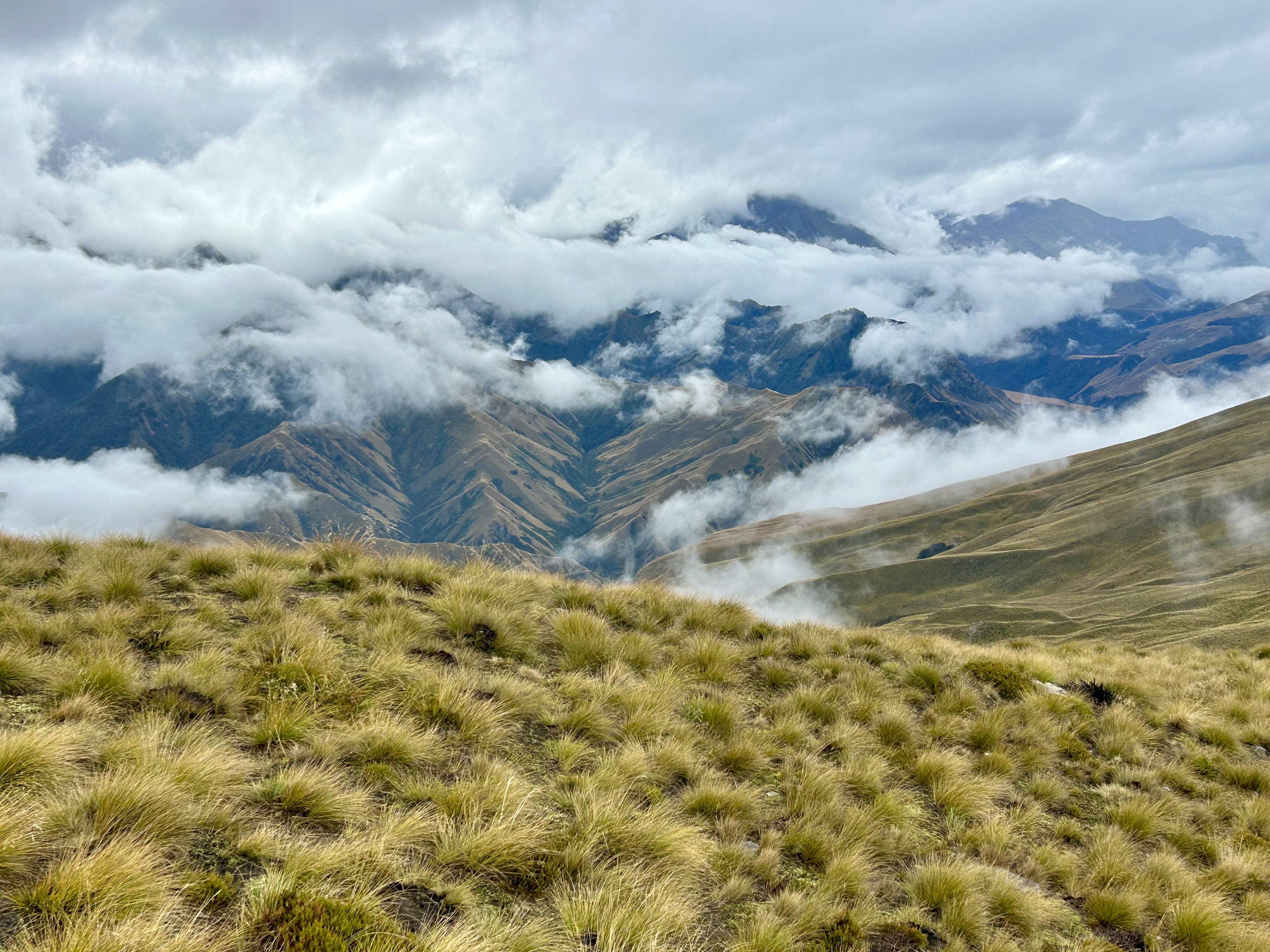
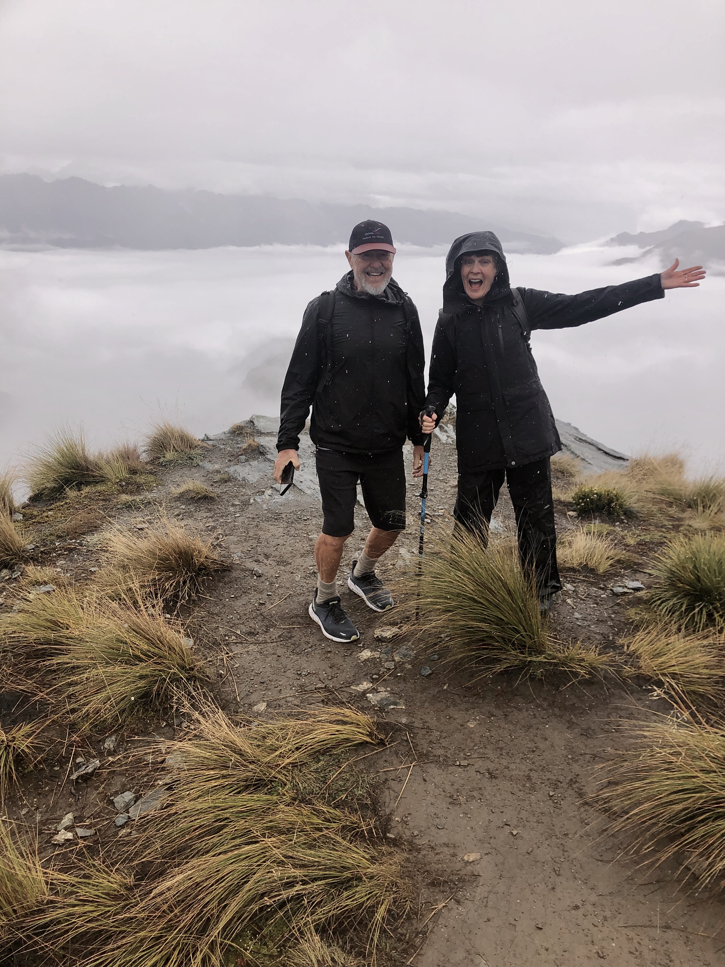
The one really wet day in four weeks we had scheduled for climbing Ben Lomond which looms over Queenstown and offers, on good days, spectacular views. Anyway, we did. You cheat by getting the chair lift up to the gondola and after that there are several hours of unrelenting uphill. (Does ‘unrelenting’ sound better than ‘relentless’? Milder? It is intended to mean — but in a mild way, it’s not Everest — there are NO flat spots or short downhills until you get up as high as you want to go.) Mountain weather.


I’m summarising again: mountains, hilly, lots of ups and downs. Everywhere. Expect them to the point of not even thinking about them.
And then there’s Invercargill.
The Horizontal City

We’d been to Invercargill before. There’s a walk over to the left of the arrowhead called the Tuatapere Hump Ridge that we tried and failed to find interesting. At the time Invercargill too seemed bleak, at 46.5 degrees South somewhere really quite near to the end of the world. It was, and is, windy, cloudy and cold. The average high ranges from 9.5°C to 17.8. The hottest temperature on record is 33°C one day in 1948. It has eight hours of daylight at the winter solstice (you could say 9 to 5) and 16 hours at the height of summer (you could say, a lot). It averages about four hours of sunshine a day and in NZ is out-windied only by Wellington.
In 2010 it featured in the news for the collapse of its sports stadium’s roof under the weight of snowfall.

I like … appreciate … admire this photo for several reasons only one of which is the lowering grey cloud. It’s a Southland photo which belongs to the culture of the Fiordland Big 3. (Strictly not Southland but close enough.) ‘The idea is simple – adults hunt and catch a deer, a pig and a pest. To win, they have to be the heaviest combined weight. Children catch one possum, a hare or a rabbit and one pest.’ It’s the land of the hardy warrior, one might say pictured here amongst, and looking over, the quite spectacular devastation.
But most significantly Invercargill is flat. So flat. So profoundly flat. So stimulatingly flat.

If you go back to the aerial photo above you will note that most of the lower lakes run north-south and drain south. Invercargill (‘Inver’ from the Gaelic for ‘mouth of’; Cargill an early Superintendent of the Otago: 🤔) is on the edge of a large plain of alluvial sands generated by and partly carted there by glaciation. And swamp residue. The Waihopai River strolls in from the the north-east and then just sits there, part of a substantial estuary.
The river.

Below is the road, a sort of causeway across the river and its swamp, connecting the city proper with Otatara and the airport.
Anyway this time I found a lot to like about it and not just the late shadows and long uninterrupted views.


This is a city, in size one-fifth of a Geelong, where apparently there is a market for these shoes.
It is a city where, on a prominent corner of the main drag, the city impact church nestles up against ‘Hemp Health — the natural choice’ and the sex shop (which handily also offers record cleaning).

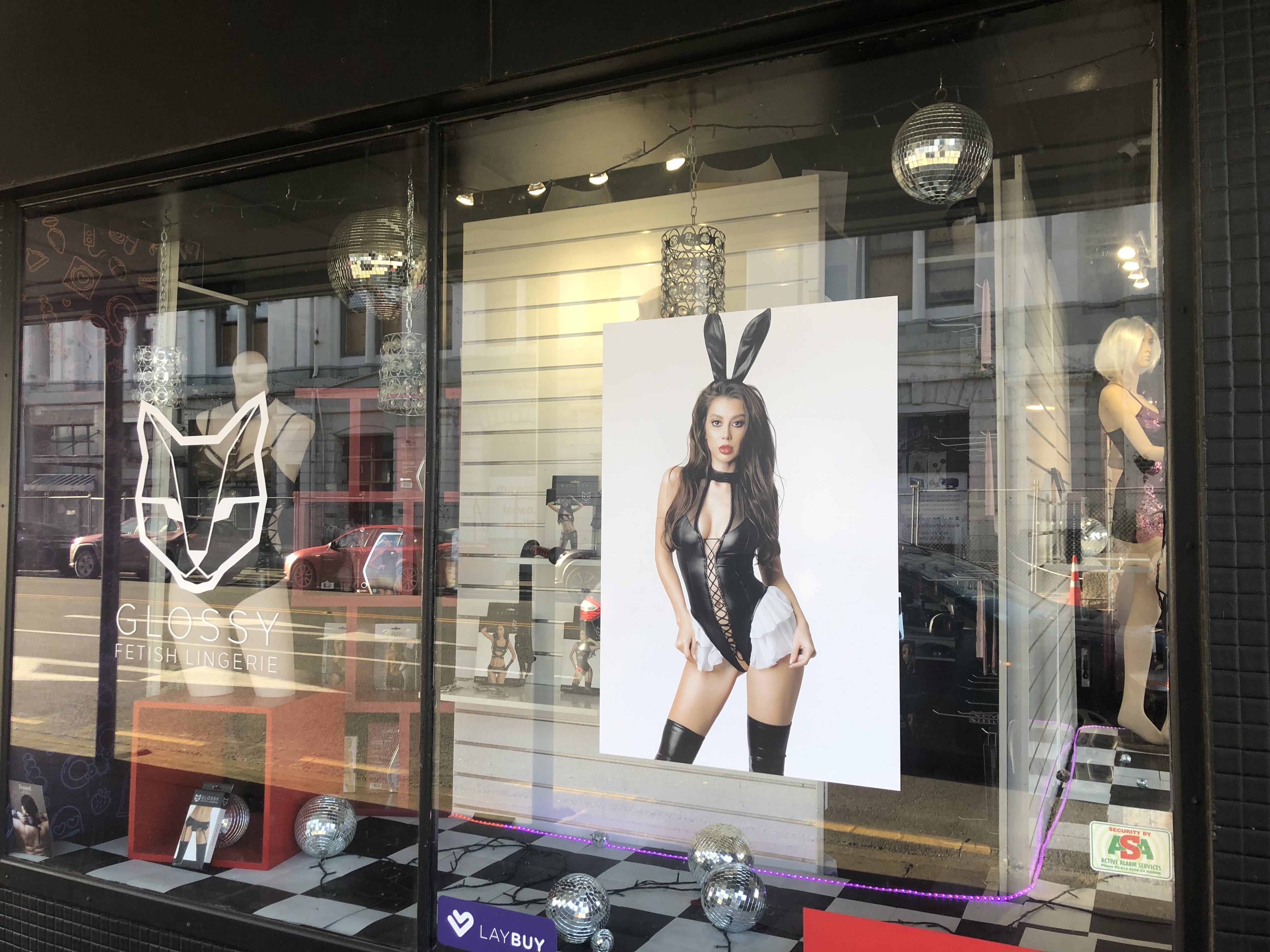
The main prominent corner (Dee and Tay) features these features. [Footnote: Invercargill street names often tend to stop at just one commonly Scottish syllable. Bond, Leet, Spey, Tyne, Forth, Eye, Tweed, Earn, Jed, Ness, Bute. Ease of pronunciation maybe?]


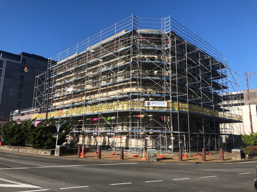
Bottom left, war memorial in the middle of the roundabout. To its right what was once a bank associated with New South Wales. I liked the patterns its scaffolding made in the late western light. Then above that is the ‘Maori/ Celtic Wall’. The internet has next to nothing to say about that. ‘After first arriving in Southland about 1100 AD the Maori developed a sophisticated culture, the Scottish settlers began to arrive in the mid-1800s. This wall symbolises the merging of these cultures on Southland.’ You could probably do better than that.
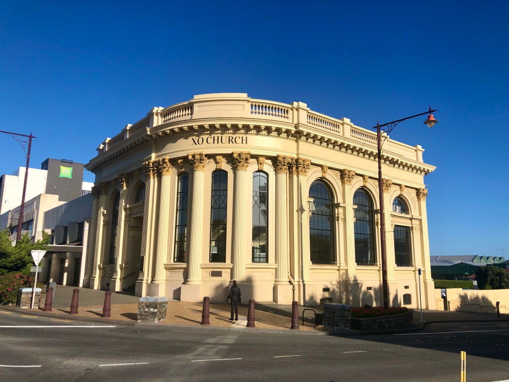
And then there’s the XO Church. ‘XO Church was founded more than 50 years ago formerly as Bethel, Cornerstone and now Crossover [XO I guess], and has always had a heart for the city and the nations [sic]. We are a family of Christian believers, who do more than just meet on a Sunday for a service. We are dedicated to Jesus, and the people of this city, and our desire is to help others to reach their full potential, becoming the people they’ve been created to be through relationship.’
One way they do this is by distributing 1160 easter eggs and 1800 hot cross buns, this easter anyway (2024). Their property and their digital presence suggest a very active, young and thriving concern with very smart people running it.
There is some grand architecture which takes you above the first floor.

That’s the Town Hall (and Theatre), a building of some distinction. Below is the First Presbyterian Church which I was going to say seemed, in the correspondence and relationship of its forms, to be influenced by American architecture and not least by Frank Lloyd Wright. And I discover the architect, J. T. Mair who later became the nation’s Government Architect, studied at the University of Pennsylvania, and feel, momentarily, virtuous.

It’s a very fine building. Also peeping above the skyline is the dome of St Mary’s Basilica.

Churches and purveyors of body-building supplements (‘Supp South’) both with fervent adherents, hot old bangers with straight-through exhausts touring up and down the main drag, customers for winkle-picker shoes, huntin shootin and fishin: it’s a place of contrasts.
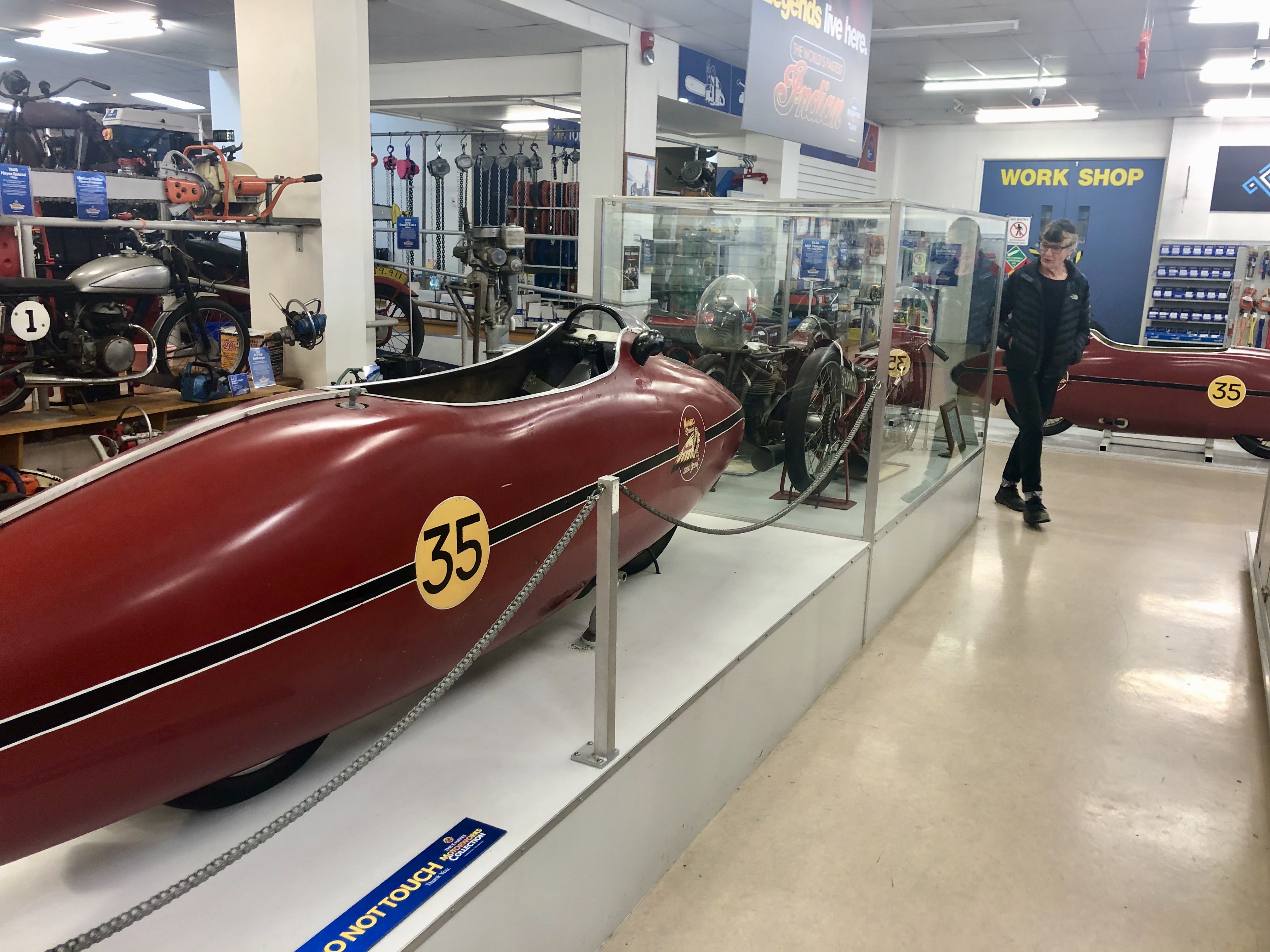
Elsewhere in the world, Invercargill might be best known, without the knowers actually realising it, for this: ‘The World’s Fastest Indian’.
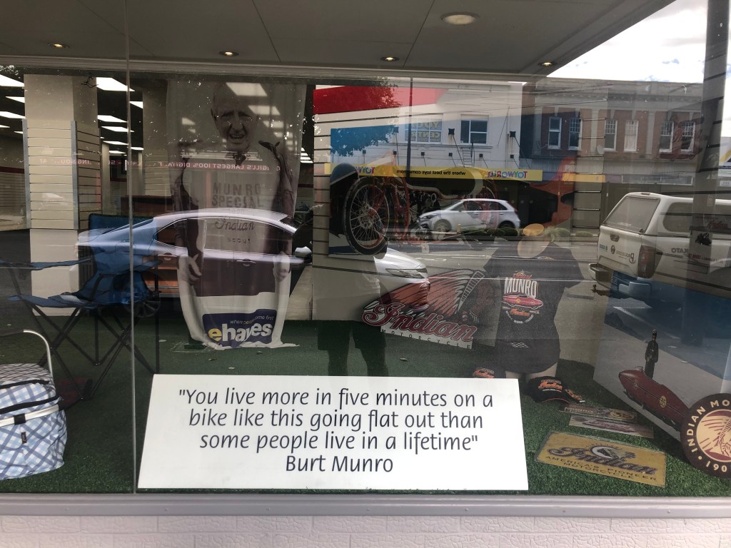
Bert Munro, an Invercargill native, born and dead, had a lifelong interest in speed. His first motor bike was an early model Indian Scout with a top speed of 55 mph (89 kmh). He immediately began to modify it. He later rode this bike at 206 mph (331 kmh) in the world record speed championships on Bonneville Salt Flats in the US having largely rebuilt it with parts he made himself. It had begun with a displacement of 600cc. When he rode it at Bonneville it was 950cc. He travelled there 10 times (once in his words as a ‘sight seer’) and set new world speed records in 1962, 1966 and 1967. The 206mph run didn’t count. He crashed before completing it.
That much at least is true.
‘The World’s Fastest Indian’ is also a film starring Anthony Hopkins as Burt. (He changed his name after regular misspelling in American magazines.) The film transports us from Invercargill to Hollywood, and not just geographically.
While modifying his motorcycle, an ageing Burt has a heart attack. An ambulance takes him to the hospital and he is told he has angina, and is advised to take it easy and not to ride his motorcycle. He — of course — ignores this advice.
Burt is finally able to save enough to travel by cargo ship to Los Angeles, working his passage as the cook. But when he arrives, he experiences bureaucracy, scepticism, and the indifference of big city people. So far, so deeply predictable. And who knows, he probably did. It is his blunt but gregarious nature (right there a national characteristic, right there, 100 per cent) which overcomes each hurdle. He wins over the motel clerk, a transvestite named Tina (of course; obvious), who assists him in clearing customs and helps him buy a car. The car salesman allows Burt to use his workshop and junkyard to build a trailer, and later offers him a job after Burt tunes up a number of the cars on the lot. Burt declines the offer, however, and shortly afterwards begins his long trip to Utah.
Following? Could be true. Allow yourself Coleridge’s willing suspension of disbelief …
Like Odysseus, Burt makes friends along the way: a Native American (yes!) highway policeman who helps him fix his trailer, a woman named Ada who allows him to repair his trailer in her garage and briefly becomes his lover (mmm … required), and an Air Force pilot (good looking but troubled, possibly?) who is on leave from military service in Vietnam. (You can see the writers sitting there in a backroom saying, ‘Come on. What else do we need? Where’s that damn list?’)
He eventually arrives at the Salt Flats only to be blocked (mandatorily) by race officials for not registering his motorcycle for competition in advance, and for not having the mandated safety equipment (Of course! Get with it!! He’s a Kiwi!!! He’s from the land than gave us bungey-jumping!!!!) In a show of sportsmanship, however, various competitors and fans in the Bonneville series intervene on his behalf (ooo … close to jumping the shark here), and he is eventually allowed to make a timed run. Despite various problems, he succeeds in his quest (amazingly) and sets a new record (just wait for it …) at the 8th and last mile of his run. Amazing. By the end, his leg is burned by the exhaust, motorcycle and man collapse. But, what a relief, survive.
To proof. Here’s the inside and the outside of the actual bike, part of a rather grand exhibition at the sumptuously equipped hardware store E. Hayes & Sons in Dee Street.

So much to see and do in Invers. But what I loved as much as anything were the Jeffrey Smarts, not everywhere you looked but, so many of them. Flat, and perfect.


That one’s for Marge, Denise and Rex.
A Linguistic Digression

Australians are notoriously bad at Kiwi accents. ‘Fush and chups’, they go. Then, ‘Yuck yuck yuck’. I fear that’s just how things are: we are not yet in all ways a mature nation. But are Kiwis bad at (rendering) Kiwi accents too? I want to review this fine Invercargillian graffito in that light.
‘Death and Tixes.’ And, could be ‘clap’ or ‘clup’. For reasons of uncertainty we’ll leave that out.
There’s an antipodean version of something like Grimm’s Law that says as you go east from Cape Byron and, completely ignoring vocabulary, you should at least consider the prospect, with variations, of a vowel shift one slightly to the right. ‘A’ to ‘e’, ‘e’ to ‘i’ etc. That leaves with you with a problem at ‘u’, but nothing is easy in this world.
Still I want to say about ‘Death and Tixes’, let’s try harder: push the ‘e’ in ‘death’ over into ‘i’, and the ‘i’ in ‘tixes’ more correctly to ‘e’. I realise I should be using phonetic symbols here, but I think I would have written ‘Dith and Texes’. Then they would have known what we were talking about.
Further south: Bluff
Can you go south of Invercargill? Yes you can, and probably must simply for the adventure of it.
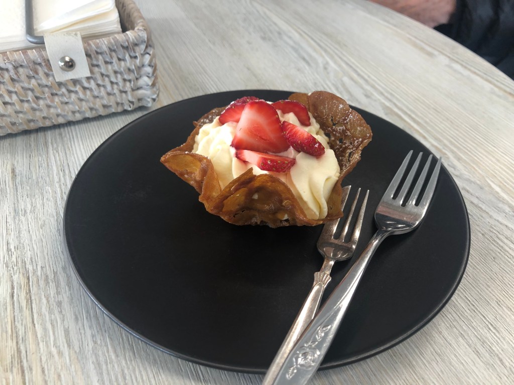
The adventure of it … AND the prospect of popping in to the Bluff real estate agents for a flat white and a brandy snap basket.
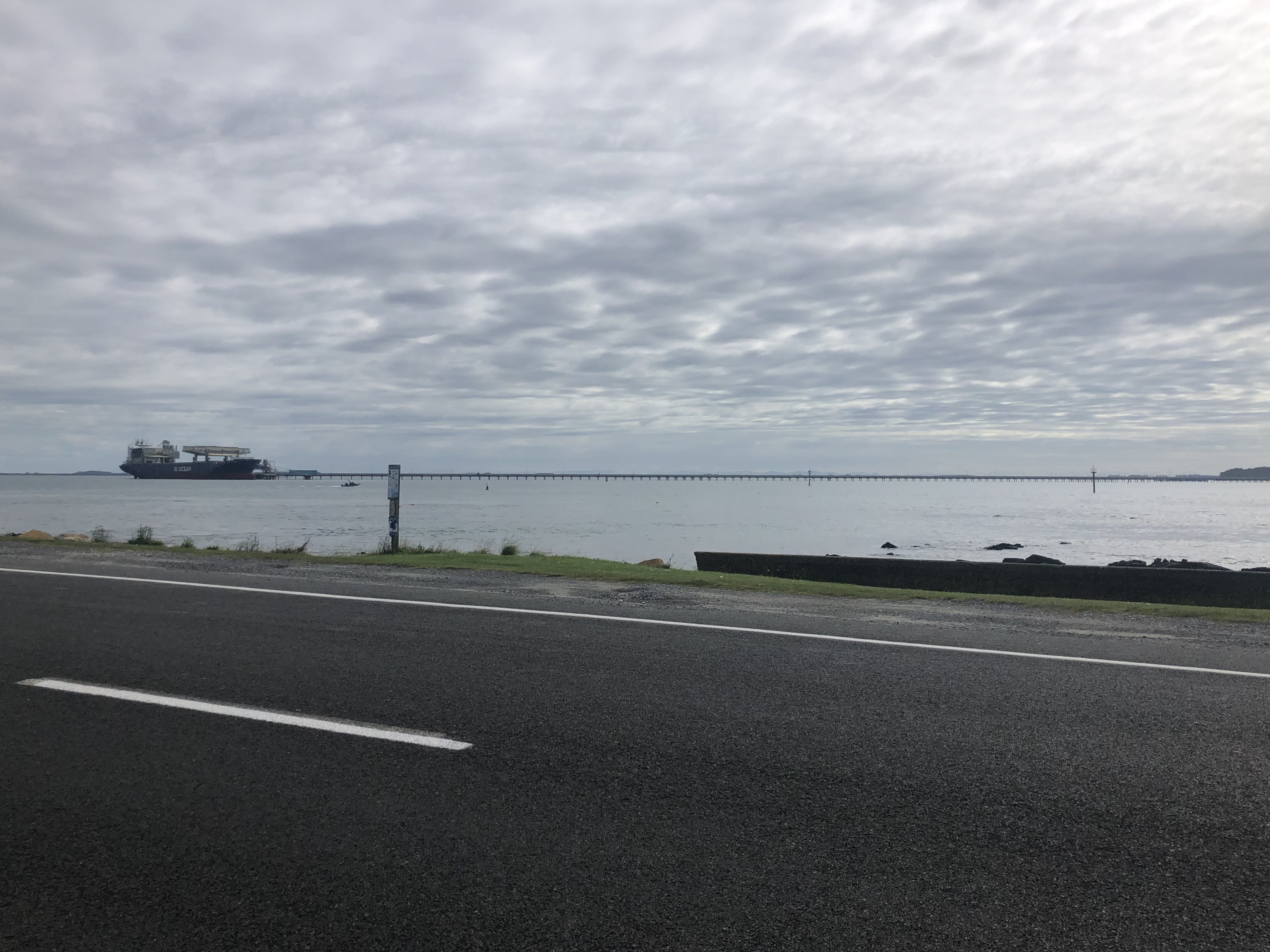

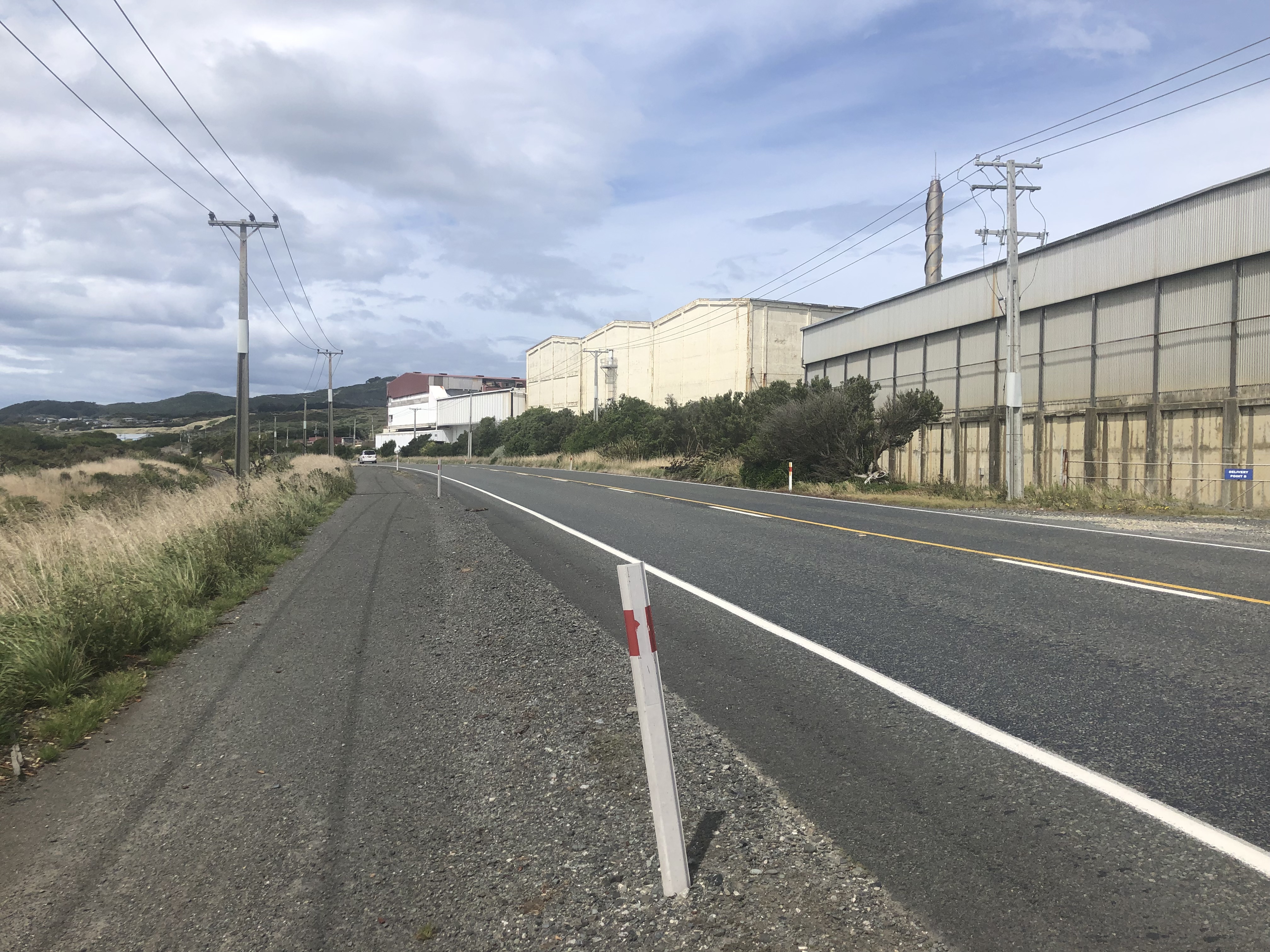
The short drive to Bluff, the South Island’s southernmost town is flat, industrial. At left above, that ship is at the end of a jetty with close to a kilometre to reach the shoreline. Bluff Harbour is not a deep water port making it, among other things, a suitable place to farm the remarkable oysters for which Bluff is known. (Oooh … Bluff oysters. Is Bluff a place then?)
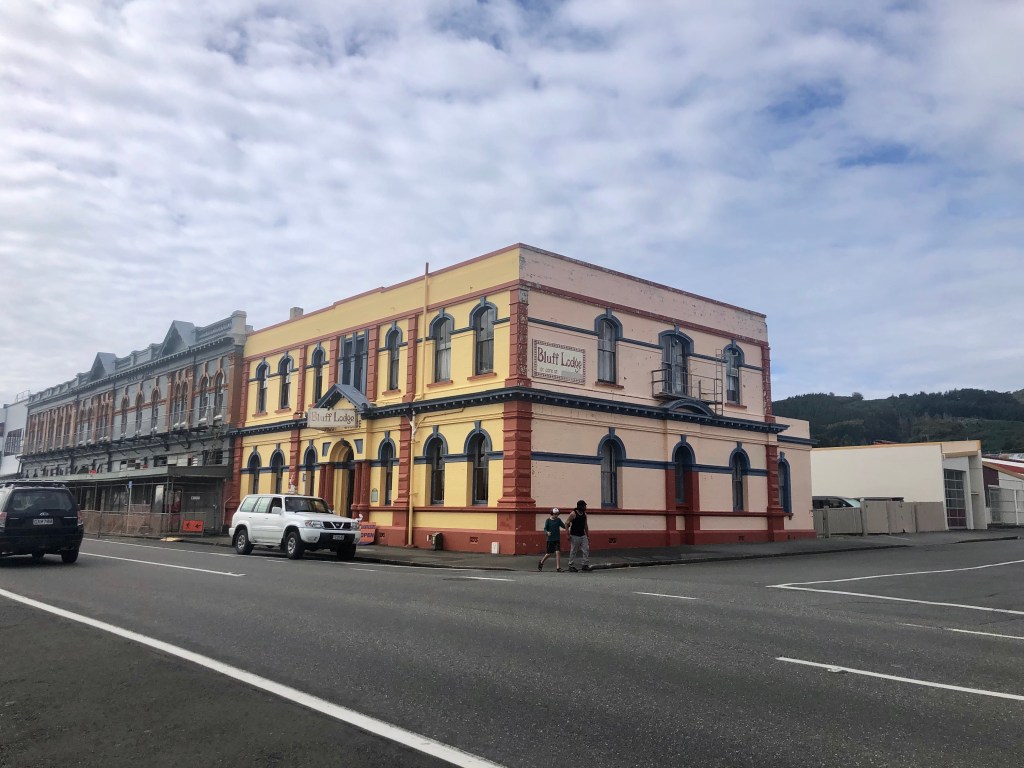
Bluff proper is a strip of shops looking for the identity they once had backed with a few streets of, can I say ‘shacks’? Some of them are quite ambitious but, I think it’s fair to say, Bluff provides a comprehensive treatise on the wear occasioned by proximity to the winds and water of the Foveaux Strait.
But the visitor drives through Bluff. You are en route to Stirling Point from which you will embark on the Bluff Track.

French motorcyclists at Stirling Point taking photos of one of those sorts of signs. London is 18,958km away, New York 15,088, the Equator 5133, the South Pole 4840. Sydney the even 2000. Dog Island 6. But we also have Kumagaya and Suqian. What and where are they? I looked up Kumagaya and it’s got a rugby pitch. Just for moment I thought that might be it. But they are, of course, Invercargill’s sister cities (in Japan not so far from Tokyo, and Northern China).
The track is cut into the low, thick and hardy vegetation of the littoral. No special views; more just having been there.
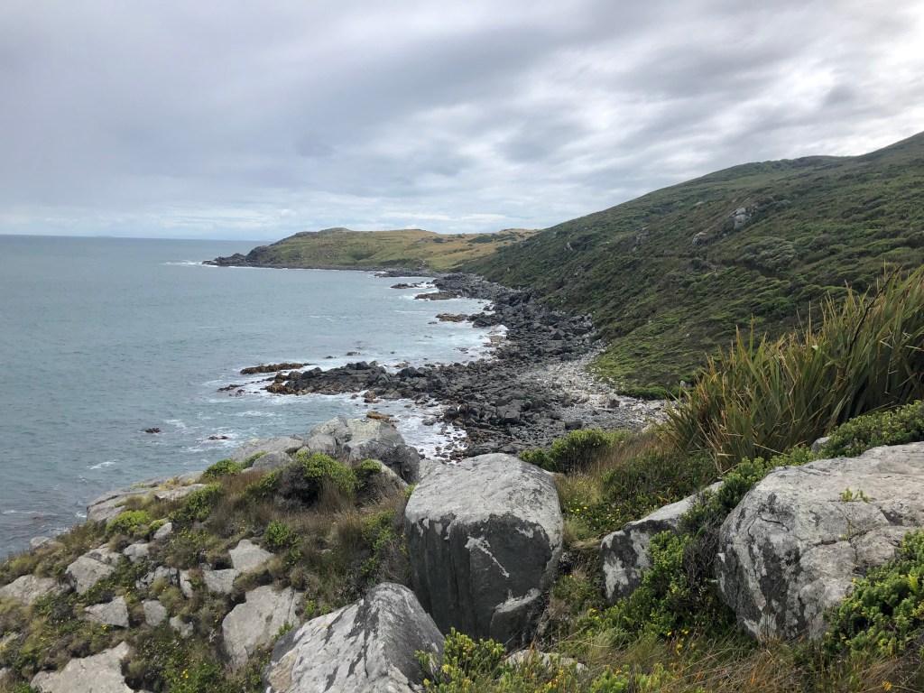

Slope Point and Curio Bay (not far away) are the actual southernmost parts of the South Island. But this is a contender, the beacon on the southernmost part of Bluff Track with Stewart island in the background. If you want to talk about New Zealand entier you can quite happily say from Bluff to Cape Reinga, the tip of the North Island, according to the sign 1403km away.
A final effort at orientation

• • • • • • •
With reason, I’ve gone on and on. The ‘Other Stories’ can be found right here.

Thanks for this set of stories David.
I love the South Island and have been on three photography work shop tours over the past  six years , the latest being a winter landscapes tour, taking me to Mount White, Ashburton lakes region, and Aoraki NP. Stunning.
Attached are some of my images.
Cheers
Ross
Ross Kimber
rfk imaging
+61419308415
kimra@bigpond.net.au
PO Box 1414
Fitzroy North
VIC 3068
See some of Rossâ images at
http://www.rfkimaging.com
http://www.facebook.com/ross.kimber.5/
http://www.instagram.com/rossk17/
The fisherman in the poster looks very much like Sir Edmund Hilary. I met him once on the way to Everest; he was giving out ball point pens to school age children.