

Ten days, six walks. That’s what the itinerary said. But what’s an itinerary: a set of aspirations? A rough plan of what you might do? Perhaps more commonly thought of as an iron clad guarantee that everything would be all right, and that you do/ see all the things that are on that list. Directive. Yes. Except that this one had been constructed not quite at random but pretty close. According to whim and with barely plausible ambitions. Just getting on a plane for a start … what an idea. I had almost forgotten how. Booking things … it seemed like an impertinence, or if not an impertinence, a fairly low confidence flutter.
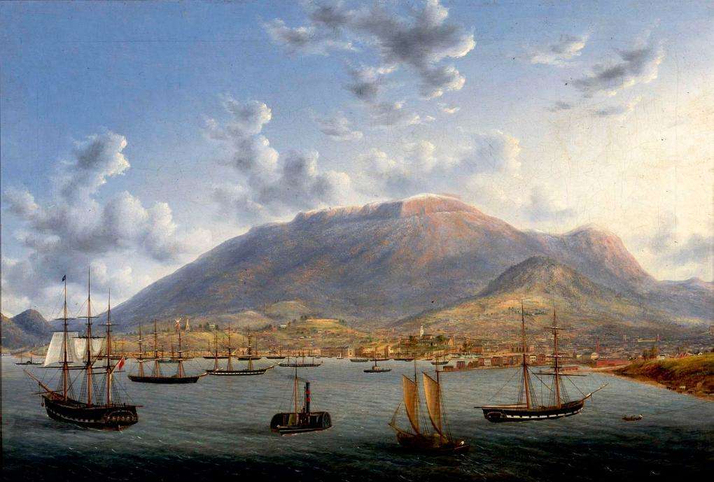
But eventually the Tamar Estuary unfolded beneath us, there was a (wildly expensive) car at the Budget depot, and Lonnie was still there in all its two- and three-storey glory.

It’s quiet after 8 apart from the hoons with the announcements from their straight thru exhausts bouncing off the empty streets and the valley walls. Tassie. Wonderful.

Why go to Tassie? Because you tried to last year on almost exactly the same dates and you couldn’t. That’s one reason. There are others. It’s the attractive forthrightness of the Jacqui Lambies. It’s looking at the results of consuming too many, far too many, Banjo’s pastries. It is an encounter with taste unfettered by fashion. It’s watching people have a go because they can. (That applies to bulldozing trees as much as it does to saving them.) It’s seeing the consequences of living proximately but feeling isolated. It’s getting your feet wet in history — all those preserved buildings and picturesque precincts, the back of Launceston’s waterfront, the golden sandstone of Hobart’s older houses, the Hope and Anchor being the oldest continuously licenced pub in Australia, the gruesome stories attached to Port Arthur, Sarah and Maria Islands, Eaglehawk Neck, not to mention the colonial treatment of its Indigenous population. History is also being lived as you watch in a form of participatory time shift. Is it 70s? 80s? Could it be in part the 1950s? And then there is MONA which is an assemblage and reflection of all these things.
Any one of those things would draw you, but probably for us the winners are the geography and climate, its natural world.
It is by no means all pristine wilderness. But even where it isn’t there is often a lot to drink in and respond to.

And there’s this of course.

But then …
That’s why ten days, six walks.
• • • • • • • •
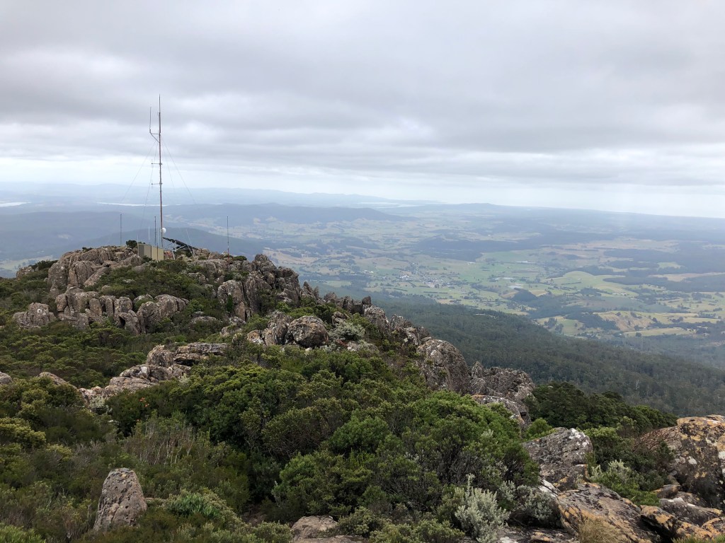
Mount Arthur (Indigenous name unknown)
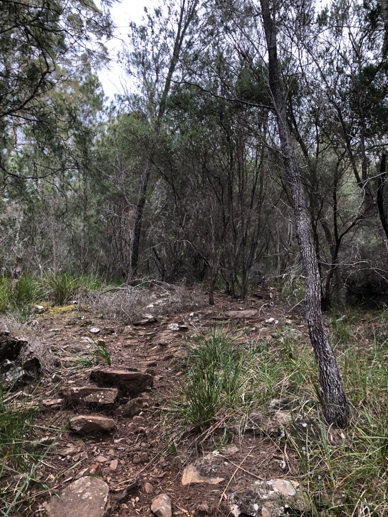
Mount Arthur (1188m asl) is 30 kms north-east of Launceston. Guides say four hours up and back; we took five. Guides say 8.5-9.5 kms all up; after wandering all over the top, my GPS said 11.8. It is called a popular walk, but I think only with afficionados and people who care. The track does not look heavily used.
We’d been there before and been rebuffed. You leave the car at the end of a dirt road sort of in someone’s quite isolated front yard and, like a lot of walks, it starts very steeply. But in this case, after a very brief concession, it gets steeper. And then there’s a boulder field. And then to get to the top you climb bigger boulders. Last time, years ago, we started late, it was pouring rain, we got to the boulder field and I’d had enough. But I remember the track as having shown real promise and you like to get to the top just to see what’s what. And as it turns out it is a wonderful walk, reasonably hard (for the aged) but with a real reward from the top.


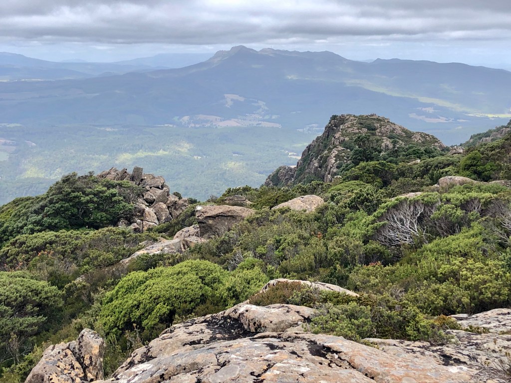
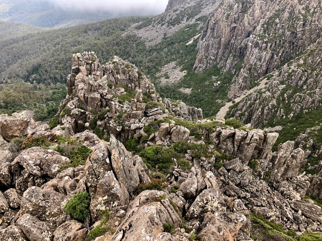
Turapina / Ben Lomond

Turapina contains the second highest peak in Tasmania. A number of outcrops surround a massive boulder field plateau. The least prepossessing, Legge’s Tor is (at 1572m) the highest of these. We’ve walked here quite a lot, usually a 12km loop starting at ‘Carr Villa’, now a classy Scout Camp, and climbing up through the Big Opening to the plateau, across the Plains of Heaven (true), and down Jacob’s Ladder back to the car.
Conditions have also varied including once when the temperature dropped about 15 or more degrees in 10 minutes, almost too quickly to properly notice and get the gloves on. This photo was taken on one of those snowy days.

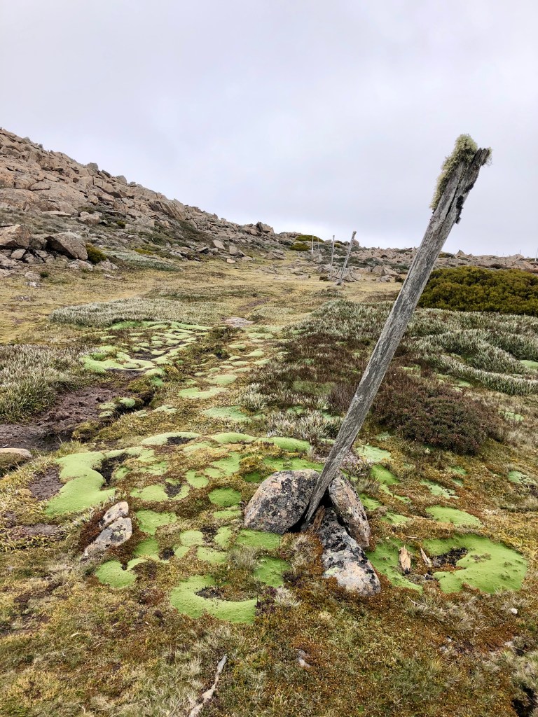
But it wasn’t like that when we arrived this time, a blowy overcast day with no hint of snow.

The knees were still recovering from Mt Arthur the previous day, so we drove up to the ski village and walked across the plateau to Legge’s Tor, a few kilometres, not much more than a stroll really.


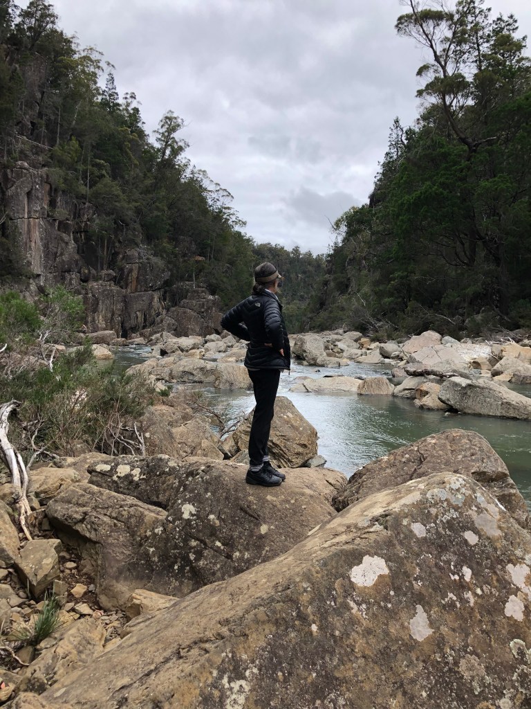
Apsley Gorge (Indigenous name unknown)

There are two Apsley Gorges within 30 kilometres of each other, one on the Douglas River and one on the Apsley River, both in the east coast Douglas-Apsley National Park, unusual in Tasmania for being dry eucalypt forest. I don’t know much about the first one, but the second has a walk attached to it.
It can be a there and back, or it can be a loop, either way roughly the same distance, around six kms. The point about the loop, however, is that you walk back down, and in, the river. We had been here 20 years before and I hadn’t been properly prepared but the idea of working your way through the gorge and then down the river held major attractions. There’s a lot of pleasure to be had rock-hopping your way down a river.
Whatever your choice you can’t go anywhere without first crossing it.

You immediately notice the difference in the forest: lots of varieties of eucalypt with native pines, blackwood and grasses as well, but ratty to my untutored eye in a way that the rainforests aren’t. That said, mea culpa, this Park contains more than half of all eucalypt species found in Tasmania, a huge range of flowering plants and grasses and a great variety of wild life. None of which we saw, just as it happens.
The track rises over a headland for several kilometres and then descends sharply into the Gorge.

We thought about it, doing the loop and going back down the river, and did some modest reconnaissance. The advice is ‘if the river is knee deep in the wade across to the entry do not attempt the walk through the gorge.’ There had been some recent big rains on the east coast but it was just mid-calf. I knew that choice entailed more than a dozen river crossings, and that there are bits which you could run along and there are bits where you have to work your way through past vertical cliffs on at least one side. I watched Jan and Al, two fit 50 year-olds from Perth, do one crossing pushed around by the current and wet up to mid thigh and and thought, if it was 10 centimetres lower … but it wasn’t. Not in the mood. So we turned back into the few hundred steps to get out of the gorge and went back the way we’d come.

On return we sat here at Apsley Waterhole and had a cup of tea. This rocky-bottomed pool is apparently a favourite of swimmers and one guy did turn up to glissade into the very cold water. We were waiting for Jan and Al, as one does, and an hour and quarter after we got back they appeared, stumbling through that rock at the upper end of the pool, having had an adventure. We cheered and clapped and exchanged phone numbers. But then there were the two 20 yo girls who had also chosen to come back down the river. We rescued one from a mightily engorged leech before they left. They didn’t seem quite as well prepared. We left. Al did some work on their van, but Jan waited for them. Two and a half hours. That’s a big day out in the gorge. Glad we didn’t. Another time.
Tiarra-Marra-Monah / Maria Island
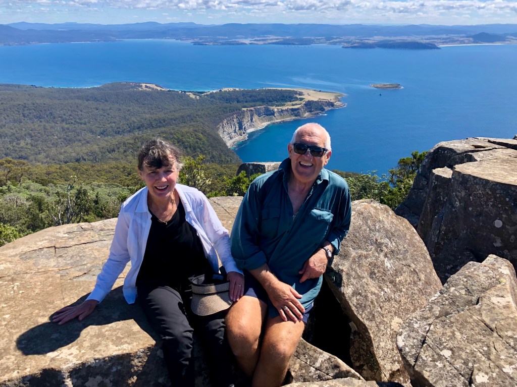
We went to Tiarra-Marra-Monah, which probably no-one anywhere ever calls Tiarra-Marra-Monah, because we hadn’t been there before. It is significant because the figure-8 island, the two parts of which are connected by McRae Isthmus, is a National Park entire. There is no shop, no car, very basic accommodation in the old penitentiary, wildlife tamed by people looking not touching, and lots of other beautiful things. And you can only get there by ferry.
The ferry was a puffer jacket and walking boot fashion show, North Face, Mountain Designs and Kathmandu all heavily represented. As evident it was a most beautiful autumn day. We hired bikes because there was a lot to see and walking wouldn’t allow us to do what we wanted which was to visit the Painted Caves and then make an attempt on Bishop and Clerk, two 700m dolerite columns on the northern end of the island.


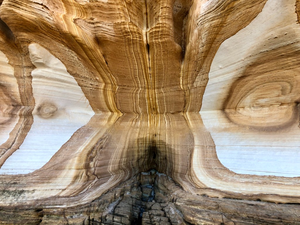
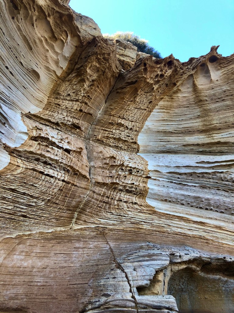
The Painted Cliffs did not disappoint. After a 100m walk along a beach, around a jutting corner were these cliffs, limestone stained along its strata by millennia of dripping iron. These cliffs are about 6-8 metres high and in full sun would have been simply amazing.

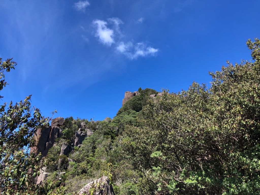
The walk to Bishop and Clerk — to the top of the Bishop really, only very good rock climbers could get up the Clerk — starts quite high on top of some ocean cliffs and its first third is quite amiable, a steady but reasonably gentle climb through forest.

This is a popular walk. There is another climb on the island up Mount Maria more difficult to reach and more difficult when you get there. But it would seem that most people who visit the island have Bishop and Clerk in their sights. There were probably about 80 people on the track with us which, while not Bourke Street, is pretty unusual. They ranged from young hippies dancing across the scree field in bare feet (‘See?! It’s just a matter of choice.’) to people who really should have consulted their doctor before setting out. Some at least of these rested at the scree field (‘scree’ smaller than ‘boulders’ but used apparently interchangeably in this location) and turned around. Some I think had never seen a boulder field before and they can look like a rock wall.

And this one is a bit annoying. It goes on beyond your expectations, you keep turning blind corners and there it is again. More! Bugger. It had captured the trekkers’ imagination. And then, when you’re through it, you look up and think you’re nearly there. But you’re not. There’s another 20 minutes.

Quite a lot of advice is offered (brochure, guide, map, bloke who rented us the bikes) not to do the last 50 metres. But really, you know … as if. You’ve got that far. You’ve beaten the scree field. What danger could lurk that would stop you from here? But sure enough there’s quite a boulder in the way, a couple of metres high with a negative face to climb onto. That is a face that slopes down rather than up, and that says in a quiet but menacing voice, you’re going to slide off here. But there are a couple of footholds in the right places and a crack that you can get your fingers into for purchase and, like most people on the mountain that day, we got to the top. I felt renewed.
Kunanyi / Mt Wellington
You turn the corner on the way in from the airport and, bang, there it is. The Mountain. What’s the weather like in Hobart? Is there any snow on The Mountain? Can you see the Organ Pipes or are they muffled in cloud? We hadn’t come from the airport but we were coming in that road. There are other cities with natural features that announce them — Sydney has the harbour, Rio the Sugarloaf, New York Manhattan — but Hobart has The Mountain. It doesn’t really need a name but all the signage these days says ‘kunanyi / Mt Wellington’, a change legislated in 2013, and one of the State’s inaugural dual-named geographic features. So hurrah for that. Why would you want a mountain like this, here, named after an English Duke who helped supervise, at a distance, the fighting of a war with the French, half a world away geographically and much further culturally.

We’ve done a lot of walking on The Mountain — near a capital city of walkers it’s covered in tracks — and have preferences. We’d had a great family day in Nubeena and were ready for a climb. So, start at The Springs, up the Ice House Track, stiff but quick, to the top and clamber across the South Wellington track to the summit (1271m for interest). Down the Panorama Track to the Chalet and then along Organ Pipes back to the car. Might be about 12kms. Ideal really.
I noticed a few spots of rain on the cars as we left downtown Hobart but hardly any on the ground. But by the time we got to Fern Tree the gutters were running quite hard and further on up to The Springs the walls of the cuttings had sprung leaks. Water was squirting out of them, something I’d never seen before. Clearly a day for the raincoats. We were putting them on and getting organised when a bloke came over with something for us to see on his phone. He was track-builder and his gang had been up, as it happened, on Ice House Track. He showed us a video of his mate mid-calf in the torrent that was the Ice House Track. There might have been next to no rain in Hobart, Australia’s second driest capital, but a few kilometres away as the crow flies The Mountain had had 80mm overnight. He was going home and suggested we revise our plans. Fair point, and achievable. We could use tracks that ran more closely with the contours rather than perpendicularly across them.
Looks fine doesn’t it: the Lenah Valley Track before traversing up to the Organ Pipes. Panorama up to the summit. Back the same way. We’d gone 200m when we heard this noise.
We were reasonably out of it, but the floor of the forest was running and making a great watery racket. Sort of a marvel in its own way and rather than diminish the pleasure of the walk re-directed it.


Our feet stayed reasonably dry till we needed to go up the Summit Track to the Organ Pipes. And then they didn’t. Make sure the sound is turned up.
There are plenty of boulder fields to walk across on the ‘front’ of The Mountain. Adding to the dimensions of sensory experience we experienced while doing so was listening to very active subterranean watercourses somewhere beneath us grunting and shlooooshing away.


Something special seems to happen to the colours of vegetation in the wet. This talks to walkers. I know because of the incidence of photos just like this one.
The one minute that the cloud parted allowing us to see what was below, probably the northern suburbs Glenorchy way.

It could have looked like this, but it mattered not one whit.

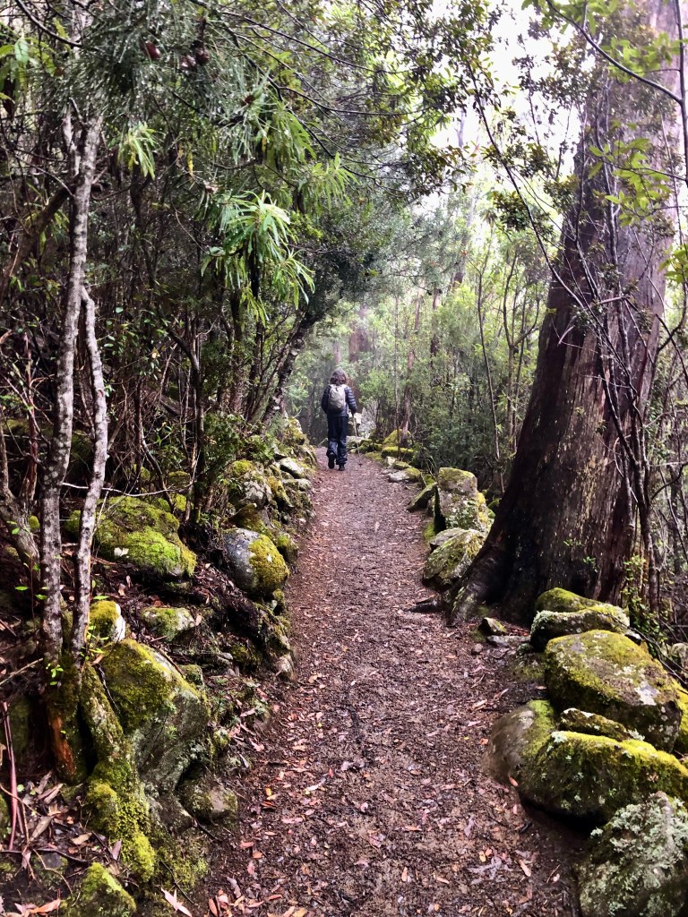
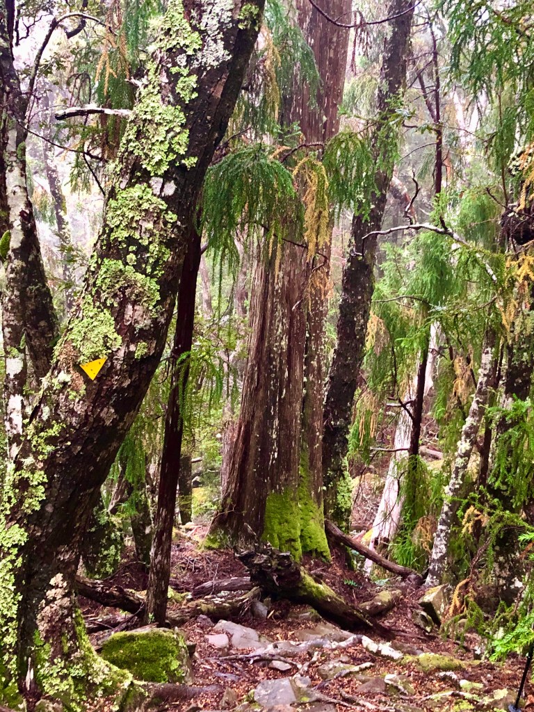
Meander Falls

We hadn’t been to Meander Falls before and they sounded promising. They weren’t in my standard guidebook (the excellent Day Walks In Tasmania by John and Monica Chapman), and the advice about the walk was various. Some young adventurer reports (with selfie) on the internet that he had run there and back in 2.5 hours which would make him a) a world-record holding rogainer and b) quite likely a combination of a dickhead and bullshit artist. But that’s the internet for you.
I forgot to un-pause my Map My Walks so I don’t know how far to say we walked. The signs tend to concentrate on times and congregate around 5-6 hours. In intermittent bouts of rainfall, we took six with lunch and time spent ogling.
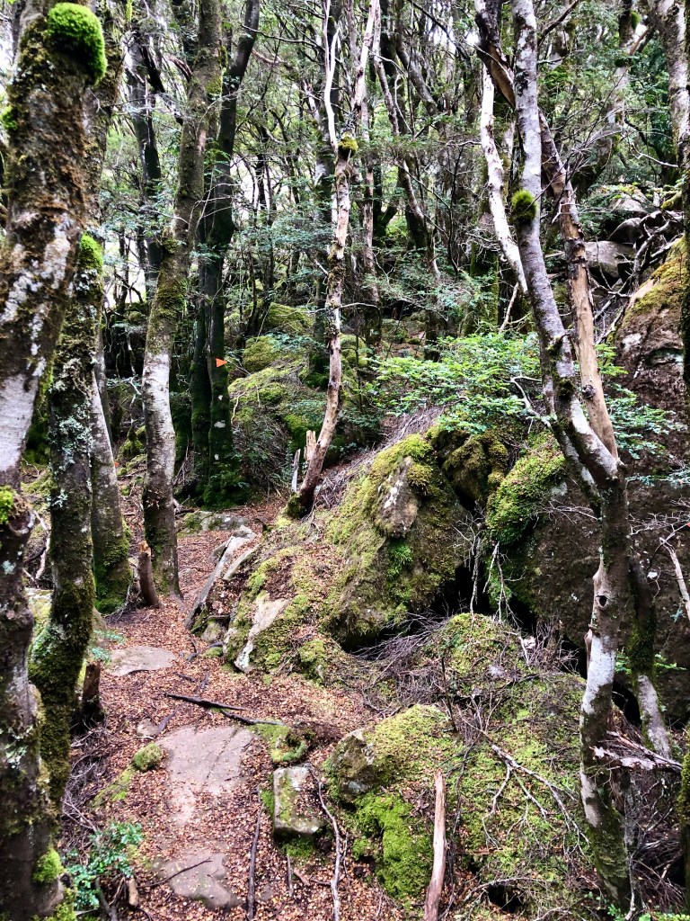
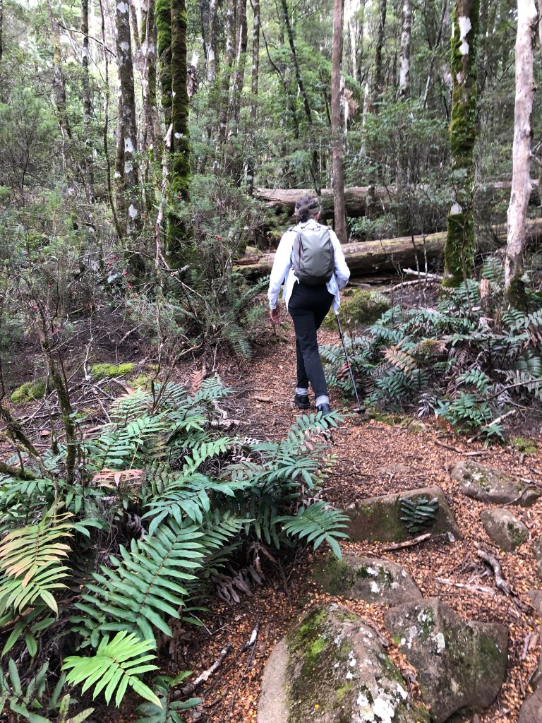
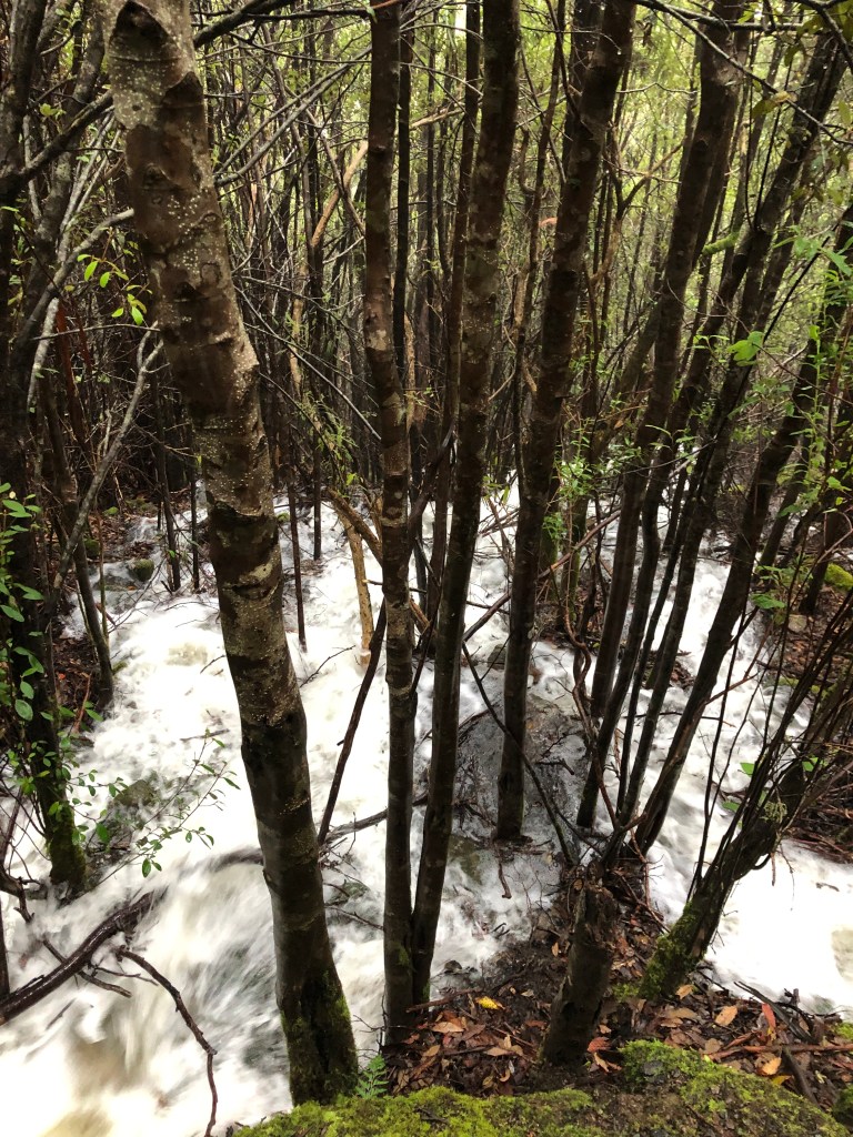
The first third (a theme is emerging here) is a stroll through beech forest next to the Meander which on this particular day was boiling, fabulous. Compared to the northern floods it was nothing of course, but in this micro-environment it was hurling down, noisy company almost all the way.

The track is officially: ‘Formed earthen track, few obstacles. Generally a modified surface, sections may be hardened. Width: variable and less than 1200mm. Kept mostly clear.’ This is a reasonably representative section of it in the second third.
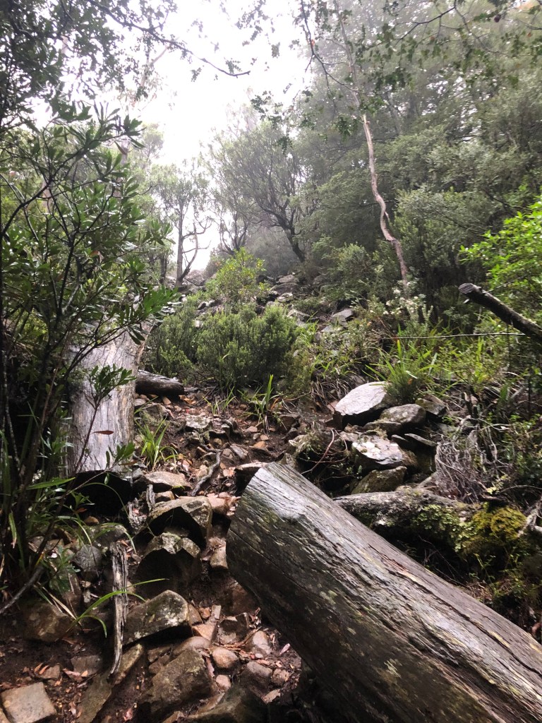
The river remained company until the last third when the track veers away, still climbing steeply, to circumvent a rocky prominence. But exquisite scenery everywhere.


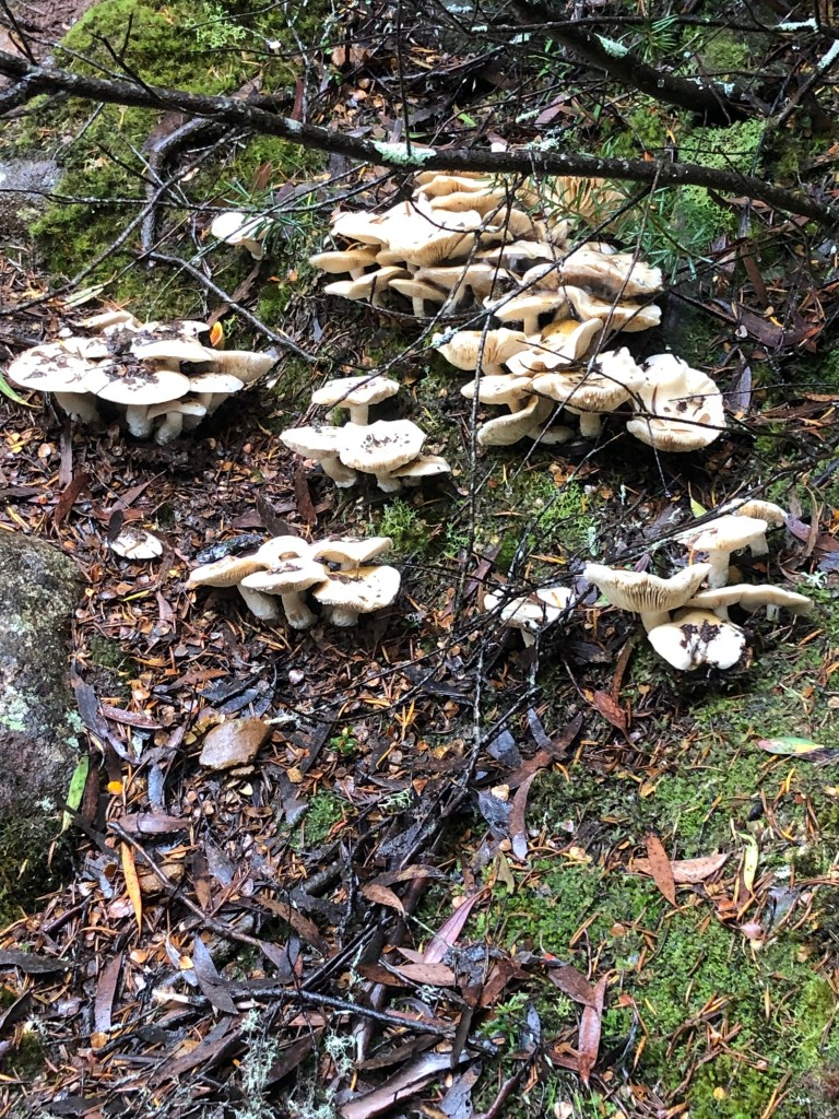
One feature of this walk was the range of fungi we saw, must have been 20 or 30 types, each seeming to be trying to outdo the other in terms of colour and form.

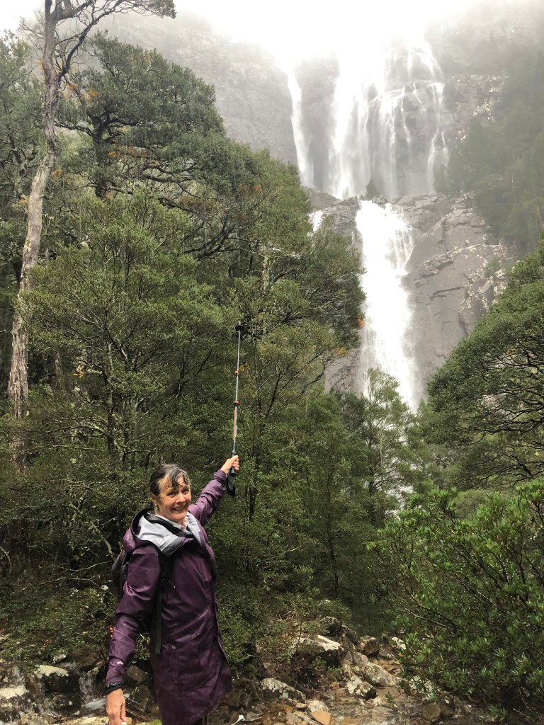
The approach to the falls — on this wet wet day; we were lucky — was signalled at some distance by their noise, a constant and increasing roaring. There’s a flattish bit across the top of a headland, very wet in this instance, before the curtain goes up. But then the curtain does go up.
When the tops haven’t disappeared into the mist the two drops are round 90 dramatic metres. They’re not the Victoria or Niagara Falls, but gee it was fun to see them. Maybe it’s the effort of getting there, or maybe it’s the cup of tea.

Happy travels.

Thanks David, blown away by the wonderful photographs and very much entertained by your lively commentary. And mightily impressed by your intrepid adventuring – referring to both you and Myrna. I’m feeling rather envious from my armchair.
Stunning, stunning photos David. Thank you. You and Myrna are legends. Some of the places you managed to walk look so ‘dangerous’. You both look incredibly fit. That is obviously the secret. Cheers
Thanks for the great tour of the spots I haven’t seen in Tassie, except Mt Wellington and the Ben Lomond area. A real delight. Blessings on you both for making the old dart come alive. We had a number of holidays at Orford just down from Triabunna. On a photo found on the web, I saw Spring Beach back on the mainland just south of Orford. Magic white strip, headlands north and south and the clearest seawater ever. Paradise. Signs up everywhere. NO SWIMMING! Undertow. Did heaps of fishing off the coast between Marish Island and the coast. Lots to recall, with pleasure. Many thanks for the trip. Love to you both. Bax
Terrific as always. The quality of both commentary and photography leaves contemporary travel writing far in its wake; and your audience hungry for more!
Exhausting read, but very impressed and very grateful. Nice work, thanks Dave.
Sent from mobile device [Ross Turner +61408772595]
>
Another wonderful adventure-thanks Myrna and David!
Too many pictures, not enough words!
Wonderful writing and photographs as usual David. I’ve done a few of these hikes but my favourite hike in Van Diemen’s Land is the one from Williamsford (near Roseberry) to the Montezuma Falls. It follows a world famous railway line (to the fans) from Williamsford (a deserted mining village) to the falls which are claimed to be the highest in Tasmania. You can hike on further to Zeehan along the line but that takes two more days. The falls are brilliant. I have in my collection of original paintings one of locomotive K1 (the first ever Garrett locomotive) on the bridge over the Montezuma River. The driver stopped in the middle of the bridge on each trip so that any passengers could marvel at the falls. Hardly anybody had a camera in the days that the railway was operating so there are not a lot of photographs of the falls. Next time you’re in Tasmania, do this hike.